Why Wisconsin Shipwreck Coast National Marine Sanctuary stands out
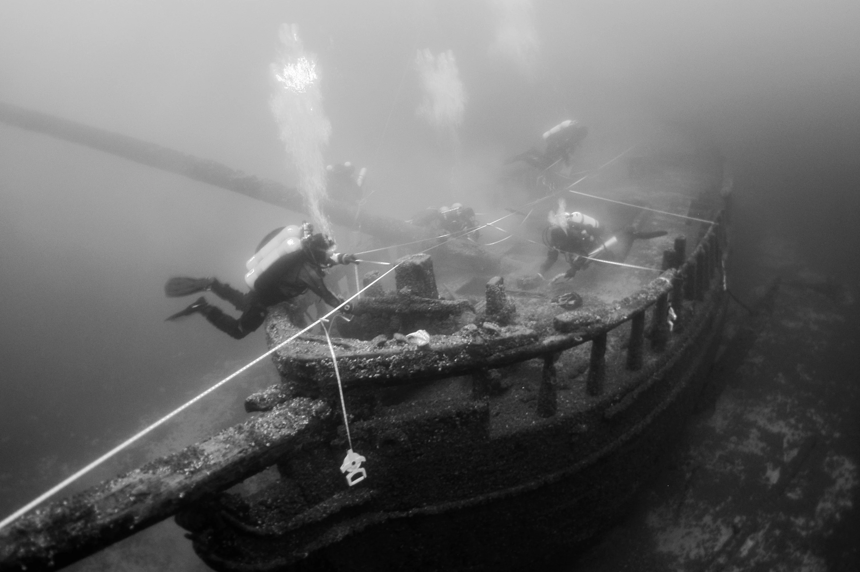
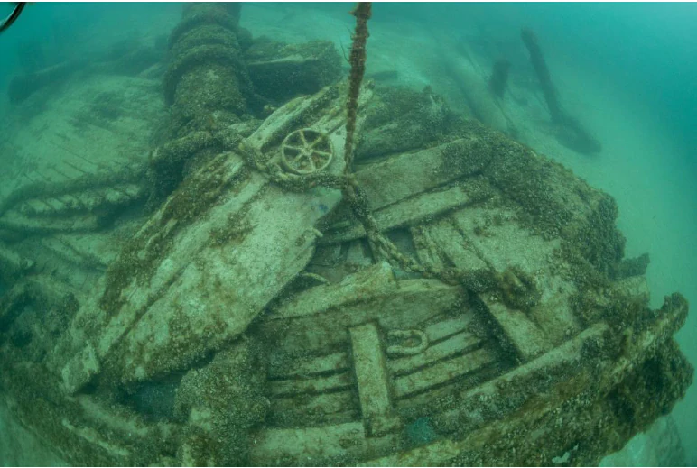
The sanctuary is best known for its remarkable concentration of preserved Great Lakes shipwrecks, which collectively form one of the most important underwater archaeological landscapes in the United States. Cold, fresh lake water has left many wrecks visually almost unchanged since the day they sank, allowing vessels such as the schooners Gallinipper and Home, the paddle steamer Niagara, and the steam barge Selah Chamberlain to survive with their hulls, masts, deck structures, machinery, and cargo still intact. These wrecks span more than a century of freshwater maritime history and represent the schooners, steamers, and barges that carried lumber, grain, coal, and passengers between Wisconsin ports and the wider Great Lakes economy. Their preservation, combined with active research and lakebed mapping, makes the sanctuary a flagship site for understanding America's inland maritime past.
Wisconsin Shipwreck Coast National Marine Sanctuary history and protected-area timeline
The history of the Wisconsin Shipwreck Coast National Marine Sanctuary stretches back long before its formal designation. Indigenous peoples used these Lake Michigan waters for trade, communication, and sustenance for thousands of years before European arrival, and it is likely that cultural materials remain on the lakebed alongside later wrecks. After European-American settlement expanded throughout the nineteenth century, the waters became a major artery of commerce, and storm-driven losses and accidents gradually created an extensive underwater archaeological record across Lake Michigan.
The modern sanctuary effort began with a 2008 Wisconsin Historical Society report examining Wisconsin's historic shipwrecks and assessing opportunities for a state-federal partnership with the National Marine Sanctuary Program. Building on this work, Wisconsin formally nominated the area in December 2014. NOAA accepted the nomination in February 2015, announced its intent to designate the sanctuary in October 2015, and by January 2017 proposed a larger 1,075-square-mile sanctuary called the Wisconsin-Lake Michigan National Marine Sanctuary. After public comment and meetings in Algoma, Manitowoc, Sheboygan, and Port Washington, NOAA adjusted both the boundaries and the name to the current Wisconsin Shipwreck Coast configuration.
However, the original proposal was withdrawn after a Trump administration executive order restricted new marine sanctuary designations to expand offshore oil and gas drilling, and Wisconsin Governor Scott Walker rescinded the state's nomination. The sanctuary effort was revived when Governor Tony Evers took office in 2019 and asked NOAA to proceed. NOAA issued an environmental impact statement and final management plan in June 2020, formally designated the sanctuary in June 2021, and celebrated its establishment at a ceremony at the Wisconsin Maritime Museum in Manitowoc on October 9, 2021. It became the first U.S. national marine sanctuary designated since 2019.
Since designation, the sanctuary has progressed through a series of research, mapping, and access milestones. In 2021, NOAA and partners conducted pilot lakebed surveys and installed real-time wind, wave, and temperature buoys. In 2022, NOAA mapped additional wrecks using sonar and high-resolution video, established a 15-seat advisory council, and began campaigns exploring a future NOAA facility on the Wisconsin coast. In 2023, the sanctuary published Maritime Cultural Landscapes studies and addressed public concerns about anchor restrictions. In 2024, mooring buoys were installed at 24 shipwreck sites, transforming access for divers, paddlers, and educational visitors.
Wisconsin Shipwreck Coast National Marine Sanctuary landscape and geographic character
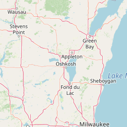
The sanctuary's landscape is defined by Lake Michigan itself, the largest freshwater lake entirely within the United States and one of the five Great Lakes. Along Wisconsin's mid-Lake Michigan shoreline, the lake's bottom slopes gradually from sandy and cobbled nearshore shallows into deeper offshore basins. The sanctuary covers this nearshore to mid-depth zone, lying entirely below the waterline and overlapping a continuous stretch of about 82 miles of coast and the inland cities of Port Washington, Sheboygan, Manitowoc, and Two Rivers.
The underwater terrain of the sanctuary is shaped by glacial lake-bottom processes rather than terrestrial landforms. Its substrates include soft sediments, sand, gravel, and glacial till, with subtle ridges, shoals, and basins that influence vessel traffic and wreck preservation. Because the lakebed has been extensively mapped with sonar and explored by autonomous underwater vehicles, the sanctuary is now one of the most bathymetrically well-documented stretches of Lake Michigan.
The climate above the lake is also a defining component of the sanctuary's character. Cold, fresh, well-oxygenated lake water has created conditions that favor exceptional shipwreck preservation. Ice and winter storms continue to shape the surface waters, while summer brings warmer temperatures and the boating, paddling, and diving season that draws most visitors to the sanctuary.
Wisconsin Shipwreck Coast National Marine Sanctuary ecosystems, habitats, and plant life
Although the sanctuary's defining focus is cultural rather than biological, its ecological setting is integral to its identity. The waters lie within Lake Michigan, a Laurentian Great Lake whose cold, fresh, well-oxygenated depths create a relatively stable, low-decay environment.
These freshwater conditions, combined with seasonal variation in temperature and light, support communities of plankton, forage fish, and bottom-dwelling organisms that are typical of the central Lake Michigan basin. The lakebed itself includes soft sediments and coarser substrates populated by invertebrates and small fish that interact with shipwreck structures as artificial reef habitat. Because of the sanctuary's focus on underwater cultural resources, biological studies within it are generally pursued in close connection with archaeological surveys rather than as standalone ecological research.
Above the waterline, the sanctuary is bordered by the human coastal communities of the Wisconsin lakeshore, where beaches, harbors, marinas, and river mouths connect the offshore archaeological resources with onshore visitor infrastructure and environmental context.
Wisconsin Shipwreck Coast National Marine Sanctuary wildlife and species highlights
Wildlife within and around the sanctuary is characteristic of the central Lake Michigan basin. The lake supports populations of cold- and cool-water fish species typical of the Great Lakes, and the sanctuary's waters provide seasonal habitat for both resident and migratory fish. Open water and nearshore areas also serve as habitat for waterfowl, with Lake Michigan functioning as an important migratory flyway.
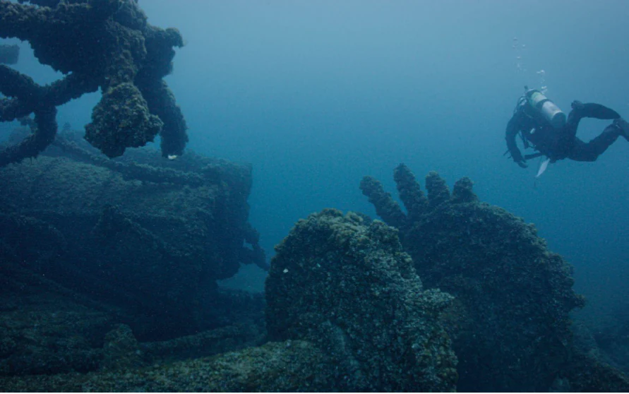
Shipwrecks themselves function as artificial reef structures, attracting fish and invertebrate communities that concentrate around masts, hulls, and broken decks. These biological aggregations add ecological as well as archaeological importance to the wrecks, although most wildlife-focused research in the sanctuary is conducted alongside heritage and archaeological investigations rather than as separate wildlife surveys.
Onshore, the surrounding coastal communities and lake-edge habitats support typical Great Lakes shoreline wildlife, including waterbirds, gulls, and seasonal visitors, all of which contribute to the broader ecological character of the sanctuary region.
Wisconsin Shipwreck Coast National Marine Sanctuary conservation status and protection priorities
The sanctuary is fundamentally a conservation resource, although its primary focus is the protection of nationally significant underwater cultural heritage rather than wildlife. By shielding shipwrecks from damage by anchoring, grappling, looting, and other destructive activities, it preserves what NOAA has recognized as archaeological resources of national importance. A growing number of these wrecks, more than two dozen by 2024, have been listed on the National Register of Historic Places.
Protection is operationalized through NOAA oversight, joint management with the State of Wisconsin, and on-the-water tools such as mooring buoys, mapping, and outreach. Installation of mooring buoys at 24 shipwreck sites during 2024 represents a major conservation milestone, allowing visitors to access wrecks without dropping anchors onto them and reducing cumulative damage from recreational boating and diving.
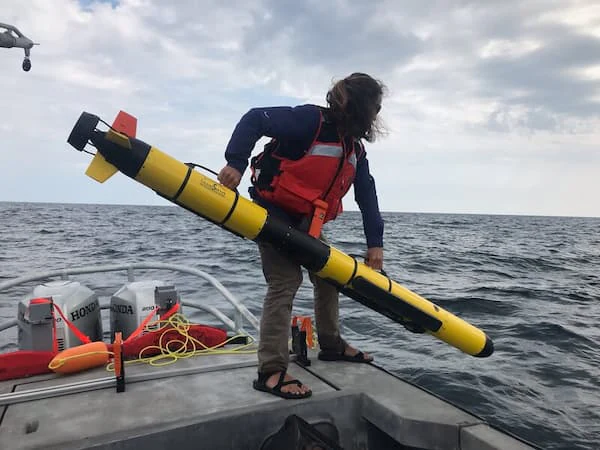
The sanctuary also contributes to broader Great Lakes science through lakebed mapping, autonomous underwater vehicle surveys, real-time buoys monitoring winds, waves, and water temperatures, and partnerships with universities such as the University of Delaware and the University of Wisconsin-Milwaukee. These efforts generate baseline data that supports both cultural resource protection and ecological understanding of Lake Michigan.
Wisconsin Shipwreck Coast National Marine Sanctuary cultural meaning and human context
The sanctuary lies within waters long used by Indigenous peoples for travel, trade, and sustenance, a context that likely still involves underwater cultural materials predating European contact. European-American settlement from the 1830s onward transformed these same waters into a primary corridor of Great Lakes commerce, with Wisconsin ports shipping lumber, grain, coal, and passengers across the upper Midwest.
Maritime heritage remains a defining element of regional identity in the four counties the sanctuary borders. Wisconsin's lakeshore cities, Port Washington, Sheboygan, Manitowoc, and Two Rivers, host maritime museums, working harbors, and community traditions tied to the lake. The Wisconsin Maritime Museum in Manitowoc played a central role in celebrating and interpreting the sanctuary's creation, underscoring the site's place in the broader cultural landscape of Wisconsin's coast.
The sanctuary itself has become a new cultural anchor for the region, supporting public events, teacher workshops, youth diving and ROV programs, and advisory councils. Together, these activities embed the sanctuary in local identity while extending public engagement with America's inland maritime history.
Top sights and standout views in Wisconsin Shipwreck Coast National Marine Sanctuary
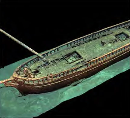
The Wisconsin Shipwreck Coast National Marine Sanctuary's standout quality is the remarkable preservation of its Lake Michigan shipwrecks, many of which look almost the same as when they sank thanks to the lake's cold, fresh water. With 36 known wrecks documented at designation and as many as 59 or 60 additional wrecks believed to lie undiscovered, the sanctuary offers an exceptionally dense and well-preserved record of nineteenth- and early twentieth-century Great Lakes shipping. Notable vessels include the schooners Gallinipper and Home (Wisconsin's oldest known wrecks by build date), the paddle steamer Niagara, and the steam barge Selah Chamberlain.
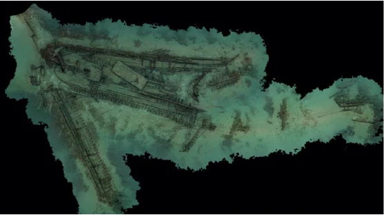
Equally significant is the sanctuary's role as a hub for active research, mapping, and public engagement. Sonar and autonomous underwater vehicle surveys, photogrammetric and 3D modeling of wrecks, mooring buoys at 24 wreck sites, real-time wind and wave buoys, advisory councils, education programs, and partnerships with Wisconsin museums and universities all reflect a sanctuary designed for both protection and active exploration. As the first national marine sanctuary on Lake Michigan and only the second in the Great Lakes, it also represents an important expansion of the national sanctuary system into America's freshwater interior.
Best time to visit Wisconsin Shipwreck Coast National Marine Sanctuary
The sanctuary is experienced primarily through Wisconsin's Lake Michigan coastline, and the warmer months from late spring through early fall offer the most rewarding conditions for visiting the region. Summer brings the most active boating, paddling, and diving season, when the surface waters are calmer, nearshore temperatures are mildest, and community events such as the 'Get Into Your Sanctuary' days are typically held. This is also the period when most mooring-buoy installation, lakebed mapping, and educational cruises are scheduled.
Fall brings quieter conditions, cooling water, and the possibility of seeing the shoreline communities settle into their off-season rhythm, while the underlying archaeology of the sanctuary remains as accessible through museums, digital models, and exhibits regardless of season. Winter on Lake Michigan is cold and frequently icy, and the lake's storms have historically contributed to the wreck record that the sanctuary protects, but winter conditions are not generally conducive to on-water visitation. For visitors interested in the sanctuary's heritage rather than its surface waters, the Wisconsin Maritime Museum and other partner institutions provide year-round context.