
Viewpoints
Park geography
Analyzing the protected area boundaries, elevation extremes, and diverse natural terrain features
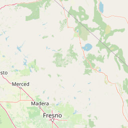
Comprehensive Geographic Profile and Mapped Terrain of Yosemite National Park in California
Examine the detailed geographic layout of Yosemite National Park, spanning from its minimum elevation of 648 meters to a maximum of 3997 meters. This structured profile highlights the park boundary measurements, internal lakes and meadows, and the broader mountain landscape context within the Sierra Nevada range.
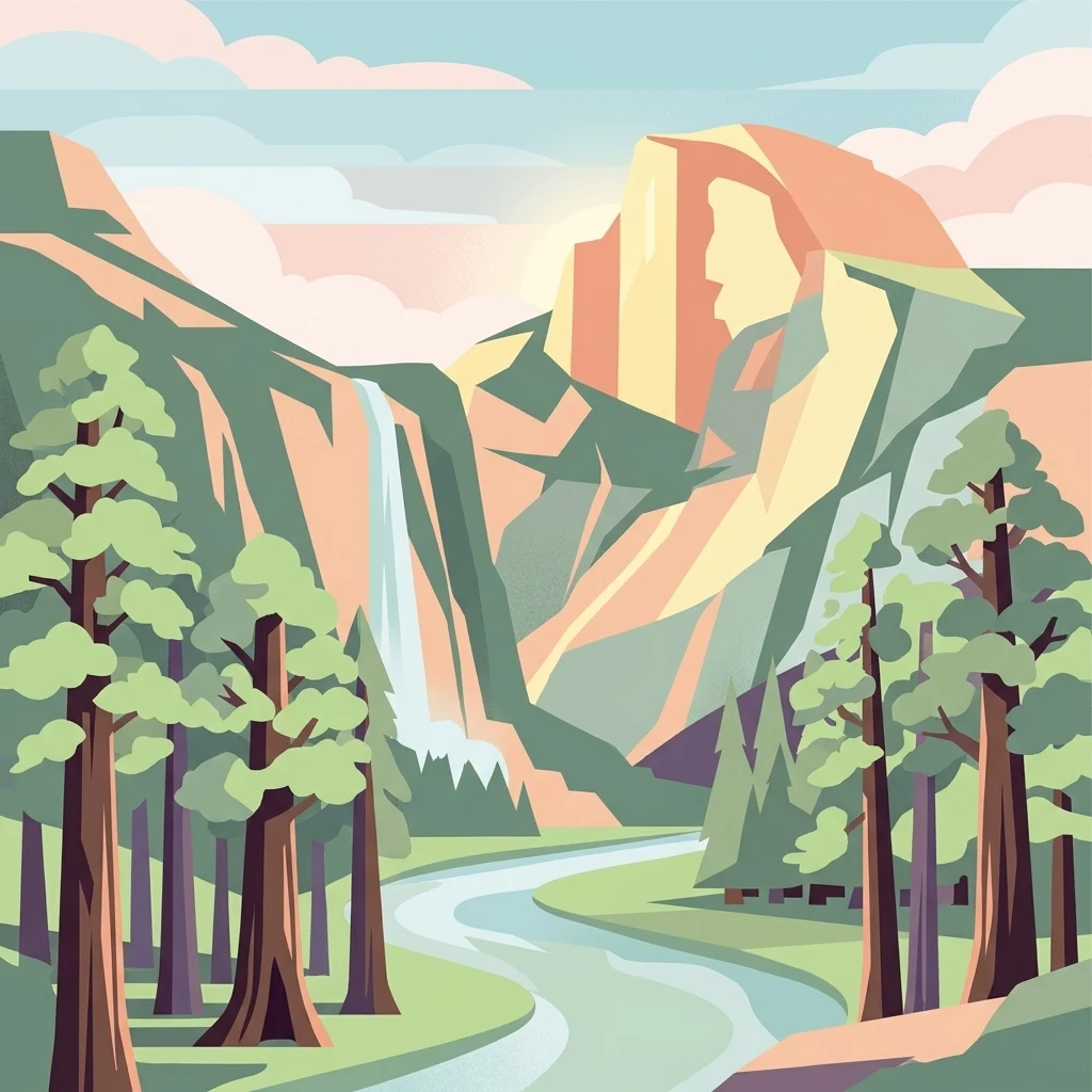
Iconic Sierra Nevada wilderness of granite cliffs, waterfalls, and ancient giant sequoia groves
Yosemite National Park
Yosemite National Park is a premier protected area in the central Sierra Nevada mountain range of California, spanning approximately 1,187 square miles across Tuolumne, Mariposa, Mono, and Madera counties. The park is internationally renowned for its dramatic granite cliffs, spectacular waterfalls, clear streams, ancient giant sequoia groves, and remarkable biological diversity. Designated a UNESCO World Heritage Site in 1984, Yosemite represents one of the largest and least fragmented habitat blocks in the Sierra Nevada, with nearly 95 percent of its terrain designated as wilderness. The park's geological character is defined by granite formations sculpted by Pleistocene glaciers, which transformed ancient river-cut V-shaped valleys into the iconic U-shaped canyons visible today. Yosemite played a foundational role in the development of the national park concept in the United States, beginning with the Yosemite Grant of 1864, signed by President Abraham Lincoln, which was the first instance of land being set aside specifically for preservation and public use by the federal government.
- Location
- United States of America
- Park type
- National park
- Established
- 1890
- Area
- 3,070 km²
- Highest point
- 4,000 m
Location overview
Continental park boundaries within the United States of America
Geographic Location of Yosemite National Park in California
Yosemite National Park is located within the state of California in the United States of America. Managed under a single national jurisdiction, the inland protected landscape contains no marine, coastal, or island components.
- Countries
- United States of America
- Regions
- California
- Primary location
- California
- Geographic setting
- Inland
Boundary and coordinates
Mapping the spatial footprint and 3,070 square kilometers of protected area.
Yosemite National Park Geographic Boundary Maps and Spatial Extent
Interactive boundary geometry outlines the spatial context of the Yosemite conservation wilderness. Associated geographic facts present estimated calculations of total area, coordinate limits, and center points.
- Boundary area
- 3,025.2 km²
- Boundary perimeter
- 311.4 km
- Northernmost point
- 38.1863° N
- Southernmost point
- 37.4921° N
- Easternmost point
- 119.1995° W
- Westernmost point
- 119.8862° W
- Geographic centre
- 37.8485° N, 119.557° W
- North–south span
- 77.1 km
- East–west span
- 60.4 km
Elevation and terrain
Trace the dramatic vertical span and alpine landscapes across the Sierra Nevada
Yosemite National Park Elevation Ranges and Mountain Terrain
Yosemite National Park features a vast elevation range spanning from 648 meters up to a high point of 4000 meters. Mapped geographic records detail names, types, measurements, and spatial relationships for key interior features.
- Minimum elevation
- 648 m
- Maximum elevation
- 3,997 m
- Highest point
- 4,000 m
Selected named natural features
Streams
Rail Creek
Streams
Ackerson Creek
Rivers
Tuolumne River
Wetlands
Kerrick Meadow
2,840 m
Mountain saddles
Sky Pilot Col
3,544 m
Environmental setting
Charting mountain relief, Mediterranean climate, and partial forest cover.
Environmental and Landscape Classifications of Yosemite National Park
Recorded mountain relief, seasonal water, and forest cover offer complementary ways to read the physical setting. Interactive habitat and landscape classifications link directly to matching protected areas in the global registry.
- Relief
- Mountain
- Climate
- Mediterranean
- Water
- Major water bodies
- Forest cover
- Partial forest
- Seasonality
- Seasonal
Landscape features
Mountains · Valleys · Cliffs · Canyon · Forest · Woodland · Grassland · Wetland · Lakes · Rivers · Waterfalls · Glacier · Tundra
Habitat types
Temperate broadleaf forest · Temperate coniferous forest · Montane forest · Alpine meadow · Grassland · Shrubland · Wetland · Riverine habitat · Lacustrine habitat · Tundra habitat · Glacial habitat
Park atlas
Browse surrounding protected areas, regional park geography, and diverse conservation landscapes adjacent to California's iconic Yosemite National Park.
Discover Other National Parks Near Yosemite National Park, Sierra Nevada, and California
Explore a curated list of national parks and protected areas adjacent to Yosemite National Park, offering deeper insights into the varied landscapes of the Sierra Nevada. Comparing these sites reveals the broader regional spread of conservation efforts and diverse geological formations beyond Yosemite's renowned granite cliffs and sequoia groves.
Wildlife reserveTuolumne County
Park boundaries overlap#1 closest
Northwest

Emigrant Wilderness: A Detailed Geographic Atlas of Protected Sierra Nevada Landscapes
Mapping glaciated granite basins and volcanic ridges in Tuolumne County.
Emigrant Wilderness is a sprawling protected area defined by a distinct mix of granitic domes, cirques, and a unique volcanic sector in its northeastern reaches. Spanning from lower forest elevations to alpine peaks, the area provides a window into the complex geological history of the central Sierra Nevada. The terrain includes hundreds of high-country lakes and meadow systems that support diverse alpine ecosystems and represent the rugged nature of the Pacific Crest Trail corridor.
- Area
- 454.37 km²
- Established
- 1974
- IUCN
- Ib
- Relief
- Mountain
Wildlife reserveCalifornia
Park boundaries overlap#2 closest
Northeast
Hoover Wilderness: Protected Alpine Geography in the Central Sierra Nevada, California
High-altitude glacial basins and Sierra crest wilderness
The Hoover Wilderness preserves a vital strip of high-elevation terrain along the eastern Sierra Nevada crest. Characterized by glacier-carved basins, interconnected alpine lakes, and sharp granite ridges, this protected area serves as a primary ecological gateway to the high country. Its landscape features define the headwaters of the Walker River, offering a compact yet significant look at California's protected alpine wilderness.
- Area
- 518.89 km²
- Established
- 1964
- IUCN
- Ib
- Relief
- Mountain

Protected landscapeNevada
Park boundaries overlap#3 closest
Northeast
Humboldt, Toiyabe National Forest: Protected Landscape and Regional Mountain Geography
A vast network of Nevada mountain ranges and alpine wilderness
Humboldt, Toiyabe National Forest serves as a defining public land entity across Nevada and eastern California. As the largest national forest in the contiguous United States, it preserves a striking collection of isolated mountain ranges, including the Ruby Mountains and the rugged Jarbidge wilderness, within a broader basin-and-range landscape. Examine the boundaries and terrain that characterize this complex, high-desert ecosystem.
- Area
- 25,454 km²
- Established
- 1908
- Relief
- Mountain
- Access
- Easy access

Protected landscapeCalifornia
Park boundaries overlap#4 closest
East
Inyo National Forest: An Atlas of Protected Landscapes and Sierra Nevada Geography
High altitude wilderness and volcanic terrain in Eastern California
Spanning from the arid Owens Valley floor to the 14,000 foot crest of the Sierra Nevada, Inyo National Forest remains a cornerstone of the American West. This protected landscape contains the Ancient Bristlecone Pine Forest, Mount Whitney, and the Mono Inyo volcanic chain, providing a dense geographic record of glacial, tectonic, and ecological diversity across a vast managed corridor.
- Area
- 7,702.71 km²
- Established
- 1907
- IUCN
- Ib
- Relief
- Mountain

Protected landscapeCalifornia
Park boundaries overlap#5 closest
Southeast
Sierra National Forest: Protected Landscapes of the Central California Sierra Nevada
Geography of alpine lakes, conifer forests, and mountain basins
Spanning from 900 to nearly 14,000 feet in elevation, Sierra National Forest protects a massive vertical range of California terrain. Discover its iconic wilderness areas and reservoir-studded landscape, providing a deep look at the geographic connectivity between major national parks in the central Sierra Nevada.
- Area
- 5,300 km²
- Established
- 1893
- Relief
- Mountain
- Climate
- Alpine
Protected landscapeCalifornia
Park boundaries overlap#6 closest
Northwest
Stanislaus National Forest: Sierra Nevada Mountain Geography and Protected Wilderness Lands
California mountain terrain and forest landscape map
Stanislaus National Forest is a sprawling protected landscape located in the central Sierra Nevada of California. Characterized by volcanic and granite formations, the area protects critical watersheds, Wild and Scenic rivers, and large swaths of old growth forest that define the rugged mountain interior.
- Area
- 3,634.48 km²
- Established
- 1897
- Relief
- Mountain
- Climate
- Temperate

Wildlife reserveCalifornia
20 km away#7 closest
Southeast
John Muir Wilderness: Sierra Nevada Protected Landscape and High Mountain Geography
California wilderness area with glacial basins and granite peaks
John Muir Wilderness represents one of the largest protected high-elevation areas in the contiguous United States. Spanning the Sierra Nevada crest, its granite terrain is sculpted by Pleistocene glaciation into sharp arêtes, deep canyons, and hundreds of alpine lakes. This wilderness serves as a vital geographic anchor for mountain ecosystems, offering an extensive look at the high-country landscape of eastern California.
- Area
- 2,641.76 km²
- Established
- 1964
- IUCN
- Ib
- Relief
- Mountain
Wildlife reserveFresno County
About 25 km away#8 closest
Southeast
Kaiser Wilderness: Exploring the Alpine Ridges and Glacial Terrain of the Central Sierra Nevada
A federally protected wilderness area in Fresno County, California.
Kaiser Wilderness offers a dense collection of signature Sierra Nevada landforms, including granite cliffs, subalpine forests, and high-altitude lakes. This wildlife reserve preserves a rugged, glacier-scoured interior that provides a distinct contrast to the surrounding regional landscape of the Sierra National Forest, making it a critical entity for understanding mid-elevation mountain ecology.
- Area
- 92 km²
- Established
- 1976
- IUCN
- Ib
- Relief
- Mountain
MoriAtlas Explorer
Continue Exploring Yosemite National Park's Protected Landscape and Geography
Deepen your understanding of Yosemite National Park's role as a mapped protected landscape within California. This atlas view allows for focused study of its geographic features and regional distribution, providing crucial context for further protected-area exploration and geographic analysis.
Browse next
Global natural geography
Explore related park routes
Explore MoriAtlas Global ParksBrowse All MoriAtlas ParksGlobal Park Map DiscoveryMoriAtlas: Browse All CountriesBrowse All MoriAtlas ContinentsNational Park Environment AtlasGrand Canyon National Park AtlasYellowstone National Park AtlasYosemite National Park Atlas and GeographySerengeti National Park AtlasGalápagos National Park Protected LandscapeBanff National Park Geography and AtlasKruger National Park Atlas EntryUluṟu-Kata Tjuṯa National Park AtlasExplore Uluru-Kata Tjuta National Park GeographyPlitvice Lakes National Park AtlasFiordland National Park Protected LandscapeGreat Smoky Mountains National Park AtlasAfghanistan National Parks and Protected AreasAlbania National Parks and Protected AreasAlgeria National Parks and Protected AreasAmerican Samoa National Parks and Protected AreasAndorra National Parks and Protected AreasAngola National Parks and Protected AreasAntarctica National Parks and Protected AreasAntigua and Barbuda Park List