
Mori Atlas logo
National parkYosemite National Park

Discover the mapped boundaries and regional context of this significant California national park.

Yosemite National Park: Protected Landscape and Geographic Atlas Detail

Yosemite National Park stands as a premier protected landscape, offering a unique entry point into California's diverse geography. This detail page focuses on its role as a mapped natural area, providing essential context for atlas-based discovery of its protected boundaries and regional setting. Understand Yosemite National Park not just as a destination, but as a key element within a broader geographic and conservation framework.

National ParkUNESCO World Heritage SiteGranite CliffsWaterfallsGiant SequoiaWilderness Area
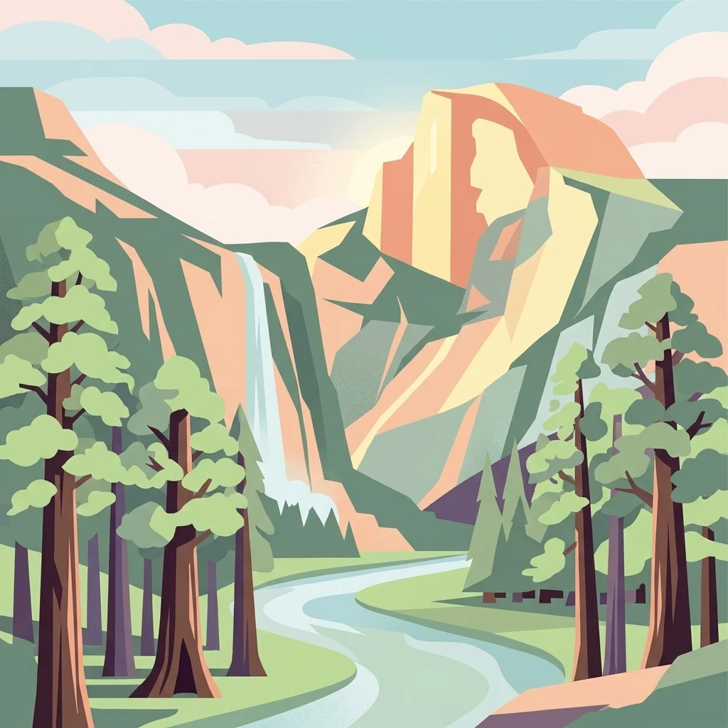
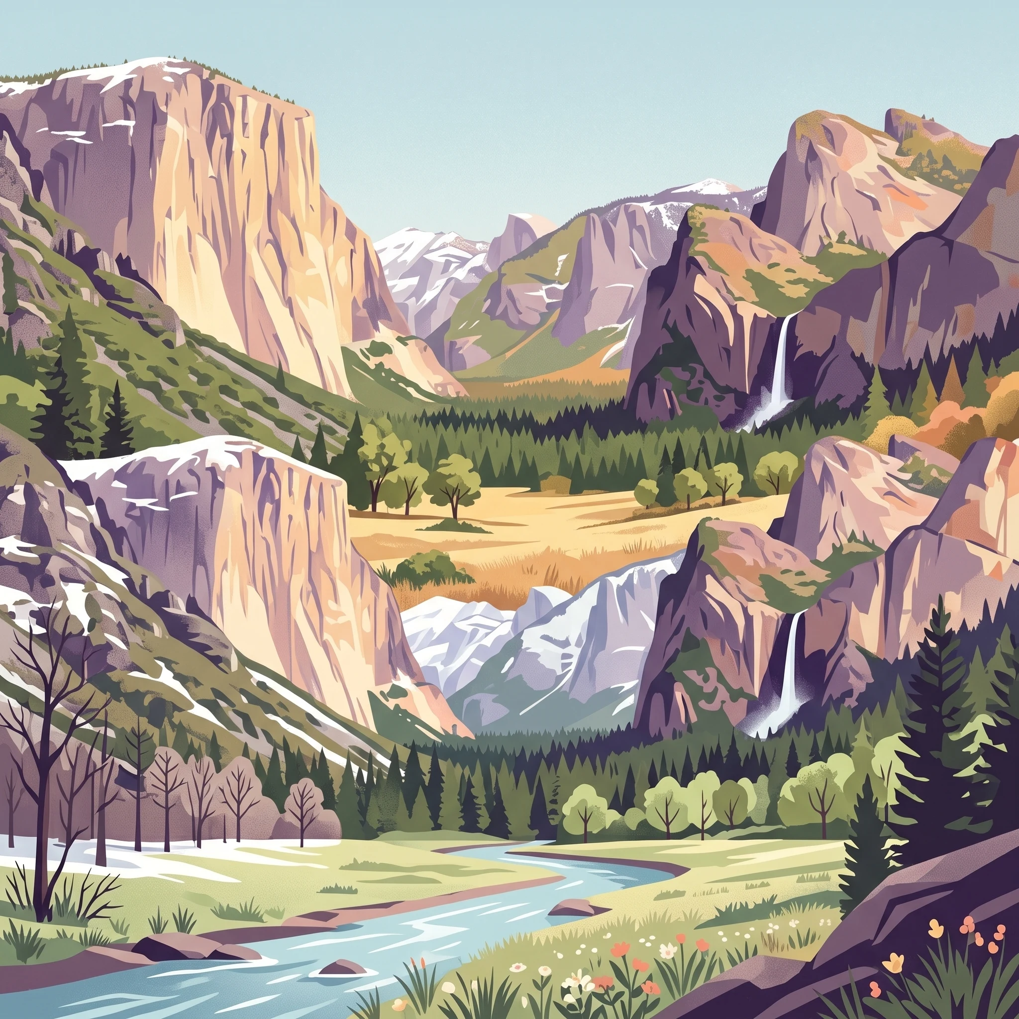
Stylized illustration of a mountain with a waterfall, forest, and river in a scenic landscape

Yosemite National Park

National park

Park overview

Structured park overview, official facts, and landscape profile for Yosemite National Park

Yosemite National Park park facts, protected area profile, and essential visitor context

Review the core facts for Yosemite National Park, including designation, size, terrain, visitor scale, habitats, and operating context in one park-focused overview.

About Yosemite National Park

Yosemite National Park stands as one of the most significant protected areas in the United States, preserving a remarkable slice of the Sierra Nevada ecosystem that has shaped both American conservation history and the world's understanding of wild landscapes. The park's identity is defined by its extraordinary concentration of natural wonders: granite cliffs that rise thousands of feet above meadows and forests, waterfalls that plummet from hanging valleys, and ancient groves of giant sequoia that have stood for millennia. The geological story of Yosemite spans hundreds of millions of years, from the formation of the Sierra Nevada Batholith deep beneath the surface to the erosive powers of glaciers that carved the characteristic U-shaped valleys visible today. This geological foundation supports an astonishing diversity of habitats, ranging from chaparral-covered slopes at lower elevations through coniferous forests to alpine meadows and bare rock at the highest elevations. The park's significance extends beyond its natural wonders to its historical role in the American conservation movement, as it provided the model for the national park system that would eventually preserve thousands of special places across the country and around the world.

Quick facts and research context for Yosemite National Park

Yosemite National Park covers 1,187 square miles in east-central California, making it one of the largest national parks in the United States. The park is centered in Tuolumne and Mariposa counties, extending into Mono and Madera counties. It was established on October 1, 1890, following decades of conservation advocacy led by John Muir and others. The park contains three giant sequoia groves: Mariposa Grove with approximately 200 trees, Tuolumne Grove with 25 trees, and Merced Grove with 20 trees. Two Wild and Scenic Rivers, the Merced and Tuolumne, originate within the park's borders. The park receives approximately four million visitors annually, with most concentrated in the seven-square-mile Yosemite Valley. The highest point in the park is Mount Lyell at 13,120 feet, while the elevation range spans from 2,127 feet to 13,114 feet.

Protection and recognition

Documenting terrestrial management scope and official UNESCO World Heritage recognition

Yosemite National Park Protection Status and Global Conservation Designations

Establishments dating back to 1890 mark Yosemite National Park as a foundational terrestrial protected landscape within the global conservation framework. Tracking the official designated year alongside documented UNESCO World Heritage status helps conservationists verify regional boundaries and global preservation frameworks.

International recognition

Protection details

Protection scope
Terrestrial
Designated year
1890
Transboundary protection
No
Park context

Deeper park guide and search-rich context for Yosemite National Park

Yosemite National Park history, landscape, wildlife, and travel context

Explore Yosemite National Park through its history, landscape character, ecosystems, wildlife, conservation priorities, cultural context, and seasonal travel timing in a structured park guide built for atlas discovery and search intent.

Why Yosemite National Park stands out

Yosemite is best known for its spectacular granite cliffs, including the iconic El Capitan, which rises approximately 3,000 feet above the valley floor and is a world-renowned rock climbing destination. The park features some of the world's most impressive waterfalls, with Yosemite Falls ranking as the fourth tallest in North America at 2,425 feet. The park protects three groves of ancient giant sequoia trees, among the largest and longest-living organisms on Earth. The U-shaped Yosemite Valley, carved by glacial activity, represents the park's most recognizable landscape, flanked by towering granite monoliths and cascading waterfalls. The park also contains extensive high country with Tuolumne Meadows, one of the largest subalpine meadows in the Sierra Nevada, and serves as habitat for diverse wildlife including black bear, mule deer, cougar, and the endangered Sierra Nevada bighorn sheep.
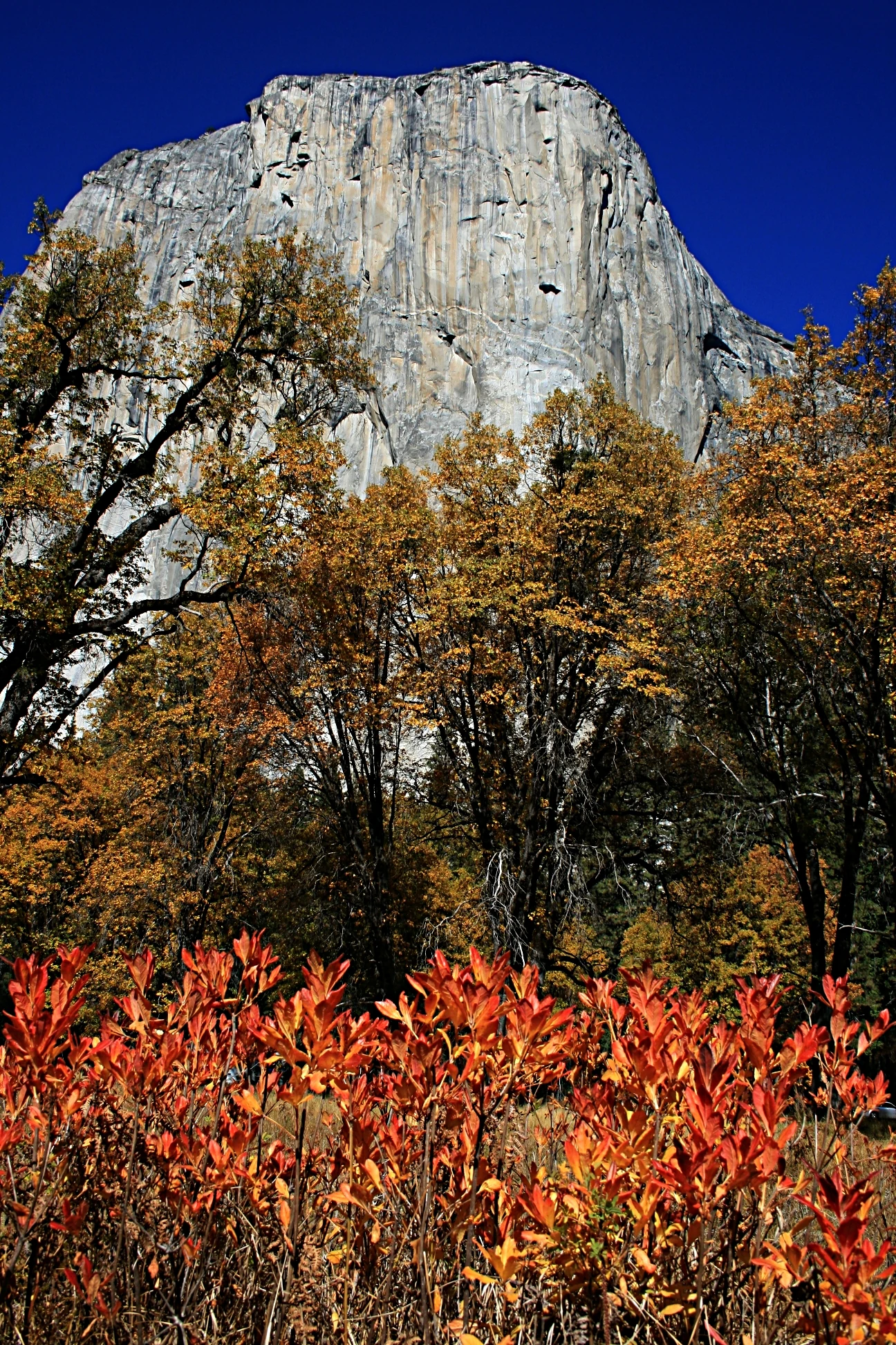
Red and orange foliage in foreground with El Capitan granite cliff in background under clear blue sky
View of El Capitan from the valley floor during autumn with colorful foliage

Yosemite National Park history and protected-area timeline

Yosemite's human history spans thousands of years, beginning with the indigenous peoples who called this landscape home. The Ahwahneechee people were the primary tribe residing within what is now the park boundaries, while surrounding areas were inhabited by related Southern Sierra Miwok, Northern Paiute, Mono, and Yokuts tribes. These indigenous peoples lived in the region for nearly 4,000 years, with the landscape providing game, fish, acorns, and other resources essential to their survival. The California Gold Rush of 1848 brought dramatic change, as tens of thousands of European Americans flooded the region, leading to conflict and the displacement of native peoples. The Mariposa War resulted in the forced removal of the Ahwahneechee, with Chief Tenaya and his people driven from their ancestral lands in 1851. European American exploration of Yosemite Valley began around 1833, with the first well-documented entrance occurring when the Mariposa Battalion, led by James Savage, entered the valley in 1851. Doctor Lafayette Bunnell, part of that expedition, later named Yosemite Valley based on his interviews with Chief Tenaya. The 1864 Yosemite Grant, signed by President Abraham Lincoln during the Civil War, represented a revolutionary concept: the preservation of natural scenery for public enjoyment. This was the first time land was set aside specifically for preservation and public use by the U.S. government, establishing a precedent that would lead to the creation of Yellowstone National Park in 1872 and eventually the entire National Park System. Galen Clark served as the first guardian of the grant, while John Muir's influential writings and advocacy led to the establishment of Yosemite National Park in 1890, encompassing the valley and surrounding areas. The National Park Service took over management in 1916, and the park was designated a UNESCO World Heritage Site in 1984.

Yosemite National Park landscape and geographic character

Yosemite's landscape is defined by the dramatic contrast between its glacial-carved valley floor and the surrounding mountainous terrain. The Sierra Nevada Batholith provides the geological foundation, with granite formations comprising approximately 95 percent of the park's landforms. The most recognizable feature is Yosemite Valley, a flat-floored canyon approximately seven miles long and one mile wide, surrounded by towering granite cliffs including El Capitan, Half Dome, Sentinel Rock, and Cathedral Spires. These cliffs exhibit dramatic exfoliation patterns where sheets of granite have peeled away from the rock face over millennia. The valley floor contains the Merced River, meadows, and doton trees, creating a pastoral landscape that contrasts sharply with the sheer walls rising above. Beyond the valley, the park contains numerous granite domes including Sentinel Dome and North Dome, while the high country features the extensive Tuolumne Meadows, a subalpine grassland surrounded by peaks and ridges. The park contains three distinct giant sequoia groves, with the Mariposa Grove being the largest at approximately 200 trees. Water features are abundant, with Yosemite Falls, Bridalveil Fall, Vernal Fall, and Nevada Fall among the most prominent, along with hundreds of smaller cascades that appear during spring snowmelt.
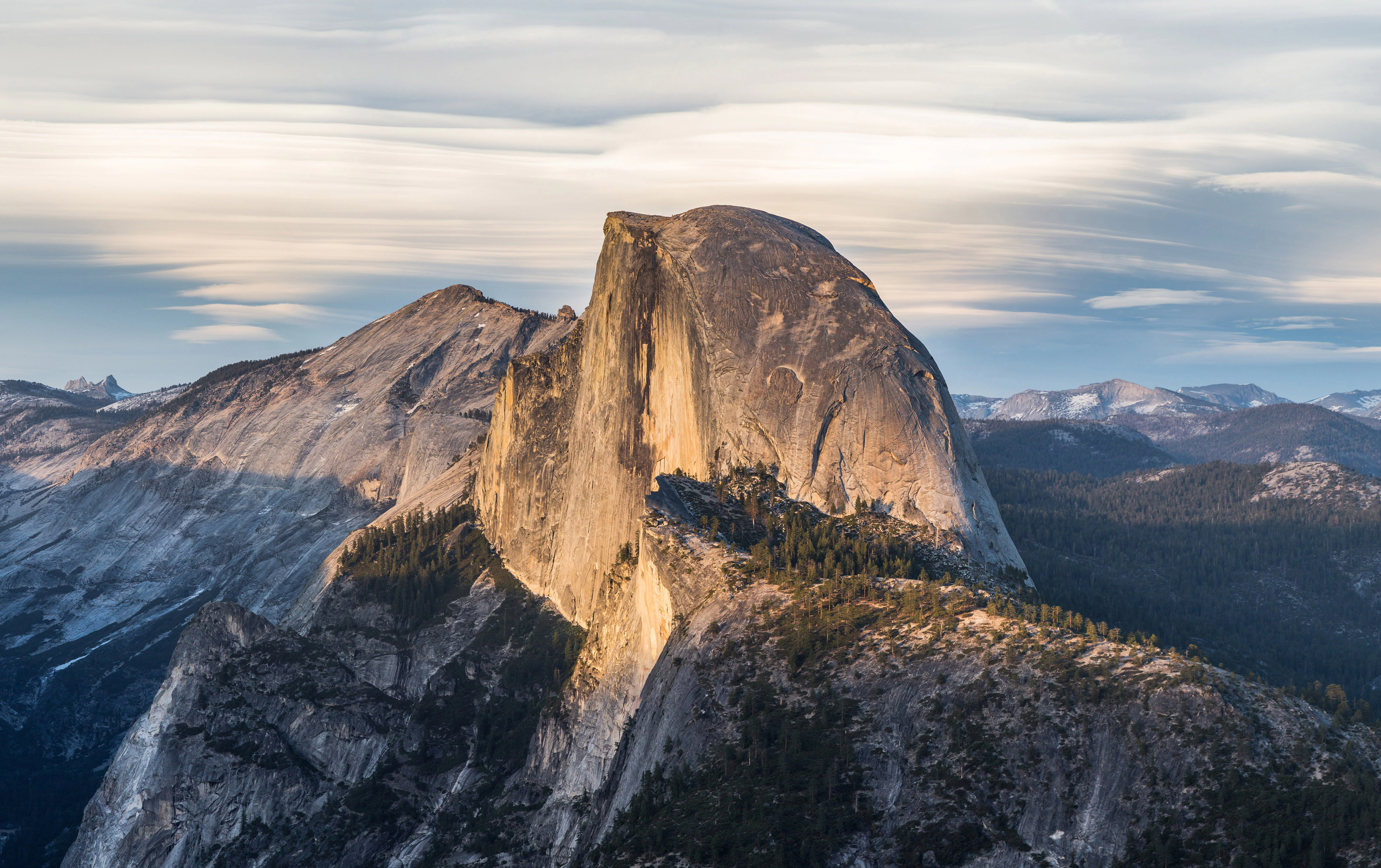
A large granite dome-shaped mountain with steep cliffs and a flat top, surrounded by rocky peaks and forested areas under a partly cloudy sky
Half Dome viewed from Glacier Point in Yosemite National Park

Yosemite National Park ecosystems, habitats, and plant life

Yosemite National Park preserves an extraordinary range of habitats across its dramatic elevation gradient from 2,127 to 13,114 feet. Five major vegetation zones characterize the park: chaparral and oak woodland at lower elevations, lower montane forest dominated by ponderosa pine and incense cedar, upper montane forest with red fir and lodgepole pine, subalpine zone featuring whitebark pine and mountain hemlock, and alpine tundra above treeline. The park contains approximately 352 square miles of old-growth forest, representing some of the most intact woodland remaining in the Sierra Nevada. Of California's approximately 7,000 plant species, more than 20 percent occur within Yosemite's boundaries, and the park provides suitable habitat for more than 160 rare plant species. Wetlands and meadows scattered throughout the park at various elevations provide critical habitat for numerous species, while the Merced and Tuolumne river systems support riparian ecosystems along their courses. The park's varied habitats support over 250 species of vertebrates, including fish, amphibians, reptiles, birds, and mammals, making it one of the most biodiverse protected areas in the Sierra Nevada.
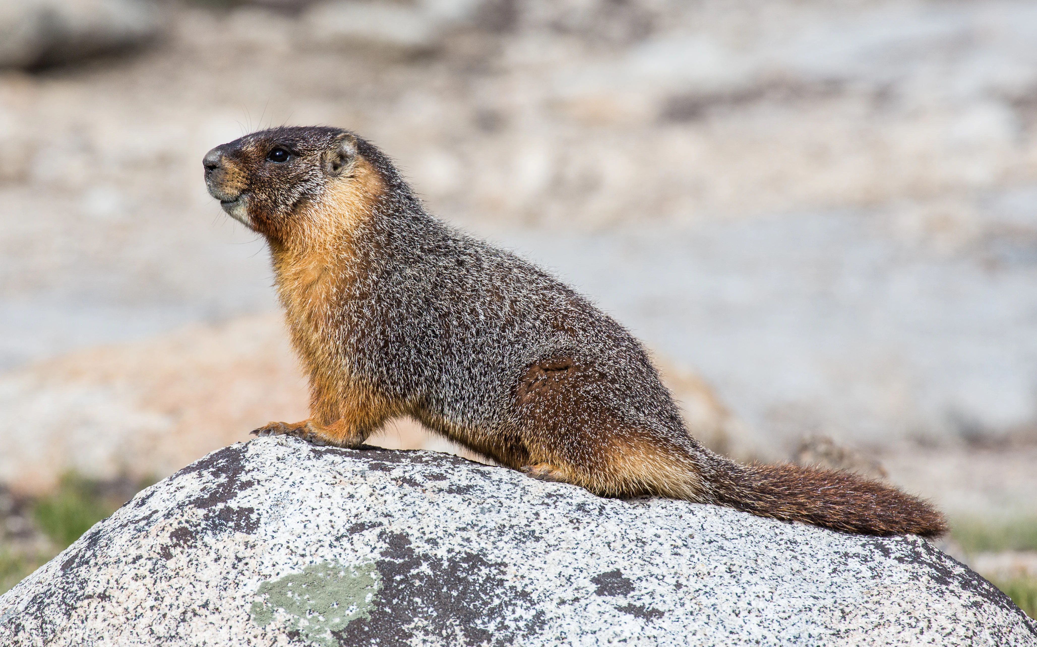
Yellow-bellied Marmot sitting on a large gray rock with brownish fur
Yellow-bellied Marmot perched on a granite rock in Yosemite National Park

Yosemite National Park wildlife and species highlights

Yosemite supports a rich community of wildlife reflecting the diversity of its habitats and the connectivity of its protected landscapes. Mammals common throughout the park include black bear, coyote, bobcat, cougar, gray fox, and red fox, along with smaller species such as raccoon, river otter, and numerous rodents. Mule deer are commonly seen in meadows and forests throughout the park. At higher elevations, species such as the golden-mantled ground squirrel, chickaree, and fisher are prevalent, while the iconic yellow-bellied marmot inhabits alpine meadows. The park provides critical habitat for Sierra Nevada bighorn sheep, with a small reintroduced population found around Tioga Pass in the high country. Birdlife is exceptionally diverse, with species ranging from the white-headed woodpecker in lower forests to the black rosy finch and Clark's nutcracker in alpine zones. The great grey owl and willow flycatcher depend heavily on meadow habitats. Some species have been lost from the park within historical time, including the brown bear, California condor, and least Bell's vireo, while 37 species currently have special status under California or federal endangered species legislation.
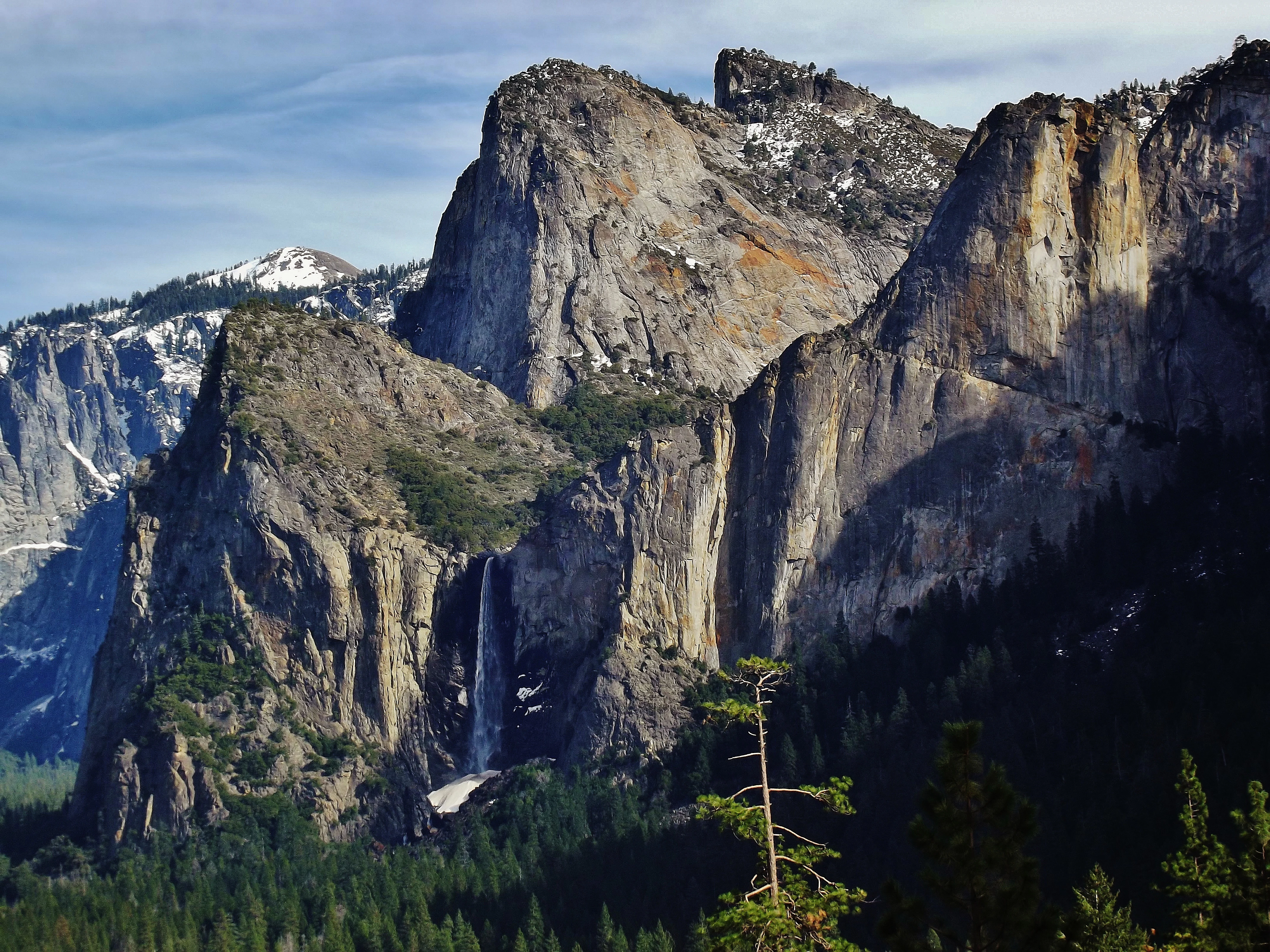
Bridalveil Fall waterfall flowing down granite cliffs with forested valley below
Bridalveil Fall waterfall cascading into a U-shaped valley surrounded by granite cliffs

Yosemite National Park conservation status and protection priorities

Yosemite National Park represents one of the most significant conservation achievements in American history and continues to face ongoing management challenges. The park's designation as a UNESCO World Heritage Site in 1984 recognized its outstanding universal value as a natural landscape. Approximately 89 percent of the park, totaling 677,600 acres, was designated as the Yosemite Wilderness in 1984, providing the highest level of protection under the National Wilderness Preservation System. The park serves as a critical habitat block in the Sierra Nevada, supporting connectivity for wildlife movement across the mountain range. Conservation challenges include the presence of over 130 non-native plant species that threaten native communities, with species such as yellow star thistle competing with indigenous vegetation. Climate change is affecting the park through reduced snowpack, earlier spring melt, and increased wildfire frequency and intensity. The park's fire management has evolved from early fire suppression to prescribed fire programs that help maintain the natural fire regime essential for giant sequoia reproduction. The O'Shaughnessy Dam in Hetch Hetchy Valley remains a point of historical contention between those who oppose the flooding of a valley once compared to Yosemite Valley and those who support the water supply for San Francisco.

Yosemite National Park cultural meaning and human context

Yosemite's cultural landscape encompasses thousands of years of human presence, though the story is marked by displacement and loss for the region's indigenous peoples. The Ahwahneechee people, whose name means dwellers, were the primary residents of Yosemite Valley before European American settlement. The word Yosemite itself derives from the Miwok term yohhe'meti, meaning they are killers, which historically referred to the Ahwahneechee. Following the Mariposa War of 1851, the Ahwahneechee were forced from their lands, with Chief Tenaya and his people driven across the Sierra to join the Mono Lake Paiute. Many Ahwahneechee descendants were absorbed into that community, while others remained in the valley working in the emerging tourism industry. The last full-blooded Ahwahneechee, Totuya or Maria Lebrado, died in 1931. The National Park Service historically suppressed indigenous cultural expression, burning the Indian village in 1929 and evicting remaining Native residents in 1969. Today, the park maintains policies to protect sacred sites and allow Native peoples to return to their homelands. The park also contains significant historic structures including the Ahwahnee Hotel, now the Yosemite Valley Lodge, and Camp 4, which played a central role in the development of American rock climbing culture.
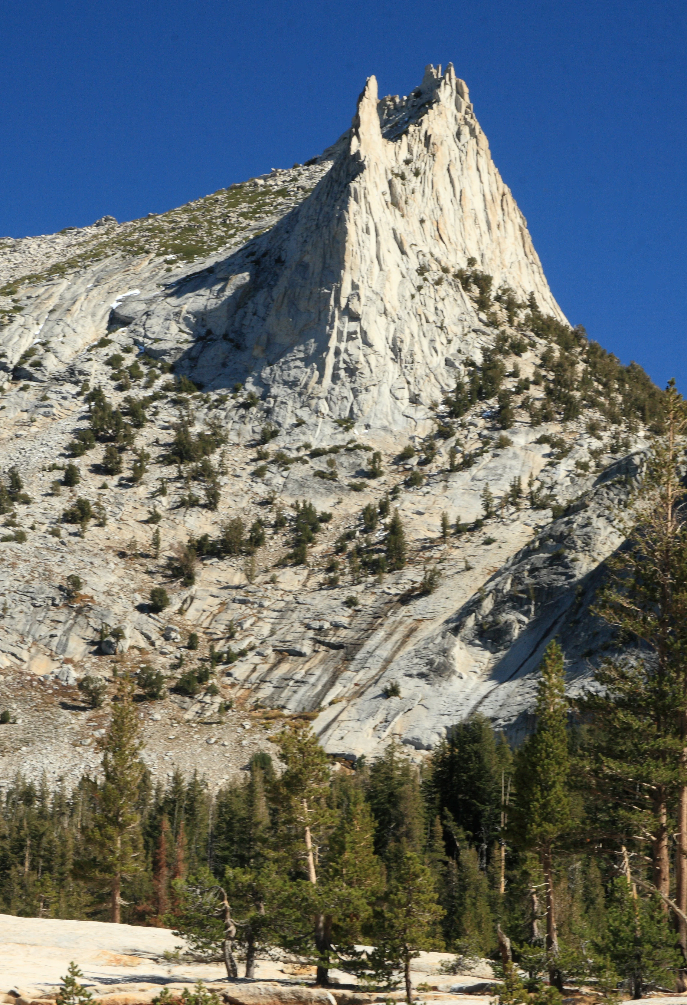
Granite peak with steep cliffs and scattered trees, forested base under clear blue sky.
Cathedral Peak's distinctive rocky spire rises above a forested foreground under a clear blue sky.

Top sights and standout views in Yosemite National Park

Yosemite Valley offers the park's most accessible and iconic scenery, with El Capitan, Half Dome, and the cascading falls providing the visual vocabulary that defines American wilderness. The Mariposa Grove of giant sequoia represents one of the largest and most accessible ancient forest stands in California, with trees reaching more than 2,000 years in age. Tuolumne Meadows provides a contrasting experience in the high country, with subalpine grasslands and mountain peaks offering hiking and climbing opportunities away from the valley crowds. The park's wilderness designation ensures that over 800 miles of trails lead into some of the most remote and pristine terrain in the Sierra Nevada. Hetch Hetchy Valley, while flooded by the O'Shaughnessy Dam, offers waterfalls including Wapama Falls and a more secluded experience. The park's rock climbing opportunities range from beginner bouldering to world-class routes on El Capitan, with Camp 4 serving as the historic center of American climbing culture.
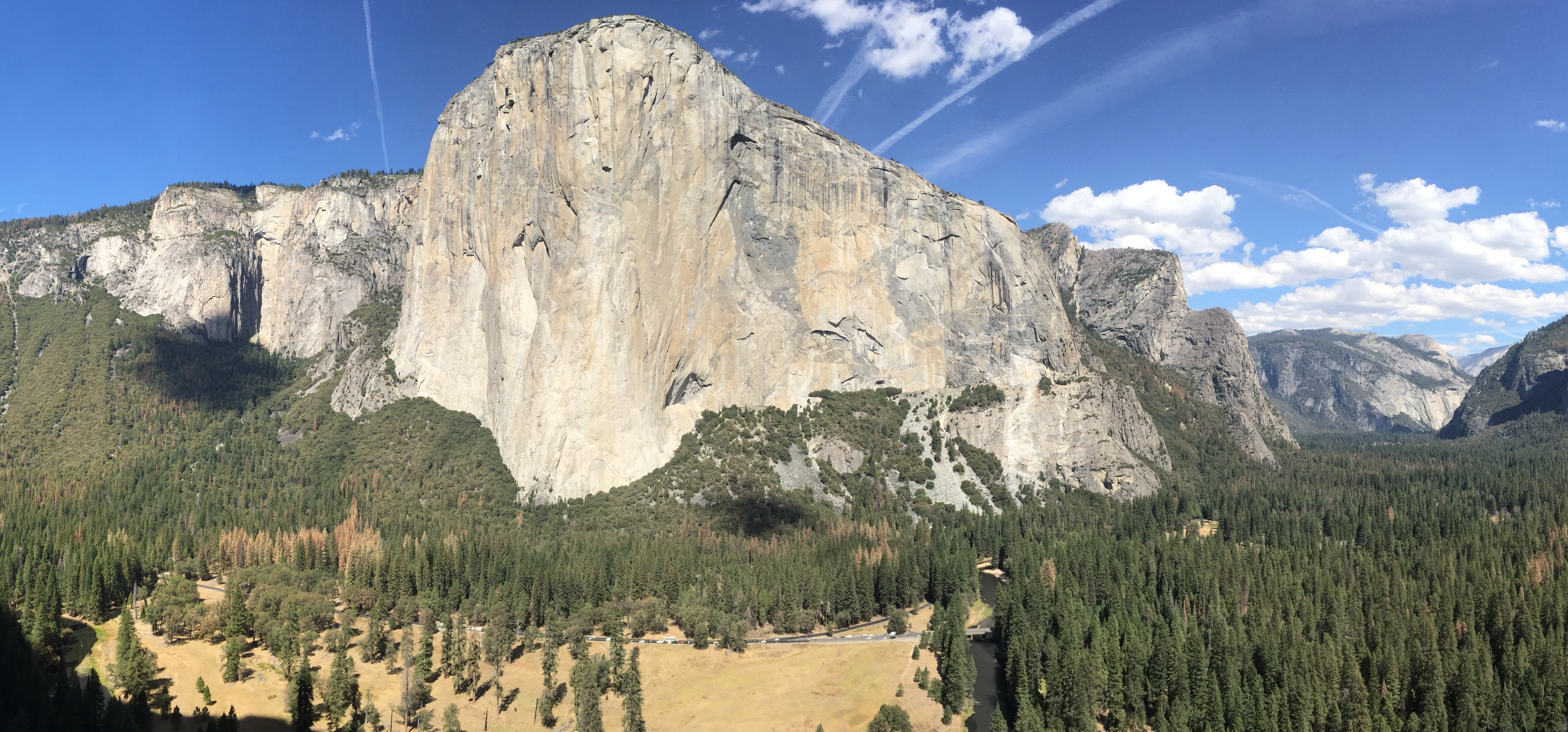
Wide panoramic view of El Capitan rock formation in Yosemite Valley with forested hills and clear blue sky.
Panoramic view of El Capitan from Central Pillar of Frenzy in Yosemite Valley.

Best time to visit Yosemite National Park

Yosemite can be visited year-round, though each season offers distinctly different experiences. Spring and early summer, particularly April through June, bring the most dramatic waterfall displays as snowmelt cascades from hanging valleys and glacial steps. Wildflower displays in meadows are particularly spectacular during this period. Summer months draw the largest crowds, with warm temperatures in the valley allowing hiking, rock climbing, and camping, though the valley can become congested and parking limited. The high country, including Tuolumne Meadows, becomes accessible from mid-summer through early fall. Autumn offers fewer crowds and mild temperatures, with fall colors particularly striking in the oak woodlands and along the Merced River. Winter transforms the landscape, with snow blanketing the high country and occasional snow in the valley, creating opportunities for cross-country skiing, snowshoeing, and a more peaceful experience of the park's iconic scenery. Road closures during winter, particularly over Tioga Pass, limit access to some areas but create a quieter atmosphere in the valley.
Park guides

Access data-backed answers to essential questions about the Sierra Nevada landscape.

Explore Focused Planning Guides for Yosemite National Park

Navigating the massive wilderness of the Sierra Nevada requires clear spatial and environmental context. Focused resources address critical timing decisions to help you identify the optimal month for waterfall flow and high-country access.
Monthly climate preview

Long-term temperature and precipitation patterns from representative mountain terrain

Yosemite National Park Monthly Climate Normals and Weather Patterns

Long-term meteorological records for Yosemite National Park at an elevation of 2554 meters reveal a classic high-mountain cycle with freezing winters and warm, dry summers. Comparing the complete monthly weather averages helps map the precise shift in temperature extremes and precipitation across the calendar year.
Annual mean4 °C
-5 °C16 °C
Jan-5°
Feb-5°
Mar-3°
Apr
May
Jun11°
Jul16°
Aug15°
Sep11°
Oct
Nov
Dec-5°
Warmest month
July

15.8 °C

Coolest month
February

-5.1 °C

Wettest month
January

4.1 mm/day

Driest month
August

0.3 mm/day

Park location guide

Geography guide, regional context, and park location map for Yosemite National Park

Yosemite National Park park geography, regions, and map view in United States of America

Understand where Yosemite National Park sits in United States of America through a broader geographic reading of the surrounding landscape, nearby location context, and its mapped position within the national park landscape.

How Yosemite National Park fits into United States of America

The United States of America is a federal presidential republic and one of the world's largest countries by area and population. It consists of 50 states across a vast territory spanning multiple time zones, with its capital in Washington, D.C. and largest city in New York City. The nation has a diverse economy, influential political system, and significant cultural and military presence globally.

Wider geography shaping Yosemite National Park in United States of America

The United States occupies a vast territory in North America, bordered by Canada to the north and Mexico to the south. The 48 contiguous states stretch from the Atlantic to the Pacific Ocean, while Alaska occupies the northwestern region and Hawaii is an archipelago in the Pacific. The country encompasses diverse terrain including the Rocky Mountains, Appalachian Mountains, Great Plains, and extensive river systems.

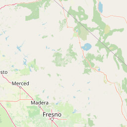
Map view of Yosemite National Park

Use this park location map to pinpoint Yosemite National Park in United States of America, understand its exact geographic position, and read its mapped placement within the surrounding landscape more clearly.

Pigeon | © OpenStreetMap contributors

Location context for Yosemite National Park

California
Natural feature types

Explore the Geological and Natural Landmarks of Yosemite National Park

Use this structured index to trace the specific natural landforms and hydrological features that shape the identity of Yosemite National Park. Discover the geographic distribution of cliffs, meadows, and forests through the MoriAtlas mapping system for a deeper understanding of this protected Sierra Nevada wilderness.
Recorded earthquake history

Review Historical Earthquake Records for Yosemite National Park

Access a structured collection of recorded seismic events associated with the region surrounding Yosemite National Park. This MoriAtlas catalogue provides historical data on event magnitudes and proximity to the park to support geographic discovery.

Yosemite National Park Earthquake History

Catalogued events

2,715 events

Strongest magnitude

Magnitude 6.2

Most recent event

Jul 30, 2026

This history includes earthquakes recorded inside the park or within 50 km of its borders

Gain visual insight into Yosemite's glacial valleys, soaring granite formations, and ancient sequoia groves, showcasing its unique protected-area character.

Explore Yosemite National Park: Photos of Iconic Granite Landscapes, Waterfalls, and Giant Sequoias

Browse an extensive collection of Yosemite National Park photos to visually explore its famed granite cliffs, spectacular waterfalls, and ancient giant sequoia groves. These images provide essential context for understanding the park's unique glacial-carved landscape, diverse habitats, and overall protected Sierra Nevada environment.

Red and orange foliage in foreground with El Capitan granite cliff in background under clear blue sky

A panoramic view of Half Dome and Eastern Yosemite Valley with granite mountains, green forests, and a clear blue sky with scattered clouds

A large granite dome-shaped mountain with steep cliffs and a flat top, surrounded by rocky peaks and forested areas under a partly cloudy sky

Yellow-bellied Marmot sitting on a large gray rock with brownish fur

Bridalveil Fall waterfall flowing down granite cliffs with forested valley below

River with rocks and grass, surrounded by forested hills and granite cliffs under a blue sky with scattered clouds

Granite peak with steep cliffs and scattered trees, forested base under clear blue sky.

Wide panoramic view of El Capitan rock formation in Yosemite Valley with forested hills and clear blue sky.

A large sequoia tree with a tunnel carved through its base in a forested area, with visitors walking through the tunnel and tall pine trees in the background under a clear blue sky

Smooth granite landscape with a single tree, clear blue sky, and distant hills

Black and white photograph of Half Dome rock formation with steep cliffs and forested slopes under clear sky.

Black-and-white photograph of a large two-story hotel building with a porch and awnings, surrounded by trees and a grassy area.

Panoramic illustration of Yosemite National Park featuring mountain ranges, valleys, rivers, and forests under a clear blue sky

Mule deer with large antlers walking on a paved road, surrounded by trees and rocks

Concrete dam with water cascading from spillway, surrounded by rocky hills and a lake under clear blue sky.

Smoke plume from wildfire with Half Dome and forested mountains in background

Park atlas

Browse surrounding protected areas, regional park geography, and diverse conservation landscapes adjacent to California's iconic Yosemite National Park.

Discover Other National Parks Near Yosemite National Park, Sierra Nevada, and California

Explore a curated list of national parks and protected areas adjacent to Yosemite National Park, offering deeper insights into the varied landscapes of the Sierra Nevada. Comparing these sites reveals the broader regional spread of conservation efforts and diverse geological formations beyond Yosemite's renowned granite cliffs and sequoia groves.
Wildlife reserveTuolumne County
Park boundaries overlap#1 closest

Northwest

Emigrant Wilderness: A Detailed Geographic Atlas of Protected Sierra Nevada Landscapes

Mapping glaciated granite basins and volcanic ridges in Tuolumne County.

Emigrant Wilderness is a sprawling protected area defined by a distinct mix of granitic domes, cirques, and a unique volcanic sector in its northeastern reaches. Spanning from lower forest elevations to alpine peaks, the area provides a window into the complex geological history of the central Sierra Nevada. The terrain includes hundreds of high-country lakes and meadow systems that support diverse alpine ecosystems and represent the rugged nature of the Pacific Crest Trail corridor.

Area
454.37 km²
Established
1974
IUCN
Ib
Relief
Mountain
Wildlife reserveCalifornia
Park boundaries overlap#2 closest

Northeast

Hoover Wilderness: Protected Alpine Geography in the Central Sierra Nevada, California

High-altitude glacial basins and Sierra crest wilderness

The Hoover Wilderness preserves a vital strip of high-elevation terrain along the eastern Sierra Nevada crest. Characterized by glacier-carved basins, interconnected alpine lakes, and sharp granite ridges, this protected area serves as a primary ecological gateway to the high country. Its landscape features define the headwaters of the Walker River, offering a compact yet significant look at California's protected alpine wilderness.

Area
518.89 km²
Established
1964
IUCN
Ib
Relief
Mountain
Protected landscapeNevada
Park boundaries overlap#3 closest

Northeast

Humboldt, Toiyabe National Forest: Protected Landscape and Regional Mountain Geography

A vast network of Nevada mountain ranges and alpine wilderness

Humboldt, Toiyabe National Forest serves as a defining public land entity across Nevada and eastern California. As the largest national forest in the contiguous United States, it preserves a striking collection of isolated mountain ranges, including the Ruby Mountains and the rugged Jarbidge wilderness, within a broader basin-and-range landscape. Examine the boundaries and terrain that characterize this complex, high-desert ecosystem.

Area
25,454 km²
Established
1908
Relief
Mountain
Access
Easy access
Protected landscapeCalifornia
Park boundaries overlap#4 closest

East

Inyo National Forest: An Atlas of Protected Landscapes and Sierra Nevada Geography

High altitude wilderness and volcanic terrain in Eastern California

Spanning from the arid Owens Valley floor to the 14,000 foot crest of the Sierra Nevada, Inyo National Forest remains a cornerstone of the American West. This protected landscape contains the Ancient Bristlecone Pine Forest, Mount Whitney, and the Mono Inyo volcanic chain, providing a dense geographic record of glacial, tectonic, and ecological diversity across a vast managed corridor.

Area
7,702.71 km²
Established
1907
IUCN
Ib
Relief
Mountain
Protected landscapeCalifornia
Park boundaries overlap#5 closest

Southeast

Sierra National Forest: Protected Landscapes of the Central California Sierra Nevada

Geography of alpine lakes, conifer forests, and mountain basins

Spanning from 900 to nearly 14,000 feet in elevation, Sierra National Forest protects a massive vertical range of California terrain. Discover its iconic wilderness areas and reservoir-studded landscape, providing a deep look at the geographic connectivity between major national parks in the central Sierra Nevada.

Area
5,300 km²
Established
1893
Relief
Mountain
Climate
Alpine
Protected landscapeCalifornia
Park boundaries overlap#6 closest

Northwest

Stanislaus National Forest: Sierra Nevada Mountain Geography and Protected Wilderness Lands

California mountain terrain and forest landscape map

Stanislaus National Forest is a sprawling protected landscape located in the central Sierra Nevada of California. Characterized by volcanic and granite formations, the area protects critical watersheds, Wild and Scenic rivers, and large swaths of old growth forest that define the rugged mountain interior.

Area
3,634.48 km²
Established
1897
Relief
Mountain
Climate
Temperate
Wildlife reserveCalifornia
20 km away#7 closest

Southeast

John Muir Wilderness: Sierra Nevada Protected Landscape and High Mountain Geography

California wilderness area with glacial basins and granite peaks

John Muir Wilderness represents one of the largest protected high-elevation areas in the contiguous United States. Spanning the Sierra Nevada crest, its granite terrain is sculpted by Pleistocene glaciation into sharp arêtes, deep canyons, and hundreds of alpine lakes. This wilderness serves as a vital geographic anchor for mountain ecosystems, offering an extensive look at the high-country landscape of eastern California.

Area
2,641.76 km²
Established
1964
IUCN
Ib
Relief
Mountain
Wildlife reserveFresno County
About 25 km away#8 closest

Southeast

Kaiser Wilderness: Exploring the Alpine Ridges and Glacial Terrain of the Central Sierra Nevada

A federally protected wilderness area in Fresno County, California.

Kaiser Wilderness offers a dense collection of signature Sierra Nevada landforms, including granite cliffs, subalpine forests, and high-altitude lakes. This wildlife reserve preserves a rugged, glacier-scoured interior that provides a distinct contrast to the surrounding regional landscape of the Sierra National Forest, making it a critical entity for understanding mid-elevation mountain ecology.

Area
92 km²
Established
1976
IUCN
Ib
Relief
Mountain

Common questions about visiting, size, designation, and location context for Yosemite National Park

Yosemite National Park FAQs for park facts, access, geography, and protected area context

Find quick answers about Yosemite National Park, including protected-area facts, park geography, trail and visitor context, and how the park fits into its surrounding country and regional landscape.
MoriAtlas Explorer

Continue Your Protected Areas Search Across the Global Atlas

Deepen your exploration by continuing the structured search for national parks and protected areas worldwide. Utilize the comprehensive filtering capabilities to compare different conservation landscapes and refine your understanding of global park geography. Discover more about the distribution and characteristics of protected natural areas.

Global natural geography