
Mori Atlas logo
Countries

Browse mapped protected lands and explore Guadeloupe's unique volcanic and marine landscapes.

Guadeloupe National Parks and Protected Areas: A Geographic Atlas Explorer

Guadeloupe, a French overseas department in the Caribbean, offers a rich tapestry of protected natural areas. This atlas entry point allows for detailed exploration of its national parks and diverse protected landscapes, highlighting their geographic distribution and regional context. Understand the mapped boundaries and terrain that define these valuable conservation areas, from volcanic peaks to marine reserves, all accessible through structured geographic discovery.

Guadeloupe National Parks and Protected Areas: A Geographic Atlas Explorer
Park system

National Parks in Guadeloupe: A Protected Area Geography Profile

Comparing historical protection trends, island habitats, and volcanic landscape designations

Evaluating the Guadeloupe park system involves looking at median territory sizes, diverse tropical designations, volcanic habitats, and coastal marine reserve records. Synthesized datasets allow researchers and explorers to contrast climate distributions and establishment dates based on currently verified park records.

Known protected area

173 km²

Area data available for 1 of 1 park.

Median park size

173 km²

Median across 1 park with known area.

Oldest known park

Established in 1989.

Largest known park

Recorded area: 173 km².

Designation distribution

National park1

Habitat distribution

Coastal habitat1
Marine habitat1
Montane forest1
Tropical forest1
Wetland1

Climate distribution

Tropical1
About

Explore the Geographic Spread of Guadeloupe's Protected Landscapes and Mapped Terrain

Discover National Parks and Protected Areas in Guadeloupe, French Caribbean

Explore Guadeloupe's national parks and protected areas through this geographic atlas, offering a detailed overview of the islands' conservation landscapes. MoriAtlas provides structured entries to understand the distribution of protected natural spaces across this French Caribbean region. It serves as an essential resource for discovering Guadeloupe's unique volcanic and tropical environments.

Guadeloupe is a French overseas department and region in the Caribbean, consisting of six inhabited islands and several uninhabited islets. The capital is Basse-Terre on Basse-Terre Island, while Pointe-à-Pitre serves as the largest metropolitan area and main business center. It is an outermost region of the EU and uses the euro as currency.

Guadeloupe is an overseas department and region of France situated in the Caribbean. The archipelago comprises Basse-Terre, Grande-Terre, Marie-Galante, La Désirade, and the Îles des Saintes, among other smaller islands. As a French overseas department, it is fully integrated into the French Republic while also being a constituent territory of the European Union. The population was 378,561 as of January 2024.

Largest city:Pointe-à-Pitre
Currency code:EUR
ISO code:GP
Parks count
1
Capital
Basse-Terre
Area
1,628 km²
Population
378,561 (2,024)
Elevation
1,467 m

Coastal
Island
Mountainous
Landlocked
Park atlas1 park

Explore the Mapped Geography of Guadeloupe's Protected Landscapes and Island Ecosystems

National Parks and Protected Areas in Guadeloupe: A Comprehensive Atlas View

Discover the protected areas and national parks situated within Guadeloupe. This atlas provides a geography-first exploration of the islands' conservation landscapes, from volcanic terrain to marine reserves, offering a structured overview for detailed park discovery. Navigate through Guadeloupe's rich protected territories and understand their regional context within the Caribbean.
Watercolor painting of mountains, a lake, and green hills
National parkGuadeloupe

Guadeloupe National Park: Volcanic Rainforest and Protected Landscape Identity

Explore mapped boundaries and regional geography.

Guadeloupe National Park stands as a significant protected landscape, primarily defined by the dramatic volcanic terrain of Basse-Terre. This atlas entry focuses on the park's vital role in preserving one of the Caribbean's most extensive tropical rainforest ecosystems, centered around the active La Soufrière volcano. Understand its mapped boundaries, unique geographic setting within the Lesser Antilles, and its importance as a national park and UNESCO biosphere reserve.

Area
173 km²
Established
1989
IUCN
II
Relief
Mountain
Landscape and environment

Understand how Guadeloupe is shaped by terrain, ecosystems, and seasonal conditions

Guadeloupe geography, nature, climate, and landscape context for park-focused travel research

Explore the physical geography, natural setting, and climate patterns of Guadeloupe through a location-first overview built for travel research, national park discovery, and broader regional context. This section helps explain how landscapes, habitats, and environmental conditions shape what people search for, where they travel, and how they experience protected areas in Guadeloupe.

Guadeloupe geography and landscape

Guadeloupe is located in the Caribbean, south of Antigua and Barbuda and Montserrat, and north of Dominica. The islands are volcanic in origin, with the active volcano La Grande Soufrière on Basse-Terre Island reaching 1,467 meters, the highest point. The terrain varies between mountainous forested areas and lower-lying plains.

Guadeloupe nature and environment

Guadeloupe features diverse natural landscapes including volcanic peaks, tropical forests, and coastal areas. The island of Basse-Terre contains significant forest cover and the active Soufrière volcano, while the surrounding waters support marine ecosystems. Several protected areas exist throughout the archipelago.

Guadeloupe climate and seasonal conditions

Guadeloupe has a tropical climate with warm temperatures year-round, influenced by Atlantic trade winds. The region experiences a wet season typically from June to November and a drier period from December to May.

Explore this place

Related topics and popular queries

Ways to explore Guadeloupe

Useful phrases, related topics, and discovery prompts connected to Guadeloupe.
where is guadeloupe locatedguadeloupe french overseas departmentvolcano la grande soufriere guadeloupeguadeloupe islands caribbeanguadeloupe population 2024capital of guadeloupeguadeloupe currency euroguadeloupe caribbean islandsguadeloupe overseas departmentfrench caribbean islandslesser antilles franceguadeloupe islandsbasse-terre guadeloupefrench eu region caribbeanguadeloupe volcanic islandeurozone caribbean
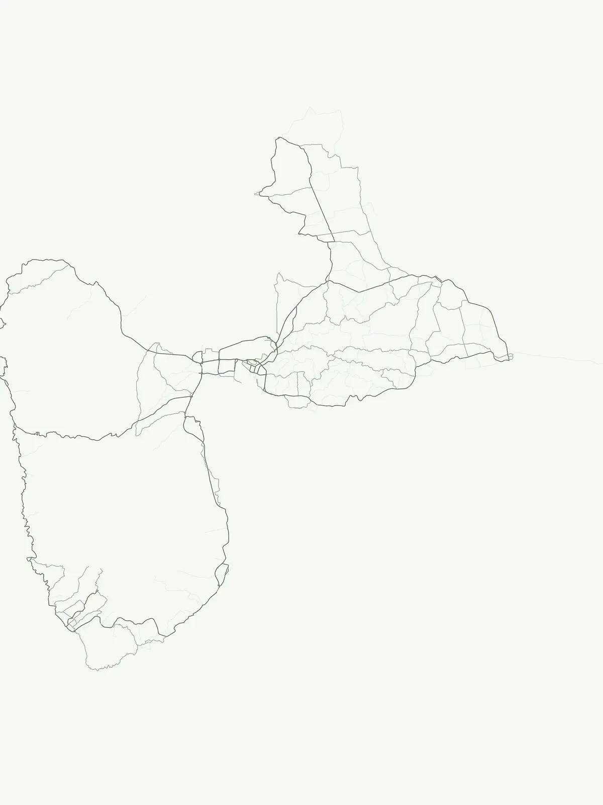
Park map

Discover the mapped geography and distribution of Guadeloupe's national parks and protected areas across its unique Caribbean island terrain.

Explore National Parks and Protected Areas on the Map of Guadeloupe

Preview the geographic positions of national parks and protected areas within Guadeloupe, observing how these conservation landscapes are distributed across the French Caribbean islands. This country-level map provides a foundational atlas view, allowing deeper exploration of park locations and regional protected area context.
Natural feature types

Examine the Natural Features and Protected Landscapes of Guadeloupe

Continue your geographic exploration by browsing the specific natural features and landforms cataloged within protected areas across Guadeloupe. MoriAtlas provides a structured, map-focused pathway for understanding the unique terrain, volcanic composition, and coastal geography of this Caribbean region.

Explore key details on park locations, conservation status, and the regional spread of protected landscapes across the French Caribbean.

Guadeloupe National Parks: Common Questions About Protected Area Geography

Delve into frequently asked questions regarding Guadeloupe's national parks and diverse protected areas, including their unique Caribbean geography and ecological significance. Understand how these insights clarify the distribution of conservation landscapes and help trace the distinct volcanic and marine environments throughout the archipelago.
Other countries

Compare protected landscapes and mapped geography across nearby island nations in the MoriAtlas.

Explore Other Caribbean Countries and National Parks Beyond Guadeloupe

Discover national parks and other notable protected areas across countries geographically relevant to Guadeloupe within the MoriAtlas. This expanded country view enables users to survey diverse conservation landscapes and understand broader regional protected area geography.

Puerto Rico National Parks and Protected Areas: Regional Geography and Atlas Explorer

Explore the structured dataset of Puerto Rico protected areas, ranging from mountain and elfin forests to unique karst landscapes and coastal watersheds. Access detailed information on state forest boundaries and regional geographic distribution throughout the archipelago.

10 parks

Antigua and Barbuda National Parks and Protected Areas: Geographic Discovery

Uncover the protected natural areas of Antigua and Barbuda through a structured geographic lens. This resource facilitates discovery of the nation's national parks and conservation landscapes, detailing their mapped boundaries and regional context. Understand how these protected lands contribute to the unique geography of the Caribbean nation, offering insights into their distribution and natural terrain. It serves as a vital atlas entry point for exploring the conservation geography of Antigua and Barbuda.

3 parks

Dominica's National Parks and Protected Landscapes: An Atlas Explorer

Access a structured geographic overview of Dominica's national parks and protected natural areas. This atlas-style explorer helps you understand the distribution of protected lands, the unique volcanic terrain, and the mapped boundaries of Dominica's conservation landscapes. Delve into the island's natural geography with detailed, context-aware information for focused exploration.

3 parks

National Parks and Protected Areas of Grenada: Regional Geography and Atlas

Examine the geographic framework of protected areas within Grenada. This resource highlights the spatial distribution of key sites including montane forest reserves and coastal wetlands, providing a clear overview of the national landscape and its conservation boundaries.

2 parks

Caribbean Netherlands National Parks, Protected Landscapes, and Regional Geography

Access a structured overview of protected lands across the Caribbean Netherlands. This resource provides geographic data on national parks and natural wilderness areas, facilitating the study of island environments from Bonaire to Saba and Sint Eustatius.

1 park

Sint Maarten National Parks and Regional Protected Area Geography

Trace the environmental geography of Sint Maarten by investigating its network of protected areas and marine parks. Access precise mapping data and site-specific records for natural landscapes across the island territory, including essential coral reef and seagrass meadow habitats.

1 park

Trinidad and Tobago National Parks and Protected Areas: Geographic Atlas Explorer

Access a detailed geographic overview of Trinidad and Tobago, featuring a structured database of protected areas and national parks. Investigate the distribution of natural landscapes from coastal peninsulas to rugged interior terrain, providing a clear reference for understanding the country's environmental boundaries and regional geography.

1 park

Curacao National Parks and Protected Areas: Mapped Landscapes and Geography

Explore the curated geography of Curacao's national parks and protected lands. This atlas view details the distribution of conservation areas and natural landscapes, offering a structured approach to understanding the island nation's unique terrain and protected regions. Navigate Curacao's significant protected areas and gain geographic context for its natural heritage.

1 park

Protected area types

Continue Exploring Guadeloupe's Park Designation Categories in Detail

Deepen your understanding of Guadeloupe's protected landscapes by examining each represented park designation group. MoriAtlas provides structured insights into the geographic distribution and landscape context of these classifications, allowing for focused atlas-based discovery of conservation efforts across the archipelago. Continue to uncover the unique patterns of protected lands within Guadeloupe and beyond.

Guadeloupe Protected Area Designations
MoriAtlas Explorer

Continue Your Global Geographic Exploration with MoriAtlas Park Discovery

Dive deeper into the world's protected landscapes and national parks through MoriAtlas's structured atlas interface. Discover how continents and countries are organized, and how individual park geography fits into the broader map. Our platform is built for understanding the distribution and context of protected areas worldwide, facilitating your journey through global natural geography.

Global natural geography






