Mori Atlas logo
National parkAgulhas National Park

Discover the mapped boundaries and regional geography of Agulhas National Park in Western Cape.

Agulhas National Park: National Park Protected Landscape and Geographic Atlas

Agulhas National Park represents a significant protected landscape within the Western Cape province of South Africa. This national park offers a distinct geographic identity, serving as a key entry for exploring its mapped boundaries and the surrounding regional terrain. Understanding Agulhas National Park through its atlas context reveals its role as a vital protected area within the diverse geography of the southern African continent.

Coastal Protected AreaFynbos BiomeWhale WatchingMarine ConservationBirdwatchingShipwreck History

Agulhas National Park

National park

Park overview

Structured park overview, official facts, and landscape profile for Agulhas National Park

Agulhas National Park park facts, protected area profile, and essential visitor context

Review the core facts for Agulhas National Park, including designation, size, terrain, visitor scale, habitats, and operating context in one park-focused overview.

About Agulhas National Park

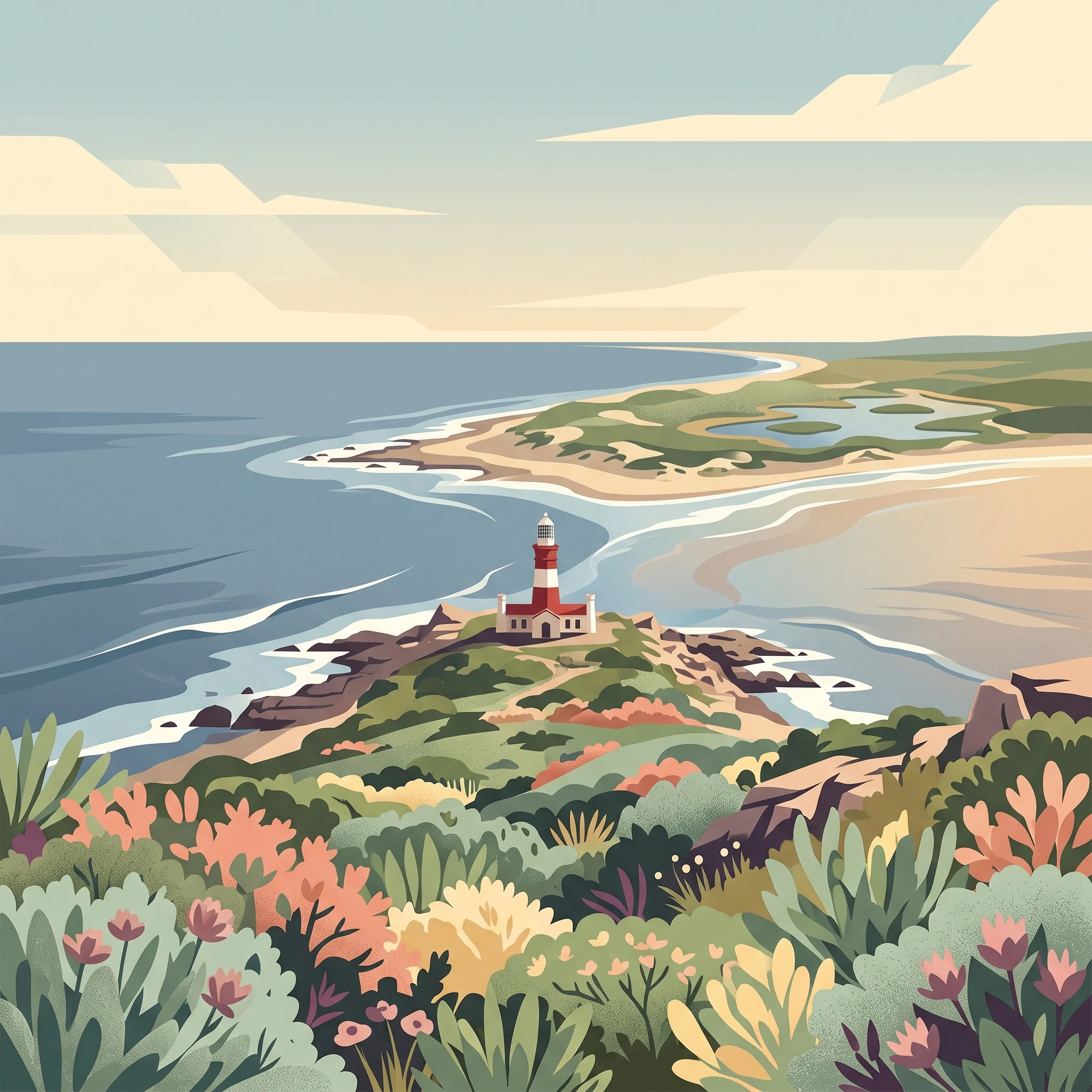
Agulhas National Park occupies a distinctive place in South Africa's protected area network as the keeper of the nation's southernmost coastline. The park's terrain is characterized by a low-lying coastal plain that rises gently toward the inland mountains, creating a mosaic of habitats that support remarkable biodiversity despite the relatively limited area. The coastal ecosystem is dominated by fynbos vegetation, a fire-adapted Mediterranean-type shrubland unique to the Cape region and one of the world's richest floral kingdoms. Within the park's boundaries, visitors encounter a landscape shaped by the relentless convergence of ocean currents, where the warm Agulhas Current from the east meets the cold Benguela Current from the west, creating productive waters that sustain abundant marine life.

Quick facts and research context for Agulhas National Park

Located approximately 200 kilometres southeast of Cape Town along the Agulhas Plain, the park stretches between the coastal towns of Gansbaai and Struisbaai. Covering roughly 20,959 hectares, it protects the southern tip of Africa and encompasses the famous Cape Agulhas lighthouse, the second-oldest in South Africa. The park contains over 2,000 native plant species and features wetlands that serve as critical refuge areas for birds and amphibians. The coastline is historically significant for shipwrecks due to dangerous reefs, with several vessels including HMS Birkenhead and the Arniston lost to the treacherous waters near Cape Agulhas.

Protection and recognition

Understanding coastal protection frameworks and official management scope at Cape Agulhas

Documented Protection Status and Conservation Profile of Agulhas National Park

National park datasets provide verified insight into the official conservation status, management boundaries, and designation history of Agulhas National Park. Reviewing official frameworks helps clarify how mixed protection boundaries safeguard the southern tip of Africa without relying on unverified status claims.

Protection details

Protection scope
Mixed
Transboundary protection
No
Park context

Deeper park guide and search-rich context for Agulhas National Park

Agulhas National Park history, landscape, wildlife, and travel context

Explore Agulhas National Park through its history, landscape character, ecosystems, wildlife, conservation priorities, cultural context, and seasonal travel timing in a structured park guide built for atlas discovery and search intent.

Why Agulhas National Park stands out

Agulhas National Park is best known for marking the precise southernmost point of Africa where the Atlantic and Indian Oceans officially meet, a geographic milestone that draws visitors seeking to stand at the continent's edge. The park's second-major attraction is the historic Cape Agulhas lighthouse, an icon of South Africa's maritime heritage and the second-oldest operating lighthouse in the country. The protected landscape also preserves one of the world's six floral kingdoms, the fynbos biome, with hundreds of endemic species carpeting the coastal slopes. The surrounding waters of the Agulhas Bank support productive fishing grounds and seasonal whale migrations, making the park a destination for marine wildlife observation.

Agulhas National Park history and protected-area timeline

The Agulhas area was recognized for its ecological and cultural significance long before formal protection was established. The Cape Agulhas lighthouse was constructed in 1848 to warn ships away from one of Africa's most dangerous coastlines, and the region's shipwreck history extends back centuries, with vessels like HMS Birkenhead and the Arniston becoming part of the area's maritime legacy. The surrounding agricultural community historically used the land for grazing and small-scale farming, but conservation concerns eventually led to the establishment of the national park in 1998. The creation of the park represented a collaborative effort between South African National Parks and local landowners to protect the ecologically sensitive Agulhas Plain while maintaining sustainable land use practices in the region.

Agulhas National Park landscape and geographic character

The park's landscape presents a striking contrast between the flat coastal plain and the dramatic oceanic boundary that defines its southern edge. Rolling fynbos-covered hills sweep toward the coastline, where rocky outcrops and sandy beaches alternate along the shore. The most prominent geographic feature is Cape Agulhas itself—a dramatic headland where visitors can observe the meeting of the Atlantic and Indian Oceans. Inland, seasonal wetlands fill with winter rains, creating shallow pans that attract waterfowl and provide breeding habitat for amphibians. The coastal cliffs and offshore reefs create the dangerous conditions that have claimed numerous vessels over centuries, contributing to the area's historical significance as both a navigational challenge and a maritime cemetery.

Agulhas National Park ecosystems, habitats, and plant life

The ecological character of Agulhas National Park is defined by the fynbos biome, a vegetation type remarkable for its species richness and high degree of endemism. Over 2,000 native plant species have been recorded within the park's boundaries, including numerous species of protea, erica, and restio that form the distinctive plant communities of this Mediterranean-type ecosystem. The wetlands scattered across the coastal plain provide crucial habitat for waterbirds and support amphibians that depend on seasonal water bodies for breeding. The offshore waters of the Agulhas Bank represent a distinct marine environment where the mixing of warm and cold ocean currents creates highly productive conditions for marine life.

Agulhas National Park wildlife and species highlights

The marine environment surrounding Agulhas National Park supports significant populations of cetaceans, with southern right whales migrating through the area between November and January to calve in the protected coastal waters. The rocky shoreline provides habitat for the African black oystercatcher, a threatened shorebird species that breeds along the coast. The Damara tern, a migratory seabird, uses the area during its breeding season, while the Cape platanna, a local amphibian species, inhabits the wetland areas. The park's waters support diverse marine fish species, and the productive Agulhas Bank fishing grounds attract both commercial and recreational fishing activity in the surrounding region.

Agulhas National Park conservation status and protection priorities

Agulhas National Park plays a vital role in protecting a small but ecologically significant portion of the fynbos biome, one of the world's six floral kingdoms and one of the most threatened ecosystems on Earth. The park safeguards critical habitat for numerous endemic plant species that occur nowhere else on the planet, contributing to global conservation efforts for Mediterranean-type ecosystems. The coastal wetlands provide protected habitat for waterbirds and amphibians, many of which face pressure from agricultural development across the Agulhas Plain. The marine environment, where two major ocean currents converge, represents a unique ecosystem that benefits from the park's coastal protection boundaries.

Agulhas National Park cultural meaning and human context

The Agulhas coastline carries deep historical significance as one of the most notorious stretches of shoreline in Southern African maritime history. The treacherous reefs off Cape Agulhas have claimed numerous vessels over centuries, giving the area a rich legacy of shipwreck lore and maritime tragedy. The Cape Agulhas lighthouse, built in 1848, stands as a testament to the region's importance in maritime navigation and remains an important cultural landmark. The nearby town of Bredasdorp houses a shipwreck museum that preserves artifacts from vessels lost along this dangerous coast, including relics from the HMS Birkenhead and Arniston disasters.

Top sights and standout views in Agulhas National Park

The defining experience for most visitors is standing at Cape Agulhas, the southernmost point of Africa, where markers indicate the exact meeting point of the Atlantic and Indian Oceans. The historic lighthouse offers panoramic views and houses a museum detailing the region's maritime history. Whale watching provides seasonal wildlife encounters from November through January when southern right whales congregate in the nearshore waters. The fynbos-covered landscapes, particularly impressive during the spring flowering season, showcase the extraordinary plant diversity of this unique biome.

Best time to visit Agulhas National Park

The park offers rewarding experiences throughout the year, though different seasons emphasize different aspects of its character. The austral spring months of September through November bring the fynbos into full bloom, with wildflowers carpeting the coastal slopes in vivid displays of color. Summer from December through February offers warm weather ideal for beach exploration but also brings higher visitor numbers. Whale watching is best from November through January when southern right whales are most active in the coastal waters. Winter rains transform the wetlands into vibrant bird habitat, though some coastal areas may experience windy conditions.
Monthly climate preview

Thirty-year historical climate averages mapped at a representative coastal elevation of five meters

Agulhas National Park Monthly Climate Normals and Weather Patterns

Long-term meteorological records at coastal elevations reveal a moderate climate profile where mid-year months experience cooler temperatures and increased daily rainfall while the beginning and end of the year remain warmer and drier. Accessing the complete monthly profile provides detailed tracking of historical temperature fluctuations and daily rainfall averages throughout the year.
Annual mean18 °C
15 °C21 °C
Jan21°
Feb21°
Mar20°
Apr18°
May17°
Jun15°
Jul15°
Aug15°
Sep15°
Oct16°
Nov18°
Dec19°
Warmest month
February

20.9 °C

Coolest month
August

14.5 °C

Wettest month
June

2.1 mm/day

Driest month
February

0.8 mm/day

Park location guide

Geography guide, regional context, and park location map for Agulhas National Park

Agulhas National Park park geography, regions, and map view in South Africa

Understand where Agulhas National Park sits in South Africa through a broader geographic reading of the surrounding landscape, nearby location context, and its mapped position within the national park landscape.

How Agulhas National Park fits into South Africa

South Africa is the southernmost country in Africa, spanning 1.22 million km² with a population of over 63 million. The country operates with three capital cities, Pretoria (executive), Cape Town (legislative), and Bloemfontein (judicial), and is renowned for its biodiversity, national parks, and multicultural society.

Wider geography shaping Agulhas National Park in South Africa

South Africa occupies the southernmost region of Africa, with coastline along both the Atlantic Ocean to the west and the Indian Ocean to the east. The interior features elevated plateaus including the Highveld, with the Drakensberg escarpment marking the eastern highlands. The country shares borders with Namibia, Botswana, Zimbabwe, Mozambique, Eswatini, and Lesotho.

Map view of Agulhas National Park

Use this park location map to pinpoint Agulhas National Park in South Africa, understand its exact geographic position, and read its mapped placement within the surrounding landscape more clearly.

Pigeon | © OpenStreetMap contributors

Location context for Agulhas National Park

Western Cape
Natural feature types

Browse the Geographic Landscapes and Natural Features of Agulhas National Park

Investigate the physical geography and documented natural landmarks within and surrounding Agulhas National Park. MoriAtlas provides a structured view of these coastal and inland features to enhance your understanding of the park landscape and its position at the edge of the African continent.
Park atlas

Explore the Geographic Spread and Diverse Coastal Protected Landscapes of South Africa's Southernmost Region

Discover Other Protected Areas and Nearby National Parks Near Agulhas National Park

Continue your exploration of Agulhas National Park by browsing other protected areas and national parks across the Southern Overberg region and coastal Western Cape. Compare diverse fynbos biomes, marine conservation zones, and critical coastal habitats within this unique geographic context.
Nature reserveWestern Cape
14 km away#1 closest

West

Dyer Island Nature Reserve Complex: Protected Marine Islands and Coastal Ecosystems

A critical conservation node in the Western Cape

The Dyer Island Nature Reserve Complex encompasses a series of low lying, wind-swept rocky islets that function as a cornerstone for South African marine research. By preserving the crucial breeding grounds of African penguins and providing a hub for the Cape fur seal population, this reserve defines a unique stretch of the Western Cape marine geography where high concentrations of predators and prey interact.

Established
1988
IUCN
Ia
Water
Water-dominated
Nature reserveWestern Cape
About 24 km away#2 closest

Northwest

Salmonsdam Nature Reserve: Atlas of Protected Landscapes in the Western Cape Overberg

Mountain fynbos, river gorges, and forest catchment geography.

Salmonsdam Nature Reserve is a compact protected expanse in the Overberg mountains of the Western Cape. The reserve encompasses the full Paardensberg River catchment, featuring complex terrain that ranges from high rocky ridges to the wet valley floor of Die Weivlakte. Its geography supports a high concentration of Afromontane forest patches and mountain fynbos habitats within a small, accessible area.

Area
8.34 km²
Established
1962
Relief
Mountain
Climate
Mediterranean
Nature reserveWestern Cape
About 73 km away#3 closest

Northwest

Kogelberg Nature Reserve: Protected Mountain Geography in the Western Cape, South Africa

Coastal mountain fynbos and protected river ecosystems

Situated in the Western Cape of South Africa, Kogelberg Nature Reserve protects an exceptional concentration of fynbos vegetation and rugged sandstone terrain. The area spans coastal mountain ridges, riparian corridors, and forest-filled ravines, serving as a landmark for botanical diversity and protected-landscape mapping in the region.

Area
30 km²
Relief
Mountain
Scope
Terrestrial
Water
Major water bodies
National parkWestern Cape
80 km away#4 closest

Northeast

Bontebok National Park: A Unique Protected Landscape in South Africa's Western Cape

Mapping the endemic bontebok's habitat and diverse fynbos.

Bontebok National Park represents a singular achievement in conservation, dedicated to protecting the rare bontebok antelope and showcasing the extraordinary biodiversity of the Cape Floristic Region. Located in the Western Cape, this smallest of South Africa's national parks features a landscape of fynbos-covered foothills beneath the Langeberg Mountains, with the Breede River defining its southern edge. Explore its mapped boundaries and unique ecosystems, offering a concentrated natural discovery experience within a UNESCO World Heritage Site.

Area
27.86 km²
Established
1931
IUCN
II
Relief
Mixed relief
Nature reserveWestern Cape
About 95 km away#5 closest

Northwest

Jonkershoek Nature Reserve: A Detailed Atlas of Mountain Catchment and Fynbos Ecology

Protected mountain geography near Stellenbosch, Western Cape

Jonkershoek Nature Reserve serves as a primary water source for the surrounding Western Cape landscape. This profile outlines the reserve's role in the Cape Floral Region, detailing its complex mountain topography, river headwaters, and significant fynbos plant communities that characterize the terrain.

Area
110 km²
Relief
Mountain
Climate
Mediterranean
Access
Easy access
National parkWestern Cape
104 km away#6 closest

Northwest

Table Mountain National Park: Mapped Protected Landscape and Geographic Context in Western Cape

National Park details focused on atlas exploration and regional geography.

Table Mountain National Park is a designated national park within the Western Cape region, offering a distinct geographic profile for atlas exploration. This entity provides detailed mapped boundaries and landscape context, crucial for understanding its role as a protected area in South Africa. Users can explore the specific geography that defines this park and its place within the broader regional context, making it a key point of interest for structured geographic discovery and map-based research.

Area
221 km²
Established
1998
Relief
Mountain
Climate
Mediterranean
Nature reserveWestern Cape
About 111 km away#7 closest

Northeast

Grootvadersbosch Nature Reserve: Protected Forest Landscapes and Langeberg Geography

Indigenous forest terrain in the Western Cape foothills.

Grootvadersbosch Nature Reserve offers a deep look into the largest surviving indigenous forest patch within the Langeberg range. This protected area integrates diverse valley geography with historic colonial farm infrastructure, providing a unique site for studying the natural terrain and river catchments of the South African Overberg region.

Area
2.5 km²
Relief
Mountain
Climate
Mediterranean
Access
Access unknown
Biosphere reserveWestern Cape
About 112 km away#8 closest

Northwest

Cape Winelands Biosphere Reserve: Geographic Overview and Protected Area Mapping

Western Cape mountain terrain and sustainable landscape integration

The Cape Winelands Biosphere Reserve serves as a model for integrated landscape management in South Africa. Situated along the Cape Fold Belt, this reserve protects crucial water catchments and endemic floral habitats while encompassing a globally recognized wine-producing region. Access detailed mapping of its core, buffer, and transition zones to see how conservation persists within a working agricultural environment.

Area
1,243.4 km²
Established
2007
Relief
Mountain
Climate
Mediterranean

Common questions about visiting, size, designation, and location context for Agulhas National Park

Agulhas National Park FAQs for park facts, access, geography, and protected area context

Find quick answers about Agulhas National Park, including protected-area facts, park geography, trail and visitor context, and how the park fits into its surrounding country and regional landscape.
MoriAtlas Explorer

Continue Your Protected Areas Search Across the Global Atlas

Deepen your exploration by continuing the structured search for national parks and protected areas worldwide. Utilize the comprehensive filtering capabilities to compare different conservation landscapes and refine your understanding of global park geography. Discover more about the distribution and characteristics of protected natural areas.

Global natural geography