
Mori Atlas logo
National parkAhaggar National Park

Tracing the volcanic topography, ancient plateaus, and protected boundaries of a vast desert mountain wilderness

Ahaggar National Park: A Comprehensive Geographic Atlas of Algeria's Saharan Highland Massif

Ahaggar National Park protects a massive central Saharan highland region in southern Algeria, serving as a critical refuge for specialized desert flora and fauna. The mapped territory encompasses the rugged Hoggar Mountains, where ancient metamorphic rock and eroded volcanic pillars rise to reach the summit of Mount Tahat. This protected landscape preserves both the stark beauty of rocky desert terrain and a deep cultural heritage connected to the Kel Ahaggar Tuareg, marking a significant convergence of natural history and human legacy.

Saharan highlandvolcanic landscaperocky desertmountain massifrelict wildlifebirdwatching
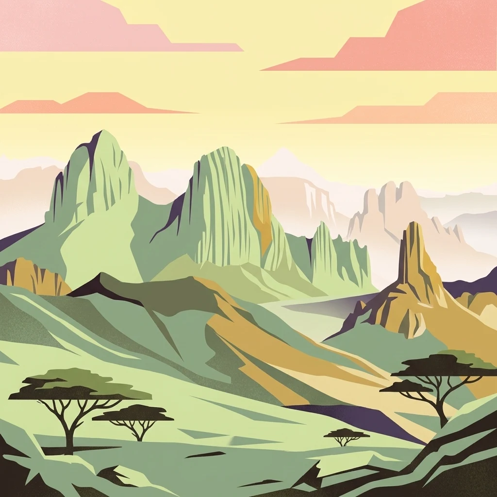
A stylized flat-design illustration of a rugged desert mountain range with sparse trees and sunset-toned skies.

Ahaggar National Park

National park

Park overview

Structured park overview, official facts, and landscape profile for Ahaggar National Park

Ahaggar National Park park facts, protected area profile, and essential visitor context

Review the core facts for Ahaggar National Park, including designation, size, terrain, visitor scale, habitats, and operating context in one park-focused overview.

About Ahaggar National Park

Ahaggar National Park lies at the heart of the Sahara in southern Algeria, encircling the Hoggar Mountains highland region along the Tropic of Cancer. Far from the flat, sand-covered image many travelers associate with the Sahara, the Hoggar is a rocky highland world of plateaus, escarpments, canyon-cut valleys, and isolated peaks shaped by deep time and the erosive force of desert winds. The protected area, on the order of 450,000 square kilometers, is one of the largest national parks in Africa and one of the most distinctive anywhere on the continent.

The park's defining feature is its elevation. While much of the surrounding Sahara sits at modest altitude, the Hoggar averages more than 900 meters above sea level, with the highest peak, Mount Tahat, rising to around 2,908 meters. This added elevation produces cooler nights, occasional frosts in winter, and a less extreme climate than the lowland desert. The underlying geology is ancient and dramatic, with metamorphic rocks roughly two billion years old overlain by younger volcanic deposits, some of which have been worn away to expose the resistant plugs that form the park's most spectacular summits such as Ilamen.

Ecologically, the park belongs to the West Saharan montane xeric woodlands ecoregion and supports vegetation quite unlike the surrounding desert: scattered acacias such as Vachellia tortilis and Vachellia seyal, myrtle, tamarisk, colocynth, and Calotropis procera clustered around wadis, seepages, and the bases of rocky outcrops. These scattered green patches sustain a surprisingly diverse community of desert fauna, including relict populations of Saharan-adapted mammals and birdlife that makes the park recognized internationally.

Culturally, the Hoggar is the homeland of the Kel Ahaggar Tuareg, a confederation whose identity has been shaped by these mountains for centuries. The park contains landmarks of global resonance, including the tomb of Tin Hinan at Abalessa, regarded as the ancestral matriarch of the Tuareg, and the Assekrem hermitage of Charles de Foucauld, perched high above the surrounding landscape. The fusion of stark Saharan scenery, ancient human heritage, and isolated biodiversity makes the protected area one of the most multidimensional parks in North Africa.

Quick facts and research context for Ahaggar National Park

Ahaggar National Park is a category II protected area located in Tamanrasset Province in southern Algeria, deep within the central Sahara. Established in 1987 and later reconstituted as the Ahaggar Cultural Park, it encompasses roughly 450,000 square kilometers of highland desert centered on the Hoggar Mountains.

The park contains Mount Tahat, the highest point in Algeria, and the prominent Assekrem plateau. It lies within the West Saharan montane xeric woodlands ecoregion, has been recognized as an Important Bird Area by BirdLife International, and supports relict Saharan wildlife including Northwest African cheetahs, Saharan barbary sheep, and Dorcas gazelles. The nearby city of Tamanrasset serves as the main gateway to the region.

Protection and recognition

Documented terrestrial protection scope and management parameters

Ahaggar National Park Protection Status and Conservation Framework

Ahaggar National Park maintains a documented terrestrial protection scope within its regional conservation framework. Official records compile available management parameters and institutional recognition metrics for structured park analysis.

Protection details

Protection scope
Terrestrial
Transboundary protection
No
Park context

Deeper park guide and search-rich context for Ahaggar National Park

Ahaggar National Park history, landscape, wildlife, and travel context

Explore Ahaggar National Park through its history, landscape character, ecosystems, wildlife, conservation priorities, cultural context, and seasonal travel timing in a structured park guide built for atlas discovery and search intent.

Why Ahaggar National Park stands out

The park is best known for protecting the highland heart of the Hoggar Mountains, a rugged massif in the central Sahara that rises dramatically out of the surrounding desert plains. Its iconic landforms include deeply eroded volcanic peaks, ancient metamorphic plateaus, and stark inselberg-like summits, with Mount Tahat at roughly 2,900 meters serving as the highest point in Algeria. It is also recognized for the Assekrem plateau, a celebrated lookout point associated with the hermitage of Charles de Foucauld. Beyond its scenery, the park is distinguished by its relict Saharan biodiversity, including the rare Northwest African cheetah, and by its status as an Important Bird Area supporting specialist desert species such as sandgrouse, larks, and wheatears.
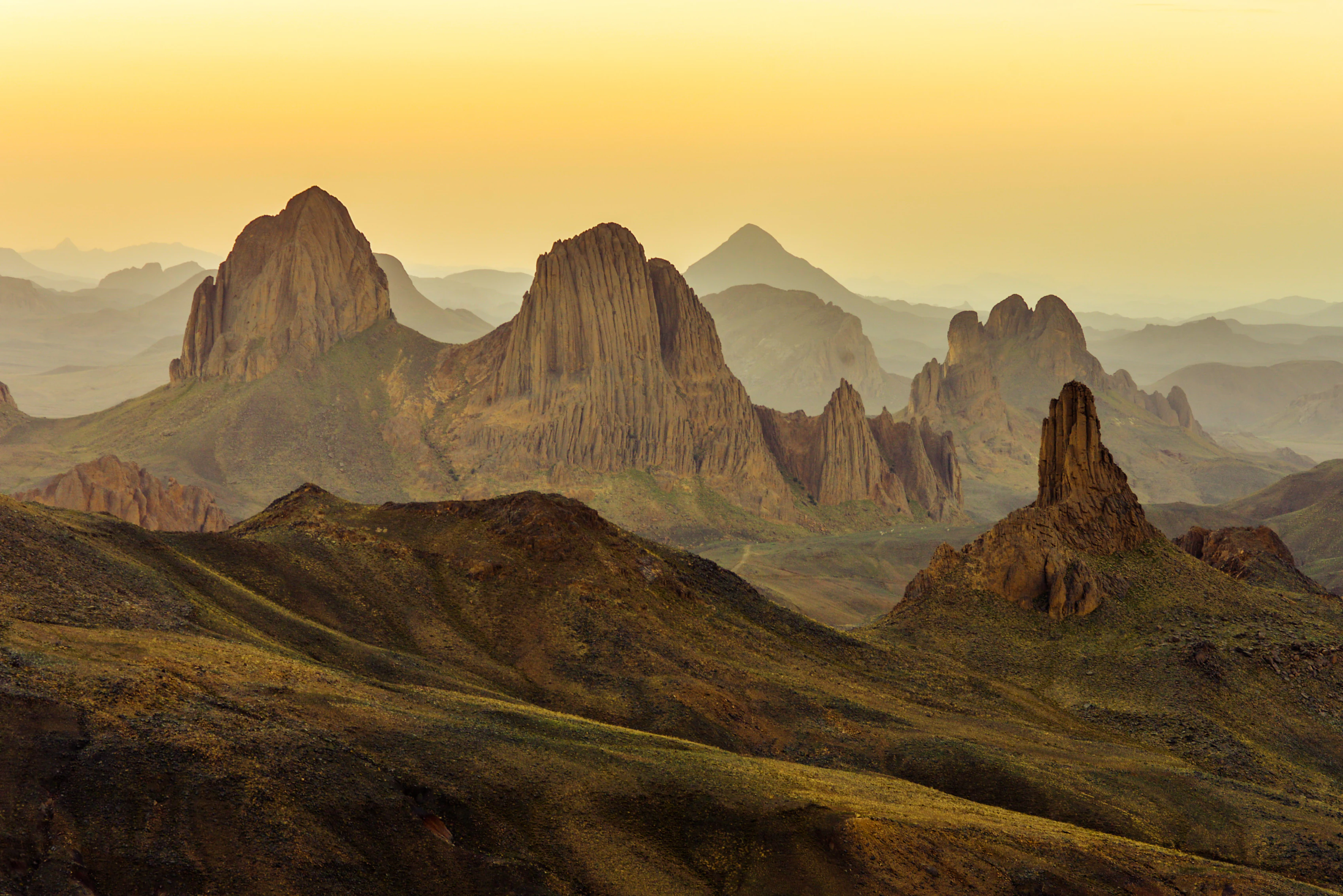
Wide angle photograph of the rugged Hoggar Mountains landscape in Algeria at sunset, featuring sharp volcanic peaks and deep valleys in warm golden lighting.
Sunset view over the rocky spires and peaks of the Assekrem plateau in Ahaggar National Park.

Ahaggar National Park history and protected-area timeline

The human history recorded in the Ahaggar region stretches back at least to the Neolithic period, with extant rock paintings in the mountains dating to around 6000 BC. These images are among the oldest surviving evidence of human settlement and artistic expression in the central Sahara, marking the area as a long-occupied landscape long before the modern concept of a national park existed.

In more recent centuries, the Hoggar Massif became the heartland of the Kel Ahaggar Tuareg, a confederation whose nomadic and semi-nomadic traditions are deeply intertwined with the mountains. The tomb of Tin Hinan, traditionally regarded as the ancestral matriarch of the Tuareg, stands at the oasis of Abalessa near Tamanrasset, anchoring the region's cultural identity. Tamanrasset itself grew on a wadi that was part of an ancient watercourse, the Tamanrasset River, which flowed during the African humid period before the Sahara's modern arid climate set in.

In 1911, the French religious figure Charles de Foucauld established a hermitage on the Assekrem plateau, a site that has remained a spiritual and pilgrimage landmark to the present day and continues to host a small community of monks. During the 1960s, the mountains also became the site of French underground nuclear tests, a darker historical chapter in the modern story of the region.

The protected area itself was formally established in 1987 as Ahaggar National Park, a massive category II reserve of roughly 450,000 square kilometers. In 2011, the designation was reoriented toward a broader cultural and natural mandate, and the area is now administered as the Ahaggar Cultural Park, continuing to safeguard both the natural environment of the Hoggar Mountains and the deep Tuareg heritage of the region.

Ahaggar National Park landscape and geographic character

The landscape of Ahaggar National Park is defined by the striking contrast between the surrounding Sahara and the highland massif at its core. Average elevations across the Hoggar exceed 900 meters above sea level, and the highest peak, Mount Tahat, reaches about 2,908 meters, making it both the apex of the range and the highest point in Algeria. The terrain is overwhelmingly rocky rather than sandy, a world of stone plateaus, sharp ridgelines, wind-sculpted outcrops, and deeply carved wadis.

Much of the underlying geology consists of metamorphic rocks roughly two billion years old, among the oldest exposures in the region. Superimposed on this ancient base are younger volcanic deposits, and several of the most dramatic peaks, including the prominent Ilamen, are remnants of extinct volcanic domes. As softer volcanic material eroded away over millions of years, the harder volcanic plugs that once filled the cones were left standing as isolated towers and pinnacles, giving the Hoggar its distinctive silhouette.

Among the most celebrated places in the park is the Assekrem plateau, a high vantage point with sweeping views across the massif and a long association with Charles de Foucauld's hermitage. Scattered oases and wadi systems, including those that once carried the ancient Tamanrasset River during the African humid period, interrupt the rocky expanse and concentrate pockets of life in an otherwise austere environment.
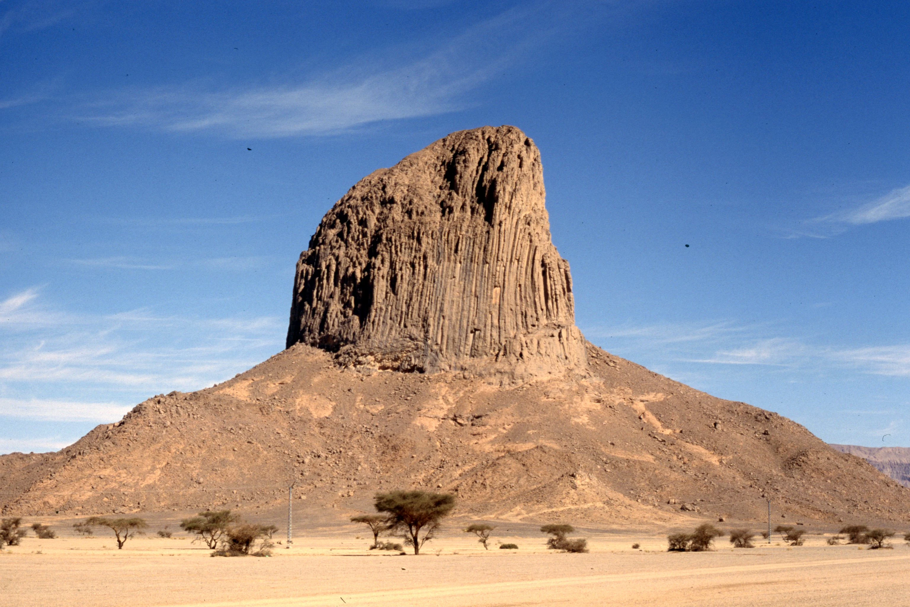
A large, isolated volcanic rock pinnacle rises above a sparse, arid desert landscape under a clear blue sky.
The distinctive volcanic rock formation of Assekrem in the Hoggar Mountains.

Ahaggar National Park ecosystems, habitats, and plant life

The natural environment of Ahaggar National Park sits within the West Saharan montane xeric woodlands ecoregion, a transitional Saharan biome where elevation and exposure create conditions distinct from the surrounding lowland desert. Despite the arid setting, the park's combination of higher altitude, cooler nights, and varied topography supports a richer and more diverse ecological community than most other parts of the Sahara.

Vegetation is sparse but ecologically significant, concentrated along wadis, around oases, and in pockets of soil held between rocks. Trees such as Vachellia tortilis and Vachellia seyal, together with myrtle and the salt-tolerant Tamarix aphylla, form scattered woodlands in favored microhabitats. Drought-adapted plants such as Citrullus colocynthis and Calotropis procera add to a flora uniquely shaped by the harsh Saharan climate. Because the highlands capture occasional rainfall and experience cooler temperatures, they also serve as a refuge for relict species that have long since disappeared from the warmer lowlands.
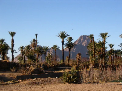
A grove of tall date palm trees in the foreground with rugged, dark volcanic mountain peaks rising in the background under a clear blue sky.
A desert oasis landscape in the Hoggar Mountains of Ahaggar National Park.

Ahaggar National Park wildlife and species highlights

Wildlife in the Hoggar Mountains reflects the broader pattern of Saharan fauna, with species concentrated where elevation, vegetation, and water allow survival. The park supports populations of herbivorous mammals adapted to the arid mountains, including the Saharan subspecies of the barbary sheep, which moves through the rocky terrain, and the Dorcas gazelle, which ranges across more open desert margins within the protected area.

Carnivores and larger predators have a particularly notable presence in the region. Camera-trap surveys between 2008 and 2010 documented individuals of the Northwest African cheetah in the park, and a cheetah was filmed and photographed in the Atakor volcanic field in 2020, confirming the persistence of this rare desert subspecies. Historically, the area west of the Hoggar also held African wild dogs until the 20th century, and relict populations of the West African crocodile once inhabited the mountains, although these have since vanished.

Birdlife is one of the strongest ecological signatures of the protected area, which BirdLife International has designated an Important Bird Area. The park supports significant populations of species adapted to the central Saharan environment, including spotted, crowned, and Lichtenstein's sandgrouse, pharaoh eagle-owls, pallid harriers, greater hoopoe-larks, bar-tailed and desert larks, pale rock martins, fulvous babblers, white-crowned and mourning wheatears, desert sparrows, and trumpeter finches. Together they form one of the most distinctive desert bird communities in North Africa.

Ahaggar National Park conservation status and protection priorities

Ahaggar National Park plays an outsized role in Saharan conservation because it protects a highland refuge in an otherwise extreme desert biome. Its cooler temperatures, scattered vegetation, and isolated water sources preserve relict species whose ranges have contracted dramatically across the Sahara, while its sheer size offers rare continuity across a vast and otherwise unprotected landscape.

Recognition of the park's ecological importance is reflected in its Important Bird Area status, awarded by BirdLife International for its populations of specialist desert bird species. The park also retains one of the few confirmed strongholds of the Northwest African cheetah in the central Sahara, alongside viable populations of Saharan barbary sheep and Dorcas gazelle, making it a key site for the conservation of large Saharan mammals.

The shift from a strictly national park designation in 1987 to the broader Ahaggar Cultural Park framework in 2011 reflects an integrated approach to safeguarding both the natural environment and the deep Tuareg cultural heritage of the Hoggar. This combined mandate acknowledges that long-term conservation in the region depends on pairing ecological protection with the continued presence and traditions of the Kel Ahaggar communities who have shaped the landscape for centuries.

Ahaggar National Park cultural meaning and human context

The Hoggar Mountains are inseparable from the identity of the Kel Ahaggar Tuareg, the confederation whose history, language, and customs are intimately tied to the massif. The region is widely regarded as a Tuareg heartland, and references to the Ahaggar in Saharan culture carry a depth of meaning far beyond its physical boundaries. The tomb of Tin Hinan at Abalessa, near Tamanrasset, is one of the most important cultural landmarks in the park, traditionally venerated as the resting place of the Tuareg matriarch.

In the 20th century, the Assekrem hermitage of Charles de Foucauld, built in 1911 on a high plateau within what is now the protected area, added another significant layer to the cultural landscape. The hermitage remains occupied by a small community of Catholic monks and draws pilgrims and travelers seeking both solitude and the sweeping vistas that have shaped the site's enduring mystique. Nearby Tamanrasset, founded on a former wadi of the ancient Tamanrasset River, serves as the main cultural and logistical hub of the region, bridging Tuareg heritage, Algerian administration, and the broader Saharan world.

Top sights and standout views in Ahaggar National Park

The park's standout feature is the Hoggar highland massif itself, a vast rocky kingdom of plateaus, eroded volcanic plugs, and wind-sculpted stone rising out of the central Sahara, anchored by Mount Tahat, the highest peak in Algeria. Equally iconic is the Assekrem plateau, a celebrated viewpoint and the site of Charles de Foucauld's enduring hermitage, offering some of the most panoramic vistas in North Africa.

Equally remarkable is the park's ecological signature: a desert refuge where relict populations of the Northwest African cheetah and Saharan barbary sheep still roam, recognized internationally as an Important Bird Area for its specialized desert avifauna. Layered on top of the natural heritage is the deep cultural presence of the Kel Ahaggar Tuareg and the tomb of Tin Hinan at Abalessa, making the protected area one of the rare places where sweeping Saharan scenery, rare wildlife, and millennia of human heritage converge in a single landscape.

Best time to visit Ahaggar National Park

The Hoggar region experiences hot summers and cool, occasionally freezing winters, with rainfall rare and unpredictable throughout the year. Cooler months between late autumn and early spring generally offer the most comfortable conditions for exploring the highland plateaus, when daytime temperatures are milder and the crisp air sharpens the visibility of the dramatic rock scenery. Winter nights can drop below freezing at altitude, a reminder of the surprising climate contrasts of this elevated desert.

Wildlife observation can be rewarding at almost any season thanks to the resident populations of cheetahs, barbary sheep, and desert birds, while the quality of light over the rocky highlands tends to be especially striking during the cooler months. Summer visits are possible but require careful planning around extreme heat, particularly at lower elevations within the park.

Monthly climate preview

Long-term representative monthly temperature and precipitation patterns

Ahaggar National Park Climate Normals and Annual Temperature Rhythm

Representative coordinate measurements reveal marked annual temperature variations alongside consistently minimal precipitation across twelve distinct intervals. Detailed monthly records supply complete temperature ranges and precipitation metrics for comprehensive atmospheric analysis.
Annual mean25 °C
14 °C33 °C
Jan14°
Feb17°
Mar21°
Apr27°
May31°
Jun33°
Jul32°
Aug32°
Sep31°
Oct26°
Nov20°
Dec15°
Warmest month
June

33 °C

Coolest month
January

13.6 °C

Wettest month
August

0.3 mm/day

Driest month
November

0 mm/day

Park location guide

Geography guide, regional context, and park location map for Ahaggar National Park

Ahaggar National Park park geography, regions, and map view in Algeria

Understand where Ahaggar National Park sits in Algeria through a broader geographic reading of the surrounding landscape, nearby location context, and its mapped position within the national park landscape.

How Ahaggar National Park fits into Algeria

Algeria is a North African country spanning over 2.38 million km², making it the largest country in Africa. It borders the Mediterranean Sea to the north and shares land borders with seven countries. The population exceeds 47 million, with most concentrated in the northern coastal region.

Wider geography shaping Ahaggar National Park in Algeria

Algeria occupies the central portion of the Maghreb region in North Africa. It is bordered by Tunisia and Libya to the northeast, Niger to the southeast, Mali, Mauritania, and Western Sahara to the southwest, and Morocco to the west. The Mediterranean Sea forms its northern border. The terrain consists of the Tell Atlas mountain range and coastal plains in the north, transitioning to the Sahara desert in the south.

Map view of Ahaggar National Park

Use this park location map to pinpoint Ahaggar National Park in Algeria, understand its exact geographic position, and read its mapped placement within the surrounding landscape more clearly.

Pigeon | © OpenStreetMap contributors

Location context for Ahaggar National Park

Tamanrasset Province

Visualizing the volcanic massifs and high desert terrain of the Hoggar Mountains.

Ahaggar National Park Photos and Landscape Scenery

Photographic collections reveal the rugged topography, stone plateaus, and eroded volcanic peaks defining Ahaggar National Park. Visualizing these remote environments helps clarify the scale of the Hoggar highlands and the character of Saharan protected landscapes.

Wide angle photograph of the rugged Hoggar Mountains landscape in Algeria at sunset, featuring sharp volcanic peaks and deep valleys in warm golden lighting.

A wide-angle panoramic photograph showing a vast, arid mountain range with jagged rocky peaks and deep valleys under a light sky.

A large, isolated volcanic rock pinnacle rises above a sparse, arid desert landscape under a clear blue sky.

A grove of tall date palm trees in the foreground with rugged, dark volcanic mountain peaks rising in the background under a clear blue sky.

Park atlas

Compare surrounding desert highlands and regional conservation landscapes

Explore Protected Areas and Parks Near Ahaggar National Park

Browse nearby national parks and protected areas sharing the stark geological features of the central Sahara. Comparing these surrounding reserves provides a broader geographic perspective on regional desert mountain ecosystems.
Nature reserveNiger
About 286 km away#1 closest

Southeast

Aïr and Ténéré National Nature Reserve: Protected Landscape Atlas in Niger's Sahara

Discover unique Sahelian ecosystems isolated within the desert.

Delve into the Aïr and Ténéré National Nature Reserve, a monumental protected area in northern Niger. This reserve is celebrated for its extraordinary geographic setting, acting as an island of Sahelian life within the expansive Sahara Desert. Examine its mapped boundaries, the striking contrast between its blue marble mountains and the Ténéré desert, and its critical role in preserving unique desert flora and fauna. The reserve's vast scale and ecological distinctiveness make it a key destination for understanding protected land geography and Saharan conservation.

Area
64,560 km²
Established
1988
IUCN
IV
Relief
Mountain
National parkAlgeria
About 472 km away#2 closest

Northeast

Tassili n'Ajjer National Park: A Protected Saharan Landscape in Algeria

Explore its mapped boundaries and regional geographic context.

Tassili n'Ajjer National Park is a large national park situated in Algeria, renowned for its protected status and vast desert geography. This park offers rich opportunities for atlas-based exploration, allowing users to trace its extensive mapped boundaries and understand its position within the broader North African landscape. Discover the unique terrain and natural features that define this significant protected area, providing essential geographic context.

Area
72,000 km²
Established
1972
Relief
Mountain
Climate
Arid
Protected areaTahoua Region
About 760 km away#3 closest

South

Mare de Tabalak Protected Area: Geography and Wetland Landscape in Tahoua, Niger

Mapping a unique Sahelian freshwater ecosystem and seasonal floodplains

Mare de Tabalak serves as one of the most ecologically significant wetlands in Niger. This protected area, characterized by its permanent freshwater lake and vast seasonal floodplains, sits at the intersection of the Ader Doutchi plateaus and the Tadrès sand dunes. The site acts as a major hub for migratory bird populations and supports essential regional pastoral and agricultural livelihoods within the Tahoua landscape.

Area
7 km²
Established
2005
Relief
Lowland
Climate
Arid
Protected areaTahoua Region
About 856 km away#4 closest

South

Mare de Dan Doutchi Protected Area: Mapping the Sahelian Wetlands of Tahoua Region

Permanent freshwater lake and Ramsar-listed ecological site

Situated in the Tahoua Region, Mare de Dan Doutchi acts as a rare permanent waterbody in the transition zone between the Sahel and the Sahara. This detailed profile covers the hydrological features of the basin, its role as a seasonal refuge for diverse bird species, and its importance to regional livelihoods within the Iullemmeden Basin context.

Area
382.5 km²
Established
1974
Relief
Lowland
Climate
Arid
Wildlife reserveZinder
About 949 km away#5 closest

South

Mare de Lassouri Wildlife Reserve: Geographic Context and Sahel Wetland Mapping

Protecting vital aquatic habitats in the Zinder Region

Mare de Lassouri serves as a central hub for wetland conservation within the Zinder Region of Niger. This shallow freshwater basin offers a rich habitat mosaic where migratory waterbirds congregate amid bushy savanna, providing essential ecological value and sustaining local agricultural livelihoods in a resource-scarce Sahelian landscape.

Area
7.5 km²
Established
2005
Relief
Lowland
Climate
Arid
A soft, light watercolor painting of a valley landscape with rolling green hills, distant purplish mountains, and patches of pink, yellow, and green vegetation.
Wildlife reserveNiger
About 956 km away#6 closest

South

Dallol Bosso Wildlife Reserve: Geographic Atlas and Protected Landscape Context in Niger

A 350-kilometer seasonal wetland corridor and regional hydrologic system

Dallol Bosso stands as a major seasonal drainage corridor in western Niger. This wildlife reserve spans from the Malian border to the Niger River, offering a distinct study in Sahelian hydrology. Its alluvial soils and wetland characteristics support specific agricultural patterns, making it a focal point for understanding the human and natural geography of the Boboye region.

Area
8,921.22 km²
Established
2004
Relief
Lowland
Climate
Subtropical
A soft, horizontal watercolor painting showing a green and tan landscape of trees and hills with a reflecting body of water in the foreground, set against a white background.
Nature reserveMaradi Region
About 978 km away#7 closest

South

Geschützter Wald von Madarounfa: Protected Woodland and Nature Reserve in the Maradi Region

Mapping the Sahel-Sudan transition landscapes of Niger.

Located in the Maradi Region, this nature reserve protects a rare mosaic of dryland vegetation, including acacia and tamarind groves on alluvial soils. The woodland functions as a critical environmental anchor within the surrounding agricultural plains, offering a window into the natural history of the Goulbi de Maradi river valley.

Area
8.3 km²
Established
1950
Relief
Lowland
Climate
Subtropical
A soft watercolor painting showing a winding river or lake flowing through a landscape with gentle green hills, clusters of trees, and a pale sky.
Nature reserveMaradi Region
About 981 km away#8 closest

South

Madarounfa Lake Nature Reserve: Geographic Overview of Niger's Premier Wetland

Seasonal wetlands and riparian habitats in Maradi Region

Madarounfa Lake functions as a pivotal natural feature in the Maradi Region, blending seasonal hydrological shifts with a distinct cultural identity. This protected area supports critical riparian woodland and waterbird populations, serving as an essential resource for the surrounding landscape. Its classification as a wetland of international importance highlights the environmental complexity of the Sahel-Sudanese transition zone.

Area
8.5 km²
Established
2019
Relief
Lowland
Scope
Terrestrial

Common questions about visiting, size, designation, and location context for Ahaggar National Park

Ahaggar National Park FAQs for park facts, access, geography, and protected area context

Find quick answers about Ahaggar National Park, including protected-area facts, park geography, trail and visitor context, and how the park fits into its surrounding country and regional landscape.
MoriAtlas Explorer

Continue Your Protected Areas Search Across the Global Atlas

Deepen your exploration by continuing the structured search for national parks and protected areas worldwide. Utilize the comprehensive filtering capabilities to compare different conservation landscapes and refine your understanding of global park geography. Discover more about the distribution and characteristics of protected natural areas.

Global natural geography