
Mori Atlas logo
Marine protected areaAkaroa Marine Reserve

A comprehensive look at the marine boundaries and coastal terrain of this protected harbour ecosystem

Akaroa Marine Reserve: Mapped Protected Area and Volcanic Harbour Geography in New Zealand

Akaroa Marine Reserve encompasses a critical 512 hectare no-take zone at the entrance of a dramatic volcanic harbour on the Banks Peninsula of New Zealand. The reserve features a transition from rocky reef and kelp habitats near the Pacific Ocean to softer sand and mud substrates inside the harbour. This protected landscape is defined by its complex geological origins as an eroded shield volcano and its integration into a layered management system that includes customary fishing areas and nearby marine sanctuaries.

marine reserveno-take zoneharbour ecosystemvolcanic harbourreef habitatkelp forest
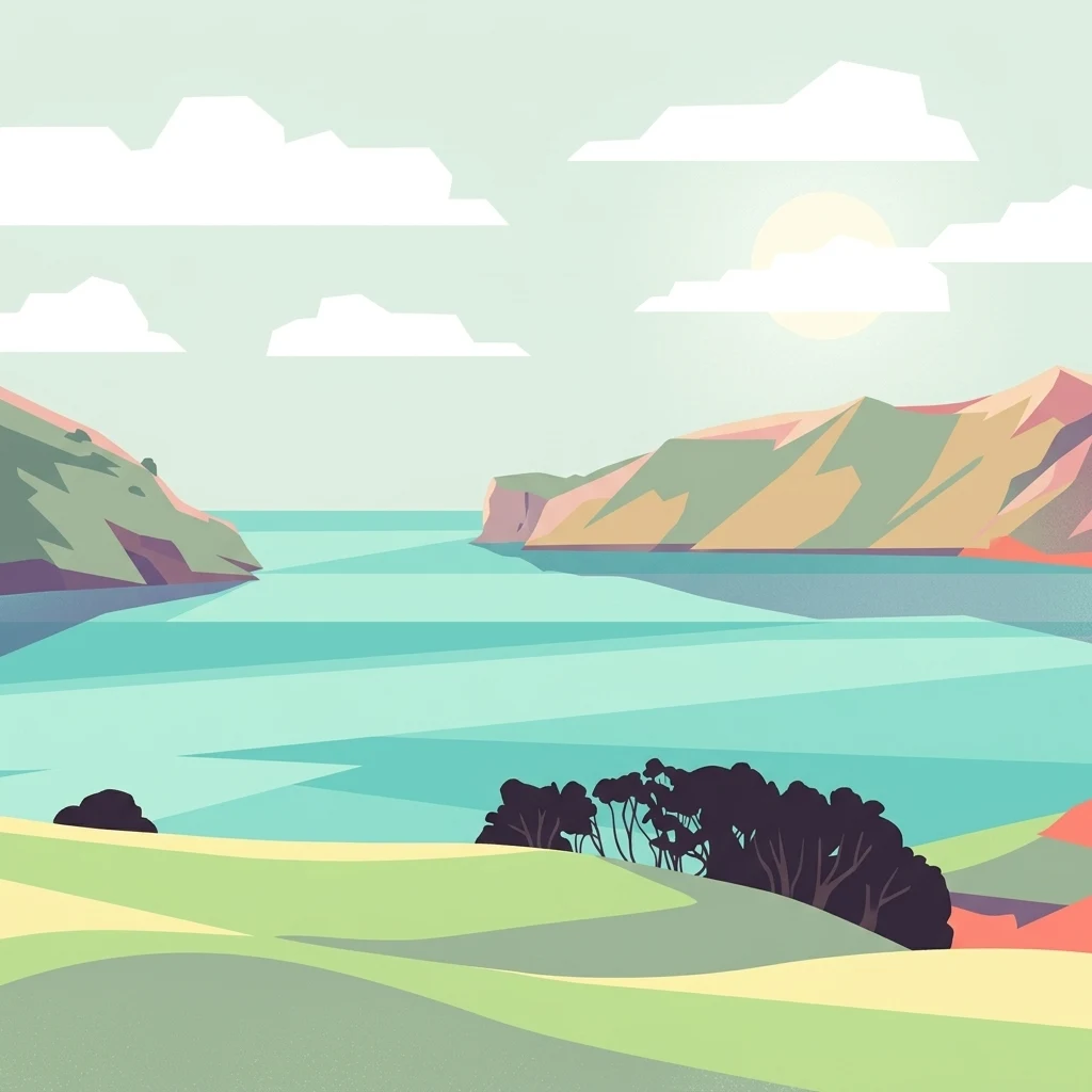
A flat-style vector illustration depicting a coastal inlet between two rocky hills, with rolling green fields in the foreground, turquoise water, and a bright sun in a pale sky.

Akaroa Marine Reserve

Marine protected area

Park overview

Structured park overview, official facts, and landscape profile for Akaroa Marine Reserve

Akaroa Marine Reserve park facts, protected area profile, and essential visitor context

Review the core facts for Akaroa Marine Reserve, including designation, size, terrain, visitor scale, habitats, and operating context in one park-focused overview.

About Akaroa Marine Reserve

Akaroa Marine Reserve sits at the entrance to Akaroa Harbour on the volcanic Banks Peninsula, the eroded remnant of two overlapping shield volcanoes on the southern edge of Christchurch's coastal reach. The reserve occupies roughly 512 hectares of coastal waters on the seaward side of the harbour mouth, with the surrounding Akaroa Taiāpure managing the remainder of the harbour under a fisheries co-management framework. Together, these zones represent a layered approach that combines full no-take protection with traditional Māori oversight of customary food gathering.

The harbour itself is a flooded volcanic crater system, producing steep cliffs, deep embayments, and a complex seafloor of rock, sand, and mud. The fauna differs noticeably between the inner harbour, where softer sediments dominate, and the outer harbour, where harder substrates support kelp forests and reef communities. This habitat diversity is part of what made the harbour attractive both for indigenous fishing and for contemporary recreational and commercial use, and what ultimately drove the long campaign for protection.

Culturally, the harbour has deep significance to Ngāi Tahu. The waters are known by the traditional name Te Whata o Kōkiro, reflecting their role as a longstanding source of mahinga kai, the traditional food gathering areas. Local hapū and rūnanga were central actors throughout the reserve's establishment process, advocating for co-management through a taiāpure while also securing provisions for customary harvest. The result is a marine reserve that reflects not only biodiversity protection, but also an ongoing negotiation between conservation, customary rights, and contemporary recreational interests.

In practice, the reserve sits within a broader protected network on Banks Peninsula that includes the Pōhatu Marine Reserve at Flea Bay, the Port Levy Mātaitai Reserve and Rāpaki Mātaitai Reserve in nearby Lyttelton Harbour, and the Akaroa Taiāpure across the rest of Akaroa Harbour. Each layer has a distinct legal character: the marine reserves are full no-take zones, while the taiāpure and mātaitai are fisheries governance tools that allow regulated fishing.

Quick facts and research context for Akaroa Marine Reserve

Akaroa Marine Reserve is a no-take marine reserve located at the entrance to Akaroa Harbour on the Banks Peninsula, near Christchurch on New Zealand's South Island. Established in 2014, the reserve covers roughly 512 hectares of marine area and is classified as a strict nature reserve under the IUCN system. It operates alongside the Akaroa Taiāpure, a fisheries co-management zone covering most of the rest of the harbour, and is near the separate Pōhatu Marine Reserve at Flea Bay. The harbour holds traditional significance to Ngāi Tahu, and the surrounding area is home to endangered Hector's dolphins, seabirds, and a mix of reef, sandy, and muddy habitats.

Protection and recognition

Explore documented marine protection measures and official status records for Akaroa Marine Reserve.

Akaroa Marine Reserve Protection Status and Designated Conservation Scope

Marine protection status data outlines the established governance framework and official conservation boundaries for Akaroa Marine Reserve. Structured designation records provide clear contextual insight into regional marine management and international recognition standards.

Protection details

Protection scope
Marine
Transboundary protection
No
Park context

Deeper park guide and search-rich context for Akaroa Marine Reserve

Akaroa Marine Reserve history, landscape, wildlife, and travel context

Explore Akaroa Marine Reserve through its history, landscape character, ecosystems, wildlife, conservation priorities, cultural context, and seasonal travel timing in a structured park guide built for atlas discovery and search intent.

Why Akaroa Marine Reserve stands out

Akaroa Marine Reserve is known for being the culmination of one of New Zealand's longest and most contested marine reserve campaigns, culminating in a no-take sanctuary at the mouth of a harbour strongly associated with Ngāi Tahu customary fishing. The reserve's location near the harbour entrance places it within an area noted for dolphin sightings, including the endangered Hector's dolphin, and rocky reef and subtidal habitats that contrast with the muddy and sandy inner harbour. Its identity is closely tied to its role within a wider co-management arrangement that blends marine protection with traditional Māori fisheries governance. The reserve is also recognised in marine monitoring circles for studies using baited underwater video that have documented differences in fish abundance and size between protected and fished areas. Together with Pōhatu Marine Reserve, it forms part of a small but meaningful network of fully protected marine sites around Banks Peninsula.
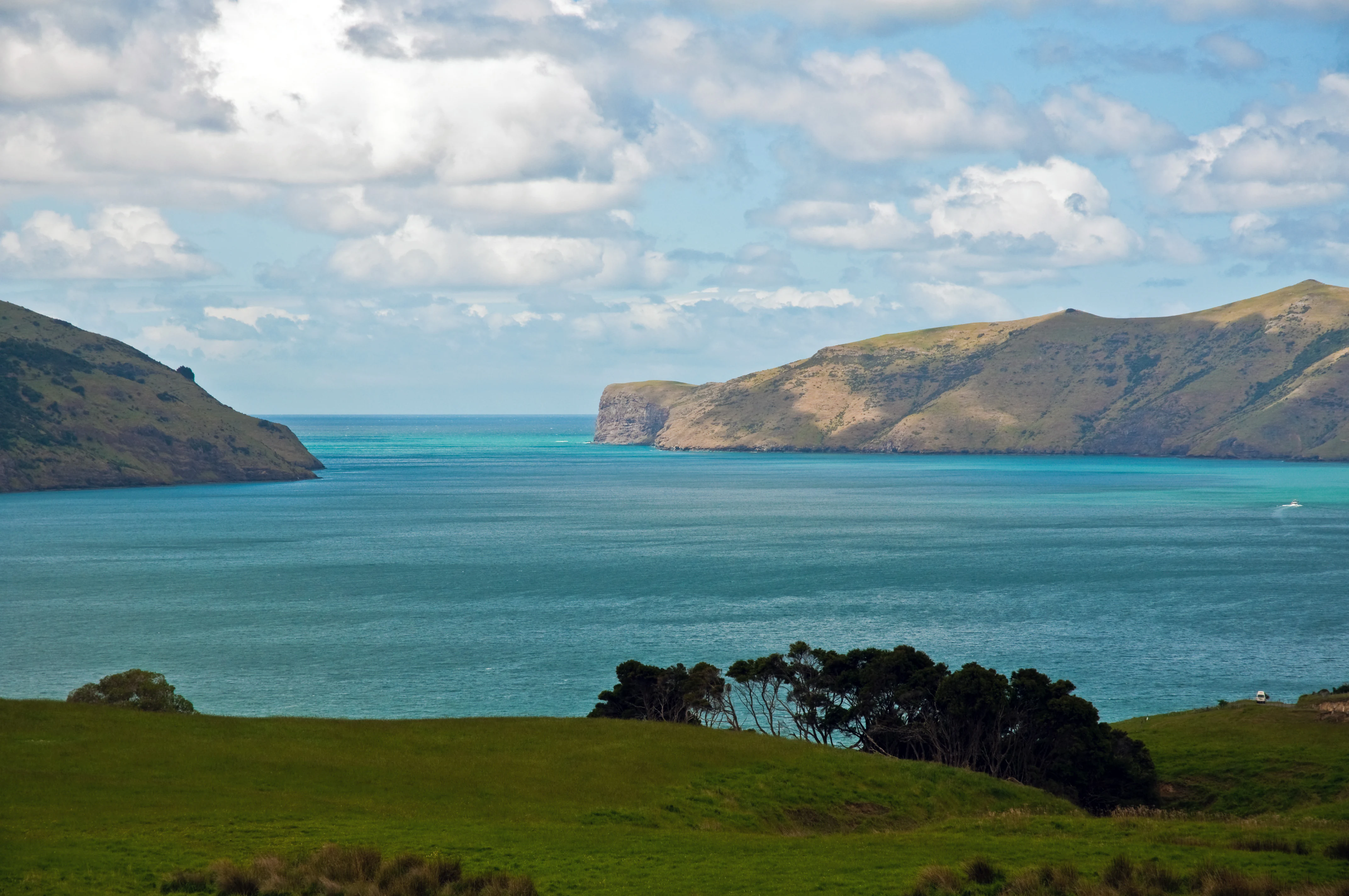
A wide coastal view of the entrance to Akaroa Harbour with deep blue water, rolling green hills on both sides, and a cloudy sky.
The entrance to Akaroa Harbour, a significant coastal feature within the Akaroa Marine Reserve.

Akaroa Marine Reserve history and protected-area timeline

The history of Akaroa Marine Reserve spans nearly three decades of public debate, legal challenges, and shifting political will. Throughout the 1980s and 1990s, long-time fishers and local Māori reported a marked decline in fish stocks within the harbour. Pollution from sewage, farm runoff, subdivision development, and algal blooms had degraded water quality, while over-fishing had reduced the abundance of traditional kaimoana species. By the early 1990s, the harbour's customary food gathering areas had shrunk significantly.

In 1990, the conservation organisation Forest and Bird conducted exploratory dives in Akaroa Harbour to assess its ecological condition. The Akaroa Harbour Marine Protection Society was formally established and in 1996 proposed a 560-hectare no-take marine reserve in the eastern waters of the outer harbour, intended to act as a breeding pool and feeding area for dolphins.

The proposal proved deeply divisive. Recreational anglers argued the chosen area was a key fishing ground in northeasterly weather. Local rūnanga, including Te Rūnanga o Ngāi Tahu, pointed to the area's traditional name, Te Whata o Kōkiro, describing it as a food storehouse of profound cultural importance. Commercial fishers, for whom Akaroa Harbour was once an economic mainstay, also opposed the plan. In response, fishers secured a smaller, separate 215-hectare reserve at the sheltered Pōhatu / Flea Bay, outside the harbour entrance, which became the Pōhatu Marine Reserve.

The breakthrough came when the rūnanga applied to establish a taiāpure over approximately 90 percent of the harbour, while supporting a marine reserve over the remaining 10 percent. The Māori Land Court recommended this dual approach in January 2004, and the taiāpure was formally established in February 2006. A local pāua farmer, who relied on harvesting giant bladder kelp to feed farmed pāua and to produce fertiliser, negotiated an exemption that allowed ongoing kelp harvest under the taiāpure framework, an arrangement criticised by some as ecologically risky but ultimately accepted by Ngāi Tahu.

Even after the taiāpure was in place, the marine reserve remained politically contested. In 2010, Conservation Minister Kate Wilkinson declined the marine reserve application on the grounds that it would adversely affect recreational fishing. The decision was challenged in the High Court and overturned in 2012 on the basis that the two consultation rounds had, in fact, attracted more support than opposition. In April 2013, Conservation Minister Nick Smith announced approval of a reduced reserve of about 465 hectares, intended to balance protection with customary and recreational fishing concerns. The final size was later set at roughly 512 hectares, and the reserve was formally established in 2014.

Akaroa Marine Reserve landscape and geographic character

Akaroa Harbour is a deeply indented natural harbour on the Banks Peninsula, formed by the eroded remains of overlapping Miocene-era shield volcanoes. Steep volcanic cliffs and forested hills enclose deep inlets, while the harbour entrance opens to the Pacific Ocean between two headlands. This drowned caldera landscape produces a strongly varied seafloor: rocky reef and kelp habitats near the entrance, and softer sand and mud substrates further inside the harbour.

The marine reserve occupies the seaward part of this landscape, where harder substrates and ocean exposure shape the biological communities. The contrast between the inner and outer harbour, in terms of both physical habitat and fauna, is one of the defining landscape-scale features of the area. Adjacent land uses include small settlements around the harbour edge and an active pāua farm near the harbour entrance, both of which influence the surrounding marine environment.

Akaroa Marine Reserve ecosystems, habitats, and plant life

The marine reserve encompasses a mix of reef, sand, and mud habitats typical of the transition between sheltered harbour waters and the open coast. Kelp forest, including giant bladder kelp (Macrocystis pyrifera), grows on rocky substrates near the entrance, supporting reef-associated fish and invertebrate communities. Inner harbour habitats, while not within the reserve, contrast sharply with these exposed reef systems, with softer sediments favouring different benthic and pelagic species.

Scientific surveys using baited underwater video have identified 28 fish species within and around the reserve, with notable differences in the abundance and size of blue cod and blue moki inside protected areas compared to fished taiāpure zones. Marine habitat mapping work, including the Iongairo initiative launched in 2021, has helped document the distribution of rocky reef, sandy flats, muddy basins, and important species such as pāua, mussels, and various seaweeds throughout the wider harbour system.

Akaroa Marine Reserve wildlife and species highlights

Akaroa Harbour is recognised as an important habitat for the endangered Hector's dolphin, a small cetatian endemic to New Zealand, and set netting is restricted in the harbour specifically to protect this species. The broader Banks Peninsula coast supports a mix of pelagic seabirds, reef fish such as blue cod and blue moki, and shellfish including pāua (abalone) and mussels. Echinoderms, kelp-associated invertebrates, and a range of reef predators all form part of the local marine food web.

The reserve and adjacent Pōhatu Marine Reserve have been used as reference sites in studies of how protection from fishing affects fish size and abundance. Both reserves show evidence of increased size and numbers of key indicator species compared with fished areas, although the absence of pre-reserve baseline data in Akaroa makes direct causal conclusions more cautious than at Pōhatu.

Akaroa Marine Reserve conservation status and protection priorities

Akaroa Marine Reserve represents a significant example of community-driven marine conservation in New Zealand, born from more than two decades of campaigning by local divers, conservationists, and researchers. As an IUCN Category Ia strict nature reserve, it provides full no-take protection across roughly 512 hectares of harbour entrance waters, generating a refuge for reef communities, breeding populations of fish, and habitat for dolphins at the boundary between harbour and open ocean.

The reserve's value is amplified by its integration with surrounding management tools: the Akaroa Taiāpure permits regulated fishing under Ngāi Tahu and stakeholder governance, while nearby Pōhatu Marine Reserve and two mātaitai reserves in Lyttelton Harbour add further protection across the Banks Peninsula coastal system. Concerns remain about ongoing ecological pressures, including kelp harvesting, runoff from surrounding land use, and historical over-fishing, which continue to shape management discussions.

Akaroa Marine Reserve cultural meaning and human context

Akaroa Harbour holds deep significance for Ngāi Tahu, with the waters traditionally known as Te Whata o Kōkiro, the food storehouse of Kōkiro, reflecting generations of customary harvest. Local hapū such as Ōnuku Rūnanga have customary fishing rights enshrined under rōhe moana arrangements, and tangata tiaki, or marine guardians, are empowered to allocate extra catch through kaitiaki permits for gatherings such as tangihanga (funerals) and hui.

The reserve and its companion taiāpure emerged from a compromise that recognised both the cultural importance of the harbour and the need for biodiversity protection. The rights of Ngāi Tahu to manage the harbour, alongside recreational, commercial, and marine farming interests, are reflected in the Akaroa Taiāpure Management Committee, which includes Ngāi Tahu representatives and a range of fisheries stakeholders.

Top sights and standout views in Akaroa Marine Reserve

Akaroa Marine Reserve stands out as one of New Zealand's most hard-won marine reserves, established in 2014 after two decades of community advocacy, legal battles, and political negotiation. Its placement at the mouth of an iconic volcanic harbour, combined with its proximity to the historic French and British settlement of Akaroa, gives it both ecological and cultural weight.

The reserve is also notable for its layered governance: it sits within a wider system that includes the Akaroa Taiāpure, the Pōhatu Marine Reserve, and customary Māori management through tangata tiaki. For visitors and researchers alike, the reserve offers a comparatively accessible glimpse of how marine protection, indigenous fishing rights, and contemporary recreational use intersect on a single harbour.

Best time to visit Akaroa Marine Reserve

The reserve is an underwater site and is most meaningfully experienced through diving, snorkelling, or guided boat tours, conditions for which are generally most favourable during the warmer, calmer months of late spring to early autumn in the Southern Hemisphere. Wildlife viewing, including potential encounters with Hector's dolphins, is heavily influenced by sea state, and visits on calm days can offer better underwater visibility and surface sightings. Winter months can bring rougher conditions and reduced visibility, though the harbour retains ecological interest year round.
Monthly climate preview

Long term monthly temperature ranges and precipitation patterns for Akaroa Marine Reserve

Akaroa Marine Reserve Climate Normals, Average Temperature and Precipitation

Representative coordinates record measured monthly temperature swings from 8.48 degrees Celsius to 15.34 degrees Celsius alongside steady daily precipitation normals. Analyzing the full twelve month climate dataset reveals detailed seasonal shifts across the protected marine area.
Annual mean12 °C
8 °C15 °C
Jan15°
Feb15°
Mar14°
Apr13°
May11°
Jun
Jul
Aug
Sep
Oct11°
Nov12°
Dec14°
Warmest month
February

15.3 °C

Coolest month
July

8.5 °C

Wettest month
June

2.4 mm/day

Driest month
February

1.6 mm/day

Park location guide

Geography guide, regional context, and park location map for Akaroa Marine Reserve

Akaroa Marine Reserve park geography, regions, and map view in New Zealand

Understand where Akaroa Marine Reserve sits in New Zealand through a broader geographic reading of the surrounding landscape, nearby location context, and its mapped position within the national park landscape.

How Akaroa Marine Reserve fits into New Zealand

New Zealand is an island nation in the southwestern Pacific Ocean comprising two main islands and numerous smaller islands. Located east of Australia across the Tasman Sea, it features varied topography with the Southern Alps running along the South Island and volcanic terrain on the North Island. The country was settled by Maori people between 1280 and 1350, followed by European exploration beginning in 1642, and became a Dominion in 1907 before gaining full independence in 1947.

Wider geography shaping Akaroa Marine Reserve in New Zealand

New Zealand lies in the southwestern Pacific Ocean, east of Australia across the Tasman Sea. The country consists of two main islands, the North Island and South Island, plus over 600 smaller islands. The North Island features volcanic plateaus and hills while the South Island is dominated by the Southern Alps mountain range. The country has a long coastline and is surrounded by the Pacific Ocean.

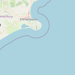
Map view of Akaroa Marine Reserve

Use this park location map to pinpoint Akaroa Marine Reserve in New Zealand, understand its exact geographic position, and read its mapped placement within the surrounding landscape more clearly.

Pigeon | © OpenStreetMap contributors
Recorded earthquake history

Examine Historical Earthquake Records for Akaroa Marine Reserve

Review a detailed catalogue of seismic events recorded in the vicinity of Akaroa Marine Reserve. This dataset tracks historical earthquake data by distance, offering a structured perspective on regional seismic patterns recorded near this New Zealand marine protected area.

Akaroa Marine Reserve Earthquake Records

Catalogued events

341 events

Strongest magnitude

Magnitude 6.1

Most recent event

Aug 30, 2025

This history includes earthquakes recorded inside the park or within 50 km of its borders

Visual reference of rocky reefs, kelp forests, and coastal protected habitats

Akaroa Marine Reserve Photos and Scenery: Volcanic Harbour Landscapes

Visual documentation captures the rugged volcanic cliffs, exposed headlands, and submerged reef habitats that define the Akaroa Marine Reserve environment. Photographic archives provide essential visual context for examining subtidal ecosystems, kelp forests, and marine conservation boundaries across the outer harbour.

A wide coastal view of the entrance to Akaroa Harbour with deep blue water, rolling green hills on both sides, and a cloudy sky.

An elevated, panoramic view looking out over the turquoise waters of the Akaroa Harbour entrance, surrounded by the green, rolling hills of the Banks Peninsula.

Park atlas

Compare regional marine reserves and coastal habitats across the Banks Peninsula

Explore Parks Near Akaroa Marine Reserve and Surrounding Protected Landscapes

Browse other protected areas near Akaroa Marine Reserve to examine regional marine ecosystems and coastal conservation networks. Expanding the geographic comparison reveals how volcanic harbour habitats connect with neighbouring coastal reserves across New Zealand.
A watercolor illustration of a rolling green coastal landscape with hills and cliffs meeting the sea, depicted in soft pastel tones against a white background.
Marine protected areaCanterbury
2.4 km away#1 closest

East

Pōhatu Marine Reserve: Mapping Coastal Conservation and Protected Marine Landscapes in Canterbury

A vital marine protected area on the Banks Peninsula coastline

The Pōhatu Marine Reserve serves as a critical no-take zone within the volcanic crater landscape of Canterbury. Its geography consists of sheltered inlets, steep cliff faces, and rich reef systems that support diverse fish biomass and protected nesting sites for native penguin colonies. The area remains a primary example of integrated coastal wildlife conservation on the Banks Peninsula.

Area
2.153 km²
Established
1999
Relief
Upland
Climate
Temperate
Regional parkCanterbury Region
About 57 km away#2 closest

Northwest

Waimakariri River Regional Park: Geography and Protected Landscape Atlas for Canterbury

Braided river corridors and wetland habitats in the Canterbury Region

Waimakariri River Regional Park encompasses a significant managed corridor along the Waimakariri River, featuring an intricate mix of braided riverbeds, saltmarshes, and reforested land. This profile details the park topography, highlighting its role in regional flood management and its varied natural terrain across the Canterbury Plains, providing a clear geographic view of its multi-use protected boundaries.

Area
150 km²
Relief
Lowland
Access
Easy access
Scope
Terrestrial
A horizontal watercolor illustration depicting a coastal landscape with winding light-colored sandbars, pale water channels, and soft green rolling hills under a muted pastel sky.
Regional parkCanterbury Region
About 64 km away#3 closest

North

Northern Pegasus Bay Regional Park: Canterbury Coastal Geography and Protected Land Atlas

Mapping the beaches, estuaries, and dunes of Northern Pegasus Bay.

Northern Pegasus Bay spans a long, curving stretch of the Canterbury coastline on New Zealand's South Island. This regional park protects a range of coastal landforms, including pebbly beaches, dune systems, and the regionally significant Ashley Rakahuri Estuary. The geography reflects a dynamic exchange of sediment across multiple river mouths, creating a distinct environmental corridor between coastal communities and the sea.

Relief
Lowland
Climate
Temperate
Access
Easy access
Scope
Mixed
A soft watercolor illustration featuring a panoramic view of rolling green hills, distant mountains, a meandering stream, and wildflowers in the foreground.
Protected landscapeSouth Island
About 126 km away#4 closest

Northwest

Craigieburn Forest Park: Protected Alpine Landscape and Southern Alps Geography

High country terrain from beech forests to alpine ridges.

Situated along the eastern flanks of the Southern Alps, Craigieburn Forest Park offers a complex mountain geography that serves as both a recreational hub and an ecological restoration zone. The area features a clear transition from beech-clad valley floors and glacial terraces to wide tussock basins and craggy summits, providing a detailed look at the diverse natural terrain of the Canterbury region.

Area
446.948 km²
Established
1967
Relief
Mountain
Climate
Alpine
National parkNew Zealand
128 km away#5 closest

Northwest

Arthur's Pass National Park: Dramatic Alpine Protected Landscape in the Southern Alps

Explore the unique geography and mapped boundaries of this South Island national park.

Arthur's Pass National Park, a substantial protected area within New Zealand's Southern Alps, presents a compelling focus for geographic and atlas exploration. Characterized by dramatic alpine terrain shaped by ancient glacial forces, the park exhibits a striking ecological contrast between its drier eastern beech forests and wetter western rainforests. Users can delve into the mapped park boundaries and understand the regional landscape context of this unique protected area, making it a key destination for understanding New Zealand's natural geography.

Area
1,184.7 km²
Established
1929
IUCN
II
Relief
Mountain
A soft watercolor painting of stylized, rolling green hills against a white background.
Nature reserveNew Zealand
About 137 km away#6 closest

West

Peel Forest Park Nature Reserve: Mapped Geography and Protected Forest Landscapes

Canterbury Foothills and Southern Alps transition zone

Located in the foothills of New Zealand, Peel Forest Park preserves a significant fragment of native podocarp forest. This reserve features a diverse landscape of river valleys and forested slopes, offering a clear view of the transition from the Canterbury Plains to the Southern Alps massif.

Area
7.686 km²
Established
1909
Relief
Mountain
Climate
Temperate
Protected landscapeCanterbury
About 150 km away#7 closest

Northwest

Lake Sumner Forest Park: Geography and Protected Landscape Atlas for Canterbury

Mountainous river valleys and remote beech forests

Spanning over 100,000 hectares of the Canterbury high country, Lake Sumner Forest Park stands as a prime example of New Zealand's protected backcountry. This mapping resource details the park's river-carved terrain, subalpine fringes, and its role as a connective wilderness area between major South Island mountain ranges.

Area
1,051 km²
Relief
Mountain
Climate
Temperate
Access
Moderate access
Marine protected areaCanterbury
152 km away#8 closest

North

Hikurangi Marine Reserve: Protected Marine Geography and Submarine Canyon Systems

Exploring the coastal reefs and deep trench environments of Canterbury

Hikurangi Marine Reserve represents a core protected landscape within the New Zealand marine atlas. Centered on the Kaikoura Canyon, the reserve features a sharp transition from rocky shoreline reefs to deep-sea environments that support a high density of cetaceans and seabirds. This map-focused profile examines the physical boundaries and unique oceanographic conditions that define this essential no-take marine zone.

Area
104.16 km²
Established
2014
IUCN
Ia
Relief
Lowland

Common questions about visiting, size, designation, and location context for Akaroa Marine Reserve

Akaroa Marine Reserve FAQs for park facts, access, geography, and protected area context

Find quick answers about Akaroa Marine Reserve, including protected-area facts, park geography, trail and visitor context, and how the park fits into its surrounding country and regional landscape.
MoriAtlas Explorer

Continue Your Protected Areas Search Across the Global Atlas

Deepen your exploration by continuing the structured search for national parks and protected areas worldwide. Utilize the comprehensive filtering capabilities to compare different conservation landscapes and refine your understanding of global park geography. Discover more about the distribution and characteristics of protected natural areas.

Global natural geography