
Mori Atlas logo
Protected landscapeAllegheny National Forest

Analyzing the rolling Allegheny Plateau terrain, reservoir boundaries, and remnant old-growth hardwood ecosystems.

Allegheny National Forest: A Comprehensive Map and Geographic Overview of Pennsylvania's Protected Wilderness

Situated in northwestern Pennsylvania, Allegheny National Forest stands as a significant protected landscape defined by its rolling plateau topography and extensive second-growth hardwood cover. This geographic record highlights the forest's complex boundaries, including the expansive Allegheny Reservoir, designated wilderness areas, and critical riverine ecosystems. Explore the spatial distribution of these conserved lands as they transition through Warren, McKean, Forest, and Elk counties.

national forestAppalachian forestAllegheny Plateauhardwood forestsecond-growth forestold-growth forest
A flat vector illustration showing a river flowing through a forested valley with mountains in the background under a sunny sky.

Allegheny National Forest

Protected landscape

Park overview

Structured park overview, official facts, and landscape profile for Allegheny National Forest

Allegheny National Forest park facts, protected area profile, and essential visitor context

Review the core facts for Allegheny National Forest, including designation, size, terrain, visitor scale, habitats, and operating context in one park-focused overview.

About Allegheny National Forest

Allegheny National Forest occupies a broad swath of the Allegheny Plateau in northwestern Pennsylvania, covering a four-county area between the Allegheny River watershed and the upper reaches of the state's oil and gas country. Established in 1923 on land that had been heavily logged and burned over in the late nineteenth and early twentieth centuries, the forest today represents one of the largest contiguous forested regions in the eastern United States.

The forest's ecological character is closely tied to its history. The original pre-colonial forest was dominated by eastern hemlock and American beech, with sugar maple, birch, chestnut, white pine, and oak as secondary species. Predation by native wolves and cougars once kept deer populations low, and natural disturbances such as windthrow and fire shaped a mosaic of openings. After industrial-scale logging, tanning, and wood-chemical operations nearly stripped the plateau, the landscape that returned under Forest Service management is fundamentally different: an even-aged second-growth forest dominated by black cherry, sugar maple, red maple, and birch, with smaller but important surviving old-growth remnants protected in scenic and research natural areas.

Allegheny National Forest lies within the broader Allegheny Highlands forests ecoregion and is recognized for its watershed, recreational, and biodiversity values. The completion of Kinzua Dam in 1965 created the large Allegheny Reservoir, dramatically expanding water-based recreation. Designated wilderness areas, including Hickory Creek Wilderness and Allegheny Islands Wilderness, preserve portions of the forest in a more natural state. The remaining region is one of the least densely populated areas east of the Mississippi River, providing a large working landscape where watershed protection, timber, wildlife habitat, and outdoor recreation coexist.

Quick facts and research context for Allegheny National Forest

The Allegheny National Forest was established on September 24, 1923, and is the only national forest in Pennsylvania. It covers about 513,175 acres across four northwestern counties: Warren, McKean, Forest, and Elk. Approximately ninety percent of its area is forested, and it lies within the Allegheny Highlands ecoregion.

The forest is administered by the U.S. Forest Service, with headquarters in Warren, Pennsylvania, and ranger district offices in Marienville and Bradford. Its landscape includes the Allegheny Reservoir, formed by the Kinzua Dam on the Allegheny River, as well as designated wilderness areas and scenic and research natural areas such as Hearts Content and Tionesta.

Protection and recognition

Documented management scope and formal designation metrics for public lands

Allegheny National Forest Protection Status and Terrestrial Conservation Data

Allegheny National Forest holds a terrestrial protection status framework supported by official records and baseline administrative parameters. Structured conservation data details the documented management scope without relying on unverified international recognition sources.

Protection details

Protection scope
Terrestrial
Transboundary protection
No
Park context

Deeper park guide and search-rich context for Allegheny National Forest

Allegheny National Forest history, landscape, wildlife, and travel context

Explore Allegheny National Forest through its history, landscape character, ecosystems, wildlife, conservation priorities, cultural context, and seasonal travel timing in a structured park guide built for atlas discovery and search intent.

Why Allegheny National Forest stands out

Allegheny National Forest is best known for its expansive second-growth hardwood forests, particularly its dominance of black cherry, maple, and birch that regenerated after the era of intensive logging between roughly 1890 and 1930. It contains some of the most extensive remaining old-growth tracts in Pennsylvania, including the famous old-growth northern hardwood stands at Hearts Content Scenic Area and Tionesta Scenic and Research Natural Areas. The forest is also recognized for the Allegheny Reservoir, the rolling Allegheny Plateau scenery, and its mix of even-aged timber management, wilderness preservation, and recreational use. It stands out as one of the most forested landscapes in the densely populated eastern United States and as a working example of multiple-use national forest management.
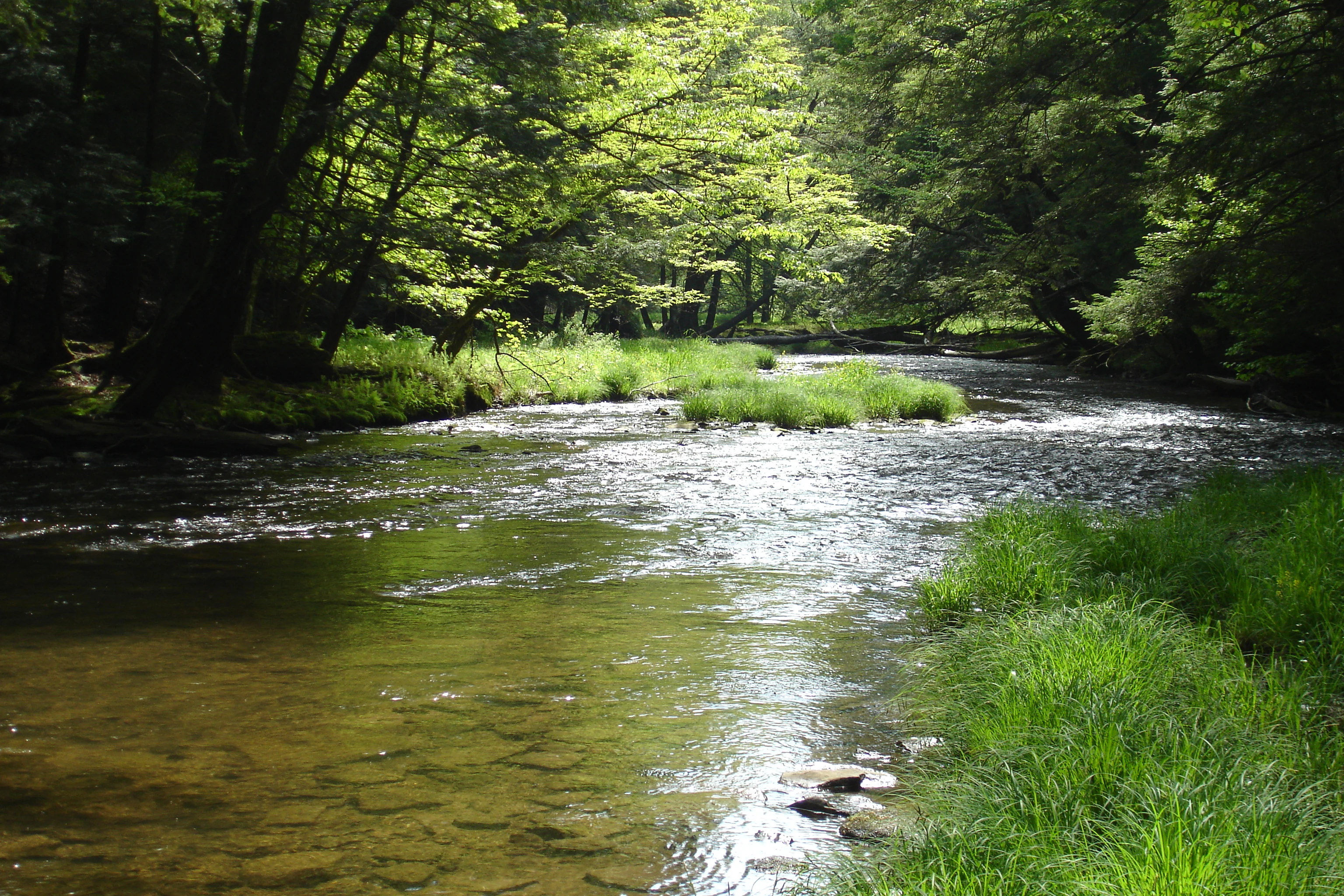
A shallow stream flowing over a rocky bed, surrounded by dense green trees and grassy banks in Allegheny National Forest.
Mead Run flowing through the lush hardwood forests of Allegheny National Forest.

Allegheny National Forest history and protected-area timeline

The history of Allegheny National Forest begins long before its 1923 establishment. In the eighteenth century, the forests of northwestern Pennsylvania were dominated by eastern hemlock and American beech, accompanied by sugar maple, birch, chestnut, white pine, and oaks. Black cherry was a relatively minor component of this original forest. Predators such as the eastern wolf and eastern cougar helped regulate deer populations, and a diverse understory flourished beneath a multilayered canopy shaped by frequent natural disturbances.

European settlement in the early nineteenth century brought small-scale clearing for agriculture and modest water-powered milling. By the 1840s, portable steam engines enabled much larger circular sawmill operations. The Civil War era fueled a hemlock-bark tanning industry that consumed vast amounts of bark and timber, paving the way for more intensive industrial logging in the late nineteenth century. Bandsaw mills, railroads, and specialized locomotives opened steep and previously inaccessible hillsides, and the wood chemical industry of the late nineteenth and early twentieth centuries used virtually every tree on the plateau for charcoal, methanol, and related products.

By 1900 the combination of logging, tanning, and chemical industries had stripped the Allegheny Plateau almost completely, leaving barren hillsides, depleted deer populations, and a landscape prone to flooding and wildfire. Many absentee landowners abandoned their holdings, leaving rural counties with delinquent tax rolls. The Weeks Act of 1911 authorized federal land purchases for national forests in the East, and in 1923 the federal government established the Allegheny National Forest on this recovering landscape.

In the decades after 1923, a new second-growth forest of black cherry, maple, and birch replaced the original hemlock-beech forest. The Civilian Conservation Corps of the 1930s built recreation infrastructure, and the Multiple-Use Sustained-Yield Act of 1960 and subsequent environmental legislation expanded the forest's mission to encompass wildlife, recreation, and watershed protection. Kinzua Dam's completion in 1965 created the Allegheny Reservoir, transforming recreation, while the 1984 Pennsylvania Wilderness Act protected Hickory Creek Wilderness and Allegheny Islands Wilderness. A long-running conflict over private mineral rights beneath the forest, particularly regarding oil and gas drilling, has shaped contemporary management decisions.

Allegheny National Forest landscape and geographic character

Allegheny National Forest spreads across a rolling, dissected section of the Allegheny Plateau, characterized by long ridgelines, steep stream valleys, and broad forested uplands. Forest cover blankets approximately ninety percent of its area, giving the region the visual continuity of much larger western forests despite its location in the densely populated eastern United States.

The most prominent hydrological feature is the Allegheny Reservoir, formed when the Kinzua Dam impounded the Allegheny River in the 1960s. The reservoir's shoreline and associated ridges offer sweeping views and frame much of the forest's iconic scenery. Beyond this, the landscape is laced with streams such as Minister Creek, which winds through mature forest and supports one of the forest's best-known hiking corridors.

Included within the rolling plateau scenery are the unusual old-growth stands of Hearts Content Scenic Area and the Tionesta Scenic and Research Natural Areas, where towering, unevenly aged hemlock and beech trees still survive. Riverine forests also persist on Crull's Island and Thompson's Island in the Allegheny River, providing a contrast to the more uniform second-growth uplands. Together these features create a landscape that mixes expansive even-aged timber stands, preserved old-growth pockets, reservoir shorelines, and island forests.
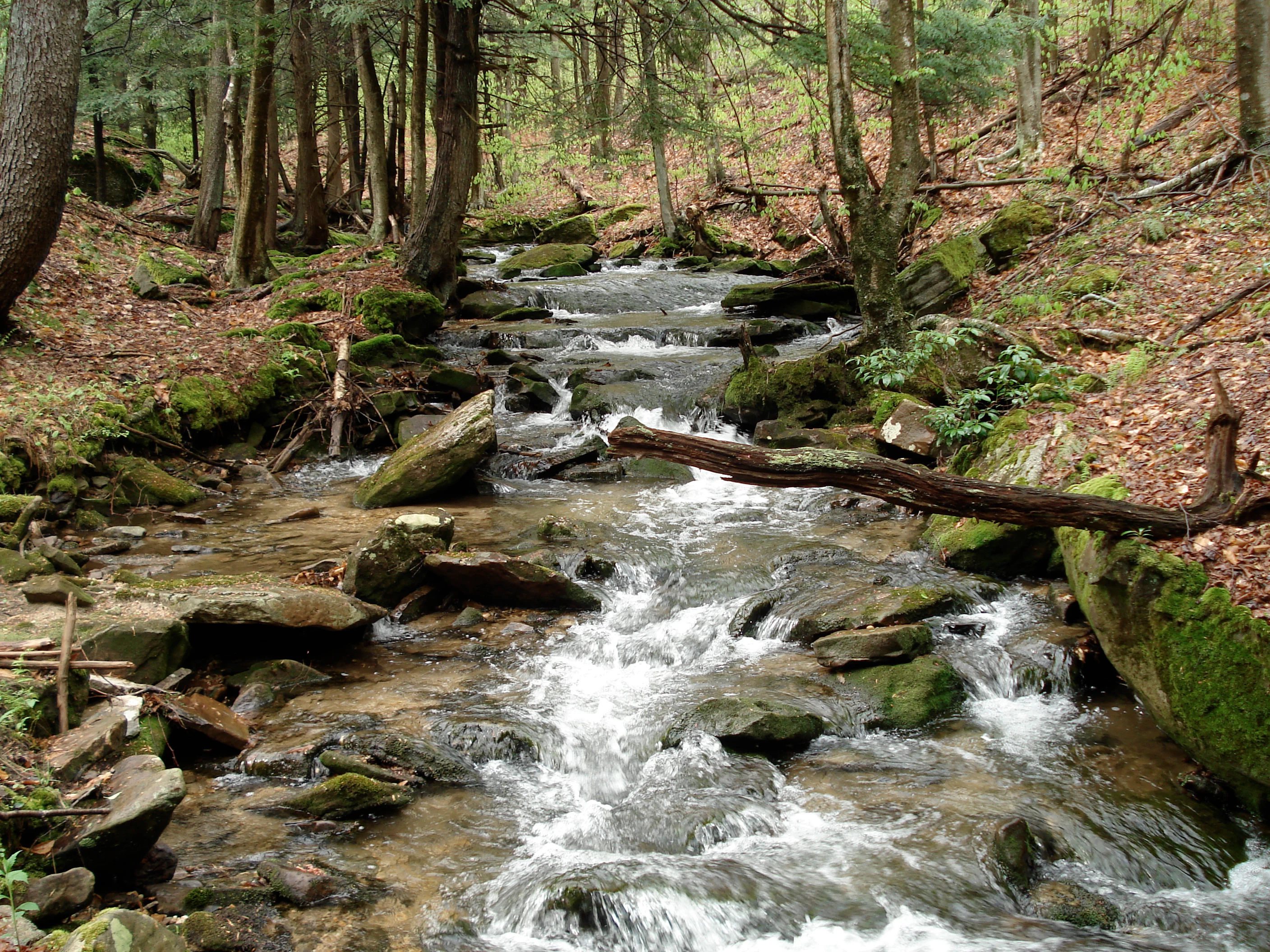
A small, rocky mountain stream flows through a dense forest in Allegheny National Forest, with moss-covered rocks and a fallen log crossing the water.
Minister Creek flows through a forested area in Allegheny National Forest.

Allegheny National Forest ecosystems, habitats, and plant life

The forest lies within the Allegheny Highlands forests ecoregion, a transitional zone where northern hardwood ecosystems meet Appalachian plant communities. Its most distinctive ecological trait is its even-aged, second-growth composition, which arose after landscape-scale clearing at the turn of the twentieth century and has been shaped by even-aged silvicultural management.

The dominant vegetation is northern hardwood: black cherry, sugar maple, red maple, and birch form the canopy, with understory layers of saplings, shrubs, and spring ephemerals. Oak and other species appear in scattered mixes, particularly on drier, sunnier sites. In the surviving old-growth stands, the composition reverts to hemlock and beech, giving ecologists a rare window into the pre-colonial character of the Allegheny Plateau.

Mature forests, regenerating clearings, streams, and reservoir edges create a mosaic of habitats ranging from open young forest with dense browse to shaded interior woodlands. This structural diversity supports a wide range of plant communities and seasonal habitats, from rich understory wildflower displays in the maturing forest canopy to specialized shoreline and riparian vegetation along the reservoir and larger streams.

Allegheny National Forest wildlife and species highlights

The mix of mature forest, young regenerating stands, and riparian zones supports an unusually diverse wildlife community for a heavily forested eastern landscape. White-tailed deer are a defining species of the Allegheny Plateau; their populations were suppressed by historical predation, then rebounded after predators were removed, eventually peaking in the mid-twentieth century. Managing deer impacts on forest regeneration remains an ongoing challenge.

Black bears are common across the forest, taking advantage of the abundant acorns, cherries, and beech nuts produced by maturing hardwoods. Wild turkeys also thrive in this mosaic, feeding on mast and using the mature canopy for nesting habitat. Songbird populations are rich in both the second-growth stands and the older scenic areas, with raptors, woodpeckers, and migratory songbirds all using the forest during the breeding season.

Cold, shaded streams support wild brook trout and other native fish, and the Allegheny Reservoir supports a warm-water fishery as well. Wetland complexes and beaver meadows, like those near Beaver Meadows, attract amphibians, waterfowl, and other wet-habitat wildlife. The combination of interior forest, edge habitat, water, and small natural openings sustains a stable population of game and non-game species across the forest.

Allegheny National Forest conservation status and protection priorities

The conservation significance of Allegheny National Forest lies in its role as one of the largest forested landscapes in the eastern United States and its function as a long-term experiment in multiple-use national forest management. Following decades of devastating logging and land abandonment, the forest was assembled under the Weeks Act and restored under the U.S. Forest Service beginning in 1923.

Key protections include the old-growth reserves at Hearts Content Scenic Area and Tionesta Scenic and Research Natural Areas, the riverine forests of Crull's Island and Thompson's Island, and the designated Hickory Creek Wilderness and Allegheny Islands Wilderness added by the 1984 Pennsylvania Wilderness Act. These protected pockets preserve genetic, structural, and compositional features that have largely disappeared elsewhere in the region.

The forest also serves as a major watershed protector. Its streams feed into the Allegheny River and contribute to clean drinking water for downstream communities. Federal oversight, environmental review under the National Environmental Policy Act, and ongoing Forest Plan revisions address resource conflicts, including the historically contentious issue of private mineral rights and oil and gas drilling beneath the forest. The wilderness, scenic, and research designations together mark the forest as a critical refuge for native biodiversity within an otherwise heavily altered landscape.

Allegheny National Forest cultural meaning and human context

For thousands of years before European settlement, the Allegheny Plateau was inhabited and used by Native American communities who maintained the landscape through small-scale burning to support berry production, oak mast, hunting, and travel. European-American colonization in the nineteenth century transformed the region through agriculture, tanning, logging, mining, and the early petroleum industry; the forest sits near the site of the first commercial oil well in the United States at Titusville, Pennsylvania.

The forest's modern identity is closely tied to the rural timber and oil culture of northwestern Pennsylvania, including small towns such as Warren, Tionesta, Marienville, and Bradford. The legacy of the Civilian Conservation Corps and the post-World War II recreation boom helped shape the area's tradition of outdoor recreation, hunting, and fishing. The Wilderness Act of 1964, authored by Howard Zahniser, who grew up in the forest's Tionesta community, links the local heritage directly to national conservation history.

Top sights and standout views in Allegheny National Forest

Allegheny National Forest's most distinctive features include its vast second-growth hardwood cover, some of the largest surviving old-growth northern hardwood stands in Pennsylvania, and the scenic Allegheny Reservoir. The Hearts Content Scenic Area in particular stands out as a preserved fragment of the original hemlock-beech forest that once covered the plateau.

Other notable highlights include the Hickory Creek Wilderness and Allegheny Islands Wilderness, scenic Minister Creek, popular Beaver Meadows trails, and the small but ecologically significant riverine forests on Crull's Island and Thompson's Island. The forest is also notable for its longstanding role as a model of multiple-use management, balancing timber, recreation, watershed protection, and wildlife habitat across one of the most extensive forest landscapes east of the Mississippi River.

Best time to visit Allegheny National Forest

The forest is accessible year-round, but each season offers a distinctly different landscape experience. Spring brings blooming wildflowers and active streams, while summer is the prime time for full canopy hiking, lake recreation on the Allegheny Reservoir, and abundant wildlife viewing in the early morning and evening.

Fall is widely considered the most visually striking season, when the hardwood canopy turns vivid shades of red, orange, and yellow, attracting leaf-peepers and photographers throughout the plateau. Winter transforms the forest into a quiet snow-covered landscape suitable for cross-country skiing, snowmobiling, and other motorized recreation on designated trails. Cooler-season visits also tend to bring crisp, clear views from the many scenic overlooks around the reservoir.
Monthly climate preview

Long-term temperature and precipitation averages for representative coordinates

Allegheny National Forest Climate Normals and Annual Weather Patterns

Historical climate data reveals a wide annual temperature range alongside steady monthly precipitation totals across the recorded coordinate. Reviewing the complete twelve-month profile provides deeper analytical context for long-term regional weather patterns.
Annual mean8 °C
-5 °C20 °C
Jan-5°
Feb-4°
Mar
Apr
May13°
Jun18°
Jul20°
Aug20°
Sep16°
Oct
Nov
Dec-2°
Warmest month
July

20.5 °C

Coolest month
January

-5.3 °C

Wettest month
June

3.4 mm/day

Driest month
February

2.1 mm/day

Park location guide

Geography guide, regional context, and park location map for Allegheny National Forest

Allegheny National Forest park geography, regions, and map view in United States of America

Understand where Allegheny National Forest sits in United States of America through a broader geographic reading of the surrounding landscape, nearby location context, and its mapped position within the national park landscape.

How Allegheny National Forest fits into United States of America

The United States of America is a federal presidential republic and one of the world's largest countries by area and population. It consists of 50 states across a vast territory spanning multiple time zones, with its capital in Washington, D.C. and largest city in New York City. The nation has a diverse economy, influential political system, and significant cultural and military presence globally.

Wider geography shaping Allegheny National Forest in United States of America

The United States occupies a vast territory in North America, bordered by Canada to the north and Mexico to the south. The 48 contiguous states stretch from the Atlantic to the Pacific Ocean, while Alaska occupies the northwestern region and Hawaii is an archipelago in the Pacific. The country encompasses diverse terrain including the Rocky Mountains, Appalachian Mountains, Great Plains, and extensive river systems.

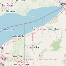
Map view of Allegheny National Forest

Use this park location map to pinpoint Allegheny National Forest in United States of America, understand its exact geographic position, and read its mapped placement within the surrounding landscape more clearly.

Pigeon | © OpenStreetMap contributors

Location context for Allegheny National Forest

Pennsylvania

Explore photographic records of plateau forests, reservoir shores, and old growth habitats.

Allegheny National Forest Photos and Scenic Landscape Visual Reference

Visual documentation captures the rolling terrain, dense hardwood canopies, and aquatic environments of Allegheny National Forest. Examining these protected area photographs reveals the topography, forest structure, and landscape character that define Pennsylvania's federal woodland.

A shallow stream flowing over a rocky bed, surrounded by dense green trees and grassy banks in Allegheny National Forest.

A wide view of a calm lake in Allegheny National Forest, surrounded by a dense forest under a sky filled with fluffy white clouds.

A small, rocky mountain stream flows through a dense forest in Allegheny National Forest, with moss-covered rocks and a fallen log crossing the water.

Park atlas

Compare regional forest reserves, upland plateaus, and nearby protected habitats.

Parks Near Allegheny National Forest and Surrounding Protected Landscapes

Visitors exploring Allegheny National Forest can extend their geographic inquiry into adjacent protected areas and regional forest reserves. Broadening the scope across the surrounding Pennsylvania uplands reveals connected conservation landscapes and diverse natural terrain.
Watercolor painting of a green landscape featuring gentle rolling hills, a winding stream, and trees against a soft, pale background.
Protected areaPennsylvania
About 0.5 km away#1 closest

Northeast

Allegheny National Recreation Area: Protected Geography and Highland Landscapes

Northwestern Pennsylvania plateau and river corridor mapping

Spanning the broad swells of the Allegheny Plateau, this protected area features extensive hardwood forests and the significant reservoir systems of northwestern Pennsylvania. The terrain is characterized by its deep valleys and long-distance trails, providing a comprehensive look at the highland geography preserved within the Allegheny National Forest administrative framework.

Area
81.55 km²
Established
1984
Relief
Upland
Climate
Temperate
National parkOhio
172 km away#2 closest

West

Cuyahoga Valley National Park: Detailed Atlas and Protected Landscape Information

Explore the mapped geography and natural terrain of Ohio's National Park.

Access detailed atlas information for Cuyahoga Valley National Park, a vital protected landscape in Ohio. Understand its geographic scope, mapped boundaries, and the surrounding natural terrain. This entry provides essential context for exploring the park's identity as a National Park and its significance within the broader mapped geography of the United States.

Area
132.7 km²
Established
2000
IUCN
II
Visitors
2.9M annual
National parkOntario
199 km away#3 closest

North

Rouge National Urban Park: Ontario's Mapped Protected Landscape Atlas

Explore national park boundaries and regional geography.

Investigate Rouge National Urban Park, a designated national park situated in Ontario, Canada. This page provides detailed atlas-style information focusing on its mapped boundaries, regional geographic context, and its identity as a significant protected natural landscape. Understand the park's role within the broader Canadian atlas for landscape exploration.

Area
79.1 km²
Established
2015
IUCN
V
Relief
Mixed relief
Watercolor painting showing layers of soft green hills and mountain ridges fading into a light hazy background.
Protected landscapeWest Virginia
233 km away#4 closest

South

Monongahela National Forest: Protected Appalachian Landscapes and Regional Geography

Mapping West Virginia wilderness and mountain terrain

Monongahela National Forest protects nearly one million acres of the central Appalachian Mountains. This massive federally managed landscape is defined by the Allegheny Front, the highest peak in the Allegheny range at Spruce Knob, and iconic geological formations like Seneca Rocks. The region represents a vital intersection of climate, hydrology, and biodiversity in the eastern United States, housing eight distinct wilderness areas and complex high-altitude ecosystems.

Area
3,727.8 km²
Established
1920
Visitors
3M annual
Relief
Mountain
Marine protected areaNew York
About 236 km away#5 closest

Northeast

Lake Ontario National Marine Sanctuary: Geographic Atlas and Protected Area Overview

Mapping freshwater maritime heritage and coastal New York landscapes.

Spanning the southeastern waters of Lake Ontario, this marine protected area safeguards dozens of historic shipwrecks and vital Indigenous cultural sites. This atlas entry provides geographic context on the sanctuary boundaries, submerged archaeological zones, and the surrounding New York freshwater environment.

Area
4,460 km²
Established
2024
IUCN
V
Relief
Lowland
Wildlife reserveOntario
About 241 km away#6 closest

Northeast

Wellers Bay National Wildlife Area: Coastal and Island Geography in Ontario

An important Great Lakes barrier beach protected reserve

Wellers Bay National Wildlife Area contains a rare collection of undeveloped shorelines, including the Baldhead peninsula and offshore islands. This protected area offers a deep look into the littoral processes of Lake Ontario, providing crucial sanctuary for waterbirds and endangered species within a fragile, compact, and natural woodland environment.

Area
0.74 km²
Established
1978
IUCN
Ia
Scope
Terrestrial
A minimalist watercolor painting showing rolling green hills and a flat plateau with abstract vegetation against a white background.
Wildlife reserveWest Virginia
252 km away#7 closest

South

Dolly Sods Wilderness: Geography and Protected Landscape Analysis for West Virginia

High-altitude plateaus and sub-arctic Appalachian terrain.

Trace the boundaries and protected landscape of Dolly Sods Wilderness, a 17,000-acre wildlife reserve in West Virginia. This atlas-focused look highlights the area's geological elevation near 4,000 feet, its unique plant communities including sphagnum bogs, and the distinct role of its recovering ecosystems within the larger Monongahela National Forest.

Area
71.94 km²
Established
1975
IUCN
Ib
Visitors
7.5K annual
A soft watercolor painting depicting a marshy landscape with trees, grasses, and a body of water in a pale, airy style.
Nature reserveOhio
About 254 km away#8 closest

West

Old Woman Creek National Estuarine Research Reserve: Protected Lake Erie Estuary

Northern Ohio coastal wetland and research landscape.

Old Woman Creek National Estuarine Research Reserve represents a vital freshwater estuary on the Lake Erie shore. This reserve protects a unique combination of marsh, swamp forest, and barrier beach, providing significant insight into the natural function of Great Lakes coastal systems in northern Ohio.

Area
2.32 km²
Established
1980
Relief
Lowland
Climate
Temperate

Common questions about visiting, size, designation, and location context for Allegheny National Forest

Allegheny National Forest FAQs for park facts, access, geography, and protected area context

Find quick answers about Allegheny National Forest, including protected-area facts, park geography, trail and visitor context, and how the park fits into its surrounding country and regional landscape.
MoriAtlas Explorer

Continue Your Protected Areas Search Across the Global Atlas

Deepen your exploration by continuing the structured search for national parks and protected areas worldwide. Utilize the comprehensive filtering capabilities to compare different conservation landscapes and refine your understanding of global park geography. Discover more about the distribution and characteristics of protected natural areas.

Global natural geography