
Mori Atlas logo
Nature reserveAlte Spreemündung

Trace the historic river channels and riparian transitions of this protected German wetland

Alte Spreemündung Nature Reserve: Mapping the Hydrological Landscape of Brandenburg

(Naturschutzgebiet Alte Spreemündung)

Located in eastern Brandenburg, the Alte Spreemündung nature reserve preserves a distinct hydrological interface where the River Spree enters the Schwielochsee. This protected landscape encompasses both historic and current river mouths, creating a complex mosaic of freshwater habitats. The area offers significant insight into the glacial lowland geography and riverine processes that define the region southeast of Berlin.

wetlandsriver mouthlake shorelowland riverglacial lakeriparian habitat
A flat-style digital illustration depicting a wide river valley featuring a central waterfall descending from canyon-like cliffs into a winding river surrounded by evergreen forests and meadows.

Alte Spreemündung

Nature reserve

Park overview

Structured park overview, official facts, and landscape profile for Alte Spreemündung Nature Reserve

Alte Spreemündung Nature Reserve park facts, protected area profile, and essential visitor context

Review the core facts for Alte Spreemündung Nature Reserve, including designation, size, terrain, visitor scale, habitats, and operating context in one park-focused overview.

About Alte Spreemündung Nature Reserve

Alte Spreemündung is a compact but ecologically focused nature reserve in the eastern Brandenburg landscape, defined above all by its position at a historic and current meeting point between the River Spree and the Schwielochsee. The reserve takes its name from the old mouth of the Spree, a former channel of the river that once discharged into the lake. Over time, the river shifted, and a new mouth developed, leaving the older arm as a quieter, partly isolated watercourse alongside the active one. The protection area preserves this pairing of old and new river mouths, together with the transitional shoreline and lowland habitats that surround them.

Located in the municipality of Tauche within the Oder-Spree district, the reserve sits southeast of the village of Trebatsch and east of the small settlement of Sawall. Its position on the northwestern shore of the Schwielochsee places it firmly within the Spree lowlands east of Berlin, a region shaped by glacial processes that produced broadlake basins, winding river arms, and extensive wetland margins. The 108-hectare designation coincides with an FFH (Fauna-Flora-Habitat) site, meaning that the reserve is recognized not only at the level of Brandenburg's regional nature protection system but also under the European Union's Natura 2000 network for its habitat value.

The reserve functions as part of a wider cluster of protected areas along the Spree and around the Schwielochsee. Just across the nearby Bundesstraße 87 to the northwest lies the larger Spreebögen bei Briescht nature reserve, covering around 110 hectares. Together, these and other neighboring sites form a network of protected river and lake habitats in the district. Alte Spreemündung is small in size but plays a clear role within this broader regional mosaic, focusing protection on the specific transition between the Spree's two mouths and the Schwielochsee's northwestern shoreline.

Quick facts and research context for Alte Spreemündung Nature Reserve

Alte Spreemündung is a designated nature reserve (Naturschutzgebiet) located in the municipality of Tauche, Oder-Spree district, Brandenburg, in eastern Germany. It was placed under protection on 16 May 1990 and carries the official German nature reserve number 1249. The protected area covers approximately 108 hectares and is identical in extent to an FFH (Fauna-Flora-Habitat) site of the same designation.

The reserve is classified under IUCN Category IV as a Habitat/Species Management Area and is recorded in the World Database on Protected Areas under WDPA ID 14414. It lies on the northwestern shore of the Schwielochsee, at the point where the historical and current mouths of the River Spree meet the lake, just southeast of Trebatsch.

Protection and recognition

Examine official Natura 2000 designations and recorded conservation boundaries.

Alte Spreemündung Protection Status and International Recognition Data

Alte Spreemündung features documented conservation records, including official Natura 2000 entries tied to its geographic boundary. Review verified protection status details and international recognition sources compiled for this protected area.
Park context

Deeper park guide and search-rich context for Alte Spreemündung Nature Reserve

Alte Spreemündung Nature Reserve history, landscape, wildlife, and travel context

Explore Alte Spreemündung Nature Reserve through its history, landscape character, ecosystems, wildlife, conservation priorities, cultural context, and seasonal travel timing in a structured park guide built for atlas discovery and search intent.

Why Alte Spreemündung Nature Reserve stands out

The reserve is best known for its hydrological transition zone between the River Spree and the Schwielochsee, formed by an old river arm and the current river mouth side by side. This configuration creates a distinctive wetland mosaic of still and slow-moving water, shoreline, and adjoining lowland habitats, which is central to the area's designation under both German nature protection law and the European Habitats Directive.
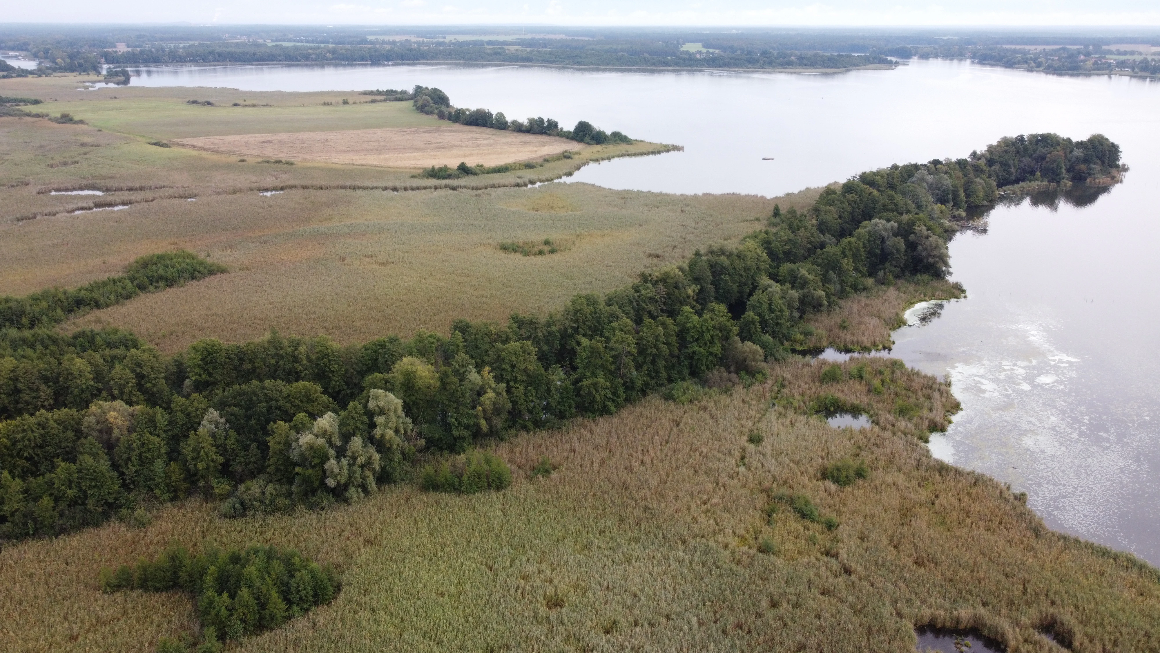
An aerial shot of the Alte Spreemündung nature reserve showing a green forested strip dividing meadows from the broad expanse of Schwielochsee.
Aerial view of the Alte Spreemündung nature reserve where the Spree River enters the Schwielochsee.

Alte Spreemündung Nature Reserve history and protected-area timeline

Alte Spreemündung was formally designated as a nature reserve on 16 May 1990, in the period immediately following German reunification when many new conservation areas were established across the former East Germany. Its designation number is 1249 in the official register of Brandenburg nature reserves.

The reserve's identity is intrinsically historical: it is named for the former mouth of the River Spree into the Schwielochsee. Over time, the river's main discharge into the lake shifted to a different point, leaving the earlier channel as an old arm. Recognizing the ecological value of this relict feature alongside the current mouth, the region placed the area under protection to preserve the dynamic of the two river mouths and their associated habitats.

The site was subsequently also designated as an FFH (Fauna-Flora-Habitat) area under the European Union's Habitats Directive, integrating it into the broader Natura 2000 network. Management planning for Natura 2000 in Brandenburg has documented the area, reinforcing its dual status as both a regional Naturschutzgebiet and a European-level habitat site.

Alte Spreemündung Nature Reserve landscape and geographic character

The landscape of Alte Spreemündung is defined by water on three sides: the broad expanse of the Schwielochsee to the southeast, and two channels of the River Spree, the historic old arm and the current discharge channel, meeting the lake from the northwest. This setting produces a strongly water-shaped terrain, with shoreline transitions, low-lying banks, riparian vegetation, and likely small areas of soft, marshy ground where river and lake influence overlap.

The surrounding region lies in the Spree lowlands east of Berlin, an area marked by glacial action during past ice ages. Past glaciation left behind basins that later filled as lakes such as the Schwielochsee, and shaped river courses into meandering and sometimes branching forms. As a result, the wider context features a mix of broad lake surfaces, slow river arms, agricultural lowlands, and patches of woodland. Within this broader setting, Alte Spreemündung represents a small but sharply defined node where river and lake dynamics come into direct contact.

Land access runs along the northwestern side via roads passing through the locality of Trebatsch, with the Bundesstraße 87 forming a notable boundary feature just to the northwest of the reserve. The small hamlet of Sawall lies to the west of the protected area. The result is a compact, water-dominated landscape embedded in an otherwise gently rolling Brandenburg rural environment.

Alte Spreemündung Nature Reserve ecosystems, habitats, and plant life

The nature of Alte Spreemündung centers on the habitats associated with a lowland river mouth system. The juxtaposition of an older, quieter Spree arm with the active mouth channel, both meeting the Schwielochsee, creates a gradient of conditions: flowing fresh water, near-stagnant oxbow-like water, and open still-water shoreline. These conditions support vegetation and fauna typical of riparian and lakeside transitions, including reedbeds, wet meadows, and structurally diverse shorelines that are uncommon at this density elsewhere in the district.

As an FFH site, the reserve is recognized for habitat types of European conservation interest linked to this transitional setting. The combination of freshwater, wetland margins, and adjacent terrestrial areas provides habitat diversity in a small footprint, and helps explain why the area is considered significant enough to be designated under both German and European frameworks.

The nature reserve sits within the broader Spree wetland landscape, where similar transitions occur elsewhere, notably at the neighboring Spreebögen bei Briescht. Among such neighboring sites, Alte Spreemündung is the more compact and tightly focused, with its value concentrated in the immediate zone where the river historically and currently meets the lake.

Alte Spreemündung Nature Reserve conservation status and protection priorities

Alte Spreemündung carries a dual conservation status that underlines its recognized value. At the regional level, it is protected as a Naturschutzgebiet (nature reserve) under Brandenburg law, with designation number 1249 since 16 May 1990. The protection is focused on preserving the old mouth of the Spree, the current mouth, and the adjoining lake shoreline as a coherent ecological unit. The reserve is classified under IUCN Category IV as a Habitat/Species Management Area, indicating an emphasis on active conservation of specific habitats and species.

At the European level, the reserve coincides exactly with an FFH (Fauna-Flora-Habitat) site of the same name, integrating it into the Natura 2000 network under the EU Habitats Directive. This means that its habitats are considered significant not only within Brandenburg but also within the broader framework of European nature conservation. The site is included in the World Database on Protected Areas under WDPA ID 14414, and management planning for Natura 2000 in Brandenburg has documented the area, providing a baseline for ongoing protection.

The reserve functions as one node in a wider protected-area network along the Spree and around the Schwielochsee, complementing larger sites such as Spreebögen bei Briescht to the northwest. Together, these reserves aim to maintain functional connectivity for wetland and river-mouth habitats across the district, ensuring that transitions between river, lake, and land remain ecologically intact.

Top sights and standout views in Alte Spreemündung Nature Reserve

Alte Spreemündung stands out for the rare opportunity it preserves to observe the Spree's transition into the Schwielochsee across both a historic and a current river mouth within a single protected unit. Its small size, around 108 hectares, concentrates the focus on this specific hydrological interface rather than a broader landscape mosaic.

The reserve's dual designation under both Brandenburg nature protection law and the EU Habitats Directive gives it a recognized conservation profile beyond that of purely regional sites. Its position beside the Schwielochsee, one of the larger natural lakes of eastern Brandenburg, also places it within a regional identity strongly connected to water, fishing, boating, and rural lake-shore culture, even though the reserve itself is set aside primarily for ecological reasons.

Best time to visit Alte Spreemündung Nature Reserve

The character of Alte Spreemündung is shaped by water levels, vegetation, and weather rather than by specific visitor infrastructure. Late spring and early summer typically bring the most vivid wetland vegetation along the river mouth and lake shore, while autumn can highlight bird movements associated with the broader Spree and Schwielochsee area. Winter visits offer quieter conditions and clearer views of the open lake and channel structure when trees are bare, though cold weather can limit access on surrounding paths.

Monthly climate preview

Long-term monthly temperature ranges and precipitation patterns for Brandenburg

Alte Spreemündung Climate Normals, Annual Temperature and Precipitation Rhythm

Representative coordinate measurements track average temperature swings and monthly precipitation totals across the year at Alte Spreemündung. Analyzing the complete twelve-month record reveals broader climate normals and foundational environmental data.
Annual mean9 °C
-1 °C21 °C
Jan-1°
Feb
Mar
Apr
May14°
Jun18°
Jul21°
Aug20°
Sep15°
Oct
Nov
Dec
Warmest month
July

20.5 °C

Coolest month
January

-1 °C

Wettest month
July

2.6 mm/day

Driest month
April

1.1 mm/day

Park location guide

Geography guide, regional context, and park location map for Alte Spreemündung Nature Reserve

Alte Spreemündung Nature Reserve park geography, regions, and map view in Germany

Understand where Alte Spreemündung Nature Reserve sits in Germany through a broader geographic reading of the surrounding landscape, nearby location context, and its mapped position within the national park landscape.

How Alte Spreemündung Nature Reserve fits into Germany

Germany is a federal republic in Western and Central Europe with a population of over 83 million across sixteen constituent states. It is Europe's largest economy by nominal GDP and a major global exporter and importer. The capital is Berlin, and the country borders Denmark, Poland, Czech Republic, Austria, Switzerland, France, Luxembourg, Belgium, and the Netherlands.

Wider geography shaping Alte Spreemündung Nature Reserve in Germany

Germany is located in Western and Central Europe, spanning 357,022 km². It borders Denmark to the north, Poland and the Czech Republic to the east, Austria and Switzerland to the south, and France, Luxembourg, Belgium, and the Netherlands to the west. The country has coastlines on the Baltic Sea and North Sea to the north, with the Alps located in the southern region.

Map view of Alte Spreemündung Nature Reserve

Use this park location map to pinpoint Alte Spreemündung Nature Reserve in Germany, understand its exact geographic position, and read its mapped placement within the surrounding landscape more clearly.

Pigeon | © OpenStreetMap contributors

Location context for Alte Spreemündung Nature Reserve

Brandenburg

Visual reference for wetland habitats, river mouths, and glacial lake shores

Alte Spreemündung Photos and Protected Area Landscape Scenery

Visual documentation reveals the distinct hydrological transition zones and shoreline terrain defining Alte Spreemündung. Examining protected area imagery provides a clear window into the lowland river habitats and water-shaped scenery of Brandenburg.

An aerial shot of the Alte Spreemündung nature reserve showing a green forested strip dividing meadows from the broad expanse of Schwielochsee.

A digital map showing the outline of the Alte Spreemündung nature reserve in blue, situated along a river and the Schwielochsee lake in Brandenburg, Germany.

Park atlas

Compare nearby wetland reserves and regional lowland water ecosystems

Exploring Parks Near Alte Spreemündung and Surrounding Brandenburg Protected Landscapes

Discover other protected areas near Alte Spreemündung to compare regional wetland reserves and glacial lake ecosystems across eastern Brandenburg. Examining adjacent protected landscapes helps connect individual river mouths and lowland habitats into a broader geographical context.
Nature reserveBrandenburg
About 3.7 km away#1 closest

Northeast

Dammühlenfließniederung Nature Reserve: Brandenburg Protected Land and Geography Atlas

Floodplain and riparian habitats in the Niederlausitz region

Explore the geographic framework of Dammühlenfließniederung, an essential nature reserve in eastern Brandenburg. This area safeguards the Dammühlenfließ stream valley and a segment of the Schwielochsee lakeshore, representing the unique glacial lowlands of the region through a focused wetland and floodplain corridor.

Area
0.79 km²
Established
1998
IUCN
IV
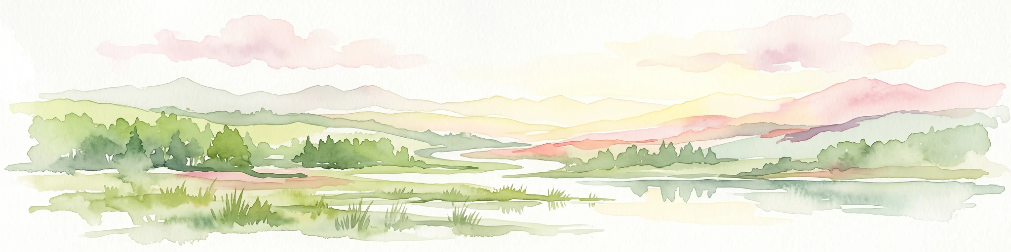
Soft, muted watercolor illustration depicting a marshy, low-lying landscape with gentle hills in the background and grassy vegetation in the foreground.
Nature reserveBrandenburg
6.4 km away#2 closest

Southeast

Dammer Moor Nature Reserve: Protected Wetland and Mire Landscapes in Brandenburg

Geographic overview of a rare Natura 2000 watershed habitat

Dammer Moor features a distinctive calcareous valley mire characterized by calcium mudde, forming a vital protected mosaic within the Lieberose area of Brandenburg. This reserve supports a diverse range of habitats including base-rich Molinion meadows, old oak woodlands, and alder-ash riparian zones that provide essential refuge for numerous amphibian and reptile species.

Area
1.807 km²
Established
1990
IUCN
IV
Relief
Lowland
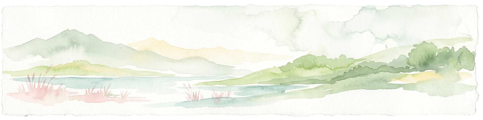
A soft watercolor painting of a wetland featuring grassy foregrounds, a winding stream, distant rolling hills, and a pale sky.
Protected areaBrandenburg
About 14 km away#3 closest

Northwest

Reichardtsluch Protected Area: A Wetland Geography Overview in Brandenburg, Germany

Glacial moraine terrain and seasonal amphibian habitats

Reichardtsluch acts as a vital, two-hectare wetland refuge within the Beeskower Platte region of Brandenburg. This protected landscape is defined by its dramatic seasonal hydrology, alternating between full inundation and dry spells. The site remains a core component of the broader Natura 2000 network, offering insight into postglacial drainage patterns and forest-fringed amphibian breeding ecology in eastern Germany.

Area
0.29 km²
Established
2003
Relief
Lowland
Climate
Temperate
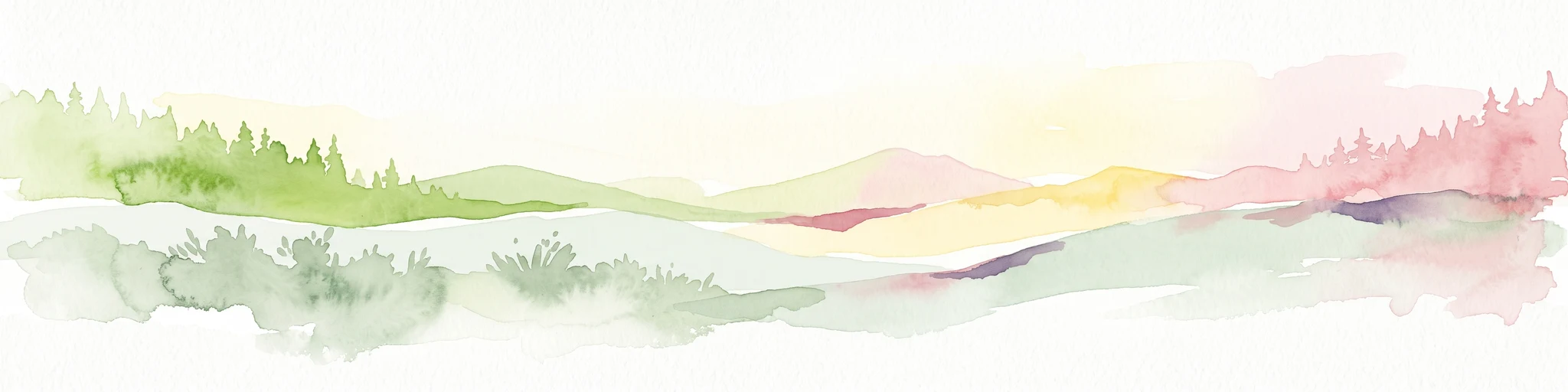
A pale, soft-toned watercolor painting showing a wetlands landscape with rolling green hills, a calm river or stream, and sparse red vegetation in the foreground.
Nature reserveBrandenburg
About 19 km away#4 closest

West

Kockot Nature Reserve: Protected Hardwood Forest and Brandenburg Hydrology

A core zone of the Spreewald Biosphere Reserve

Kockot represents an essential piece of Brandenburg lowland geography. This nature reserve protects a water-influenced hardwood forest mosaic on peat and gley soils, offering a focused look at non-intervention forest dynamics within the Spree river floodplain system.

Area
2.868 km²
Established
1990
IUCN
IV
Nature reserveBrandenburg
22 km away#5 closest

Southwest

Wiesenau Nature Reserve: Mapped Habitat Mosaic and Protected Landscapes in Brandenburg

Essential geographic overview of the Spreewald floodplain ecosystems.

Located near Lübben, Wiesenau protects a rich array of ponds, oxbows, and sediment zones integrated into the Spreewald Biosphere Reserve. The area serves as a prime example of the diverse, interconnected woodland and wetland terrain characteristic of the Brandenburg lowland region.

Area
1.35 km²
Established
1990
IUCN
IV
Nature reserveBrandenburg
23 km away#6 closest

Northwest

Groß Schauener Seenkette Nature Reserve: Mapped Wetlands and Brandenburg Lake Geography

An undisturbed chain of shallow lakes and protected fen landscapes

This protected nature reserve in Brandenburg preserves a vital chain of six interconnected lakes. The geography is defined by extensive reedbeds, sedge stands, and rare inland saline meadows, providing a crucial habitat mosaic. Learn how these wetlands connect to the surrounding Dahme-Heideseen region through a network of terrain-focused conservation areas and historic trails.

Area
21.249 km²
Established
2000
Relief
Lowland
Climate
Temperate
Nature reserveBrandenburg
24 km away#7 closest

West

Meiereisee und Kriegbuschwiesen: A Protected Mosaic of Mires, Dunes, and Floodplain Meadows

Geographic analysis of a specialized Brandenburg nature reserve

The Meiereisee und Kriegbuschwiesen nature reserve is defined by its complex geological and ecological layout, spanning four separate zones that range from dystrophic lakes and kettle bogs to dry sand dunes and low-intensity hay meadows. This protected entity provides a critical refuge for wetland species within the larger Spreewald Biosphere Reserve area of Brandenburg.

Area
1.172 km²
Established
2000
Relief
Lowland
Climate
Temperate
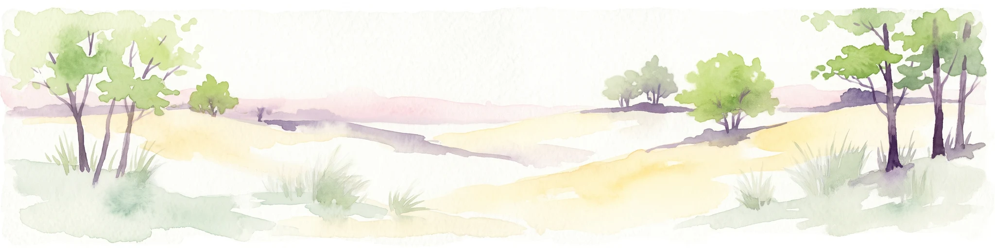
A watercolor illustration of an open dune landscape with soft yellow sand, green grass, and scattered trees under a light sky.
Nature reserveBrandenburg
26 km away#8 closest

Northwest

Binnendüne Waltersberge: Nature Reserve and Glacial Landscape in Brandenburg

Exploring inland sand dune geography and protected habitat boundaries.

Binnendüne Waltersberge is a significant nature reserve representing the glacial history of Brandenburg. Its terrain features a wave-like sand ridge that contrasts bare, sun-exposed surfaces with lichen-rich pine forests. This site serves as an essential example of psammophilic ecosystem restoration and regional geomorphology within the Oder-Spree landscape.

Area
0.14 km²
Established
1990
Relief
Upland
Climate
Temperate

Common questions about visiting, size, designation, and location context for Alte Spreemündung Nature Reserve

Alte Spreemündung Nature Reserve FAQs for park facts, access, geography, and protected area context

Find quick answers about Alte Spreemündung Nature Reserve, including protected-area facts, park geography, trail and visitor context, and how the park fits into its surrounding country and regional landscape.
MoriAtlas Explorer

Continue Your Protected Areas Search Across the Global Atlas

Deepen your exploration by continuing the structured search for national parks and protected areas worldwide. Utilize the comprehensive filtering capabilities to compare different conservation landscapes and refine your understanding of global park geography. Discover more about the distribution and characteristics of protected natural areas.

Global natural geography