
Why Arnspitze Group stands out
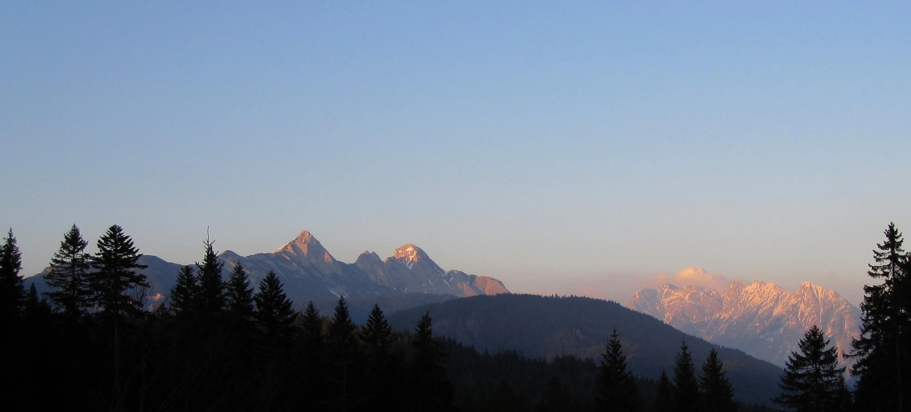
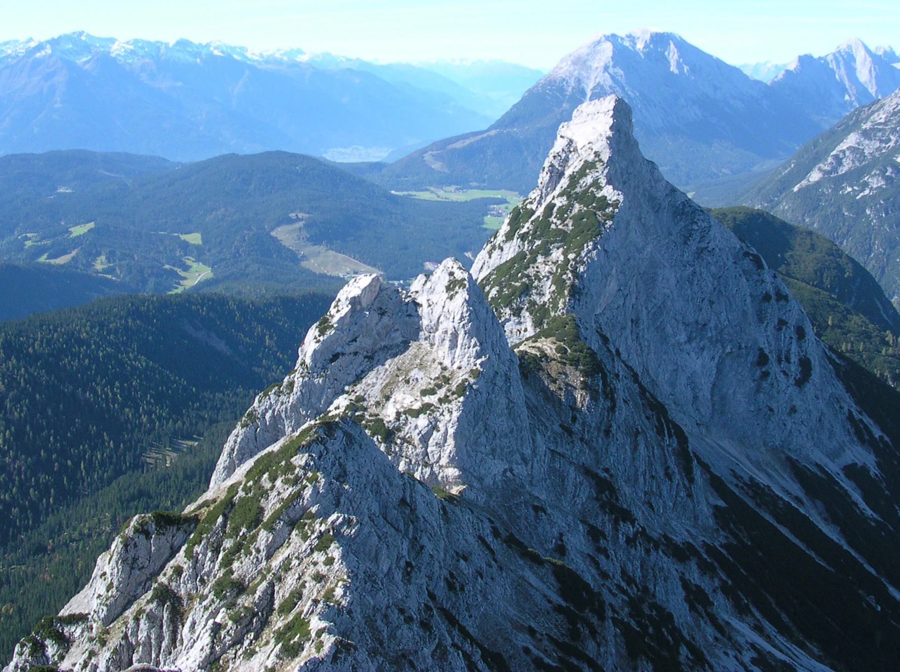
The Arnspitze Group is best known as a compact, free-standing limestone ridge that rises abruptly above the broad valleys around Seefeld and Mittenwald. Its defining summit, the Große Arnspitze, marks the exact border between Tyrol and Bavaria, and the ridge connecting the Große Arnspitze, the Mittlere Arnspitze, and the Arnplattenspitze provides one of the most rewarding ridge traverses in this corner of the Northern Limestone Alps. The chain is also recognized for its long-standing protected status, anchored by the 1942 Arnspitze Nature Reserve, which protects Wetterstein limestone terrain, forested slopes, and traditional alpine landscapes across the Austrian and Bavarian sections of the group.
Arnspitze Group history and protected-area timeline
The Arnspitze Group has a documented history of conservation that stretches back to the early twentieth century, with the formal protection of the area predating many of the high-profile nature reserves in the modern Austrian Alpine system. The Arnspitze Nature Reserve was established on 19 November 1942, initially covering the area as it stood during the wartime period, and it has remained in force through subsequent decades on both sides of the border. The Tyrolean portion of the reserve, covering the municipalities of Leutasch and Scharnitz in the district of Innsbruck Land, is now protected under Tyrolean nature conservation law and covers roughly 10.8 square kilometers, while the Bavarian portion adds another 1.7 square kilometers. The Tyrolean section is recognized as the oldest nature reserve in the state of Tyrol.
Earlier human presence in the area is reflected by small-scale industrial activity rather than large settlement. Lead was mined at the base of the Große Arnspitze, on Bavarian territory just north of the Austrian border in the Isar valley, at the southwestern end of the Riedboden. The mine is no longer active, but it documents a long-standing pattern of human use of the lower slopes and valley approaches to the massif.
A more recent historical chapter is the major fire that broke out on the southeastern slopes of the Arnspitze at the end of August 1947, after a period of extreme drought. The blaze drew a large-scale joint response, with thousands of firefighters from Upper Bavaria and Tyrol working for weeks to contain it. The affected southeastern flank of the mountain has remained visibly bare ever since, providing a lasting physical record of the event in the contemporary landscape.
Arnspitze Group landscape and geographic character
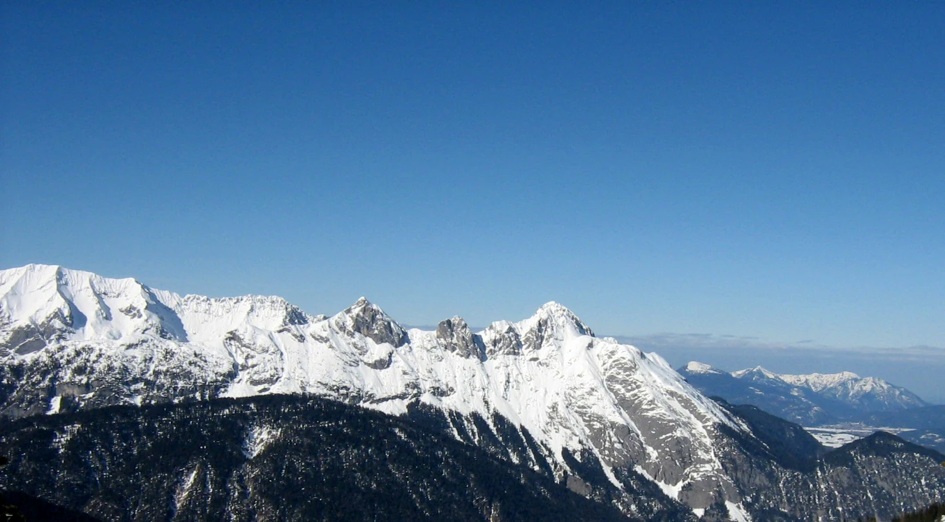
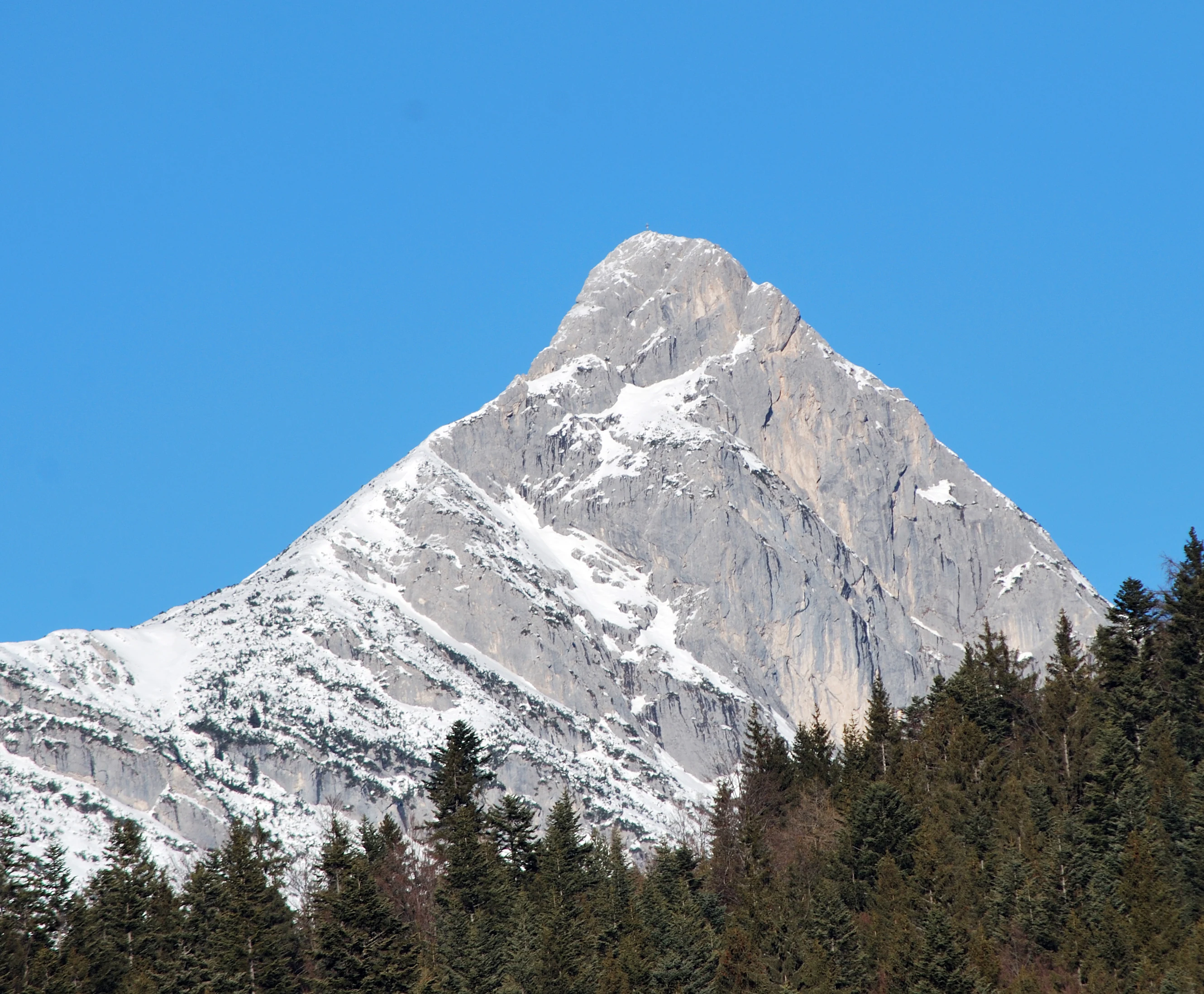
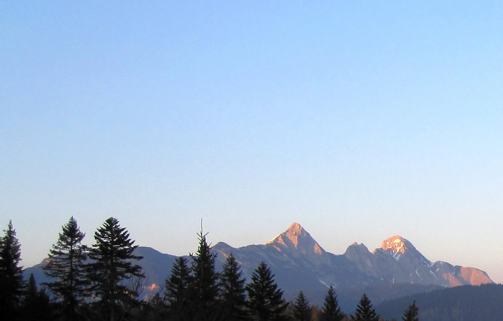
The Arnspitze Group forms a compact, ridge-like massif that rises noticeably above the surrounding valleys, giving it a distinct profile in the otherwise open terrain of the Seefeld-Mittenwald region. The main ridge stretches roughly ten kilometers from northwest to southeast and rises from gently sloping valley floors to a skyline dominated by cliffs, slabs, and exposed limestone crests. The Große Arnspitze, at 2,196 meters, sits exactly on the Austria-Germany border and serves as the visual anchor of the chain, with the twin-topped Mittlere Arnspitze and the Arnplattenspitze continuing the ridge to the southeast.
At lower elevations, the massif is framed by the broad agricultural and forested landscapes of the Leutasch valley to the west and the Isar valley near Scharnitz to the east. The northern approaches are gentler and more wooded, while the southern and southeastern slopes drop more steeply, opening out toward the wider Wetterstein terrain. The southeastern faces, in particular, still carry visible scars from the 1947 fire, and these bare slopes contrast sharply with the rest of the forested massif.
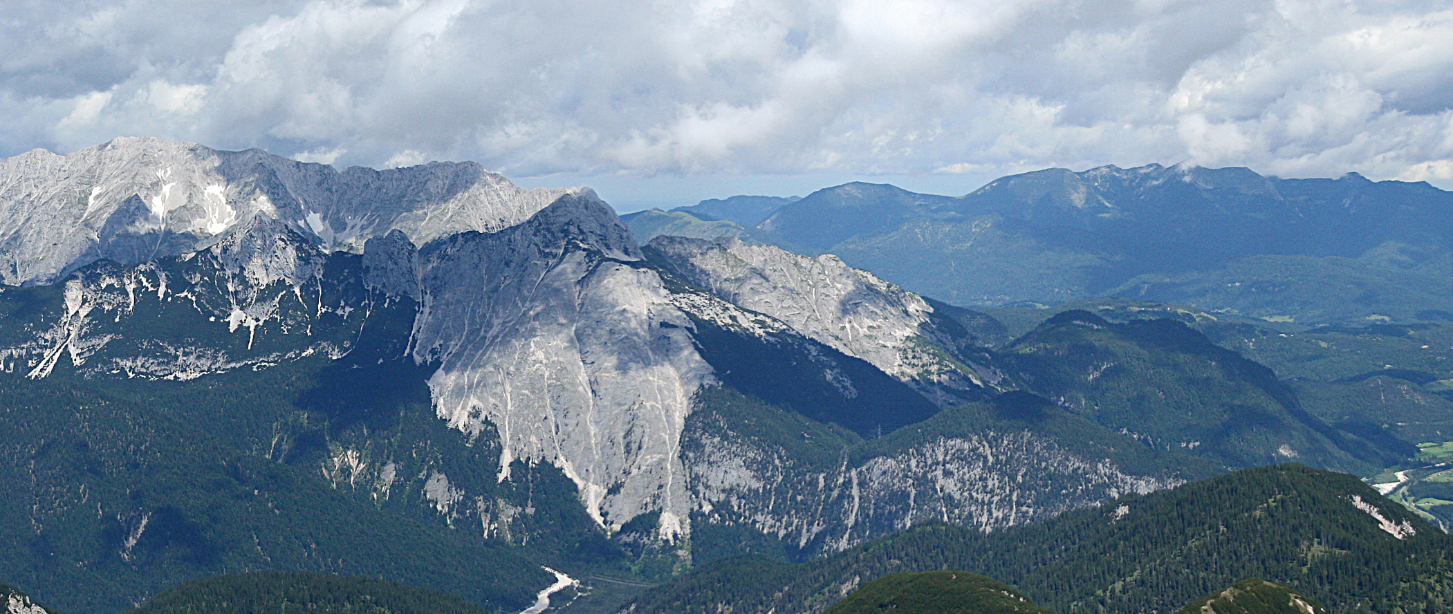
The terrain is shaped almost entirely by Wetterstein limestone that dips to the southeast, giving rise to the characteristic pale rock faces, deeply eroded gullies, and karst-style benches visible across the upper slopes. Smaller bands of Raibler strata and pockets of main dolomite at the Zunteregg add subtle variations to the geology. Below the summits, glacial and post-glacial shaping has produced high saddles such as the Hoher Sattel and the Riedbergscharte, which serve both as natural passes and as gateways onto the ridge for hikers coming up from the valleys.
Arnspitze Group ecosystems, habitats, and plant life
The Arnspitze Group is dominated by alpine and sub-alpine habitats shaped by its limestone geology and its position above the valley floors. The lower slopes are largely covered by mixed montane forest typical of the Northern Limestone Alps, with conifer stands giving way to grassy clearings and alpine meadows as elevation increases. Where soils are thin or absent, exposed limestone benches support specialized calcareous grassland and rock communities that are characteristic of this part of the North Tyrol Limestone Alps.
The protected area encompasses the spectrum of habitats from valley forest up through dwarf-shrub heath and into the high alpine zone, allowing vegetation patterns to develop along a relatively continuous elevation gradient. The southeastern flank that was burned in 1947 has been recolonized slowly, and the present mixture of bare rock, pioneer vegetation, and recovering scrub continues to provide a distinctive habitat mosaic within the reserve.
Water features in the massif are modest but ecologically meaningful, with small streams draining the upper slopes into the Leutasch and Isar catchments, and small tarns such as the Wildsee sitting in the higher basins. These wetter microhabitats add to the structural diversity of the area, supporting a more varied flora and fauna than the surrounding open rock would on its own.
Arnspitze Group wildlife and species highlights
The protected status of the Arnspitze Group, combined with its range of habitats from valley forest through alpine grassland to high cliffs, supports a typical Northern Limestone Alps fauna. Forested lower slopes provide cover for red deer and other ungulates that move between the massif and the broader forested landscapes of the Leutasch and Isar valleys. Chamois are commonly associated with the steeper cliffs and higher meadows of the chain.
Raptors are regular users of the open cliff habitat, and the vertical limestone faces provide nesting sites for species typical of the North Tyrol and Bavarian alpine regions. Smaller alpine passerines, including pipits and alpine choughs, are part of the seasonal fauna of the higher meadows and rocky ledges. The mix of closed forest, open rock, and recovering burned slopes allows a range of habitat specialists to coexist in a relatively compact area.
Because the reserve predates many of Tyrol's modern protected areas and has been managed under Tyrolean conservation law for decades, the wildlife of the Arnspitze Group has been given sustained protection, even as activities such as grazing and limited hunting have continued under traditional alpine land-use practices around the massif's fringes.
Arnspitze Group conservation status and protection priorities
The primary conservation significance of the Arnspitze Group lies in its very long-standing protected status. The Arnspitze Nature Reserve was established in 1942, and the Tyrolean portion of the massif, covering parts of the municipalities of Leutasch and Scharnitz, is now recognized as the oldest nature reserve in the state of Tyrol, with an area of approximately 10.8 square kilometers. A smaller Bavarian section, covering about 1.7 square kilometers, extends the protection across the international boundary, so the massif is one of only a few cross-border nature reserves of its age in this part of the Alps.
The reserve protects a coherent cross-section of Northern Limestone Alps landscapes, including stands of montane forest, alpine meadows, exposed limestone habitats, karst features, and the high rocky ridge that defines the main chain. By linking forests of the valley floors with the open alpine zone above, it safeguards ecological connectivity between habitats that typically become fragmented in more developed valleys.
The burn scar from the 1947 fire has itself become part of the conservation narrative of the massif: areas that were catastrophically altered are now slowly recovering under natural processes, providing a long-term reference site for post-fire ecological development in a protected alpine limestone environment.
Arnspitze Group cultural meaning and human context
The Arnspitze Group is embedded in an alpine cultural landscape shaped by the historic Tyrolean communities of Leutasch and Scharnitz and the Bavarian town of Mittenwald. Local footpaths, alpine pastures, and traditional huts reflect centuries of pastoral and forestry activity in the valleys below the chain. The presence of the old lead mine at the foot of the Große Arnspitze adds a modest but distinctive layer of mining heritage tied to the geological character of the massif.
Cross-border ties between Upper Bavaria and Tyrol are especially visible on the Arnspitze Group, where the border runs over the Große Arnspitze and the protected area spans both states. The 1947 fire response, in which thousands of firefighters from both sides worked together for weeks, is a well-documented example of this long-standing regional cooperation and remains a vivid element of the area's shared local memory.
Top sights and standout views in Arnspitze Group
The defining highlights of the Arnspitze Group are its compact ridge of limestone summits, with the border-straddling Große Arnspitze at its center; the protected status of the massif as Tyrol's oldest nature reserve; and the combination of well-established valley approaches from Leutasch, Scharnitz, and Mittenwald with more exposed ridge and climbing routes that connect the main summits. The visible scar of the 1947 fire on the southeastern slopes provides an unusually direct record of a historical event that still shapes the visual identity of the massif today.
Best time to visit Arnspitze Group
The Arnspitze Group is at its most attractive for general hiking and ridge walking in the warmer months from late spring through early autumn, when the higher trails are free of snow and the valley approaches are most accessible. Summer brings long daylight hours that suit the longer ridge traverses, while early autumn often offers clear skies and stable conditions for climbing the higher summits. Winter conditions are typically more demanding, with the higher peaks and saddles requiring winter mountaineering equipment, so most visitors concentrate on the valley and lower-forest approaches during the colder months.