
Mori Atlas logo
Marine protected areaAstola Island

A rugged island plateau and vital wetland ecosystem off the Balochistan coast of Pakistan

Astola Island Marine Protected Area: Geographic Boundaries and Regional Landscape Context

Astola Island stands as the largest offshore island in Pakistan, defined by a distinct tilted plateau and seven rocky hillocks rising from the Arabian Sea. As an essential marine protected area and Ramsar wetland, it features dramatic sea cliffs, natural caves, and critical nesting beaches for endangered sea turtles. The landscape provides a unique look at the coastal geography of the Balochistan region, showcasing fragmented terrain and fringe coral communities in a remote marine environment.

islandmarine protected areaArabian SeaRamsar wetlandsea turtle nestingcoral reefs
A graphic illustration showing steep coastal cliffs dropping into the ocean with coniferous-like trees in the foreground and a setting sun in the background.

Astola Island

Marine protected area

Park overview

Structured park overview, official facts, and landscape profile for Astola Island

Astola Island park facts, protected area profile, and essential visitor context

Review the core facts for Astola Island, including designation, size, terrain, visitor scale, habitats, and operating context in one park-focused overview.

About Astola Island

Astola Island is a small, uninhabited landmass in the northern Arabian Sea, positioned off the coast of Balochistan in southwestern Pakistan. It lies roughly twenty-five kilometers from the nearest mainland point and about thirty-five kilometers southeast of Pasni, the regional fishing port that serves as the main launching point for visitors and seasonal fishermen. With an area of around 6.7 square kilometers, Astola is the largest offshore island belonging to Pakistan and serves as both a navigational landmark and a natural refuge in an otherwise arid coastal region.

Geographically, the island is defined by a tilted plateau topped by a series of seven small hillocks, a feature that gives it its traditional name Haft Talar, meaning Seven Hills. The northern side rises in steep cliffs with sharp vertical drops, while the southern face slopes more gradually toward the sea. Deep chasms, crevices, natural caves, and sheltered coves cut into the terrain, producing a rugged coastline that contrasts sharply with the flat Makran coast on the mainland.

Ecologically, Astola has gained recognition as one of Pakistan's most important small-island conservation areas. Its isolation has allowed endemic reptiles and breeding seabird colonies to persist in a setting untouched by permanent human settlement. The surrounding waters contain hard and soft coral communities and a diversity of reef-associated fish, while the island's beaches serve as nesting habitat for endangered sea turtles. The combination of unusual topography, limited freshwater, and an absence of trees creates an austere but distinctive environment that supports only sparse scrub vegetation adapted to arid conditions.

Astola also carries significant cultural and historical weight. It was referenced in ancient Greek accounts of Alexander the Great's naval expeditions, was sacred to Hindu pilgrims under the name Satadip, and remains a seasonal hub for fishermen from the Makran coast who come for lobster and oyster harvesting. A small mosque dedicated to a Muslim saint and the ruins of an ancient Hindu temple of the goddess Kali still stand on the island, reflecting its long history as a waypoint for travelers, traders, and fishermen crossing the Arabian Sea.

Quick facts and research context for Astola Island

Astola Island sits in the Arabian Sea off the Gwadar District of Balochistan, Pakistan, and is the country's largest offshore island. The terrain consists of a tilted plateau broken by seven hillocks, with steep cliffs on the north face and a gentler slope on the south. There is no source of fresh water on the island, and vegetation is limited to drought-tolerant scrub.

The island is a designated Ramsar wetland and Pakistan's first Marine Protected Area. It supports endangered green and hawksbill sea turtles, endemic reptiles, breeding seabirds, and fringing coral reefs, while remaining uninhabited for most of the year.

Protection and recognition

Marine protected area designation history and Ramsar site status

Astola Island Protection Status and International Recognition Details

Marine conservation records for Astola Island outline official designation timelines established in 2017 alongside documented international recognition sources. Structured protection facts track the governance scope and formal Ramsar site status associated with the island ecosystem.

International recognition

Protection details

Protection scope
Marine
Designated year
2017
Transboundary protection
No
Park context

Deeper park guide and search-rich context for Astola Island

Astola Island history, landscape, wildlife, and travel context

Explore Astola Island through its history, landscape character, ecosystems, wildlife, conservation priorities, cultural context, and seasonal travel timing in a structured park guide built for atlas discovery and search intent.

Why Astola Island stands out

Astola is best known for being Pakistan's first Marine Protected Area and for its Ramsar-recognized wetland status in the Arabian Sea. Its compact landscape of seven rocky hillocks, sea cliffs, and natural caves creates a distinctive silhouette that has made it a landmark for mariners off the Makran coast. Ecologically, the island stands out for its nesting beaches of endangered green and hawksbill sea turtles, its endemic Astola viper, and the coral reef communities that fringe its shores. It is also recognized for the breeding seabird populations that historically used the island, even as feral cats have disrupted some colonies.
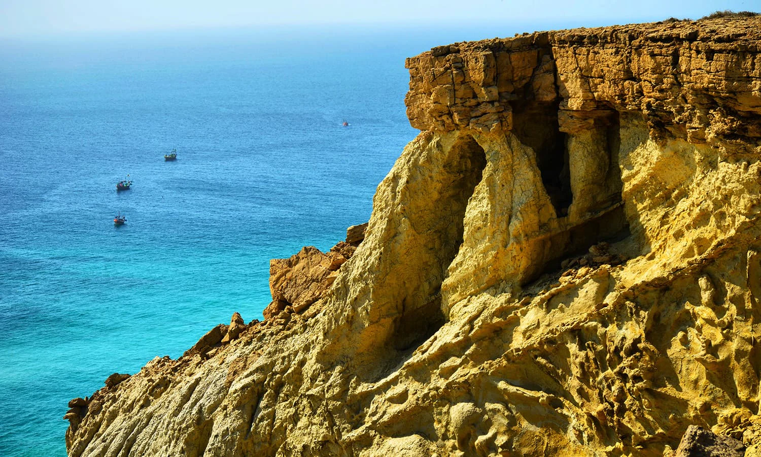
A high-angle view showing a jagged, sunlit rocky cliff face falling into deep blue and turquoise ocean water, with small fishing boats visible in the distance.
The rugged cliffs and turquoise waters surrounding Astola Island, a remote marine protected area in Balochistan, Pakistan.

Astola Island history and protected-area timeline

The earliest written references to Astola Island appear in the accounts of Nearchus, the admiral dispatched by Alexander the Great to explore the Arabian Sea and Persian Gulf coast in 325 BC. Arrian recorded that sailors in Nearchus's fleet were frightened by stories of an uninhabited island he called Nosala, and the island also appears under the name Carmina or Karmine in these classical texts. Some scholars have linked this ancient Carmine to Astola, though others suggest the description better matches a different coastal location such as Khor Kalmat.

In later centuries the island became known to Hindu pilgrims as Satadip, and the ruins of an ancient temple dedicated to the goddess Kali still remain on the island. The name Haft Talar, meaning Seven Hills, became the local designation, reflecting the distinctive hillock terrain that defines Astola's profile.

In the modern era, the Government of Pakistan installed a lighthouse on Astola in 1982 to aid navigation in the surrounding waters, later replacing it with a solar-powered version in 1987. On 10 May 2001 the island was designated under the Ramsar Convention as a wetland of international importance, marking a turning point in its formal recognition. In June 2017, Pakistan declared Astola its first Marine Protected Area as part of international commitments under the Convention on Biological Diversity and the Aichi Biodiversity Targets. On 4 August 2020, a new Pakistani political map formally depicted both Astola and Churna Island as part of the country's territory.

Astola Island landscape and geographic character

Astola Island is shaped by a broad tilted plateau that rises from the Arabian Sea, with a cluster of seven small hillocks defining its skyline. The terrain is dissected by deep chasms and crevices several feet wide, giving the island a fractured and rugged character. Its north face is dramatic and cliff-like, falling sharply to the sea, while the south face slopes more gradually, producing a clear asymmetry between the two sides of the island.

Several natural caves and sheltered coves notch into the coastline, adding to the island's varied shoreline. The highest point reaches around seventy-five meters above sea level, making Astola a visible landmark for vessels traveling along the Makran coast. With no source of fresh water and only sparse scrub vegetation, the island's landscape appears austere and exposed, dominated by rock, dry soil, and the surrounding sea.
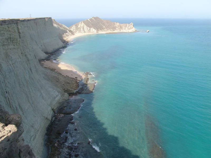
An elevated, wide-angle view of a rocky coastline in Astola Island with steep, light-colored cliffs dropping directly into clear, bright turquoise sea water.
A view overlooking the dramatic cliff coastline and turquoise waters of Astola Island.

Astola Island ecosystems, habitats, and plant life

Astola's isolation in the Arabian Sea has shaped a distinctive ecological profile in which endemic species, seabird colonies, and marine habitats converge in a remarkably compact area. The arid conditions, combined with the absence of fresh water, exclude most terrestrial lifeforms, leaving behind a community of drought-adapted plants, reptiles, and seasonal breeding birds.

Vegetation on the island is sparse and scrubby, with no trees present. The largest shrub is Prosopis juliflora, a species introduced into South Asia from South America in 1877. Plant life depends largely on occasional rainfall and stored soil moisture, reinforcing the impression of a harsh, semi-desert island environment softened only marginally by the surrounding ocean.

The marine environment around Astola is biologically richer. The island is surrounded by coral reef communities that include hard corals, soft corals, and a wide range of associated fish and invertebrates. Sea snakes are also part of the local marine fauna, with multiple species recorded in the waters around the island. Occasionally, the rare Arabian Sea humpback whale has been sighted nearby, underscoring the broader ecological significance of the surrounding sea.
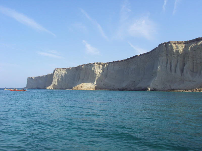
A wide view of the steep, light-colored limestone cliffs of Astola Island meeting the blue sea, with a small boat visible in the water near the base.
The distinctive limestone cliffs of Astola Island rising from the Arabian Sea.

Astola Island wildlife and species highlights

Astola Island supports a small but ecologically important wildlife community shaped by its isolation and arid conditions. The beaches at the base of the cliffs serve as nesting habitat for endangered green sea turtles and hawksbill turtles, making the island a critical site for the conservation of these species in Pakistani waters.

The island is also notable for its reptiles, including the endemic Astola viper, a subspecies of the saw-scaled viper found nowhere else. Other reptiles, such as the carpet viper, cliff racer, skinks, and long-tailed desert lizards, also inhabit the island. Birdlife has historically been one of Astola's most distinctive features. The island supports breeding populations of coursers, curlews, godwits, gulls, plovers, and sanderling, with surveys recording dozens of resident, wintering, and migratory species. Sooty gulls once maintained a major breeding colony on Astola, though this colony has been lost due to predation by feral cats introduced to control rodent populations.

In the surrounding waters, wildlife diversity extends to sea snakes and the occasional appearance of the rare Arabian Sea humpback whale, reinforcing the island's significance as both a terrestrial refuge and a marine habitat.
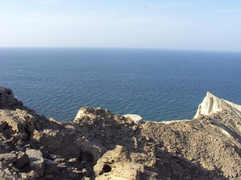
A high angle view looking down from rocky cliffs on Astola Island toward the deep blue waters of the Arabian Sea.
A view overlooking the rugged cliffs of Astola Island toward the Arabian Sea.

Astola Island conservation status and protection priorities

Astola Island holds an unusually layered conservation status for such a small landmass. It was designated as a Ramsar wetland of international importance on 10 May 2001, recognizing its value for waterbirds, marine turtles, and broader biodiversity, and it was later declared Pakistan's first Marine Protected Area in June 2017 under commitments related to the Convention on Biological Diversity and the Aichi Biodiversity Targets.

Conservation concerns on the island include the impact of feral cats introduced by fishermen to control rodent populations. These cats have contributed to the extirpation of the sooty gull breeding colony and continue to threaten nesting sites for other birds and reptiles. The fragility of the island's vegetation, the lack of freshwater, and the slow recovery of disturbed breeding populations all highlight the need for careful management of any human presence on the island.

Astola Island cultural meaning and human context

Astola Island carries a long cultural heritage tied to ancient seafaring routes, religious tradition, and the fishing economy of the Makran coast. Its earliest known reference appears in classical accounts from Alexander the Great's era, when Admiral Nearchus described an island in the Arabian Sea that has been linked, with some scholarly dispute, to Astola itself. The ancient Persian expression mahi khoran, meaning fish eaters, became associated both with this coastal region and with the island's supposed historical inhabitants known as Ichthyophagoi.

The island was known to Hindu pilgrims as Satadip, and the ruins of an ancient temple dedicated to the goddess Kali still remain on the island. In more recent centuries, a small mosque dedicated to the Muslim saint Pir Khawaja Khizr has served mainland fishermen who use the island as a seasonal base for lobster and oyster harvesting. During the fishing season, the island briefly hosts fishermen and seasonal workers, while from June to August it returns to an uninhabited state due to rough seas and the off-season.
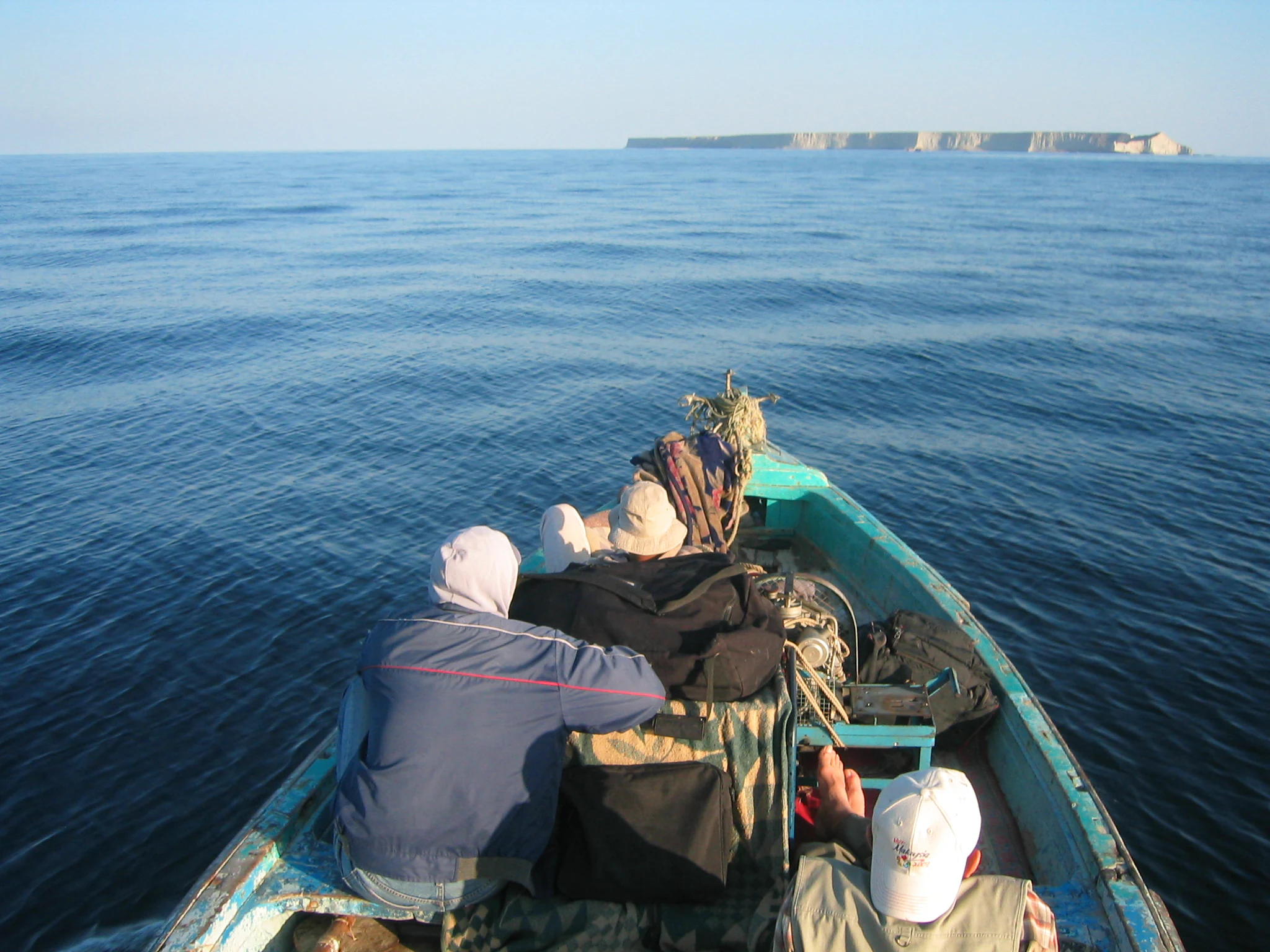
A view from the back of a small motorboat traveling on calm, blue water toward a flat, rocky island in the distant horizon.
A boat journey approaching Astola Island in the Arabian Sea.

Top sights and standout views in Astola Island

Astola Island stands out as Pakistan's largest offshore island, its first Marine Protected Area, and a designated Ramsar wetland. Its compact geography of seven rocky hillocks, dramatic sea cliffs, and natural caves gives it a distinctive silhouette rarely seen elsewhere along the Makran coast.

The island's ecological highlights include nesting beaches for endangered green and hawksbill sea turtles, an endemic subspecies of saw-scaled viper, breeding seabird populations, and fringing coral reefs. Combined with its layered history of ancient naval exploration, Hindu pilgrimage, and modern fishing use, Astola represents a rare convergence of natural and cultural significance in the Arabian Sea.

Best time to visit Astola Island

Astola Island has a hot desert climate influenced by its location in the Arabian Sea, with warm temperatures year-round and very low rainfall. Summers from May to August are hot and humid, with daytime highs around 32 degrees Celsius and the highest rainfall of the year during the monsoon months of June and July.

Winters from December to February are mild and likely the most comfortable period for visitors, with daytime temperatures between roughly 27 and 29 degrees Celsius and cooler nights. However, from June to August the island is typically uninhabited due to the fishing off-season, rough seas, and high tides, so any visit generally requires coordinating with local fishermen or authorized operators from Pasni during calmer months.

Monthly climate preview

Long-term temperature and precipitation averages across representative coordinates

Astola Island Climate Normals and Representative Monthly Temperature Records

Representative coordinate measurements trace measured monthly temperature and precipitation rhythms across Astola Island from nineteen ninety-one to two thousand twenty. Devolved monthly climate normals provide structured baseline data for detailed meteorological comparison.
Annual mean26 °C
22 °C29 °C
Jan22°
Feb22°
Mar24°
Apr26°
May28°
Jun29°
Jul28°
Aug27°
Sep27°
Oct27°
Nov26°
Dec23°
Warmest month
June

29.1 °C

Coolest month
January

21.6 °C

Wettest month
January

0.5 mm/day

Driest month
September

0.1 mm/day

Park location guide

Geography guide, regional context, and park location map for Astola Island

Astola Island park geography, regions, and map view in Pakistan

Understand where Astola Island sits in Pakistan through a broader geographic reading of the surrounding landscape, nearby location context, and its mapped position within the national park landscape.

How Astola Island fits into Pakistan

Pakistan, officially the Islamic Republic of Pakistan, is a federal parliamentary Islamic republic in South Asia. It is the fifth-most populous country and the 33rd-largest by area. The country gained independence from British India in 1947 and has a diverse history spanning ancient civilizations including Mehrgarh and the Indus Valley Civilisation. Pakistan shares maritime borders with Oman and is bounded by the Arabian Sea, Gulf of Oman, and several neighboring countries.

Wider geography shaping Astola Island in Pakistan

Pakistan is located in South Asia, bordered by the Arabian Sea to the south, the Gulf of Oman to the southwest, and shares land borders with India to the east, Afghanistan to the west, Iran to the southwest, and China to the northeast. The country also shares a maritime border with Oman in the Gulf of Oman. The Wakhan Corridor in Afghanistan separates Pakistan from Tajikistan in the northwest.

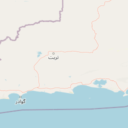
Map view of Astola Island

Use this park location map to pinpoint Astola Island in Pakistan, understand its exact geographic position, and read its mapped placement within the surrounding landscape more clearly.

Pigeon | © OpenStreetMap contributors

Location context for Astola Island

Balochistan

Explore photographic records of rocky sea cliffs, coastal plateaus, and isolated marine habitats.

Astola Island Photos and Landscape Scenery: Visualizing Pakistan's Marine Protected Area

Visual records illustrate the rugged terrain, dramatic sea cliffs, and sparse scrub vegetation defining the protected island environment. Detailed photography provides a clear window into the remote marine ecosystems and geological features characterizing Pakistan's offshore sanctuary.

A high-angle view showing a jagged, sunlit rocky cliff face falling into deep blue and turquoise ocean water, with small fishing boats visible in the distance.

A wide angle view of the rugged, rocky coastline of Astola Island meeting clear, shallow turquoise water under a bright blue sky.

An elevated, wide-angle view of a rocky coastline in Astola Island with steep, light-colored cliffs dropping directly into clear, bright turquoise sea water.

A wide view of the steep, light-colored limestone cliffs of Astola Island meeting the blue sea, with a small boat visible in the water near the base.

A high angle view looking down from rocky cliffs on Astola Island toward the deep blue waters of the Arabian Sea.

A wide view of the ocean at sunset with the dark silhouette of the cliffs of Astola Island in the background.

A view from the back of a small motorboat traveling on calm, blue water toward a flat, rocky island in the distant horizon.

Park atlas

Compare surrounding marine reserves and coastal protected landscapes across the Makran coast.

Other Parks Near Astola Island and Related Protected Areas in the Region

Visitors exploring Astola Island can browse nearby national parks and protected areas to compare regional coastal geography and marine habitats. Extending the search provides broader context on surrounding wildlife reserves and coastal terrain configurations.
A soft watercolor illustration of a coastal landscape with rocky terrain in the foreground and a calm bay in the distance.
Wildlife reserveBalochistan
About 80 km away#1 closest

East

Ormara Turtle Beaches Wildlife Reserve: Mapping Coastal Protected Habitats in Balochistan

Coastal sandy terrain and protected marine nesting environments

Examine the geography of Ormara Turtle Beaches, a 10 km protected sandy coastline on the Arabian Sea. The reserve offers clear insights into the marine-focused ecosystems and arid landscape character found along the Balochistan Makran coast, serving as a primary site for turtle nesting research and coastal conservation mapping.

Area
24 km²
Established
2001
Relief
Lowland
Climate
Subtropical
National parkBalochistan
About 127 km away#2 closest

East

Hingol National Park: Pakistan's Unique Protected Landscape and Geological Atlas

Discover dramatic rock formations and coastal geography.

Hingol National Park stands as a monumental protected landscape within Balochistan, Pakistan, offering an unparalleled atlas view of geological diversity. Renowned for its hoodoos like the Princess of Hope and the Balochistan Sphinx, the park also features active mud volcanoes and striking coastal semi-desert terrain. The confluence of the Hingol River with the Arabian Sea creates important wetland habitats. This national park provides a rich context for exploring unique natural formations and regional geography, making it a significant point of discovery within Pakistan's protected areas.

Area
6,100 km²
Established
1988
IUCN
II
Relief
Mixed relief
A minimalist watercolor illustration showing a winding river or estuary flowing through green coastal marshlands with soft hills in the background.
Wildlife reserveBalochistan
About 208 km away#3 closest

West

Jiwani Coastal Wetland: Mapped Protected Area and Coastal Geography in Balochistan

A vital mangrove-dominated estuary and wildlife reserve.

Jiwani Coastal Wetland stands as a unique protected reserve within Balochistan, characterized by its mix of brackish lagoons, mangrove swamps, and critical sea turtle nesting beaches. Its geographic position at the Gwatar Bay edge makes it a vital ecological link along the Arabian Sea, offering distinct landscape insights into the intersection of river-fed marshes and arid coastal terrain.

Area
19 km²
Established
2001
Relief
Lowland
Climate
Arid
Protected areaBalochistan
About 243 km away#4 closest

East

Miani Hor Protected Area: Coastal Lagoon Mapping and Regional Geography in Balochistan

Coastal lagoon and unique mangrove wetland ecosystem

Miani Hor functions as a major tidal lagoon and protected wetland along the Balochistan coast. The area is defined by its extensive mangrove forests and connection to the Arabian Sea, providing a essential study in estuarine geography and wetland conservation within the Lasbela District.

Area
74.71 km²
Established
2001
Relief
Lowland
Scope
Mixed
A pale, minimalist watercolor painting showing soft green hills or islands against a light, misty horizon.
Marine protected areaBalochistan
About 280 km away#5 closest

East

Churna Island Marine Protected Area: Geography and Coastal Atlas of Balochistan

Mapping the coral reef systems and rocky island terrain

Churna Island represents a unique marine protected area located near the border of Balochistan and Sindh. Characterized by a desolate rocky surface, the true ecological value resides in its extensive submerged reef structures, which provide habitat for a vast array of coral species and pelagic fish. This atlas resource provides a structured look at the island's coastal geography and its growing role in regional marine conservation.

Area
0.6 km²
Established
2024
Relief
Upland
Climate
Subtropical
National parkPakistan
About 383 km away#6 closest

East

Kirthar National Park: Discover Pakistan's Arid Mountain Protected Landscape

Explore the mapped geography and unique terrain of this vital national park.

Kirthar National Park represents a critical expanse of protected semi-arid mountainous terrain in southern Pakistan, covering over 3,000 square kilometers. It is recognized for its significant populations of Sindh ibex, urial, and chinkara gazelles, alongside a diverse array of raptors, including migratory vulture and eagle species. The park's unique landscape, characterized by parallel ridges and deep, dry valleys, provides crucial habitat in a region facing considerable development pressures, offering a distinct geographical context for protected area exploration.

Area
3,087 km²
Established
1974
IUCN
II
Relief
Mountain
A wide watercolor painting showing a body of water in the foreground, green trees and shrubs in the middle ground, and rolling hills in the background under a pale sky.
Protected areaThatta District
About 400 km away#7 closest

East

Haleji Lake Protected Area: Mapping Wetlands and Freshwater Ecosystems in Thatta District

A significant freshwater reservoir and Ramsar site in southern Sindh, Pakistan.

Situated in the low-lying plains of Thatta District, Haleji Lake functions as an essential freshwater sanctuary for migratory bird species. The site features a distinct mosaic of managed reservoirs, fringing marshes, and brackish lagoons, offering a unique look at the interaction between water engineering and natural wetland conservation in the Indus basin.

Area
6.58 km²
Established
1943
Relief
Lowland
Scope
Terrestrial
Watercolor painting of a calm lake with grassy foreground, small islands, and distant hills under a soft light.
Wildlife reserveSindh
About 426 km away#8 closest

East

Keenjhar Lake Wildlife Reserve: Sindh Province Protected Wetland and Geographic Atlas

Mapped freshwater wetland and regional wildlife sanctuary

Keenjhar Lake is a prominent freshwater wetland and wildlife reserve in the Thatta District of Sindh. This expansive basin serves as a key ecological anchor for migratory waterbirds and a central feature of the regional landscape. The area combines significant hydrological value with distinct cultural history, providing a unique look into the protected geography of southeastern Pakistan.

Area
134.68 km²
Relief
Lowland
Scope
Terrestrial
Water
Water-dominated

Common questions about visiting, size, designation, and location context for Astola Island

Astola Island FAQs for park facts, access, geography, and protected area context

Find quick answers about Astola Island, including protected-area facts, park geography, trail and visitor context, and how the park fits into its surrounding country and regional landscape.
MoriAtlas Explorer

Continue Your Protected Areas Search Across the Global Atlas

Deepen your exploration by continuing the structured search for national parks and protected areas worldwide. Utilize the comprehensive filtering capabilities to compare different conservation landscapes and refine your understanding of global park geography. Discover more about the distribution and characteristics of protected natural areas.

Global natural geography