Why Auckland Islands stands out
The Auckland Islands are best known as one of the most pristine and ecologically significant island groups in the New Zealand subantarctic. They host the largest and most diverse communities of subantarctic invertebrates in the region, including a large number of endemic beetles, flies, moths, and the endemic Auckland Island wētā. Their birdlife is similarly distinctive, with breeding colonies of several albatross species, rockhopper and yellow-eyed penguins, an estimated million pairs of sooty shearwaters, and a remarkable cluster of endemic landbirds such as the Auckland teal, Auckland rail, Auckland snipe, Auckland shag, and Auckland Island tomtit. Equally defining is the islands' role as a marine wildlife refuge. Port Ross is the most important southern right whale gathering ground in New Zealand waters, and the surrounding coast supports major populations of New Zealand sea lions and New Zealand fur seals. Combined with their status as a National Nature Reserve and a UNESCO World Heritage Site within the New Zealand Subantarctic Islands, these features make the Auckland Islands a benchmark location for subantarctic biodiversity conservation.
Auckland Islands history and protected-area timeline
The Auckland Islands have a layered human history that begins long before European contact. Traces of Polynesian settlement, possibly dating to the thirteenth century, have been identified by archaeologists on Enderby Island, making it the most southerly known Polynesian settlement. When European whalers arrived, the islands were uninhabited. The British whaler Ocean, captained by Abraham Bristow, rediscovered the archipelago in 1806 and named it after William Eden, 1st Baron Auckland. Bristow returned in 1807 to claim the islands for Britain, working for Samuel Enderby, whose name was later given to Enderby Island. Explorers Dumont D'Urville and James Clark Ross visited in 1839 and 1840, and the Ross Expedition produced the first major scientific description of the islands' flora in Hooker and Reeve's Flora of Lord Auckland and Campbell's Islands, published between 1843 and 1845.
The early nineteenth century was dominated by sealing. From 1807 until the mid-1820s, the islands became one of the principal sealing stations in the Pacific, with at least 82 vessels recorded as visiting for sealing purposes and roughly eleven of them wrecked offshore. By 1812, seal populations had collapsed so heavily that commercial sealing shifted to Campbell Island and Macquarie Island. Temporary whaling bases also existed, but permanent settlement attempts failed. A community of about seventy Māori and Moriori from the Chatham Islands migrated to the archipelago in 1842, surviving on sealing and flax cultivation for around two decades. Charles Enderby proposed an agricultural and whaling settlement at Port Ross, which was established in 1849 as Hardwicke but lasted only two and a half years. Most of the Māori returned to the Chatham Islands in 1866, while many of the Moriori resettled on Stewart Island, where some of their descendants still live.
The nineteenth century was also an era of shipwrecks and castaway depots. The Grafton was wrecked in Carnley Harbour in 1864, and the Scottish sailing ship Invercauld met a similar fate a few months later. In 1866, the General Grant was wrecked on the western coast; ten survivors endured eighteen months on Auckland Island before rescue. The Dundonald was lost off Disappointment Island in 1907, with fifteen survivors living off supplies from the Auckland Island depot. In response to the high risk of wrecks, New Zealand authorities established emergency depots at Port Ross, Norman Inlet, and Carnley Harbour from 1887, supplemented by boats and finger-post supply caches across the islands.
Scientific interest grew steadily through the twentieth century. Three independent scientific expeditions visited the Auckland Islands in 1840 alone, including the United States Wilkes Expedition, d'Urville's second voyage of the Astrolabe, and the British Ross Expedition on Erebus and Terror. The Philosophical Institute of Canterbury conducted the Sub-Antarctic Islands Scientific Expedition of 1907 aboard the Hinemoa. From 1941 to 1945, the so-called Cape Expedition, a wartime coastwatching programme staffed by scientific volunteers, hosted a New Zealand meteorological station on the islands and also gathered important biodiversity data; later researcher Robert Falla became one of New Zealand's most distinguished biologists as a result. The 1972 to 1973 Auckland Islands Expedition spent several months studying fauna and flora. The marine environment was declared a marine mammal sanctuary in 1993 and a marine reserve in 2003, and in 1998 the New Zealand Subantarctic Islands, including the Auckland Islands, were inscribed as a UNESCO World Heritage Site.
Auckland Islands landscape and geographic character
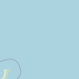
The Auckland Islands rise from the southern Pacific as a deeply rugged archipelago dominated by two ancient, eroded shield volcanoes. The main Auckland Island stretches about 42 kilometres in length and broadens to roughly 26 kilometres at its southern end, where its terrain rises to more than 600 metres in a mass of steep cliffs and narrow ridges. Prominent summits include Cavern Peak, Mount Raynal, Mount D'Urville, Mount Easton, and the strangely shaped Tower of Babel. The southern coast is particularly dramatic, with deeply incised inlets such as Port Ross cutting into the northern end of the main island.
Adams Island, separated from the main island by the narrow channel of Carnley Harbour, is triangular in shape, covers roughly 100 square kilometres, and is even more mountainous. It culminates at Mount Dick, the highest point of the entire group at 705 metres. The waters of Carnley Harbour occupy the remains of the crater of the older, deeply eroded volcano whose rim is preserved by Adams Island and the southern part of Auckland Island. The whole archipelago rests on a foundation of Miocene volcanic rocks about 12 million years old, with underlying volcanic sequences 15 to 25 million years old and some much older granite and fossil-bearing sedimentary rocks dated to around 100 million years.
Smaller islands add significant variety to the seascape. Enderby Island lies off the northern tip of the main island, Disappointment Island stands to the northwest, and Ewing, Rose, Dundas, and Green Islands cluster around the core group, together adding roughly 12 square kilometres of additional land area. The deeply indented coastline, with its narrow channels and sheltered harbours, gives the archipelago a constantly changing profile of cliffs, sea stacks, and isolated rocks rising from cold southern ocean swells.
Auckland Islands ecosystems, habitats, and plant life
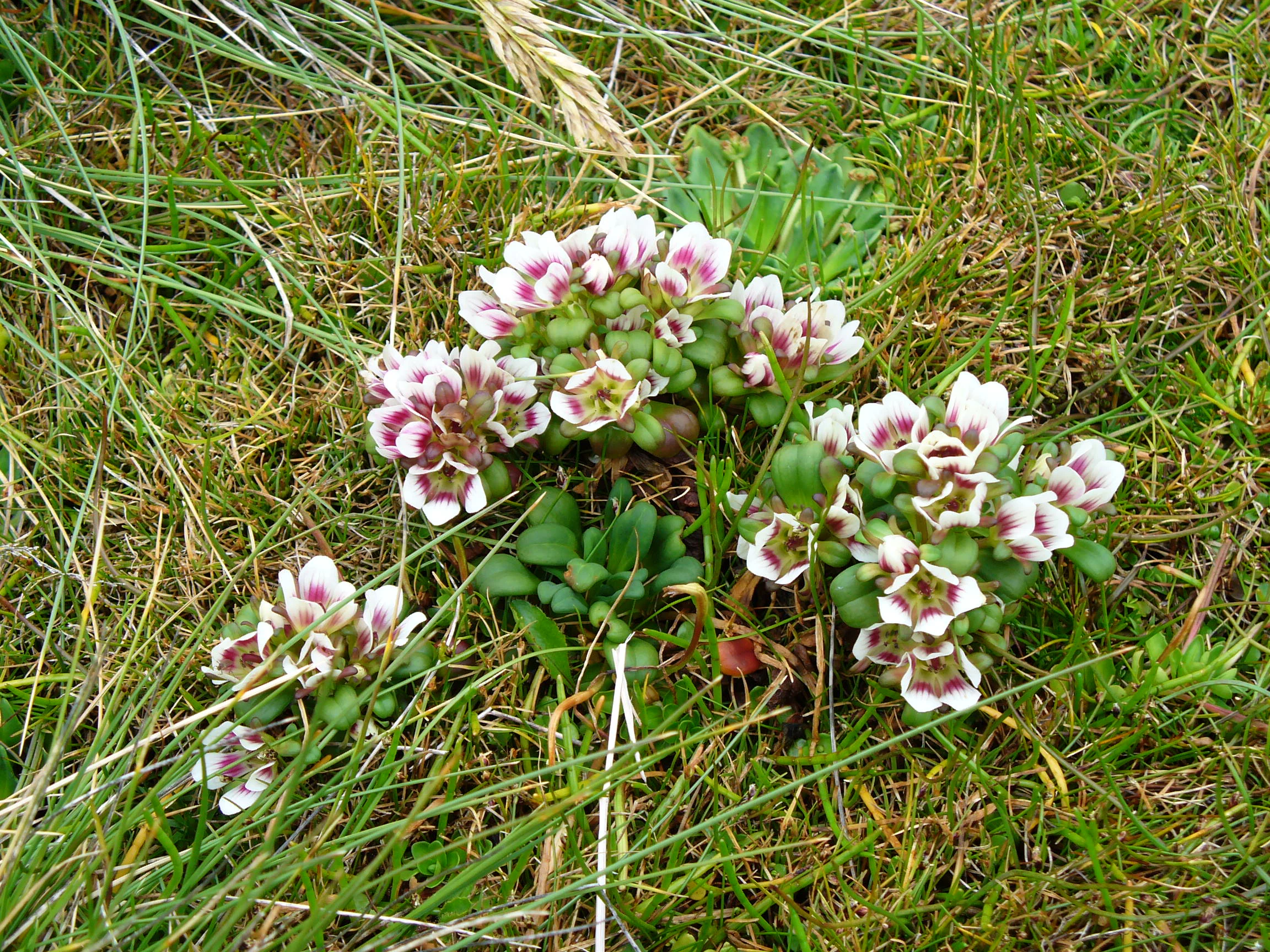
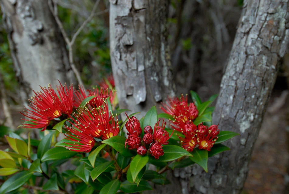
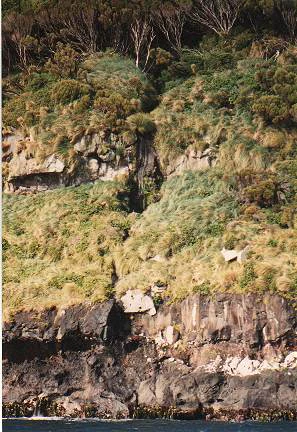
Ecologically, the Auckland Islands form a southern outpost of the Antipodes Subantarctic Islands tundra ecoregion, and they are regarded as one of the most intact ecological reference sites in the New Zealand subantarctic. The flora comprises about 228 vascular plant species, of which more than 80 percent are indigenous. Vegetation is strongly structured by altitude and exposure. Inland from the salt-spray zone, coastal fringes are cloaked in forest of southern rātā (Metrosideros umbellata), with the subantarctic tree daisy (Olearia lyallii) appearing in places, possibly introduced by sealers in the nineteenth century. Above this is a subalpine shrub zone dominated by Dracophyllum, Coprosma, and Myrsine, often mixed with rātā, and at higher elevations the landscape opens into tussock grassland and megaherb communities. Endemic species include several Gentianella forms such as Gentianella concinna and Gentianella cerina, along with Azorella schizeilema, Dracophyllum cockayneanum, Geum albiflorum, Plantago aucklandica, and a number of Cardamine and Poa taxa unique to the islands.
The invertebrate fauna of the Auckland Islands is the richest documented anywhere in the subantarctic. Twenty-four spider species, eleven springtail species, and more than 200 insect species have been recorded, including roughly 57 beetle species, 110 fly species, and 39 moth species. The islands also host an endemic genus and species of wētā, Dendroplectron aucklandensis, a distinctive insect found nowhere else. Freshwater systems are home to the climbing galaxias (kōaro), a fish that lives in the sea as a juvenile but returns to freshwater streams as an adult, together with nineteen endemic freshwater invertebrate species such as a unique mollusc, a crustacean, a mayfly, multiple flies, and two caddisflies. The marine bivalve Austrovenus aucklandica, the Auckland Islands cockle, is endemic to the archipelago's waters.
This ecological richness has been shaped by a long history of introductions and removals. Captains Musgrave and Norman introduced goats, sheep, cattle, and other species in 1865 while searching for castaways. By the 1990s, ecologists had eliminated or allowed the extinction of cattle, sheep, goats, dogs, possums, and rabbits on most islands, and in 1993 the last rabbits on Enderby Island were removed through poisoning, an effort that also eradicated mice there. Feral cats, pigs, and mice still remain on Auckland Island itself, and the Department of Conservation has been working since 2018 on one of the world's largest multi-species eradication plans to make the entire island group pest-free. Notably, rats have never successfully colonised the Auckland Islands, despite their abundance elsewhere in the region and despite numerous shipwrecks and human visits over the past two centuries.
Auckland Islands wildlife and species highlights
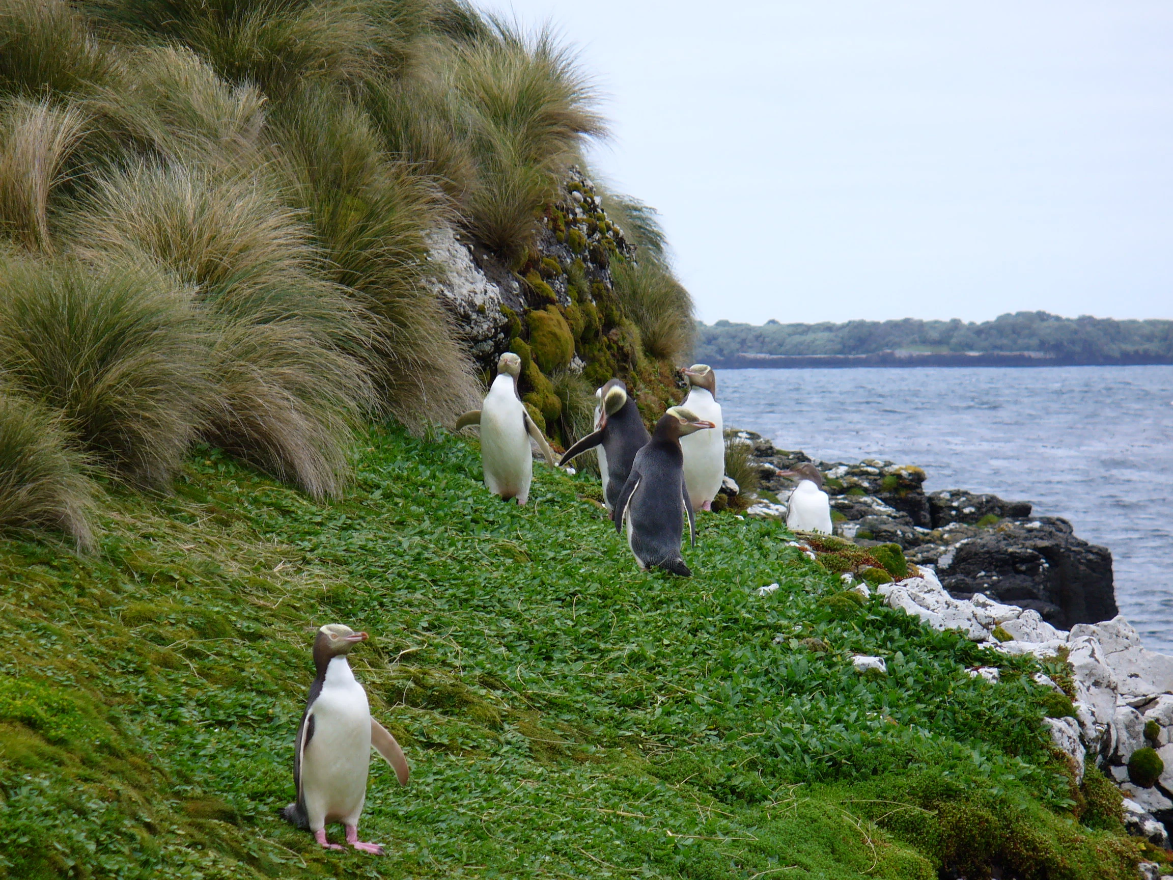
The Auckland Islands harbour one of the most significant seabird concentrations in the New Zealand subantarctic. Breeding colonies include several species of albatross: Antipodean, southern royal, light-mantled, and white-capped albatrosses, alongside the endemic Gibson's albatross (Diomedea antipodensis gibsoni). Together with penguins, petrels, and other seabirds, these colonies form internationally recognised breeding populations. The islands are home to roughly a million pairs of sooty shearwaters, and the rockhopper and yellow-eyed penguins both breed in significant numbers, especially on Enderby Island. Smaller petrels such as the white-chinned petrel also nest on the islands.
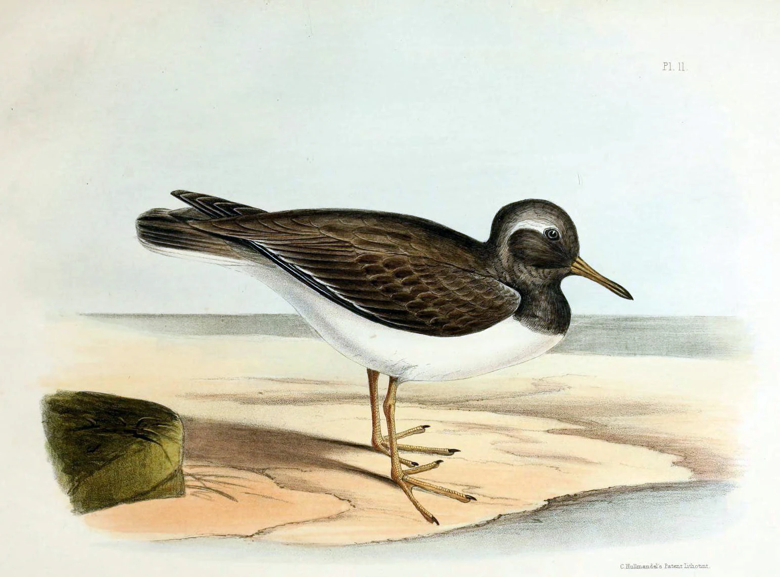
On land, the Auckland Islands hold a remarkable cluster of endemic and near-endemic birds. Endemic taxa include the Auckland teal, the Auckland rail, the Auckland snipe, the Auckland shag, the Auckland Island tomtit, and the Auckland Island banded dotterel, a distinctive subspecies of the double-banded plover. The now extinct Auckland Island merganser, a duck confined to the Auckland Islands before its disappearance, illustrates how isolated island populations can both evolve uniquely and be extremely vulnerable. Other landbirds present include red-fronted and yellow-crowned parakeets, New Zealand falcons, tūī, New Zealand bellbirds, and New Zealand pipits. BirdLife International has identified the whole island group as an Important Bird Area because of its significance for seabird breeding and its concentration of endemic species and subspecies.
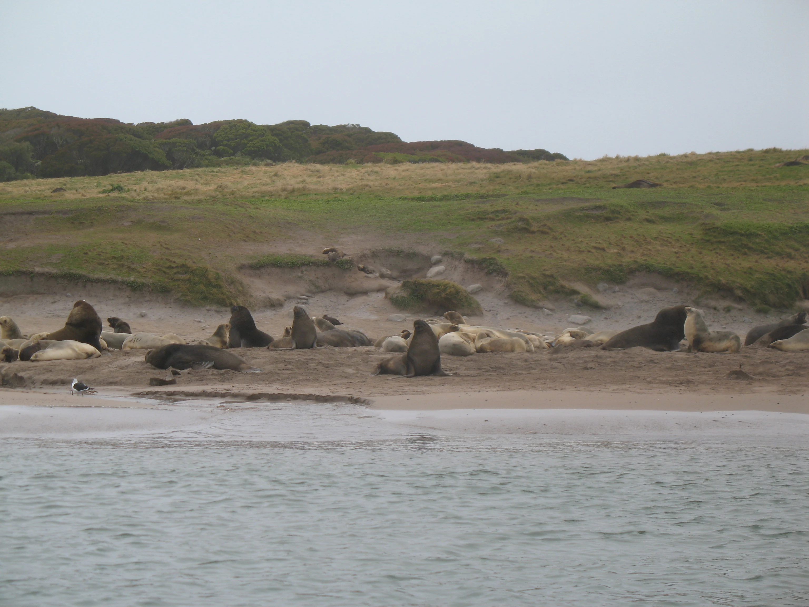
The surrounding sea is equally important for marine wildlife. New Zealand fur seals haul out in large numbers, and the threatened New Zealand sea lion, by the twenty-first century, breeds primarily on the Auckland Islands, making this archipelago its main pupping ground. Southern elephant seals are frequent winter migrants, and leopard seals occasionally appear. A well-recovering population of more than 2,000 southern right whales feeds and aggregates in the waters around the islands, and the Port Ross area is regarded as the most important and well-established congregating ground for the species in New Zealand waters, exceeding even the Campbell Island aggregation in significance.
Auckland Islands conservation status and protection priorities
Conservation is the defining framework for the modern Auckland Islands. The archipelago has been protected as a National Nature Reserve under New Zealand law, which is the highest level of protection available in the country. This status prohibits virtually all forms of exploitation and tightly restricts access. The surrounding territorial sea and internal waterways, designated a marine mammal sanctuary in 1993 and a marine reserve in 2003, add roughly 4,980 square kilometres of additional protected marine habitat. Together with the marine reserves around the Antipodes, Bounty, and Campbell Islands, the Auckland Islands marine reserves form the largest natural sanctuary in New Zealand.
The islands' conservation significance also reaches the international stage. As part of the New Zealand Subantarctic Islands, the Auckland Islands were inscribed as a UNESCO World Heritage Site in 1998, recognising both their outstanding natural value and their importance for science. The whole group has been identified as an Important Bird Area by BirdLife International because of its exceptional seabird breeding colonies and high concentration of endemic bird taxa. The Southland Conservancy of the Department of Conservation manages the reserve, with expedition party size, length of stay, and landings deliberately kept to a minimum. Entry is by permit only, and applicants must undergo thorough pre-expedition quarantine checks to prevent the introduction of invasive species.
Restoration efforts have been central to maintaining this protection. Introduced mammals such as cattle, sheep, goats, dogs, possums, and rabbits were eliminated or allowed to go extinct on the smaller islands during the 1990s, and rabbits and mice were eradicated from Enderby Island in 1993. Feral cats, pigs, and mice remain on Auckland Island itself, posing a continuing threat to endemic species such as the Auckland Island tomtit, Auckland snipe, and other ground-nesting birds. Since November 2018, the Department of Conservation has been scoping and preparing one of the world's largest multi-species island eradications to remove these last introduced mammals and make the entire Auckland Island group pest-free, an initiative expected to take around ten years and to cost tens of millions of New Zealand dollars.
Auckland Islands cultural meaning and human context
The cultural history of the Auckland Islands weaves together Polynesian presence, British colonial administration, European exploration, and the difficult experiences of sealing communities, castaways, and nineteenth-century settlers. Archaeological traces of Polynesian settlement on Enderby Island, possibly dating to the thirteenth century, represent the most southerly evidence of Polynesian voyaging and expand the cultural geography of the Pacific far beyond more commonly known settlement frontiers.
During the nineteenth century, the islands witnessed the rapid rise and fall of sealing and whaling enterprises, with at least 82 sealing vessels documented and multiple ships wrecked along the coast. Names such as Port Ross, Carnley Harbour, Hardwicke, Enderby Island, and Disappointment Island preserve memories of whaling captains, the Enderby family's commercial ventures, attempted colonial settlement, and the challenges faced by European explorers like Dumont D'Urville and James Clark Ross. Between 1842 and 1866, a small community of Māori and their Moriori captives from the Chatham Islands established a temporary presence on the islands, leaving a complex legacy that connects the Auckland Islands to wider histories of mobility, displacement, and encounter in southern New Zealand.
Maritime tragedy has its own cultural imprint on the archipelago. The famous wrecks of the Grafton and the General Grant, both in 1864 and 1866 respectively, and the loss of the Dundonald off Disappointment Island in 1907 are commemorated through graves, inscriptions, and the surviving remains of huts and castaway depots. These stories form an important part of New Zealand's castaway tradition and have inspired books and accounts such as François Édouard Raynal's Wrecked on a Reef and Andrew Fagan's Swirly World Sails South. Today, the islands are uninhabited, and the Department's careful permitting process reflects the enduring cultural ethic that these islands are not just a scientific resource but a place of historical significance that deserves careful stewardship.
Top sights and standout views in Auckland Islands
Among the Auckland Islands' standout qualities are their sheer physical remoteness, the depth of their volcanic terrain, and the intact nature of their ecological communities. The combination of rugged Miocene shield-volcano landscapes, deeply indented coastlines, and the drowned crater harbour of Carnley Harbour creates a setting of remarkable geological interest. Ecologically, the islands host New Zealand's most important subantarctic seabird breeding colonies, including several species of albatross, a million strong sooty shearwater population, and iconic penguin species.
The archipelago is, in addition, a centre of endemism in the New Zealand region, with a remarkable concentration of unique plants, invertebrates, birds, and freshwater species, not least the iconic Auckland Island wētā, the Auckland Islands cockle, and the suite of endemic landbirds. The conservation framework that surrounds these features, encompassing National Nature Reserve status, marine mammal sanctuary, marine reserve, and UNESCO World Heritage listing, makes the Auckland Islands one of the most thoroughly protected natural areas in the southern hemisphere. The gathering of southern right whales at Port Ross and the role of the islands as the modern stronghold of the New Zealand sea lion further enhance their global ecological significance.
Best time to visit Auckland Islands
The Auckland Islands lie in the path of persistent westerly weather and have a cool, wet subpolar oceanic climate characterised by year-round cloud cover, mild summers, and cool but rarely severe winters. Conditions are relatively constant, with strong winds, frequent rain, and overcast skies in any season. Weather patterns are broadly comparable to those of the Faroe Islands and the Aleutian Islands, and the surrounding sea keeps temperatures stable.
For visitors, the most favourable period generally falls in the austral late summer to early autumn months, roughly February through April, when days are marginally longer, conditions are slightly drier, and surface weather is often more settled than in midwinter. Wildlife viewing is rewarding throughout much of the year: the seabird breeding season extends across the warmer months, southern right whales aggregate in Port Ross, and New Zealand sea lions breed on the beaches. Because access is by permit only and managed closely by the Department of Conservation, prospective visitors should plan well in advance and prepare for a true subantarctic wilderness experience rather than conventional tourism logistics.