
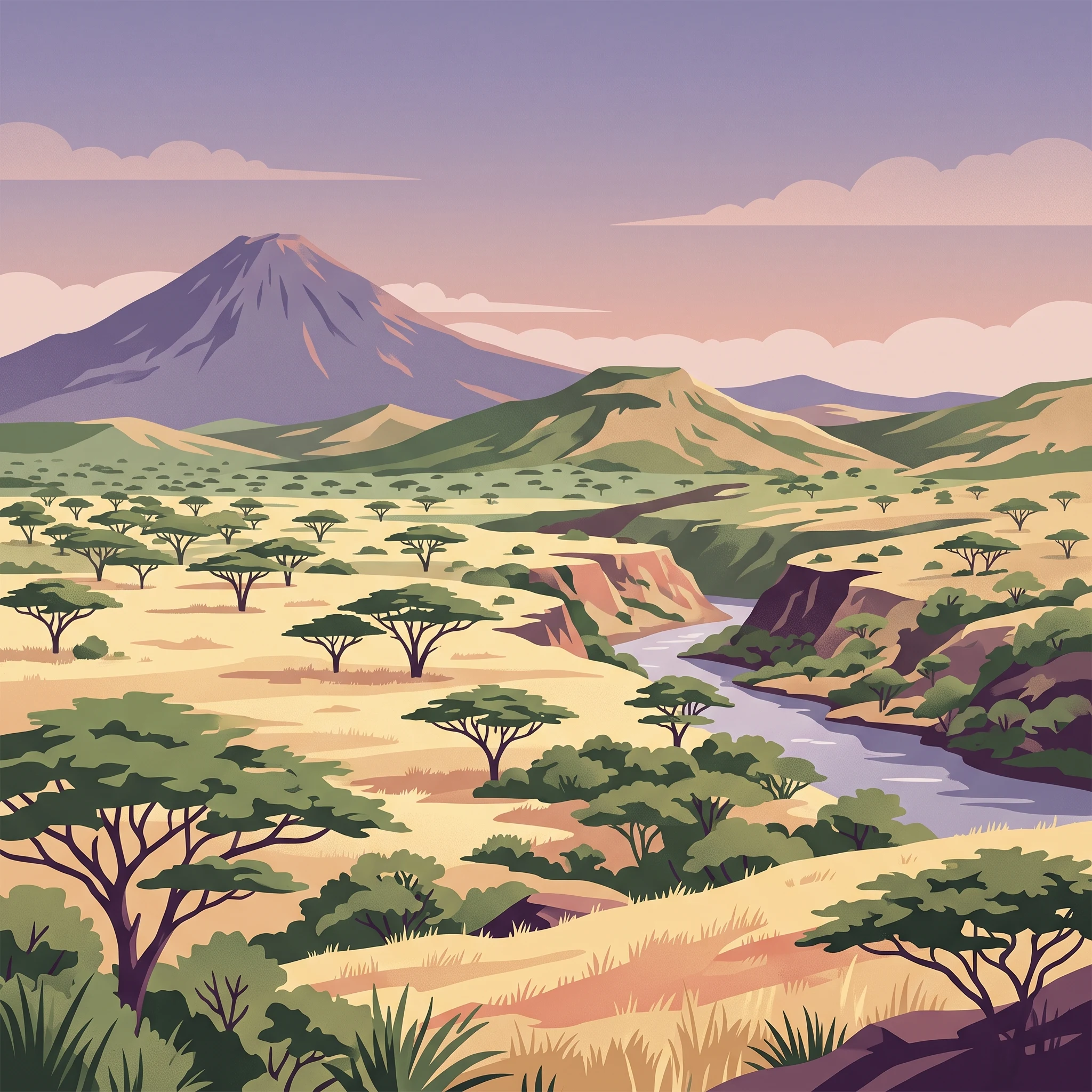
Trip Timing Basics
When to Visit Awash National Park: The Best Time for Your Trip
For those planning a visit to Awash National Park, identifying the right time to go requires balancing the search for dry, comfortable weather against the shifting conditions of the Ethiopian landscape. The best time to visit Awash National Park is widely considered to be during the cooler, drier window from November to January. During these months, travelers can expect stable conditions that make navigating the acacia woodland and grasslands significantly easier. This period aligns with the tail end of the rainy season and the onset of the northern winter, offering a respite from the peak humidity and precipitation spikes observed mid-year.
The Impact of Rainfall on Accessibility
Seasonal precipitation patterns serve as the primary constraint on travel to this region. While the park remains an important stronghold for biodiversity year-round, its accessibility is inherently tied to the rainfall cycles that peak between July and August. During these months, increased precipitation can influence both the condition of internal park roads and the visibility of wildlife as vegetation becomes denser and more lush. Visitors aiming for clear trails and more predictable ground transport generally prioritize the drier months when the risk of boggy or washed-out paths is minimized. This transition from the wet season into the dry cycle is not instantaneous, and those travelling early in the dry season often find the landscape still lush from previous rains, which can create a unique contrast between vibrant green terrain and manageable travel conditions.
Navigating Seasonal Temperature Fluctuations
Temperature dynamics in this semi-arid region add another layer to your planning. While the area rarely experiences extreme cold, the daily range can shift noticeably throughout the year. The cooler months between November and January benefit from lower average minimums, often dipping into the lower teens in degrees Celsius, which provides a comfortable environment for daytime excursions to sites like the Awash Falls or the trails around Mount Fentale. Conversely, the months leading into the mid-year rainy season often bring the highest average daily maximums, which can exceed 37 degrees Celsius. Understanding these temperature variations helps in preparing for the mid-day heat, which remains a constant feature of the savanna climate. Regardless of the month chosen, visitors should be prepared for the reality of a high-altitude, semi-arid environment where the intensity of the sun, combined with localized wind patterns, influences how time spent outdoors feels. While these seasonal shifts dictate the rhythm of the year, they also offer different perspectives on the park’s ecosystems, ranging from the arid beauty of the dry season to the productive, water-fed landscapes of the wetter months.
Visit Planning
Optimal Months for Visiting Awash National Park
The Dry Season Advantage: November to January
For most travelers, the window spanning November through January represents the most predictable period for visiting. This timeframe follows the main rains, resulting in lower humidity levels and generally clear skies. With average daily temperatures remaining cooler than at other times of the year, particularly in the morning and evening, it is an ideal phase for outdoor activities like hiking near Mount Fentale or exploring the landscape around Awash Falls. The minimal precipitation, often less than 1 mm per day during these months, minimizes the risk of travel delays caused by washed-out tracks, providing the most reliable access to the park's diverse terrain.
Transition and Warming: February to May
As the year progresses into February, the park enters a period of gradual warming that persists through May. Visitors choosing these months will encounter significantly higher daytime temperatures, with average maximums often climbing toward their annual peak in March and April. While this period remains relatively dry compared to the mid-year rainy season, the humidity begins to rise noticeably by April. Travelers during this window should prioritize early morning or late afternoon excursions to avoid the intense midday heat, which can make prolonged exposure in the open acacia savanna challenging. This season is well-suited for those who prefer avoiding the crowds that may gather during the cooler winter months but who are prepared to adapt their schedule to accommodate the rising heat.
Navigating the Rainy Season: June to September
June signals a shift in the park climate as weather patterns become more erratic, leading into the peak rainfall months of July and August. During this time, precipitation reaches its highest levels, with daily averages climbing above 4 mm and 5 mm respectively. The increased moisture leads to higher humidity, which can persist through early September. While the rainfall transforms the landscape, turning the dry acacia woodland into lush green grazing grounds, it also introduces significant challenges for navigation. Certain areas of the park may become difficult to traverse if ground conditions deteriorate. This period is less common for general tourism but may appeal to those interested in witnessing the dramatic seasonal shift in vegetation and observing the park when it is at its most vibrant. Visitors must remain flexible, as access to remote tracks is never guaranteed during these months and should always be verified with local authorities before arrival.
Annual Climate Overview
Monthly Temperature, Rainfall, and Climate Patterns in Awash National Park
Understanding the climate patterns of Awash National Park requires a look at how altitude and tropical location interact to produce distinct environmental cycles. Because the park is situated at an elevation of roughly 1,134 meters, the temperature profile remains consistently warm throughout the year, yet subtle shifts in humidity, precipitation, and cloud cover significantly alter the visitor experience. It is important to note that the following climate patterns are derived from long-term averages recorded between 1991 and 2020. These figures serve as a historical baseline for planning purposes and should not be treated as live weather forecasts or local predictions for specific areas like the summit of Mount Fentale or the riverine valleys.
Thermal Trends and Annual Heat Patterns
Visitors should anticipate high daytime temperatures across every month of the calendar year. The climate data indicates that the warmest period typically spans from March through June, where average maximum temperatures consistently hover between 36°C and 37°C. During these months, the intense sun combined with lower humidity can make the acacia woodland environments feel quite arid. Conversely, the "coolest" months occur at the beginning and end of the year, with December and January seeing average minimums dip toward 13°C to 14°C. While these nights provide relief from the heat, the daily maximums during these months still frequently reach into the low-to-mid 30s, maintaining a warm, sun-drenched environment even in the depth of the regional winter.
The Impact of Rainfall on Park Humidity and Visibility
Precipitation is the primary driver of environmental change in the park. The rainfall pattern is not uniform, with a marked increase in moisture during July and August, where precipitation averages peak at over 4.3 mm and 5.0 mm per day respectively. This shift is accompanied by a noticeable rise in relative humidity, which climbs from annual lows of roughly 40 percent in early spring to over 65 percent during the peak of the rainy season in August. This increased moisture often correlates with heavier cloud cover, which can reduce direct solar exposure and temper the absolute peak of the midday heat. Visitors should recognize that while this moisture supports the park's vibrant flora and riverine ecosystems, it also marks the period when road surfaces and trail conditions are most subject to change.
Daylight Cycles and Wind Conditions
Daylight duration in the park is relatively stable due to its proximity to the equator, fluctuating between approximately 11.5 hours in December and 12.5 hours in June. While this variation is minor, the timing of sunrise and sunset remains a critical consideration for wildlife observation. Wind speeds remain generally consistent throughout the year, averaging between 2.5 and 3.0 meters per second. These winds rarely reach extreme levels, but they can be a factor when traversing the more exposed grassland areas or when climbing the slopes of Mount Fentale, where localized wind effects may differ significantly from the general park climate normals. By observing these annual cycles, travelers can better align their expectations with the park's environmental rhythm, ensuring they are prepared for the transition from the dry, clear-sky months to the more humid, verdant conditions of mid-year.
Seasonal dynamics
Understanding Seasonal Climate Patterns in Awash National Park
The Dry and Cool Window: November to January
This period represents the most stable phase for travel to the park, defined by reliable, lower humidity levels and moderate temperature ranges. Following the final dissipation of the major rains, November marks the start of a clear, dry cycle that persists through January. Visitors often prefer these months because they offer the most comfortable conditions for outdoor exploration and hiking around the volcanic landscapes of Mount Fentale. The relatively low humidity, often averaging below 45 percent, mitigates the intensity of the midday sun. This window is characterized by steady, predictable weather that provides the highest level of logistical certainty for those planning to navigate the park's internal tracks.
The Warming Phase: February to May
As the year progresses into February, the climate transitions into a distinctly warmer phase. While rainfall remains minimal, daily temperature maximums climb steadily, frequently exceeding 36 degrees Celsius by March and April. This period is less about seasonal shifts in precipitation and more about an increase in heat intensity. During these months, the air feels noticeably drier and the landscape begins to show the cumulative effects of the preceding dry months. Travellers will find that the lack of rainfall keeps the park's roads in good condition, but the elevated thermal profile requires a shift in daily habits, such as favoring early morning or late afternoon activities to avoid the peak heat of the day.
The Rainy Season and Transitional Months: June to October
Unlike the clear-cut dry seasons, the period from June through October is defined by shifting humidity and intermittent precipitation. July and August stand out as the peak of the rainy season, where monthly rainfall totals and humidity levels reach their annual maximums. This change is not uniform; instead, it is a period of transition that begins with increasing cloud cover in June and ends with the final tapering off of moisture in October.
During this phase, the park's acacia woodlands transform, becoming greener and more lush. However, the higher moisture content in the soil can impact road accessibility, particularly on secondary tracks that may become soft or difficult to navigate. The temperature normals during these months are paradoxically cooler in terms of daily maximums compared to the preceding hot season, largely due to the insulating effect of consistent cloud cover and increased atmospheric humidity. September and October act as a bridge, where the landscape retains its post-rain growth but the precipitation levels drop significantly, creating a secondary, albeit shorter, window of opportunity for those who prefer to visit when the vegetation is vibrant but the roads have begun to dry.
Seasonal Experiences
Seasonal Shifts and Wildlife Viewing at Awash National Park
Timing the Awash Waterfalls and Riverine Exploration
The iconic Awash Falls, where the river descends into a rugged gorge, undergo a dramatic shift depending on the local hydrological cycle. While the falls remain a centerpiece throughout the year, their visual presence and the accessibility of the surrounding riverside terrain are fundamentally dictated by the timing of the rainy seasons. During the height of the dry months, particularly between November and January, the river flow is often quieter, exposing rocky platforms along the water edge. This period offers the most stable conditions for walking along the riverbank, which is when observers are most likely to spot crocodiles basking on exposed rocks. Conversely, the weeks following the peak rainfall of July and August often present a much more powerful cataract, though the increase in water volume can limit the ability to traverse certain low-lying riverside paths. Visitors looking for a balance between dramatic water flow and walkable access typically find that the early months of the year, just as the landscape begins to dry out, provide a reliable window for both photography and riverside wildlife observation.
Seasonal Patterns for Wildlife Tracking
Wildlife viewing in the acacia woodlands is highly dependent on the vegetation cover and the availability of water, both of which fluctuate with the annual climate. During the driest months, such as November, December, and January, large mammals like the Beisa oryx, Soemmerring gazelles, and various kudu species are more likely to congregate near permanent water sources, including the Awash River and the Filwoha springs. This concentration can make sightings more predictable for those touring the park by vehicle. As the landscape remains relatively open and thin, visibility is generally higher.
As the region transitions into warmer months, particularly leading toward the shorter rainy periods, the savanna grass can grow taller, potentially obscuring smaller species like dik-diks. Furthermore, the behavior of the park's well-known primate troops, including the hamadryas baboons, is influenced by these shifts. While baboons are frequently spotted throughout the year, their movement patterns between the gorge cliffs and the woodland areas are less dictated by season than by daily routine. However, the presence of these animals remains a constant feature of the park experience, provided that visitors plan their exploration around the cooler parts of the day to ensure both personal comfort and active animal behavior.
Accessing Mount Fentale and the Filwoha Hot Springs
The volcanic landscape surrounding Mount Fentale provides a distinct backdrop for the park, and the decision to hike or explore this area is best balanced against temperature profiles. Since the region experiences significant heat, particularly in the shoulder months of February through May, early morning departures are essential. The Filwoha hot springs are an oasis feature that remains accessible regardless of the season, but they are particularly atmospheric during the cooler, clearer months of the year. Visitors should note that the ground conditions around the volcanic areas and the trails leading toward the summit can become more challenging following the rainy months, as soil stability and trail clarity are subject to seasonal erosion. Always verify the current state of park roads and trail access with local authorities before setting out for remote sectors of the park, as environmental conditions can shift rapidly outside of the long-term averages.
Visitor Priorities
Optimizing Your Trip to Awash National Park for Wildlife, Hiking, and Climate
Balancing Thermal Comfort with Activity Levels
For travelers who prioritize physical activities like hiking the slopes of Mount Fentale, the timing of your visit must account for the significant temperature swings experienced throughout the day. While the park is generally warm year-round, the cooler months of November, December, and January offer the most manageable thermal environment for sustained outdoor exertion. During these months, the average daily mean temperature drops to its annual low, often hovering near 22 to 23 degrees Celsius. The critical trade-off here is the early morning start; even in the cooler season, the mid-day sun in the Ethiopian highlands can be intense. Choosing this period allows you to complete trail ascents before the peak afternoon temperatures, which regularly climb well into the 30s.
Prioritizing Drier Conditions for Exploration
If your primary goal is reliable access to the park's more remote areas, such as the trails around the Filwoha hot springs or the internal tracks leading to better wildlife vantage points, the months with minimal precipitation are essential. The period spanning from November through January presents the lowest average daily rainfall, often less than 1 millimeter per day. This consistency minimizes the risk of sudden, heavy rainfall turning unpaved tracks into difficult terrain. The primary compromise for this dryness is the landscape's aesthetic. While these months offer unparalleled accessibility, the surrounding acacia woodlands and grasslands may appear brown or parched compared to the lush, vibrant green landscape that follows the rainy season.
Seeking Peak Landscape Vitality
Visitors looking to experience the Awash Falls at their most impressive state often look toward the transition periods following the peak of the rainy season. While July and August bring the highest precipitation, which can impede movement and saturate the ground, the immediate aftermath in September often leaves the river levels higher and the vegetation lush. Opting for late September or early October offers a window where the waterfall volume is still elevated and the scenery is visually richer. The trade-off is higher humidity and a greater likelihood of lingering muddy patches on low-lying walking paths. This window requires more flexibility in your daily itinerary, as localized rainfall can still occur, and road conditions may not have fully recovered from the peak summer showers.
Maximizing Daylight for Extended Days
Travelers focused on maximizing their time in the field often evaluate daylight length as a factor for planning. The variations in daylight hours at this latitude are relatively subtle, ranging from approximately 11.5 hours in December to 12.5 hours in June. If your priority is the longest possible window of light for birdwatching or extended wildlife tracking, late May and June provide the most generous daylight hours. The sacrifice for this extra time is the heat. By June, the mean temperature is among the highest of the year, frequently exceeding 27 degrees Celsius, and you will need to plan for mandatory rest periods during the hottest hours of the day, effectively neutralizing the advantage of the longer sunlit period.
Access and Logistics
Seasonal Access and Operational Considerations for Awash National Park
Accessing Awash National Park requires careful planning due to its location on a critical artery connecting Addis Ababa to the port of Djibouti. The park is situated approximately 200 kilometers east of the capital, with the main transit route, Highway 4, serving as the primary corridor for regional trade. Visitors driving to the park will likely pass through the towns of Metehara and Awash, which flank the main entrance. Because this route experiences high volumes of heavy commercial traffic, transit times can be unpredictable. Planning your trip should always account for potential delays caused by freight movement, especially when navigating the stretch between the capital and the park boundaries.
Road Conditions and Regional Logistics
While climate data indicates that the peak rainy season between July and August can influence local ground conditions, physical access is primarily dictated by the operational status of the regional road network. It is important to distinguish between seasonal weather patterns and daily infrastructure stability. Heavy precipitation during the late summer months may affect the quality of secondary tracks within the park, but the main access roads are subject to a broader range of regional logistical factors. You must verify current road conditions and travel safety status with local authorities or reputable transport operators before departing. Since road safety can be influenced by regional events, avoid night travel on major highways, as visibility can be poor and commercial traffic intensity remains constant.
Operational Status and Requirements
There is no single fixed seasonal schedule that determines when the park is open to the public; however, the practicality of exploring the interior landscapes, such as the trails around the Awash Falls or the slopes of Mount Fentale, shifts with the moisture levels of the soil and vegetation. While the park is generally considered a year-round destination, periods of high rainfall may temporarily restrict access to lower-lying areas or sensitive riverine tracks. Any information regarding specific visitor center hours, current permit requirements, or temporary entry restrictions is subject to change. Always consult official park management offices or the relevant government tourism authority for the most current regulations regarding entry, fees, and any necessary site-specific permits. Relying on historical descriptions or outdated travel guides for operational rules is not recommended, as management policies regarding access and protection can be updated to address evolving conservation needs.
Safety and Preparation
Seasonal Safety and Preparation for Awash National Park
Managing Thermal Exposure in the Savanna Landscape
Preparation for this park must account for the persistent warmth of the Awash landscape, where daily high temperatures commonly exceed 33 degrees Celsius throughout the year. Because the park is situated in a semi-arid lowland zone, travelers should expect significant exposure to sunlight and heat, especially when exploring open acacia woodlands or the surroundings of Mount Fentale. While temperatures remain high, the intensity of solar radiation often peaks during the transition months of February, March, and April. Adjusting your daily routine to prioritize outdoor activities during the early morning or late afternoon hours is a standard practice for managing physical exertion in these conditions. Always monitor current local forecasts before your visit, as daily heat indices can shift based on cloud cover and wind patterns.
Navigating Seasonal Terrain During Wet Periods
The most significant change in preparation arises during the core rainy months of July and August, when precipitation levels typically reach their annual peak. While the rain helps refresh the arid environment, it also affects the ground conditions, particularly along unpaved tracks and in low-lying areas. During these months, the primary safety focus shifts to mobility and access management. Visitors should be prepared for the possibility of muddier, more difficult terrain and should ensure their travel plans are flexible enough to accommodate temporary changes in trail or road conditions. Always seek guidance from park authorities regarding the current state of specific routes, such as those leading to the Filwoha hot springs or riverine areas, rather than assuming historical accessibility remains constant.
Preparing for Environmental Variability and Daylight
The park offers relatively consistent daylight hours throughout the year, typically ranging between 11.5 and 12.5 hours. This stability allows for predictable planning, though it is vital to remember that the onset of dusk in this region does not allow for long periods of transition. Plan to complete all hiking and outdoor excursions well before sunset to avoid navigating unfamiliar or uneven terrain in the dark. Furthermore, because humidity levels fluctuate significantly between the dry season, when they can drop below 40 percent, and the wetter months when they rise above 60 percent, your physical comfort will vary. Carrying adequate, readily accessible supplies to stay hydrated is an essential daily practice regardless of the month, as the combination of heat and low humidity in the dry season can increase the rate of fluid loss during physical activity. Check with local visitor centers upon arrival for the most current advice on area-specific conditions and safety protocols, as these are subject to change based on seasonal environmental impacts.
Trip Strategy
Choosing the Optimal Window for Your Awash National Park Visit
Balancing Climate Comfort and Access Priorities
Deciding when to travel to Awash National Park requires a candid assessment of what matters most to your experience. The primary trade-off involves prioritizing the temperate, dry days of the late year against the desire for lush, waterfall-heavy landscapes that emerge during the rainier months. If your visit focuses on traversing the park's diverse terrain and spotting wildlife in open acacia woodlands, the period between November and January offers the most predictable weather. During these months, the convergence of cooler minimum temperatures and minimal precipitation creates reliable conditions for exploring the gorge and the plains around Mount Fentale.
Interpreting Seasonal Trade-offs
Visitors who prioritize thermal comfort often find the cooler, dry season most rewarding. By contrast, those who prefer the vibrancy of the landscape during the peak of the rainy season must accept potential challenges with trail accessibility and higher humidity. It is important to remember that weather patterns in this part of Ethiopia do not adhere to rigid, year-round schedules. A year with early rainfall may render certain paths challenging, while a drier-than-average summer might keep trails open longer than typical norms suggest.
Ultimately, the most successful visits are built on a framework of flexibility. Rather than seeking a single ideal month, consider the specific environmental conditions that align with your tolerance for heat and rain. If you favor birdwatching, note that endemic species activity can shift based on water availability, which in turn follows the irregular, sometimes localized, rainfall patterns of the region.
Next Steps for Your Journey
Before finalizing your travel dates, always look beyond climate averages. While this guide provides the context of long-term environmental trends, real-world conditions on the ground change rapidly. Verify the latest official alerts regarding road maintenance, park access, and safety protocols with the relevant park authorities or authorized local guides. By combining these climatological insights with up-to-the-minute operational information, you can identify the window that best serves your specific goals and interests.