

Mori Atlas logo
National parkAwash National Park

Explore the mapped boundaries and natural terrain of this Ethiopian National Park.

Awash National Park: Protected Landscape Identity and Geographic Context in Ethiopia

Awash National Park stands as a key protected area within Ethiopia's diverse geography. This canonical page provides an atlas-focused perspective, detailing the park's mapped boundaries and its unique place within the natural landscape of the Horn of Africa. Understand the geographic context of this important national park, essential for any structured exploration of protected lands in the region.

acacia woodlandvolcanic landscapesafari wildlifeEthiopia national parkssavanna ecosystemsriverine wetlands

Awash National Park

National park

Park overview

Structured park overview, official facts, and landscape profile for Awash National Park

Awash National Park park facts, protected area profile, and essential visitor context

Review the core facts for Awash National Park, including designation, size, terrain, visitor scale, habitats, and operating context in one park-focused overview.

About Awash National Park

Awash National Park represents Ethiopia's commitment to preserving its natural heritage in the strategically important eastern-central region of the country. The park's location at the intersection of two major Ethiopian administrative regions, Oromia and Afar, reflects the ecological transition between highland and lowland environments that creates remarkable biodiversity within a relatively compact area. The Addis Ababa-Dire Dawa highway bisects the park, separating the Illala Saha Plains in the south from the Kudu Valley to the north, and while this provides convenient access for visitors, it also creates management challenges related to human-wildlife interaction and habitat fragmentation. The park's core protection mandate centers on preserving the acacia woodland and savanna ecosystems that represent characteristic East African landscapes at their most northerly extent in the Horn of Africa. Water resources are central to the park's ecological function, with the Awash River and its associated wetlands providing critical dry-season habitat for numerous species and creating oases of green in the otherwise semi-arid landscape. The park serves as an important ecological corridor linking higher-elevation protected areas in the Ethiopian highlands with lowland ecosystems to the east.

Quick facts and research context for Awash National Park

Awash National Park covers roughly 850 square kilometers at elevations mostly around 900 meters above sea level, with Mount Fentale reaching 2,007 meters as the park's highest point. The park is located at the junction of Oromia and Afar states, approximately 225 kilometers east of Addis Ababa along the Addis Ababa-Dire Dawa highway. The Awash River serves as the southern boundary and provides crucial habitat for hippos, crocodiles, and diverse birdlife. Established in 1966, it was one of Ethiopia's first national parks and remains managed by the Ethiopian Wildlife Conservation Authority. The park features four distinct ecosystems: arid acacia woodlands, thorned bushlands, grazing savannas, and riverine wetlands.

Protection and recognition

Documenting the management scope, designation history, and regional conservation classification.

Awash National Park Protection Status and Official Protected Area Designation

National park status and mixed protection frameworks govern the mapped boundaries of Awash National Park to preserve its unique geographic terrain. Explorers can trace the official classification, conservation history, and verified designation records compiled from international geographic databases.

Protection details

Protection scope
Mixed
Transboundary protection
No
Park context

Deeper park guide and search-rich context for Awash National Park

Awash National Park history, landscape, wildlife, and travel context

Explore Awash National Park through its history, landscape character, ecosystems, wildlife, conservation priorities, cultural context, and seasonal travel timing in a structured park guide built for atlas discovery and search intent.

Why Awash National Park stands out

Awash National Park is best known for its remarkable concentration of wildlife in a semi-arid Ethiopian setting, particularly populations of Beisa oryx that thrive in the acacia savanna. The park's dramatic landscape, where the Awash River cascades through gorges to create the iconic Awash Falls, provides one of the most visually striking natural features in Ethiopian protected areas. Mount Fentale, the dormant stratovolcano that dominates the western skyline, offers a distinctive volcanic backdrop and the Filwoha hot springs with their remarkable palm grove oases. The park also hosts significant populations of primates including olive baboons, guerezas, grivets, and hamadryas baboons, while the bird checklist exceeds 450 species including seven endemics.

Awash National Park history and protected-area timeline

Awash National Park was formally established in 1966, though the legislative act authorizing its creation was not fully completed until three years later in 1969. The park's creation was part of a broader post-colonial Ethiopian initiative to establish a national park system that would showcase the country's natural wonders while promoting conservation. However, the establishment of Awash National Park, along with the nearby Metehara Sugar Plantation to the south, had significant consequences for the indigenous Karayyu Oromo people whose traditional lands and livelihoods were disrupted by the new protected area designation. This displacement of local communities, contrary to stated government intentions that such establishments would benefit local populations, represents a recurring challenge in Ethiopian conservation history. Despite these social challenges, the park has persisted as one of Ethiopia's primary protected areas and has weathered periods of inadequate funding, poaching pressure, and habitat encroachment that have affected many African parks.

Awash National Park landscape and geographic character

The physical landscape of Awash National Park is defined by the dramatic interplay of volcanic terrain, river systems, and semi-arid savanna. Mount Fentale, a dormant stratovolcano in the western sector, rises to 2,007 meters and provides a commanding backdrop while its slopes contribute volcanic soils to the surrounding terrain. The Awash River carves a spectacular gorge along the southern boundary, with the renowned Awash Falls creating a waterfall of considerable beauty where the river descends from the higher plateau. In the upper Kudu Valley near Filwoha, hot springs emerge amid groves of doum palm trees, creating a unique microhabitat where geothermal activity supports lush vegetation in otherwise arid surroundings. The terrain ranges from flat plains of the Illala Saha to rolling hills in the Kudu Valley, with the vegetation transitioning from dense acacia woodland in the valleys to more open grassland on the higher ground. The park's location at the transition between the Ethiopian highlands and the Afar depression contributes to this varied topography.

Awash National Park ecosystems, habitats, and plant life

The ecological character of Awash National Park is defined by four distinct ecosystems that create a mosaic of habitats supporting remarkable biodiversity. The arid acacia woodlands dominate the park's central areas, with scattered acacia trees providing critical shade and browse for herbivores across extensive savanna grasslands. Thorned bushlands occupy transitional zones where denser vegetation provides shelter for smaller mammals and birds. The grazing savannas support some of the park's most productive wildlife habitat, particularly for large herbivores like oryx and gazelles. Perhaps most significant are the riverine wetlands along the Awash River, where permanent water and denser vegetation create a dramatically different environment supporting hippos, crocodiles, and diverse birdlife. The Filwoha and Doha sites feature distinctive doum palm trees and desert date trees that create palm grove habitats unique within the Ethiopian protected area network.

Awash National Park wildlife and species highlights

Awash National Park supports an impressive mammalian diversity with more than 81 species recorded within its boundaries. The Beisa oryx is perhaps the most iconic large mammal, with stable populations roaming the acacia savanna throughout the park. Antelope species are particularly well-represented, with Soemmerring's gazelles, Defassa waterbucks, lesser kudus, greater kudus, Salt's dik-diks, and Swayne's hartebeests all present. Predators include lions, leopards, cheetahs, spotted hyenas, and striped hyenas, while smaller carnivores include caracals, servals, aardvarks, and aardwolves. Primates are abundant, with olive baboons, guerezas, grivets, and hamadryas baboons commonly observed. The park once supported elephants, rhinos, zebras, and Cape buffalo, but these species have been extirpated since the 1960s due to hunting and habitat loss. Reptile diversity is equally impressive with 43 species, including Nile crocodiles in the Awash River, rock pythons in riverine forests, and numerous snake species including black mambas and puff adders. The bird checklist exceeds 453 species, including seven endemics such as wattled ibis, thick-billed raven, and Abyssinian ground hornbills, with the Somali ostrich representing the park's largest avian resident.

Awash National Park conservation status and protection priorities

Awash National Park holds significant conservation importance as one of Ethiopia's oldest protected areas and one of the few remaining strongholds for savanna ecosystems in the country. The park protects critical habitat for species like the Beisa oryx that have declined across their former range, while the riverine ecosystems provide refuge for species dependent on permanent water sources in an otherwise semi-arid landscape. The bird diversity, particularly the seven endemic species found within the park, makes Awash an important site for avian conservation in the Horn of Africa. However, the park faces considerable conservation challenges including the extirpation of several flagship species, pressure from agricultural expansion in the surrounding areas, and the impacts of the highway that bisects the park. The displacement of the Karayyu Oromo people during the park's establishment also represents a historical conservation social justice concern that continues to influence local attitudes toward protection efforts.

Awash National Park cultural meaning and human context

The cultural context of Awash National Park is shaped primarily by the historical presence of the Karayyu Oromo people whose ancestral lands were incorporated into the park at its establishment in 1966. The Oromo communities had maintained traditional pastoral and agricultural lifestyles in the Awash River basin for generations, and the creation of the protected area disrupted these practices and displaced communities from lands they had long inhabited. This displacement illustrates a recurring theme in the history of African protected areas where conservation initiatives created without adequate consideration of indigenous rights led to both social hardship and long-term resentment that undermined park management. The Awash River itself holds cultural significance for local communities as a vital water source in the semi-arid environment, and the hot springs at Filwoha likely hold traditional importance as well given their scenic and geothermal qualities.

Top sights and standout views in Awash National Park

Awash National Park offers several standout features that distinguish it within Ethiopia's protected area network. The Awash Falls provide the park's most iconic scenic attraction where the river crashes through a dramatic gorge. Mount Fentale's volcanic cone creates a striking backdrop and offers hiking opportunities to its summit. The Filwoha hot springs with their palm groves represent a unique ecological niche and create an otherworldly landscape within the park. The diversity of large mammals, particularly the reliable sightings of Beisa oryx, makes Awash a prime wildlife viewing destination. The primate populations, especially the troops of hamadryas baboons that display complex social behavior, provide excellent wildlife observation opportunities. The birdlife, with over 450 species including rare endemics, makes the park significant for ornithological tourism.

Best time to visit Awash National Park

The best time to visit Awash National Park corresponds to the seasons that balance wildlife viewing conditions with accessibility. The park experiences a bimodal rainfall pattern with a primary rainy season typically occurring from June to September followed by a long dry season that can extend for up to ten months. The dry season, particularly from October through April, generally offers better wildlife viewing as animals concentrate around remaining water sources and vegetation thins, improving visibility. However, the landscape is most lush and scenic during and immediately after the rainy season. The period from November to March coincides with cooler temperatures and represents peak visitor season, though this coincides with the dry season when some water sources may be reduced. Visitors should be aware that the park's semi-arid environment means conditions can be hot year-round, with temperatures coolest during the elevated dry season months.
Park guides

Targeted answers for understanding seasonal timing in the Ethiopian savanna

Awash National Park Protected Area Guides and Focused Visitor Questions

Selected published guides provide structured answers to core park questions about seasonal conditions and timing. Regional research focuses strictly on when to visit the acacia woodlands and volcanic terrain along the Awash River.
Monthly climate preview

Thirty year temperature normals and precipitation records for the reserve terrain

Awash National Park Climate Profile and Historical Weather by Month

Representative measurements from the park region highlight a warm environment with monthly mean temperatures ranging from 22.59 to 27.68 degrees Celsius. Deeper analysis of the complete twelve month dataset reveals detailed average minimums, daily precipitation variations, and long term historical climate trends.
Annual mean25 °C
23 °C28 °C
Jan23°
Feb25°
Mar26°
Apr26°
May27°
Jun28°
Jul26°
Aug25°
Sep25°
Oct25°
Nov23°
Dec23°
Warmest month
June

27.7 °C

Coolest month
December

22.6 °C

Wettest month
August

5.1 mm/day

Driest month
January

0.4 mm/day

Park location guide

Geography guide, regional context, and park location map for Awash National Park

Awash National Park park geography, regions, and map view in Ethiopia

Understand where Awash National Park sits in Ethiopia through a broader geographic reading of the surrounding landscape, nearby location context, and its mapped position within the national park landscape.

How Awash National Park fits into Ethiopia

Ethiopia is a landlocked federal parliamentary republic located in the Horn of Africa. With a population of approximately 135 million people, it is the 14th-most populous country in the world and the most populous landlocked country. The country is known for its ancient history, diverse ethnic groups, and the capital Addis Ababa, which lies near the East African Rift.

Wider geography shaping Awash National Park in Ethiopia

Ethiopia is located in the Horn of Africa, bordered by Eritrea to the north, Djibouti to the northeast, Somalia to the east, Kenya to the south, South Sudan to the west, and Sudan to the northwest. The country sits on the African and Somali tectonic plates, with the East African Rift running through it. The terrain includes highlands, valleys, and lowlands.

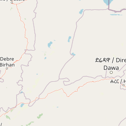
Map view of Awash National Park

Use this park location map to pinpoint Awash National Park in Ethiopia, understand its exact geographic position, and read its mapped placement within the surrounding landscape more clearly.

Pigeon | © OpenStreetMap contributors

Location context for Awash National Park

Afar RegionOromia
Park atlas

Trace the surrounding geography of protected areas, comparing the savanna ecosystems and volcanic landscapes adjacent to Awash National Park.

Discover Related National Parks and Protected Areas Around Awash National Park

After exploring Awash National Park, you can browse other national parks and protected areas that share similar savanna ecosystems, volcanic terrain, and riverine landscapes in Ethiopia. Comparing these adjacent conservation areas provides a deeper understanding of regional biodiversity, geographic spread, and the diverse challenges facing protected areas across the East African Rift.
National parkArsi Zone
About 160 km away#1 closest

Southwest

Arsi Mountains National Park: Protected Ethiopian Highlands Landscape & Geography

Mapped protected terrain and endemic species habitat within the Arsi Zone.

Arsi Mountains National Park is a vast protected area celebrated for its significant biodiversity and distinctive Afro-alpine ecosystems. Situated in the Arsi Zone, this national park encompasses a dramatic mountain landscape central to the Ethiopian Highlands. It serves as a crucial refuge for endangered endemic species, including the mountain nyala and Ethiopian wolf, within its varied ecological zones and protected park boundaries, offering rich context for geographic exploration.

Area
10,876 km²
Established
2011
IUCN
II
Relief
Mountain
National parkAfar Region
About 182 km away#2 closest

Northeast

Yangudi Rassa National Park: Protected Semi-Desert National Park in Afar Region

Mapped landscape and dryland ecosystems.

Yangudi Rassa National Park represents a critical protected area within Ethiopia's Afar Region, covering extensive semi-desert and grassland terrains. The park's geography is marked by Mount Yangudi and the broad Rassa Plains, with the Awash River shaping its riverine forests and marshes. This national park offers a unique insight into dryland ecosystems and their conservation, providing a distinct mapped landscape for geographic study and exploration.

Area
4,731 km²
Established
1969
IUCN
II
Relief
Mixed relief
National parkBale Zone
About 221 km away#3 closest

South

Bale Mountains National Park National Park: Explore Protected Landscape and Regional Geography

Mapped boundaries and natural terrain context for this Ethiopian park.

Delve into Bale Mountains National Park, a designated national park in Ethiopia's Bale Zone, focusing on its role as a vital protected landscape. This page offers detailed insights into the park's mapped boundaries and its contribution to the regional geography, providing a foundation for structured atlas exploration of protected areas and natural terrain. Understand the geographic significance and landscape identity of this key conservation entity within the broader context of Ethiopia's natural heritage.

Area
2,220 km²
Established
1970
IUCN
II
Relief
Mountain
National parkEthiopia
About 246 km away#4 closest

Southwest

Abidjatta-Shalla National Park: Ethiopian National Park and Rift Valley Bird Habitat

Mapped terrain and protected wetland ecology in the Ethiopian Rift Valley.

Explore Abidjatta-Shalla National Park, a significant protected area in Ethiopia renowned for its stunning avian spectacles, particularly the vast flamingo colonies on Lake Abijatta. This national park's landscape is defined by the distinct volcanic geology of the Rift Valley, featuring both shallow alkaline waters and deeper lakes that create diverse wetland ecosystems. Understand its geographic placement within Ethiopia and its importance as a major birdwatching destination, offering insights into unique protected natural landscapes.

IUCN
II
National parkOromia Region
About 246 km away#5 closest

Southwest

Abijatta-Shalla National Park: Protected National Park within Oromia Region

Mapped landscape and regional geographic context.

Delve into the protected landscape identity of Abijatta-Shalla National Park, a designated national park situated within the Oromia Region. This dedicated detail page offers an atlas-driven perspective, focusing on the park's geographic scope, mapped terrain, and its significance as a protected natural area. Understand its role in the broader context of Ethiopian protected lands and regional geography.

Area
887 km²
Established
1974
IUCN
II
Relief
Mountain
National parkDjibouti
About 349 km away#6 closest

Northeast

Yoboki National Park: Djibouti National Park Geographic Atlas Explorer

Discover its mapped boundaries and regional terrain.

Yoboki National Park is a key protected area within Djibouti, offering a distinct focus for geographic exploration. This entry provides structured information to understand the park's mapped landscape and its position within the Horn of Africa's regional geography. Delve into the park's protected land identity and terrain context, essential for atlas-based discovery and appreciating its natural features.

IUCN
II
Relief
Mixed relief
Climate
Arid
Scope
Terrestrial
National parkEthiopia
About 381 km away#7 closest

West

Didessa National Park: Protected River Valley Landscape in Ethiopia's Western Highlands

Discover dramatic escarpments, forested terrain, and waterfalls.

Explore Didessa National Park, a protected area in western Ethiopia notable for its dramatic topographical features. This national park showcases a striking landscape of steep escarpments flanking the Didessa River valley, supporting lush forest ecosystems. Key features include numerous waterfalls that contribute to the park's distinctive terrain and ecological significance. Understanding Didessa National Park offers insight into Ethiopia's protected lands and their unique geographic attributes.

Area
1,300 km²
Established
2017
IUCN
II
Relief
Lowland
National parkTadjourah Region
About 416 km away#8 closest

Northeast

Day Forest National Park: Ancient Juniper Woodland and Protected Landscape in Djibouti

Discover a rare East African forest refuge with unique endemic species.

Day Forest National Park represents a critical ecological island within Djibouti's predominantly semi-desert geography. As the nation's oldest national park, it protects the largest remaining East African juniper forest, a vital sanctuary for species found nowhere else on Earth. Located in the Goda Mountains of the Tadjourah Region, its existence relies on rare localized rainfall, creating a distinctive mountainous forest environment that offers profound insights into protected landscape dynamics and regional biodiversity.

Area
15 km²
Established
1939
IUCN
II
Relief
Mountain

Common questions about visiting, size, designation, and location context for Awash National Park

Awash National Park FAQs for park facts, access, geography, and protected area context

Find quick answers about Awash National Park, including protected-area facts, park geography, trail and visitor context, and how the park fits into its surrounding country and regional landscape.
MoriAtlas Explorer

Continue Your Protected Areas Search Across the Global Atlas

Deepen your exploration by continuing the structured search for national parks and protected areas worldwide. Utilize the comprehensive filtering capabilities to compare different conservation landscapes and refine your understanding of global park geography. Discover more about the distribution and characteristics of protected natural areas.

Global natural geography
