
Mori Atlas logo
Nature reserveBattweiler Höhe

Understanding the mapped landscape boundaries and botanical significance of this ridge-based nature reserve

Battweiler Höhe Nature Reserve: Exploring the Protected Calcareous Grasslands of Rhineland-Palatinate

Battweiler Höhe is a protected nature reserve located within the rolling terrain of the Zweibrücken hill country in Rhineland-Palatinate, Germany. The area spans a distinct ridge between Battweiler and Niederhausen, focusing on the preservation of lime-rich semi-dry grasslands that host a variety of rare plant species. This site functions as an integral component of a regional network of open-land habitats maintained through traditional grazing and mowing practices, defining its character as a critical conservation landscape.

calcareous grasslandnature reserveRhineland-PalatinateSüdwestpfalzZweibrücken hill countrydry grassland
A minimalist, stylized vector illustration of a valley with towering mountains, a cascading waterfall, and a foreground of tall grasses under a warm sunset sky.

Battweiler Höhe

Nature reserve

Park overview

Structured park overview, official facts, and landscape profile for Battweiler Höhe

Battweiler Höhe park facts, protected area profile, and essential visitor context

Review the core facts for Battweiler Höhe, including designation, size, terrain, visitor scale, habitats, and operating context in one park-focused overview.

About Battweiler Höhe

Battweiler Höhe is a compact nature reserve in the southwestern German state of Rhineland-Palatinate, located in the Südwestpfalz district on the edge of the Verbandsgemeinde Zweibrücken-Land. Although small, at roughly 24 hectares, it plays an important local and regional role by protecting a strip of calcareous semi-dry grassland on a low hill ridge near Battweiler.

The reserve protects one of the habitat types that has become increasingly rare across the wider landscape: calcareous grassland (Kalkmagerrasen). These lime-influenced open grasslands evolve only where soils are shallow and nutrient-poor, and they depend on traditional, low-intensity land use to survive. Without grazing or mowing, they would quickly be lost to scrub and woodland. The site therefore represents not only a stand of rare plants, but also a working example of how traditional agricultural practices can be maintained as a conservation tool.

Beyond the grassland itself, the reserve includes associated habitat features such as hedges, scrub patches, and woodland edges. These edge structures provide critical refuge and food resources for wildlife, linking the open grassland with neighboring woodland and farmland. Together, they make the site part of a broader biotope network across the Zweibrücken hill country, an area whose combination of geology, climate, and historical land use has produced a distinctive mosaic of habitats.

Quick facts and research context for Battweiler Höhe

Battweiler Höhe is a protected nature area in the Landkreis Südwestpfalz, Rhineland-Palatinate, Germany. Covering about 24 hectares, it lies on a low hill ridge between Battweiler and Niederhausen in the Verbandsgemeinde Zweibrücken-Land.

The reserve was placed under formal nature protection on 10 June 2003. Its purpose is the preservation, development, and recovery of calcareous grasslands, extensively managed meadows, and associated woody edge habitats. The reserve is part of a connected system of calcareous grassland biotopes across the Zweibrücken hill country.

Protection and recognition

Examine documented conservation data and official protected area records.

Battweiler Höhe Protection Status and Official Designation Records

Battweiler Höhe brings together structured conservation records, official protection status details, and international database identifiers. Researchers examine these verified management entries to evaluate the protected landscape and its broader geographical context.

Protection details

WDPA ID
318171
Park context

Deeper park guide and search-rich context for Battweiler Höhe

Battweiler Höhe history, landscape, wildlife, and travel context

Explore Battweiler Höhe through its history, landscape character, ecosystems, wildlife, conservation priorities, cultural context, and seasonal travel timing in a structured park guide built for atlas discovery and search intent.

Why Battweiler Höhe stands out

Battweiler Höhe is best known for its calcareous grassland habitats. These semi-dry, lime-rich grasslands support rare and protected plant species such as mountain germander (Berg-Gamander), the musk orchid relative Mücken-Händelwurz, helmet orchid (Helm-Knabenkraut), common fringed gentian (Gewöhnlicher Fransenenzian), and pasqueflowers (Kuhschellen). The reserve is also recognized as part of a regional network of lime-rich open-land habitats within the Zweibrücken hill country, valued both for its scenic character and its scientific importance. Traditional sheep grazing and manual mowing keep the grassland open, which is essential for the survival of these species.
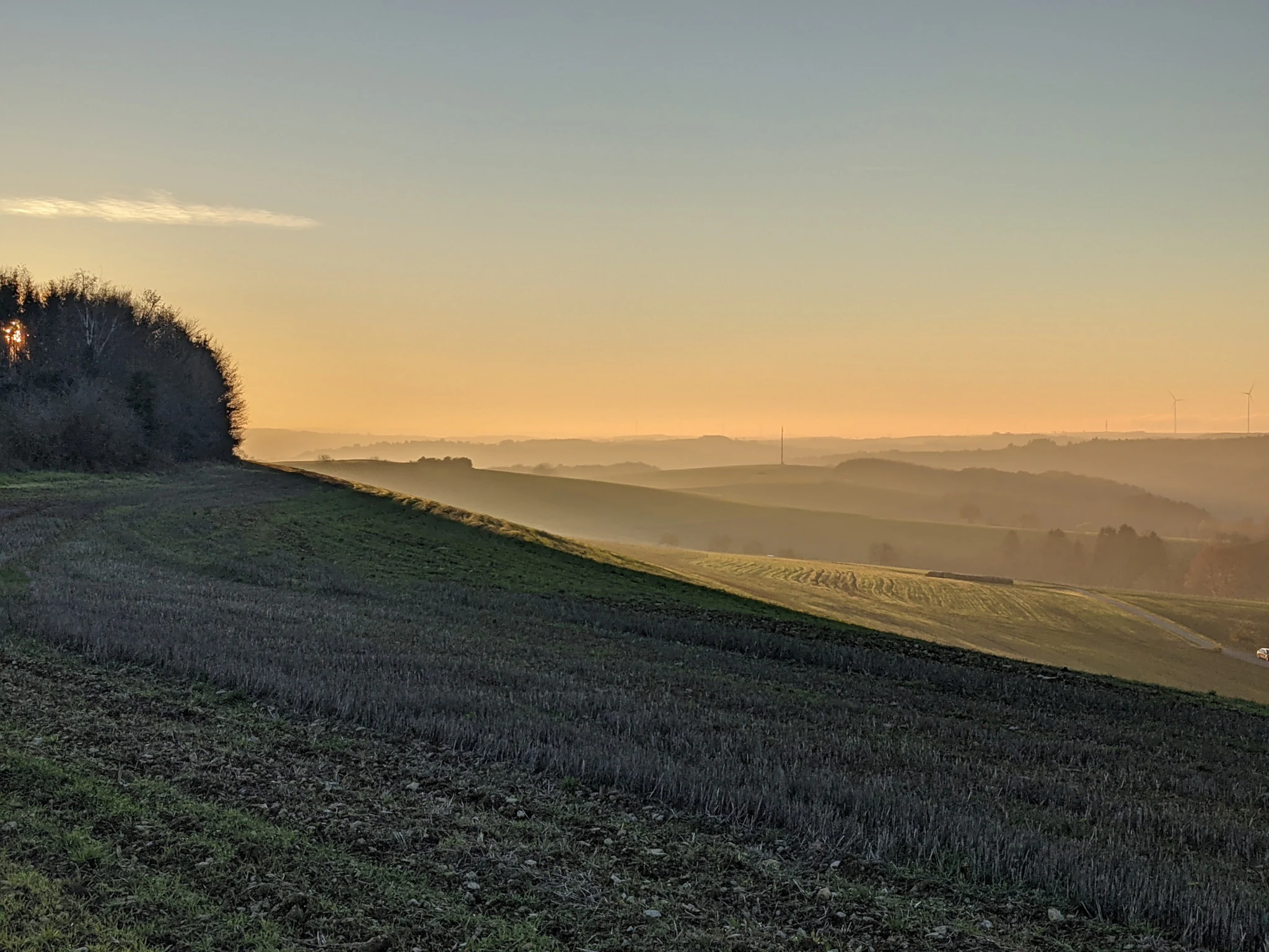
A wide, golden-hour view over rolling hills and cultivated fields, with a tree-lined ridge on the left and a hazy, distant horizon.
A golden hour view across the rolling landscape of Battweiler Höhe.

Battweiler Höhe history and protected-area timeline

The area that would become Battweiler Höhe was, until recently, partially shaped by agriculture, with some sections historically used as arable land. The decisive moment in the reserve's modern history came on 10 June 2003, when the site was formally placed under nature protection as a Naturschutzgebiet, locking in its role as a long-term refuge for calcareous grassland and associated species.

In the years that followed, conservation work focused on expanding the existing calcareous grassland patches and strengthening the network of open habitats. A further significant step came in 2017 and 2018, when the Kreisverwaltung Südwestpfalz purchased additional plots within the protected area. These were previously used for crop cultivation, and converting them to conservation use allowed the reserve's grassland core to grow.

Management throughout this period has been deliberately traditional. Conservation grazing with sheep, supplemented by manual mowing where needed, has been used to maintain the open character of the grassland, prevent encroachment by scrub, and keep conditions favorable for the specialized plant species the reserve was created to protect.

Battweiler Höhe landscape and geographic character

The landscape of Battweiler Höhe is that of a gentle hill ridge in the Zweibrücker Hügelland, the rolling hill country south of Zweibrücken. Rather than dramatic peaks or cliffs, the scenery is shaped by low, elongated elevations, with shallow lime-rich soils that have always limited agricultural intensity in the area.

The protected strip stretches roughly 1.3 kilometers in length and about 250 meters in width, following the ridge between Battweiler and Niederhausen in a northeasterly direction. Viewed from the ridge, the surrounding countryside opens out gently toward Zweibrücken, giving the small reserve a sense of openness that contrasts with its compact surface area. Grassland, scrub, and woodland edges alternate along the slope, creating the classic mosaic texture of a traditional Central European hill landscape.

The shallow, stony soils of the ridge are central to the site's character. They restrict soil depth and fertility, which in turn limits how densely the land can be vegetated. This has been a key factor in allowing open, herb-rich grassland to persist here when it has disappeared from many other parts of the region.

Battweiler Höhe ecosystems, habitats, and plant life

Ecologically, Battweiler Höhe is defined primarily by its calcareous grasslands. These are open, species-rich plant communities that develop on shallow, lime-rich soils; they remain one of the most botanically valuable and most threatened habitat types in Central Europe today. At Battweiler Höhe, the grasslands have been actively extended and managed, creating conditions for a range of specialist plants that depend on this exact combination of soil chemistry, openness, and management regime.

Also present in the reserve are patches of extensive grassland (Extensivgrünland), areas managed at low intensity rather than intensively fertilized and cut. These connect the core calcareous grassland with the wider countryside. Typical site-native trees, shrubs, hedges, and forest and forest-edge zones are also deliberately maintained as part of the reserve's habitat network.

Together, these elements form a working biotope network within the Zweibrücken hill country. The reserve is not an isolated fragment but part of a regional system of similar habitats, giving species the ability to move between different patches of suitable ground. This connectivity is a central reason why the site is valued scientifically as well as ecologically.

Battweiler Höhe wildlife and species highlights

Wildlife at Battweiler Höhe is considered primarily in terms of the habitats the reserve protects. Calcareous grasslands of this kind are known to support a wide variety of invertebrates, including butterflies, wild bees, and other pollinating insects, many of which rely specifically on the open, warm microclimate and the diversity of flowering plants found in these grasslands.

The site's combination of open grassland, hedges, scrub, and forest edges creates a varied structure that supports small mammals, reptiles, and breeding birds that benefit from transitional habitats between open ground and woodland. The reserve's formal designation language describes the protected woody areas as Lebensräume rarer, partially threatened wild animal species, underscoring that the habitat mosaic is the core wildlife asset of the site, rather than a single flagship species.

Because of its small size and grassland character, the reserve is better understood as a refuge for habitat specialists than as a destination for large mammal sightings. Birdwatchers and naturalists visiting similar sites in the region typically look for species tied to warm, open grassland and edge habitats rather than forest interior fauna.

Battweiler Höhe conservation status and protection priorities

The central conservation value of Battweiler Höhe lies in the protection and recovery of calcareous grassland (Kalkmagerrasen), a habitat type that has declined sharply across much of Germany and Central Europe. The reserve's official purpose is the preservation, development, and where needed, restoration of these grasslands, and of the extensive meadows, hedges, and forest edges associated with them.

The site is also recognized as part of a connected biotope network across the Zweibrücken hill country. Preserving this network is considered important not only for its scenic quality but also for scientific reasons: calcareous grasslands host a high concentration of specialized plant and insect species, and isolated fragments without management rapidly lose their distinctive character. By maintaining sheep grazing and occasional manual mowing, the reserve keeps the habitat in the open, species-rich state that these species require.

A further conservation milestone came in 2017 and 2018, when the district administration (Kreisverwaltung Südwestpfalz) purchased additional plots inside the reserve boundary that had previously been used for crop farming. The deliberate conversion of formerly arable land into protected grassland expanded the area available for nature and reduced pressures from intensive agriculture on the immediate edge of the reserve.

Battweiler Höhe cultural meaning and human context

The cultural dimension of Battweiler Höhe is closely tied to traditional land use. Calcareous grasslands across the Zweibrücker Hügelland are not natural wilderness in the strict sense; they are the product of centuries of low-intensity farming, in particular sheep grazing and hand mowing on soils that were never suitable for intensive crop production. Preserving the grassland today therefore means preserving the agricultural practices that shaped it.

The continuation of sheep grazing as a conservation tool reflects this heritage. Rather than introducing heavy mechanical management or letting the land revert to scrub, the reserve continues to rely on the same basic relationships between livestock, land, and people that originally produced the habitat.

Locally, the reserve also reflects the broader identity of the Landkreis Südwestpfalz, which maintains a substantial network of protected sites across its varied terrain. Battweiler Höhe is one strand in this regional fabric of small, specialized nature reserves, each anchored in a particular combination of geology, history, and modern management.

Top sights and standout views in Battweiler Höhe

The Battweiler Höhe offers a compact but unusually well-defined example of calcareous grassland conservation in Rhineland-Palatinate. Within just a few hectares, it brings together the three elements that make this habitat type work: lime-rich shallow soils, open herb-rich grassland, and traditional low-intensity management practices.

Its plant list is striking for a site of this size, including rare and protected species such as mountain germander, Mücken-Händelwurz, helmet orchid, common fringed gentian, and pasqueflowers. The reserve's role within a wider biotope network in the Zweibrücken hill country gives it a significance well beyond its footprint, and its continuing use of sheep grazing and manual mowing reflects an unusually direct link between cultural land use and modern conservation outcomes.

Best time to visit Battweiler Höhe

The most rewarding period to experience the reserve is late spring into summer, when calcareous grasslands typically come into full bloom. In this window, the open swards of Battweiler Höhe develop their richest display of flowering plants, and the warm, open conditions that define the habitat are at their most visible and most active for pollinating insects.

Visitors with an interest in orchids, gentians, and other characteristic grassland species often time their visits to coincide with the peak flowering periods of these plants, which broadly fall between late spring and midsummer depending on the season. Outside these months, the site is quieter and less visually striking, but the underlying landforms and habitat mosaic remain recognizable throughout the year. Because the reserve is a formal Naturschutzgebiet, visitors should treat it primarily as a place for quiet observation rather than active recreation and should follow any applicable access rules.


Monthly climate preview

Long term monthly averages for temperature and precipitation rhythm in Rhineland-Palatinate

Battweiler Höhe Climate Normals and Measured Annual Temperature Patterns

Representative coordinate sampling records long term temperature and precipitation normals across twelve distinct intervals for Battweiler Höhe. Analyzing these monthly averages provides a reliable baseline for understanding regional climate trends without relying on current forecasts.
Annual mean9 °C
0 °C19 °C
Jan
Feb
Mar
Apr
May13°
Jun17°
Jul19°
Aug19°
Sep14°
Oct
Nov
Dec
Warmest month
July

19.2 °C

Coolest month
January

-0.2 °C

Wettest month
December

2.4 mm/day

Driest month
April

1.5 mm/day

Park location guide

Geography guide, regional context, and park location map for Battweiler Höhe

Battweiler Höhe park geography, regions, and map view in Germany

Understand where Battweiler Höhe sits in Germany through a broader geographic reading of the surrounding landscape, nearby location context, and its mapped position within the national park landscape.

How Battweiler Höhe fits into Germany

Germany is a federal republic in Western and Central Europe with a population of over 83 million across sixteen constituent states. It is Europe's largest economy by nominal GDP and a major global exporter and importer. The capital is Berlin, and the country borders Denmark, Poland, Czech Republic, Austria, Switzerland, France, Luxembourg, Belgium, and the Netherlands.

Wider geography shaping Battweiler Höhe in Germany

Germany is located in Western and Central Europe, spanning 357,022 km². It borders Denmark to the north, Poland and the Czech Republic to the east, Austria and Switzerland to the south, and France, Luxembourg, Belgium, and the Netherlands to the west. The country has coastlines on the Baltic Sea and North Sea to the north, with the Alps located in the southern region.

Map view of Battweiler Höhe

Use this park location map to pinpoint Battweiler Höhe in Germany, understand its exact geographic position, and read its mapped placement within the surrounding landscape more clearly.

Pigeon | © OpenStreetMap contributors

Location context for Battweiler Höhe

Rhineland-Palatinate

Explore photographic records of the rolling ridge landscapes, rare flora, and protected terrain.

Battweiler Höhe Photos and Scenery: Visualizing Calcareous Grassland Habitats

Visual records capture the low ridge topography and rare calcareous grassland habitats defining the protected landscape. Examining these photographs helps observers understand the environmental character and vegetation patterns preserved across the reserve.

A wide, golden-hour view over rolling hills and cultivated fields, with a tree-lined ridge on the left and a hazy, distant horizon.

Park atlas

Compare surrounding hill country reserves and lime-rich grassland habitats

Exploring Parks Near Battweiler Höhe and Connected Regional Protected Landscapes

Browse other protected areas near Battweiler Höhe to examine regional hill terrain and similar calcareous grassland ecosystems. Comparing adjacent reserves reveals the broader ecological network spanning the Zweibrücken hill country and southwestern Germany.
Nature reserveRheinland-Pfalz
About 7.7 km away#1 closest

South

Wahlbacher Heide Nature Reserve: Geographic Mapping and Protected Landscape Analysis

Explore the Muschelkalk dry grasslands of the Westpfalz region

Wahlbacher Heide offers a focused look at the calcareous dry grassland habitats within the Westpfalz region of Germany. This nature reserve provides essential insights into the preservation of rare orchids and gentians on Lower Muschelkalk bedrock. Use this mapped resource to understand the interplay between the crescent-shaped open meadows, juniper stands, and the surrounding agricultural corridor that frames this important protected site.

Area
0.074 km²
Established
1985
Nature reserveRhineland-Palatinate
About 11 km away#2 closest

North

Westricher Moorniederung Nature Reserve: Protected Wetland and Moorland Atlas

Mapping low-lying basin landscapes and riparian corridors in the German Palatinate.

Spanning 40 kilometers between the Bliesaue and Kaiserslautern, the Westricher Moorniederung protects an intricate network of bogs, marsh zones, and alluvial forests. This lowland basin acts as a vital ecological link within Rhineland-Palatinate, defined by its drainage systems and diverse mire habitats. Gain insight into the regional geography and protected land boundaries that define this significant wetland system.

Area
21.52 km²
Established
1998
IUCN
IV
Nature reserveRheinland-Pfalz
About 11 km away#3 closest

Southwest

Monbijou Nature Reserve: Mapped Protected Landscapes in the Südwestpfalz District

Regional geography and conservation of dry grassland habitats

Monbijou stands as a significant twenty-six hectare nature reserve in Rheinland-Pfalz, defined by its mosaic of sun-exposed dry grasslands and forest-edge communities. This protected area plays a crucial role in maintaining rare plant species and uncommon animal habitats within the rolling terrain of the southwestern Palatinate, near the Hornbach stream and the local airfield.

Area
0.26 km²
Established
1978
Scope
Terrestrial
Water
Minor water
Nature reserveRheinland-Pfalz
About 12 km away#4 closest

North

Neuwoogmoor Nature Reserve: Protected Peatland and Wetland Landscape Mapping in Rheinland-Pfalz

Essential geographic data on this historic Palatinate mire system.

Neuwoogmoor serves as a crucial nature reserve in Rheinland-Pfalz, protecting one of the few remaining peat moorland fragments in the Landstuhler Bruch. The site encompasses a diverse mosaic of bog pools, reed beds, and bog woodland that create an intimate and highly structured wetland terrain. This detailed entry provides geographic context on its protected status, hydrological features, and role as a habitat for rare plant communities in the western Palatinate landscape.

Area
0.6 km²
Established
1986
IUCN
IV
Relief
Lowland
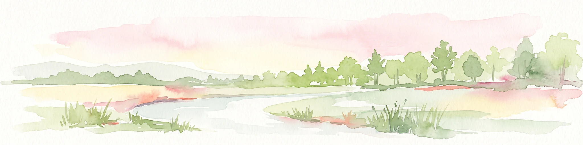
A soft, artistic watercolor painting showing a wide, tranquil wetland scene with soft green and yellow hues, distant rolling hills, and patches of trees and vegetation in a floodplain environment.
Protected landscapeSaarland
About 13 km away#5 closest

West

Beeder Bruch Protected Landscape: Blies River Floodplain and Wetland Geography in Saarland

A managed riverine sanctuary in the Bliesgau Biosphere Reserve

Beeder Bruch is a formally recognized protected landscape in Saarland, defined by the extensive floodplain of the Blies river. The site integrates wet meadows, riparian forests, and reedbeds, serving as a key European bird protection zone. Visitors can explore the mapped terrain, which utilizes conservation grazing to maintain essential wetland habitats and support local biodiversity within the Bliesgau region.

Area
127 km²
Established
2015
IUCN
V
A soft, light-toned watercolor painting of a wetland landscape featuring a small stream, grassy banks, and a treeline under a pale pink sky.
Nature reserveRhineland-Palatinate
About 13 km away#6 closest

North

Scheidelberger Woog Nature Reserve: Geographic Overview of a Palatinate Wetland Landscape

Tracing the protected peat-rich moorland boundaries in Rhineland-Palatinate

Scheidelberger Woog stands as a vital nature reserve and lowland moor basin in the western Palatinate. Its mapped terrain features a fine-grained mosaic of reed beds, damp woodlands, and river-fed ponds. This geographic detail provides essential insight into the area's ongoing conservation efforts and its role within the wider moor network of the Kaiserslautern district.

Area
2.32 km²
Established
1987
Relief
Lowland
Scope
Terrestrial
A minimalist watercolor illustration featuring a green treeline, soft rolling hills, and a calm body of water in warm light tones on a white background.
Protected landscapeRhineland-Palatinate
About 13 km away#7 closest

North

Landstuhler Bruch Protected Landscape: Regional Geography and Mapped Wetland Basin

Exploring the historic moorland basin of the Westpfalz

Situated in the Westpfalz region of Rhineland-Palatinate, the Landstuhler Bruch is a gentle lowland depression marked by a complex history of drainage and conservation. This protected area offers deep insight into the regional geology, preserved wetland pockets, and hydrological networks that define the local landscape. Understanding this basin provides a window into the intersection of cultural heritage and active ecological restoration in southwestern Germany.

Area
67 km²
Established
1985
IUCN
V
Relief
Lowland
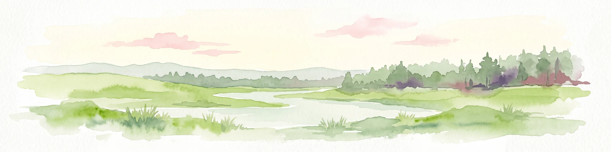
A watercolor painting showing a green valley with a meandering river, low hills in the distance, and light pink clouds in the sky.
Nature reserveRhineland-Palatinate
About 14 km away#8 closest

North

Glanniederung bei Elschbach: Protected River Floodplains and Wetland Geography

Nature reserve habitat and riparian landscape mapping

Spanning the Glan river valley in Rhineland-Palatinate, this nature reserve conserves a vital mosaic of wet meadows, reed beds, and near-natural stream courses. Gain insight into the regional conservation geography of this Palatinate habitat management area, where floodplain landforms define the ecological character of the protected valley floor.

Area
0.533 km²
Established
1987
IUCN
IV
Relief
Lowland

Common questions about visiting, size, designation, and location context for Battweiler Höhe

Battweiler Höhe FAQs for park facts, access, geography, and protected area context

Find quick answers about Battweiler Höhe, including protected-area facts, park geography, trail and visitor context, and how the park fits into its surrounding country and regional landscape.
MoriAtlas Explorer

Continue Your Protected Areas Search Across the Global Atlas

Deepen your exploration by continuing the structured search for national parks and protected areas worldwide. Utilize the comprehensive filtering capabilities to compare different conservation landscapes and refine your understanding of global park geography. Discover more about the distribution and characteristics of protected natural areas.

Global natural geography