Mori Atlas logo
Nearby park discovery

Geographic map of surrounding conservation areas and regional landscape connectivity

Protected Landscapes and Nature Reserves Near Bergwiesen im Osterzgebirge, Saxony

Examine the geographic distribution of protected lands in the vicinity of Bergwiesen im Osterzgebirge. This collection maps nearby nature reserves and mountain habitats within the eastern Ore Mountains to provide a clear view of regional conservation terrain and local land-use patterns.

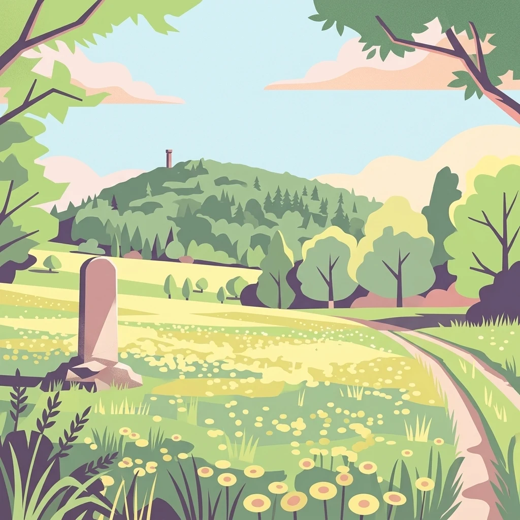
A colorful illustration of a green meadow with yellow flowers, a winding dirt path, trees, and a hill with a tower in the background. A stone marker stands in the foreground.

A long-running conservation effort to preserve species-rich mountain meadows in the eastern Ore Mountains.

Bergwiesen im Osterzgebirge

Bergwiesen im Osterzgebirge is a large-scale nature conservation project in the eastern Ore Mountains of Saxony, Germany, focused on maintaining traditional mountain meadow landscapes that developed through centuries of extensive agricultural use. It is the 50th project under the federal "chance.natur" program, which has existed since 1979 to support major conservation initiatives across Germany. The project centers on a network of open-land habitats, including mountain meadows, wet meadows, mat-grass swards, bogs, and distinctive stone-strip field systems known locally as Steinrücken. These habitats support a remarkable variety of plants and animals and form a cultural landscape shaped by roughly five hundred years of human land use. Core focal areas include the Geisingberg and the Grenzwiesen Fürstenau, situated within the protected zones of Altenberg and Fürstenau, with additional buffer areas extending into surrounding villages. Beyond habitat preservation, the initiative promotes nature-compatible agriculture as a means of keeping these landscapes open and ecologically rich. By combining land-use traditions with modern conservation funding, the project plays an important role in sustaining both the natural and cultural heritage of the Osterzgebirge region.

Location
Germany
Park type
Nature reserve
Established
1999
Bergwiesen im Osterzgebirge Nature Reserve Map
Regional park map

See the ranked park cluster in its geographic setting

Nearby parks around Bergwiesen im Osterzgebirge

This regional map shows the same 20 nearby parks ranked below around Bergwiesen im Osterzgebirge. Select a ranked marker to highlight that park’s boundary where boundary data is available.
Reference park: Bergwiesen im OsterzgebirgeRanked nearby park20 nearby parks shown
20 nearby parks

Explore surrounding regional park geography, geographic separation, and environmental context

Ranked Parks and Protected Areas Geographically Near Bergwiesen im Osterzgebirge

Analyze geographic distance and direction metrics to examine protected areas situated near Bergwiesen im Osterzgebirge within a structured regional framework. Compare recorded landscape characteristics and country data to uncover broader ecological patterns across neighboring conservation zones.
Watercolor painting of a panoramic mountain landscape with rolling green hills, patches of forest, and distant peaks under a soft sky.
Nature reserveSaxony
About 3 km away#1 closest

Northwest

Geisingberg Nature Reserve: A Volcanic Basalt Peak in the Eastern Ore Mountains of Saxony

Exploration of protected mountain terrain and volcanic geology

Geisingberg serves as a rare volcanic Quellkuppe rising above the Saxon mining landscapes of Altenberg. The nature reserve protects 300 hectares of high-altitude bogs, species-rich meadows, and historic forest clearings. Gain a deeper understanding of this mountain through detailed mapped terrain, topographic features, and long-standing protected-area status within the Ore Mountains.

Area
3 km²
Established
1960
Relief
Mountain
Climate
Temperate
Watercolor painting of a peat bog with a small meandering stream, scattered deadwood, and a distant mountain range under a pale sky.
Nature reserveSachsen
About 3.9 km away#2 closest

Southwest

Georgenfelder Hochmoor Nature Reserve: A Protected Highland Bog in the Ore Mountains

Examining the geography and mapped peatland terrain in the Sachsen region

Georgenfelder Hochmoor is a distinct ridge-top raised bog located on the high plateau of the Osterzgebirge. This protected area maintains a significant ten-thousand-year peat profile and plays a vital role in the watershed divide of the Ore Mountains, offering a clear example of modern transboundary conservation and mountain moorland development.

Area
0.135 km²
Established
1961
IUCN
IV
Visitors
17.5K annual
A soft watercolor illustration featuring a panoramic view of a peat bog landscape with evergreen trees and distant rolling mountains under a white background.
Nature reserveÚstecký kraj
About 4.2 km away#3 closest

Southwest

Rašeliniště U jezera, Cínovecké rašeliniště: Protected Nature Reserve and Bog Landscape

Geography and environmental context in the Ústecký kraj mountain range.

Situated at high elevations in the Ore Mountains, Rašeliniště U jezera, Cínovecké rašeliniště protects a functioning example of a rare raised bog ecosystem. This reserve contains diverse bog-pool flora and peat-forming habitats, standing as a significant site for understanding the montane geography of northern Bohemia and the ongoing conservation of Krušné hory wilderness areas.

Area
0.601 km²
Established
2001
IUCN
IV
Relief
Mountain
Nature reserveSächsische Schweiz-Osterzgebirge
About 4.5 km away#4 closest

Northwest

Weicholdswald Nature Reserve: Mapped Protected Landscapes of the Eastern Ore Mountains

A preserved beech forest enclave within the Sächsische Schweiz-Osterzgebirge

Weicholdswald stands as a primary nature reserve in the Sächsische Schweiz-Osterzgebirge district, known for its 160-year-old beech trees and extensive deadwood habitats. This protected area provides a rare look at near-natural forest ecosystems that have remained free from historic clear-cutting or coniferous monocultures, maintaining rich biodiversity across its streams and granitic slopes.

Area
1.037 km²
Established
1961
IUCN
IV
Nature reserveSachsen
About 11 km away#5 closest

West

Gimmlitztal Nature Reserve in the Ore Mountains: Mapped Protected Landscapes

Exploring the stream valley geography of Saxony, Germany.

Gimmlitztal is a significant nature reserve in the German state of Saxony that protects the unique hydrology and biodiversity of the Gimmlitz stream corridor. The terrain includes forested slopes and traditional meadow patches, reflecting a long history of human interaction with the Ore Mountain environment. This reserve functions as a continuous green ribbon for regional habitat preservation.

Area
2.578 km²
Established
2015
IUCN
IV
A soft watercolor illustration of a bog landscape with a dark central pool, surrounding marsh vegetation, and distant pale hills.
Nature reserveÚstecký kraj
About 17 km away#6 closest

East

Rájecká rašeliniště Nature Reserve: Protected Peatland and Sandstone Geography in Ústecký kraj

Geographic atlas and protected area landscape summary

Rájecká rašeliniště serves as a critical study in landscape ecology, featuring rare peat-forming vegetation located within the high-relief sandstone formations of the Ústecký kraj. This protected nature reserve provides a unique look at how specialized bog communities thrive despite the porous, water-draining characteristics of the local sandstone terrain, highlighting the site's importance within the Czech conservation landscape.

Area
0.017 km²
Established
2004
IUCN
IV
Water
Major water bodies
A horizontal watercolor painting showing rolling green hills in the distance and colorful, stylized vegetation in the foreground.
Nature reserveÚstí nad Labem Region
About 17 km away#7 closest

Southeast

Rač Nature Reserve: Volcanic Slopes and Protected Habitats in Ústí nad Labem

Geomorphology and ecological succession in the České středohoří range

Rač Nature Reserve is a landmark for volcanic ecology, preserving a mosaic of trachyte rock formations and open grassland on the slopes of Hradiště u Habří. This protected area serves as a vital refuge for rare steppe-like flora and a high concentration of thermophilic insect species, offering a concentrated look at natural land recovery and geological history in northern Bohemia.

Area
0.154 km²
Established
1953
IUCN
IV
Relief
Mountain
A watercolor illustration depicting rolling, soft hills and green vegetation with distant, faded mountains in the background, set against a plain white background.
Nature reserveGermany
About 23 km away#8 closest

North

Spargründe bei Dohna: Nature Reserve and Protected Valley Landscapes in Germany

Examining the crystalline ravines and forest ecosystems of the Saxon landscape

Spargründe bei Dohna stands as a distinct nature reserve at the northern margin of the Elbtalschiefergebirge. The site encompasses narrow, steeply-sided valleys carved into Dohna Granodiorite, creating a rugged terrain of rocky ridges and shaded deciduous woodland. This geographic overview examines the boundaries and natural features of the reserve, highlighting its role within the wider Müglitztal protected area network.

Area
0.373 km²
Relief
Upland
Climate
Temperate
Access
Easy access
Nature reserveSaxony
About 26 km away#9 closest

Northwest

Weißeritztalhänge Nature Reserve: Protected Slope Forests and River Valley Geography

Regional landscape profile in Saxony, Germany

Weißeritztalhänge represents a significant nature reserve situated along the Wilde Weißeritz in Saxony. The protected area features expansive slope forests that transition from the Saxon lowlands into the Erzgebirge, providing a critical refuge for diverse woodland and river-dwelling species.

Area
4.486 km²
Established
1961
IUCN
IV
Relief
Upland
Watercolor painting showing a landscape with green hills, trees, and a river winding through the scene
National parkGermany
About 27 km away#10 closest

Northeast

Saxon Switzerland National Park: Protected Area Geography and Map Exploration

Discover its mapped boundaries and regional landscape context.

Saxon Switzerland National Park, a protected national park in Germany, offers a distinct focus for geographic and atlas-based discovery. This page details the park's specific protected landscape, its mapped boundaries, and its contribution to the regional geography. MoriAtlas allows for in-depth exploration of such natural areas, providing essential context for understanding their place within broader natural systems and mapped terrains.

Area
93.5 km²
Established
1990
IUCN
II
Visitors
1.7M annual
A pale, soft watercolor illustration showing a horizontal landscape of light green trees, shrubs, and rolling grassy plains on a white background.
Nature reserveGermany
About 29 km away#11 closest

North

Elbinseln Pillnitz und Gauernitz: A Study in Protected Saxon River Landscapes

Examining floodplain geography and rare river island ecosystems

Located in the Elbe valley between Dresden and Meissen, Elbinseln Pillnitz und Gauernitz preserves the final natural river islands within the state of Saxony. This protected nature reserve anchors a vital network of alluvial soils, riparian woodlands, and unarmored riverbanks, offering a unique perspective on the dynamic floodplain geography of Germany's major river corridors.

Area
0.235 km²
Established
2006
IUCN
IV
Relief
Lowland
Nature reserveFreistaat Sachsen
About 29 km away#12 closest

North

Windberg Nature Reserve: Mapping the Forested Ridge and Protected Landscape of Saxony

Geology, mining heritage, and protected oak-beech forest ecosystems

Windberg serves as the prominent local landmark for Freital, defined by its elongated forested plateau and complex tectonic geography. This nature reserve offers a study in the intersection of environmental conservation and human industrial history, featuring Saxony's deepest cave and varied habitats within the eastern Ore Mountains foothills.

Established
1967
Relief
Mountain
Climate
Temperate
Access
Easy access
Watercolor painting of a soft landscape featuring distant hills and foreground vegetation in shades of green, yellow, and soft red.
Nature reserveSachsen
About 29 km away#13 closest

North

Dresdner Elbtalhänge Nature Reserve: Geography, Mapped Boundaries, and Landscape Context

An essential nature reserve along the Elbe valley in Sachsen

Dresdner Elbtalhänge captures the striking transition between the flat Elbe floodplain and the Westlausitz hill region. This detailed atlas entry covers the reserve's unique geomorphology, including its incised ravine systems, south-facing oak forests, and exposed rock formations that define its protected character within Sachsen.

Area
203.6 km²
Established
2007
IUCN
IV
A soft watercolor illustration of rolling green hills with distant mountain peaks under a light sky.
Natural monumentÚstecký kraj
About 32 km away#14 closest

Southeast

Radobýl Natural Monument: Basalt Formations and Volcanic Geography in Ústecký kraj

A protected volcanic landmark with steppe ecosystems and ridge views.

Radobýl stands as a distinctive volcanic remnant in the Ústecký kraj, featuring profound columnar basalt jointing and frost-weathered cliffs. This protected natural monument shelters rare dry grassland habitats and rocky terrain, while offering expansive views across the Litoměřice basin and the surrounding Bohemian landscape.

Area
0.063 km²
Established
1966
IUCN
IV
Relief
Mountain
Nature reserveSaxony
About 33 km away#15 closest

West

Unterer Großhartmannsdorfer Teich Protected Landscape and Historic Mining Reservoir

Essential wetland geography in the Ore Mountains of Saxony

The Unterer Großhartmannsdorfer Teich reservoir serves as a critical example of mining water engineering within Saxony. Today, the area functions as a protected nature reserve, preserving an extensive network of peatlands, reed beds, and diverse aquatic habitats that support significant waterbird populations and regional biodiversity.

Area
1.55 km²
Established
1568
Relief
Upland
Climate
Temperate
Watercolor illustration of rolling green hills, forests, and distant mountains
National parkCzechia
About 34 km away#16 closest

East

Bohemian Switzerland National Park: Czech Sandstone Protected Landscape and Map Exploration

Discover its unique terrain and protected area geography.

Bohemian Switzerland National Park is a protected area in the Czech Republic known for its exceptional sandstone geology. This national park showcases a dramatic landscape of towering rock formations, deep gorges, and striking canyons, forming a significant part of the Elbe Sandstone Mountains. Through MoriAtlas, users can explore its mapped protected boundaries, understand its regional geographic context, and appreciate its unique natural heritage.

Area
79 km²
Established
2000
IUCN
II
Relief
Mixed relief
Natural monumentÚstecký kraj
About 36 km away#17 closest

South

Velká Volavka Natural Monument: Protected Landscape and Regional Botanical Geography

A rare saline plant refuge in the Ústecký kraj foothills.

Velká Volavka is a specialized natural monument protecting an inland salt-steppe community at the foot of the Ranské středohoří range. This botanical sanctuary provides critical habitat for endangered halophilous species, showcasing a unique intersection of geological seepage and rare flora within the Czech Republic landscape.

Area
0.006 km²
Established
2000
IUCN
IV
Relief
Upland
Nature reserveUstecky Region
About 38 km away#18 closest

Southeast

Vrch Hazmburk Nature Reserve: Geographic Atlas and Protected Landscape Overview

Volcanic terrain and steppe ecosystems in the Ustecky Region

Vrch Hazmburk stands as a notable example of Neovolcanic geology, characterized by steep basalt slopes, frost-shattered cliffs, and a rich mosaic of dry grassland habitats. Located in the Ustecky Region, this protected site preserves a critical transition zone for thermophilic plants and rare invertebrates, offering a clear view of how geological movement and long-term land stability define the Bohemian lowland landscape.

Area
0.604 km²
Established
2011
IUCN
IV
Relief
Mountain
A watercolor landscape illustration showing a winding river flowing through a lush green valley with distant hills.
Natural monumentÚstecký kraj
About 41 km away#19 closest

East

Meandry Chřibské Kamenice: Geography of a Bohemian Natural Monument

Protected river meanders and sandstone valley terrain in northern Bohemia

Meandry Chřibské Kamenice serves as a vital protected area in the Czech Republic, specifically preserving the natural river dynamics of the Chřibská Kamenice stream. Its narrow floodplain, characterized by evolving meanders, riparian woodland, and marshy habitats, offers a focused look at how watercourses shape the sandstone landscapes of the Ústecký kraj region.

Area
0.085 km²
Established
1996
IUCN
III
Relief
Lowland
Watercolor painting of a low-lying saline landscape with soft green vegetation, rolling hills in the background, and a warm yellow sky.
Natural monumentÚstecký kraj
About 41 km away#20 closest

Southwest

Slanisko u Škrle Natural Monument and Rare Inland Saline Landscape in the Czech Republic

Geographic analysis of halophytic habitats and protected lowland terrain

The Slanisko u Škrle natural monument serves as a key reference for inland saline ecology in the Most Basin. This site preserves mineralised grasslands and rare plant communities on a south-facing slope above the Chomutovka river, providing an essential look at the intersection of geology and sensitive habitat preservation.

Area
0.034 km²
Established
2002
IUCN
IV
Relief
Lowland
Distance methodology

Geographic measurements, not driving distances

How nearby park distances are calculated

Distances use park boundaries whenever the available geometry allows it. When one or both boundaries are missing, the mapped park locations provide a clearly labelled estimate. Every value represents straight-line geographic separation and does not use roads or routing.

Boundary distance

Calculated between the nearest points of both park boundaries.

Location-to-boundary estimate

Estimated from one mapped park location to the nearest boundary of the other park.

Mapped-location estimate

Estimated between the mapped locations of both parks.

MoriAtlas Explorer

Explore the Geographic Boundaries of Bergwiesen im Osterzgebirge Nature Reserve

Continue exploring the montane meadows and protected stone-strip field systems of Bergwiesen im Osterzgebirge through the MoriAtlas regional map. Gain deeper insight into the ecological corridors and traditional land-use patterns that define this significant nature reserve in the heart of Saxony.