
Why Bernshäuser Kutte stands out
Bernshäuser Kutte is best known for being a textbook example of an Erdfallsee, a sinkhole lake created by the subsidence of Permian salt deposits below Triassic sandstone. Its near-perfect circular shape, unusual depth relative to its surface area, and meromictic water stratification make it a landmark of central German karst and salt-subsidence geology. The lake is also recognised as a key protected site within the Thuringian Rhön. Its combination of geological significance, enclosed deciduous forest setting, and ecologically unusual water body has placed it under successive layers of protection, from its 1942 designation as a Naturschutzgebiet to its inclusion in the European Natura 2000 network.
Bernshäuser Kutte history and protected-area timeline
The protected status of Bernshäuser Kutte dates back to 16 October 1942, when the area was formally designated as a Naturschutzgebiet under the Reich Nature Conservation Act. This early designation makes it one of the long-established nature reserves of the Wartburgkreis and reflects pre-war German interest in preserving unusual geological and limnological features.
Over the following decades, scientific attention focused on the lake's unusual stratification and water chemistry. A pumping test in 1972 confirmed that the lake has no significant groundwater connection and is sustained primarily by direct precipitation in its small catchment. Limnological studies have documented a long-term decline in deep-water oxygen levels, from measurable values at 35 metres depth in 1960 to complete anoxia at much shallower depths by the early twenty-first century, signalling progressive eutrophication concerns.
In more recent years, the protection framework around Bernshäuser Kutte has expanded in step with European conservation policy. The site is now part of the FFH (Fauna-Flora-Habitat) protected area "Forstloch-Pleß-Stoffelskuppe-Bernshäuser Kutte", contributing to the Natura 2000 network that underpins nature conservation across the European Union. A 2015 publication by the Arbeitsgruppe Artenschutz Thüringen, co-authored by Martin Görner, Karl-Friedrich Abe, Ludwig Bauer, Wolfgang Schmalz, and Falko Wagner, retraces seventy years of the reserve's development and provides one of the most thorough accounts of its conservation history.
Bernshäuser Kutte landscape and geographic character
Bernshäuser Kutte occupies a compact but visually dramatic landscape defined by a steep, almost perfectly circular basin cut into the surrounding sandstone uplands. The lake sits at around 383 metres above sea level within the broader terrain of the Thuringian Rhön, a gently rolling highland of forests, fields, and small villages typical of central Germany.
The walls of the basin are formed of Lower Triassic Buntsandstein, the reddish sandstone that underlies much of the regional scenery. Where this sandstone has subsided into collapsed Zechstein salt cavities below, it has produced unusually regular slopes that plunge toward the water. Where the rim is highest, on most sides of the lake, these slopes rise steeply and are covered in continuous deciduous woodland that runs almost down to the shoreline. In the northwest, the rim is noticeably lower, and here a small brook called the Froschbach has carved a flat-floored channel that extends like a trench almost to the edge of Bernshausen.
The broader setting within the Thuringian Rhön is one of mixed agricultural land, woodland, and small traditional villages, including Bernshausen itself and the nearby settlements of Urnshausen and Roßdorf. The lake lies between these communities and is embedded in a mosaic of fields, forest patches, and minor stream valleys that drain eventually toward the Felda and Werra river systems to the north and west.
Bernshäuser Kutte ecosystems, habitats, and plant life
Ecologically, Bernshäuser Kutte is defined by the unusual character of its water body and by the deciduous forest that encircles it. The lake's meromictic stratification, in which deep and shallow water masses do not mix, sets it apart from most other lakes in the region and creates distinct habitat zones within a very small surface area.
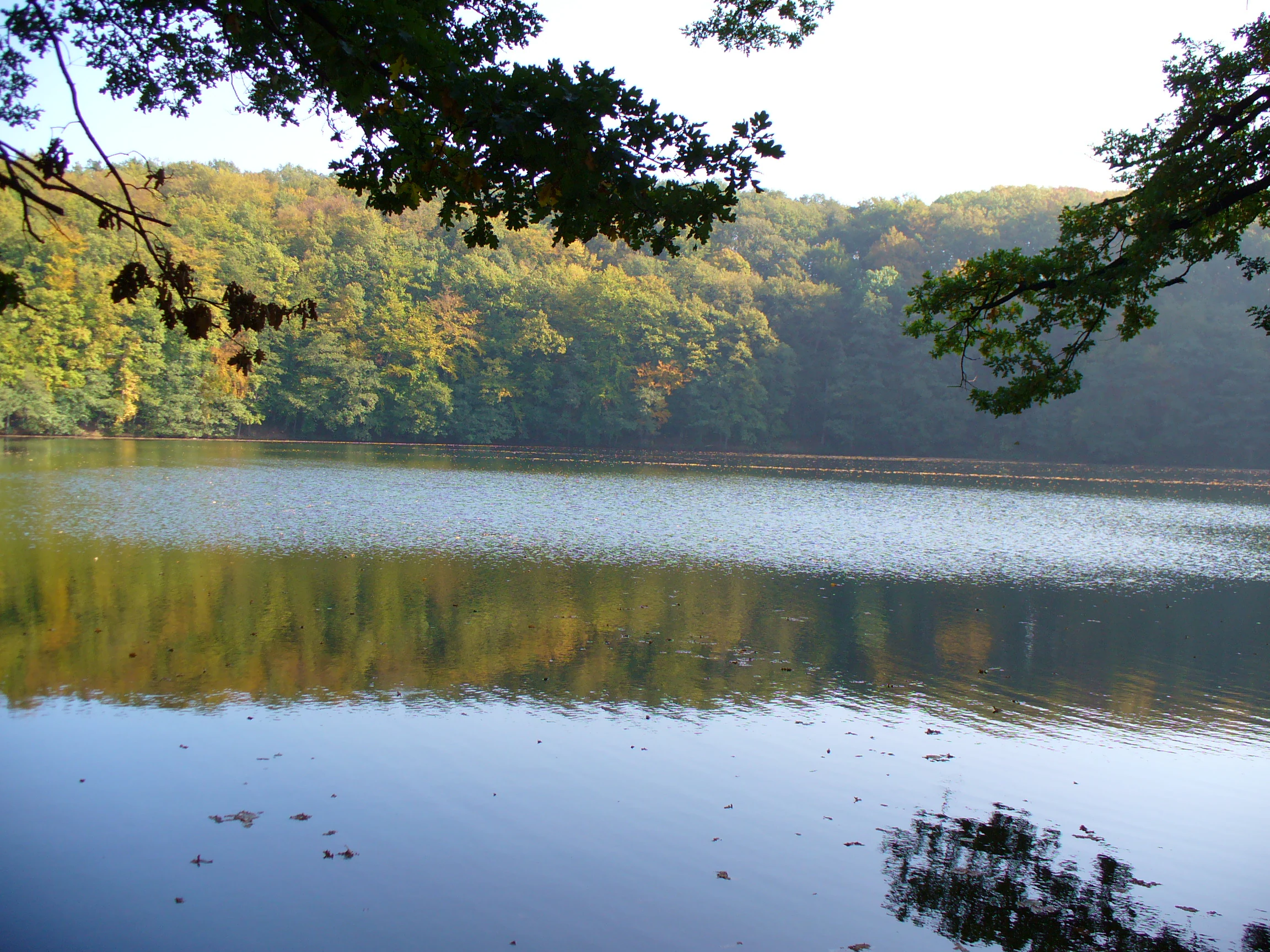
The forest around the lake is predominantly deciduous, dominated by broadleaf species typical of the Buntsandstein soils of the Thuringian Rhön. This woodland extends down the crater slopes to the water's edge on most sides and forms a near-closed canopy around the basin. Combined with the steep slopes and the sheltered microclimate, the forest contributes to the lake's distinctive atmosphere and supports the terrestrial habitats associated with the protected area.
Because of the lake's small size, isolation, and unusual chemistry, its biological communities have been the subject of repeated scientific study, particularly with regard to oxygen dynamics and nutrient status. The combination of forest, sinkhole water body, and detached catchment makes the site a compact but ecologically coherent unit within the larger Rhön landscape.
Bernshäuser Kutte wildlife and species highlights
Bernshäuser Kutte is primarily valued for its geological and limnological character rather than for charismatic large fauna, and the available source material does not support a detailed species-level wildlife account. The lake itself, however, represents a specialised aquatic habitat shaped by its meromictic stratification and progressive eutrophication, conditions that strongly influence which aquatic organisms can thrive at different depths.
The deciduous forest surrounding the basin provides typical woodland habitat for the Thuringian Rhön, supporting the usual range of forest birds, small mammals, and invertebrates associated with mature broadleaf woodland on sandstone soils. Heavier recreational use along the shoreline has affected bank vegetation and soil structure, an issue of relevance to ground-dwelling invertebrates and shoreline flora. Detailed wildlife inventories are not documented in the source material, so any broader wildlife description would go beyond what the references support.
Bernshäuser Kutte conservation status and protection priorities
Conservation interest in Bernshäuser Kutte centres on its geological origin, its unusual lake hydrology, and the forest ecosystem that surrounds it. The site is formally recognised as both a Geotop (geological monument) and a Naturschutzgebiet (nature reserve). The reserve was first proclaimed on 16 October 1942 under the Reich Nature Conservation Act, giving it a protection history of more than eight decades, and the protected area now spans roughly 13.06 hectares.
In addition to its national-level protection, Bernshäuser Kutte forms part of the FFH protected site "Forstloch-Pleß-Stoffelskuppe-Bernshäuser Kutte", which is included in Thuringia's contribution to the European Natura 2000 network. Its IUCN management category is IV, Habitat/Species Management Area, indicating active management for specific habitat or species objectives rather than strict wilderness preservation.
Despite this layered protection, the lake faces ongoing pressures. Long-term monitoring has documented a marked decline in deep-water oxygen levels, with anoxic conditions rising from around 35 metres depth in 1960 to shallower than 5 metres by 2012, a sign of progressive eutrophication. At the same time, informal recreational use as a swimming site has caused significant trampling damage to shoreline vegetation, creating a tension between public enjoyment and conservation that managers continue to address.
Bernshäuser Kutte cultural meaning and human context
Bernshäuser Kutte is woven into the local identity of the Thuringian Rhön, but the source material does not support a detailed cultural or ethnographic narrative. The lake's older literary name, "Grüne Kutte", hints at a traditional local sense of the site as a distinctive and somewhat mysterious feature in the landscape, but no specific folk traditions, legends, or historical uses are documented in the source pages.
The lake lies close to villages such as Bernshausen, Urnshausen, and Roßdorf, all part of the small-scale rural settlement pattern that has long characterised the Rhön. The area has historically been shaped by agriculture and forestry, and the lake itself has been used informally for bathing for generations, a practice that continues today even though it is no longer compatible with the reserve's conservation objectives. Beyond this local recreational role, no deeper cultural or indigenous heritage context is documented in the available sources.
Top sights and standout views in Bernshäuser Kutte
Bernshäuser Kutte stands out as a textbook example of a salt-subsidence sinkhole lake in central Germany. Its nearly circular form, surprising depth, and complete dependence on rainfall combine to produce a water body with rare meromictic stratification and distinct habitat layering.
Equally notable is the depth of its conservation history: protected in 1942, long-studied by scientists, and embedded in the modern Natura 2000 framework, the site is a small but well-documented example of how geological heritage, ecological research, and nature conservation intersect in the Thuringian Rhön. Yet the lake remains a living, used landscape; informal swimming, shoreline trampling, and ongoing eutrophication all shape its present-day character and management challenges.
Best time to visit Bernshäuser Kutte
The lake and its surrounding forest can be appreciated year round, but seasonal conditions strongly shape the visitor experience. In late spring and early summer, the deciduous canopy around the basin is fully leafed out and the slopes form a continuous green wall above the water, while the surface of the lake remains cool because of its meromictic stratification.
In autumn, the surrounding Buntsandstein woodland turns colour and contrasts vividly with the dark, still water of the sinkhole, making this a particularly atmospheric time to view the basin. Winter brings bare branches and often clear, calm conditions that emphasise the circular geometry of the crater and the deep blue tones of the water. Summer visits, while pleasant in the forest, coincide with peak informal swimming use, which puts additional pressure on already trampled shoreline areas.