

Why Bimberi Nature Reserve stands out
Bimberi Nature Reserve is best known for protecting the rugged forested high country of the Brindabella Range, including the summit of Bimberi Peak, the highest point of the Australian Capital Territory, and for forming a key link in the broader Australian Alps conservation network between Kosciuszko and Namadgi national parks.
Bimberi Nature Reserve history and protected-area timeline
Bimberi Nature Reserve was formally established in April 1985, bringing the rugged Brindabella Range country into formal protection under the New South Wales parks system. For more than two decades it operated as one of several distinct protected areas in the Brindabellas, lying between Kosciuszko National Park to the north and the newly designated Namadgi National Park in the Australian Capital Territory to the south, and adjoining the smaller Brindabella National Park. A major chapter in the reserve's history came on 7 November 2008, when it was inscribed on the Australian National Heritage List as one of eleven component areas that together constitute the Australian Alps National Parks and Reserves. This listing placed Bimberi within a nationally recognized heritage framework alongside larger and better-known parks, affirming its significance as a contributor to a connected Australian Alps protected landscape rather than as an isolated reserve.
Bimberi Nature Reserve landscape and geographic character
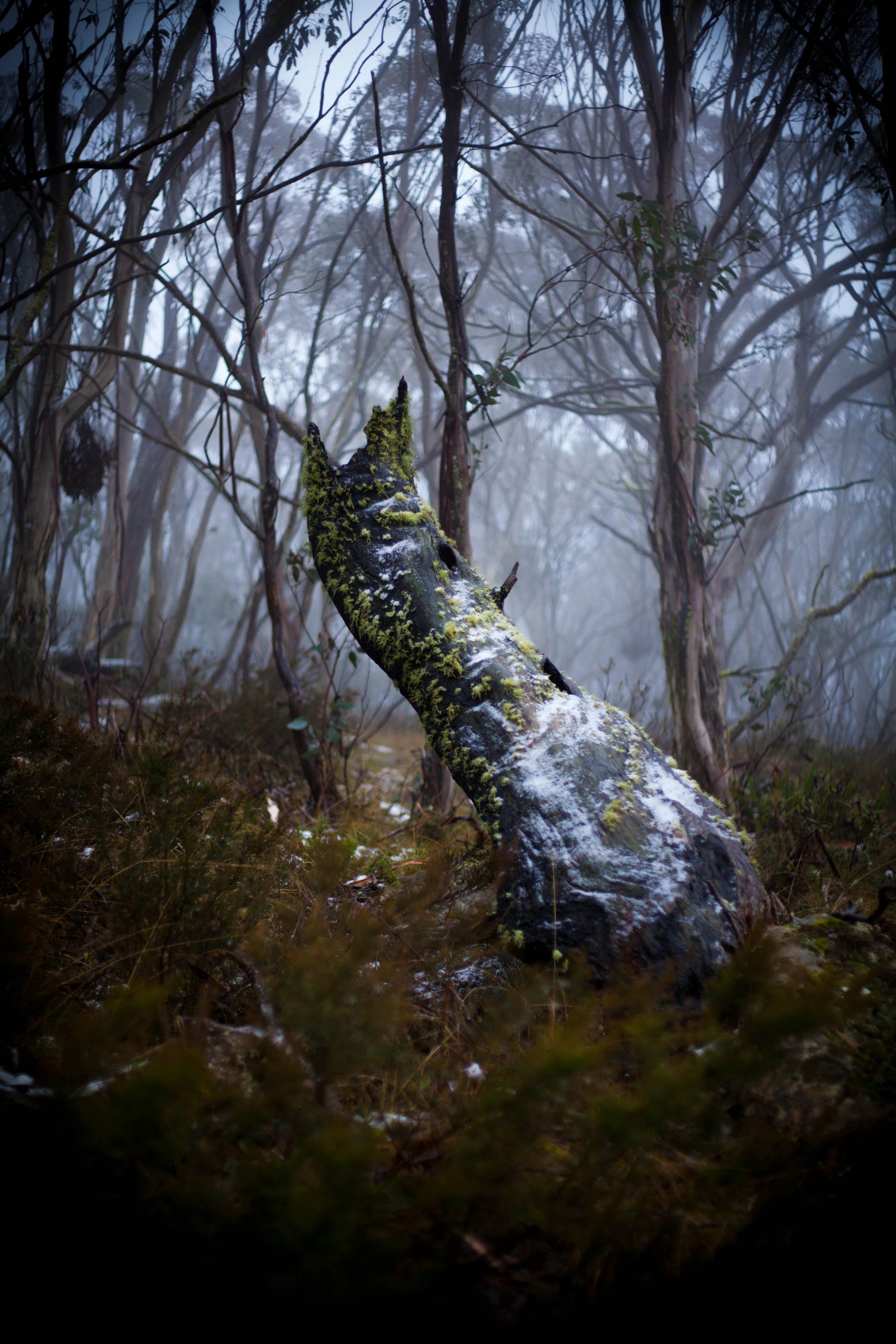
Bimberi occupies a stretch of the Brindabella Range, a rugged spine of forested ridges and deep valleys in southeastern New South Wales. The terrain is characterized by steep forested slopes, dissected gorges, snow gum and eucalypt woodland on higher elevations, and rocky summit country along the range's central crest. Bimberi Peak, on the reserve's edge, is the highest point of the Australian Capital Territory and also marks the boundary between New South Wales and the ACT, giving the landscape a strongly defined high point that anchors the reserve's identity. Elevations rise into the subalpine zone, where exposed rocks and low-stature vegetation give way to deeper, sheltered forests along creek lines that drain the range. The result is a transitional high-country landscape, bridging the wetter montane forests of the range with the more open, winter-snow-affected alpine country further south.
Bimberi Nature Reserve ecosystems, habitats, and plant life
Ecologically, Bimberi sits within the broader Australian Alps bioregion, where cool temperate and subalpine vegetation patterns dominate. The reserve protects extensive tracts of native eucalypt forest that grade upward into stands of snow gum, with associated montane heath, shrublands, and grassy understorey communities on higher, more exposed terrain. Rocky outcrops, ridgelines, and sheltered creek corridors create a mosaic of habitats typical of the Brindabella high country, supporting a mixture of tall wet sclerophyll forest, drier open woodland, and the more stunted subalpine communities found near and above the upper treeline. These gradients allow the reserve to function as an ecological transition zone between the montane forests that dominate Brindabella and the more extensive alpine and subalpine environments further south in Kosciuszko National Park and northward along the range.
Bimberi Nature Reserve conservation status and protection priorities
Bimberi's principal conservation role is as part of the broader Australian Alps landscape, a wide cool-climate montane and subalpine system that has been progressively assembled into a contiguous protected-area network. Its inclusion in the Australian National Heritage List in 2008, as one of eleven component areas forming the Australian Alps National Parks and Reserves, recognizes its value for preserving native forests, subalpine habitats, watershed integrity, and the ecological connectivity between large reserved systems in New South Wales and the Australian Capital Territory. By sitting between Kosciuszko National Park and Namadgi National Park and adjoining Brindabella National Park, Bimberi strengthens landscape-scale protection of the Brindabella Range, supports refugia for alpine and subalpine species, and contributes to the long-term resilience of Australia's high-country ecosystems against pressures such as historical grazing impacts, altered fire regimes, and climate change.
Bimberi Nature Reserve cultural meaning and human context
The Brindabella Ranges, where Bimberi is located, hold long-standing significance for Indigenous communities of southeastern Australia, with the broader high country carrying deep cultural meaning for traditional custodians. Within the wider reserve network of the Australian Alps, ongoing recognition of Aboriginal heritage and connection to country is an important part of contemporary management context, even where specific site-level details for Bimberi itself are limited.
Top sights and standout views in Bimberi Nature Reserve
Bimberi's standout features include its position on the Brindabella Range, its overlap with the ACT border, and its inclusion in the Australian Alps National Parks and Reserves heritage complex. The summit area of Bimberi Peak is the highest point in the Australian Capital Territory and a defining landmark of the reserve. The reserve functions as a connective ecological bridge between Kosciuszko, Namadgi, and Brindabella national parks, and its heritage-listed status reflects its standing as a significant piece of Australia's high-country conservation estate.
Best time to visit Bimberi Nature Reserve
The reserve's high-elevation setting in the Brindabella Range means it experiences cool to cold winter conditions with snowfall on upper slopes, and warmer, drier summers. The cooler months can showcase snow-affected alpine scenery, while spring and early summer are typically the most comfortable periods for walking and appreciating snowmelt-fed creeks, wildflower display potential, and stable trail conditions, though visitors should always prepare for changeable mountain weather.

