
When to Visit
Best Time to Visit Black Canyon of the Gunnison National Park: A Quick Orientation
For most travelers, the best time to visit Black Canyon of the Gunnison National Park is between late spring and early autumn. During this window, snow-free rim roads and more predictable temperatures create the most accessible environment for viewing the canyon depth and participating in rim-based activities. This period allows visitors to experience the park at its most open state, with access to both the North and South Rims that can be significantly limited or entirely restricted during the long, harsh winter.
Balancing Accessibility and Temperature
Deciding when to arrive at this national park requires a trade-off between pleasant weather and road accessibility. Summer provides the warmest conditions, but the high elevation of the canyon rim brings intense sun and potential afternoon thunderstorms. Conversely, the cooler shoulder seasons of late spring and early autumn offer thinner crowds and comfortable hiking conditions, though temperatures drop rapidly as soon as the sun dips below the canyon walls. Because the canyon is famous for its extreme steepness, sunlight is a scarce resource that dictates much of the daily temperature experience. In deep sections of the gorge, sunlight reaches the base for as little as 33 minutes per day, meaning the canyon floor and its immediate surroundings remain significantly cooler than the surface temperatures might suggest.
The Impact of Elevation and Geography
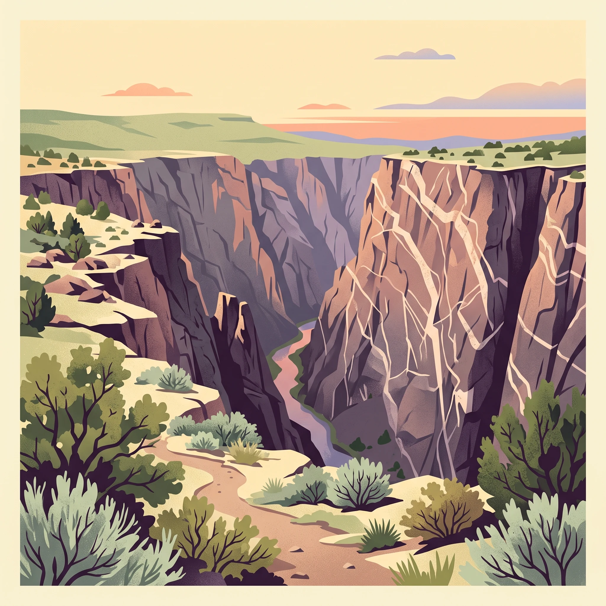
Situated in a biological crossroads where the Rocky Mountains meet the Colorado Plateau, the park experiences marked temperature variability. The 2,627-meter elevation of the rim environment ensures that even in peak summer months, nighttime temperatures can drop sharply. Visitors should anticipate a climate that behaves more like a mountain environment than a high desert, even though the visual landscape of the dark gneiss and pegmatite-streaked walls feels arid. Access to the inner canyon, a prime objective for many, is technically demanding and highly weather-dependent. Regardless of the chosen month, the park's topography means that microclimates vary drastically between the sun-drenched rim and the shadowed, cold depths of the Gunnison River gorge. Those planning their visit should prioritize understanding these temperature swings, as the primary constraint on park access remains the ability of the road infrastructure to stay open in the face of significant winter accumulation and freezing temperatures that persist well into the spring months.
Seasonal Planning
Best Months to Visit Black Canyon of the Gunnison National Park
Peak Season for Rim Access and High-Elevation Hiking
The most reliable period for accessing the park rim drives and engaging in high-elevation hiking occurs from June through August. During these months, the average maximum temperatures reach their annual highs, peaking near 31 degrees Celsius in July. While these conditions make the upper trails and rim overlooks the most accessible, travelers should balance this with the reality of diurnal temperature shifts. Even in mid-summer, nighttime temperatures can drop significantly, often dipping toward 5 degrees Celsius at this high elevation. This window offers the best opportunity for visitors to experience the full extent of the scenic drives without the complications of lingering snow or seasonal road closures, though it also coincides with the peak for typical afternoon thunderstorm activity.
The Transition Periods of Late Spring and Early Autumn
For those who prefer moderate temperatures and seek to avoid the peak heat of mid-summer, May and September serve as excellent shoulder periods. In May, the park experiences a steady warming trend, with average daily highs climbing from roughly 18 degrees Celsius in April to near 24 degrees Celsius. September offers a similar, if slightly cooler, environment, with daily highs averaging 26 degrees Celsius. These months represent a strategic trade-off: visitors gain more comfortable hiking temperatures and generally clearer conditions, but they must accept a higher degree of uncertainty regarding late-season snow in May or early-season cold snaps in late September. Access remains generally consistent during these months, though travelers should verify the status of specific inner canyon routes, which may remain closed or hazardous based on conditions deeper in the gorge.
Navigating the Challenges of the Cold Season
From November through March, the park enters a deep winter phase characterized by significant cold and limited accessibility. Average minimum temperatures during these months frequently drop well below negative 15 degrees Celsius, with January and December seeing averages near negative 20 degrees Celsius. While the park remains an entity of geological wonder during this time, the cold and potential for road closures make it a period best suited for visitors prepared for winter-specific exploration. The primary trade-off is between the solitude of a snowy landscape and the logistical necessity of managing extreme thermal conditions and reduced daylight hours, which drop to under 10 hours in mid-winter. Visitors planning trips during this window must prioritize checking for active alerts, as road conditions and services are subject to significant restrictions during the peak of the winter climate.
Climate and Weather
Annual Weather and Climate Patterns at Black Canyon of the Gunnison
Annual Thermal Variability and Elevation Impacts
The climate at this high-elevation national park is defined by significant temperature swings and the influence of deep, shadowed topography. Because the park sits at a substantial elevation, typically above 2,600 meters, annual climate patterns differ markedly from the lower valleys of western Colorado. The most defining thermal characteristic is the intense seasonal divide. Winter months, specifically December through February, see mean temperatures hovering well below freezing, with average daily lows frequently dropping near negative 20 degrees Celsius. In contrast, the brief summer period from late June through August offers the only sustained window of warmth, with average maximums climbing toward 30 degrees Celsius. These numbers are based on long-term climate normals and should be treated as historical context rather than immediate forecasts for your specific visit dates.
Patterns in Daylight and Solar Exposure
Daylight duration fluctuates dramatically throughout the year, impacting both the temperature and the visitor experience. From a high of over 14.6 hours in June, daylight hours dwindle to just over 9.3 hours by December. This reduction in solar intensity, combined with the canyon's extreme depth, creates unique microclimates. The steep, narrow gorge walls are famous for their ability to block sunlight, often allowing only a few minutes of direct exposure per day in the deepest sections. Travelers should note that while high-rim temperatures might feel moderate in early spring or late autumn, the canyon floor remains a distinct environment where cold air pools and shadows persist regardless of the sun's position above the rim.
Understanding Seasonal Precipitation Trends
The park's precipitation profile is relatively consistent, characterized by low overall moisture levels throughout the year. Most months experience precipitation normals near 1.2 to 1.4 millimeters per day. There is no classic monsoon season here, though brief, localized afternoon thunderstorms are a known occurrence during the summer months. These convective events can develop rapidly, bringing sudden changes to the high-rim environment. Unlike regions where heavy, prolonged rainfall defines the seasons, the primary precipitation concern here is the accumulation of snow during the colder half of the year. Visitors planning trips outside the summer peak should be prepared for varying ground conditions, as lower temperatures in the shoulder months can turn even minor precipitation into ice or snow that remains on shaded routes.
Wind, Humidity, and Atmospheric Context
Relative humidity levels correlate with the seasonal temperature cycle, generally falling as temperatures rise toward mid-summer. You will notice the lowest humidity values, often under 40 percent, during the dry, warm stretch of June. This relative dryness can exacerbate the intensity of the high-altitude sun, making hydration and sun protection vital for anyone exploring the rim trails. Wind speeds remain relatively stable throughout the year, generally ranging between 2.0 and 3.0 meters per second. While these averages might seem moderate, the exposed nature of the canyon rim can amplify wind effects, leading to higher perceived cooling on clear days, even when ambient temperatures appear comfortable on a thermometer.
Annual Weather Cycles
Seasonal Patterns and Weather Transitions in Black Canyon of the Gunnison
Defining the Park's High-Altitude Annual Rhythm
Rather than a traditional four-season model, the climate at Black Canyon of the Gunnison is best understood as a binary shift between an accessible, temperate period and a prolonged winter phase. Because the park sits at an average elevation exceeding 2,600 meters, the rhythm of the year is dictated by the arrival and departure of snow and the resulting volatility in temperatures. Travelers should view the annual calendar as a progression from the thaw of late spring to the stable heat of midsummer, followed by a rapid cooling phase that defines the autumn transition.
The Extended Winter Window
Winter conditions generally dominate from November through March. This period is defined by mean temperatures that hover near or below freezing, frequently dropping into the negative double digits at night. The high-altitude environment means that cold persists long after the sun rises, and the steep canyon walls ensure that many areas remain in deep shade throughout the day. Snow accumulation is typical during these months, and the combination of ice and steep, narrow roads necessitates strict adherence to park-specific winter travel protocols. Visitors should not view this as a dormant period in the traditional sense, but as a time of limited operational capacity where the landscape is starkly transformed by snow and extreme thermal shifts.
The Transitional Windows of Spring and Autumn
Transitions between these climatic phases are notably brief. April marks the initial thaw, though snow remains a regular threat and temperatures stay volatile. Visitors during this month often experience rapid fluctuations, where high-altitude air can warm significantly during the day only to plummet after sunset. The spring transition acts as a gateway to the primary visiting season, characterized by lengthening daylight hours and a steady decline in humidity.
September serves as the reciprocal transition, where the warmth of the summer peak begins to fade. While the days remain pleasant, the risk of frost increases, and the nights begin to mirror the sharp temperature drops characteristic of the winter months. This period is distinct from the summer peak because the atmosphere loses the humidity that often moderates the heat, leading to sharper daily temperature ranges that demand careful preparation for those exploring the rim or planning inner-canyon hikes.
The Summer Peak Phase
From June through August, the park experiences its most stable weather phase. This is the period when precipitation reaches its annual low point and daylight hours are at their peak, facilitating the most reliable access to the park's rim drives and recreational activities. While daytime temperatures can feel warm to hot, the thin, dry air of the high altitude causes temperatures to drop rapidly once the sun dips behind the canyon rims. Even during the height of summer, visitors should anticipate a significant diurnal temperature swing. Unlike lower-elevation environments, the canyon floor remains a distinct microclimate that never experiences the full heat of the plateau, regardless of the month.
Seasonal Experiences
Seasonal Landscapes and Visitor Activities at Black Canyon
Connecting Seasonal Conditions to Canyon Exploration
The ability to access the canyon depths and navigate the rim trails is intrinsically tied to the seasonal cycles of western Colorado. Because the Black Canyon topography is defined by its extreme depth and narrow walls, which prevent most direct sunlight from reaching the river level, the thermal experience of hiking varies dramatically between the rim and the gorge floor. During the core visiting season from late spring through early autumn, the higher elevations offer moderate daytime temperatures that make traversing exposed rim trails like the South Rim Rock Nature Trail or the North Rim North Vista Trail more comfortable. In contrast, descending into the inner canyon is a significantly different experiential endeavor, as the lack of light and airflow means these areas remain cooler and often retain moisture longer than the sun-drenched plateau.
Wildlife Observation and Seasonal Cycles
Wildlife viewing opportunities are closely tied to the shifting vegetation and seasonal migration patterns within the park. In early summer, the emergence of fawns among the mule deer populations is a consistent highlight for visitors exploring the rim roads. As the summer heat intensifies in July and August, larger mammals like elk tend to seek relief in higher elevations, making them less visible near the main access points compared to the shoulder seasons of spring and fall. Bird watchers find the most consistent activity during the warmer months, particularly when observing peregrine falcons near the Painted Wall or listening for the distinct calls of the canyon wren. Visitors should note that while summer offers the most consistent weather for these sightings, the crepuscular nature of many species, including coyotes and mountain lions, means dawn and dusk remain the primary times for active observation regardless of the time of year.
Navigating Technical Terrain and Trail Access
Experience-based planning requires a clear understanding of the park's trail infrastructure. The designated nature trails, such as Cedar Point or the Chasm View Nature Trail, are maintained for broad accessibility during the snow-free months. However, the inner canyon routes present a unique challenge, as they are unmaintained and lack formal trail markings. These rugged descents are best suited for periods when temperatures allow for safe, prolonged physical exertion, typically late spring or early autumn, as the mid-summer peak can introduce significant heat stress on exposed sections. Visitors aiming to explore these steep, demanding paths must reconcile their physical preparedness with the seasonal volatility of the gorge, ensuring they avoid the icy or mud-prone conditions that frequently define the long winter transition period.
Visitor Priorities
Selecting the Best Time to Visit Black Canyon Based on Travel Interests
Planning for Milder Temperatures
For visitors seeking the most comfortable walking weather, the late spring window of May and the early autumn period of September offer the best balance of temperature and safety. During May, the average daily high reaches approximately 23.85 degrees Celsius, providing warm conditions for rim-based hiking while avoiding the sweltering heat of peak July afternoons, which can see averages exceed 31 degrees Celsius. September acts as the mirror of this transition, with high temperatures settling around 26.62 degrees Celsius. These shoulder months are essential for those who want to avoid the extreme, sometimes freezing, nighttime lows that occur during the winter and the intense daytime peaks of mid-summer. The compromise for choosing these periods is the increased potential for volatile weather and the possibility that spring run-off or autumn storms may introduce mud or debris onto higher-elevation trails.
Prioritizing Longest Daylight for Exploration
If your primary goal is maximizing time spent outdoors to enjoy extensive rim hikes like the North Vista Trail or the longer stretches of the South Rim, the summer months of June and July are superior. These months provide the longest daylight windows of the year, reaching over 14 hours, which is critical when navigating terrain that can be physically demanding. The extended daylight offers a significant safety margin for hikers, ensuring that scenic photography and nature observation can occur without the urgency of early sunsets. The trade-off is the heat; because the canyon walls act as heat traps, the inner-canyon routes become significantly more strenuous during these months. Visitors must balance the benefit of extended daylight against the necessity of starting early to avoid the hottest parts of the day, as temperatures can climb rapidly once the sun is fully engaged.
Aligning with Traditional Rock Climbing Windows
Climbers planning to tackle the park's multi-pitch traditional routes must work within the specific seasons that balance environmental risks. The peak climbing windows are identified as mid-April through early June and mid-September through early November. These periods avoid the extreme thermal shifts of deep winter while steering clear of the mid-summer peak, where afternoon thunderstorms and high heat can make the deep, sheer canyon walls dangerous. These spring and autumn windows provide more reliable climbing conditions, though they introduce their own set of challenges, including the presence of poison ivy, the emergence of ticks in approach gullies, and the persistent risk of rapid weather changes common to high-altitude environments. Climbers should be aware that many routes are committing, and relying on these specific periods does not eliminate the requirement for advanced preparation and the ability to endure unplanned conditions.
Access and Operations
Seasonal Access and Operational Considerations at Black Canyon of the Gunnison
Understanding Seasonal Road and Rim Accessibility
Access to the park is defined by its two distinct rim areas, the South Rim and the North Rim, both of which operate under different logistical schedules. The South Rim remains open year-round for vehicle access, although the road beyond the visitor center often closes to private vehicles during winter months when snow accumulation makes transit difficult. In contrast, the North Rim road is typically closed to all vehicle traffic throughout the winter season. Travelers planning a trip during the shoulder months of late autumn or early spring must anticipate that snow or ice can create temporary, unscheduled closures on either road, regardless of the broader seasonal status.
Practical Planning for Park Facilities and Routes
Visitors should not assume that all facilities are functional throughout the year. While the South Rim Visitor Center is a primary contact point, its operating hours may fluctuate based on the season or staffing levels. Facilities like campgrounds, picnic areas, and water stations are subject to seasonal shut-offs, particularly as temperatures drop consistently below freezing. Because these operational adjustments respond to real-time weather events rather than rigid calendar dates, checking the current status on the official National Park Service website is a mandatory step before departing for the park.
Navigating Inner-Canyon Access and Permits
Reaching the Gunnison River via the designated inner-canyon routes is a specialized endeavor that requires specific preparation regardless of the time of year. Accessing these trails often requires a wilderness permit, and potential visitors must verify if permit requirements have changed or if specific routes are closed for maintenance or safety reasons. These trails are physically demanding and, unlike the rim drives, they are not maintained for standard tourist access. Because terrain conditions are volatile, especially during spring runoff or after storm events, consult the park rangers or current trail alerts to confirm that your planned route is open and safe for your skill level. Relying on outdated maps or general seasonal expectations can lead to choosing routes that are inaccessible or closed for conservation purposes.
Safety and Preparation
Seasonal Safety and Climate Preparation for Black Canyon of the Gunnison
Preparing for Extreme Diurnal Temperature Swings
Visitors should prepare for the dramatic temperature fluctuations that define the Black Canyon of the Gunnison, regardless of the season. Even in the peak summer months of July and August, when average daily highs climb near 31 degrees Celsius, nighttime temperatures often drop toward 5 degrees Celsius. This shift requires a layering strategy for all outdoor activities, including rim-side sightseeing and trail exploration. Because the deep canyon geography creates unique microclimates, the temperature on the rim can feel significantly different from conditions inside the gorge. Travelers should avoid relying on generalized regional weather forecasts and instead consult current park-specific updates for the most accurate information before setting out.
Managing High Altitude and Terrain Exposure
The park sits at an elevation of approximately 2,600 meters, which increases the intensity of sun exposure and can impact physical exertion for unacclimatized visitors. High-altitude environments often lead to faster dehydration and increased fatigue during moderate activity. Preparing for these conditions means prioritizing protection from the sun, such as wearing brimmed hats and appropriate clothing, and maintaining awareness of one's physical limits. The terrain along the canyon edge is inherently rugged and characterized by steep, unstable cliffs. Official guidance consistently emphasizes that visitors must remain behind established trail barriers and stay on designated paths. Attempting to navigate beyond these safety perimeters significantly increases the risk of falls or becoming stranded in steep, inaccessible terrain where rescue operations are exceptionally difficult and time-intensive.
Seasonal Weather Preparedness
Preparation needs shift drastically across the calendar year based on the park's distinct seasonal cycles. During the winter months, when average minimums drop to nearly -20 degrees Celsius, visitors must account for limited daylight hours of fewer than 10 hours per day. Winter visits require robust, wind-resistant cold-weather gear to handle conditions that remain consistently frigid throughout the day. Conversely, during the transition into late spring and early autumn, the primary safety concern shifts toward managing the volatility of rapid weather changes, where unexpected storms or temperature drops can occur with little notice.
Always check official park alerts for current conditions, including road closures or trail status updates, before planning any excursion. Because weather patterns at this elevation are inherently unstable, having a flexible itinerary that allows for immediate adjustment to changing conditions is the most effective safety strategy. If you plan to descend into the inner canyon, remember that this activity requires advanced physical preparation and, in many cases, specific wilderness permits. The conditions in the gorge are often far more demanding than those on the rim, and current information from park staff is essential for gauging the feasibility of such routes.
Final Planning
How to Choose the Right Time to Visit Black Canyon of the Gunnison National Park
Choosing your travel dates for this park hinges on how you balance the requirement for full road access against the reality of high-altitude weather volatility. Because the canyon is defined by extreme depth and steep walls, the environment functions as a natural trap for both cold air and shadow. If your primary goal is accessing the North and South Rim drives, visiting between late spring and early autumn is the most reliable strategy. During this window, you benefit from consistent access to scenic overlooks and the widest availability of maintained rim trails. However, you must accept that even mid-summer heat at the rim can be intense, and the canyon floor remains a distinct, more dangerous climate zone regardless of the date on the calendar.
For those prioritizing inner-canyon exploration or technical climbing, the decision requires a more nuanced approach. Spring and early autumn provide the most comfortable thermal conditions for strenuous activity, as the mid-summer sun often makes the gorge floor oppressively hot. Yet, these shoulder seasons are exactly when weather patterns fluctuate most unpredictably, bringing the risk of rapid temperature drops and sudden storms. Conversely, a winter trip offers solitude and a unique perspective on the canyon walls, but it demands a rigid commitment to limited access, as many park facilities and roads close when snow conditions become prohibitive. You must decide whether the trade-off of fewer crowds justifies the significant reduction in logistical flexibility and the heightened exposure to severe cold.
Ultimately, there is no single date that satisfies every preference. Your final choice should be guided by your specific activity goals and your tolerance for regional weather shifts. If you are an average visitor looking for standard sightseeing, the months of June through August offer the highest operational certainty. If you are a specialized enthusiast, look to the transition periods of May or September to capture the best balance of manageable heat and accessible terrain. Regardless of when you choose to go, remember that historical climate normals serve only as a general guide. Real-time conditions, including sudden road closures, hazardous trail status, and local alert levels, are subject to change. Always consult official park resources for current operational status, weather warnings, and safety requirements before finalizing your travel plans.