
Mori Atlas logo
Nature reserveBockwitz

Mapping the Rewetted Lake Systems and Industrial Reclamation Terrain of this Sachsen Protected Area

Bockwitz Nature Reserve: A Detailed Geographic Overview of the Sachsen Mining Follow-on Landscape

(Naturschutzgebiet Bockwitz)

Bockwitz stands as a prominent nature reserve in Sachsen, representing a significant post-mining landscape shaped by the historical lignite industry near Borna. This protected area encompasses 545 hectares of rewilded terrain where groundwater rebound has transformed former opencast excavation pits into a complex mosaic of stillwater lakes. The geography is defined by the prominent Bockwitzer See and adjacent residual pit holes, creating a distinct habitat that illustrates the ecological evolution of former industrial lands into a managed wetland environment.

post-mining landscaperewetted lakeslignite mining aftermathwetland mosaicnature reserveSaxon conservation
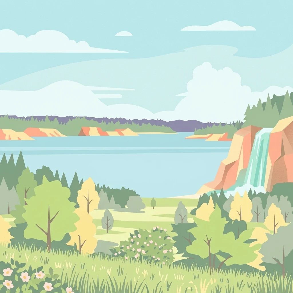
A flat-style digital illustration depicting a calm blue lake surrounded by green forests and rolling hills, with a small waterfall cascading down a cliff face on the right.

Bockwitz

Nature reserve

Park overview

Structured park overview, official facts, and landscape profile for Bockwitz Nature Reserve

Bockwitz Nature Reserve park facts, protected area profile, and essential visitor context

Review the core facts for Bockwitz Nature Reserve, including designation, size, terrain, visitor scale, habitats, and operating context in one park-focused overview.

About Bockwitz Nature Reserve

Bockwitz Nature Reserve is a protected landscape in the central German state of Saxony, situated in the Leipzig district on the eastern flank of the town of Borna. Administratively, the reserve overlaps three municipalities: Borna, Frohburg, and Kitzscher. Despite sitting within a region historically shaped by intensive lignite mining, the area has been designated specifically because the mining legacy is now generating new ecological value rather than subtracting from it.

The reserve is part of what German planners and ecologists call a Bergbaufolgelandschaft, a landscape shaped by the aftermath of large-scale extraction. The site originated as the Borna-Ost/Bockwitz opencast lignite mine, which left behind a series of residual pit holes (Tagebaurestlöcher). As mining operations ended and pumping ceased, groundwater levels began to rise again. Over time, this process has filled the abandoned pits, creating a connected system of standing water bodies. The largest and most central of these is Bockwitzer See, and the Südkippe residual pit is also encompassed within the protected boundary.

Ecologically, this transformation has converted what was once a heavily disturbed industrial surface into a wetland-oriented mosaic. The lakes, their shorelines, and the surrounding post-mining terrain support habitats that would have been absent from the original agricultural or mixed land use before mining. As a result, the reserve is recognized as a significant habitat and species management area under IUCN Category IV, balancing protection with active stewardship.

Geographically, the area is framed by transport corridors that underline its unusual inland setting. To the west runs the A 72 motorway and the Wyhra river, while the S 176, B 176, and S 242 roads define segments of the broader boundary. Despite this infrastructural context, the reserve holds together as a coherent natural island in a working Saxon landscape, and its designation reflects Saxony's broader approach to using abandoned mining land as a foundation for new conservation value.

Quick facts and research context for Bockwitz Nature Reserve

Bockwitz Nature Reserve lies in the Leipzig district of Saxony, spanning parts of the municipalities of Borna, Frohburg, and Kitzscher, just east of the core town of Borna. The protected area covers approximately 545 hectares and is registered under the German NSG identifier L 60, with a corresponding record in the World Database on Protected Areas. It is classed as an IUCN Category IV area, indicating active habitat and species management.

The reserve sits within a post-mining landscape created by the former Borna-Ost/Bockwitz lignite opencast mine. Its core features are a series of stillwater lakes formed in residual pit holes after mining ended, including Bockwitzer See and the Südkippe residual pit. Groundwater rebound is the key natural process driving habitat development here, gradually converting dry industrial terrain into a mosaic of aquatic and semi-aquatic environments.

Protection and recognition

Examine documented conservation parameters and official registry references for Bockwitz.

Bockwitz Protection Status and Official Protected Area Designation Records

Registry records compile the documented protection status, management parameters, and official identifiers associated with Bockwitz. Structured database metrics outline the verified conservation context and administrative framework governing the protected landscape.

Protection details

WDPA ID
318212
Park context

Deeper park guide and search-rich context for Bockwitz Nature Reserve

Bockwitz Nature Reserve history, landscape, wildlife, and travel context

Explore Bockwitz Nature Reserve through its history, landscape character, ecosystems, wildlife, conservation priorities, cultural context, and seasonal travel timing in a structured park guide built for atlas discovery and search intent.

Why Bockwitz Nature Reserve stands out

Bockwitz is best known for its rewetted mining follow-on landscape, where former lignite opencast pits have been transformed into a complex of stillwater lakes through natural groundwater rebound. The contrast between heavy industrial past and emerging wetland habitat is the park's defining ecological signature. Among its individual features, Bockwitzer See stands out as the most prominent lake within the reserve. The presence of multiple residual pit lakes (Tagebaurestlöcher) within a single protected area gives Bockwitz a distinctive position within Saxony's network of Bergbaufolgelandschaften.
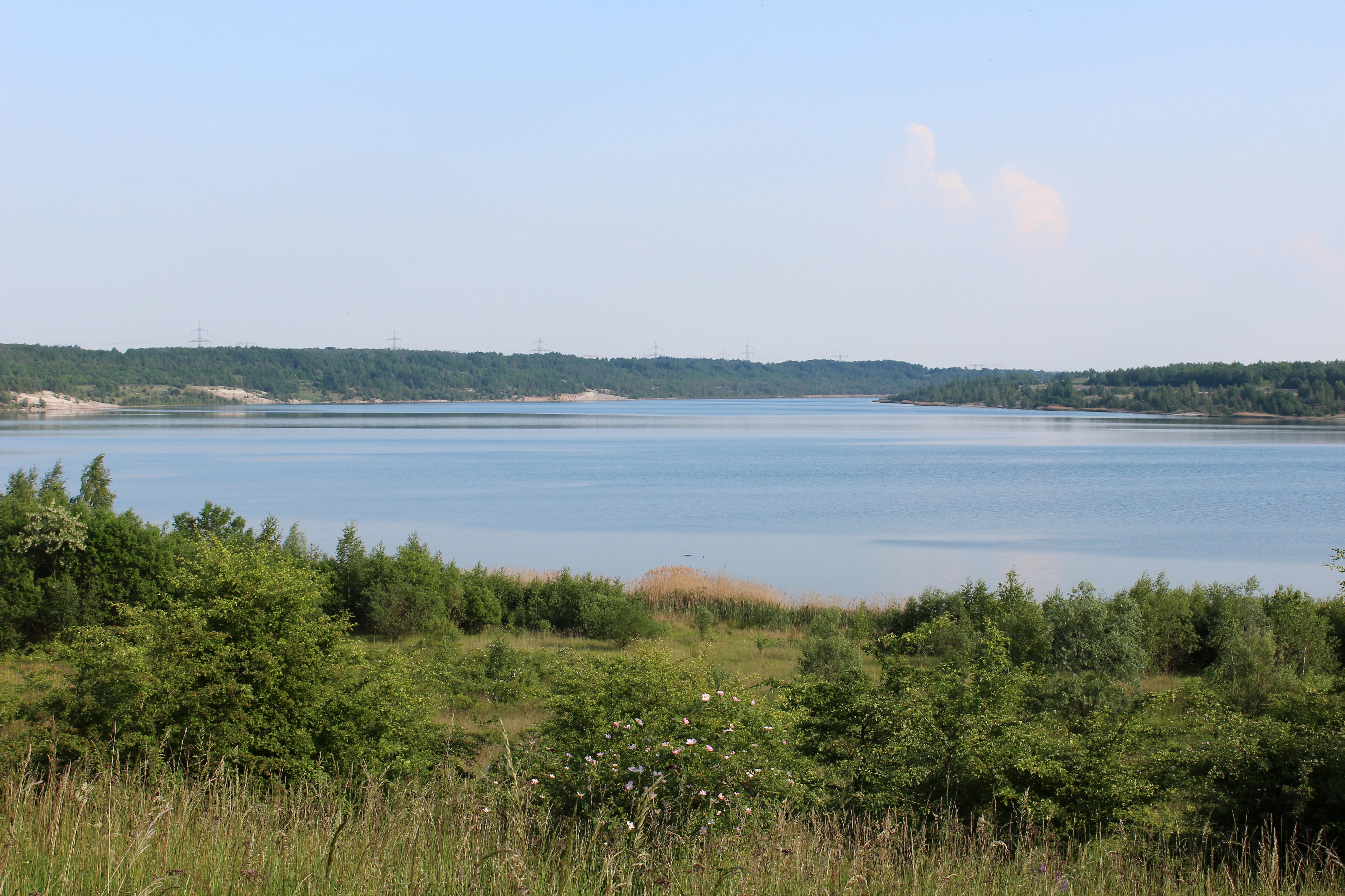
A wide, eye-level shot of a large, calm lake surrounded by low, forested hills under a clear, light-blue sky.
A wide view of the Bockwitzer See, showing the calm water and surrounding post-mining landscape.

Bockwitz Nature Reserve history and protected-area timeline

Bockwitz's history is inseparable from the lignite industry that once dominated the Leipzig basin. The area was part of the Borna-Ost/Bockwitz opencast mine, and the terrain bears the physical markings of decades of lignite (Braunkohle) extraction. When active mining came to an end, the site entered a transitional phase in which industrial infrastructure was removed and the residual pits were left to fill naturally.

Recognition of the site's emerging ecological value led to its designation as a nature reserve (Naturschutzgebiet) in 1999. The reserve was then formally established through a regulation issued by the Leipzig regional presidency on 6 August 2003, giving the area its official NSG identifier L 60 and anchoring it within Saxony's statutory protected-area system. Its subsequent listing in the World Database on Protected Areas confirmed its standing at an international level.

Since designation, the reserve's history has largely been one of ecological recovery driven by hydrological change rather than active restoration. Rising groundwater has gradually filled the abandoned pits, gradually converting the dry, post-extraction terrain into standing water. This trajectory has positioned Bockwitz as an example of how mining follow-on landscapes can be reintegrated into regional conservation networks once extraction ceases.

Bockwitz Nature Reserve landscape and geographic character

The landscape of Bockwitz is a textbook example of a mining follow-on terrain in central Germany. The defining surface features are not naturally formed valleys or river meanders, but rather the broad, geometrically shaped residual pit holes left behind by the Borna-Ost/Bockwitz opencast lignite mine. These basins, known locally as Tagebaurestlöcher, dominate the topography of the reserve and give the area its unusual character.

The most prominent landform within the protected boundary is Bockwitzer See, a sizeable stillwater lake occupying the largest of these pits. A second significant feature is the Südkippe residual pit, contributing to the overall sense of a multi-basin lake landscape. Past mining activity also left behind spoil heaps and disturbed substrates along the edges of these pits, and gradations between open water, exposed banks, and rewetted surroundings create a patchwork of micro-landscapes across the reserve.

Beyond the pit basins themselves, the reserve's hydrology is closely tied to the Wyhra river, which flows along the western flank near the A 72 motorway. The interplay between the rising groundwater table that fills the residual pits and the regional river system shapes not only the lakes themselves but also the character of their shorelines. The result is a strikingly anthropogenic yet increasingly water-dominated landscape that belies its industrial origins.

Bockwitz Nature Reserve ecosystems, habitats, and plant life

The nature of the Bockwitz reserve is defined by the ecological transition that follows the end of opencast mining. As groundwater levels rebound inside the residual pit holes, standing water bodies form and expand, initiating a process of habitat colonisation that is still unfolding. The result is a habitat mosaic centred on open water, wetland margins, and the disturbed but regenerating post-mining ground around them.

Because the reserve overlaps three municipalities, Borna, Frohburg, and Kitzscher, it covers a relatively broad footprint for a Saxon nature reserve of this type. That footprint allows different pits and shorelines to be at different stages of ecological development, from newly flooded basins with sparse vegetation to more mature lake margins where wetland communities have had longer to establish. This gives the protected area a kind of internal ecological gradient driven primarily by water and substrate age.

The reserve's IUCN Category IV designation reflects that this is not purely a hands-off wilderness but a managed habitat and species area. Active habitat stewardship is part of what makes the mosaic viable, especially around the edges where former mining land meets surrounding agricultural and forested terrain. The ecological value of the area lies less in any single pristine community and more in the rare combination of young lakes, disturbed substrates, and regenerating vegetation occurring together within a single protected boundary.

Bockwitz Nature Reserve conservation status and protection priorities

Bockwitz is recognized as a conservation site of regional significance because it demonstrates how former industrial land can be transformed into long-term habitat value. Its designation under the German Naturschutzgebiet framework and its IUCN Category IV classification position it as a managed area where the protection of habitats and species is balanced with the realities of a post-mining landscape.

The reserve's conservation importance rests on the gradual emergence of stillwater habitats from former lignite pits. Because these water bodies are still developing, their future ecological character depends on continued stewardship, including habitat management around the margins and monitoring of the ongoing groundwater-driven filling process. This makes the reserve both a conservation outcome and an ongoing conservation project.

Inclusion in international databases, including the World Database on Protected Areas, gives the reserve broader recognition. Within Saxony, it forms part of the network of protected areas in the Leipzig district and contributes to the state's broader effort to integrate Bergbaufolgelandschaften into its conservation strategy. In that sense, Bockwitz is less about preserving an untouched landscape and more about shepherding a recovering one.

Bockwitz Nature Reserve cultural meaning and human context

The cultural context of Bockwitz is rooted in the industrial and energy history of central Saxony. The region around Borna, Frohburg, and Kitzscher has long been associated with lignite extraction, and the reserve sits directly on land that was once part of the active Borna-Ost/Bockwitz opencast mine. For local communities, the area carries the memory of mining employment, infrastructure, and the reshaping of the landscape that accompanied decades of coal production.

The transformation of this same ground into a protected nature reserve reflects a broader shift in regional identity, where Saxon communities and planners have begun to view formerly extractive land as a basis for new environmental, recreational, and ecological uses. The reserve is therefore not only a natural site but also a marker of the region's transition away from lignite-dominated land use.

Top sights and standout views in Bockwitz Nature Reserve

Bockwitz's strongest point of distinction is the multi-basin lake landscape formed by flooded former opencast pits, with Bockwitzer See as the central feature and the Südkippe residual pit as a complementary water body. The reserve occupies a meaningful place in Saxony's mining follow-on landscape network and offers a coherent example of how disturbed industrial land can evolve into a managed wetland habitat system.

A further highlight is the reserve's size and administrative reach: at roughly 545 hectares and spanning parts of Borna, Frohburg, and Kitzscher, it is large enough to contain a genuine ecological mosaic rather than a single feature. Its protected status since 1999 and its international recognition through the World Database on Protected Areas give it durable standing as a conservation site in central Germany.

Best time to visit Bockwitz Nature Reserve

Bockwitz is a low-profile inland nature reserve whose seasonal character is tied mainly to its stillwater lakes and surrounding post-mining terrain. Late spring and early summer tend to make the wetland margins and rewetted basins feel most active, with rising temperatures and stabilised water levels giving the landscape its most coherent lake-and-shore character.

Autumn can offer quieter conditions and a more contemplative atmosphere, with the open water surfaces and mineral-toned surroundings of the former mining land coming into focus. Winter visits, as the source imagery from January illustrates, can be stark but atmospheric, with the reserve appearing spare and minimal against the Saxon cold. Because the reserve is managed primarily for habitat rather than visitor infrastructure, any visit is best framed around observation of landscape and water rather than formal facilities.

Monthly climate preview

Track monthly average temperature and precipitation rhythms across the landscape

Bockwitz Climate Normals and Long-Term Weather Patterns

Representative coordinate measurements reveal consistent shifts in monthly average temperatures and precipitation rates throughout the year. Examining the full twelve-month profile provides deeper clarity into long-term climate norms across the protected terrain.
Annual mean9 °C
-1 °C19 °C
Jan-1°
Feb
Mar
Apr
May13°
Jun17°
Jul19°
Aug19°
Sep14°
Oct
Nov
Dec
Warmest month
July

19.1 °C

Coolest month
January

-0.9 °C

Wettest month
July

2.7 mm/day

Driest month
April

1.3 mm/day

Park location guide

Geography guide, regional context, and park location map for Bockwitz Nature Reserve

Bockwitz Nature Reserve park geography, regions, and map view in Germany

Understand where Bockwitz Nature Reserve sits in Germany through a broader geographic reading of the surrounding landscape, nearby location context, and its mapped position within the national park landscape.

How Bockwitz Nature Reserve fits into Germany

Germany is a federal republic in Western and Central Europe with a population of over 83 million across sixteen constituent states. It is Europe's largest economy by nominal GDP and a major global exporter and importer. The capital is Berlin, and the country borders Denmark, Poland, Czech Republic, Austria, Switzerland, France, Luxembourg, Belgium, and the Netherlands.

Wider geography shaping Bockwitz Nature Reserve in Germany

Germany is located in Western and Central Europe, spanning 357,022 km². It borders Denmark to the north, Poland and the Czech Republic to the east, Austria and Switzerland to the south, and France, Luxembourg, Belgium, and the Netherlands to the west. The country has coastlines on the Baltic Sea and North Sea to the north, with the Alps located in the southern region.

Map view of Bockwitz Nature Reserve

Use this park location map to pinpoint Bockwitz Nature Reserve in Germany, understand its exact geographic position, and read its mapped placement within the surrounding landscape more clearly.

Pigeon | © OpenStreetMap contributors

Location context for Bockwitz Nature Reserve

Sachsen

Explore protected area imagery, rewetted lakes, and post-mining habitat character.

Bockwitz Photos and Landscape Scenery: Visualizing Saxony Mining Follow-On Terrain

Visual documentation captures the post-mining terrain, rewetted lake basins, and developing wetland habitats that define the reserve. Examining these landscape photographs provides clear insight into the ecological recovery and water-dominated geography of the region.

A wide, eye-level shot of a large, calm lake surrounded by low, forested hills under a clear, light-blue sky.

A outdoor bench sits on a grassy area in front of a wide lake under an overcast sky.

Park atlas

Compare adjacent wetland habitats and regional conservation landscapes

Exploring Parks Near Bockwitz and Protected Areas in the Surrounding Region

Continue exploring protected areas near Bockwitz by examining other regional nature reserves and wetland habitats. Comparing these adjacent conservation lands reveals broader patterns of post-mining landscape restoration across central Germany.
A horizontal watercolor illustration depicting a wetland landscape with grassy banks, a winding stream, and reeds.
Nature reserveSachsen
About 6.8 km away#1 closest

South

Eschefelder Teiche: Protected Wetland Landscapes and Pond Geography in Sachsen

Historic water basins and regional wetland habitats

The Eschefelder Teiche nature reserve occupies a distinctive position in the Saxon landscape, tracing a historic chain of artificial ponds from Frohburg to Eschefeld. This protected area offers insight into managed wetland ecosystems, featuring the expansive Großteich and preserved heritage structures like the Teichhaus complex, which remain central to local conservation and bird populations.

Area
5.62 km²
Relief
Lowland
Climate
Temperate
Access
Easy access
A horizontal watercolor painting depicting a soft-focus forest in the foreground and rolling hills in the background.
Nature reserveThuringia
About 13 km away#2 closest

South

Leinawald Nature Reserve: Mapping the Protected Forests and Wetland Habitats of Eastern Thuringia

A comprehensive look at the landscape geography, pond networks, and conservation status of this German woodland.

Leinawald represents a unique confluence of historical forestry, wartime heritage, and ecological recovery within the Altenburger Land region. The area is defined by its loess-mantled ridges and periodic wetland valleys, containing a complex grid of ponds, brooks, and secondary habitats formed in former quartz quarries. Understanding the environmental layers of this site reveals the intersection of natural vegetation potential and 20th century landscape transformation.

Area
18.437 km²
Established
1961
IUCN
IV
Relief
Upland
A horizontal watercolor illustration showing soft green rolling hills, trees, and a pale yellow sky.
Nature reserveSaxony
About 15 km away#3 closest

Northeast

Alte See, Ruhmberg Nature Reserve: Geographic Atlas of a Protected Landscape in Saxony

Ecological recovery of former military sites in the German lowlands.

Situated in the Landkreis Leipzig, the Alte See, Ruhmberg nature reserve offers a complex study in land use and conservation. The protected area features a unique transition between alder carr wetlands along the Parthe river and the dry, open grasslands of the Ruhmberg hill, creating a high-density biodiversity hotspot within the broader context of Saxon geography.

Area
2.66 km²
Established
2015
IUCN
IV
Nature reserveThuringia
About 19 km away#4 closest

West

Phönix Nord Nature Reserve: Mapped Protected Area in the Altenburger Land of Thuringia

A restored post-mining mosaic of heath, scrub, and woodland

Phönix Nord preserves a unique post-mining landscape shaped by historic lignite extraction. This nature reserve in Thuringia features a mosaic of rewilded slopes and reclaimed mineral soils, managed as a vital habitat for native species. Through its distinct topography and conservation efforts, it stands as a key example of industrial renaturation in central Germany.

Area
1.672 km²
Established
2008
IUCN
IV
Relief
Lowland
Nature reserveSaxony
About 25 km away#5 closest

Southeast

Um die Rochsburg Nature Reserve: Geography and Protected River Valley Landscapes in Saxony

A vital riverine conservation zone along the Zwickauer Mulde.

Spanning over 250 hectares, Um die Rochsburg protects the steep, wooded slopes of the Zwickauer Mulde and Brausebach valleys. This nature reserve highlights the regional importance of river-influenced terrain and managed habitat corridors within the Mittelsachsen landscape of Saxony.

Area
2.596 km²
Established
1961
IUCN
IV
Nature reserveSachsen
About 32 km away#6 closest

East

Scheergrund Nature Reserve: Geographic Atlas and Protected Landscape Overview

Mapping the geology and woodland history of the Leisnig region

Scheergrund functions as a vital nature reserve and geological reference site within the Saxon landscape. This area provides insight into Holocene tufa systems, ancient dam structures, and the complex interplay between spring-fed stream morphology and human development in the Freiberger Mulde tributary valley.

Area
0.578 km²
Established
1961
IUCN
IV
A soft watercolor painting depicting a serene floodplain forest with trees, grasses, and a winding stream, rendered in light green and muted tones.
Nature reserveLeipzig
About 33 km away#7 closest

Northwest

Burgaue Nature Reserve: Alluvial Forest and Hydrological Geography in Leipzig, Germany

Protected floodplain woodland and restored wetland corridors.

Burgaue is a distinctive nature reserve forming the northwestern anchor of the Elster Luppe floodplain. This urban-adjacent protected area preserves a complex topography of historic river channels, wet depressions, and hardwood forest. Through recent hydrological restoration, the landscape maintains its status as a vital riparian habitat and a significant element of the regional Saxon environment.

Area
2.7 km²
Established
1367
Relief
Lowland
Climate
Temperate
Protected landscapeThuringia
About 40 km away#8 closest

Southwest

Zaufensgraben Protected Landscape: Geography and Natural Boundaries in Thuringia, Germany

A steep-sided stream valley and protected nature corridor near Gera

Zaufensgraben is a protected landscape corridor centered on a three-kilometer stream valley in Gera, Thuringia. Renowned for its steep gradient within the Weiße Elster system, this area preserves older willow stands and exposes complex Zechstein geology. Its mapped boundaries offer a look at how small-scale protected terrain maintains ecological character within an urbanized historical setting.

Area
0.11 km²
Relief
Upland
Scope
Terrestrial
Water
Minor water

Common questions about visiting, size, designation, and location context for Bockwitz Nature Reserve

Bockwitz Nature Reserve FAQs for park facts, access, geography, and protected area context

Find quick answers about Bockwitz Nature Reserve, including protected-area facts, park geography, trail and visitor context, and how the park fits into its surrounding country and regional landscape.
MoriAtlas Explorer

Continue Your Protected Areas Search Across the Global Atlas

Deepen your exploration by continuing the structured search for national parks and protected areas worldwide. Utilize the comprehensive filtering capabilities to compare different conservation landscapes and refine your understanding of global park geography. Discover more about the distribution and characteristics of protected natural areas.

Global natural geography