
Mori Atlas logo
Nature reserveBodenmöser und Hengelesweiher

Mapping the peatland mosaic, dystrophic lakes, and protected hill landscapes of the Westallgäu region

Bodenmöser und Hengelesweiher Nature Reserve: A Detailed Atlas of Pre-Alpine Wetland Geography

(FFH-Gebiet Bodenmöser und Hengelesweiher)

Bodenmöser und Hengelesweiher forms a vital protected landscape mosaic within the Westallgäu hills of Baden-Württemberg. This atlas entry details the geography of diverse peat-forming habitats, including fens, transitional mires, and dystrophic waters that define the region. By examining the mapped boundaries and terrain, users can understand how this site integrates multiple conservation layers to preserve rare aquatic ecosystems and montane forest patches across the pre-Alpine slopes.

peatlandsraised bogsfenstransitional miresdystrophic lakeswet meadows
An illustration of a marshy wetland with pools of water, sparse trees, and a sunlit horizon.

Bodenmöser und Hengelesweiher

Nature reserve

Park overview

Structured park overview, official facts, and landscape profile for Bodenmöser und Hengelesweiher

Bodenmöser und Hengelesweiher park facts, protected area profile, and essential visitor context

Review the core facts for Bodenmöser und Hengelesweiher, including designation, size, terrain, visitor scale, habitats, and operating context in one park-focused overview.

About Bodenmöser und Hengelesweiher

Bodenmöser und Hengelesweiher sits in the rolling transitional landscape between the Pre-Alpine Allgäu and the broader southwest German uplands. Although administratively part of Baden-Württemberg's Landkreis Ravensburg, its character is strongly Allgäuian, shaped by the Westallgäuer Hügelland natural region and the foothills that rise toward the Adelegg. The eight component parcels are scattered south of the upper Argen river, west and east of Isny im Allgäu, rather than forming a single contiguous block.

In ecological terms, the protected area combines wetland, peatland, open water, and forest habitats within a relatively small footprint. This concentration is precisely what gives the site its conservation value: the number of habitat types packed into the 759 hectares is high, and several of them are considered priorities for restoration across Europe. The site protects oligo- to mesotrophic standing waters with Littorelletea and Isoëto-Nanojuncetea vegetation, natural eutrophic lakes with Magnopotamion or Hydrocharition communities, and dystrophic lakes and ponds, alongside calcareous fens, Molinia wet meadows, tall-herb fringes, and montane acidophilous spruce forest.

The designation recognizes that this mosaic supports a particularly rich set of species of community interest. The official species inventory includes the four-toothed whorl snail and narrow whorl snail, both highly sensitive to peatland hydrology; the large white-faced darter dragonfly tied to bog pools; the dusky large blue butterfly; the marsh fritillary; the broad-bodied diving beetle Graphoderus bilineatus; the bullhead fish; the greater mouse-eared bat; the European beaver; and several bryophyte species of conservation concern, including Buxbaumia viridis and Drepanocladus vernicosus.

For the visitor or geographer, the site is less a single dramatic destination and more a representative slice of the Westallgäu's wetland heritage. It illustrates how fragmented but legally coordinated conservation can preserve habitat diversity in a heavily used working landscape, and it anchors the regional network of FFH sites around Ravensburg alongside Wurzacher Ried, Feuchtgebietskomplexe nördlich Isny, and Obere Argen und Seitentäler.

Quick facts and research context for Bodenmöser und Hengelesweiher

Bodenmöser und Hengelesweiher is a Habitats Directive (FFH) site in Baden-Württemberg's Landkreis Ravensburg, administered by the Regierungspräsidium Tübingen. It covers about 7.59 square kilometers across eight sub-areas situated in the Westallgäuer Hügelland and near the Adelegg, between roughly 675 and 827 meters above sea level.

The site encompasses multiple Annex I habitat types, including dystrophic lakes, nutrient-poor standing waters, natural eutrophic lakes, lowland hay meadows, Molinia fens, transitional bog and quaking mire complexes, degraded but restorable raised bogs, and montane acidophilous spruce forest. It is also recognized as a bird protection area through its overlap with the Vogelschutzgebiet Bodenmöser.

Protection and recognition

Examining documented designation records and international recognition sources for the protected area.

Bodenmöser und Hengelesweiher Protection Status and Natura 2000 Recognition

Bodenmöser und Hengelesweiher maintains formal documentation including Natura 2000 recognition records and official database identifiers. Reviewing these verified protection sources provides clear insight into the conservation framework governing the landscape.
Park context

Deeper park guide and search-rich context for Bodenmöser und Hengelesweiher

Bodenmöser und Hengelesweiher history, landscape, wildlife, and travel context

Explore Bodenmöser und Hengelesweiher through its history, landscape character, ecosystems, wildlife, conservation priorities, cultural context, and seasonal travel timing in a structured park guide built for atlas discovery and search intent.

Why Bodenmöser und Hengelesweiher stands out

The site is best known for the coexistence of diverse peatland habitat types within a single protected zone, including calcareous fens, degraded raised bogs, transitional mires, and quaking bog communities pooled around dystrophic and mesotrophic waters. Hengelesweiher itself is a classic dystrophic kettle lake, while Bodenmöser represents the broader peatland complex of the Westallgäu. Equally distinctive is the layered protection framework. The same landscape functions simultaneously as a Habitats Directive site, a bird protection area, and a pair of nature reserves, allowing coordinated conservation of habitats, birds, invertebrates, bryophytes, and higher plants. This stacking of designations is unusual even within the broader Allgäu network of FFH sites.
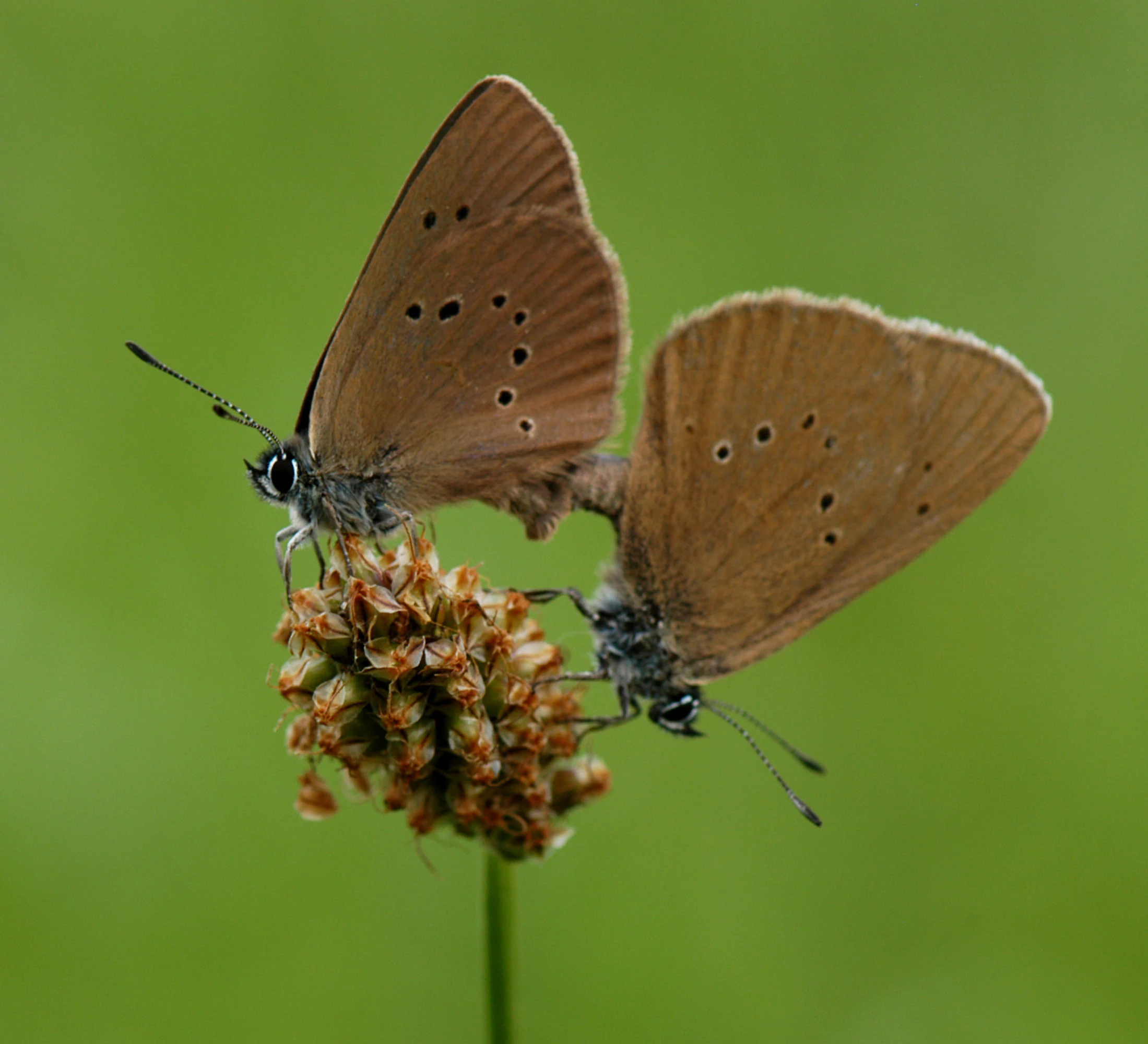
Two brown butterflies with dark spots on their wings, mating while perched on a small, textured flower head against a soft green background.
A pair of Dusky Large Blue butterflies mating on a flower in the Bodenmöser und Hengelesweiher nature reserve.

Bodenmöser und Hengelesweiher history and protected-area timeline

The conservation story of Bodenmöser und Hengelesweiher begins not as a single project but as the gradual recognition that the peatland and pool complex south of Isny merited formal European protection. In 2005, the Regierungspräsidium Tübingen submitted the area to the European Commission as a candidate site under the Habitats Directive, also referred to by its German designation FFH-Gebiet, with the code DE-8325-341.

After more than a decade of assessment and planning, the site was formally designated by regulation of the Regierungspräsidium Tübingen dated 5 November 2018, entering into force on 11 January 2019. The designation brought together two pre-existing nature reserves, Bodenmöser and Hengelesweiher, and the Vogel­schutzgebiet Bodenmöser, creating a single coordinated framework inside the Natura 2000 network.

The individual components of the site have their own longer histories as protected landscapes. Bodenmöser in particular has long been recognized as one of the Westallgäu's significant peatland remnants, while Hengelesweiher represents the region's tradition of preserving dystrophic kettle lakes as refugia for specialized flora and invertebrates. By combining them into a larger FFH site, Baden-Württemberg aligned local protection with broader European biodiversity goals and tied the landscape into the management planning cycle for Natura 2000 areas.

Bodenmöser und Hengelesweiher landscape and geographic character

The terrain of Bodenmöser und Hengelesweiher is shaped by the gentle, glacially influenced topography of the Westallgäuer Hügelland, with elevations that rise from about 675 meters in the lower parcels to roughly 827 meters in the higher ones. Toward the southeast, the landscape climbs further into the forested flanks of the Adelegg, one of the more prominent pre-Alpine upland features of the Allgäu.

The most visually distinctive features are the still waters and the mires that surround them. Hengelesweiher is a dystrophic lake whose dark, nutrient-poor waters are ringed by peat-forming vegetation, while other parcels contain oligo-mesotrophic standing waters and naturally eutrophic lakes with floating plant communities. Between and around these waters lie transitional mires, quaking bogs, degraded raised bogs still considered capable of restoration, and calcareous fens where groundwater chemistry shifts the plant communities toward more basiphilous species.

Forest plays a quieter but persistent role in the landscape mosaic. Montane acidophilous spruce forests occupy the higher, poorer soils, while alder and ash floodplain woodlands line the small streams and seepage zones, particularly along the upper Argen and its tributaries. Small brooks with Ranunculion and Callitricho-Batrachion vegetation thread between the mires, and wet meadows with tall-herb fringes occupy the more agriculturally shaped transitions. Although the area is not mountainous, the combination of rolling hills, scattered woodland, and dark-water pools gives the protected area a strongly pre-Alpine wetland character.
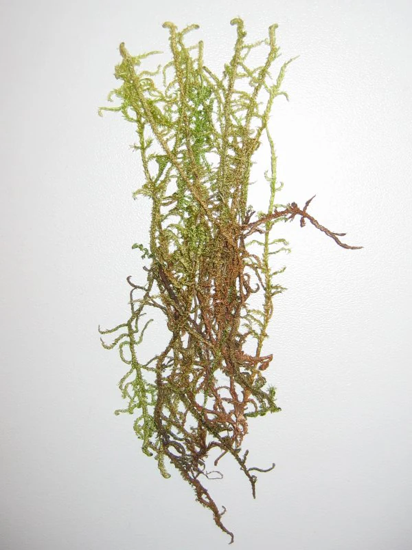
A cluster of varnished hook moss featuring long green and brownish stems isolated against a plain white background.
A close-up view of varnished hook moss (Drepanocladus vernicosus), a notable species found within the Bodenmöser wetlands.

Bodenmöser und Hengelesweiher ecosystems, habitats, and plant life

Ecologically, the site is defined by the overlap of three intertwined systems, which together give it a complexity that belies its modest total area. The still-water system includes nutrient-poor, nutrient-moderate, nutrient-rich, and dystrophic lakes and ponds, each hosting its own characteristic aquatic flora. The peatland system extends from calcareous fens and Molinia wet meadows through transitional mires and quaking bog communities to degraded but recoverable raised bogs and bog pools with Rhynchosporion vegetation. The forest system binds the mosaic together, with montane spruce forest on acidic soils and alder floodplain woodland along brooks and seepage lines.

This layering of habitats creates the conditions for unusual species combinations. Bog pools, for example, support both the large white-faced darter and rare bryophytes like Drepanocladus vernicosus, while calcareous fens harbor Sumpf-Glanzkraut (Liparis loeselii) and a range of whorl snails. The wet meadows with their tall-herb fringes and Molinion grasslands link these specialized wetlands to the broader agricultural mosaic, supporting butterflies such as the dusky large blue and the marsh fritillary, whose larvae depend on specific host plants and the structure of traditional mowing regimes.

From a methodological standpoint, the site is also notable for what it does not have: large continuous wilderness areas. Instead, its eight parcels reflect how European conservation increasingly works through coordinated networks of smaller, ecologically linked remnants, each too small on its own but collectively capable of maintaining peatland hydrology, aquatic chemistry, and the species that depend on them.
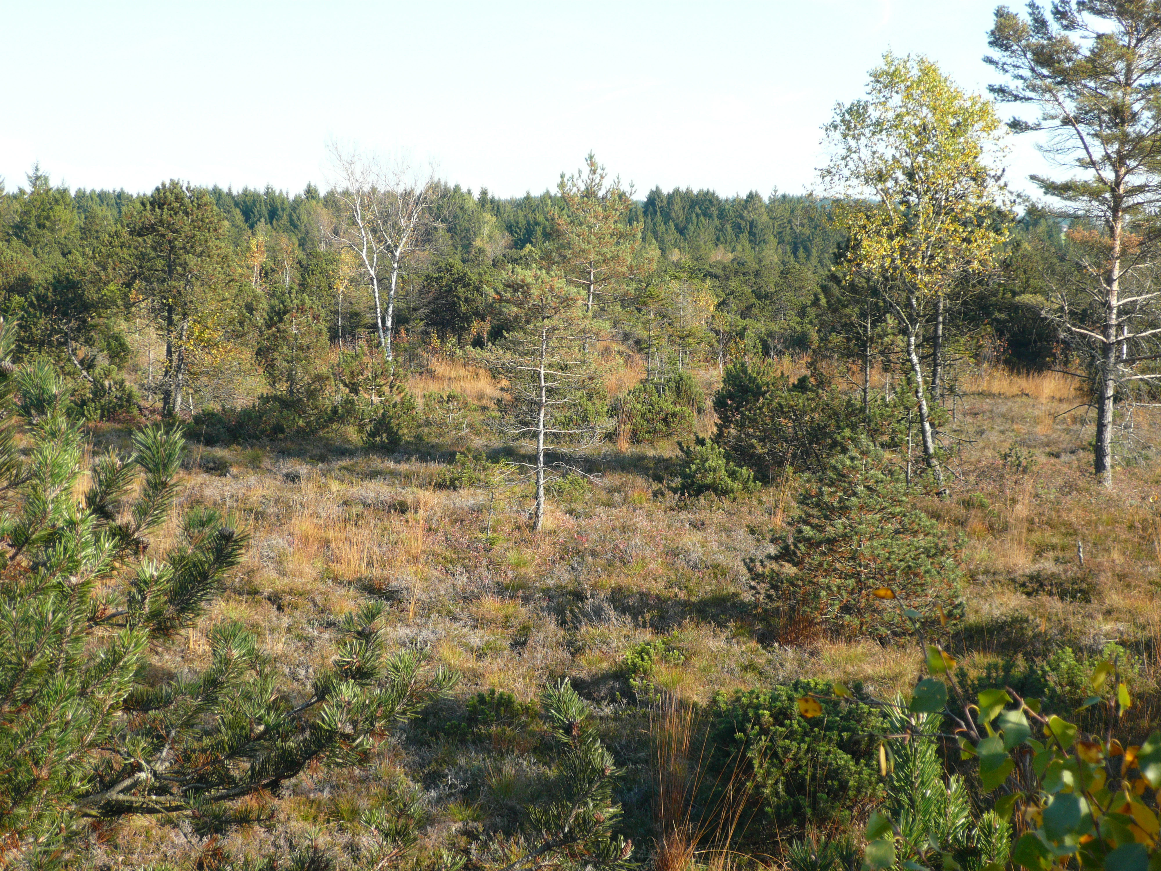
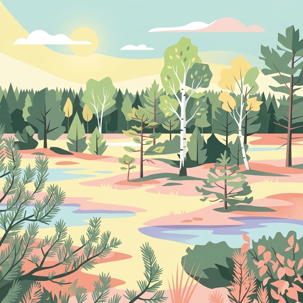
A view across a boggy moorland with scattered pine and birch trees in Baden-Württemberg, Germany.
The moorland landscape of the Bodenmöser nature reserve.

Bodenmöser und Hengelesweiher wildlife and species highlights

The wildlife profile of Bodenmöser und Hengelesweiher is shaped strongly by the invertebrates and bryophytes that thrive in the peatland and pool complexes, rather than by large charismatic mammals. Two whorl snails, the four-toothed whorl snail (Vertigo geyeri) and the narrow whorl snail (Vertigo angustior), are characteristic of the site's calcareous and transitional mires and serve as indicator species for intact peatland hydrology.

Among dragonflies, the large white-faced darter (Leucorrhinia pectoralis) is one of the most visually notable inhabitants, breeding in the boggy, fish-free still waters. The broad-bodied diving beetle Graphoderus bilineatus, another species of community interest, occupies similar habitats within the protected area. Wet meadows and fens also support butterflies of conservation concern, notably the dusky large blue (Maculinea nausithous) and the marsh fritillary (Euphydryas aurinia), whose presence depends on carefully maintained traditional land use.

Aquatic vertebrate life includes the bullhead (Cottus gobio) in the small brooks, while the broader landscape supports the European beaver (Castor fiber), whose activity along the watercourses contributes to the dynamic mosaic of pools, dams, and wet woodland that the site protects. The greater mouse-eared bat (Myotis myotis) forages over the more open meadow and forest edge habitats. Among plants, Sumpf-Glanzkraut (Liparis loeselii) and several bryophyte species of community interest, including Buxbaumia viridis and Drepanocladus vernicosus, confirm the site's role in the conservation of pre-Alpine peatland flora.

Bodenmöser und Hengelesweiher conservation status and protection priorities

From the conservation perspective, Bodenmöser und Hengelesweiher is significant primarily as a coordinated restoration framework for threatened peatland and aquatic habitats rather than as a single flagship landscape. Many of the habitat types it contains are listed as priorities under the European Habitats Directive, including calcareous fens, degraded raised bogs considered restorable, transitional mires, and bog pools with Rhynchosporion vegetation. Their protected status implies an active management mandate, not just prohibition of damage.

The site's value lies as much in the combination and connectivity of habitats as in any single feature. Because dystrophic, mesotrophic, and eutrophic waters coexist nearby, the protected network can support species with very different chemical and hydrological requirements. The overlapping designations as a Habitats Directive site, a Bird Protection Area (Vogelschutzgebiet Bodenmöser), and two nature reserves create a layered framework designed to maintain traditional land use, hydrological conditions, and habitat structure across ownership boundaries.

The conservation work that follows from this designation is documented in a dedicated management plan prepared for the FFH area 8325-341 and the associated bird protection area 8325-441. In practice, that plan guides measures such as maintaining appropriate water levels in fens and bogs, keeping open habitats open through managed mowing or grazing, and protecting the specific microhabitats required by the site's whorl snails, dragonflies, bryophytes, and fen orchids. Located in an agricultural and forestry region, the site is also an important node in Baden-Württemberg's contribution to the broader Natura 2000 network across the Allgäu.

Bodenmöser und Hengelesweiher cultural meaning and human context

The area around Bodenmöser und Hengelesweiher sits in a cultural landscape shaped by centuries of low-intensity farming and forestry in the Westallgäu. The presence of traditional hay meadows with Alopecurus and Sanguisorba and the dependence of several protected butterfly species on continued, appropriately timed mowing show how present-day biodiversity in the site remains closely tied to regional farming practices.

The villages and small towns around the protected area, including Argenbühl and Isny im Allgäu, are part of a broader Allgäu identity characterized by dispersed settlements, dairy farming, and a strong sense of regional landscape stewardship. The fact that the protected area is administered by the Tübingen regional council and integrated into Baden-Württemberg's Schutzgebietsverzeichnis reflects the governance tradition of bundling local nature reserves into larger, regionally coordinated frameworks.

For visitors and residents alike, the site represents a quiet continuation of the historical relationship between Westallgäu communities and their peatlands and ponds, in which these landscapes were viewed as both a working environment and, increasingly over time, a heritage worth safeguarding. The Natura 2000 designation builds directly on this longer local tradition rather than imposing a new identity on the landscape.

Top sights and standout views in Bodenmöser und Hengelesweiher

The combination of peatland habitat types in a relatively compact area, from calcareous fens through transitional mires to restorable raised bogs, makes the site a textbook example of pre-Alpine wetland diversity. The presence of dystrophic, mesotrophic, and eutrophic standing waters within the same network adds a rare aquatic dimension to the conservation profile.

Species highlights include whorl snails sensitive to peatland hydrology, the large white-faced darter, the broad-bodied diving beetle Graphoderus bilineatus, the bog orchid Liparis loeselii, and the European beaver working along the watercourses. The layered governance, with overlapping FFH, nature reserve, and bird protection designations coordinated through a single management plan, is as much a highlight as any particular species.

Best time to visit Bodenmöser und Hengelesweiher

Because the site is a working mosaic of wetlands and forests embedded in the Westallgäu landscape rather than a directly accessible tourist attraction, the most interesting seasonal character comes from the peatland and meadow cycle. Late spring and early summer are typically the period when wet meadows and tall-herb fringes are most florally expressive and when many of the protected butterflies can be observed, while the bogs and dystrophic pools of Hengelesweiher tend to be most visually quiet in late summer and autumn, when water levels in mires are often lowest and bog vegetation enters its more muted phase.

Winter generally brings snow cover that simplifies the landscape into dark conifer stands, white meadows, and the still surfaces of dystrophic pools, while still allowing the structural character of the site to be appreciated at a distance from public paths. Because of the strictly protected status of much of the area, any actual on-site visit should be planned around marked trails and viewing points rather than direct access to the protected parcels.

Monthly climate preview

Long-term representative point measurements for Bodenmöser und Hengelesweiher across twelve months

Bodenmöser und Hengelesweiher Climate Normals, Annual Temperature and Precipitation Rhythm

Bodenmöser und Hengelesweiher exhibits a measured annual temperature range from sub-zero winter lows to warm summer maximums alongside consistent monthly precipitation patterns. Reviewing the complete twelve-month climatology provides deeper context for the recorded temperature and precipitation normals at this representative elevation coordinate.
Annual mean7 °C
-3 °C16 °C
Jan-3°
Feb-2°
Mar
Apr
May11°
Jun14°
Jul16°
Aug16°
Sep12°
Oct
Nov
Dec-2°
Warmest month
July

16.2 °C

Coolest month
January

-2.8 °C

Wettest month
June

5.4 mm/day

Driest month
February

2.7 mm/day

Park location guide

Geography guide, regional context, and park location map for Bodenmöser und Hengelesweiher

Bodenmöser und Hengelesweiher park geography, regions, and map view in Germany

Understand where Bodenmöser und Hengelesweiher sits in Germany through a broader geographic reading of the surrounding landscape, nearby location context, and its mapped position within the national park landscape.

How Bodenmöser und Hengelesweiher fits into Germany

Germany is a federal republic in Western and Central Europe with a population of over 83 million across sixteen constituent states. It is Europe's largest economy by nominal GDP and a major global exporter and importer. The capital is Berlin, and the country borders Denmark, Poland, Czech Republic, Austria, Switzerland, France, Luxembourg, Belgium, and the Netherlands.

Wider geography shaping Bodenmöser und Hengelesweiher in Germany

Germany is located in Western and Central Europe, spanning 357,022 km². It borders Denmark to the north, Poland and the Czech Republic to the east, Austria and Switzerland to the south, and France, Luxembourg, Belgium, and the Netherlands to the west. The country has coastlines on the Baltic Sea and North Sea to the north, with the Alps located in the southern region.

Map view of Bodenmöser und Hengelesweiher

Use this park location map to pinpoint Bodenmöser und Hengelesweiher in Germany, understand its exact geographic position, and read its mapped placement within the surrounding landscape more clearly.

Pigeon | © OpenStreetMap contributors

Location context for Bodenmöser und Hengelesweiher

Baden-Württemberg
Recorded earthquake history

Review the Bodenmöser und Hengelesweiher Seismic History and Earthquake Records

Examine the historical catalogue of seismic activity associated with the Bodenmöser und Hengelesweiher protected area. MoriAtlas provides a clear, data-focused perspective on recorded events, offering users a reliable way to view past ground movement records in the Westallgäu region.

Bodenmöser und Hengelesweiher Earthquake History

Catalogued events

29 events

Strongest magnitude

Magnitude 5.2

Most recent event

Oct 15, 2007

This history includes earthquakes recorded inside the park or within 50 km of its borders

Protected-area landscape imagery revealing rare peatlands, kettle lakes, and habitat mosaics

Bodenmöser und Hengelesweiher Photos and Scenery, Visual Exploration of Pre-Alpine Wetlands

Visual records capture the distinctive terrain of Bodenmöser und Hengelesweiher, featuring dark dystrophic waters, raised bogs, and transitional mires across the Westallgäu hill country. Photographic documentation provides direct insight into pre-Alpine wetland habitats, forest mosaics, and protected aquatic ecosystems.

Two brown butterflies with dark spots on their wings, mating while perched on a small, textured flower head against a soft green background.

A close up top-down view of a male Leucorrhinia pectoralis dragonfly with clear, veined wings resting on a green plant stem.

A cluster of varnished hook moss featuring long green and brownish stems isolated against a plain white background.

A view across a boggy moorland with scattered pine and birch trees in Baden-Württemberg, Germany.

Park atlas

Compare surrounding pre-Alpine wetlands and regional conservation landscapes

Parks Near Bodenmöser und Hengelesweiher and Related Protected Areas

Browse other protected areas and regional nature reserves situated across the Westallgäu hill country. Expanding the geographic scope allows structured comparison of neighboring peatland mosaics and pre-Alpine water habitats.
A soft watercolor painting showing rolling green hills and a forested ridgeline against a pale sky on a white background.
Nature reserveBaden-Württemberg
0.6 km away#1 closest

East

Adelegg Nature Reserve: Geographic Profile of an Alpine-Influenced Forested Ridge in Baden-Württemberg

Mapping deep ravine terrain and protected forest mosaics in Germany

The Adelegg nature reserve represents a vital Natura 2000 site within the Westallgäu region. This protected area features a striking vertical relief composed of steep, forested slopes and high-elevation grasslands. Explore the geographic layout of this ridge, which includes a complex array of calcareous beech forests, rare orchid habitats, and diverse ravine ecosystems that define this rugged southwestern German landscape.

Area
6.33 km²
Established
2019
Relief
Mountain
Climate
Temperate
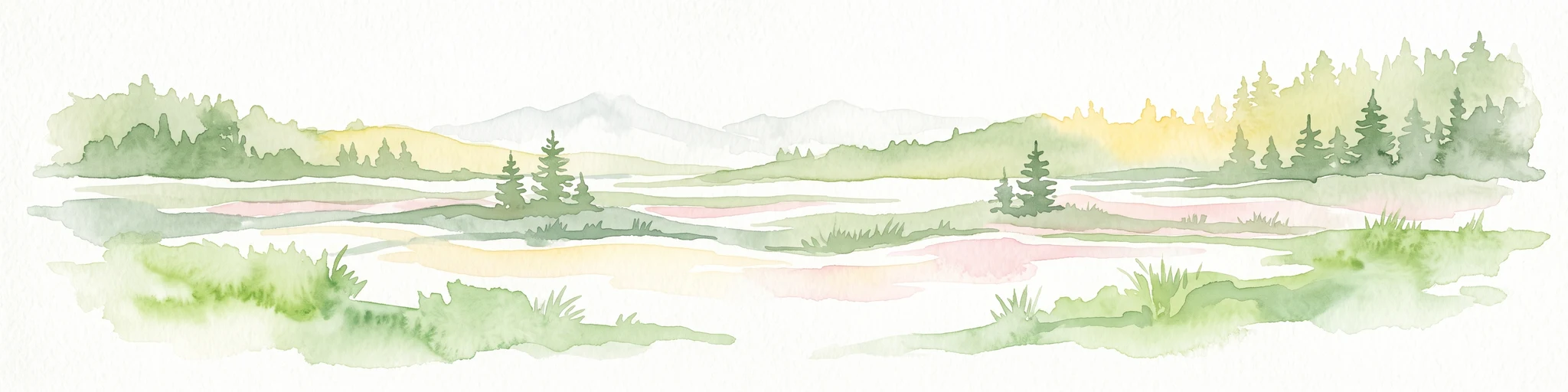
A horizontal watercolor illustration depicting a soft, atmospheric landscape with marshy ground, scattered evergreen trees, and distant hills.
Nature reserveLandkreis Oberallgäu
About 10 km away#2 closest

East

Schönleitenmoos im Wierlinger Forst Protected Nature Reserve and Allgäu Bog Landscape

Raised bog geography on the Rhine-Danube watershed in Germany.

Schönleitenmoos im Wierlinger Forst is a compact nature reserve characterized by its well-preserved raised bog sequence and post-glacial origins. This site in the Oberallgäu district is essential for studying peatland vegetation zones and the rare occurrence of the rust-leaved alpine rose outside the high Alps, offering a detailed perspective on Bavarian landscape formation.

Area
0.23 km²
Established
1960
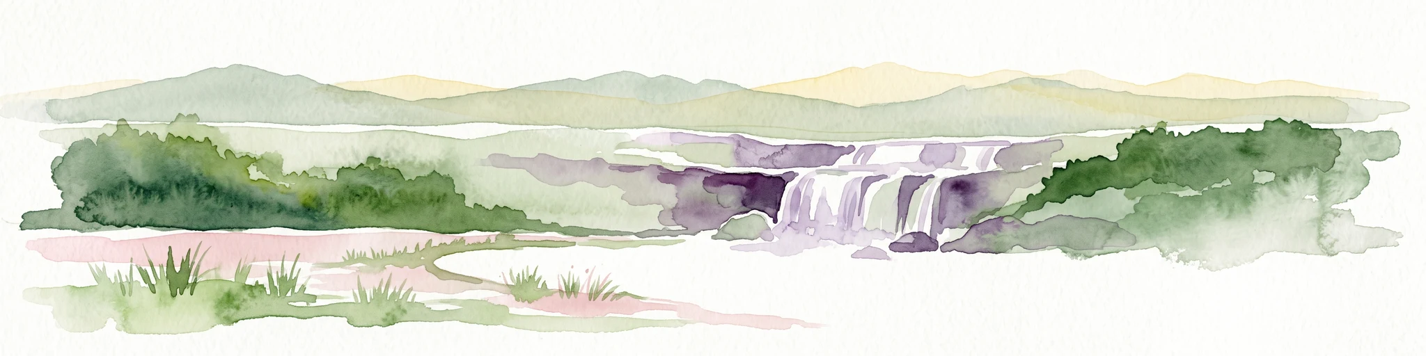
Watercolor illustration of a lush natural ravine with a small cascading waterfall, surrounded by green forest slopes and distant rolling hills.
Nature reserveBavaria
About 13 km away#3 closest

East

Rohrbachtobel im Wirlinger Forst Nature Reserve and Bavarian Pre-Alpine Forest Geography

Mapped protected gorge landscapes and molasse geology in the Oberallgäu district

Rohrbachtobel im Wirlinger Forst offers a unique look at small-scale protected landscapes in Germany. This nature reserve features a dramatic stream-cut gorge and serves as a natural habitat for diverse plant species, including European yew and multiple orchid varieties, within the wider context of the Bavarian pre-Alpine forest zone.

Area
0.14 km²
Established
1959
Relief
Upland
Scope
Terrestrial
Protected landscapeBaden-Württemberg
About 14 km away#4 closest

North

Uferbewuchs der Eschach Protected Landscape and Riparian Corridor Map

Riparian conservation within the Riß-Aitrach-Platten of Baden-Württemberg

Tracing the protected linear riparian corridors of the Eschach stream, this area is a significant example of urban-edge conservation in Germany. It maintains continuous stream-bank vegetation through the Leutkirch municipal landscape, linking directly to broader floodplain habitats of the Aitrach river system through its glacial-plateau geographic setting.

Established
1953
IUCN
V
A soft, panoramic watercolor painting featuring green, rolling hills and a winding river or stream through a forested landscape against a bright, hazy sky.
Nature reserveBaden-Württemberg
15 km away#5 closest

Northwest

Altdorfer Wald Nature Reserve: Geographic Atlas and Protected Landscape Overview

Mire, spring, and forest ecosystems in Baden-Württemberg

The Altdorfer Wald nature reserve consolidates a significant network of watercourses, peatlands, and old-growth forest stands across the Upper Swabian Pre-Alpine hills. This protected area stands as a primary focal point for understanding the interplay between hydrological richness, calcareous deposits, and diverse temperate forest habitats within the regional geography of Baden-Württemberg.

Area
13.71 km²
Established
2019
Relief
Upland
Climate
Temperate
Nature reserveBavaria
About 20 km away#6 closest

South

Nagelfluhkette Nature Park: Mapping the Alpine Ridges and Conglomerate Landscapes

A cross-border nature reserve in the Bavarian Alps.

Nagelfluhkette Nature Park is defined by its dramatic vertical transitions and unique Nagelfluh conglomerate geology. This protected area connects valley wetlands like the Großer Alpsee with steep mountain summits along the Hochgrat ridge. The region serves as an essential example of integrated conservation, linking forests, high-altitude moorlands, and traditional alpine agricultural landscapes across the Bavarian and Vorarlberg border.

Area
480 km²
Established
2008
Relief
Mountain
Climate
Alpine
A soft watercolor painting of a rolling landscape featuring a winding river, grassy plains, and distant hills in muted green, pink, and yellow tones.
Protected landscapeBodenseekreis
About 22 km away#7 closest

West

Spätwürmeiszeitliche Terrassen zwischen Burnau, Prestenberg, Vorderreute, Buch und Krumbach Geography

A protected landscape site in the Bodenseekreis district

Spätwürmeiszeitliche Terrassen zwischen Burnau, Prestenberg, Vorderreute, Buch und Krumbach is defined by its series of level river terraces resulting from Würm ice age glacial retreat. Spanning roughly 22 hectares near the Schwarzach river, the site remains a vital example of fluvioglacial geomorphology and regional landscape preservation within the pre-Alpine foreland.

Area
0.22 km²
Established
1963
Relief
Upland
Climate
Temperate
Protected landscapeBaden-Württemberg
About 28 km away#8 closest

West

Tettnanger Wald mit Hochwacht, Krüntenbühl, Reichenbühl, Argenhardter Kopf, Schoos und Steilrand des Argentales an dem Schwandenbogen: Geography and Protected Boundaries

A Glacial Landscape Protection Area in the Lake Constance Basin

This protected landscape in Baden-Württemberg captures a classic moraine terrain shaped by glacial retreat. With its system of ridges, dead-ice hollows, and escarpments along the Argen valley, the area serves as a critical geological reference point. Explore the detailed topography and mapped boundaries of this forest landscape within the broader Bodenseebecken region.

Area
7.01 km²
Established
1954

Common questions about visiting, size, designation, and location context for Bodenmöser und Hengelesweiher

Bodenmöser und Hengelesweiher FAQs for park facts, access, geography, and protected area context

Find quick answers about Bodenmöser und Hengelesweiher, including protected-area facts, park geography, trail and visitor context, and how the park fits into its surrounding country and regional landscape.
MoriAtlas Explorer

Continue Your Protected Areas Search Across the Global Atlas

Deepen your exploration by continuing the structured search for national parks and protected areas worldwide. Utilize the comprehensive filtering capabilities to compare different conservation landscapes and refine your understanding of global park geography. Discover more about the distribution and characteristics of protected natural areas.

Global natural geography