

Mori Atlas logo
Nature reserveBoginderra Hills Nature Reserve

Geographic atlas of the Nurraburra Hills complex and unique native woodland mosaic habitats.

Boginderra Hills Nature Reserve: A Protected Granite Woodland Landscape in New South Wales

Boginderra Hills Nature Reserve serves as a vital ecological anchor within the Riverina landscape of New South Wales, preserving a robust expanse of eucalypt and cypress pine woodland. This protected area centers on an ancient granite ridge that rises above the surrounding plains, providing a critical refuge for diverse native flora and threatened woodland bird species. By studying the reserve's mapped boundaries and complex terrain, one gains deeper insight into the conservation of inland Australian ecosystems.

strict nature reservegranite hillseucalypt woodlandcypress pinenative flora refugewoodland birds

Boginderra Hills Nature Reserve

Nature reserve

Park overview

Structured park overview, official facts, and landscape profile for Boginderra Hills Nature Reserve

Boginderra Hills Nature Reserve park facts, protected area profile, and essential visitor context

Review the core facts for Boginderra Hills Nature Reserve, including designation, size, terrain, visitor scale, habitats, and operating context in one park-focused overview.

About Boginderra Hills Nature Reserve

Boginderra Hills Nature Reserve is a compact but ecologically significant protected area in the south-west slopes and Riverina transition zone of New South Wales. It preserves the main ridge of the Boginderra Hills within the larger Nurraburra Hills system, a cluster of low granite rises that stand out against the surrounding flat, largely agricultural country north of Temora.

The reserve's forested character is central to its identity. Because the rocky terrain was unsuitable for cropping and only lightly used for grazing, much of the original woodland cover survived in a region where most of the lowland plains have been cleared. The result is a relatively continuous block of habitat that supports plant communities ranging from creekline eucalypts such as tumbledown red gum and red stringybark, through tick bush and drooping sheoak on the drier slopes, to Dwyer's red gum, black cypress pine and currawang on the rockiest exposures.

Management by the NSW National Parks and Wildlife Service follows the strict nature reserve model. There are no constructed walking trails, picnic areas or developed visitor infrastructure within the reserve, and the managing authority has indicated that none will be built. This approach reflects both the small size of the area and a deliberate choice to minimise disturbance to flora, fauna and the geological features of the hills themselves.

For visitors and researchers, the reserve offers a snapshot of what much of the Riverina woodland once looked like and a refuge for wildlife that has retreated from cleared farmland. Its combination of distinctive geology, intact plant communities and a policy of minimal intervention makes it a useful example of high-protection conservation in a working agricultural landscape.

Quick facts and research context for Boginderra Hills Nature Reserve

Boginderra Hills Nature Reserve sits in the Riverina region of New South Wales, north of Temora, and is managed by the NSW National Parks and Wildlife Service. It is classified as a strict nature reserve under IUCN Category Ia, the highest level of protection, reflecting an emphasis on minimal disturbance and ecological preservation.

The reserve covers roughly 756 hectares of forested granite hill country that was progressively protected through purchases beginning in 1982 and expanded in 2005 with adjacent hill land. Despite its compact size, the park conserves a continuous block of woodland in a regional landscape otherwise dominated by cleared agricultural land.

Protection and recognition

Examine documented terrestrial protection metrics and official designation scope

Boginderra Hills Nature Reserve Protection Status and Governance Data

Boginderra Hills Nature Reserve maintains a documented terrestrial protection scope within the regional conservation network. Structured conservation metrics outline the recorded administrative status and international recognition data for this protected area.

Protection details

Protection scope
Terrestrial
Transboundary protection
No
Park context

Deeper park guide and search-rich context for Boginderra Hills Nature Reserve

Boginderra Hills Nature Reserve history, landscape, wildlife, and travel context

Explore Boginderra Hills Nature Reserve through its history, landscape character, ecosystems, wildlife, conservation priorities, cultural context, and seasonal travel timing in a structured park guide built for atlas discovery and search intent.

Why Boginderra Hills Nature Reserve stands out

Boginderra Hills Nature Reserve is best known for its protected patch of intact eucalypt and cypress pine woodland growing on ancient granite hills in an otherwise heavily cleared agricultural landscape. The reserve's vegetation pattern, shaped by soil depth, rockiness and slope aspect, produces a mosaic of distinct plant communities, from creekline gums to rock-loving species such as Dwyer's red gum and black cypress pine. It is also recognised for the threatened woodland birds that depend on this habitat, including the turquoise parrot, speckled warbler, brown treecreeper and grey-crowned babbler. Its long-term protection as a strict nature reserve, with no constructed trails or visitor facilities, gives the park a reputation for quiet, low-impact ecological preservation rather than tourism development.

Boginderra Hills Nature Reserve history and protected-area timeline

The reserve was established in 1982, when the NSW Parks and Wildlife Service purchased 551 hectares of mainly forested granite hill country. The purchase recognised the conservation value of the Boginderra Hills in a region where surrounding lowlands had been heavily modified for cropping and grazing.

In August 2005, an additional 205 hectares of adjacent hill country with similar character were acquired and incorporated into the reserve, bringing the protected area to its current size. The expansion consolidated protection across connected ridges of the Nurraburra Hills system rather than fragmenting it across isolated parcels.

Prior to reservation, the land had been used for livestock grazing; the rocky terrain made cropping impractical and prevented substantial clearing of the hill itself. The area also contains a trigonometric station named Nurraburra, established by the Central Mapping Authority during earlier survey work. Since the reserve was declared, public use has been limited to low-key recreation, with an explicit management policy of avoiding the construction of trails or visitor facilities to minimise ecological impact.

Boginderra Hills Nature Reserve landscape and geographic character

The landscape of Boginderra Hills Nature Reserve is defined by a pronounced ridge of granite hills set within a much flatter regional context. The hills form the main spine of the Nurraburra Hills complex and rise to approximately 494 metres above sea level at their highest point, providing a localised high point in the surrounding plains.

The hills are composed of Boginderra granite, a rock type formed deep within the Earth from slowly cooling magma bodies known as plutons that were later uplifted to their present positions. This geological origin dates back roughly 370 million years to the Late Devonian period, making the bedrock itself an ancient feature of the regional geology. Chemical analysis of the Nurraburra Hills granite indicates a silica-rich composition of around 77 percent silicon dioxide and 11 percent aluminium oxide, alongside a range of other metal oxides. Drilling in other hills of the same complex has detected traces of rare earth elements, though not in commercially viable quantities, and the Boginderra Hills themselves remain unsurveyed for mineral resources.

At the surface level, the landscape is shaped by shallow soils, exposed rock and erosion patterns that have strongly influenced vegetation distribution. Steeper, rockier slopes support hardier woodland species, while creeklines and pockets of deeper soil retain taller forest communities. A trigonometric station on the ridge attests to the prominence of the hills in earlier surveying of inland New South Wales.

Boginderra Hills Nature Reserve ecosystems, habitats, and plant life

The reserve's ecological character is anchored in woodland communities typical of inland New South Wales but increasingly rare at the local scale. The vegetation reflects a careful adjustment of plant species to soil depth, moisture and rockiness, which together produce a layered mosaic across the hills.

In sheltered creeklines and deeper soils, taller eucalypts such as tumbledown red gum and red stringybark dominate, forming the most forest-like part of the reserve. Drier slopes with shallower soil carry tick bush and drooping sheoak, while rocky ridges and exposed aspects support drought-tolerant species such as Dwyer's red gum, black cypress pine and currawang. The north-east of the reserve, where conditions are slightly more mesic, supports white box and yellow box, broad-canopied eucalypts that historically characterised large areas of the Riverina and adjoining slopes.

Kurrajong trees are scattered through the reserve, adding structural variety to the canopy. Two plant species of particular conservation significance, the small blue-flowering annual Brunonia australis and the perennial herb Mitrasacme paradoxa, occur within the protected area, underlining the importance of the habitat mosaic for less conspicuous native flora.

Boginderra Hills Nature Reserve wildlife and species highlights

The reserve supports a diverse but incompletely documented fauna, with mammals, reptiles, amphibians and birds all present across the protected hills. So far, no targeted survey has been undertaken for bats or small ground mammals, so the recorded mammal list reflects only larger, more easily observed species.

Documented mammals include short-beaked echidna, common brushtail possum, eastern grey kangaroo, swamp wallaby and red-necked wallaby, indicating that the woodland provides forage and shelter for a mix of arboreal, grazing and ground-dwelling native species. The reptile and amphibian community includes southern shiny-tailed gecko, tree dtella, thick-tailed gecko, nobbi lashtail, tree-crevice skink, and shiny-palmed shining skink, a typical set of species for rocky eucalypt woodland with exfoliating bark and abundant shelter sites.

Birdlife is a particular strength of the reserve. At least 65 bird species have been observed within its boundaries, with a further 69 recorded in surrounding areas and likely to occur on the hills as well. Among the species recorded are several of conservation concern, including turquoise parrot, speckled warbler, brown treecreeper and the eastern subspecies of the grey-crowned babbler, all of which depend on structurally diverse woodland and have declined across much of their former range in inland eastern Australia.

Boginderra Hills Nature Reserve conservation status and protection priorities

As an IUCN Category Ia strict nature reserve, Boginderra Hills Nature Reserve is managed primarily for ecological preservation rather than recreation, which places it at the more restrictive end of protected-area categories. This designation recognises both the conservation value of the habitat and a deliberate policy of limiting human intervention.

In a regional context, the reserve's significance is amplified by the extent of habitat loss around it. The surrounding Riverina plains have been extensively cleared for cropping and pasture, so the remaining forested hills function as a refuge block for woodland-dependent species. Protecting this habitat directly benefits threatened woodland birds such as turquoise parrot, speckled warbler, brown treecreeper and grey-crowned babbler, which would otherwise have very limited secure habitat in the locality.

The reserve also plays a role in safeguarding less conspicuous native flora, including two species of conservation interest, Brunonia australis and Mitrasacme paradoxa. The absence of trails, facilities or planned visitor infrastructure reflects a management approach that prioritises the integrity of these ecological values over public access or tourism development, and represents a long-term conservation investment in a relatively small but ecologically important landscape.

Boginderra Hills Nature Reserve cultural meaning and human context

The cultural record for Boginderra Hills Nature Reserve is limited but suggestive. Like many of the surrounding hill areas, the Boginderra Hills may have seen light use by Aboriginal Australians for various purposes (though direct evidence has yet to be confirmed). The reserve itself does not contain documented sites of strong cultural significance on the publicly available record, and its current management focus is ecological rather than cultural interpretation.

In the more recent past, the terrain was used for livestock grazing before the reserve was declared. The rocky, hilly ground made cropping impractical, which in turn preserved much of the natural vegetation that now forms the basis of the reserve's conservation value. A trigonometric station named Nurraburra, established by the Central Mapping Authority, marks the ridge as a landmark used in the broader survey history of inland New South Wales.

Top sights and standout views in Boginderra Hills Nature Reserve

Boginderra Hills Nature Reserve offers an unusually intact window into the woodland landscapes that once covered much of the Riverina and surrounding slopes, now preserved in a compact, strictly managed reserve. Its mosaic of eucalypt, cypress pine and acacia communities, structured by soil depth and slope aspect, gives the park a richly layered botanical character despite its modest size.

Wildlife observation is a notable draw for the area, particularly for birdwatchers interested in threatened woodland species such as turquoise parrot, speckled warbler, brown treecreeper and grey-crowned babbler. The reserve's policy of providing no constructed trails or visitor facilities means any visit requires self-sufficiency and low-impact practice, but it also preserves the area as a quiet ecological refuge with minimal disturbance.

Best time to visit Boginderra Hills Nature Reserve

The reserve's woodland character can be appreciated year-round, but cooler months from autumn through spring are generally the most comfortable for walking and observation. Spring typically brings the most active birdlife and flowering displays among native shrubs and ground covers, while autumn offers milder temperatures and stable walking conditions.

Summer in inland New South Wales can be very hot and dry, with exposed granite ridges offering little shade, so visits during the cooler parts of the day are advisable if travelling in warmer months. Because the reserve has no formal trails or facilities, visitors should plan around daylight hours and seasonal weather rather than around any structured visitor program.
Monthly climate preview

Long-term monthly temperature averages and precipitation patterns for New South Wales

Boginderra Hills Nature Reserve Climate Normals and Annual Temperature Rhythm

Boginderra Hills Nature Reserve exhibits a measured annual temperature range alongside consistent monthly precipitation values recorded at a representative local coordinate. Examining the complete twelve-month climatology provides deeper insight into long-term meteorological normals across the protected landscape.
Annual mean16 °C
8 °C26 °C
Jan26°
Feb25°
Mar21°
Apr16°
May12°
Jun
Jul
Aug
Sep12°
Oct16°
Nov20°
Dec23°
Warmest month
January

25.8 °C

Coolest month
July

7.5 °C

Wettest month
November

1.8 mm/day

Driest month
April

0.9 mm/day

Park location guide

Geography guide, regional context, and park location map for Boginderra Hills Nature Reserve

Boginderra Hills Nature Reserve park geography, regions, and map view in Australia

Understand where Boginderra Hills Nature Reserve sits in Australia through a broader geographic reading of the surrounding landscape, nearby location context, and its mapped position within the national park landscape.

How Boginderra Hills Nature Reserve fits into Australia

Australia is a constitutional monarchy and federal parliamentary democracy comprising six states and ten territories. With a population of nearly 28 million, it is one of the world's most urbanised countries, with most people concentrated on the eastern seaboard. The country has a high Human Development Index and is known for its cultural diversity, ancient Aboriginal heritage, and unique wildlife.

Wider geography shaping Boginderra Hills Nature Reserve in Australia

Australia occupies the entire Australian continent, the island of Tasmania, and numerous smaller islands. It is the world's flattest and driest inhabited continent, featuring vast deserts in the interior (the Outback), tropical rainforests along the eastern coast, and a coastline bordering the Indian and Pacific Oceans.

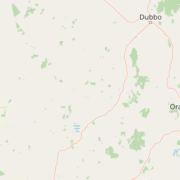
Map view of Boginderra Hills Nature Reserve

Use this park location map to pinpoint Boginderra Hills Nature Reserve in Australia, understand its exact geographic position, and read its mapped placement within the surrounding landscape more clearly.

Pigeon | © OpenStreetMap contributors

Location context for Boginderra Hills Nature Reserve

New South Wales
Park atlas

Compare adjacent woodland reserves and regional protected landscapes across New South Wales.

Explore Parks Near Boginderra Hills Nature Reserve and Surrounding Protected Areas

Visitors exploring Boginderra Hills Nature Reserve can browse nearby protected areas and adjacent woodland reserves to examine regional conservation patterns. Extending the geographic review reveals connected natural habitats and related park environments across the surrounding plains.
Nature reserveNew South Wales
About 35 km away#1 closest

Southwest

Ingalba, Big Bush and Pucawan Nature Reserves: Regional Geography and Protected Woodland Map

Inland New South Wales conservation complex within the Lachlan Fold Belt

These three nature reserves function as one of the most substantial surviving remnants of mugga ironbark and western grey box woodland in southern inland New South Wales. Located west of Temora, the reserves protect forty-nine square kilometres of distinct woodland and dry heathland communities that provide essential habitat corridors across a heavily cleared agricultural region. The mapping highlights the unique topography and geological variety that sustains this protected landscape.

Area
49.27 km²
IUCN
Ia
Relief
Upland
Climate
Temperate
Watercolor depiction of a river, trees, and rolling hills in a landscape
National parkNew South Wales
About 46 km away#2 closest

Southeast

Jindalee National Park: New South Wales National Park Protecting Cypress Pine Woodlands

Explore unique mapped terrain and regional conservation landscape.

Jindalee National Park represents a vital conservation effort in New South Wales, safeguarding remaining cypress pine woodlands and Critically Endangered grassy woodland ecosystems. Situated in the South West Slopes region, its undulating terrain and drainage lines form a distinctive natural landscape. The park's designation as a national park underscores its importance for preserving threatened species habitats and offers a focused point for atlas-driven discovery of its unique protected-area character and geographic context.

Area
10.76 km²
Established
2011
IUCN
II
Relief
Lowland
National parkNew South Wales
About 46 km away#3 closest

Northeast

Weddin Mountains National Park: National Park Mapping and Geographic Context

Discover mapped protected landscape boundaries in New South Wales.

Weddin Mountains National Park represents a key protected area within New South Wales, Australia, offering a focused lens for geographic exploration. This detail page provides access to the park's specific mapped boundaries and its role as a national park. Understand the surrounding regional geography and the protected landscape's identity through a detailed atlas perspective, ideal for mapping conservation areas.

Area
83.61 km²
Established
1971
IUCN
II
Relief
Mountain
Nature reserveNew South Wales
About 55 km away#4 closest

Northwest

Charcoal Tank Nature Reserve: Mapped Protected Landscapes and Regional Geography in New South Wales

Critical mallee-broombush woodland and avian refuge in a fragmented agricultural corridor

Charcoal Tank Nature Reserve stands as a vital 86-hectare protected site in central western New South Wales, preserving rare mallee and mallee-broombush woodland that has been largely cleared elsewhere. This documentation maps the reserve's unique position within the regional agricultural matrix, detailing its significance as an long-studied avian habitat and a sanctuary for native species struggling in a fragmented, semi-arid environment.

Area
0.86 km²
Established
1966
IUCN
Ia
Relief
Lowland
Nature reserveNew South Wales
About 66 km away#5 closest

Southeast

Ulandra Nature Reserve: Atlas Overview, Mapped Terrain, and Regional Protected Landscapes

Woodland conservation in the New South Wales Riverina fringe

Ulandra Nature Reserve serves as a vital sanctuary for the Cootamundra wattle and native woodland communities within a highly modified agricultural landscape. The reserve protects the rugged slopes of the Ulandra Range and the catchment of Merrybundinah Creek, offering a clear window into the natural forest geography of southeastern Australia.

Area
39.3 km²
Established
1981
IUCN
Ia
Relief
Upland
National parkNew South Wales
About 77 km away#6 closest

Northeast

Conimbla National Park: Protected Landscape Atlas and Regional Geography

Mapped boundaries and terrain within New South Wales.

Examine the protected landscape of Conimbla National Park, a designated national park situated in New South Wales, Australia. This entry provides focused geographic context, detailing its mapped boundaries and the regional terrain. It serves as a valuable resource for understanding the park's identity within the national atlas and its specific place in the Australian landscape.

Area
84.71 km²
Established
1980
IUCN
II
Relief
Upland
Nature reserveNew South Wales
About 116 km away#7 closest

Southeast

Burrinjuck Nature Reserve: Protected Inland Forest Geography and Conservation Mapping

Diverse eucalypt forest mosaic in the south west slopes of New South Wales

Located within the south west slopes of New South Wales, Burrinjuck Nature Reserve is a significant protected landscape known for its remarkably high diversity of forest types in a compact area. From moist grass forests to heathy woodlands, the reserve provides critical habitat for threatened plant populations and an unusually rich variety of woodland birds. Its terrain offers a glimpse into the ecological complexity of inland Australian catchments and ridge systems.

Area
52.5 km²
Established
1984
IUCN
Ia
Relief
Upland
National parkNew South Wales
About 117 km away#8 closest

Northeast

Nangar National Park: Australian National Park Geography and Mapped Boundaries

Explore the protected landscape within New South Wales.

Nangar National Park is a key protected area situated in New South Wales, Australia, offering a valuable point for geographic discovery. This page details its status as a national park, providing insight into its mapped boundaries and its role within the regional landscape. Users can utilize this information to understand the park's specific geographic context and its contribution to the broader atlas of Australia's protected lands.

Area
94 km²
Established
1983
IUCN
II
Relief
Mountain

Common questions about visiting, size, designation, and location context for Boginderra Hills Nature Reserve

Boginderra Hills Nature Reserve FAQs for park facts, access, geography, and protected area context

Find quick answers about Boginderra Hills Nature Reserve, including protected-area facts, park geography, trail and visitor context, and how the park fits into its surrounding country and regional landscape.
MoriAtlas Explorer

Continue Your Protected Areas Search Across the Global Atlas

Deepen your exploration by continuing the structured search for national parks and protected areas worldwide. Utilize the comprehensive filtering capabilities to compare different conservation landscapes and refine your understanding of global park geography. Discover more about the distribution and characteristics of protected natural areas.

Global natural geography