
Why Brabrand Sø stands out
Brabrand Sø is best known for being a rare intact lowland lake and wetland complex pressed directly against one of Denmark's larger cities, where glacial origin, urban proximity, and ecological recovery efforts combine into a single landscape. Its reed beds, wet meadows, and grazed shorelines offer refuge to a wide range of waterbirds, including several species that are nationally rare or red-listed in Denmark. The lake is also closely tied to the Aarhus Å corridor, which links it to the inner city and historically allowed boat passage between the urban center and the surrounding countryside. Together, these traits position Brabrand Sø as a notable example of how a peri-urban Danish lake can be managed simultaneously for biodiversity, drinking-water protection, and public recreation.
Brabrand Sø history and protected-area timeline
The history of Brabrand Sø is deeply intertwined with the geological and cultural development of the Aarhus Ådal. After the last ice age, retreating ice left a deep east-west tunnel valley, which was initially flooded by the sea, creating a brackish fjord connected to the Aarhus Bight. Over thousands of years, gradual land uplift and the accumulation of sediment in the basin converted this fjord into an increasingly enclosed freshwater lake. This natural history is reflected in local folklore, which attributes the striking lakes of the area, including Brabrand Sø, Lading Sø, and Geding Sø, to a mythical clash of giants wielding giant clubs from Hasle Høj and Borum Eshøj.
Humans have lived along the shores of Brabrand Sø for an estimated 6,000 to 7,000 years. The eastern end of the lake, around what is now the Rugholm allotment garden area, has been a particularly rich source of archaeological material. Scientific excavations began as early as 1903 with the so-called Brabrand find, followed by additional work in 1944, and the area continues to yield new finds. Stone Age material from the Ertebølle culture has been recovered near Rugholm and at the Søvangen allotment garden area, alongside seven additional sites around Høskoven, and an important new discovery was made as recently as March 2012 at Eskelunden, during work on a new concert venue. Bronze Age and Stone Age finds have also surfaced on the northern side of the lake's western end in the Laskedalen area, recorded in 2003.
The modern conservation history of the site began in 1959, when public environmental work was first initiated to safeguard the visual and recreational value of the area. The same year, the entire zone around Brabrand Sø received formal landscape protection, ensuring that no new buildings or tree plantings could obstruct views from the new Brabrandstien path. This first protection order was later expanded to include the areas around Årslev Engsø and the broader Aarhus Ådal.
From the late twentieth century onward, the lake became the focus of an extensive and sometimes difficult program of environmental restoration. Centuries of sedimentation, combined with nutrient runoff from agriculture, untreated wastewater from local businesses and housing areas via Døde Å, and the regulation of Aarhus Å, had made the lake very shallow and highly eutrophic. Projects undertaken over decades have included restoring meanders in Aarhus Å upstream of the lake, pumping out phosphorus- and nitrate-rich sediment, planting willow to absorb nutrients, removing agricultural plots near the lake, expanding wastewater treatment, and creating the adjacent Årslev Engsø to act as a purification and buffer wetland. The most recently completed major project involved an extensive upgrade of wastewater treatment at Aarhus Vand, with a budget of around 340 million kroner, signaling the continued scale of investment in the lake's environmental recovery.
Brabrand Sø landscape and geographic character
The landscape of Brabrand Sø is defined by a classic east-west glacial tunnel valley that opens the surrounding countryside visually and physically into the western edge of Aarhus. The lake itself is a long, narrow body of water lying on the valley floor, flanked by reed beds, wet meadows, and gently sloping banks. Its shallow basin, with a maximum depth of only about 2.7 meters, gives the lake a broad, open character, while the surrounding terrain is shaped less by dramatic relief than by subtle transitions between open water, marshy margins, and grazed pasture.
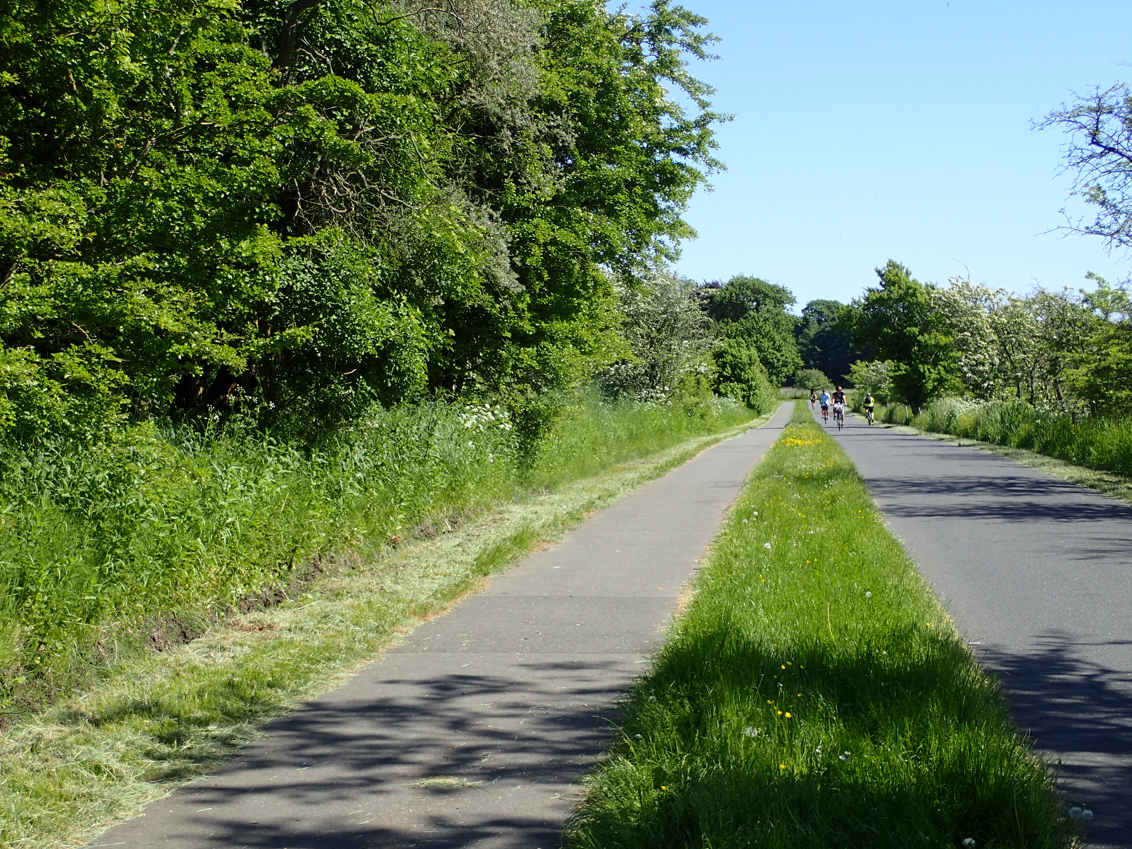
Beyond the immediate shoreline, the lake is part of a continuous valley system stretching west toward Årslev Engsø and eastward through Aarhus Å toward the city center. On both sides of the lake, open meadows intermix with small woodlands and allotment garden areas (haveforeninger), and grazing livestock help maintain a characteristic patchwork of closely cropped grassland along the banks. The valley functions as a long green wedge slicing into the urban fabric of Aarhus, which is why the Brabrandstien, a roughly 10-kilometer looping path along the lakeshore, has become such an important recreational feature for the city.
The vistas from the lake are uncommonly broad for an urban waterbody. From the elevated ground near Brabrand Kirke on the north side, the lake and the entire valley unfold in a single sweeping panorama, while from the western end the view is of gradually narrowing meadows giving way to the more enclosed Årslev Engsø. Together, these features give Brabrand Sø a sense of openness and rural calm that is unexpected so close to a sizeable Danish city.
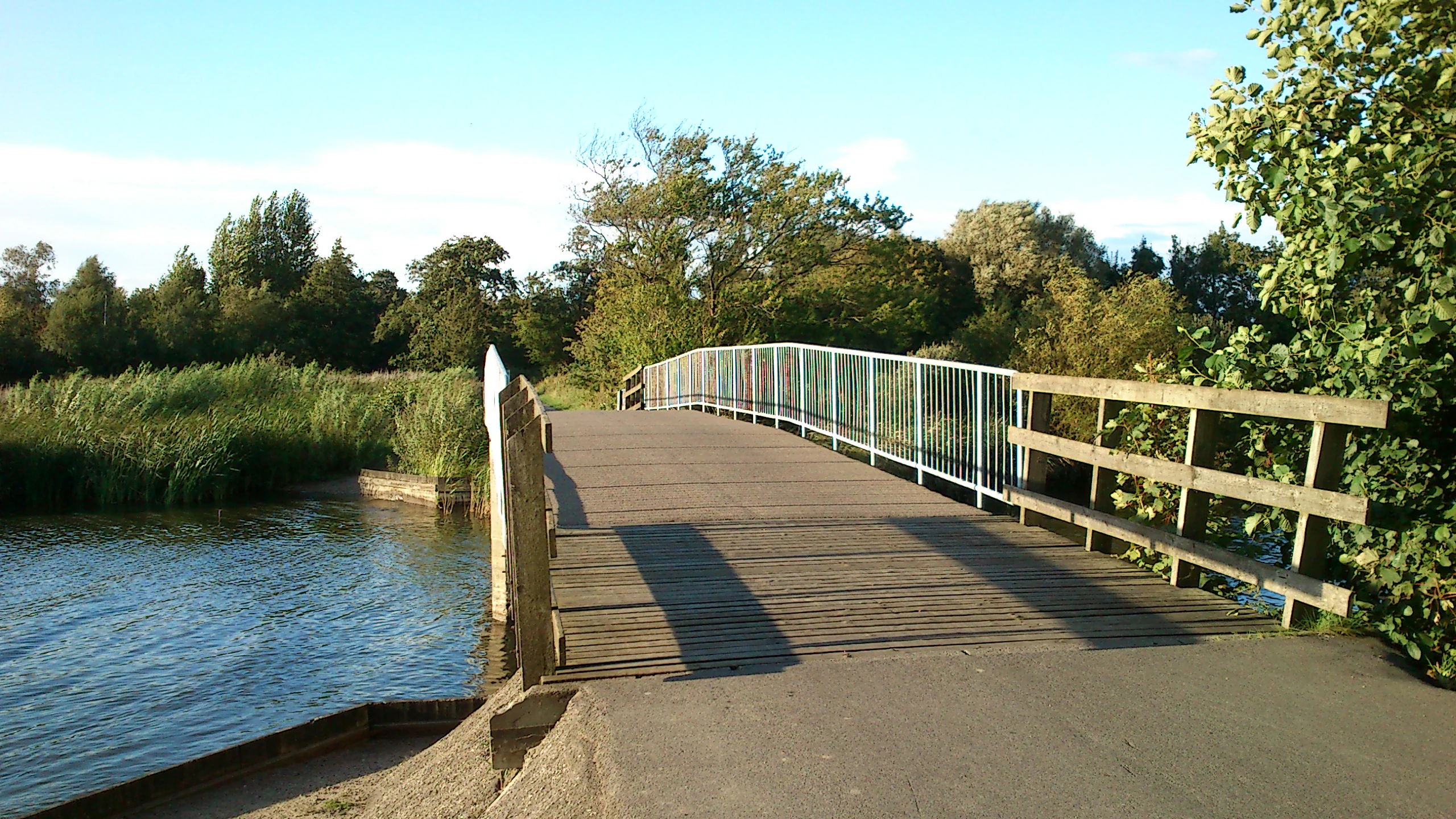
Brabrand Sø ecosystems, habitats, and plant life
Ecologically, Brabrand Sø sits at the intersection of open freshwater habitat, extensive reed beds, and species-rich wet meadows, a combination that has become rare in Denmark after centuries of drainage, reclamation, and intensification. The lake's shallow depth, nutrient-rich sediments, and sheltered valley position allow dense stands of emergent and aquatic vegetation to thrive around its margins, supporting both common wetland flora and nationally uncommon species.
The wet meadows surrounding the lake are characterized as rigkær, a fen-meadow habitat associated with naturally base-rich groundwater seepage and high plant diversity. This habitat has been heavily reduced across Denmark and is now considered a threatened landscape type, which is one of the reasons the area around Brabrand Sø and Årslev Engsø is designated as a Natura 2000 site and an EU Habitats Directive area. Among the plant species recorded at the lake are rare legumes of the flat-pea group, including knold-fladbælg and kær-fladbælg, both of which are scarce or relatively scarce in a Danish context.
The lake also plays host to a community of aquatic invertebrates, dragonflies, and other wetland-dependent species whose presence reflects the relative health of the reed beds and shallow margins. The green mosaic dragonfly, classified as near-threatened in Denmark and protected under Annex IV of the EU Habitats Directive since 1992, is among the more notable invertebrate inhabitants. Pond bats, a bat species that is endangered in Western Europe and protected under Natura 2000 (Plan 233), also maintain a population in the area, using the lake and its fringing habitats as part of their feeding and roosting range.
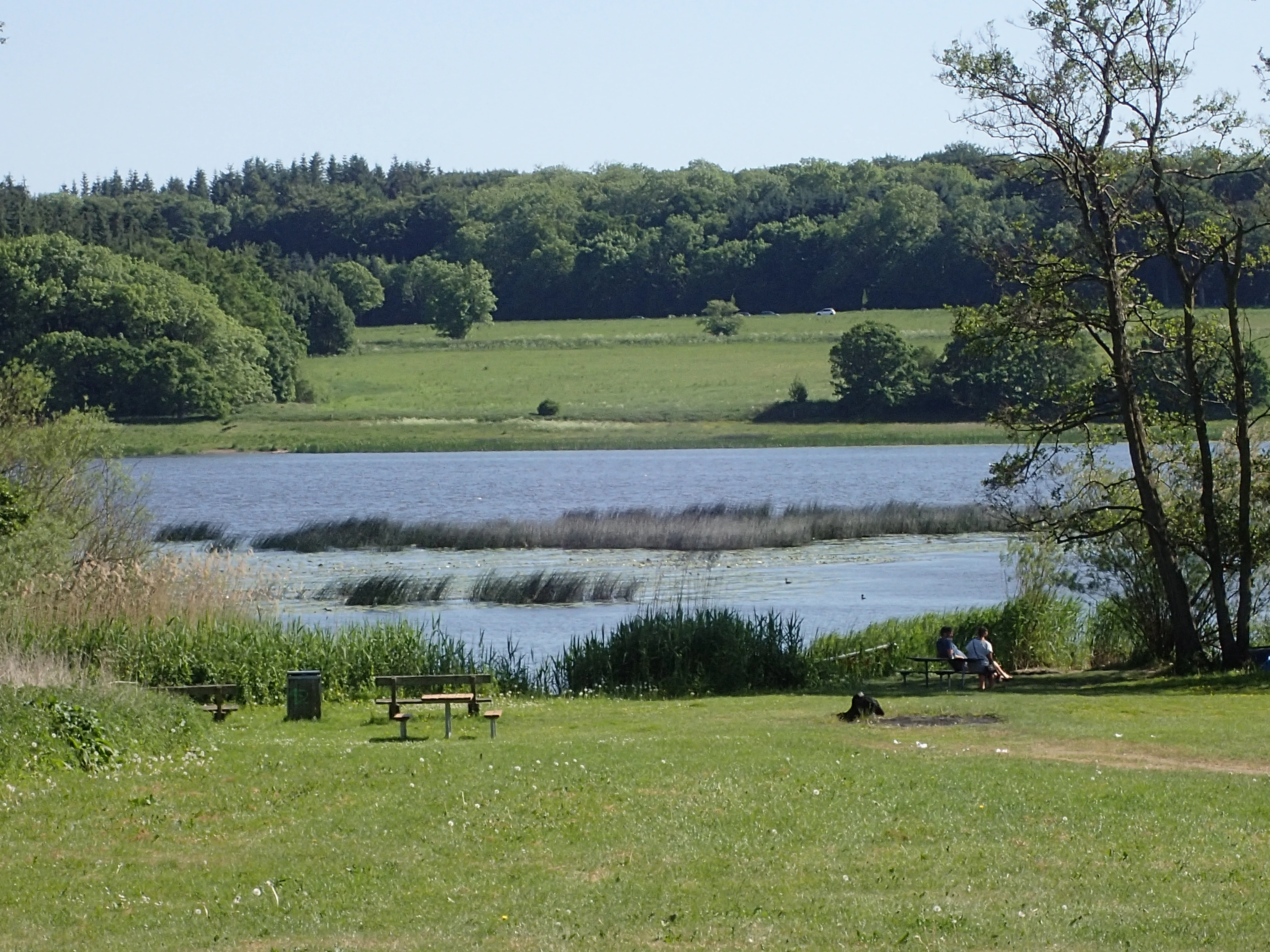
Brabrand Sø wildlife and species highlights
Brabrand Sø is widely recognized as one of the more important bird sites in the Aarhus region, functioning as both a wintering ground and a migratory stopover for a wide variety of waterbirds, waders, and reedbed specialists. Its combination of open water, dense reeds, and surrounding wet meadows creates a layered habitat structure that supports different species throughout the year, from overwintering ducks and coots to spring and autumn passage migrants.
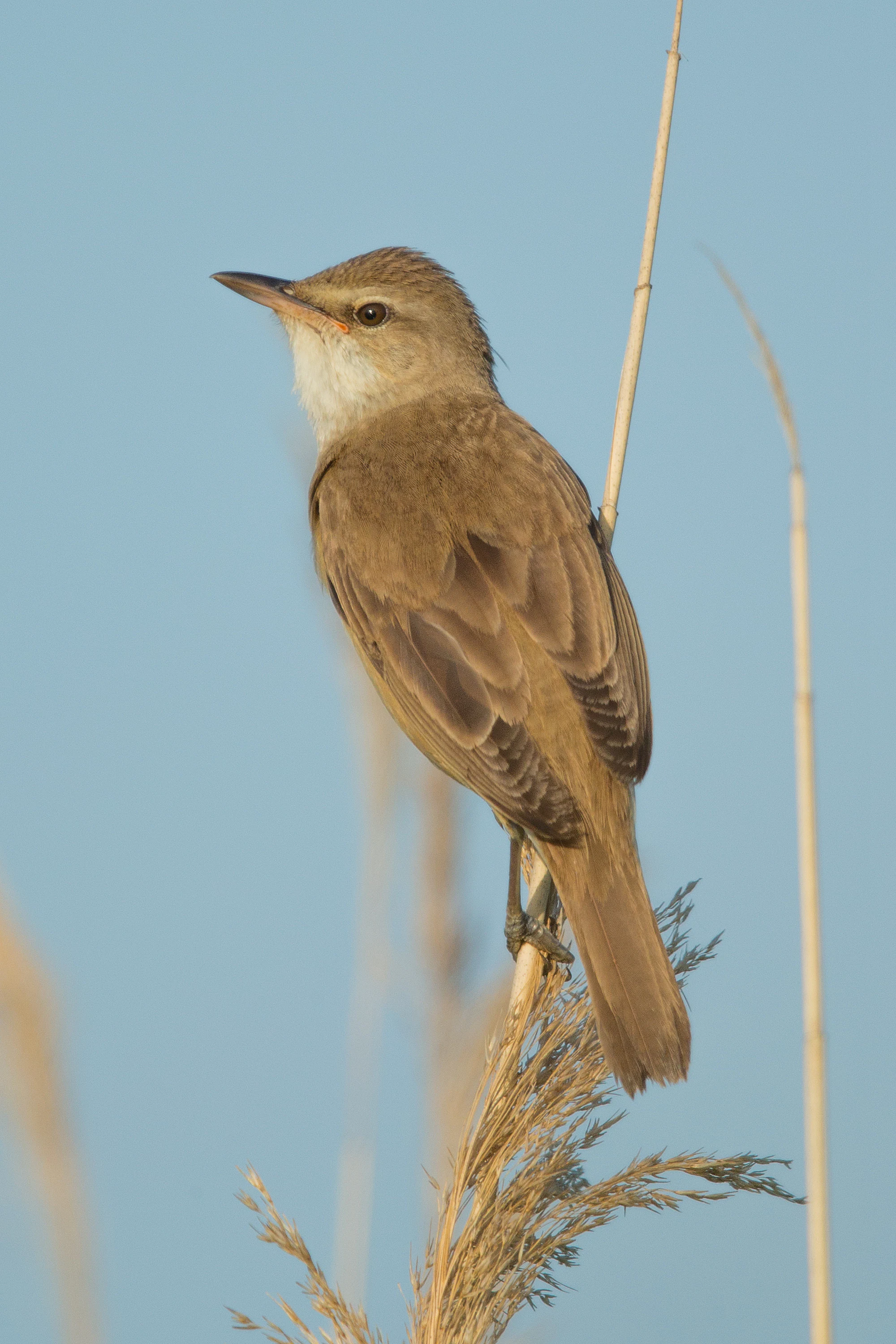
Among more uncommon visitors, several nationally rare or red-listed species have been recorded at the lake. The spoonbill has been observed here on multiple occasions, a notable occurrence given its vulnerable status and relative rarity in Denmark. The southern nightingale has also been recorded, adding a marginal but distinctive passerine presence, while the great reed warbler, classified as endangered among Danish breeding birds, is established in the lake's reedbeds. The spotted crake, classified as near-threatened at the national level, has likewise been recorded in the area.
Beyond these rarer species, the lake is also a stronghold for many of the more common waterbirds and reedbed inhabitants typical of Danish lowland lakes. Sightings of common dabbling and diving ducks, herons, gulls, and terns are routine, and the lake's ponds and wet meadows support a diverse assemblage of amphibians and insects that in turn sustain the local bat population, including the protected pond bat. The result is a layered wildlife profile that ranges from charismatic breeding birds of the reed margins to less conspicuous invertebrates and mammals around the water's edge.
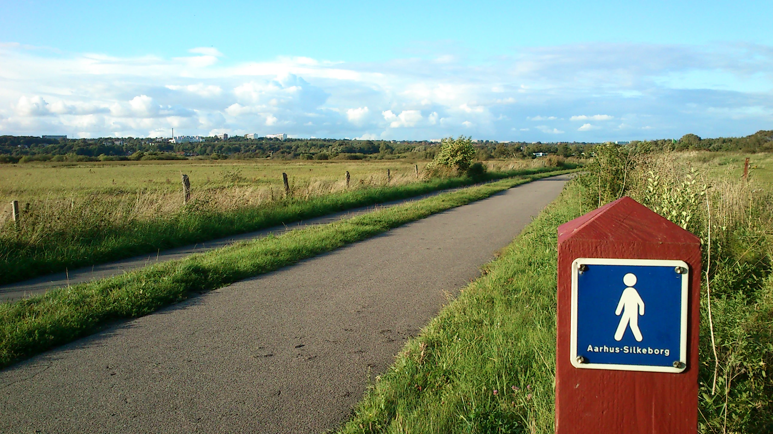
Brabrand Sø conservation status and protection priorities
Conservation is central to the identity of Brabrand Sø, both because the habitats it protects are nationally rare and because the area underpins critical drinking-water resources for the wider Aarhus region. The lake and its surrounding meadows are part of a Natura 2000 site (Plan 233), and the area is also a designated habitat area under the EU Habitats Directive, recognizing the importance of its rigkær meadows, reed beds, and other wetland features for European biodiversity.
The lake has been formally protected by landscape conservation order (fredning) since 1959, originally to preserve the views across the lake from the newly laid-out Brabrandstien path and to prevent new construction or plantings from obstructing that vista. Subsequent conservation orders expanded the protected zone to include the area around Årslev Engsø and the upper Aarhus Ådal, creating a continuous corridor of legally protected landscape.
Beyond the statutory framework, the lake has been the subject of an unusually intensive multi-decade program of environmental improvement. Significant pollution pressures, including nutrient runoff from agriculture, untreated wastewater from surrounding housing and businesses, and heavy sediment accumulation especially after Aarhus Å was channelized, triggered strong eutrophication that made management unavoidable. Response measures have included restoring meanders in Aarhus Å, dredging nutrient-rich sediment, planting willows to capture nutrients in the catchment, removing nearby agricultural plots, upgrading wastewater treatment, and creating Årslev Engsø as a buffer purification wetland. The most recently completed major project, a large-scale wastewater treatment upgrade at Aarhus Vand funded at around 340 million kroner, illustrates how seriously the relevant authorities continue to take the lake's water quality.
A key driver behind this effort is the role of Brabrand Sø in safeguarding groundwater. Drinking water for up to about 200,000 people in the Aarhus area is sourced from groundwater around the lake, including from the Stavtrup and Åbo waterworks. The long-term aspiration articulated by public authorities is to restore the historic rigkær conditions around the lake while eliminating the remaining sources of nutrient and pollutant input, securing both ecological recovery and continued safe drinking-water supply.
Brabrand Sø cultural meaning and human context
Brabrand Sø carries a long human history alongside its natural values. Archaeological evidence suggests sustained settlement along its shores for 6,000 to 7,000 years, making the lakeside one of the more continuously inhabited micro-regions in the Aarhus area. Stone Age material from the Ertebølle culture has been recovered at multiple sites around the eastern end of the lake, including at the Rugholm allotment garden area, the Søvangen allotment area, and around Høskoven, while Bronze Age finds have been made in the Laskedalen area on the north side of the western end. The 2012 Eskelunden discovery, made during construction of a new concert venue, illustrates how the area continues to contribute to understanding of prehistoric life in eastern Jutland.
The lake also holds a place in local folklore. According to tradition, Brabrand Sø was scooped out during a club fight between two giants standing on Hasle Høj and Borum Eshøj, with the same giants said to have created neighboring Lading Sø and Geding Sø. While clearly legendary, the tale reflects the striking visual impact that these lakes have had on local imagination.
In the modern era, the cultural role of the lake has shifted toward recreational and infrastructural uses. The Brabrandstien path, the Brabrand Rostadion rowing venue, and the connection via Aarhus Å to the city center and harbor all embed the lake in everyday Aarhus life. Municipal policy explicitly frames Brabrand Sø as a green amenity for residents, reinforcing the lake's identity as a place where natural heritage, recreation, and urban life overlap.
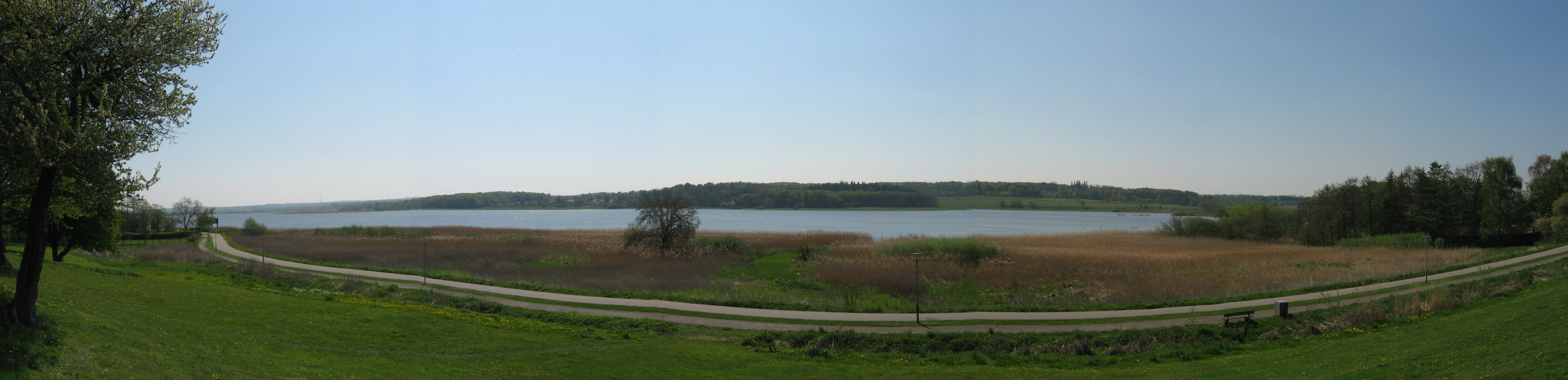
Top sights and standout views in Brabrand Sø
Brabrand Sø stands out for its combination of geological origin, ecological rarity, and closeness to one of Denmark's largest cities. Set in an ice-age tunnel valley that once opened as a fjord into the Aarhus Bight, the lake now offers a long, open, shallow waterbody framed by reed beds and grazed meadows, traversed by the popular Brabrandstien trail and used as a rowing venue by Aarhus's clubs.
Ecologically, the area is a nationally important refuge for waterbirds, including rare and red-listed species, and a stronghold for the threatened rigkær wetland habitat. Its formal status as a Natura 2000 site and EU habitat area, combined with decades of investment to restore water quality, situate it at the heart of Danish wetland conservation. The lake also underpins drinking-water supply for a substantial share of the Aarhus region, making it a rare example of a protected natural area that is simultaneously a significant piece of urban and infrastructure-related green infrastructure.
Best time to visit Brabrand Sø
Brabrand Sø has a year-round appeal, but each season emphasizes a different aspect of the area. In spring and early summer, the reed beds and meadows become especially active, with migratory waterbirds present, breeding birds such as the great reed warbler establishing territories, and wildflowers emerging in the surrounding rigkær meadows, making this period particularly rewarding for birdwatching and naturalists interested in wetland flora.
Late summer and early autumn bring warmer conditions suited to walking, cycling, and roller-skating the full 10-kilometer loop along the Brabrandstien, as well as rowing on the lake. Winter can be quieter but offers open views across the water, opportunities to observe overwintering waterfowl, and a sense of calm along the trail, though visitors should expect temperatures and daylight to be markedly reduced. Across all seasons, the relatively mild lowland climate of central Jutland means visiting conditions are generally accessible, though appropriate clothing for wind exposure along the open lake is advisable.