Mori Atlas logo
Nature reserveBradford Pennine Gateway

Discover the geographic expanse of this multi-site nature reserve across the Pennine fringe.

Bradford Pennine Gateway: Mapping the Protected Landscapes and Moorlands of West Yorkshire

Bradford Pennine Gateway represents a significant protected area in West Yorkshire, encompassing over a thousand hectares of diverse terrain. The reserve preserves a collection of upland habitats, including gritstone outcrops, post-glacial wetlands like Bingley North Bog, and expansive peatlands. Its mapped boundaries reach across the northern and western reaches of the Bradford district, linking fragmented habitats into a coherent landscape of valleys, moorland, and river corridors.

national nature reservePennine fringemoorlandpeat bogsheathlandwoodland

Bradford Pennine Gateway

Nature reserve

Park overview

Structured park overview, official facts, and landscape profile for Bradford Pennine Gateway

Bradford Pennine Gateway park facts, protected area profile, and essential visitor context

Review the core facts for Bradford Pennine Gateway, including designation, size, terrain, visitor scale, habitats, and operating context in one park-focused overview.

About Bradford Pennine Gateway

Bradford Pennine Gateway is a national nature reserve that wraps around the northern and western edges of Bradford, the largest city in West Yorkshire. Created in 2025, the reserve brings eight distinct areas covering 1,274 hectares into a single framework of national protection, drawing together fragments of the South Pennine landscape that have historically sat outside the formal reserve network. The site extends from the wooded valleys in the west, through Harden and Bingley, up to the elevated moorland around Haworth and Stanbury and across to the Baildon and Ilkley fringes to the north and east.

The reserve is distinctive for situating nationally protected wildlife habitat directly adjacent to a major city. Bradford's metropolitan area is adjacent to extensive tracts of open countryside, but the city has long been identified as one of the most nature-deprived urban areas in England. Bradford Pennine Gateway has been promoted as a response to that imbalance, providing accessible natural landscapes within easy reach of a substantial urban population. The reserve covers landscapes that include gritstone moorland, clough woodlands, river corridors, lowland farmland and, importantly, peatland systems in the higher ground.

As part of the King's Series initiative, the reserve fits into a broader ambition to expand the national nature reserve network in England, with new designations prioritised where they can deliver both conservation gains and public benefit. The framing of the reserve places equal weight on habitat protection, species recovery and public engagement, and the management structure, led by Bradford City Council, reflects that dual purpose. Educational use, field studies and community involvement are central to the reserve's intended role, alongside the more conventional conservation priorities of habitat restoration and species protection.

Quick facts and research context for Bradford Pennine Gateway

Bradford Pennine Gateway is a national nature reserve located around the northern and western fringes of Bradford in West Yorkshire, England. It was designated in 2025 under Natural England's national nature reserve framework and forms part of the King's Series programme initiated under King Charles III. At approximately 1,274 hectares, it is roughly twice the size of Ilkley Moor and is composed of eight linked sites across the district.

A significant portion of the reserve is newly protected, with around 738 hectares designated as a Site of Special Scientific Interest. Habitats include moorland, heathland, woodland, river valleys and peatland, supporting wildlife adapted to acidic and waterlogged ground. The reserve is managed by Bradford City Council and is intended to serve local research, education and community engagement.

Park context

Deeper park guide and search-rich context for Bradford Pennine Gateway

Bradford Pennine Gateway history, landscape, wildlife, and travel context

Explore Bradford Pennine Gateway through its history, landscape character, ecosystems, wildlife, conservation priorities, cultural context, and seasonal travel timing in a structured park guide built for atlas discovery and search intent.

Why Bradford Pennine Gateway stands out

Bradford Pennine Gateway is best known for being the first national nature reserve in West Yorkshire and for its role within the King's Series of new reserves. It is also recognised for gathering together an unusually varied range of Pennine habitats around a major urban area, including moorland, river valleys, woodland and peat bogs. Among its individual features, the Bingley North Bog stands out as a post-glacial wetland of considerable antiquity, while the broader reserve is associated with upland bird species such as curlews, golden plovers and short-eared owls as well as reptiles like adders.

Bradford Pennine Gateway history and protected-area timeline

The history of Bradford Pennine Gateway as a formal nature reserve is recent, with its designation as a national nature reserve taking place in May 2025. The reserve is, however, rooted in a longer story about the landscapes that surround Bradford and the gradual expansion of England's national nature reserve network.

The reserve emerged against the backdrop of the King's Series, an initiative developed under King Charles III that committed to creating twenty-five new national nature reserves in England between 2023 and 2027, with five new reserves designated each year. The programme reflects long-standing royal interest in wildlife, rural landscapes and walking, and prioritises reserves that combine nature recovery with public access. Bradford Pennine Gateway is the seventh reserve to be created within that programme and the first anywhere in West Yorkshire.

The selection of Bradford as the location for a new reserve drew on analysis identifying the city as one of the most nature-deprived in England, despite its proximity to extensive tracts of countryside. Around 738 hectares of the reserve's land were newly designated as a Site of Special Scientific Interest at the time of the reserve's creation, marking a significant expansion of formal protection across the Bradford district. Shortly after designation, work began on restoring parts of the network, with path clearance, habitat restoration and invasive species removal initiated at sites such as Bingley North Bog in August 2025.

Bradford Pennine Gateway landscape and geographic character

The landscape of Bradford Pennine Gateway is shaped by the geology of the South Pennines, with gritstone forming the underlying character of the upland areas and softer valley sediments shaping the lower ground. Much of the reserve consists of open moorland, with elevated plateaus and slopes giving way to steep cloughs and wooded valleys. These high relief areas around Haworth and Stanbury carry the rough textures typical of Pennine fringe country, with exposed rock, weathered slopes and sweeping skylines.

Lower in the landscape, the reserve incorporates river valleys and pastoral farmland. The Aire corridor around Bingley, the Harden valley and the Wharfedale edge near Burley all contribute softer, more sheltered terrain, with broadleaved woodland, hedgerows and grazing land offering a contrast to the exposed moorland. Small settlements, historic field boundaries and traditional drystone features are threaded through these valley landscapes, reinforcing the sense of a long-inhabited but lightly developed countryside.

Perhaps the most distinctive landscape element is the network of peatland habitats in the upland and mid-slope areas. Covering substantial parts of the reserve, these bogs and mires form wet, acidic and often unexpectedly remote-feeling terrain within an otherwise urban-adjacent setting. Bingley North Bog, formed from sediments left by a retreating glacier more than ten thousand years ago, offers a particularly clear example of the geological inheritance that continues to shape the reserve's character.

Bradford Pennine Gateway ecosystems, habitats, and plant life

Bradford Pennine Gateway protects a striking mosaic of habitats that together reflect the ecological range of the South Pennine fringe. The reserve combines dry and wet heathland on the higher ground with extensive peatland systems, clough woodlands in the steeper valleys, and stands of broadleaved woodland along the lower valley slopes. Grassland, both improved and semi-natural, adds further variety, particularly on the edges where farmland meets the rougher country.

The peatland component is one of the reserve's most ecologically significant features. Peat bogs in this part of England have been heavily modified in the past, and the formal recognition of large areas of bog within a national nature reserve represents an important step for habitat conservation. Restoration work is already underway in parts of the network, focused on reinstating hydrological function, removing inappropriate tree cover and supporting the recovery of bog-forming vegetation.

The reserve's wetter habitats interlock with its woodland and grassland landscapes to support a wide ecological gradient. The combination of wet bog, dry heath, riverbank woodland, and pastoral enclosure provides a rich underlying template for invertebrate, bird and mammal communities. The aim of the reserve is to allow these habitats to function in a more connected way than has historically been the case, and to reduce the fragmentation that has affected Pennine nature in recent decades.

Bradford Pennine Gateway wildlife and species highlights

The wildlife of Bradford Pennine Gateway reflects the mix of upland and valley habitats protected within the reserve. Among the reserve's most prominent species are birds associated with open moorland and rough ground, including curlews, golden plovers and short-eared owls. Curlews in particular are a focus for conservation attention across the South Pennines, and the formal protection of heathland and bog habitat within the reserve is intended to support their recovery. Short-eared owls, which hunt over rough ground and feed largely on small mammals, add to the suite of distinctive birds that use the reserve's open landscapes.

Reptiles are also a notable part of the reserve's fauna, with adders recorded on the drier heathland and moorland slopes. The presence of adders within a national nature reserve alongside a major urban area is unusual and reflects the quality of remaining habitat in the area. The reserve's wetland areas, including the older bog systems, support herons, kingfishers and dragonflies, while bats use the network of woodland edges, cloughs and water features scattered across the site.

The reserve is not a single ecological unit but rather a network of eight sites, each making a different contribution to the local wildlife community. Taken together, they provide habitat for breeding birds, wintering visitors, resident mammals and a wide range of invertebrates. The combination of formal designation and ongoing restoration work is expected to strengthen wildlife populations over time, particularly for species that have declined across the wider region.

Bradford Pennine Gateway conservation status and protection priorities

Bradford Pennine Gateway is significant from a conservation perspective because it formalises protection for habitats and species that have long been under-represented in England's national nature reserve network. As the first national nature reserve in West Yorkshire, it addresses a long-standing gap in national designation coverage for the region. The reserve falls within an area where much of the valued wildlife habitat has existed as fragmented patches, and the new designation introduces a unifying framework across eight linked sites.

A particular conservation priority within the reserve is the protection and restoration of peatland. Peat bogs in the South Pennines have suffered extensive historical degradation, and their inclusion within a national nature reserve elevates their status and opens the door to restoration funding and active management. Substantial parts of the reserve are also designated as Sites of Special Scientific Interest, adding a second tier of formal protection and reinforcing the conservation value of the underlying habitats.

Conservation planning for the reserve acknowledges both ecological and social objectives. The site's proximity to a large urban population is treated as an asset, allowing the reserve to function as a place for education, community engagement and research, while also delivering habitat recovery. Active interventions, including invasive species removal and path restoration, are already underway, signalling a management approach that combines long-term ecological restoration with near-term improvements in habitat condition.

Bradford Pennine Gateway cultural meaning and human context

The cultural context of the reserve is closely tied to the surrounding landscape of the South Pennine fringe. The area encompassed by Bradford Pennine Gateway has deep associations with literary and industrial history, particularly through the village of Haworth, much associated with the Brontë family. The moorland landscapes that form part of the reserve sit within an area long celebrated in literature and art for its atmospheric quality.

More broadly, the reserve reflects traditions of land use that combine pastoral farming, small-scale industry and the long presence of mill towns and villages in the valleys. Many of the places within the reserve network, including Harden, Bingley, Baildon, Shipley and Ilkley, are communities with strong local identities and long histories. The reserve's design is intended to respect and incorporate this existing human geography, with management led by Bradford City Council rather than a remote conservation body.

The reserve also reflects a contemporary cultural shift in expectations of what urban-adjacent nature should provide. Framing the reserve as a response to Bradford's status as a nature-deprived city speaks to a broader narrative about access to green space and the relationship between cities and the countryside that surrounds them.

Top sights and standout views in Bradford Pennine Gateway

Bradford Pennine Gateway stands out as the first national nature reserve in West Yorkshire and the seventh in the King's Series of reserves. Its eight sites collectively protect a remarkable diversity of Pennine fringe habitats, ranging from gritstone moorland and clough woodland to peat bogs and river valley farmland. The reserve's scale, at roughly twice the size of Ilkley Moor, gives it a substantial landscape footprint within the Bradford district.

Among its individual features, Bingley North Bog provides a striking example of post-glacial landscape heritage, while the broader network of upland bogs underpins both its conservation significance and its potential for restoration. The reserve also carries distinctive wildlife, including curlews, golden plovers, short-eared owls and adders, amid surroundings that draw on deep literary and cultural associations with the South Pennines.

Best time to visit Bradford Pennine Gateway

The character of Bradford Pennine Gateway changes meaningfully across the seasons. Late spring and summer bring the richest insect and plant activity, with dragonflies visible around the wetland areas and breeding birds most evident on the moorland. Summer also tends to be the most accessible period, with longer daylight hours and generally drier paths across the higher ground.

Autumn brings strong atmospherics to the moorland edges and is often a rewarding time for observing migrant and wintering birds, while early spring can be productive for hearing curlews and other upland species establishing territory. The reserve's higher and more exposed areas can be cold, wet and difficult underfoot in winter, but the lower valley sites remain accessible year round. For those primarily interested in wetland and bog habitats, late spring through early autumn offers the most rewarding conditions for both wildlife and walking.
Monthly climate preview

Long-term representative monthly averages for temperature and precipitation rhythms

Bradford Pennine Gateway Climate Normals, Annual Temperature and Precipitation

Historical coordinate measurements record sustained annual temperature ranges alongside steady monthly precipitation levels across the designated park territory. Examining the complete twelve-month normals profile reveals precise monthly variations in average minimum and maximum thresholds.
Annual mean8 °C
2 °C15 °C
Jan
Feb
Mar
Apr
May10°
Jun13°
Jul15°
Aug14°
Sep12°
Oct
Nov
Dec
Warmest month
July

14.6 °C

Coolest month
January

2.5 °C

Wettest month
November

3.2 mm/day

Driest month
May

2.2 mm/day

Park location guide

Geography guide, regional context, and park location map for Bradford Pennine Gateway

Bradford Pennine Gateway park geography, regions, and map view in United Kingdom

Understand where Bradford Pennine Gateway sits in United Kingdom through a broader geographic reading of the surrounding landscape, nearby location context, and its mapped position within the national park landscape.

How Bradford Pennine Gateway fits into United Kingdom

The United Kingdom is a parliamentary constitutional monarchy located in northwestern Europe, consisting of four constituent countries: England, Scotland, Wales, and Northern Ireland. As a major global power with over 69 million residents, it maintains significant international influence in politics, economics, and culture.

Wider geography shaping Bradford Pennine Gateway in United Kingdom

The United Kingdom is an island nation located in northwestern Europe, surrounded by the Atlantic Ocean, North Sea, English Channel, Celtic Sea, and Irish Sea. It shares a land border with the Republic of Ireland to the west. The territory includes the island of Great Britain, the northeastern portion of Ireland, and most of the smaller British Isles islands.

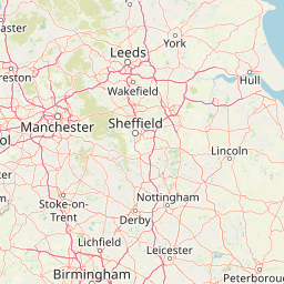
Map view of Bradford Pennine Gateway

Use this park location map to pinpoint Bradford Pennine Gateway in United Kingdom, understand its exact geographic position, and read its mapped placement within the surrounding landscape more clearly.

Pigeon | © OpenStreetMap contributors

Location context for Bradford Pennine Gateway

EnglandWest Yorkshire
Park atlas

Compare surrounding regional geography and connected Pennine habitats

Parks Near Bradford Pennine Gateway and Related Protected Landscapes

Continue exploring protected areas near Bradford Pennine Gateway to evaluate neighboring moorland terrain and regional conservation lands. Comparing adjacent upland ecosystems provides a broader geographical perspective on the wider South Pennine fringe.
Watercolor painting of green hills, a stream, and grassy areas
National parkNorth Yorkshire
About 12 km away#1 closest

Northwest

Yorkshire Dales National Park: A Protected Landscape in North Yorkshire

Explore mapped boundaries and distinctive limestone terrain.

Yorkshire Dales National Park offers a rich tapestry of mapped natural landscapes, characterized by its iconic limestone valleys, U-shaped glacial formations, and rolling heather-clad moorlands. Situated within North Yorkshire, this protected area showcases a unique karst geology, evident in features like Malham Cove and extensive cave systems. The park's traditional dry-stone walls and working farms contribute to a living cultural landscape, making it a prime destination for atlas-driven geographic discovery and understanding regional terrain.

Area
2,178 km²
Established
1954
IUCN
V
Relief
Mountain
National parkUnited Kingdom
About 28 km away#2 closest

South

Peak District National Park: Explore Protected Landscape and Regional Geography

Mapped boundaries and natural terrain context for this UK national park.

Investigate the Peak District National Park, a cornerstone of the United Kingdom's protected natural areas. This MoriAtlas entry provides essential details on its geographic scope, mapped boundaries, and landscape characteristics. Engage with structured data to understand how this national park fits into the atlas of the United Kingdom, supporting detailed geographic and protected-area discovery for researchers and explorers.

Area
1,440 km²
Established
1951
IUCN
V
Visitors
13M annual
A horizontal watercolor painting showing a wetland in the foreground with grasses, rolling hills, and distant mountains under a pale sky.
Wildlife reserveLancashire
About 72 km away#3 closest

Northwest

Leighton Moss RSPB Reserve: Geographic Atlas and Protected Wetland Boundary Analysis

Lancashire coastal wetland and reedbed ecosystems

Leighton Moss RSPB Reserve stands as the largest reedbed complex in north west England. This protected wildlife reserve offers a distinct landscape contrast between enclosed freshwater wetlands and the open saltmarsh of Morecambe Bay, providing essential habitat data for regional environmental study and birdlife geography.

Established
1964
Relief
Lowland
Access
Easy access
Scope
Terrestrial
Watercolor painting showing a lake, green hills, and sky
National parkCumbria
About 76 km away#4 closest

Northwest

Lake District National Park: Protected Landscape Atlas and Geographic Exploration

Mapped mountain terrain and glacial valleys in Cumbria

Delve into the geography of Lake District National Park, a protected area renowned for its dramatic mountainous terrain, U-shaped glacial valleys, and stunning natural lakes. This atlas perspective highlights the park's unique landscape features, mapped boundaries, and its significance within Cumbria, offering a comprehensive view for geographic discovery.

Area
2,292 km²
Established
1951
IUCN
V
Relief
Mountain
Watercolor illustration showing rolling hills, green vegetation, and a pale sky
National parkNorth Yorkshire
About 79 km away#5 closest

Northeast

North York Moors National Park: Explore its Protected Landscape and Geography

Discover mapped moorland, dales, and coastlines.

The North York Moors National Park is a vital protected landscape in North Yorkshire, celebrated for its extensive heather moorland and distinctive deeply incised dales. This page provides an atlas-style exploration of the park's geography, highlighting its unique terrain, mapped boundaries, and its integral role within the regional landscape context. Understand the diverse natural features that define this iconic national park, from the upland plateau to the dramatic Jurassic coast.

Area
1,430 km²
Established
1952
IUCN
V
Relief
Upland
Marine protected areaEngland
About 112 km away#6 closest

West

West of Walney Marine Protected Area: Irish Sea Geographic and Seabed Analysis

Mapped protected landscape in northwest England

West of Walney is a major marine protected area off the Cumbrian coast, notable for its 388 square kilometre coverage of subtidal mud and sand habitats. This site is uniquely shaped by its overlap with offshore wind energy infrastructure, providing a distinct study in regional conservation and seabed management within the Irish Sea.

Area
388 km²
Established
2016
Relief
Lowland
Climate
Temperate
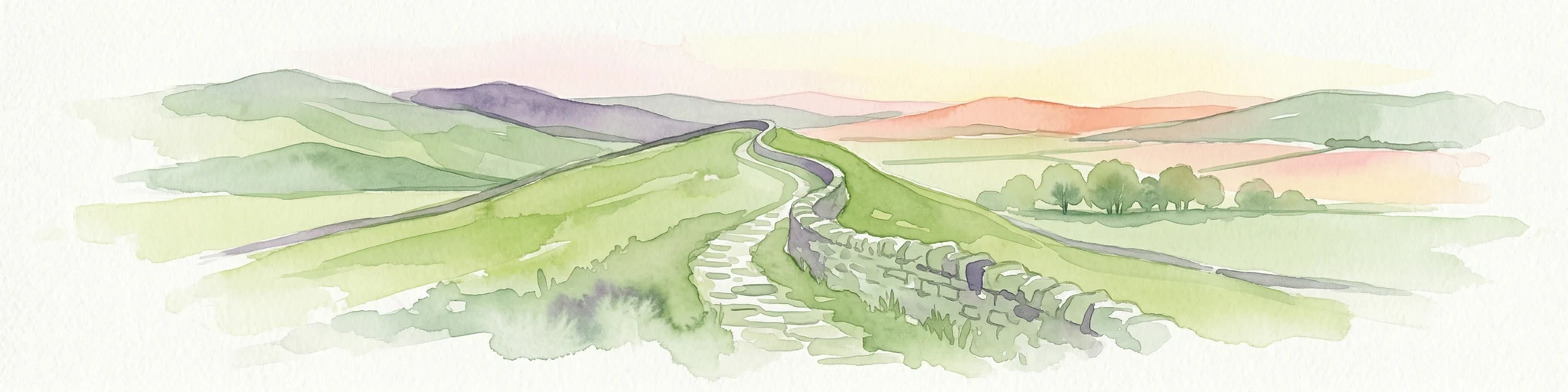
Watercolor illustration of Hadrian's Wall stretching across rolling green hills with distant mountains and trees under a sunset sky
National parkNorthumberland
About 132 km away#7 closest

North

Northumberland National Park: England's Northernmost Protected Landscape and Dark Sky Wilderness

Explore its mapped boundaries, Roman heritage, and remote moorland terrain.

Northumberland National Park protects over 1,050 square kilometers of remote and stunning natural beauty in northern England, bordering Scotland. This page provides a structured overview of its protected landscape, focusing on its geographic context within the county of Northumberland, its designation as a National Park, and its renowned status as Europe's largest Dark Sky Park. Users can discover the park's characteristic moorland terrain, the archaeological significance of Hadrian's Wall, and the vast expanses of Kielder Forest, offering an atlas-level understanding of this unique frontier landscape.

Area
1,050 km²
Established
1956
IUCN
V
Relief
Highland
Watercolor illustration of rolling mountains and green valleys with distant peaks
National parkWales
About 146 km away#8 closest

Southwest

Snowdonia National Park: Protected Landscape and Map Exploration in North Wales

Mountain terrain, glacial lakes, and regional geography.

Snowdonia National Park offers a profound exploration of mountainous protected landscapes in North Wales. This page details the park's mapped boundaries, revealing a terrain shaped by glaciation, featuring dramatic peaks like Snowdon, steep valleys, and pristine glacial lakes. Understand its geographic identity within the United Kingdom and how its protected status contributes to the regional landscape context, providing a unique focus for atlas-based discovery.

Area
2,142 km²
Established
1951
IUCN
V
Relief
Mountain

Common questions about visiting, size, designation, and location context for Bradford Pennine Gateway

Bradford Pennine Gateway FAQs for park facts, access, geography, and protected area context

Find quick answers about Bradford Pennine Gateway, including protected-area facts, park geography, trail and visitor context, and how the park fits into its surrounding country and regional landscape.
MoriAtlas Explorer

Continue Your Protected Areas Search Across the Global Atlas

Deepen your exploration by continuing the structured search for national parks and protected areas worldwide. Utilize the comprehensive filtering capabilities to compare different conservation landscapes and refine your understanding of global park geography. Discover more about the distribution and characteristics of protected natural areas.

Global natural geography