
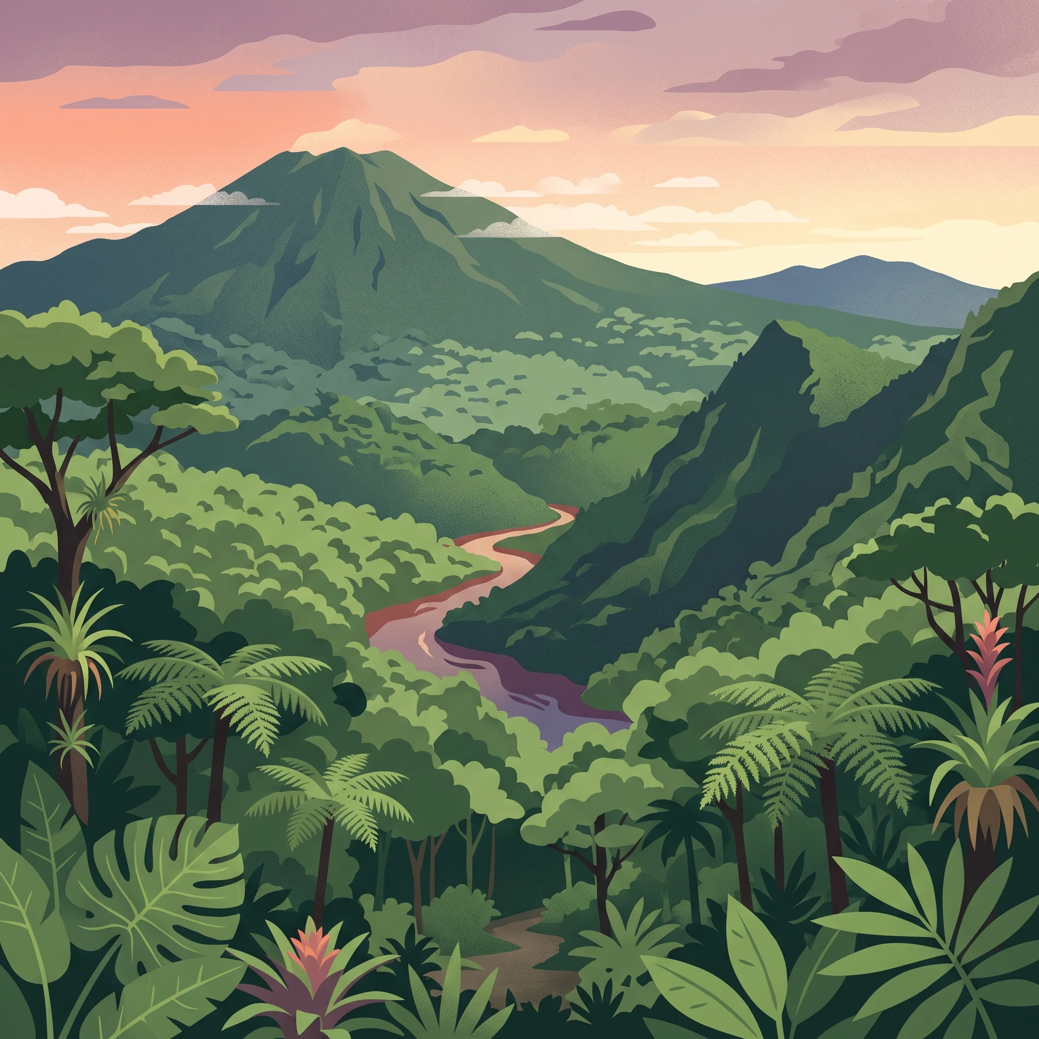
Visitor Planning
When to Visit Braulio Carrillo National Park: Understanding the Seasonal Trade-offs
Deciding on the best time to visit Braulio Carrillo National Park depends heavily on your tolerance for rain and your interest in trail conditions. As a vast, mountainous sanctuary that protects primary rainforest and cloud forest, the park experiences a complex climate driven by its topography and position between the Central Valley and the Caribbean lowlands. For most visitors, the drier months spanning January through April offer the most reliable windows for hiking, as reduced precipitation levels coincide with more stable weather patterns and improved visibility across the volcanic peaks. During this period, the relative humidity and daily rainfall drop compared to the wetter months of the year, making it easier to explore sectors like Barva Volcano or the more rugged, remote trails of the higher elevations.
The Trade-off Between Accessibility and Lushesness
While many prioritize the drier start to the year for hiking access, choosing to visit during the remainder of the year presents a different set of trade-offs. From May through December, the park receives significantly higher volumes of precipitation, which is essential for sustaining the dense biodiversity for which the area is famous. While frequent rainfall can increase the likelihood of muddy trails and dense fog obscuring the canopy, this is also when the landscape is at its most vibrant. If your primary interest lies in the park as a lush, water-rich ecological transition zone, the rain-fed months offer a more authentic look at the cloud forest ecosystems that define this rugged region. Travelers during these months should expect sudden changes in weather, requiring more robust gear and a higher degree of flexibility in their daily plans.
Factors Influencing Your Trip Timing
Beyond the primary seasonal split, several environmental factors influence the experience at Braulio Carrillo. The park's significant vertical range means that temperature shifts are tied directly to elevation. High-altitude areas, such as the summit of Barva Volcano, remain consistently cooler than the lower reaches of the park, and these peaks are often swathed in thick clouds regardless of the month. Furthermore, the park's function as a protected watershed ensures that moisture is a constant, even if the frequency of rainfall varies. Because the park serves as a bridge between diverse environments, wind patterns and daylight duration also fluctuate, creating subtle changes in the environment that can affect photography or wildlife spotting efforts. Recognizing that the climate varies by elevation rather than just by month allows for more realistic expectations, as no visit to this wild, largely untraveled territory is entirely shielded from the inherent volatility of a tropical cloud forest.
Visitor Timing
Best Months to Visit Braulio Carrillo National Park by Experience
Choosing the right time to explore Braulio Carrillo depends largely on your tolerance for rain and your interest in specific park elevations. Because the park protects vast, high-altitude terrain alongside tropical lowland ecosystems, weather conditions are rarely uniform. Selecting a window based on your primary objectives helps ensure you are prepared for the reality of the park climate.
The Drier Window for Higher Elevations
For visitors prioritizing access to the volcanic peaks, such as the trails around the Barva Volcano sector, the period from January through April offers the most stable conditions. During these months, precipitation reaches its annual low, with averages dropping near 1.81 mm per day in March. This window provides the best opportunity to experience clearer skies and slightly firmer trail surfaces. Hikers who prefer avoiding the heaviest tropical downpours should focus on this stretch, as it represents the most predictable period for reaching higher-altitude lookout points that are often otherwise obscured by dense mist or low-hanging clouds.
Embracing the Lush Wet Season
Travelers who visit between May and December must prepare for a distinct shift in environmental character. While rainfall increases significantly, climbing to peaks near 7.95 mm per day in October, this period reveals the park at its most vibrant. The intense humidity, often exceeding 90 percent during the later months of the year, feeds the dense cloud forest and rainforest canopy, resulting in deep, lush vegetation and higher water volumes in the Súcio River. Those visiting during this wetter phase should prioritize flexible itineraries. Muddy trail conditions are common, and the frequent afternoon rain showers are a standard part of the ecosystem, which may necessitate shorter hikes or more frequent breaks for shelter.
Factors Influencing Monthly Choice
It is helpful to weigh your experience against specific climatic shifts that occur throughout the year. If you seek to minimize the frequency of heavy rain, the February to April window stands out as the most reliable for planning. However, if you are drawn to the park specifically for its biodiversity and the sight of its dramatic river systems, the transitional months of May or December can provide a balance, offering slightly more vegetation cover than the driest months while avoiding the peak precipitation of late year.
Regardless of the month selected, visitors must recognize that the park elevation, reaching well over 1,000 meters, naturally invites cooler temperatures and fog. The temperature mean remains relatively consistent between 19 and 21 degrees Celsius throughout the year, meaning the true differentiator for your trip will be the precipitation and humidity patterns. Always cross-reference your chosen dates with current, localized weather alerts, as high-altitude environments often experience rapid shifts that defy monthly norms.
Annual Climate Overview
Braulio Carrillo National Park Weather and Climate by Month
Understanding the Annual Climate Cycle
The climate of Braulio Carrillo is defined by a consistent, year-round warmth punctuated by dramatic shifts in precipitation and humidity. Because the park spans significant elevation changes, visitors should recognize that these climate normals, recorded at approximately 1,065 meters, represent a baseline. Conditions in the higher-altitude cloud forest zones or along wind-exposed slopes often differ significantly from this reference point. Temperature remains remarkably stable throughout the year, with mean values hovering near 20 degrees Celsius. Rather than waiting for a season of comfortable heat or cooling, planning should focus on the changing levels of moisture that dictate trail accessibility and overall visibility.
Patterns of Precipitation and Humidity
Rainfall is the primary driver of environmental conditions within the park. The year is not neatly divided into winter and summer in the traditional sense, but rather into periods of relative dryness and intense saturation. From January through April, the park experiences its most manageable precipitation levels, often dipping below 3.5 millimeters per day. This window offers the most consistent conditions for navigating rugged terrain, though visitors should remain prepared for sudden, light showers typical of the region. As May approaches, a shift in humidity and rain frequency begins, with daily precipitation values rising significantly and often exceeding 7 millimeters through the summer and autumn months. During these wetter periods, humidity consistently remains above 90 percent, resulting in the dense fog and mist that characterize the park's higher-elevation volcanic slopes.
Daylight, Wind, and Thermal Comfort
Daylight hours follow a predictable, narrow range, varying between roughly 11.4 and 12.6 hours annually. While the fluctuation is minor, the slight increase in daylight during the middle of the year coincides with the period of highest rainfall, meaning longer days do not necessarily correlate with better hiking weather. Wind speeds are generally moderate but tend to be highest during the drier months, particularly in December and January, when gusts can be more noticeable on open, high-altitude ridges. This wind can create a chilling effect despite the steady daytime highs that often reach the mid-to-high 20s Celsius. Conversely, in the heart of the wet season, lower wind speeds contribute to a still, heavy atmosphere where the high humidity makes the relatively mild temperatures feel warmer.
Important Considerations for Visitors
It is essential to distinguish these long-term climate normals from live forecasts. These values provide an annual perspective on what is typical, but they cannot predict the behavior of any single day. Braulio Carrillo is a high-biodiversity environment where microclimates are common. A day that is clear and dry at a lower park entrance may be shrouded in heavy, wet clouds near the summit of a volcano. Travelers should rely on these averages to gauge the general seasonal shift in moisture and trail conditions but must monitor official park updates and weather reports for localized, real-time alerts before and during their visit.
Seasonal Weather Analysis
Understanding Seasonal Patterns and Weather Transitions in Braulio Carrillo
Defining the Two Core Climatic Phases
While conventional travel advice often projects a four-season model onto Costa Rican destinations, the environmental reality of this park is better understood as a bifurcated rhythm of a primary dry interval and a sustained, high-precipitation phase. This division is driven by the interaction between the Caribbean slope geography and the park's significant elevation ranges. The year is effectively split between a relative dry window from January through April and a persistent wet period that occupies the remaining eight months. These are not seasons in the temperate sense, as temperatures remain consistently mild throughout the year, but they represent significant shifts in humidity, cloud coverage, and overall trail moisture levels.
The Dry Interval: January to April
This period serves as the most reliable window for visitors prioritizing trail accessibility and visibility. From January through April, average daily precipitation rates drop to their lowest point, reaching a minimum in March. During this timeframe, the relative humidity experiences a noticeable dip, which, while still high, creates a feeling of improved air quality and a greater likelihood of clear views across the volcanic ridges and crater lakes. Visitors during these months will find that the frequency of heavy rain showers is reduced, allowing for more consistent access to the higher-altitude sectors like the Barva Volcano area. However, it is important to note that even during these drier months, the park remains a cloud forest. Mist and fog are permanent features of the high-elevation zones, regardless of calendar month.
The Wet Phase and Transitional Dynamics: May to December
Beginning in May, the climate transitions into a pattern characterized by increased precipitation and higher relative humidity that lasts through the end of the year. This period is marked by frequent, intense rainfall that sustains the park's lush, primary forest cover. The shift is not abrupt, but rather a gradual intensification of rainfall patterns. May acts as a bridge, where afternoon showers become more frequent, signaling the start of the wetter, more saturated environment. By October, the park reaches its highest levels of precipitation and humidity, resulting in extremely saturated soil conditions and dense, persistent cloud cover that can significantly limit visibility on high-altitude trails.
Navigating the Transitional Windows
Transition periods, specifically the shift from the dry window into the wet phase in May and the cooling moisture shift during the late months of November and December, require particular attention from those planning remote hikes. These months do not follow the established norms of either extreme. Instead, they present fluctuating conditions where rain patterns can be unpredictable. During these shoulder periods, the moisture level in the forest changes rapidly, often resulting in muddy trails before the official arrival of the heaviest rain months. Experienced hikers often view these transition windows as a middle ground, offering a balance between the potential for clear, dry days and the lush, vibrant vegetation that defines the park’s wet, highly biodiverse landscape. Regardless of the chosen period, the elevation-dependent climate means that conditions at the peaks often differ significantly from the more protected valley regions.
Seasonal Experiences
What Visiting Braulio Carrillo National Park Is Like Throughout the Year
Navigating Seasonal Landscapes and Biodiversity
Braulio Carrillo functions as a bridge between high-altitude cloud forests and lowland tropical rainforests, and the timing of your visit dictates which of these biomes you can explore most comfortably. The park's biodiversity remains high throughout the year, but the interaction between local topography and seasonal rainfall creates distinct windows for bird watching and volcano trekking. During the drier months from January through April, the reduced precipitation makes hiking the volcanic sectors near Barva more manageable. The trails in this region, including the paths toward the crater lakes, are typically firmer and less prone to the rapid washouts that characterize the rainy period. This is an ideal time for visitors prioritizing longer hikes who want to avoid the deep mud that can make the volcanic terrain particularly challenging.
Accessing the Forest Canopy and River Valleys
For those interested in the park's primary forest, the experience changes significantly as the year progresses. In the wetter months from May through December, the lushness of the rainforest reaches its peak. While this period experiences higher daily rainfall, it supports the dense growth that defines the park's characteristic appearance. The Quebrada Gonzales sector remains a primary point for experiencing these environments, where the Rio Sucio and Rio Quebrada Gonzales are often at higher, more turbulent volumes during the late-year months. Visitors should note that while the aerial tram provides a comfortable, covered perspective of the canopy regardless of the weather, ground-level hiking during these wetter months requires greater attention to footwear and trail conditions. The increased humidity in the latter half of the year creates a deeper, more atmospheric feel in the cloud forest, which is often what travelers seek when looking for that quintessential, misty, and intensely green Costa Rican landscape.
Timing for Wildlife Observations
While wildlife is present year-round, the seasonal variation in fruit availability and forest conditions influences visibility. Bird watchers focusing on the Resplendent Quetzal, which breeds in the cloud forest canopy, often find the transitions between dry and wet seasons to be productive periods, though these birds are a permanent fixture of the region. Because the park protects a vast range of primary forest, your success in spotting species like white-faced capuchins, howler monkeys, or even the elusive fer de lance is more often a matter of patience and quiet movement than specific calendar dates. However, the drier, sunnier days in March and April offer more consistent daylight for those spending extended hours on the trails. It is essential to recognize that because of the park's status as a wild, relatively undeveloped area, no seasonal schedule guarantees wildlife sightings. Always prioritize local information regarding specific trail closures, as the rugged terrain and frequent rain can lead to temporary maintenance issues that are independent of the broader seasonal patterns.
Visitor Priorities
Optimizing Your Visit to Braulio Carrillo National Park Based on Travel Goals
Selecting a Travel Window for Clearer Skies and Trail Access
For hikers focusing on the high-altitude terrain near the Barva Volcano, the window from January through April is the most strategic choice. During these months, precipitation levels drop significantly, often falling below 3.5 millimeters per day. This reduction in rainfall is the primary driver for improved trail stability and better visibility across the volcanic craters. If your priority is to complete specific, more technical treks where mud and saturated vegetation can impede progress, this dry period offers the most predictable conditions. The trade-off for these drier paths is a higher degree of sun exposure during clear days, so hikers should still prepare for the high-UV environment typical of this latitude and elevation.
Prioritizing Lush Forest Conditions and Biodiversity
Nature enthusiasts who view the park's characteristic cloud forest as a living, breathing entity often find that the wettest months, specifically from May through October, provide a more authentic experience. During this time, the park's humidity levels frequently exceed 90 percent, and rainfall intensifies as the seasonal patterns shift. While this increased moisture can make trails slippery and demand more robust, waterproof gear, it also feeds the park's dense canopy, mosses, and fern populations. Birdwatchers and those interested in the park's complex ecosystem often find the extra rainfall worthwhile, as it enhances the misty, ethereal atmosphere that defines the cloud forest habitat. The primary compromise here is the near-certainty of rain, meaning your schedule must be flexible enough to account for potentially reduced visibility and longer drying times for personal equipment.
Balancing Daylight and Mild Temperatures
If your primary goal is maximizing time on the trail during daylight hours, the months of May, June, and July offer the longest days, with roughly 12.5 hours of light. While these months align with the onset of the wetter season, the extended daylight provides a greater buffer for slower-paced exploration, particularly on longer routes that connect the park's varied sectors. Conversely, travelers who prioritize milder temperatures will find that the year-round consistency of the climate makes timing less dependent on extreme thermal shifts. Even in the warmest month of April, average maximums hover around 28 degrees Celsius, while the cooler months of December and January offer refreshing lows near 14 degrees. Because the temperature fluctuations are minimal throughout the year, visitors are better served by planning around precipitation thresholds rather than seeking a specific window for warmth or cold. The main consideration is that as you ascend toward the volcanic peaks, the cooling effect of elevation will always be a factor regardless of the month you choose.
Access and Logistics
Planning Seasonal Access and Visitor Logistics in Braulio Carrillo National Park
Access Considerations and Park Sectors
Braulio Carrillo contains distinct sectors that differ significantly in their accessibility and infrastructure. The Quebrada Gonzales sector, located along Highway 32, represents the most accessible portion of the park. This area provides established visitor amenities, including parking facilities, restrooms, and marked hiking trails. Because this sector is directly adjacent to a primary transit route between the capital and the Caribbean coast, it remains the most feasible point of entry for visitors without specialized off-road equipment.
In contrast, the Barva Volcano sector presents more demanding logistics. Accessing this part of the park frequently requires a high-clearance 4x4 vehicle due to the condition of the approach roads near the village of Sacramento. Readers planning to visit this higher-altitude sector should verify current road conditions, as they can fluctuate due to weather and lack of consistent maintenance. Given the remote nature of this sector, mobile phone reception is often unreliable, making it essential to coordinate transport and navigation before departing from more urban areas like San José or Heredia.
Official Requirements and Reservations
Operational rules, including entry permits, site closures, and reservation protocols, are subject to change by the national park authority (SINAC). While some park areas may operate under predictable daily schedules, specific requirements for entry into backcountry zones or volcanic crater trails often require advance booking via the official SINAC online system. Travelers should consult the official SINAC website or local ranger stations to confirm the current status of permits before finalizing travel dates. Relying on outdated information regarding fees, access hours, or required guides can result in denied entry.
Seasonal Influence on Transport and Planning
While the park remains open throughout the year, seasonal weather patterns,particularly during the peak of the rainy season from May to December,can impact local transit safety. Heavy precipitation levels, as noted in climatic data, may influence visibility on the mountain highways leading to the park, as well as the stability of unpaved access roads in the Barva sector. Planning a visit during the drier months of January through April can mitigate some of these logistical complexities by providing more consistent road surfaces and improved access to the higher-elevation trailheads. Regardless of the planned travel month, always prioritize checking official alerts regarding road closures or park entry restrictions before departing for your visit.
Safety and Preparation
Seasonal Weather Hazards and Packing for Braulio Carrillo National Park
Navigating Seasonal Terrain and Environmental Humidity
Preparation for a visit to the park revolves less around thermal extremes and more around managing the persistent moisture and varied terrain of a cloud forest environment. Because the park spans significant elevation changes, visitors should expect humidity levels that frequently exceed 90 percent during the wetter months from May to December. While temperature means remain relatively stable, the high humidity significantly influences how you should prepare your gear. Breathable, moisture-wicking layers are essential regardless of the time of year, as the forest environment remains damp even during the drier window of January through April. Synthetic fabrics that dry rapidly are highly recommended over cotton, which retains moisture and can become uncomfortable during longer hikes on trails that may remain muddy long after rainfall has ceased.
Footwear and Clothing for Trail Safety
Safety on the park trails begins with appropriate physical coverage. Due to the diverse wildlife present, including various reptile species that inhabit the undergrowth, footwear must be sturdy and completely enclosed. Sandals and open-toed shoes are inappropriate for the park's dense, rugged paths. Long pants are strongly recommended as they provide a necessary physical barrier against vegetation and insects. When selecting hiking boots, look for models with deep tread patterns to help manage the often slick, uneven ground characteristic of the Barva and Quebrada Gonzales sectors. Since trails are rarely paved or perfectly groomed, maintaining stability is a primary safety priority. Always verify current trail conditions through official park channels before your arrival, as localized rainfall can temporarily alter the state of specific paths.
Managing Daylight and Elevation Factors
Daylight hours in the park remain relatively consistent, hovering near 11.5 to 12.5 hours throughout the year. However, the dense forest canopy can make the transition from day to dusk feel rapid. Plan your hiking itinerary to ensure you are off the trails well before sunset, as visibility drops significantly under the heavy canopy. If you are exploring the higher volcanic elevations, remember that even with stable temperature averages, weather patterns can shift rapidly. Carry a versatile, waterproof outer layer that can accommodate sudden changes in mist or wind, which are frequent occurrences in the cloud forest. Because potable water is restricted to park entrance facilities, ensure you arrive with an adequate personal supply for the duration of your hike. Check the latest alerts from the National System of Conservation Areas (SINAC) regarding current trail access and safety guidance, as operational protocols can change based on weather impacts or infrastructure maintenance.
Trip Strategy
How to Choose the Right Time to Visit Braulio Carrillo National Park
Choosing the right time to visit Braulio Carrillo depends on whether you prioritize trail accessibility or the raw, atmospheric intensity of the cloud forest. There is no singular optimal window for every traveler, as the park’s environment is fundamentally defined by the tension between drier months and the persistent humidity of the rainy season. By aligning your personal expectations with the established seasonal patterns, you can select the window that best suits your specific objectives for exploring this vast volcanic landscape.
Prioritizing Clearer Trails and Views
If your primary goal is to hike the volcanic sectors or capture expansive views of the crater basins, aim for the period from January through April. This timeframe typically offers the most stable conditions and the lowest daily precipitation levels, which are critical when navigating the rugged, often steep terrain of the Barva Volcano region. During these months, trails are less prone to heavy mud, providing a more reliable experience for those focused on distance hiking or accessing higher-elevation viewpoints. While clouds and mist are permanent features of this ecosystem, the drier months provide your best statistical chance at reduced obstruction and clearer vantage points across the ridges.
Embracing the Lush Cloud Forest Experience
Travelers who prefer to see the park in its most vibrant state should consider the wetter months. While the increased rainfall from May through December presents challenges, such as slicker paths and limited visibility, it is this precipitation that sustains the park's immense biodiversity. Visiting during the wetter part of the year allows you to witness the forest at its most lush and active, with the streams and the Súcio River flowing with heightened intensity. This period is better suited for those who value the immersive, misty character of the cloud forest over ease of movement, provided you arrive with appropriate gear to manage the consistent moisture.
Making Your Final Decision
To finalize your timing, reconcile your physical hiking requirements with your capacity for flexible planning. If you seek the most predictable trail conditions, stick to the start of the year. If you are comfortable with rain and want to witness the park’s most saturated, green aesthetic, the mid-to-late year period offers a rewarding, if demanding, experience. Always remember that climate averages are not local weather forecasts. Regardless of when you choose to visit, verify current trail statuses, operating hours, and potential weather alerts through official SINAC channels before finalizing your arrangements. Your decision should remain flexible, as the wild nature of this park means conditions can shift rapidly, requiring you to prioritize safety and adaptability over strict scheduling.