
Mori Atlas logo
Nature reserveBrill

Examining the mapped boundaries and natural landscape character of this vital wetland refuge

Brill Nature Reserve: A Protected Floodplain Wetland and River Restoration Site in Schifflange

Brill Nature Reserve occupies a strategic position within the Alzette River floodplain near Schifflange, Luxembourg. This protected landscape features a complex mosaic of ponds, reedbeds, and riverine forest that serves as a critical stopover for migratory waterbirds. Through deliberate river restoration, the area has regained a meandering course, transforming from industrial valley floor into a thriving habitat that supports ornithological research and regional biodiversity.

wetlandfloodplainriver restorationbird reserveriparian habitatreedbeds
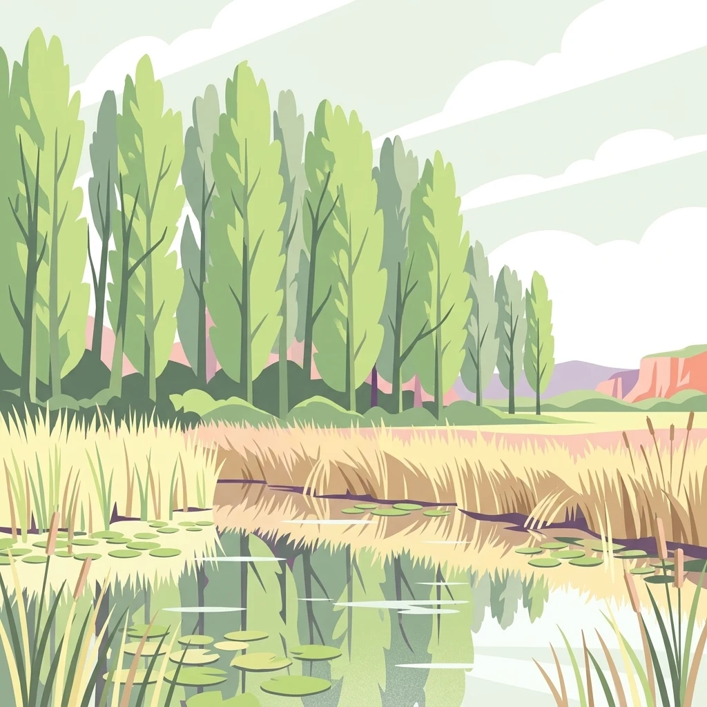
An illustrative rendering of a calm wetland with tall reeds, water lilies, and a line of slender trees under a cloudy sky.

Brill

Nature reserve

Park overview

Structured park overview, official facts, and landscape profile for Brill Nature Reserve

Brill Nature Reserve park facts, protected area profile, and essential visitor context

Review the core facts for Brill Nature Reserve, including designation, size, terrain, visitor scale, habitats, and operating context in one park-focused overview.

About Brill Nature Reserve

The Brill Nature Reserve lies in the commune of Schifflange, in southern Luxembourg, just south of the country's industrial heartland. It sits in the natural floodplain of the Alzette River, which historically spread and pooled across this lowland before industry, drainage, and poplar plantations reshaped the valley in the twentieth century. Today the reserve preserves what remains of that wetland landscape: roughly twenty hectares of ponds, reedbeds, wet meadows, and developing riverine woodland within the broader Natura 2000 network.

What makes the reserve distinctive is not its size but its setting and ecological role. It is one of only a handful of surviving floodplain wetlands in the Alzette valley, a corridor that has long been constrained by deep canalization, urbanization, and heavy industry. The Brill offers a glimpse of how the river once behaved, and after restoration, of how it can behave again. A roughly one-kilometer stretch of the Alzette was reshaped starting around 2000, with steep banks cut back and a wide, sinuous riverbed allowed to form naturally. The resulting slow current reduced erosion and created shallow flats and side pools that quickly became valuable wildlife habitat.

Ecologically, the reserve functions both as a breeding area and a migration stopover. Dense stands of reeds and broadleaf cattail fringe the ponds and host nesting species such as coots, water rails, and reed warblers. Newly exposed sandy and gravelly banks attract waders and other passage birds that were previously absent from the heavily channeled river. Fledgling poplar plantations in the flood zone are gradually dying back from waterlogging, leaving behind the deadwood and natural regeneration that yields to a more diverse river delta forest over time.

For visitors, the reserve offers a roughly three-kilometer nature trail starting near the Bestgener Millen, with sections of boardwalk leading through the reedbeds, the river delta forest, and past two bird observation hides. The site also hosts a small bird-ringing station inaugurated in 2017, giving the reserve a continuing role in ornithological research in Luxembourg.

Quick facts and research context for Brill Nature Reserve

The Brill is a nature reserve of national interest in the commune of Schifflange, Luxembourg, protecting around 19.7 hectares of wetland in the floodplain of the Alzette River. It has held protection status since 20 December 1988 and was formally upgraded together with the Am Pudel reserve in 2007 under Luxembourg's 2004 nature conservation law.

The site is part of the Natura 2000 network under the EU Birds Directive and is one of the few surviving natural floodplain wetlands in the heavily industrialized Alzette valley. Restoration work has reshaped a roughly one-kilometer stretch of the river, creating a natural meandering course with shallow water zones and gravel flats.

Protection and recognition

Analysis of terrestrial protected area designation and recognition records

Brill Protection Status and Documented Conservation Scope

Brill maintains a documented terrestrial protection scope within international conservation databases. Structured records compile available designation history and administrative recognition metrics for the protected landscape.

Protection details

Protection scope
Terrestrial
Transboundary protection
No
Core area
0.13 km²
Park context

Deeper park guide and search-rich context for Brill Nature Reserve

Brill Nature Reserve history, landscape, wildlife, and travel context

Explore Brill Nature Reserve through its history, landscape character, ecosystems, wildlife, conservation priorities, cultural context, and seasonal travel timing in a structured park guide built for atlas discovery and search intent.

Why Brill Nature Reserve stands out

The Brill is best known as one of the last remaining floodplain wetlands of the Alzette in a valley long shaped by industry, and as a demonstration site for river restoration in Luxembourg. Its combination of ponds, reedbeds, riverine forest, and a restored meandering river course has made it an important stopover for migratory waterbirds and a key local site for birdwatching and ringing research. The reserve is also recognized for the success of a LIFE-Nature project that allowed the Alzette to rediscover a more natural, slower, and ecologically richer course. Shallow water zones and flood retention areas created during this work now support new habitats alongside traditional wetland vegetation such as reeds and cattails.
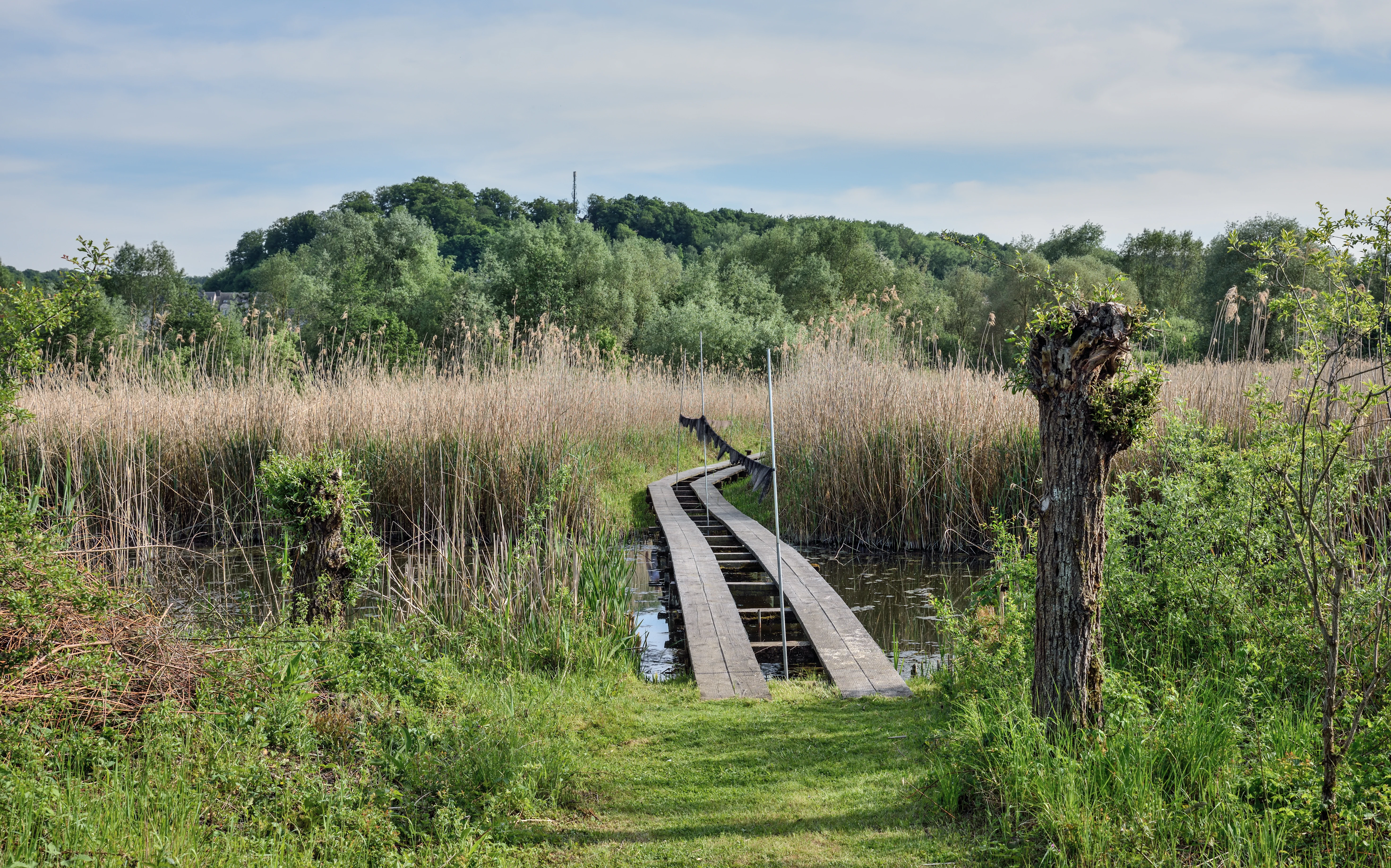
A narrow wooden boardwalk bridge crosses over water through tall brown reeds in a nature reserve, with dense green trees and a hillside in the background.
A wooden boardwalk path winds through the marshy wetlands and reeds of the Brill nature reserve.

Brill Nature Reserve history and protected-area timeline

The history of the Brill Nature Reserve is closely tied to the broader transformation of the Alzette valley and to successive waves of nature protection law in Luxembourg. Although the area's wetland character had long been shaped by the river's natural flooding, intensive industrialization and agricultural drainage in the twentieth century progressively reduced its ecological value. The first small ponds and a protective dike were installed in the 1980s to begin rescuing what remained of the habitat.

On 20 December 1988, a Grand Ducal regulation formally designated the Schifflange Brill as a protected zone of national interest, covering about 12.5 hectares with an additional 7.2-hectare buffer. The action reflected both the site's local ecological importance and, increasingly, its ornithological significance as the river corridor recovered.

In February 2005, alongside the adjacent Am Pudel reserve in the communes of Esch-sur-Alzette and Schifflange, the Brill was upgraded to full nature reserve status under Luxembourg's modern nature conservation law of 2004. Together the two reserves cover roughly 35 hectares and now form a coherent protected complex within the Natura 2000 network under the EU Birds Directive.

The defining chapter of the reserve's recent history is the LIFE-Nature river restoration project that began in 2000. Working with the neighboring Bestgener Millen, where flooding had become a recurring problem, project partners reshaped the Alzette channel near the Brill: cutting back steep banks, removing straightened embankments, and allowing the river to carve a broader, more sinuous bed. The result was a slower, less erosive flow and the formation of shallow water zones and gravel flats that added new habitat types to the reserve. In May 2017, a bird-ringing station was inaugurated on site by then Environment Minister Carole Dieschbourg, underlining the reserve's continuing role in bird research and conservation monitoring.

Brill Nature Reserve landscape and geographic character

The landscape of the Brill is shaped almost entirely by water. The reserve occupies a low-lying stretch of the Alzette floodplain, where the historic valley floor once supported a shifting patchwork of wet meadows, marshes, and river channels. Today the scene is dominated by a series of standing-water ponds, dense reedbeds, and a section of the Alzette River whose course has been deliberately allowed to become wider and more sinuous than it was for most of the twentieth century.

The terrain is flat to gently undulating, typical of an alluvial floodplain, but visually rich. Open water surfaces, sandy and gravelly flats, deadwood-strewn pioneer woodland, and thickets of common reed and broadleaf cattail alternate across short distances. Boardwalk sections of the reserve's nature trail allow visitors to cross some of the wettest ground without disturbing the fragile soils.

The surrounding valley gives the landscape a strong contrast: the Brill sits within a heavily industrialized and urbanized part of Luxembourg, but the reserve itself retains a quiet, open, and distinctly wetland character. This juxtaposition, a sliver of floodplain habitat framed by steelworks, infrastructure, and the town of Schifflange, defines much of the site's visual identity.
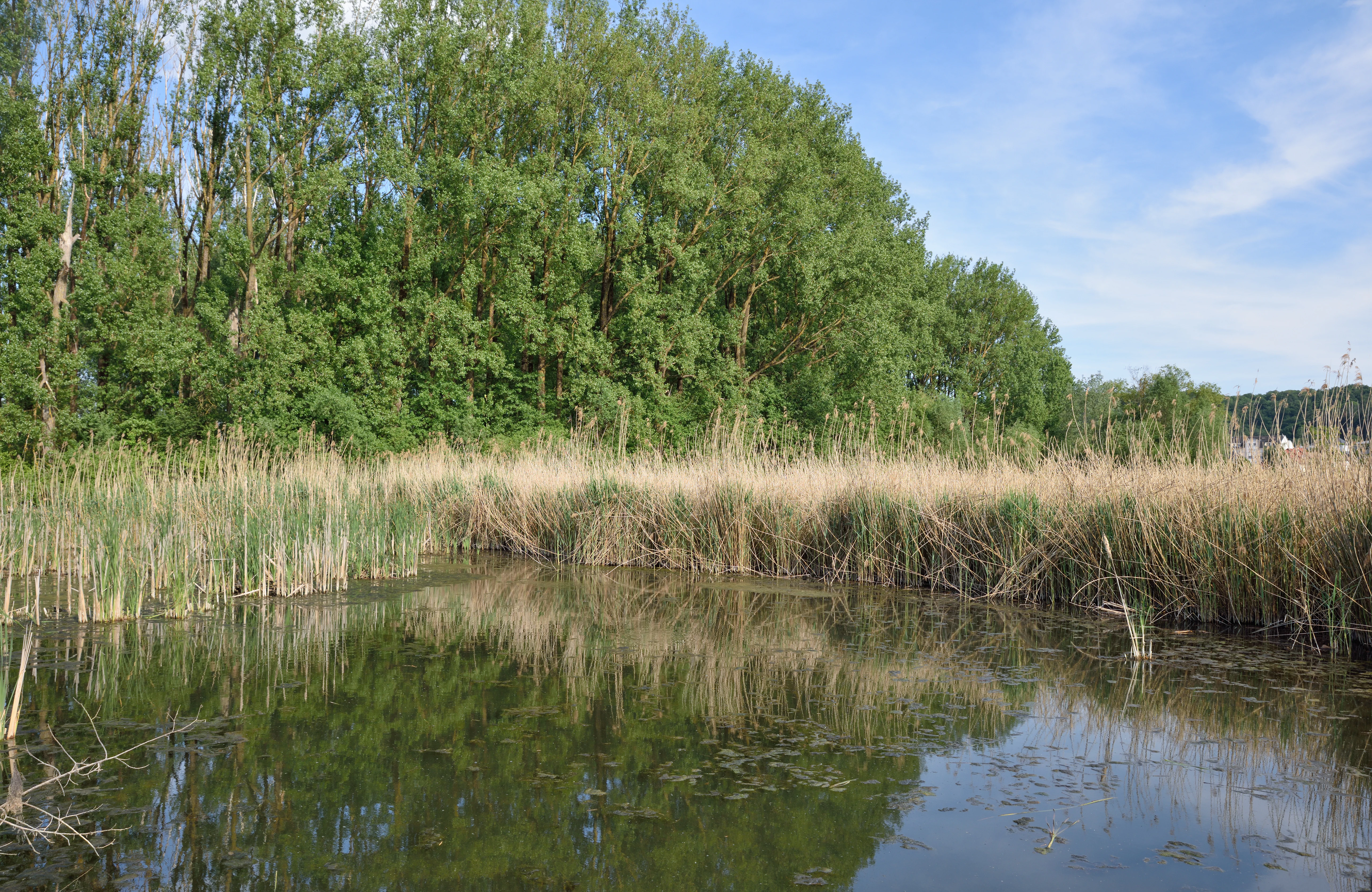
A wide view of a calm pond with tall reeds lining the shore and a dense line of trees in the background under a blue sky.
A tranquil pond bordered by tall reeds and lush trees within the Brill nature reserve.

Brill Nature Reserve ecosystems, habitats, and plant life

The Brill supports a layered wetland ecosystem that combines open water, emergent reed vegetation, wet meadow, and developing riverine forest. The standing-water ponds and shallow river margins are fringed by dense beds of common reed and broadleaf cattail, which dominate the wetland's vegetation and slowly expand outward across the open water each year due to their vigorous growth.

Beyond the reedbeds, the reserve includes wet pasture and marshland whose original character was altered by twentieth-century drainage and poplar planting. Restoration work has reversed some of these changes. Reinstated flooding is gradually killing off the poplar stands, exposing deadwood and open soil, and opening space for a more natural river-delta woodland to develop with characteristic floodplain vegetation.

The shallow water zones and gravel flats created along the restored Alzette channel add an important new element to the ecosystem, providing pioneer habitats that did not previously exist in the heavily canalized valley. The result is a dynamic mosaic of reedbeds, open water, exposed sediment, and successional woodland, all interacting with the seasonal hydrology of the river.

Brill Nature Reserve wildlife and species highlights

Wildlife at the Brill is dominated by birds, which have been the primary focus of the reserve's protection, restoration, and monitoring since the late 1980s. The site is recognized as an important passage area and resting place for migratory waterbirds and as a local breeding ground for several wetland species.

Before the river restoration, the most regularly observed birds along this stretch of the Alzette included the common kingfisher, the mallard, and the common moorhen. After the Alzette was given a more natural course, additional species began to appear along the new banks and shallow areas, including common sandpipers, common snipe, and gray wagtails.

The reedbeds of the reserve are especially important for breeding birds. Eurasian coots, water rails, and Eurasian reed warblers nest among the reeds and cattails that fringe the ponds, while the dead and dying poplar stands in the flood zone now host fieldfares and serve as wintering habitat for Eurasian teal and green sandpipers. Over time, as these poplars give way to a more natural river-delta forest, the deadwood they leave behind is expected to support a richer community of insects and the birds that depend on them. The reserve's small bird-ringing station, inaugurated in 2017, continues to contribute to ornithological research on these species and on the wider migration patterns of birds along the Alzette valley.

Brill Nature Reserve conservation status and protection priorities

The Brill is significant for conservation well beyond its modest size, both as a refuge for floodplain wetland in a heavily modified valley and as a demonstrably successful case of river restoration. Its designation in 1988 as a zone protégée under Luxembourg law recognized the site's local ornithological importance, and its later inclusion in the Natura 2000 network under the EU Birds Directive extended this recognition to the European level.

The reserve's upgrading in 2007 under Luxembourg's 2004 nature conservation law, together with the adjacent Am Pudel reserve, brought both sites into a single coherent protected complex of roughly 35 hectares. This legal consolidation strengthened long-term protection and clarified management responsibilities for the wetland and its surrounding buffer.

At the heart of the reserve's conservation value is the LIFE-Nature project that reshaped a roughly one-kilometer stretch of the Alzette channel. By removing straightened embankments, cutting back steep banks, and allowing the river to find a more sinuous, slower course, the project reduced erosion, restored seasonal flood dynamics, and created shallow water zones and gravel flats that function both as new habitat and as natural flood retention. The site now stands as a reference point in Luxembourg for combining biodiversity protection, river restoration, and flood-risk management within a heavily used industrial valley.

Brill Nature Reserve cultural meaning and human context

The name Brill reflects the long-standing regional use of the word, shared with its German equivalent Brühl, to describe a wet meadow near one or more villages. The reserve's location along the Alzette, upstream of the historic industrial center of Esch-sur-Alzette and at the edge of the town of Schifflange, places it within a landscape shaped by centuries of mining, steel production, and urban growth.

The Bestgener Millen, a historic mill complex that sits at the edge of the reserve, forms an important cultural anchor for the site and is the starting point for the official nature trail. Concern about recurring flooding at the millen became one of the practical motivations for the river restoration work that reshaped the Alzette near the Brill, illustrating how industrial heritage and modern conservation planning have come together in the management of this small reserve.

Top sights and standout views in Brill Nature Reserve

The Brill stands out for combining a small but ecologically rich wetland with a high-profile river restoration success story in the middle of one of Luxembourg's most industrialized valleys. Its ponds, reedbeds, and developing river-delta forest offer a compact but layered habitat mosaic that supports both resident wetland birds and seasonal migrants.

Equally distinctive is the reserve's place within the Natura 2000 network and its contribution to demonstrating how a heavily modified river corridor can be brought closer to a more natural state. The site pairs active conservation and research, through its bird-ringing station and ongoing monitoring, with public access via a themed nature trail and bird observation hides.

Best time to visit Brill Nature Reserve

The Brill is a working wetland reserve, so the character of a visit shifts meaningfully with the seasons. Spring and early summer are the most rewarding periods for hearing breeding birds in the reedbeds and for observing species nesting along the pond margins. Migratory waterbirds are most visible during the spring and autumn passages, when the reserve functions as a stopover habitat along the Alzette corridor. Winter offers quieter conditions and a chance to see wintering species and the open structure of the floodplain once the reedbed vegetation has died back.

Monthly climate preview

Long-term representative meteorological measurements across twelve monthly intervals

Brill Climate Normals, Annual Temperature and Precipitation Rhythm

Representative coordinates record sustained variations in monthly average temperature and daily precipitation totals throughout the year at Brill. Reviewing the complete meteorological profile provides deeper insight into measured thermal ranges and long-term climatic patterns.
Annual mean9 °C
0 °C19 °C
Jan
Feb
Mar
Apr
May13°
Jun17°
Jul19°
Aug19°
Sep14°
Oct
Nov
Dec
Warmest month
July

19.1 °C

Coolest month
January

0.4 °C

Wettest month
December

2.7 mm/day

Driest month
April

1.6 mm/day

Park location guide

Geography guide, regional context, and park location map for Brill Nature Reserve

Brill Nature Reserve park geography, regions, and map view in Luxembourg

Understand where Brill Nature Reserve sits in Luxembourg through a broader geographic reading of the surrounding landscape, nearby location context, and its mapped position within the national park landscape.

How Brill Nature Reserve fits into Luxembourg

Luxembourg is a small landlocked nation in Western Europe and the world's only grand duchy. It borders Belgium, Germany, and France, with Luxembourg City as its capital and largest city. The country has one of the highest GDP per capita figures globally and hosts several EU institutions, notably the Court of Justice. Its population of nearly 700,000 is multinational, with Luxembourgish as the national language and French and German as administrative languages.

Wider geography shaping Brill Nature Reserve in Luxembourg

Luxembourg is located in Western Europe, landlocked between Belgium to the west and north, Germany to the east, and France to the south. The terrain consists largely of forested uplands and plains in the Oesling region to the north, with the Gutland region in the south featuring more fertile land. The country covers 2,586 square kilometres, making it Europe's seventh-smallest nation.

Map view of Brill Nature Reserve

Use this park location map to pinpoint Brill Nature Reserve in Luxembourg, understand its exact geographic position, and read its mapped placement within the surrounding landscape more clearly.

Pigeon | © OpenStreetMap contributors

Location context for Brill Nature Reserve

Schifflange

Visual records of floodplain terrain, restored river channels, and riparian habitats

Brill Photos and Landscape Imagery: Exploring the Protected Wetland Scenery

Examine detailed photographs of Brill to understand the unique protected wetland character, open water ponds, and dense reedbeds of the reserve. Visual documentation reveals the distinct topography and habitat mosaic preserved along the restored Alzette River corridor.

A narrow wooden boardwalk bridge crosses over water through tall brown reeds in a nature reserve, with dense green trees and a hillside in the background.

A rustic wooden cabin with a metal roof surrounded by trees and green vegetation at the Brill nature reserve, featuring barred windows and informative signs on the exterior walls.

A wide view of a calm pond with tall reeds lining the shore and a dense line of trees in the background under a blue sky.

Park atlas

Discover related wetland habitats and regional conservation landscapes

Explore Protected Areas and Nature Reserves Near Brill

Compare Brill with other protected areas and riparian nature reserves across the surrounding region. Analyzing adjacent floodplain terrain provides deeper context on regional wetland restoration and protected land networks.
Watercolor painting of a green, rolling landscape with scattered trees and soft hills against a light background.
Nature reserveLuxembourg
About 1.9 km away#1 closest

South

Brucherbierg-Lallengerbierg Nature Reserve: Industrial Heritage and Protected Geography in Luxembourg

A restored Minett mining landscape and thriving dry-grassland ecosystem.

Brucherbierg-Lallengerbierg offers a window into the evolution of post-industrial terrain. Spanning 267 hectares in southern Luxembourg, the reserve protects a rugged landscape of cliffs, stony basins, and terraces that have been reclaimed by pioneer vegetation. Through careful ecological maintenance, the site serves as a prime example of habitat conservation, preserving a rare, open dry-meadow environment within the broader Minett industrial corridor.

Area
2.67 km²
Established
2016
Relief
Upland
Water
Minor water
Nature reserveLuxembourg
About 4.8 km away#2 closest

Southwest

Ellergronn Nature Reserve: Mapping Protected Woodland and Industrial Collapse Terrain

An atlas of reclaimed post industrial habitats in southern Luxembourg

Ellergronn Nature Reserve acts as a case study in landscape reclamation, transforming former ironstone mining pits into a deep network of collapse ponds and diverse woodland. This protected area offers a look at how subsidence and quarrying have resulted in a unique mosaic of calcareous grasslands and forest pools, providing a clear map of Luxembourg's industrial environmental history.

Area
1.104 km²
Established
1988
Scope
Terrestrial
Water
Minor water
A minimalist watercolor illustration featuring rolling green hills, patches of trees, and a soft, light-toned foreground against a white background.
Nature reserveLuxembourg
About 5.7 km away#3 closest

Southeast

Naturschutzgebitt Haard: Exploring Luxembourg's Largest Reclaimed Nature Reserve

Geography of a transformed iron-mining industrial landscape

Naturschutzgebitt Haard encompasses vast quarry faces and pioneer meadows, serving as a critical biodiversity hub within southern Luxembourg. The area offers an intricate landscape mosaic of calcareous grassland, recovering forest, and dramatic mining cliffs, providing a window into how post-industrial ground evolves into a protected refuge for specialized orchid and butterfly species.

Area
5.943 km²
Established
1994
Relief
Upland
Climate
Temperate
Nature reserveLuxembourg
About 7 km away#4 closest

Northeast

Beetebuerger Bësch: Nature Reserve and Protected Woodland Mapping in Luxembourg

A crucial reference site for forest ecology in southern Luxembourg

Beetebuerger Bësch stands as a designated nature reserve within the communes of Bettembourg, Leudelange, and Roeser. This protected forest landscape is managed to allow natural woodland development, providing researchers and visitors with a view of old growth dynamics, saproxylic invertebrate habitats, and restored riparian zones along the Koleschgriecht stream.

Area
2.373 km²
Established
2005
Relief
Lowland
Climate
Temperate
Nature reserveLuxembourg
About 8.9 km away#5 closest

East

Naturschutzgebitt Däerebësch-Waal-Hellengerbësch: Protected Forest and Transboundary Geography

Nature reserve profile and regional landscape connectivity

Spanning 222 hectares across Bettembourg, Dudelange, and Frisange, this nature reserve preserves a contiguous forest landscape essential to the Natura 2000 network. The site is defined by its role as a cross-border ecological corridor, connecting Luxembourgish woodlands with the Forêt domaniale de Zoufftgen in France through a sophisticated wildlife bridge.

Area
2.223 km²
Established
2023
Relief
Upland
Climate
Temperate
Watercolor illustration of a landscape with rolling hills, a river, and green vegetation
Protected areaProvince of Luxembourg
About 16 km away#6 closest

Northwest

Gaume Natural Park: A Protected Area Defining the Landscape of Province of Luxembourg

Explore its mapped natural landscape and geographic context.

Gaume Natural Park is a protected area offering a unique perspective on the natural landscapes found within Belgium's Province of Luxembourg. As a key geographic entity, it provides a vital component for atlas exploration, showcasing distinct mapped boundaries and regional terrain. Understand its significance as a protected natural space contributing to the Ardennes region's extensive geography, making it an essential point for structured discovery of protected lands.

Area
581.04 km²
Established
2014
IUCN
V
Relief
Lowland
A horizontal watercolor painting depicting a gentle river flowing through a soft green landscape with trees and distant rolling hills.
Nature reserveLuxembourg
About 21 km away#7 closest

Northeast

Naturschutzgebitt Birelergronn Nature Reserve: Luxembourg Protected Valley Geography

A sandstone valley landscape in central Luxembourg.

Naturschutzgebitt Birelergronn encompasses a 270 hectare nature reserve in Luxembourg, recognized for its complex hydrological features and historic milling valley structure. The area highlights the geological significance of the Luxembourg Sandstone, supporting diverse alluvial forests and the expansive Neimillen wetland complex which defines the regional ecosystem.

Area
2.717 km²
Established
1999
Relief
Upland
Climate
Temperate
Nature reserveLuxembourg
About 25 km away#8 closest

Northeast

Cornelysmillen-Schucklai Nature Reserve: Geographic and Protected Area Overview

Wetland ecosystems on the Luxembourg plateau

Cornelysmillen-Schucklai serves as a key protected area of national interest, encompassing a mosaic of marshland, meadows, and deciduous woodland. This reserve acts as a vital corridor for moisture-dependent plant communities and threatened bird populations, defining the hydrological character of the plateau region with its intricate stream systems and restored pond basins.

Area
1.437 km²
Established
2023
Relief
Upland
Climate
Temperate

Common questions about visiting, size, designation, and location context for Brill Nature Reserve

Brill Nature Reserve FAQs for park facts, access, geography, and protected area context

Find quick answers about Brill Nature Reserve, including protected-area facts, park geography, trail and visitor context, and how the park fits into its surrounding country and regional landscape.
MoriAtlas Explorer

Continue Your Protected Areas Search Across the Global Atlas

Deepen your exploration by continuing the structured search for national parks and protected areas worldwide. Utilize the comprehensive filtering capabilities to compare different conservation landscapes and refine your understanding of global park geography. Discover more about the distribution and characteristics of protected natural areas.

Global natural geography