
Why Brucherbierg-Lallengerbierg Nature Reserve stands out
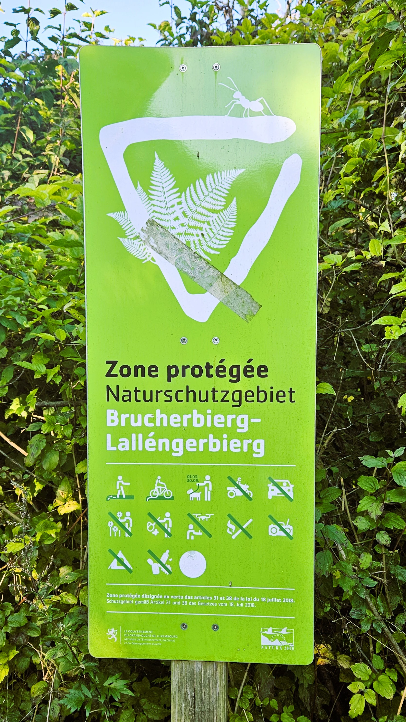
Brucherbierg-Lallengerbierg is best known as a reclaimed Minett mining landscape where former iron ore extraction sites have evolved into a distinctive dry-meadow and rocky-habitat nature reserve. Its combination of exposed rock walls, filled valleys, and engineered terraces creates a unique substrate for pioneer vegetation and species adapted to warm, dry, stony conditions. The reserve is also recognized for demonstrating how traditional sheep grazing can preserve open habitats that would otherwise be overtaken by forest succession.
Brucherbierg-Lallengerbierg Nature Reserve history and protected-area timeline
The landscape of Brucherbierg-Lallengerbierg was fundamentally shaped by the industrial history of southern Luxembourg. For much of the twentieth century, the western portion of the area functioned as an open-pit iron ore mine, supplying Minett ore that was central to Luxembourg's steel-making economy. Extraction continued in this area until the 1970s, leaving behind a terrain of rock walls, debris-filled valleys, and terraced surfaces where machinery and infrastructure once operated.
After the mining operations ended, the site was not immediately restored to agriculture or forest. Instead, the abandoned workings were allowed to undergo natural regeneration. Over the following decades, pioneer vegetation and grassland species colonized the disturbed ground, gradually transforming the industrial scars into habitats valued for their botanical and faunal diversity. By the early twenty-first century, this ecological transformation, combined with the site's geological and cultural significance, prompted formal protection.
The reserve's regulations were established on 29 March 2016 through a grand-ducal decree, designating Brucherbierg-Lallengerbierg as a protected nature reserve under Luxembourg's national framework. Since that time, the site has been managed as one of the country's Zones of National Interest, with explicit provisions for maintaining its open habitats, including the use of sheep grazing to preserve dry-meadow vegetation that would otherwise be lost to forest succession.
Brucherbierg-Lallengerbierg Nature Reserve landscape and geographic character
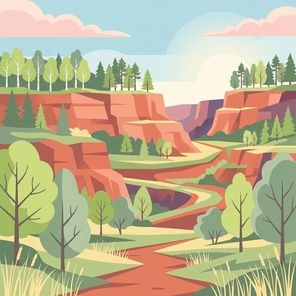
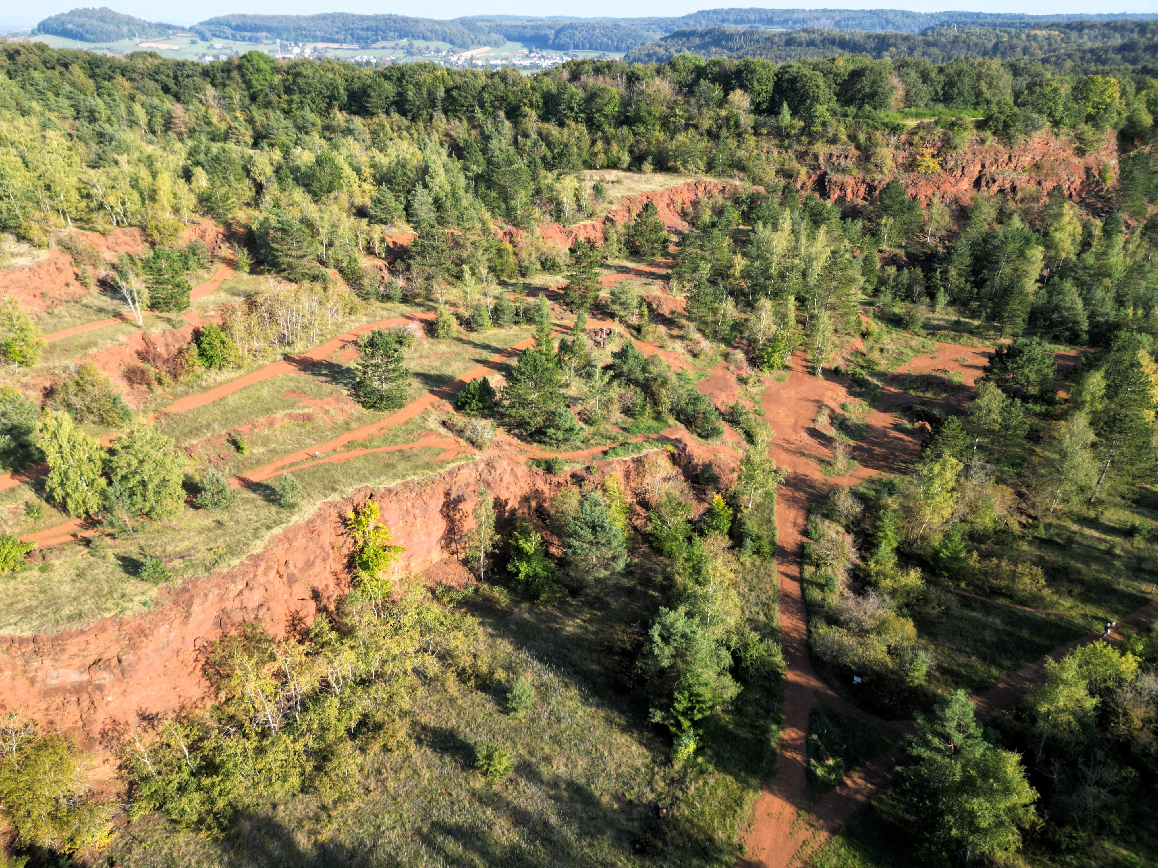
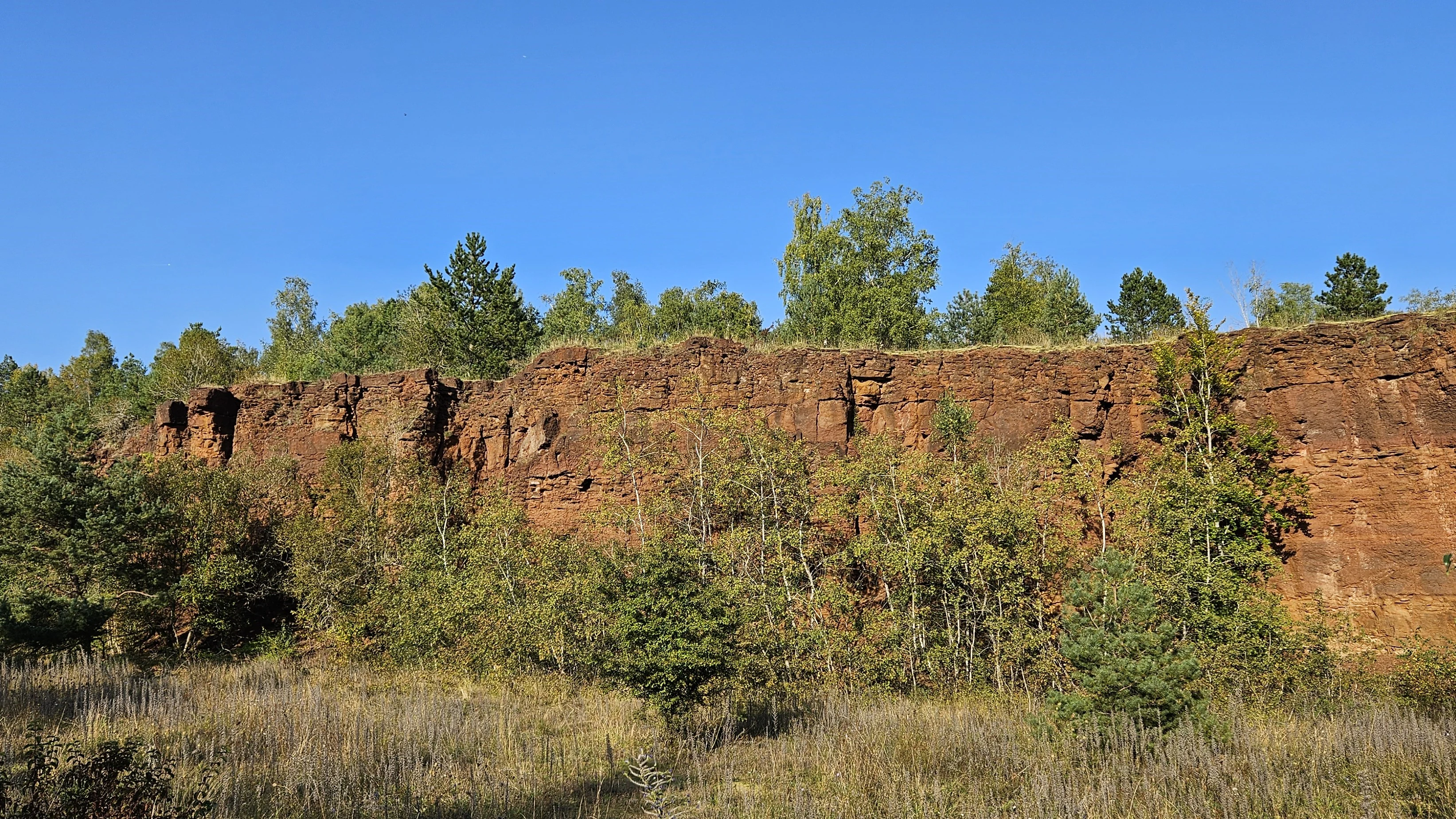
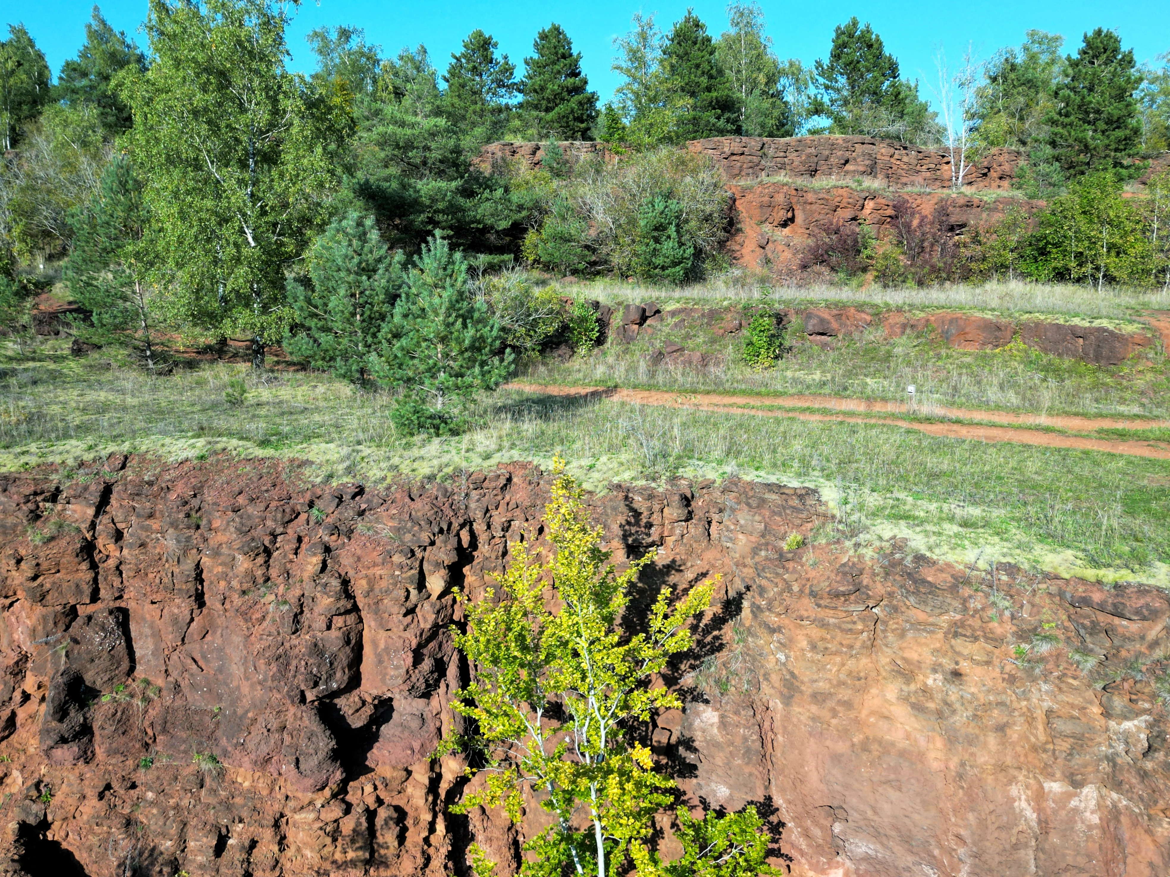
The landscape of Brucherbierg-Lallengerbierg is defined by its post-mining topography. In the western part of the reserve, former open-pit workings have left behind pronounced rock walls and cliff faces where ore was once extracted. Adjacent valleys, originally carved by excavation, were partially filled with stone and mining spoil, creating rough, stony basins. Other areas of the site were deliberately leveled into flat terraces during the industrial period, and these engineered surfaces now form one of the reserve's main structural features.
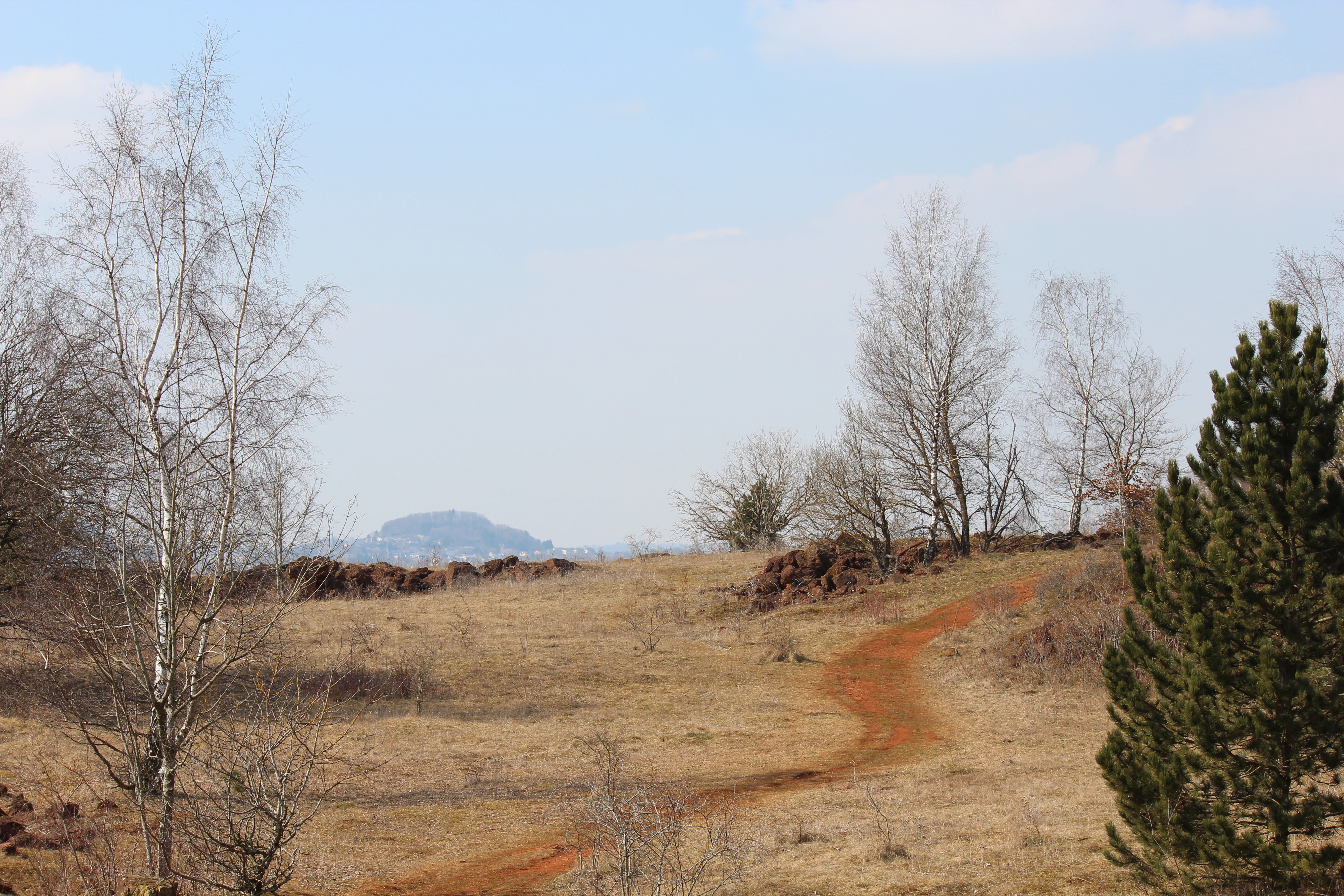
Alongside the dramatic rock walls and terraces, the reserve contains stretches of dry grassland, scattered scrub, and areas where loose stone and bare mineral substrate remain visible. The combination of vertical cliffs, sloping spoil heaps, and flatter plateaus gives the site a varied microtopography that strongly influences where vegetation can establish and where animals can find shelter. Background landmarks visible from parts of the reserve, including the Zolwerknapp quarry, reinforce the broader Minett character of the surrounding scenery.
This combination of relief and substrate types defines the visual identity of Brucherbierg-Lallengerbierg. Rather than a continuous natural landscape, the reserve reads as a patchwork of industrial geometry softened by ecological recovery: rock faces, dry meadows, shrubby margins, and stony openings that together recall both the mining history and the ongoing naturalization of the site.
Brucherbierg-Lallengerbierg Nature Reserve ecosystems, habitats, and plant life
Ecologically, Brucherbierg-Lallengerbierg is dominated by habitats adapted to dry, rocky, and mineral-rich conditions. The exposed rock walls and stone-filled valleys provide microhabitats for crevice-dwelling plants and animals, while the flatter, sun-exposed terraces support a community of species typical of dry meadows and pioneer environments. Together, these vegetation types form a mosaic that is relatively rare in Luxembourg, where most landscapes are dominated by forest or intensive agriculture.
The reserve's dry grasslands are particularly important, as they harbor plant species and invertebrates characteristic of open, warm, nutrient-poor environments. Where the bare stone and rocky substrate remain dominant, pioneer vegetation colonizes the ground, gradually building up a thin layer of organic material that supports more complex plant communities over time. Without active intervention, however, this open character is unstable, and shrubs and trees would eventually reclaim much of the area, altering both its ecological composition and its distinctive scenery.
Management of this ecological balance is closely tied to traditional land use. Sheep grazing is used throughout the reserve to suppress woody regrowth and maintain the open structure of the dry grasslands. This grazing pressure sustains conditions that allow specialized open-habitat species to persist, while also preserving a cultural landscape that reflects the historical interaction between humans, livestock, and the Minett terrain.
Brucherbierg-Lallengerbierg Nature Reserve wildlife and species highlights
The wildlife of Brucherbierg-Lallengerbierg reflects the reserve's combination of rocky, dry, and open habitats. Rock-dwelling and crevice-using species are particularly characteristic of the western sections of the site, where former mining activity has produced extensive stone walls and rough, stony ground. These features offer shelter, breeding sites, and refuge from weather and predators for animals that specialize in such environments.
In the more open dry-grassland areas, the fauna is shaped by the warm, exposed conditions and by ongoing sheep grazing. Insects and other invertebrates associated with dry meadows thrive in these settings, while birds and small terrestrial animals use the mix of short vegetation, scrub edge, and rocky outcrops for foraging and cover. The reserve's mosaic structure, with abrupt transitions between cliff, dry meadow, and terraced ground, encourages a high diversity of microhabitats within a relatively limited area.
The continuing presence of grazing livestock also plays a role in shaping the site's animal communities, both directly through disturbance and indirectly by maintaining the open vegetation that many species depend on. Over time, the reserve's combination of recovering post-industrial land, active management, and ecologically valuable microhabitats has made it a recognized component of Luxembourg's biodiversity network in the Minett region.
Brucherbierg-Lallengerbierg Nature Reserve conservation status and protection priorities
Brucherbierg-Lallengerbierg is significant for conservation because it demonstrates how former industrial land can be transformed into a habitat of recognized ecological value. The site's mix of exposed rock, dry substrate, and open grassland supports plant and animal communities that are uncommon in a landscape otherwise dominated by forest or urban-industrial land use in southern Luxembourg. Formal protection since 2016 has recognized this combination as worthy of long-term safeguarding under the country's nature protection framework.
A central aspect of the reserve's conservation strategy is the active management of its open habitats. Without intervention, natural succession would gradually convert the dry meadows and rocky clearings into shrubland and eventually forest, reducing both the botanical richness and the cultural value of the landscape. Sheep grazing is used as a deliberate conservation tool to counteract this trend, maintaining the dry-grassland character that defines much of the reserve.
The reserve also serves a broader role in Luxembourg's network of Zones of National Interest, contributing to connectivity among protected sites in the Minett. Its position within the communes of Schifflange, Kayl, and Esch-sur-Alzette gives it regional significance, illustrating how conservation can integrate former mining sites into a wider strategy for protecting biodiversity and cultural landscape heritage in one of Luxembourg's most industrialized regions.
Top sights and standout views in Brucherbierg-Lallengerbierg Nature Reserve
The standout quality of Brucherbierg-Lallengerbierg is the way its post-mining terrain now functions as a thriving dry-habitat landscape. Rock walls from former ore extraction, valleys filled with quarried stone, and leveled industrial terraces together create the physical setting for a distinctive community of pioneer plants, dry grassland specialists, and rock-dwelling animals. The reserve's protected status and active grazing management ensure that this unusual combination of industrial heritage and ecological recovery remains a permanent feature of Luxembourg's natural landscape.
Best time to visit Brucherbierg-Lallengerbierg Nature Reserve
Brucherbierg-Lallengerbierg is best appreciated in the warmer months, when dry grasslands and rocky slopes are accessible and visible in their active growing phase. Late spring through early autumn brings out the flowering character of the dry meadows and offers the clearest views of the reserve's rock walls and terraced terrain. In winter, the site's bare, exposed character and its position near landmarks such as the Zolwerknapp give it a stark, open appearance that highlights the geological impact of past mining activity.