Mori Atlas logo
Protected landscapeBrudzeński Park Krajobrazowy

Discover the geographic intersection of the Dobrzyń Lakeland and the Płock Basin river valleys.

Brudzeński Park Krajobrazowy: A Mapped Protected Landscape in Poland's Masovian Voivodeship

Brudzeński Park Krajobrazowy serves as a critical protected landscape in central Poland, defined by the deeply incised, meandering valley of the Skrwa Prawa river. This terrain features a distinct mosaic of old-growth oak-hornbeam woodlands and glacial meltwater channels, including the Karwosiecko-Cholewicka lake chain. Situated within the Masovian Voivodeship, the park represents a significant natural hinge between physical-geographical regions, offering researchers and geography enthusiasts a look at unique riverine and postglacial landforms.

landscape parkriver valleypostglacial lakesoak-hornbeam forestold-growth forestxerothermic grasslands

Brudzeński Park Krajobrazowy

Protected landscape

Park overview

Structured park overview, official facts, and landscape profile for Brudzeński Landscape Park

Brudzeński Landscape Park park facts, protected area profile, and essential visitor context

Review the core facts for Brudzeński Landscape Park, including designation, size, terrain, visitor scale, habitats, and operating context in one park-focused overview.

About Brudzeński Landscape Park

Brudzeński Park Krajobrazowy occupies a transitional zone of central Poland where the glacial landscapes of the Dobrzyń Lakeland give way to the lower-lying Płock Basin along the right bank of the Vistula. Established as a protected landscape park in 1988, it covers about 31.7 km² of forested valleys, ravines, and lake country northwest of Płock, forming an important green corridor between the river and the lake district to its north. The park's geography is essentially shaped by two forces: the erosive action of the Skrwa Prawa river, which has carved a deep winding valley toward its confluence with the Vistula, and the legacy of the last glaciation, which left behind a chain of postglacial lakes in the Karwosiecko-Cholewicka meltwater channel.

Forests dominate the visual and ecological identity of the park. Roughly half of its area is wooded, and a significant share consists of old-growth oak-hornbeam (grąd) woodland, with sessile oak and hornbeam as the principal species. The Skrwa valley, however, breaks this wooded matrix with exposed steep scarps and small ravines that harbor xerothermic (warm-loving) grassland communities, a habitat type more often associated with steppe-like slopes than with the surrounding lowlands. This combination of mature deciduous forest, warm-loving slope vegetation, and riparian habitats along the Skrwa creates a mosaic that supports a notably wide range of protected plants and breeding birds.

Within the park, three nature reserves concentrate protection on its most valuable sites: the Sikórz reserve, the Brwilno reserve, and the Brudzeńskie Jary reserve. Beyond their strictly ecological role, the park's landscapes and the nearby manor house in Sikórz, dating from the nineteenth century, make it both a recreational and culturally significant destination for residents of Płock and the broader Mazovian region. The landscape park category in Polish nature protection implies active management aimed at preserving scenic, ecological, and recreational values while allowing traditional forms of land use to continue under regulation.

Quick facts and research context for Brudzeński Landscape Park

Brudzeński Park Krajobrazowy is a protected landscape park (park krajobrazowy) in the Mazovian Voivodeship of central Poland, established on 9 June 1988. It occupies roughly 31.71 km², with an additional buffer zone of about 43.97 km², and lies along the right bank of the Vistula northwest of Płock. The park crosses the communes of Brudzeń Duży and Stara Biała and sits at the border of the Dobrzyń Lakeland (Pojezierze Dobrzyńskie) and the Płock Basin (Kotlina Płocka). It contains three nature reserves, Sikórz, Brwilno, and Brudzeńskie Jary, and more than half of its area is forested, with a strong presence of old-growth oak-hornbeam stands.

Protection and recognition

Review documented terrestrial protection scope and international recognition records.

Brudzeński Park Krajobrazowy Protection Status and Designated Area Facts

Brudzeński Park Krajobrazowy maintains a documented terrestrial protection scope within the regional landscape registry. Structured records outline available designation data and international recognition sources for conservation analysis.

Protection details

Protection scope
Terrestrial
Transboundary protection
No
Buffer area
43.97 km²
Park context

Deeper park guide and search-rich context for Brudzeński Landscape Park

Brudzeński Landscape Park history, landscape, wildlife, and travel context

Explore Brudzeński Landscape Park through its history, landscape character, ecosystems, wildlife, conservation priorities, cultural context, and seasonal travel timing in a structured park guide built for atlas discovery and search intent.

Why Brudzeński Landscape Park stands out

The park is best known for the deeply carved, winding valley of the Skrwa Prawa river, whose steep slopes, ravines, and thermophilic swards give the area a dramatic, semi-natural character unusual for the surrounding lowlands. Equally distinctive are the extensive old-growth oak-hornbeam forests, the postglacial lake chain of the Karwosiecko-Cholewicka meltwater channel with the Józefów lakes, and the embedded network of nature reserves that protect these landscapes. Protected flora such as mezereon (Daphne mezereum), lily of the valley, snowdrops, and Martagon lily, together with protected birds including the corncrake, honey buzzard, barred warbler, little bittern, common kingfisher, and black stork, underscore its ecological richness.

Brudzeński Landscape Park history and protected-area timeline

Brudzeński Park Krajobrazowy was formally created on 9 June 1988 by a legal act recorded as Official Gazette of the Płock Voivodeship No. 11, item 105. Its establishment occurred during a period in which Poland significantly expanded its network of landscape parks (parki krajobrazowe), a middle-tier protection category focused on preserving scenic, ecological, and recreational values across larger landscapes than nature reserves but with more flexibility than national parks.

The park was designed to protect the deep valley of the Skrwa Prawa in its lower, near-confluence reaches, the associated forest complexes around Brwilno, Brudzeń, and Sikórz, and the postglacial lakes of the Karwosiecko-Cholewicka meltwater channel in the park's northern portion. Within its boundaries, three nature reserves (Sikórz, Brwilno, and Brudzeńskie Jary) were recognized to provide stricter protection for the most valuable forest, ravine, and slope habitats. Since 1988, the park has been managed to maintain its mosaic of oak-hornbeam forests, thermophilic slope grasslands, river-valley habitats, and lake landscapes as a key recreational and natural resource for the Płock area in the Mazovian Voivodeship.

Brudzeński Landscape Park landscape and geographic character

The landscape of Brudzeński Park Krajobrazowy is defined by the interplay between a major river valley and a postglacial lake district. Its central feature is the lower course of the Skrwa Prawa, which meanders in a deep, narrow, incised valley toward its mouth on the Vistula. Steep slopes, eroded escarpments, and narrow ravines break the otherwise gently rolling terrain, giving the river corridor a distinctly picturesque and, in places, almost canyon-like appearance unusual for this part of central Poland.

North of the river corridor, the terrain shifts toward the Karwosiecko-Cholewicka meltwater channel, a glacial landform whose chain of lakes, including those referred to as the Józefów lakes, occupies elongated depressions left by retreating ice. This northern lake belt belongs to the broader Dobrzyń Lakeland, while the southern, river-dominated part transitions toward the lower-lying Płock Basin, placing the park at a literal hinge between two physical-geographical regions. Forests, large patches of old deciduous woodland, xerothermic grasslands on steep slopes, and open freshwater surfaces give the park a varied and visually diverse mosaic despite its relatively modest size of about 31.7 km².

Brudzeński Landscape Park ecosystems, habitats, and plant life

Ecologically, the park is anchored in extensive oak-hornbeam (grąd) forests, with sessile oak and hornbeam as the leading tree species and a significant proportion of old-growth stands. These deciduous forests form the backbone of the park's biodiversity, supported by the protected landscape buffer surrounding them. On the sun-exposed, steep slopes of the Skrwa valley and its ravines, the woodland gives way to xerothermic (warm-loving) swards, a habitat type more typical of southern European or steppic landscapes than of the Polish lowlands, and an important refuge for specialized plant communities.

The mosaic of mature deciduous forest, open thermophilic grasslands, riverbanks, and postglacial lakes creates conditions for a rich understory flora and a diverse breeding bird community. Shaded forest floors host protected flowering plants such as mezereon (Daphne mezereum), lily of the valley, and snowdrops, while the more open, warmer slopes and ravines support Martagon lily. Wet, riparian, and lakeside habitats further diversify the ecological character of the park, linking forest, slope, river, and lake systems within a single protected area.

Brudzeński Landscape Park wildlife and species highlights

The park's mosaic of habitats supports a notable variety of breeding and resident bird species, several of which are legally protected in Poland. Among the characteristic species mentioned in the park's documentation are corncrake and honey buzzard, both indicators of well-preserved, structurally diverse rural and woodland landscapes. The barred warbler, a warm-loving scrub and edge species, finds refuges in the park's xerothermic slope vegetation and forest margins, while the little bittern occurs along reed-fringed sections of lakes and slow-moving water.

Riparian birds add to this diversity, with the common kingfisher associated with the clean, fish-rich stretches of the Skrwa Prawa, and the black stork recorded as a sensitive breeder of older, quieter forest stands. Together, this bird assemblage reflects the park's combination of mature forest, river corridor, and lake habitats, confirming its ecological value beyond the strictly botanical interest of its old-growth oak-hornbeam woodlands and thermophilic flora.

Brudzeński Landscape Park conservation status and protection priorities

Conserving a transitional landscape between the Dobrzyń Lakeland and the Vistula's right-bank lowlands is the park's central purpose. Its protected landscape designation provides a framework that balances nature conservation with continued, regulated human use, including forestry, agriculture, and recreation. The three nature reserves inside the park (Sikórz, Brwilno, and Brudzeńskie Jary) concentrate stricter protection on the most ecologically valuable sites, particularly old-growth forests and structurally rich ravine-valley habitats.

The buffer zone surrounding the park, extending the protected footprint to roughly 44 km² in addition to the 31.7 km² core, helps shield core habitats from incompatible land use and maintains landscape connectivity toward the Vistula. The preservation of old-growth oak-hornbeam stands and of rare xerothermic slope communities gives the park particular international-style significance, as these habitat types are disproportionately important for saproxylic species, pollinators, and other organisms tied to long-established woodland and warm open slopes in central Europe.

Brudzeński Landscape Park cultural meaning and human context

The park sits in a rural area northwest of Płock, in the communes of Brudzeń Duży and Stara Biała, where small villages such as Brwilno, Brudzeń, and Sikórz have long histories of coexistence with the surrounding forests and the Skrwa valley. The nineteenth-century manor house in Sikórz, set within or near the park's territory, is a tangible cultural landmark and a frequent side destination for visitors, reflecting how the protected landscape also preserves elements of the region's built heritage. In this sense, the park embodies the Polish landscape park tradition of linking natural and cultural values, where conservation is understood in the context of long-standing rural land use, traditional settlement patterns, and historic estates of the Mazovian countryside.

Top sights and standout views in Brudzeński Landscape Park

A deeply incised meandering river valley, extensive old-growth oak-hornbeam forests, a postglacial lake chain, and three dedicated nature reserves. The park's xerothermic slope grasslands are a particularly distinctive feature, hosting protected plants such as mezereon, Martagon lily, lily of the valley, and snowdrops, while protected birds including corncrake, honey buzzard, barred warbler, little bittern, common kingfisher, and black stork highlight its breeding season diversity.

Best time to visit Brudzeński Landscape Park

Late spring is especially rewarding when the forest floors come alive with flowering protected species such as lily of the valley, snowdrops, and the early blooms of mezereon, and when breeding birds are most actively present. Early summer brings out the warm-loving grassland flora on the valley slopes and offers long days for exploring both the Skrwa valley and the lake belt of the Karwosiecko-Cholewicka meltwater channel in the north. Autumn highlights the colors of the oak-hornbeam forests and the quieter atmosphere of the river and lake landscapes, while winter, although less biologically active, reveals the dramatic relief of the Skrwa valley and its ravines more clearly when foliage thins.
Monthly climate preview

Long-term representative monthly temperature and precipitation patterns across the protected landscape

Brudzeński Park Krajobrazowy Climate Normals and Annual Temperature Rhythm

Historical climate records from 1991 to 2020 outline a measured annual temperature and precipitation rhythm across Brudzeński Park Krajobrazowy. Detailed monthly climate normals provide deeper analytical context regarding average minimum and maximum temperature variations throughout the year.
Annual mean8 °C
-3 °C20 °C
Jan-3°
Feb-2°
Mar
Apr
May14°
Jun18°
Jul20°
Aug20°
Sep14°
Oct
Nov
Dec-1°
Warmest month
July

20 °C

Coolest month
January

-3.2 °C

Wettest month
July

2.6 mm/day

Driest month
March

1.3 mm/day

Park location guide

Geography guide, regional context, and park location map for Brudzeński Landscape Park

Brudzeński Landscape Park park geography, regions, and map view in Poland

Understand where Brudzeński Landscape Park sits in Poland through a broader geographic reading of the surrounding landscape, nearby location context, and its mapped position within the national park landscape.

How Brudzeński Landscape Park fits into Poland

Poland, officially the Republic of Poland, is a Central European country spanning from the Baltic Sea in the north to the Carpathian Mountains in the south. It borders Germany, Czech Republic, Slovakia, Ukraine, Belarus, Lithuania, and Kaliningrad Oblast. The country has a temperate climate, diverse landscapes, and is known for its rich history, cultural heritage, and strong economic position within the EU.

Wider geography shaping Brudzeński Landscape Park in Poland

Poland occupies 312,696 km2 in Central Europe, extending from the Baltic Sea coast in the north to the Sudetes and Carpathian Mountains in the south. It borders Germany to the west, Czech Republic and Slovakia to the south, Ukraine and Belarus to the east, and Lithuania and Kaliningrad Oblast to the northeast. The landscape includes lowland plains, uplands, and mountain ranges.

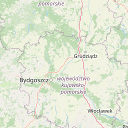
Map view of Brudzeński Landscape Park

Use this park location map to pinpoint Brudzeński Landscape Park in Poland, understand its exact geographic position, and read its mapped placement within the surrounding landscape more clearly.

Pigeon | © OpenStreetMap contributors

Location context for Brudzeński Landscape Park

Masovian Voivodeship
Park atlas

Compare adjacent river valleys, glacial lakes, and regional nature reserves

Explore Parks Near Brudzeński Park Krajobrazowy and Surrounding Protected Landscapes

Visitors exploring Brudzeński Park Krajobrazowy can continue browsing adjacent protected areas across the surrounding Mazovian region. Comparing neighboring river corridors and woodland reserves reveals broader geographic patterns in central European lowland conservation.
Protected landscapeMasovian Voivodeship
About 12 km away#1 closest

Southeast

Jar rzeki Brzeźnicy Protected Landscape: Valley Geography and Habitat Mosaic in Płock

A vital riparian green corridor in the Masovian Voivodeship

Located in Płock, Jar rzeki Brzeźnicy protects a distinct ravine ecosystem carved by the Brzeźnica stream. The site encompasses a rich layering of sandy river bars, deciduous gallery forests, old orchards, and dry meadows, creating a dense natural corridor that serves as a critical refuge for rare mammals and breeding birds.

Area
1.5 km²
Established
2002
Relief
Upland
Climate
Temperate
Nature reserveMazowieckie
About 26 km away#2 closest

South

Rezerwat przyrody Drzewce: Protected Oak-Hornbeam Woodland in the Kutno Plain

Geographic overview of a nature reserve in Mazowieckie, Poland

Located in the Mazowieckie region, Rezerwat przyrody Drzewce provides a conserved sample of oak-hornbeam forest. This nature reserve sits within the ancient Skrwa Lewa River valley, offering a look at the lowland mixed forest communities that historically characterized the Kutno Plain before widespread agricultural development.

Area
0.617 km²
Established
1988
Relief
Lowland
Climate
Temperate
Nature reserveMazowieckie
About 29 km away#3 closest

South

Jezioro Szczawińskie Nature Reserve: Mapped Wetland Landscapes in Mazowieckie, Poland

A vital bird sanctuary and lowland lake protected area.

Jezioro Szczawińskie features a rich mosaic of lake waters, marshes, and wet pastures. This protected area represents a unique zonal habitat in the Mazowieckie lowlands, offering significant insights into wetland geography, avian nesting environments, and the importance of shelterbelt corridors within an agricultural region.

Area
1.379 km²
Established
2009
Relief
Lowland
Scope
Terrestrial
A pale, soft watercolor illustration showing a winding river flowing through green hills and forests against a light sky.
Nature reserveŁódź Voivodeship
About 44 km away#4 closest

Southwest

Dąbrowa Świetlista Nature Reserve: A Detailed Atlas of Protected Polish Oak Woodlands

Examining the ecological terrain and landscape boundaries of a central Polish forest reserve

This park detail provides a structured look at Dąbrowa Świetlista Nature Reserve, a 40-hectare deciduous forest site in Łódź Voivodeship. Discover the geographic importance of this thermophilic oak community, which functions as a protected island of biodiversity within the surrounding lowland terrain of the Wysoczyzna Kłodawska region.

Area
0.401 km²
Established
1990
Relief
Lowland
Climate
Temperate
A horizontal watercolor illustration depicting a soft, pale green and reddish wetland environment with scattered trees and marsh vegetation.
Nature reserveKuyavian-Pomeranian Voivodeship
About 56 km away#5 closest

North

Mszar Płociczno Nature Reserve: Protected Peatland Geography and Landscape Boundaries in Poland

Regional protected area analysis for Kuyavian-Pomeranian landscape maps.

The Mszar Płociczno nature reserve acts as a critical refuge for transitional peatland, harboring a mosaic of Sphagnum mires, swamp forests, and coniferous woodland. This area functions as a key component of the Brodnica peatland ecological network, demonstrating long-term conservation success within the flat terrain of the Równina Urszulewska mesoregion.

Area
1.824 km²
Established
1997
Relief
Lowland
Scope
Terrestrial
National parkMasovian Voivodeship
About 56 km away#6 closest

Southeast

Kampinos National Park: Geographic Profile and Protected Forest Landscape Map

Inland dune formations and wetland habitats in Masovian Voivodeship

The expansive woodland of Kampinos National Park represents a critical protected area in Poland, characterized by its parabolic sand dunes and low-lying marshes. Gain insights into the geomorphological features of this UNESCO biosphere reserve and trace the complex hydrological network that defines its unique forest environment.

Area
385.44 km²
Established
1959
IUCN
II
Relief
Lowland
A soft watercolor illustration of a marshy landscape with low rolling hills, scattered trees, and a winding stream, rendered in light green and yellow tones on a white background.
National parkMasovian Voivodeship
About 56 km away#7 closest

Southeast

Kampinoski Park Narodowy: Mapping the Inland Dune and Wetland Landscapes of Central Poland

A vital protected area in Masovian Voivodeship

The landscape of Kampinoski Park Narodowy is defined by the Grochalskie Piachy dune complex and diverse riparian habitats. This atlas entry covers the geological history and protected boundaries of this significant lowland forest, tracing the Vistula river valley's influence on the surrounding terrain and ecological character.

Area
385.443 km²
Established
1959
Visitors
1M annual
Relief
Lowland
Nature reserveMazovia Voivodeship
About 63 km away#8 closest

Northeast

Rezerwat przyrody Dolina Mławki: Protected Wetland and Forest Geography

Nature reserve terrain and river valley mapping

Deeply explore the physical geography and conservation profile of Rezerwat przyrody Dolina Mławki. This protected area preserves a complex of alder swamp forests, wet riparian corridors, and vital breeding habitats. The site functions as a key reference for lowland Polish wetland ecosystems, offering insights into the natural hydrological and floristic patterns within the Mławka River valley.

Area
1.474 km²
Established
1994
Relief
Lowland
Scope
Terrestrial

Common questions about visiting, size, designation, and location context for Brudzeński Landscape Park

Brudzeński Landscape Park FAQs for park facts, access, geography, and protected area context

Find quick answers about Brudzeński Landscape Park, including protected-area facts, park geography, trail and visitor context, and how the park fits into its surrounding country and regional landscape.
MoriAtlas Explorer

Continue Your Protected Areas Search Across the Global Atlas

Deepen your exploration by continuing the structured search for national parks and protected areas worldwide. Utilize the comprehensive filtering capabilities to compare different conservation landscapes and refine your understanding of global park geography. Discover more about the distribution and characteristics of protected natural areas.

Global natural geography