
Mori Atlas logo
Nature reserveBrühl von Erda

Discover the ecological mosaic of damp sedge fens and dry meadow habitats within this central German valley.

Brühl von Erda Nature Reserve: Mapped Protected Landscapes and Geographic Valley Context in Hessen

(Naturschutzgebiet Brühl von Erda)

Brühl von Erda is a nature reserve in the Lahn-Dill-Kreis district of Hessen, protecting a compact valley basin carved by the Brühlbach stream. The area supports a fine-grained mosaic of spring-fed seepage zones, marshy sedge stands, and orchid-rich grassland on thin soils. Through this detailed atlas view, trace the boundaries of this protected habitat network, which serves as a vital refuge for specialized grassland meadow-breeding birds, rare butterfly populations, and diverse insect fauna.

meadowwet meadowdry grasslandspring-fed valleysedge fenorchid habitat
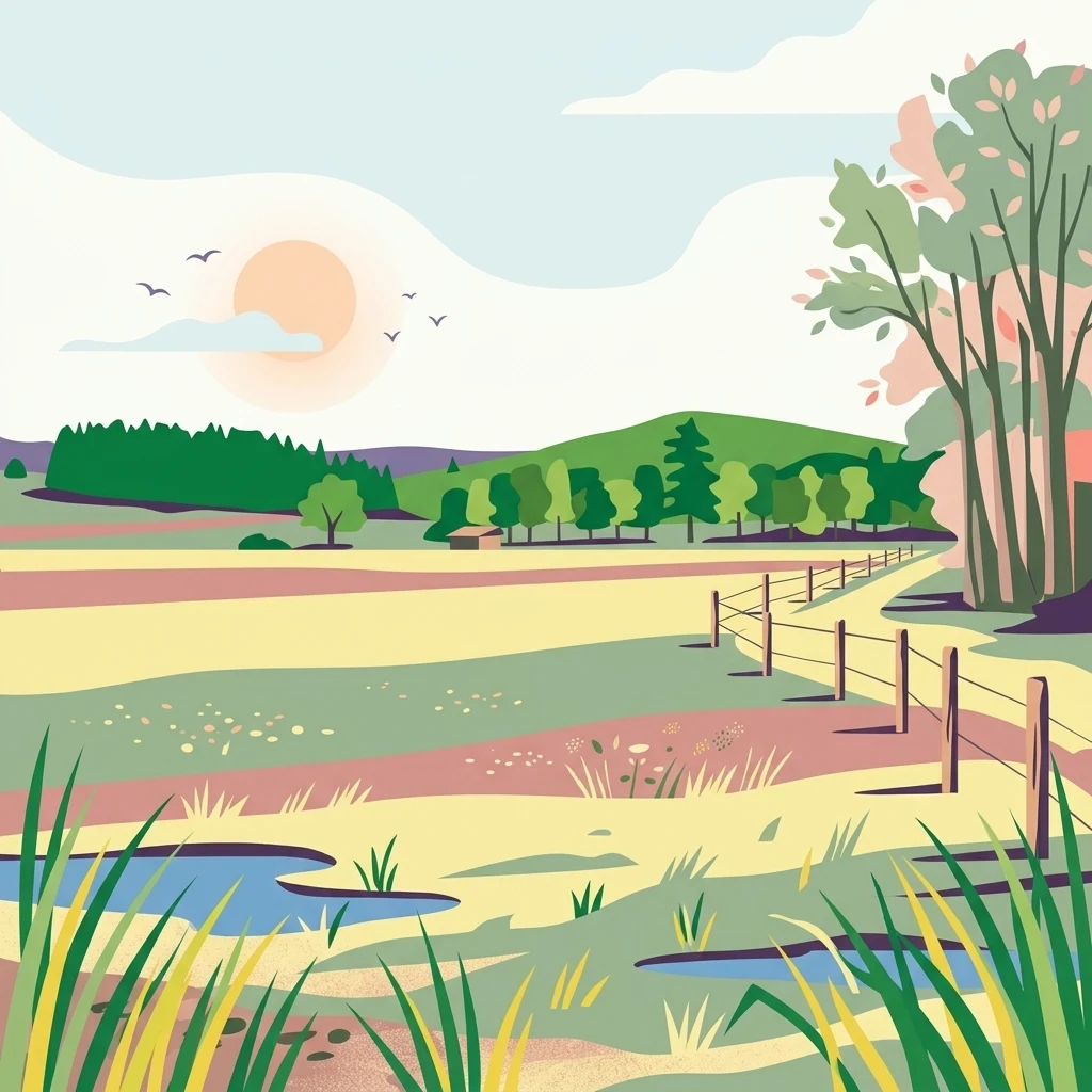
A flat-style digital illustration of a peaceful rural landscape with a meadow, scattered small pools of water, a wooden fence, and a distant treeline under a soft sunset sky.

Brühl von Erda

Nature reserve

Park overview

Structured park overview, official facts, and landscape profile for Brühl von Erda

Brühl von Erda park facts, protected area profile, and essential visitor context

Review the core facts for Brühl von Erda, including designation, size, terrain, visitor scale, habitats, and operating context in one park-focused overview.

About Brühl von Erda

Brühl von Erda lies in the gently rolling landscape of central Hesse, just outside the village of Erda in the municipality of Hohenahr. The reserve occupies a shallow valley basin that gathers water from a series of freshwater springs along the Brühlbach, the small stream that gives the area its name and its character. Over time, the combination of natural seepage, traditional grazing, and seasonal mowing has produced a working agricultural landscape that nonetheless retains an exceptional degree of botanical and structural diversity.

The protected area is composed of wet meadows with fresh, moist, and seasonally saturated soils, alongside richer pasture used for livestock grazing. Above the valley floor, thinner soils support dry grassland communities, including rare alternating-moisture mat-grass swards characteristic of traditional Central European grassland that has not been heavily fertilised. In the southern portion of the reserve, the ground becomes genuinely marshy, with a patchwork of different sedge species forming dense, waterlogged stands; this sector, together with the springs and stream corridor, is the most sensitive part of the site.

Surrounding land use shapes the reserve directly. To the west, the protected area is bordered by improved farmland, additional meadows, and the edge of Erda village itself, which keeps the habitat open and well connected to neighbouring grassland. To the east and south, woodland frames the valley and continues up to the nearby nature reserve of Oberes Verstal, creating a transition between open meadow and forest that is itself ecologically important. This framing of woodland around open, spring-fed meadow is part of what makes Brühl von Erda biologically rich within a relatively small footprint.

Beyond its immediate physical setting, the reserve is significant as part of a wider conservation network. It lies within the pan-European Habitats Directive site "Helfholzwiesen und Brühl bei Erda" and is included in the EU Birds Directive area that covers the meadow valleys around Hohenahr and the Aartalsperre. Its management is therefore not just a local initiative but part of an integrated effort to maintain semi-natural grassland and the species that depend on it across the broader Hohenahr landscape.

Quick facts and research context for Brühl von Erda

Brühl von Erda is a 33.67-hectare nature reserve in Hesse, Germany, located in the valley east of Erda within the municipality of Hohenahr in the Lahn-Dill-Kreis. It was placed under protection on 10 December 1979 under the identification number 1532001 and is administered by the higher nature conservation authority at the Regierungspräsidium Gießen. The reserve follows the course of the Brühlbach and is built around a network of freshwater springs that feed wet meadows, sedge fens, and drier grassland on shallow soils, creating a distinctly varied small-scale habitat mosaic in a compact valley basin.

Protection and recognition

Documented terrestrial protection scope and conservation records for Brühl von Erda

Brühl von Erda Protection Status and International Recognition Data

Brühl von Erda maintains a recorded terrestrial protection scope within official conservation databases and international registers. Review documented administrative frameworks, designation criteria, and recognized boundary parameters associated with this protected landscape.

Protection details

Protection scope
Terrestrial
Transboundary protection
No
WDPA ID
81472
Park context

Deeper park guide and search-rich context for Brühl von Erda

Brühl von Erda history, landscape, wildlife, and travel context

Explore Brühl von Erda through its history, landscape character, ecosystems, wildlife, conservation priorities, cultural context, and seasonal travel timing in a structured park guide built for atlas discovery and search intent.

Why Brühl von Erda stands out

Brühl von Erda is best known for its unusually compressed mosaic of contrasting habitats, where calcareous-influenced dry grassland, mat-grass swards, wet meadows, and spring-fed sedge fens occur in immediate proximity. This habitat diversity within a small area supports threatened meadow-breeding birds such as lapwing, snipe, and whinchat, alongside rare butterflies including the dusky large blue, and gives the reserve a strong ecological identity despite its modest size.
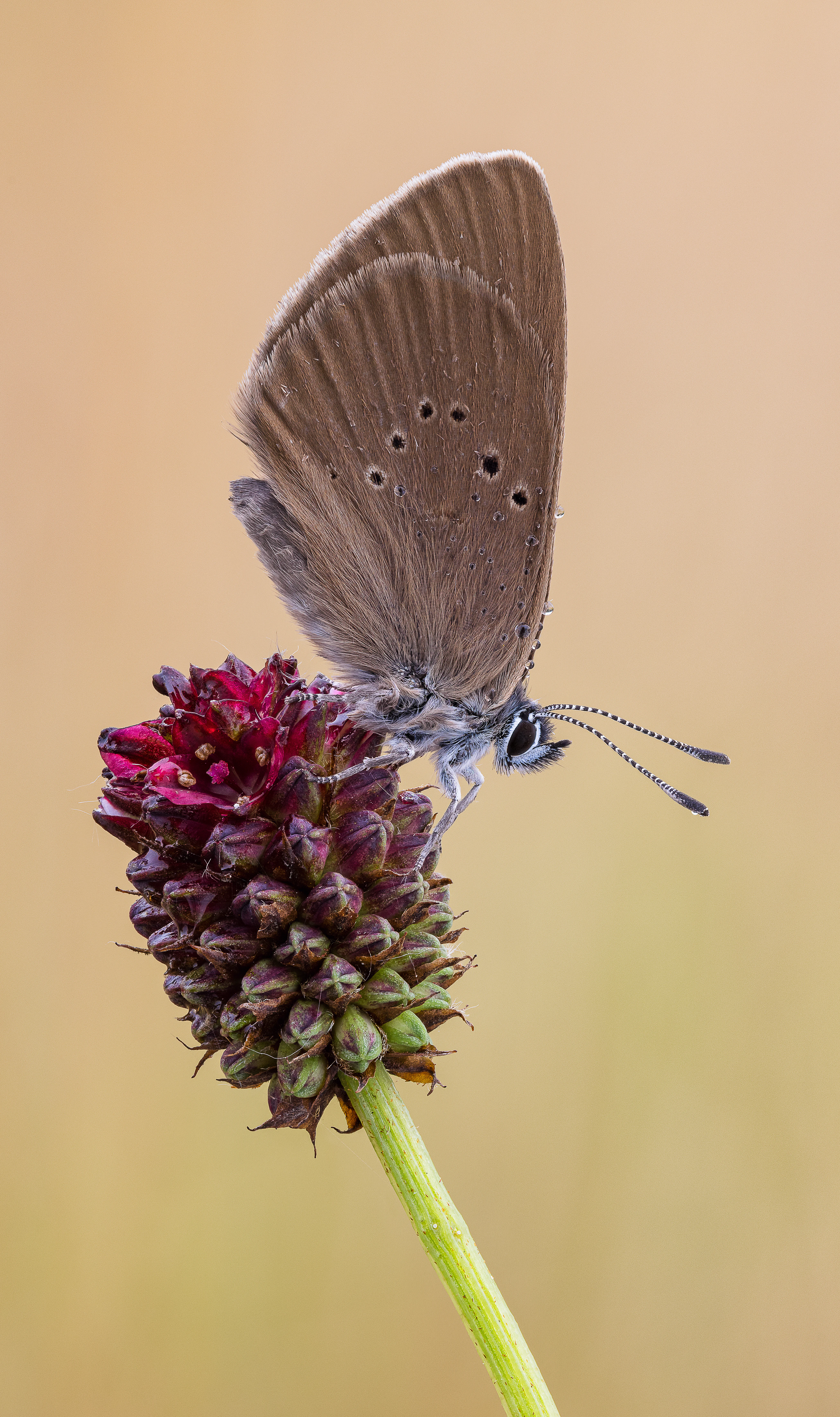
Side profile view of a Dusky Large Blue butterfly perched on a dark reddish-purple flower head against a soft, blurred golden background.
A Dusky Large Blue butterfly, an indicator species for protected meadow habitats, resting on a bloom.

Brühl von Erda history and protected-area timeline

Brühl von Erda was formally designated as a nature reserve on 10 December 1979, under the legal framework of Hessian nature conservation legislation. The identification code 1532001, still used today, ties the site to the German federal catalogue of protected areas and links it to the World Database on Protected Areas record under ID 81472. Since its designation, the reserve has been managed by the higher nature conservation authority of the Regierungspräsidium Gießen.

Its conservation history is closely tied to a broader effort to protect the traditional meadow valleys around Hohenahr. After the original 1979 designation, the reserve was incorporated into Habitats Directive site 5317-302, "Helfholzwiesen und Brühl bei Erda," and into the EU Birds Directive area 5316-401 covering the meadow valleys around Hohenahr and the Aartalsperre. These overlapping designations reflect the gradual recognition of the area not just as a local nature reserve but as a key component of European-level conservation planning for grassland habitats and meadow-breeding birds.

Brühl von Erda landscape and geographic character

The landscape of Brühl von Erda is defined by a small, shallow valley carved by the Brühlbach. The valley floor is a mixture of wet meadows, marshy sedge stands, and spring seepage zones, while the slopes and slightly raised portions of the basin carry dry, species-rich grassland. The transition between these zones happens over very short distances, and the visual character of the reserve shifts with the season: lush green and flower-rich in late spring and early summer, golden and parched in late summer, and watermarked by visible spring lines and small flooded patches after heavy rain or in spring snowmelt.

To the west, the reserve is contained by the geometric edge of modern agricultural land and the rooftops of Erda, while to the east and south the meadows give way to continuous woodland that climbs toward the neighbouring Oberes Verstal reserve. This enclosed, bowl-like setting gives the site a quiet, sheltered atmosphere and concentrates moisture into the valley, which is what allows the wet meadow and sedge fen communities to persist. On the drier slopes, shallow soils and traditional low-intensity use maintain thin swards where orchids and other uncommon flowering plants can compete successfully.
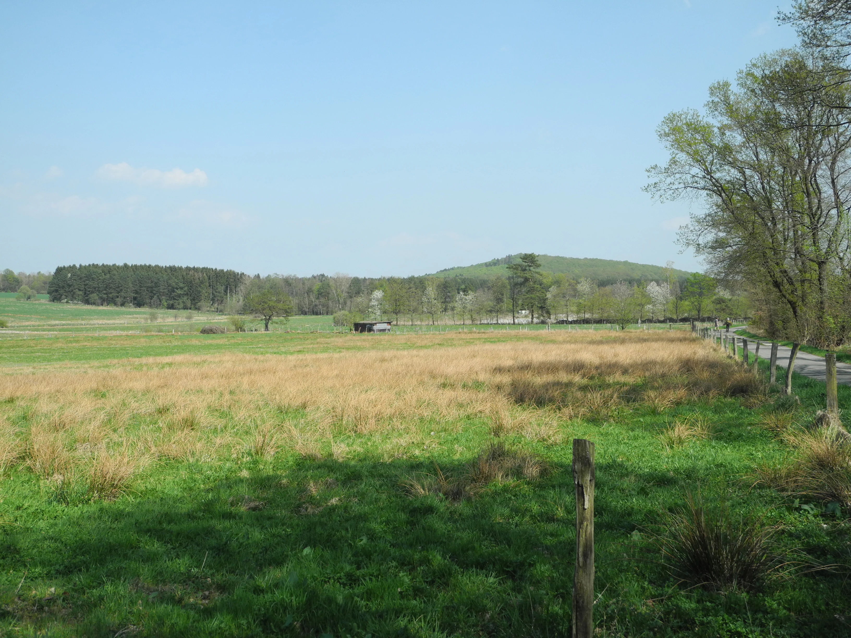
Wide view of open meadows with green and dry grass, scattered trees, and distant low hills under a clear blue sky in Brühl von Erda.
A view of the meadows and rolling hills in the Brühl von Erda nature reserve.

Brühl von Erda ecosystems, habitats, and plant life

Ecologically, Brühl von Erda is a grassland reserve whose value lies in the compression of many semi-natural habitat types into a very small area. The botanical inventory includes several regionally rare species associated with both dry and wet conditions: meadow saxifrage, the broad-leaved marsh orchid, devil's-bit scabious, common milkwort, the stemless thistle, bogbean, narrow-leaved cottongrass, bladder sedge, beaked sedge, thread rush, caraway-leaved lovage, and marsh violet. The presence of these species together signals a long continuity of traditional management and an intact hydrological system dominated by seeping groundwater rather than a single dominant stream.

The vegetation mosaic is matched by a strong invertebrate fauna. Surveys have recorded 31 butterfly species and 15 grasshopper species, with several considered rare or strongly threatened at regional level. Among the most notable invertebrates is the dusky large blue butterfly, a species tightly linked to specific meadow plants and traditional grassland management. The combination of dry, flower-rich swards and wet, structurally varied meadow ensures that both warm-loving and moisture-loving invertebrate communities can persist side by side.
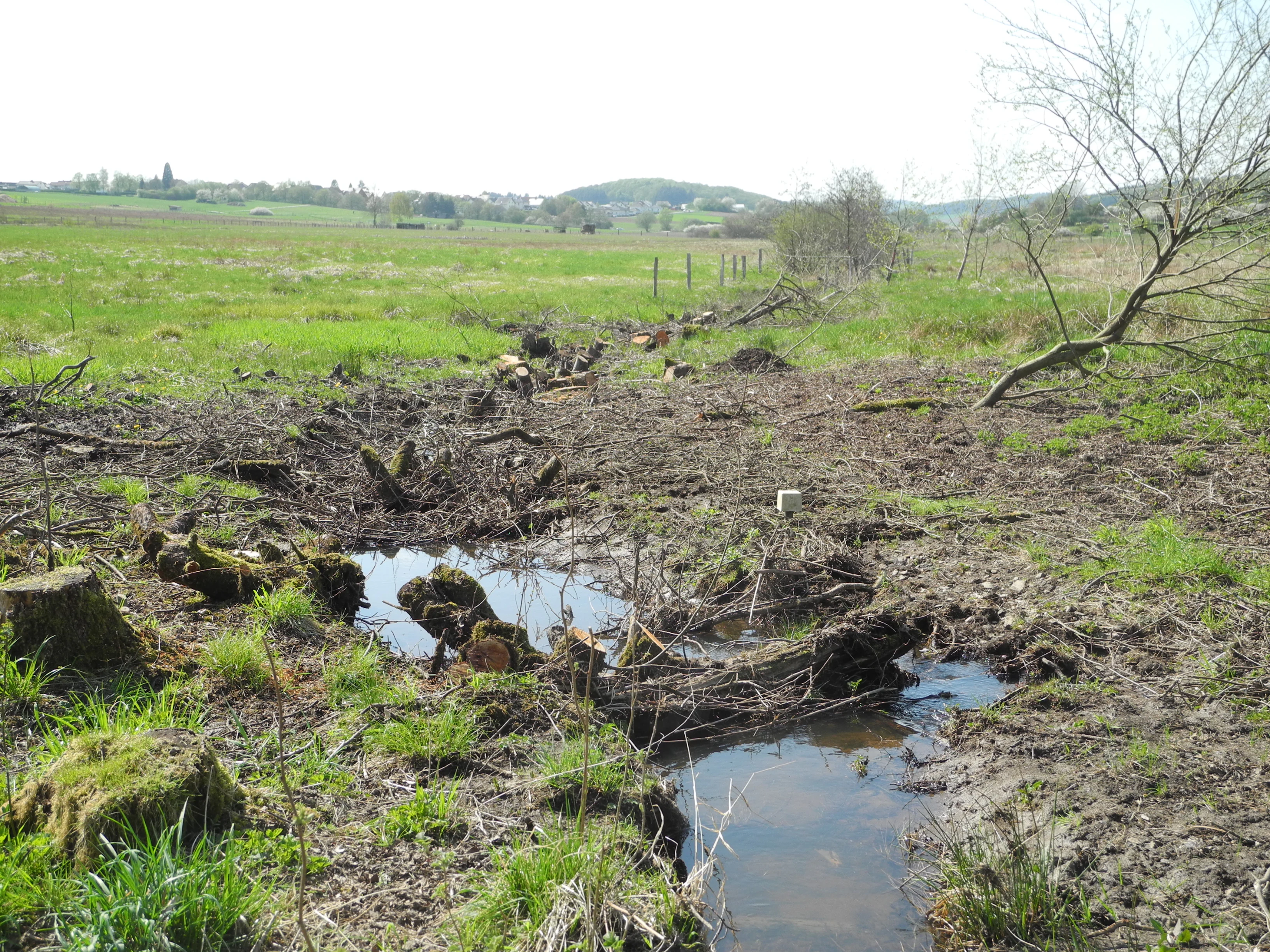
A small, muddy stream winding through a grassy, open meadow with tree stumps in the foreground and rolling hills in the background.
A small stream flowing through the wetland meadows of Brühl von Erda.

Brühl von Erda wildlife and species highlights

The wildlife profile of Brühl von Erda is shaped by the contrast between open meadow habitats and the adjacent woodland edge. Meadow-breeding birds are especially significant: the reserve supports red-backed shrike, whinchat, meadow pipit, common snipe, jack snipe, great grey shrike, northern lapwing, and grey heron, all of which depend on the combination of open ground, varied sward height, and the wet hollows created by the springs. The presence of species such as the great grey shrike, which requires large hunting territories with good visibility, points to the high quality of the habitat mosaic.

In addition to breeding birds, woodland-edge species and larger mammals use the transition zones between forest and meadow as regular feeding and movement corridors. The meadows themselves, particularly those with richer flowering, support dense populations of butterflies and grasshoppers, and the marshy margins and spring-fed areas provide amphibian and invertebrate habitat. Grey herons are regular visitors to the wetter parts of the valley, where the shallow, slow-moving water along the Brühlbach offers feeding opportunities.
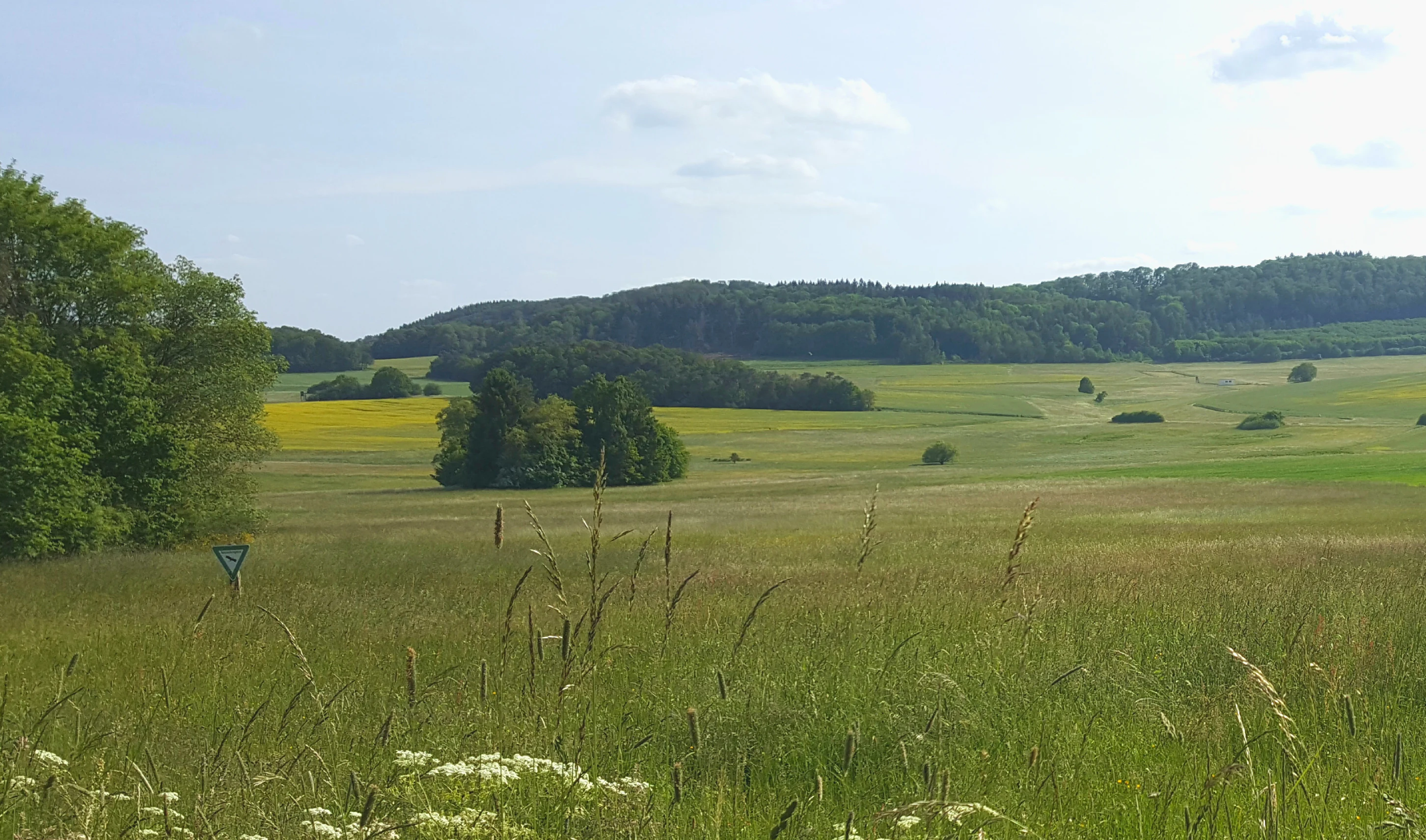
A wide view of a grassy meadow landscape at Brühl von Erda in Germany, featuring rolling green hills, patches of trees, and a distant forested ridgeline under a soft sky.
The Helfholzwiesen meadows within the Brühl von Erda nature reserve.

Brühl von Erda conservation status and protection priorities

From a conservation standpoint, Brühl von Erda is important because it preserves a working agricultural landscape of high ecological value under formal protection. The reserve is part of the EU Habitats Directive site "Helfholzwiesen und Brühl bei Erda" (5317-302) and the EU Birds Directive area "Wiesentäler um Hohenaar und die Aartalsperre" (5316-401), placing it within a European network of sites selected for their habitat and species value. Its conservation objective is not only to protect individual species, but to maintain the underlying mosaic of dry, wet, and spring-fed grassland on which those species depend.

Management is oriented around keeping the meadows open and structurally diverse. Depending on the plant community present and the breeding calendar of meadow birds, valuable grassland plots are mowed once or twice a year, or grazed with sheep, with timing carefully chosen to avoid the most sensitive nesting periods. This rotational grazing and mowing regime is essential to preventing scrub encroachment, maintaining the dry grassland communities, and keeping the wet meadows from being lost to reed or sedge monocultures. The location adjacent to the neighbouring Helfholzwiesen site extends these conservation benefits across a wider area.

Brühl von Erda cultural meaning and human context

Brühl von Erda reflects a long tradition of low-intensity grassland use in central Hesse, where small valley meadows around villages have been maintained through grazing and seasonal hay-making for generations. The reserve takes its name from the Brühlbach that runs through it, and from the village of Erda, which lies immediately to its west. The presence of traditional pastures right next to the modern agricultural landscape of the village edge gives the site a strong sense of being a piece of older countryside preserved within the working land of today, rather than an isolated or rewilded area.

Top sights and standout views in Brühl von Erda

The reserve's defining highlight is the density of habitat diversity within a small area: dry grassland, mat-grass swards, wet meadows, spring hollows, and sedge fens all occur within a single compact valley. This supports a rare combination of meadow-breeding birds, specialised butterflies such as the dusky large blue, and a notably rich grasshopper fauna. The integration of the reserve into both national and European protection frameworks, together with active management by mowing and sheep grazing, gives it a robust conservation profile despite its modest size.

Monthly climate preview

Long-term representative monthly temperature and precipitation data for Hessen

Brühl von Erda Climate Normals and Annual Temperature Rhythm

Historical NASA records for Brühl von Erda outline a measured annual temperature rhythm ranging from freezing winter lows to warm summer maximums alongside steady monthly precipitation. Examining the complete twelve-month climatology dataset reveals broader meteorological patterns and detailed baseline statistics across the terrain.
Annual mean9 °C
-1 °C19 °C
Jan-1°
Feb
Mar
Apr
May13°
Jun16°
Jul19°
Aug19°
Sep14°
Oct
Nov
Dec
Warmest month
July

18.8 °C

Coolest month
January

-0.6 °C

Wettest month
July

2.5 mm/day

Driest month
April

1.6 mm/day

Park location guide

Geography guide, regional context, and park location map for Brühl von Erda

Brühl von Erda park geography, regions, and map view in Germany

Understand where Brühl von Erda sits in Germany through a broader geographic reading of the surrounding landscape, nearby location context, and its mapped position within the national park landscape.

How Brühl von Erda fits into Germany

Germany is a federal republic in Western and Central Europe with a population of over 83 million across sixteen constituent states. It is Europe's largest economy by nominal GDP and a major global exporter and importer. The capital is Berlin, and the country borders Denmark, Poland, Czech Republic, Austria, Switzerland, France, Luxembourg, Belgium, and the Netherlands.

Wider geography shaping Brühl von Erda in Germany

Germany is located in Western and Central Europe, spanning 357,022 km². It borders Denmark to the north, Poland and the Czech Republic to the east, Austria and Switzerland to the south, and France, Luxembourg, Belgium, and the Netherlands to the west. The country has coastlines on the Baltic Sea and North Sea to the north, with the Alps located in the southern region.

Map view of Brühl von Erda

Use this park location map to pinpoint Brühl von Erda in Germany, understand its exact geographic position, and read its mapped placement within the surrounding landscape more clearly.

Pigeon | © OpenStreetMap contributors

Location context for Brühl von Erda

Hessen

Visualizing the valley basin, stream corridors, and diverse meadow habitats of central Hesse.

Brühl von Erda Photos and Protected Landscape Scenery

Photographic records reveal the distinct valley terrain, spring-fed wetlands, and dry grassland mosaics defining Brühl von Erda. Visual exploration highlights the compact ecological structures and seasonal habitat transitions characterizing the protected reserve.

Side profile view of a Dusky Large Blue butterfly perched on a dark reddish-purple flower head against a soft, blurred golden background.

A close-up view of a cluster of small, purple, spire-shaped flowers growing in a grassy field.

Wide view of open meadows with green and dry grass, scattered trees, and distant low hills under a clear blue sky in Brühl von Erda.

A small, muddy stream winding through a grassy, open meadow with tree stumps in the foreground and rolling hills in the background.

A wide view of a grassy meadow landscape at Brühl von Erda in Germany, featuring rolling green hills, patches of trees, and a distant forested ridgeline under a soft sky.

Park atlas

Compare adjacent valley habitats, grassland mosaics, and regional nature reserves

Explore Protected Areas and Parks Near Brühl von Erda in Central Hesse

Browsing other protected landscapes around Brühl von Erda reveals connected river valleys, grassland reserves, and regional conservation networks across the surrounding Lahn-Dill-Kreis district. Comparing these nearby habitats provides a clearer picture of Central Hesse valley ecosystems and regional biodiversity patterns.
Watercolor painting of a rolling landscape with green hills, a small body of water, and clusters of trees under a soft, pale sky.
Nature reserveHessen
About 13 km away#1 closest

Southwest

Koppe Nature Reserve: Protected Basalt Hill and Geological Landmark in Central Hessen

A defined volcanic cone within the forested Hörre ridge range

Koppe stands as a prominent nature reserve in central Hessen, recognized for its unusual conical shape and exposed columnar basalt formations. This protected site integrates geological interest with varied woodland habitats, ranging from dense summit beech forests to open heath communities of pine and juniper. It remains a focal point for understanding the complex natural terrain and protected landscape transitions found throughout the wider Westerwald-Lahn-Taunus region.

Area
0.234 km²
Established
1931
Relief
Mountain
Climate
Temperate
A horizontal watercolor painting depicting a soft-focus landscape of low green hills, wooded areas, and open fields under a pale sky.
Protected landscapeHessen
About 14 km away#2 closest

North

Naturpark Lahn-Dill-Bergland: Protected Area Mapping and Geographic Landscape Overview

Regional Mittelgebirge terrain in the heart of Hessen

Naturpark Lahn-Dill-Bergland serves as a core protected landscape in western Hessen, spanning the districts of Marburg-Biedenkopf and Lahn-Dill-Kreis. This atlas entry details the park's topography, including the Bottenhorner Hochflächen and the expansive forest masses of the Schelder Wald, providing a clear geographic context for its layered ridges and scenic river valley systems.

Area
830.9 km²
Established
2007
Relief
Mountain
Climate
Temperate
Watercolor painting of a tranquil wetland scene with grassy banks, small pools of water, and rolling hills in the background.
Nature reserveHessen
About 16 km away#3 closest

Northeast

Kleine Lummersbach bei Cyriaxweimar Protected Nature Reserve and Hessian Landscape Geography

A diverse forest and grassland habitat within the Marburg-Biedenkopf district

Kleine Lummersbach bei Cyriaxweimar offers an exceptional case study in protected area geography. Formed by a blend of mature oak and beech forests, nutrient-poor meadows, and seasonal ponds, the reserve provides a critical refuge for protected amphibians and bats. Its varied terrain, spanning from dense woodland to open, grazed clearings, makes it a vital site for biodiversity conservation in central Germany.

Area
1.383 km²
Established
1997
IUCN
IV
Relief
Upland
A watercolor painting showing a soft, pastoral landscape with green trees, rolling hills, and purple-toned wetland areas against a white background.
Nature reserveHessen
About 22 km away#4 closest

South

Egelpfuhl bei Oberwetz Nature Reserve: A Protected Wetland Sanctuary in Hessen, Germany

Geographic overview of a protected wet meadow valley in the Lahn-Dill district.

Egelpfuhl bei Oberwetz occupies a 10.75-hectare valley hollow defined by its moist soils and near-natural brook course. This nature reserve supports a structured habitat for endangered meadow butterflies and birds, acting as an essential ecological bridge within the intensively farmed landscape of central Germany.

Area
0.108 km²
Established
1990
IUCN
IV
A soft, painterly watercolor illustration of a rolling green landscape with a gentle stream or wetland area in the foreground and rounded hills in the background.
Nature reserveHessen
About 27 km away#5 closest

West

Aubachtal bei Rabenscheid Nature Reserve: Mapped Geography and Protected Area Data

A primary stream-valley habitat within the Hessen region

Aubachtal bei Rabenscheid offers a detailed look at a high-quality nature reserve in the Lahn-Dill-Kreis area of Hessen. The landscape is defined by the narrow valley of the Aubach, which supports a complex mosaic of wet meadows, alder swamp woodlands, and sedge mires. This site functions as a significant ecological refuge, contributing to the broader European network of protected areas through its distinct biodiversity and clean-water stream ecosystems.

Area
0.63 km²
Established
1984
IUCN
IV
Relief
Upland
Watercolor painting of a soft, hazy landscape featuring gentle green hills, clusters of trees, and open fields against a white background.
Nature reserveHessen
About 28 km away#6 closest

West

Bermershube bei Heisterberg Protected Area: Geography and Landscape Atlas

Nature reserve in the Hoher Westerwald region of Hessen

Located in the Lahn-Dill district, Bermershube bei Heisterberg represents a concentrated mosaic of upland natural features. The protected landscape combines deciduous slope forests with spring-fed wetlands and meadows, creating an essential ecological corridor within the Hoher Westerwald plateau. Detailed geographic insights reveal the interplay between the Amdorf brook drainage and the surrounding undisturbed forest ecosystems.

Area
0.449 km²
Established
1984
IUCN
IV
Relief
Upland
A horizontal watercolor painting depicting a soft, green landscape with a winding stream through a flowery meadow and forested hills in the background.
Nature reserveHessen
About 28 km away#7 closest

West

Die Heck bei Hohenroth Nature Reserve: Hessen Protected Forest and Geography

High-elevation woodland habitats in the Hoher Westerwald

Located in the Lahn-Dill district, Die Heck bei Hohenroth provides a specialized look at Mittelgebirge ecology. The reserve functions as a node within European conservation networks, protecting a mosaic of wet and dry forest patches that support rare lichens, fungi, and native bird populations across its rolling upland terrain.

Area
0.204 km²
Established
1998
IUCN
IV
A watercolor illustration of a forest edge with trees, mossy rocks, and ferns, featuring a soft, bright, and airy color palette.
Nature reserveHessen
About 29 km away#8 closest

West

Rabenscheider Holz Nature Reserve: Protected Landscapes and Stream Valleys in Hessen

Westerwald upland terrain and diverse woodland habitats

Rabenscheider Holz preserves a vital cross-section of Westerwald habitats, integrating mature broadleaf forests and traditionally managed grasslands. This nature reserve serves as an ecological anchor within the Ketzerbach stream valley, maintaining important woodland and meadow biodiversity in the state of Hessen.

Area
0.573 km²
Established
1994
IUCN
IV

Common questions about visiting, size, designation, and location context for Brühl von Erda

Brühl von Erda FAQs for park facts, access, geography, and protected area context

Find quick answers about Brühl von Erda, including protected-area facts, park geography, trail and visitor context, and how the park fits into its surrounding country and regional landscape.
MoriAtlas Explorer

Continue Your Protected Areas Search Across the Global Atlas

Deepen your exploration by continuing the structured search for national parks and protected areas worldwide. Utilize the comprehensive filtering capabilities to compare different conservation landscapes and refine your understanding of global park geography. Discover more about the distribution and characteristics of protected natural areas.

Global natural geography