
Mori Atlas logo
Nature reserveBuchenbachtal bei Christerode

A mapped overview of low-mountain stream valleys, wet meadows, and forested ridge terrain

Buchenbachtal bei Christerode Nature Reserve and Protected Landscape Geography in Hesse

(Naturschutzgebiet Buchenbachtal bei Christerode)

Buchenbachtal bei Christerode represents a core nature reserve within the Schwalm-Eder-Kreis district of Hesse, protecting a distinct low-mountain valley system. This protected area integrates the Buchenbach and Geritzbach stream corridors with surrounding broadleaf forests and traditionally managed wet meadows. The site functions as a key element of the broader regional landscape, linking riparian habitats to the forested terrain near the Schwarzenborn training area through its conserved natural boundaries.

nature reservestream valleywet meadowsbroadleaf forestlow-mountain landscapeHesse
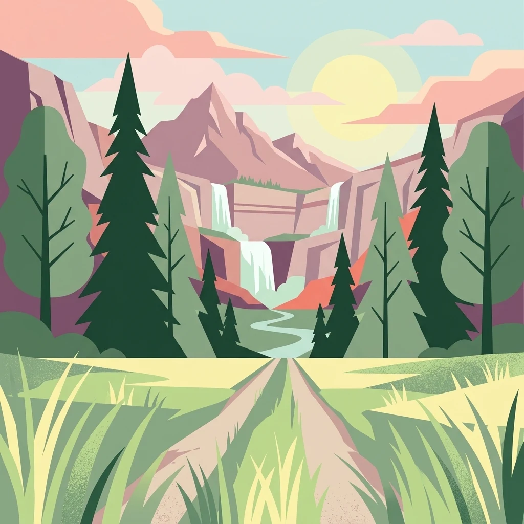
A flat-design digital illustration showing a dirt path leading toward a mountain range with a cascading waterfall, surrounded by coniferous trees and grassy foreground.

Buchenbachtal bei Christerode

Nature reserve

Park overview

Structured park overview, official facts, and landscape profile for Buchenbachtal bei Christerode

Buchenbachtal bei Christerode park facts, protected area profile, and essential visitor context

Review the core facts for Buchenbachtal bei Christerode, including designation, size, terrain, visitor scale, habitats, and operating context in one park-focused overview.

About Buchenbachtal bei Christerode

Buchenbachtal bei Christerode is a compact yet ecologically representative example of the low-mountain valley landscapes that shape much of northern Hesse. The nature reserve lies in the Schwalm-Eder-Kreis, southeast of the Knüllgebirge, on municipal land belonging to Neukirchen. It is situated south of the small village of Christerode and is framed by two roads: the L 3161 along the northeastern edge of the area and the B 454 passing to the south. To the southeast, the reserve meets the large Schwarzenborn military training area, which provides a wide, partially undeveloped buffer of forest and open land.

The reserve's core landscapes are the valleys of the Buchenbach, a tributary of the Grenff, and the Geritzbach. Along these streams the protected area preserves a mosaic of wet grassland and deciduous forest that is increasingly rare in intensively used central European landscapes. The valley floors and lower slopes carry meadows that have long been shaped by extensive, traditional forms of agricultural use, while the surrounding slopes and ridges are wooded, with forest that the protection order explicitly targets for development into near-natural, site-appropriate stands of broadleaf trees.

Although the reserve is modest in size, it plays an important role within the regional network of protected sites in the Schwalm-Eder-Kreis. It complements neighbouring reserves such as Roßbachtal bei Völkershain and Josbachtal bei Lischeid, which protect similarly structured stream valleys elsewhere in the district. Together with its adjacent landscape protection area, Buchenbachtal bei Christerode forms a continuous corridor of protected valley landscape that connects stream habitats, wet meadows, and deciduous forest across the margin of the Schwarzenborn training area.

Quick facts and research context for Buchenbachtal bei Christerode

Buchenbachtal bei Christerode is a designated nature reserve in the Schwalm-Eder-Kreis district of Hesse, Germany. It lies south of the village of Christerode, a district of the town of Neukirchen, and is bordered to the northeast by the L 3161 state road with the B 454 federal road further south. The site was first placed under protection in 1995. A landscape protection area of similar character extends directly southeast of the core reserve. The protected area is linked ecologically and administratively with the broader network of nature reserves in the Schwalm-Eder-Kreis.

Protection and recognition

Examine official protected area records and designated management status.

Buchenbachtal bei Christerode Protection Status and Designated Area Record

Buchenbachtal bei Christerode maintains documented protection records detailing the official conservation status and management scope. Regional conservation data compiles registered designation frameworks and protected area registries for rigorous environmental analysis.

Protection details

WDPA ID
162603
Park context

Deeper park guide and search-rich context for Buchenbachtal bei Christerode

Buchenbachtal bei Christerode history, landscape, wildlife, and travel context

Explore Buchenbachtal bei Christerode through its history, landscape character, ecosystems, wildlife, conservation priorities, cultural context, and seasonal travel timing in a structured park guide built for atlas discovery and search intent.

Why Buchenbachtal bei Christerode stands out

Buchenbachtal bei Christerode is best known for its combination of low-mountain stream valleys, traditionally managed wet meadows, and stands of broadleaf forest in transition toward more natural composition. The reserve is particularly valued for protecting the Buchenbach, Geritzbach, and Ziegenbach stream systems together with their immediate meadow and woodland surroundings, an ensemble that represents the typical Mittelgebirge landscape of the northern Hessian low mountain region.
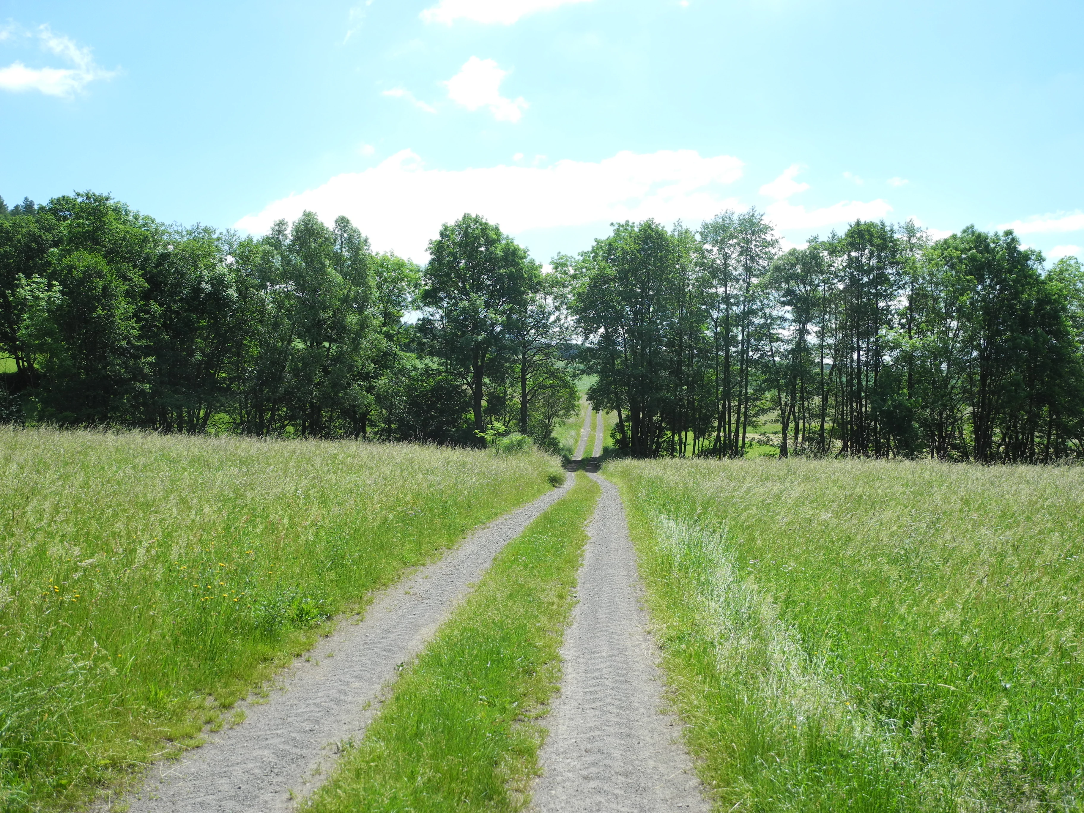
A narrow dirt path leads through a tall, green grass meadow toward a line of deciduous trees under a blue sky.
A dirt trail winds through the meadows and woodlands of the Buchenbachtal nature reserve.

Buchenbachtal bei Christerode history and protected-area timeline

The reserve has a relatively recent history in formal terms. It was placed under nature protection in 1995 by decree of the Kassel regional government authority (Regierungspräsidium Kassel), under the official designation 1634032, and the decree was published that same year in the Staatsanzeiger für das Land Hessen. In the same legal act, the surrounding landscape protection area (Landschaftsschutzgebiet Buchenbachtal bei Christerode) was designated to buffer and extend the protection of the core reserve.

Despite their formal youth, the landscapes themselves are the product of much older land use patterns. The meadows along the Buchenbach and Geritzbach have been shaped over many generations by extensive forms of grassland management typical of Hesse's low-mountain valleys, and the surrounding woodlands reflect long-standing cycles of forestry use. The 1995 protection order recognized this inherited character and established a formal framework for maintaining it, including the explicit aim of guiding the existing forests toward more natural, site-appropriate broadleaf compositions.

Buchenbachtal bei Christerode landscape and geographic character

The landscape of Buchenbachtal bei Christerode is shaped by the meeting of small low-mountain streams, gently sloping valley sides, and wooded ridges. The Buchenbach and Geritzbach cut shallow valleys into the terrain south of Christerode, creating the elongated valley corridor that gives the reserve its name and character. The valley floors are comparatively flat and carry grassland, while the slopes rising from them transition into closed forest.

To the southeast, the relief rises toward the Wickelsberg and continues toward the broader wooded terrain associated with the Schwarzenborn training area. The Ziegenbach runs along the southern edge of the protected landscape, marking the transition into the adjacent landscape protection area. Together, the streams, valley meadows, wooded slopes, and the higher ground around the Wickelsberg form a classic Mittelgebirge valley landscape, with the two roads, the L 3161 to the northeast and the B 454 to the south, defining its main access edges rather than cutting through the protected interior.

Buchenbachtal bei Christerode ecosystems, habitats, and plant life

Ecologically, the reserve is defined by the close interaction of three habitat types: low-mountain streams, wet meadows, and broadleaf forest. The Buchenbach and Geritzbach are typical Mittelgebirgsbäche, small to medium-sized streams whose flow regimes, water quality, and banksides support specialized aquatic and riparian communities. The wet meadows, or Feuchtwiesen, lining the streams are shaped by the combination of seasonal flooding, traditional mowing, and the absence of intensive agricultural inputs.

The wooded parts of the reserve are intended to develop into naturnahe, standortgerechte Laubwälder, meaning near-natural deciduous forests composed of tree species naturally suited to the local soils, hydrology, and climate. The protection order specifically calls for the conservation and natural development of these woodlands alongside the protection of the streams and meadows. The combination of streams, wet grassland, and broadleaf forest on a relatively small area creates habitat diversity well beyond what the reserve's modest size might suggest, and supports both specialized stream-side species and more generalist woodland and meadow wildlife.

Buchenbachtal bei Christerode wildlife and species highlights

The reserve's wildlife value is closely tied to the quality of its stream, meadow, and forest habitats. The protected Mittelgebirgsbäche support aquatic and bankside fauna adapted to clean, well-oxygenated low-mountain water, while the wet meadows provide habitat for invertebrates, amphibians, and ground-nesting or foraging bird species that depend on traditionally managed open grassland.

The surrounding and adjoining broadleaf forests offer breeding, shelter, and foraging habitat for typical woodland species of the Hessian low mountains. The protection order explicitly cites the safeguarding of rare plants and animal species in the area as one of its aims, and the ecological connection to the large, largely undeveloped forest of the Schwarzenborn training area to the southeast further strengthens the reserve's role as a refuge area within a broader forested landscape.

Buchenbachtal bei Christerode conservation status and protection priorities

The conservation significance of Buchenbachtal bei Christerode lies in its protection of an intact low-mountain valley ecosystem in a region where such landscapes face pressure from agricultural intensification, forestry conversion, and hydrological change. The 1995 decree targets four interrelated conservation goals: the protection of the Buchenbach, Geritzbach, and Ziegenbach as Mittelgebirgsbäche; the conservation and natural development of the surrounding broadleaf forest; the continuation of extensive land use around the streams; and the safeguarding of Feuchtwiesen and rare plant and animal species.

By pairing a core nature reserve with an adjacent landscape protection area, the conservation framework creates a graduated buffer that extends protection beyond the most sensitive habitats to include agricultural and forestry land around the Wickelsberg and the wooded meadows east of the L 3161. This integrated design helps maintain ecological continuity at the margin of the Schwarzenborn training area and ties the reserve into the wider network of protected sites in the Schwalm-Eder-Kreis.

Buchenbachtal bei Christerode cultural meaning and human context

The reserve reflects a long history of traditional land use in the Hessian low mountains. The wet meadows around the Buchenbach and Geritzbach are products of extensive grassland management that has shaped the cultural landscape of the region for generations, and the surrounding broadleaf woodlands reflect long-established patterns of forestry. The village of Christerode, a district of Neukirchen, anchors the reserve in its local rural context, and the marking of the area with the traditional metal Naturschutzgebiet sign places it within a recognizable regional tradition of state-designated nature protection in Hesse.

Top sights and standout views in Buchenbachtal bei Christerode

Buchenbachtal bei Christerode stands out for combining protected low-mountain streams, traditionally managed wet meadows, and developing broadleaf forest in a single, coherent valley landscape. Its paired structure of nature reserve and adjacent landscape protection area gives it a layered conservation framework unusually robust for a site of its size. Its location at the edge of the Schwarzenborn training area links it to a much larger forested landscape, enhancing its value as a refuge for stream, meadow, and woodland species typical of the northern Hessian Mittelgebirge.

Monthly climate preview

Long-term temperature and precipitation patterns across representative coordinates

Buchenbachtal bei Christerode Climate Normals and Weather by Month

Representative coordinate measurements reveal the multi-year temperature ranges and precipitation rates recorded across Buchenbachtal bei Christerode. Analyzing the full monthly climatology profile provides deeper insight into measured baseline environmental conditions.
Annual mean9 °C
-1 °C19 °C
Jan-1°
Feb
Mar
Apr
May12°
Jun16°
Jul19°
Aug18°
Sep14°
Oct
Nov
Dec
Warmest month
July

18.6 °C

Coolest month
January

-0.8 °C

Wettest month
July

2.5 mm/day

Driest month
April

1.4 mm/day

Park location guide

Geography guide, regional context, and park location map for Buchenbachtal bei Christerode

Buchenbachtal bei Christerode park geography, regions, and map view in Germany

Understand where Buchenbachtal bei Christerode sits in Germany through a broader geographic reading of the surrounding landscape, nearby location context, and its mapped position within the national park landscape.

How Buchenbachtal bei Christerode fits into Germany

Germany is a federal republic in Western and Central Europe with a population of over 83 million across sixteen constituent states. It is Europe's largest economy by nominal GDP and a major global exporter and importer. The capital is Berlin, and the country borders Denmark, Poland, Czech Republic, Austria, Switzerland, France, Luxembourg, Belgium, and the Netherlands.

Wider geography shaping Buchenbachtal bei Christerode in Germany

Germany is located in Western and Central Europe, spanning 357,022 km². It borders Denmark to the north, Poland and the Czech Republic to the east, Austria and Switzerland to the south, and France, Luxembourg, Belgium, and the Netherlands to the west. The country has coastlines on the Baltic Sea and North Sea to the north, with the Alps located in the southern region.

Map view of Buchenbachtal bei Christerode

Use this park location map to pinpoint Buchenbachtal bei Christerode in Germany, understand its exact geographic position, and read its mapped placement within the surrounding landscape more clearly.

Pigeon | © OpenStreetMap contributors

Location context for Buchenbachtal bei Christerode

Hesse

Explore photographic records of low-mountain stream valleys, wet meadows, and broadleaf woodland.

Visualizing Buchenbachtal bei Christerode: Scenery, Landscapes, and Protected Habitats

Photographic documentation reveals the distinct terrain, riparian habitats, and valley ecosystems defining Buchenbachtal bei Christerode. Visual exploration provides deeper insight into the protected landscapes, stream corridors, and forest transitions of the northern Hessian region.

A narrow dirt path leads through a tall, green grass meadow toward a line of deciduous trees under a blue sky.

Park atlas

Compare nearby low mountain terrain, stream valleys, and regional conservation areas

Other Parks Near Buchenbachtal bei Christerode and Surrounding Protected Landscapes

Browsing other parks near Buchenbachtal bei Christerode reveals the wider network of protected stream valleys and forest reserves across the surrounding region. Comparing these adjacent protected landscapes provides valuable geographical context for the northern Hessian low mountain terrain.
A watercolor painting showing a wide, panoramic view of soft, rolling hills with patches of forest, rendered in muted pastel colors.
Protected landscapeHesse
About 6.2 km away#1 closest

Northeast

Naturpark Knüll: Geography, Basalt Formations, and Protected Areas of Northern Hesse

An expansive cultural landscape defined by volcanic ridges and riverine habitats

Naturpark Knüll offers a deep look into the geological and structural diversity of the Knüllgebirge. By mapping the transitions between bunter sandstone, basalt hilltops, and fertile floodplains, this resource highlights the region's role in biodiversity conservation and sustainable land management across the Schwalm-Eder and Hersfeld-Rotenburg districts.

Area
832.58 km²
Established
2021
Relief
Mountain
Climate
Temperate
Nature reserveHesse
About 8.1 km away#2 closest

Southwest

Immichenhainer Teiche Nature Reserve: Protected Wetland and Geographic Map in Hesse, Germany

Mapped wetland refugium in the eastern Hessian uplands

Immichenhainer Teiche is a specialized nature reserve in Hesse, Germany, characterized by a series of ponds that support essential wetland habitats. Positioned within the Osthessisches Bergland, the site provides a compact, protected landscape that contrasts with the surrounding agricultural terrain. This location is recognized both as a formal nature reserve and as a European Natura 2000 FFH site, highlighting its significance for regional freshwater conservation and habitat management.

Area
0.232 km²
Established
1985
IUCN
IV
A horizontal watercolor painting depicting a soft-toned, rolling landscape with green meadows, distant tree lines, and a light-filled sky.
Nature reserveHesse
About 13 km away#3 closest

Northeast

Roßbachtal bei Völkershain Nature Reserve: Geography and Protected Valley Landscapes

Stream-fed meadow and forest habitats in Hesse

Located in the Schwalm-Eder-Kreis, Roßbachtal bei Völkershain encompasses a linear valley environment within the Knüllgebirge. The reserve tracks the Roßbach stream as it moves toward the Breitenbach, featuring a protected alignment of meadows and slopes that serves as a focused habitat management area in central Germany.

Area
1.141 km²
Established
1988
IUCN
IV
A watercolor painting showing a soft, stylized landscape of green hills, a winding stream, and coniferous forest sections under a pale sky.
Nature reserveHesse
About 18 km away#4 closest

North

Eichelskopf Nature Reserve: Protected Geological and Historical Landscapes in Hesse

Regional conservation profile and mapped boundaries in Schwalm-Eder.

Examine the conservation history of Eichelskopf, a key nature reserve in the Schwalm-Eder district of Hesse. Established in 1927, this site remains a vital point of interest for understanding the evolution of species protection and geological heritage management in central Germany.

Area
0.027 km²
Established
1927
Scope
Terrestrial
A watercolor painting of soft, green rolling hills and clusters of trees set against a pale, light-washed sky on a white background.
Nature reserveHesse
About 18 km away#5 closest

West

Biedenbacher Teiche bei Florshain Nature Reserve, Hesse Protected Wetland Geography

A rare refuge of stream-fed ponds and meadows in northern Hesse

The Biedenbacher Teiche bei Florshain nature reserve protects a dense concentration of wetland microhabitats along the Biedenbach stream. Spanning ponds, sedge beds, and floodplain woodlands, this site offers a look into the vital ecological character of the Schwalm-Eder region. It remains an essential, undisturbed archive of local wetland flora and fauna within the larger, intensively cultivated Hessian agricultural landscape.

Area
0.035 km²
Established
1983
Relief
Lowland
Climate
Temperate
A watercolor painting showing a soft, minimalist landscape with rolling green hills, patches of grass in the foreground, and a distant line of trees under a light, warm-toned sky.
Nature reserveMengshausen
About 18 km away#6 closest

Southeast

Bruchwiesen bei Mengshausen: A Protected Nature Reserve in the Fulda River Floodplain

Geography, floodplain terrain, and protected wetland habitat overview

Bruchwiesen bei Mengshausen serves as a critical wetland enclave within the Fulda valley. This nature reserve, located near the village of Mengshausen, safeguards a vital stretch of marshland, reed beds, and wet pastures. Through careful conservation grazing, the area provides essential habitat for endangered bird species, acting as a representative fragment of the natural floodplain landscape in eastern Hesse.

Area
0.104 km²
Established
1987
IUCN
IV
Relief
Lowland
A watercolor painting showing a tranquil lake shore with soft green vegetation and distant muted hills.
Nature reserveSchwalm-Eder-Kreis
About 19 km away#7 closest

Northwest

Borkener See Nature Reserve: Geographic Overview of a Reclaimed Wetland and Bird Sanctuary

A protected landscape featuring oligotrophic lake waters in Schwalm-Eder-Kreis.

Borkener See serves as a focal point for understanding the reclamation of mining landscapes in northern Germany. As an officially protected nature reserve, it provides a stable habitat for migratory bird species, with deep water basins and carefully managed wetland buffers defining its physical and ecological presence in the Westhessische Senke.

Area
3.5 km²
Established
1990
Relief
Lowland
Climate
Temperate
A horizontal watercolor painting showing a calm river or lake with aquatic plants, cattails, and pink lily blossoms against a backdrop of soft green hills.
Nature reserveHesse
About 20 km away#8 closest

East

Alte Fulda bei Asbach Nature Reserve: Mapped Geography and Floodplain Habitat Context

Protected river valley landscapes in the state of Hesse, Germany

The Alte Fulda bei Asbach reserve represents a compact yet ecologically significant floodplain in the middle Fulda valley. This protected area preserves a rare, near-natural oxbow environment, wet meadows, and riparian forests, offering a detailed case study for the study of river valley geography, sediment layers, and conservation-based landscape management in Central Germany.

Area
0.12 km²
Established
1984
IUCN
IV
Relief
Lowland

Common questions about visiting, size, designation, and location context for Buchenbachtal bei Christerode

Buchenbachtal bei Christerode FAQs for park facts, access, geography, and protected area context

Find quick answers about Buchenbachtal bei Christerode, including protected-area facts, park geography, trail and visitor context, and how the park fits into its surrounding country and regional landscape.
MoriAtlas Explorer

Continue Your Protected Areas Search Across the Global Atlas

Deepen your exploration by continuing the structured search for national parks and protected areas worldwide. Utilize the comprehensive filtering capabilities to compare different conservation landscapes and refine your understanding of global park geography. Discover more about the distribution and characteristics of protected natural areas.

Global natural geography