Mori Atlas logo
Wildlife reserveBugyly Sanctuary

A vital zoological sanctuary situated within the diverse low mountain terrain of central Kazakhstan

Bugyly Sanctuary Wildlife Reserve and Protected Mountain Landscapes of the Karaganda Region

Bugyly Sanctuary serves as a dedicated zoological nature reserve within the low mountain ranges of Bugyly and Tagyly, located in the Shet District of the Karaganda Region. The protected landscape creates a unique mosaic of rocky slopes and stream-fed woodland corridors, providing essential refuge for rare ungulates and bird species. This upland environment represents a significant ecological feature within the broader Sarysu River valley basin, showcasing the distinctive topography of central Kazakhstan.

low mountainswildlife sanctuaryzoological reservecentral KazakhstanKaraganda Regionargali habitat

Bugyly Sanctuary

Wildlife reserve

Park overview

Structured park overview, official facts, and landscape profile for Bugyly Sanctuary

Bugyly Sanctuary park facts, protected area profile, and essential visitor context

Review the core facts for Bugyly Sanctuary, including designation, size, terrain, visitor scale, habitats, and operating context in one park-focused overview.

About Bugyly Sanctuary

Bugyly Sanctuary occupies a well-defined but gentle corner of central Kazakhstan's landscape, sitting in the low mountains that rise modestly above the Sarysu River valley in Karaganda Region. Although the surrounding territory belongs to the broader Kazakh steppe and semi-arid uplands, the Bugyly and Tagyly ranges create enough topographic variation and shelter to support a richer mix of vegetation and animal life than the open plains that surround them.

The sanctuary was formally designated as a state zoological zakaznik, a category of protected area in Kazakhstan used specifically for safeguarding rare and valuable animal species. Under the management of the Committee of Forestry and Hunting, the reserve plays a focused role within Kazakhstan's national conservation network: rather than emphasizing broad landscape preservation alone, it targets the fauna of these particular low mountains, including ungulates, predators, and resident birdlife.

The terrain is shaped by streams, narrow gorges, and rocky slopes that give way to small pockets of mixed forest. Along these watercourses and sheltered ravines, groves of birch, aspen, willow, raspberry, and a handful of additional tree and shrub species form thin but ecologically important corridors of woodland. These wooded patches, set against an otherwise open mountain backdrop, provide cover, browse, and nesting habitat for the species the reserve was created to protect.

Beyond its conservation role, Bugyly Sanctuary is also recognized as one of the tourist and recreational destinations within the Sarysu valley, drawing interest for its scenery, its accessible mountain setting near the town of Karaganda, and the chance to encounter the wildlife and relatively untouched low-mountain landscapes of central Kazakhstan.

Quick facts and research context for Bugyly Sanctuary

Bugyly Sanctuary is a state zoological reserve located in the low mountains of Bugyly and Tagyly within the Shet District of Karaganda Region, Kazakhstan. It lies in the basin of the Sarysu River, one of the major inland drainage systems of central Kazakhstan, and is administered by the Committee of Forestry and Hunting.

The reserve covers roughly 85 square kilometers of upland terrain dissected by small streams and ravines, with sparse mixed woodlands growing along slopes and watercourses. It functions primarily as a habitat protection area for rare animal species rather than a general-use park.

Park context

Deeper park guide and search-rich context for Bugyly Sanctuary

Bugyly Sanctuary history, landscape, wildlife, and travel context

Explore Bugyly Sanctuary through its history, landscape character, ecosystems, wildlife, conservation priorities, cultural context, and seasonal travel timing in a structured park guide built for atlas discovery and search intent.

Why Bugyly Sanctuary stands out

Bugyly Sanctuary is best known for protecting populations of rare and characteristic wildlife within the low mountains of central Kazakhstan. The reserve's identity is closely tied to the Bugyly and Tagyly ranges, which form part of a network of modest but ecologically significant uplands along the Sarysu River basin. Its particular recognition comes from serving as a refuge for species such as the Siberian roe deer and the argali mountain sheep, alongside a broader community of carnivores and ground-dwelling birds that depend on the mix of rocky slopes, grassland patches, and small stream-side woodlands. This combination of rare ungulates, predators, and isolated forest groves in an otherwise arid steppe and mountain setting gives the sanctuary a distinctive conservation profile.
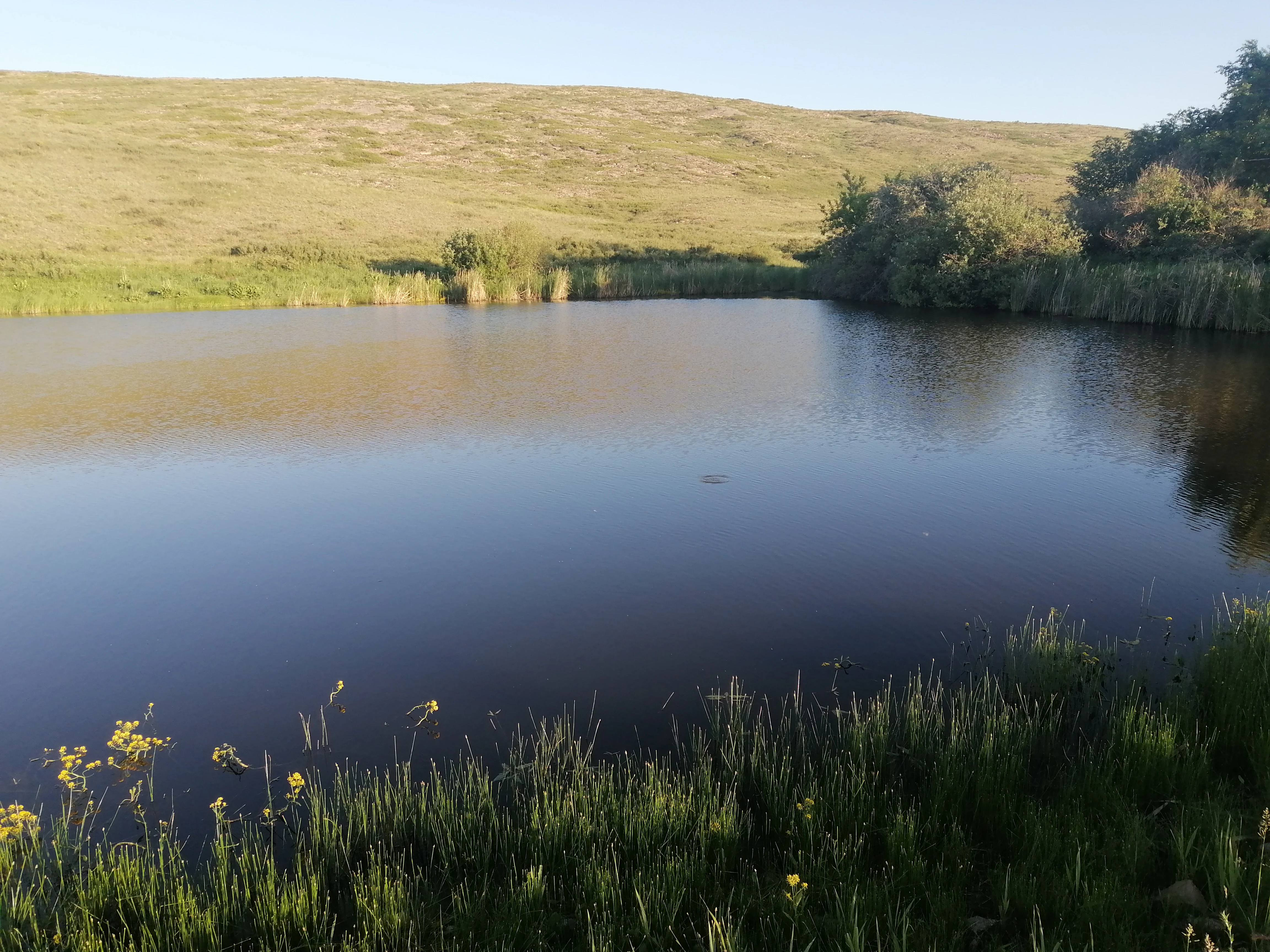
Bugyly Mountains from Zharyk village
Bugyly Sanctuary in the Karaganda Region

Bugyly Sanctuary history and protected-area timeline

The sanctuary was established as a state-level zoological zakaznik to safeguard rare animal species inhabiting the Bugyly and Tagyly ranges in central Kazakhstan. As a designated nature reserve, it falls under the oversight of Kazakhstan's Committee of Forestry and Hunting, which is responsible for the management of hunting grounds, wildlife habitat protection, and regulated use of forest resources across the country.

Its history is primarily one of targeted conservation: the reserve was set up not as a large multi-purpose park but specifically to provide legal and practical protection for fauna that depend on these low mountains. Over time it has continued to function within that zoological protection framework, recognized both for its conservation role along the Sarysu valley and as a recreational landscape point of interest in Karaganda Region.

Bugyly Sanctuary landscape and geographic character

The landscape of Bugyly Sanctuary is defined by the low-mountain topography of the Bugyly and Tagyly ranges, which rise only modestly above the surrounding steppe but create a varied and visually distinct terrain. The hills are dissected by small rivers, streams, and gullies, producing narrow ravines, gentle valleys, and exposed slopes that together define the sanctuary's surface character.

Rocky outcrops and stony slopes alternate with shallow soil pockets where birch, aspen, willow, raspberry, and associated shrubs have established themselves, forming thin bands of greenery along watercourses. Away from these moist corridors the mountains open into drier, more exposed terrain, creating the mosaic of habitats that distinguishes this part of central Kazakhstan from the flatter steppe country that surrounds it.

Because the sanctuary sits within the broader basin of the Sarysu River, its mountains are part of a wider inland drainage network that shapes both vegetation patterns and wildlife movement through the region.

Bugyly Sanctuary ecosystems, habitats, and plant life

Ecologically, Bugyly Sanctuary represents a transitional zone where the open Kazakh steppe gives way to low-mountain forest patches and rocky habitats. The vegetation is unusually heterogeneous for central Kazakhstan: along slopes and within the gorges carved by streams, small woodlands of birch and aspen mingle with willow thickets and raspberry undergrowth, producing a series of microhabitats that are otherwise scarce across this dry, continental interior.

This structural variety, the alternation of forested ravines, scattered shrubs, rocky slopes, and open ground, supports relatively high habitat diversity for a landscape of this scale. The result is a setting where woodland, montane, and steppe influences blend, and where animal and plant communities reflect that overlap rather than belonging purely to one ecosystem type.

Bugyly Sanctuary wildlife and species highlights

Wildlife is the central reason Bugyly Sanctuary exists as a protected area. The low mountains support a community of mammals and birds that reflects both the rocky, forested character of the Bugyly and Tagyly hills and their position within the wider steppe environment of central Kazakhstan.

Among the most characteristic larger mammals are Siberian roe deer and argali mountain sheep, both of which depend on the combination of open slopes, rocky cover, and accessible browse provided by the range. Carnivores common to the area include wolves, foxes, and badgers, while hares are widespread in the undergrowth along slopes and stream valleys.

Birdlife is well represented by ground-nesting and shrub-dwelling species adapted to the mix of woodland and open mountain terrain. Black grouse and various partridges are noted residents, taking advantage of the forest edges, berry-bearing shrubs, and broken ground cover that the park's habitat mosaic provides.

Bugyly Sanctuary conservation status and protection priorities

As a state zoological zakaznik, Bugyly Sanctuary is primarily a wildlife-focused reserve rather than a general landscape or wilderness park. Its conservation mandate concentrates on protecting rare and characteristic animal species of central Kazakhstan's low mountains, particularly ungulates such as the argali and roe deer, which face sustained pressure from hunting and habitat loss across the wider region.

By setting aside the Bugyly and Tagyly ranges under formal state protection, the reserve helps maintain a functioning refuge where these species can persist under regulated conditions. The sanctuary's inclusion in the network administered by the Committee of Forestry and Hunting gives it a defined institutional role, aligning local habitat protection with broader national efforts to manage Kazakhstan's hunting resources and wildlife populations in a coordinated way.

Bugyly Sanctuary cultural meaning and human context

The Bugyly and Tagyly mountains sit within a region of central Kazakhstan where traditional steppe land use, pastoralism, and local settlement have long shaped the relationship between communities and the landscape. While the sanctuary itself is defined by its zoological protection role, nearby settlements such as the village of Zharyk reflect the long-standing human presence in these low mountains, where the hills have historically supported grazing, seasonal land use, and rural livelihoods alongside their wildlife value.

Top sights and standout views in Bugyly Sanctuary

Bugyly Sanctuary stands out for combining two features that are unusually complementary in central Kazakhstan: a defined low-mountain landscape of the Bugyly and Tagyly ranges, and a focused mandate to protect rare fauna within it. The sanctuary's small woodland corridors of birch, aspen, and willow along stream valleys give it a more forested, shelter-rich character than the surrounding open steppe.

Its importance as a refuge for argali sheep and roe deer, alongside a full suite of typical central Kazakh predators and ground-nesting birds, makes it a notable zoological reserve within the Sarysu valley. For visitors interested in the less-trodden mountain scenery of central Kazakhstan and the wildlife that inhabits it, the sanctuary offers a compact but distinctive window into the country's interior uplands.

Best time to visit Bugyly Sanctuary

Given its position in the low mountains of central Kazakhstan, Bugyly Sanctuary experiences a strongly continental climate, with hot, dry summers and cold winters. Late spring through early autumn is generally the most rewarding time for visiting this kind of mountain terrain in central Kazakhstan, when snow has cleared from the slopes, the woodland corridors along streams are in active growth, and wildlife is easier to observe across open ground.

In winter the area takes on a colder, quieter character that can appeal to those interested in low-season mountain scenery and hardy central-Kazakh winter conditions, though access and conditions are more demanding. Visitors planning to explore the surrounding low mountains and Sarysu valley will generally find the warmer months more accessible and visually rewarding.
Monthly climate preview

Long-term temperature ranges and precipitation rhythm across twelve months

Bugyly Sanctuary Climate Normals and Monthly Weather Patterns

Representative coordinates record measured multi-year temperature shifts alongside steady precipitation rates throughout the annual cycle. Detailed monthly climate normals offer deeper statistical comparison for terrain analysis across the protected area.
Annual mean3 °C
-15 °C21 °C
Jan-15°
Feb-13°
Mar-6°
Apr
May13°
Jun19°
Jul21°
Aug19°
Sep12°
Oct
Nov-6°
Dec-13°
Warmest month
July

20.5 °C

Coolest month
January

-15 °C

Wettest month
July

1.3 mm/day

Driest month
September

0.6 mm/day

Park location guide

Geography guide, regional context, and park location map for Bugyly Sanctuary

Bugyly Sanctuary park geography, regions, and map view in Kazakhstan

Understand where Bugyly Sanctuary sits in Kazakhstan through a broader geographic reading of the surrounding landscape, nearby location context, and its mapped position within the national park landscape.

How Bugyly Sanctuary fits into Kazakhstan

Kazakhstan is a Central Asian country spanning vast steppes and plains, bordered by Russia, China, Kyrgyzstan, Uzbekistan, and Turkmenistan, with a coastline along the Caspian Sea. It gained independence from the Soviet Union in 1991 and has a population of approximately 20.5 million people. The country is officially secular but predominantly Muslim, with Kazakh and Russian as official languages.

Wider geography shaping Bugyly Sanctuary in Kazakhstan

Kazakhstan occupies a vast territory in Central Asia, extending into Eastern Europe. Its terrain consists largely of hilly plateaus and plains, with lowlands covering about a third of the area. The southern and eastern regions are mountainous. The country borders Russia to the north and west, China to the east, Kyrgyzstan to the southeast, Uzbekistan to the south, and Turkmenistan to the southwest. It has a coastline along the Caspian Sea.

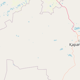
Map view of Bugyly Sanctuary

Use this park location map to pinpoint Bugyly Sanctuary in Kazakhstan, understand its exact geographic position, and read its mapped placement within the surrounding landscape more clearly.

Pigeon | © OpenStreetMap contributors

Location context for Bugyly Sanctuary

Karaganda Region

Examine the low mountain terrain, rocky outcrops, and sheltered woodland habitats of the Sarysu valley.

Bugyly Sanctuary Photos and Landscapes: Visual Exploration of Central Kazakhstan Scenery

Visual documentation of Bugyly Sanctuary reveals the distinctive low mountain topography, rocky gorges, and scattered birch groves that characterize the protected area. Examining these environmental details provides a clear understanding of the remote interior uplands and wildlife habitats found across central Kazakhstan.

Bugyly Mountains from Zharyk village

Bugyly Mountains from Zharyk village

Park atlas

Discover adjacent nature reserves and compare regional upland habitats in central Kazakhstan.

Exploring Parks Near Bugyly Sanctuary and Related Protected Landscapes

Browsing other protected areas near Bugyly Sanctuary reveals the broader network of interior uplands and wildlife reserves across central Kazakhstan. Comparing these surrounding mountain ecosystems helps contextualize local ungulate habitats and regional conservation geography.
Nature reserveKaraganda Region
About 157 km away#1 closest

West

Karaagash Nature Reserve: Granite Ridge Landscapes in Central Kazakhstan

Protected forest-steppe habitat in the Karaganda region

Karaagash Nature Reserve stands as a sentinel of central Kazakhstan's geography, protecting a rugged area where granite uplands meet ridge-and-valley plains. This reserve supports a diverse array of flora and fauna, offering a representative look at the forest-steppe transition zone and its role in regional conservation.

Area
68 km²
Established
1986
IUCN
IV
Relief
Mountain
Watercolor illustration of a mountainous landscape with green hills, trees, and a river in the foreground
National parkKazakhstan
About 161 km away#2 closest

East

Karkaraly State National Nature Park: Kazakhstan's Mountain-Forest Protected Area

Discover unique geology, archaeology, and regional landscape context.

Delve into the distinctive protected landscape of Karkaraly State National Nature Park, situated in Kazakhstan's Karaganda Region. This park preserves a rare mountain-forest ecosystem with dramatic granite formations, ancient archaeological sites, and lakes, presenting a rich geographic contrast to the surrounding Kazakh Steppe. MoriAtlas provides structured insights into Karkaraly State National Nature Park's unique terrain, its conservation value, and its position within the broader regional geography of Central Asia.

Area
1,121.2 km²
Established
1998
IUCN
II
Relief
Mountain
National parkKazakhstan
About 252 km away#3 closest

Northeast

Bayanaul National Park: Kazakhstan's First National Park Mapped Landscape

Explore granite mountains, unique lakes, and striking rock formations.

Bayanaul National Park, situated in Kazakhstan's Pavlodar Province, represents a significant protected area renowned for its extraordinary granite mountain landscape. Established as the country's first national park, it showcases unique erosion-shaped rock formations, diverse vegetation including rare pines, and four significant freshwater lakes. This park offers a distinct visual tapestry of mountainous terrain and geological wonders within the broader Central Asian geography, making it a key destination for atlas-based discovery.

Area
684.53 km²
Established
1985
IUCN
II
Relief
Mountain
Watercolor illustration of a landscape with green forests, rolling hills, and distant mountains under a soft sky
National parkAkmola Region
About 260 km away#4 closest

North

Buiratau State National Nature Park: Kazakhstan National Park within Akmola Region

Explore unique steppe-forest transition ecosystems and geography.

Buiratau State National Nature Park in Kazakhstan's Akmola Region protects a significant transitional zone between dry steppe and semi-arid forest. This national park showcases a diverse landscape of low ridges, plains, and salt lakes, contributing to its rich biodiversity. Discover the mapped boundaries and the unique ecological character of this protected area within the context of the Kazakh Uplands atlas and its regional geography.

Area
890 km²
Established
2011
IUCN
II
Relief
Upland
Nature reserveAlmaty Region
About 346 km away#5 closest

Southeast

Ile-Balkhash Nature Reserve: Protected Delta and Steppe Landscapes in Almaty Region

Central Asian conservation and regional geographic mosaic

Ile-Balkhash Nature Reserve protects the junction of the Ili River delta and the semi-arid plains of Lake Balkhash. As a major landscape restoration project, the reserve manages a complex terrain of river channels, flood meadows, and arid corridors, serving as an important site for regional wildlife recovery and ecological research in southeastern Kazakhstan.

Area
4,151.64 km²
Established
2018
IUCN
VI
Scope
Terrestrial
Wildlife reserveAkmola Region
About 432 km away#6 closest

Northwest

Atbasar Wildlife Reserve: Protected Steppe Grasslands and Wildlife Habitat in the Akmola Region

Mapping conservation landscapes of northern Kazakhstan

Explore the geographic scope of Atbasar Wildlife Reserve, a significant sanctuary in northern Kazakhstan. This protected area preserves key steppe ecosystems and habitat for marmots and migratory birds within a unique terrain of rocky spurs and open feather grass plains.

Area
751 km²
Established
1976
IUCN
IV
Relief
Upland
National parkUlytau Region
About 455 km away#7 closest

West

Ulytau National Park: Mapping the Mountain-Steppe Ecosystems of Central Kazakhstan

Protected rocky uplands and sacred steppe landscapes

Ulytau National Park stands as a major protected area in central Kazakhstan, established to unify the management of the Ulytau massif. The park preserves a unique interplay of low mountain ridges, deep intermountain hollows, and semi-arid steppe. It represents a significant effort to secure the geographic and historical integrity of the region, offering a window into the transition between Kazakhstan's open grasslands and its isolated, rugged upland systems.

Area
589.12 km²
Established
2022
IUCN
II
Scope
Terrestrial
Natural monumentPavlodar Region
About 456 km away#8 closest

Northeast

Gusiny Perelet Natural Monument: Geological Geography and Fossil Site Mapping in Pavlodar Region

An iconic Irtysh River protected area and Neogene research locality

Situated along the Irtysh River bank, Gusiny Perelet functions as a vital reference point for Neogene mammal evolution in Central Asia. The protected site showcases an exposed geological face, providing scientific insight into ancient ecosystems once dominated by Hipparion fauna. Its preserved fossil assemblage and riverside location offer a tangible connection to the region's deep natural history.

Established
1971
Relief
Lowland
Climate
Temperate
Access
Easy access

Common questions about visiting, size, designation, and location context for Bugyly Sanctuary

Bugyly Sanctuary FAQs for park facts, access, geography, and protected area context

Find quick answers about Bugyly Sanctuary, including protected-area facts, park geography, trail and visitor context, and how the park fits into its surrounding country and regional landscape.
MoriAtlas Explorer

Continue Your Protected Areas Search Across the Global Atlas

Deepen your exploration by continuing the structured search for national parks and protected areas worldwide. Utilize the comprehensive filtering capabilities to compare different conservation landscapes and refine your understanding of global park geography. Discover more about the distribution and characteristics of protected natural areas.

Global natural geography