
Mori Atlas logo
Protected landscapeBuna River-Velipojë Protected Landscape

A comprehensive look at the riverine corridors, estuarine lagoons, and coastal plains of northwestern Albania.

Buna River-Velipojë Protected Landscape: Mapped Geography and Protected Wetland Atlas

The Buna River-Velipojë Protected Landscape serves as a vital ecological transition zone where freshwater lake outflows meet the Adriatic coastline in Shkodër County. This protected area encompasses a complex network of alluvial forests, brackish lagoons, and sandy dunes that define its distinct Mediterranean character. As a crucial corridor for migratory wildlife, the landscape provides essential habitat across its river floodplains, salt pans, and coastal estuaries.

protected landscapecoastal wetlandsriver estuarylagoonalluvial forestMediterranean climate
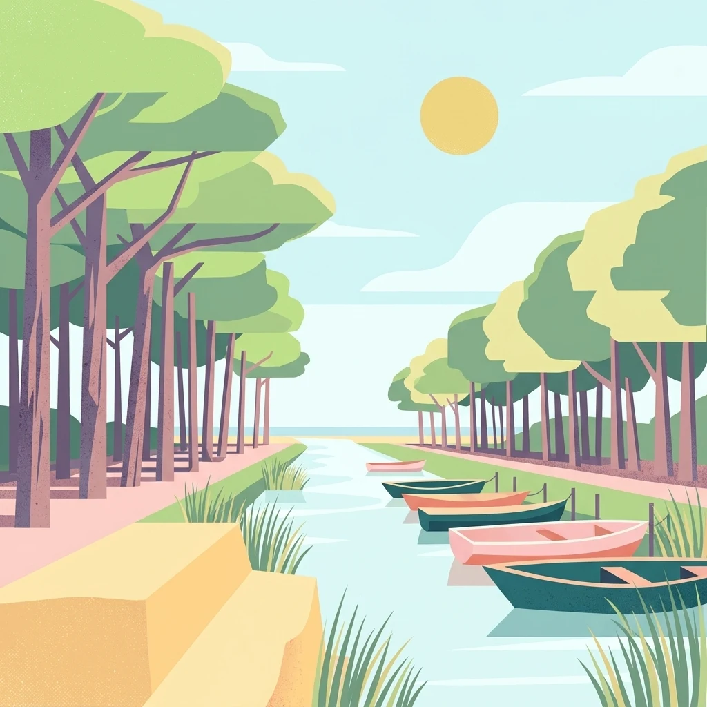
A flat vector illustration of a canal with small boats moored at the bank, flanked by tall trees under a pale sun.

Buna River-Velipojë Protected Landscape

Protected landscape

Park overview

Structured park overview, official facts, and landscape profile for Buna River-Velipojë Protected Landscape

Buna River-Velipojë Protected Landscape park facts, protected area profile, and essential visitor context

Review the core facts for Buna River-Velipojë Protected Landscape, including designation, size, terrain, visitor scale, habitats, and operating context in one park-focused overview.

About Buna River-Velipojë Protected Landscape

The Buna River-Velipojë Protected Landscape is one of the most ecologically significant protected areas in Albania, defined by the convergence of major freshwater and marine systems. Located in Shkodër County in the far northwest of the country, it is centered on the final stretch of the Buna River as it carries the waters of Lake Shkodër toward the Adriatic Sea. The protected area also incorporates the estuary of the Drin River, the Viluni Lagoon, and the broader Gulf of Drin along the coast near Velipojë.

Geographically, the park lies between the Dinaric Alps and the Mediterranean Sea. This transitional position gives it a distinctive combination of inland Balkan character and coastal Mediterranean influence. The climate reflects the same duality: summers are warm to hot and dry, while winters tend to be mild, wet, and influenced by Adriatic weather systems.

Ecologically, the protected landscape encompasses a broad mosaic of habitats. Alluvial forests line the Buna floodplain, where the river meanders through low terrain toward the sea. Marshlands, shrublands, and dry grasslands surround the wetland core, while estuarine channels, sandy beaches, and dune systems extend along the coast. The Viluni Lagoon adds a brackish coastal wetland layer, and historic salt pans provide additional feeding habitat for waterbirds.

The landscape holds several layers of international recognition. Beyond its IUCN Category V designation, it is listed under the Ramsar Convention as a wetland of international importance and forms part of the European Green Belt, the network of protected areas running along the line of the former Iron Curtain. It is also recognized as both an Important Bird Area and an Important Plant Area, underscoring the range of threatened and endemic species that depend on this transitional zone.

For visitors and researchers, the Buna River-Velipojë Protected Landscape represents one of Albania's clearest examples of where freshwater, coastal, and Mediterranean systems overlap. It is not only a stronghold for resident wildlife but also a vital seasonal corridor for migratory species traveling between the Adriatic and the interior of the Balkans.

Quick facts and research context for Buna River-Velipojë Protected Landscape

The Buna River-Velipojë Protected Landscape covers roughly 23,000 hectares in Albania's Shkodër County, encompassing the Drin River estuary, the Buna River and its mouth, the Viluni Lagoon, the Gulf of Drin, and the Adriatic coastline near Velipojë. It was formally established in 2005 and is managed by Albania's National Agency of Protected Areas.

It is recognized as an IUCN Category V protected landscape, listed as a Ramsar wetland of international importance, and designated as both an Important Bird Area and an Important Plant Area. The park forms part of the broader European Green Belt initiative that links protected areas along the former Iron Curtain across the continent.

Protection and recognition

Examine the documented conservation scope and regulatory framework for this protected area.

Buna River-Velipojë Protected Landscape Protection Status and Governance

Buna River-Velipojë Protected Landscape maintains a mixed protection scope outlining its regulatory framework and administrative boundaries. Detailed conservation records track management classifications and official designation data across the regional landscape.

Protection details

Protection scope
Mixed
Transboundary protection
No
Park context

Deeper park guide and search-rich context for Buna River-Velipojë Protected Landscape

Buna River-Velipojë Protected Landscape history, landscape, wildlife, and travel context

Explore Buna River-Velipojë Protected Landscape through its history, landscape character, ecosystems, wildlife, conservation priorities, cultural context, and seasonal travel timing in a structured park guide built for atlas discovery and search intent.

Why Buna River-Velipojë Protected Landscape stands out

The park is best known for being the meeting point between Lake Shkodër and the Adriatic Sea, creating a transition zone of wetlands, lagoons, estuaries, and riverine forests. It is recognized internationally for its role as a Ramsar site, an Important Bird and Plant Area, and a key migratory corridor between the Adriatic and inland Europe. Its combination of alluvial forests, the Viluni Lagoon, salt pans, and sandy beaches also makes it one of Albania's most important coastal wetland complexes. Conservation attention is drawn particularly by nesting sea turtles on the Gulf of Drin beaches and the presence of Dalmatian pelicans feeding in the salt pans during autumn.
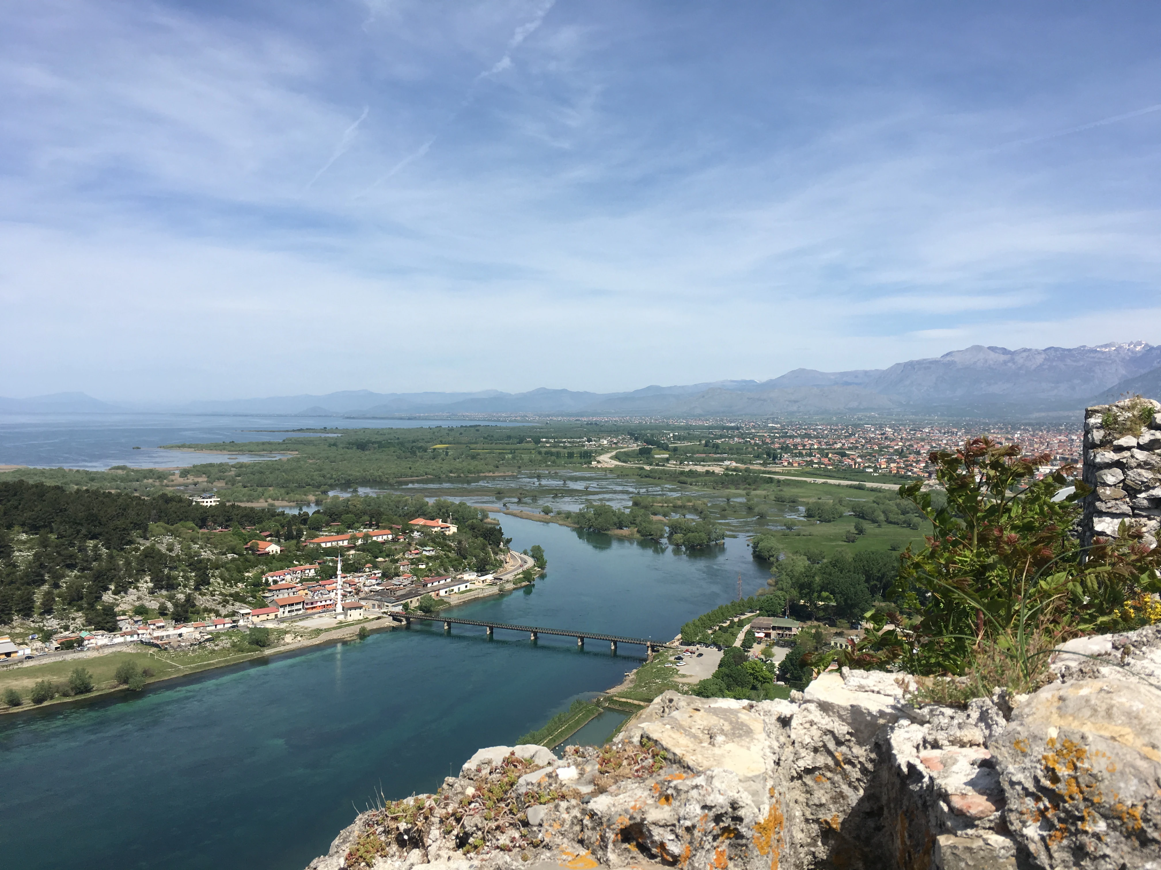
A wide aerial view shows a river winding through a valley with a bridge, a town on the banks, and a large lake in the distance under a blue sky.
Elevated view of the Buna River flowing from Lake Shkoder, seen from the vantage point of Rozafa Castle.

Buna River-Velipojë Protected Landscape history and protected-area timeline

The Buna River-Velipojë Protected Landscape was formally established on 2 November 2005 as part of Albania's expansion of its national system of protected areas. Its creation reflected growing international attention to the ecological importance of the Buna River delta, the Viluni Lagoon, and the Gulf of Drin, which together form one of the country's most significant coastal wetland complexes.

Following its establishment, the area received successive layers of international recognition. It was designated as a Ramsar wetland site, acknowledging its importance at a global level, and later confirmed as both an Important Bird Area and an Important Plant Area. Its inclusion in the European Green Belt initiative further connected the landscape to a continent-wide network of cross-border conservation areas.

Management of the protected landscape has been overseen by Albania's National Agency of Protected Areas, which is responsible for safeguarding the integrity of the site's wetlands, river corridors, and coastal zones while coordinating conservation activity across overlapping designations.

Buna River-Velipojë Protected Landscape landscape and geographic character

The landscape of the Buna River-Velipojë Protected Landscape is shaped by its position between the Dinaric Alps and the Adriatic Sea. Much of the protected area is low-lying and gently undulating, with shallow terrain that allows the Buna and Drin rivers to spread across broad floodplains before reaching the coast. This flat geography is central to the character of the site, producing extensive wetlands rather than dramatic relief.

The riverine environment dominates inland portions of the park. Meandering channels, estuarine waters, and seasonal flood zones are lined by alluvial forests and bordered by marshes, reedbeds, and shrublands. Away from the rivers, dry grasslands extend across patches of the floodplain, while coastal dunes and sandy beaches shape the edge of the Gulf of Drin as it opens toward the Adriatic.

The Viluni Lagoon is one of the most distinctive landscape features within the protected area. This shallow coastal lagoon adds a brackish dimension to the wetland mosaic, working together with historic salt pans along the coast. The result is a layered environment where freshwater, brackish, marine, and terrestrial systems interact across short distances, giving the protected landscape its unusually rich ecological character.
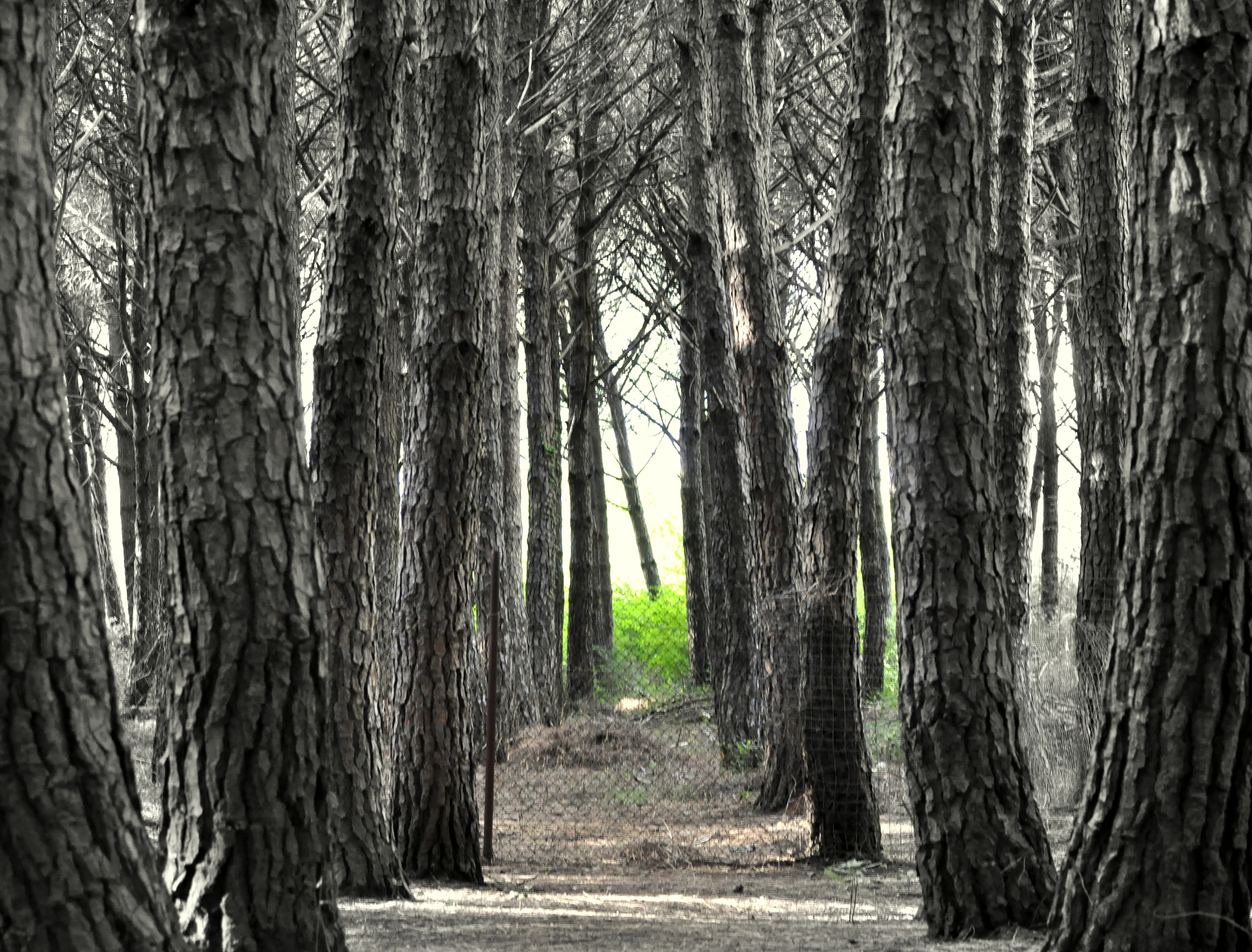
A low-angle view looking through a dense pine forest with textured tree trunks lining a dirt path and bright green light filtering through the canopy in the distance.
A dense stand of pine trees within the Buna River-Velipojë Protected Landscape.

Buna River-Velipojë Protected Landscape ecosystems, habitats, and plant life

The ecological identity of the Buna River-Velipojë Protected Landscape is built around the meeting of lake, river, lagoon, and sea. At its inland edge, the protected area draws on the freshwater system of Lake Shkodër, the largest lake in Southern and Southeastern Europe. As the Buna River carries this water toward the coast, it creates an extended zone of alluvial forest, marshland, and riparian habitat that is highly productive for wildlife.

Coastal wetlands form a second major ecological layer. The Viluni Lagoon and surrounding salt pans provide shallow, nutrient-rich habitats used intensively by waterbirds, while the beaches and dunes along the Gulf of Drin serve as nesting grounds for marine species. Estuarine and brackish conditions between these zones create transitional habitats that support specialized plant communities, contributing to the site's Important Plant Area status.

The Mediterranean climate adds a seasonal rhythm to the area's ecology. Warm, dry summers and mild, wet winters support cycles of plant growth, migration, and wetland activity that vary across the year. This combination of habitat diversity and climatic influence is fundamental to the protected landscape's role as a refuge for both resident biodiversity and migratory species moving between the Adriatic and inland Europe.

Buna River-Velipojë Protected Landscape wildlife and species highlights

The protected landscape supports a diverse wildlife community shaped by its combination of freshwater wetlands, riverine forests, and Mediterranean coastline. Mammals such as the golden jackal use the woodlands and marshes of the floodplain, while brown bears occasionally range into the coastal dune environments, drawn by seasonal feeding opportunities along the shoreline.

Marine wildlife is a defining element of the site. Common bottlenose dolphins have been recorded in the coastal waters and river delta. The beaches of the Gulf of Drin provide important nesting habitat for both green sea turtles and loggerhead sea turtles, making this stretch of Albanian coastline one of the most significant turtle nesting areas in the Adriatic.

The area is also a stronghold for waterbirds. The Dalmatian pelican uses the salt pans and coastal wetlands around the region as feeding habitat during autumn. The lagoons, salt pans, river margins, and estuaries together attract large numbers of migratory and resident birds, supporting the site's designation as an Important Bird Area and reinforcing the landscape's international conservation value.

Buna River-Velipojë Protected Landscape conservation status and protection priorities

The Buna River-Velipojë Protected Landscape matters because it protects one of the rare coastal zones where large-scale freshwater, brackish, and marine ecosystems converge along the Adriatic. The integrity of this transition directly influences biodiversity across wetlands, beaches, lagoons, and inland forests, making the site's conservation status of regional and international relevance.

Its Ramsar designation highlights the area's function as a wetland of international importance, while its status as both an Important Bird Area and an Important Plant Area reflects the rarity of the bird and plant species supported there. Inclusion in the European Green Belt further embeds the protected landscape in a transboundary conservation network that links protected areas across southeastern Europe.

The site's conservation priorities are shaped by the sensitivity of coastal habitats to pressure and by the ecological importance of migratory corridors linking inland Balkans with the Adriatic. Protecting alluvial forests, marshlands, sea turtle nesting beaches, and bird-rich salt pans requires coordinated management of freshwater flow, coastal dynamics, and human activity along the shoreline.

Top sights and standout views in Buna River-Velipojë Protected Landscape

The Buna River-Velipojë Protected Landscape's strongest points of distinction lie in the combination of major freshwater, coastal, and Mediterranean habitats across a single protected area. Its protection of the Buna River outflow, the Viluni Lagoon, and the Gulf of Drin creates a layered environment where rivers, lagoons, salt pans, dunes, and forests sit within the same boundaries.

International recognition under the Ramsar Convention, the European Green Belt, and Important Bird and Plant Area programs reinforces this ecological distinctiveness. The presence of nesting sea turtles on the Gulf of Drin beaches and seasonal use of the salt pans by Dalmatian pelicans further set the landscape apart as one of Albania's most internationally significant coastal wetland sites.

Best time to visit Buna River-Velipojë Protected Landscape

The character of the Buna River-Velipojë Protected Landscape shifts meaningfully across the seasons. Spring and early summer are typically attractive for observing wetland vegetation, breeding waterbirds, and active riverine habitats, while the warm, dry Mediterranean summer provides long days suitable for exploring the coast and lagoon margins of Velipojë.

Autumn is highlighted as an important season for wildlife observation, particularly because feeding activity by Dalmatian pelicans and other waterbirds intensifies in the salt pans and lagoons around that period. Winters in the area are mild and wetter than the summer months, shaping hydrological conditions across the floodplain and influencing bird movements along this Adriatic corridor.
Monthly climate preview

Long-term temperature and precipitation records across twelve measured monthly intervals

Buna River-Velipojë Protected Landscape Climate Normals and Monthly Weather Data

Representative coordinate records show mean monthly temperatures ranging from 5.92 degrees Celsius to 26.18 degrees Celsius alongside recorded precipitation totals. Examining the full monthly climate profile reveals complete long-term meteorological patterns across the protected landscape.
Annual mean15 °C
6 °C26 °C
Jan
Feb
Mar10°
Apr13°
May18°
Jun23°
Jul26°
Aug26°
Sep21°
Oct17°
Nov12°
Dec
Warmest month
August

26.2 °C

Coolest month
January

5.9 °C

Wettest month
November

5.4 mm/day

Driest month
July

1.1 mm/day

Park location guide

Geography guide, regional context, and park location map for Buna River-Velipojë Protected Landscape

Buna River-Velipojë Protected Landscape park geography, regions, and map view in Albania

Understand where Buna River-Velipojë Protected Landscape sits in Albania through a broader geographic reading of the surrounding landscape, nearby location context, and its mapped position within the national park landscape.

How Buna River-Velipojë Protected Landscape fits into Albania

Albania is a unitary parliamentary republic in Southeast Europe, situated on the Balkan Peninsula along the Adriatic and Ionian coastal regions. With a population of approximately 2.4 million people, it borders Montenegro, Kosovo, North Macedonia, and Greece. The country features varied landscapes ranging from the Albanian Alps to fertile coastal plains, with Tirana as its capital and largest city.

Wider geography shaping Buna River-Velipojë Protected Landscape in Albania

Albania occupies the western part of the Balkan Peninsula in Southeast Europe. The country features a varied terrain with rugged mountain ranges including the Albanian Alps (Accursed Mountains), Korab, Skanderbeg Mountains, Pindus, and Ceraunian Mountains. Fertile lowland plains extend along the Adriatic and Ionian coastal regions. The country borders Montenegro to the northwest, Kosovo to the northeast, North Macedonia to the east, and Greece to the south.

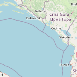
Map view of Buna River-Velipojë Protected Landscape

Use this park location map to pinpoint Buna River-Velipojë Protected Landscape in Albania, understand its exact geographic position, and read its mapped placement within the surrounding landscape more clearly.

Pigeon | © OpenStreetMap contributors

Location context for Buna River-Velipojë Protected Landscape

Shkodër County

Visual reference of wetlands, coastal lagoons, and alluvial forests

Buna River-Velipojë Protected Landscape Scenery and Photos

Photographic documentation reveals the diverse terrain and coastal habitats defining the Buna River-Velipojë Protected Landscape. Visual exploration of these wetlands, floodplains, and estuarine channels highlights the ecological character of the Adriatic migration corridor.

A wide aerial view shows a river winding through a valley with a bridge, a town on the banks, and a large lake in the distance under a blue sky.

A calm, narrow canal or lagoon stretches into the distance, bordered by a dirt path and a dense line of pine trees, with several small fishing boats moored along the bank.

A low-angle view looking through a dense pine forest with textured tree trunks lining a dirt path and bright green light filtering through the canopy in the distance.

Park atlas

Compare adjacent coastal wetlands, river estuaries, and neighboring Mediterranean landscapes

Other Parks Near Buna River-Velipojë Protected Landscape and Regional Protected Areas

Browse related protected areas and neighboring river basins connected to the wider regional geography. Expanding the geographic scope helps compare adjacent coastal wetlands and shared lowland habitats.
Watercolor painting of a wide wetland area with distant purple mountains, green grassy banks, and water channels.
Protected landscapeUlcinj
About 13 km away#1 closest

West

Saline Ulcinj: Coastal Wetland Geography and Protected Landscape Mapping

A large-scale saline nature park near Ulcinj in southern Montenegro.

Saline Ulcinj represents a significant coastal wetland complex nestled in the Buna delta. This protected landscape is defined by its unusual industrial history and modern transition into a vital nature reserve, characterized by expansive saline pools and shallow mudflats. Its geographic footprint offers a clear look at how coastal water management shapes the surrounding terrain and provides essential stopover habitats for Adriatic migratory birds.

Area
15 km²
Established
2019
Relief
Lowland
Water
Water-dominated
A watercolor painting showing a panoramic view of green rolling hills and a body of water under a soft, light sky.
Nature reserveShkodër District
About 16 km away#2 closest

North

Lake Shkodër Nature Reserve: Mapping Protected Wetland and Riverine Geography in Albania

A critical Balkan freshwater protected area.

The Lake Shkodër Nature Reserve serves as a foundational protected landscape in northern Albania, encompassing the extensive shoreline and riverine floodplains of Lake Skadar. This geographic entity showcases a transition from fertile lowlands to mountainous ridges, offering a detailed look at how hydrologic processes and alpine proximity define Balkan wetland habitats.

Area
265.35 km²
Established
2005
IUCN
IV
Relief
Lowland
A minimalist watercolor painting depicting a soft-focus landscape with green marshes, pale yellow flats, and light pink rolling hills in the background.
Nature reserveLezhë County
About 24 km away#3 closest

Southeast

Kunë-Vain-Talë-Patok-Fushëkuqe-Ishëm Nature Park: Mapped Geography and Coastal Wetlands

Protected lagoon and forest landscapes in Lezhë County, Albania

Examine the protected territory of Kunë-Vain-Talë-Patok-Fushëkuqe-Ishëm Nature Park, defined by its dynamic lagoon systems, alluvial forests, and coastal dunes along the Adriatic shore. This area provides deep insight into deltaic hydrology and the preservation of Mediterranean woodland habitats within a regional geographic context.

Area
43.93 km²
Established
2010
IUCN
IV
Relief
Lowland
Watercolor painting of a lake landscape with green marshes in the foreground, small islands in the middle, and rolling hills in the background.
National parkMontenegro
About 28 km away#4 closest

Northwest

Lake Skadar National Park: An Atlas Overview of Montenegro's Largest Freshwater Wetland

Karst Terrain and Transboundary Protected Landscapes

Lake Skadar stands as a monumental geographic feature in Montenegro, serving as the largest lake in Southern Europe. This national park protects a diverse ecosystem ranging from submerged karst springs to expansive seasonal marshes. Its status as a transboundary system offers insights into Mediterranean hydrology and endemic freshwater biodiversity within the unique Balkan karst basin.

Area
450 km²
Established
1983
Relief
Lowland
Climate
Mediterranean
Watercolor painting showing a mountainous landscape with a lake, green hills, and pink flowers
National parkAlbania
About 42 km away#5 closest

Northeast

Alps of Albania National Park: Explore Albania's Largest Protected Alpine Wilderness

Dramatic karst, glacial valleys, and high-altitude ecosystems await.

The Alps of Albania National Park offers an expansive view into one of the Balkans' most significant mountain protected areas. This national park encompasses a spectacular landscape characterized by towering limestone peaks, deep glacial valleys carved over millennia, and intricate karst formations like Grunas Canyon. Its pristine wilderness protects diverse high-altitude ecosystems and unique geological features, serving as a key destination for understanding regional geography and protected landscapes.

Area
828.447 km²
Established
2022
IUCN
II
Relief
Mountain
A minimalist watercolor painting showing a tranquil lake surrounded by gentle hills and trees against a soft, pale sky.
Nature reserveDibër County
About 45 km away#6 closest

Southeast

Lake Ulza Nature Park: Mapped Geography and Protected Area Overview in Dibër County

Analyzing the reservoir and river valley landscapes of central Albania

Lake Ulza Nature Park represents a significant protected mosaic where the Mat River creates a corridor of reservoirs, oak forests, and stony uplands. This overview examines the park geography, offering a structured look at how water bodies and mountainous terrain converge to form a unique inland habitat in Dibër County. Explore the physical relief and environmental boundaries that define this essential Albanian natural landmark.

Area
42.06 km²
Established
2013
IUCN
IV
Relief
Mixed relief
A watercolor painting showing a soft, panoramic landscape of low hills, green fields, and water, with a light and ethereal style.
Protected areaMontenegro
About 51 km away#7 closest

Northwest

Cijevna Protected Area: Mapping the River Canyon and Balkan Highlands Geography

An alpine river system spanning the Montenegro and Albania border

The Cijevna represents a striking natural corridor carved into the Prokletije mountains. This protected landscape is defined by its deep V-shaped valleys, high-altitude gorges, and seasonal discharge patterns that sustain important freshwater biodiversity across the Balkan highlands.

Nature reserveAlbania
About 57 km away#8 closest

Southeast

Shtamë Pass Nature Park: Geographic Overview and Protected Mountain Landscape Map

Highland pine forests and freshwater corridors in Albania

Shtamë Pass Nature Park sits within the central Albanian mountains, providing a critical ecological link between coastal-inland gateway regions. The area protects a complex mosaic of alpine terrain, including clear mountain lakes, cold freshwater springs, and dense black pine forests that shelter brown bears and wolves. This protected zone offers a comprehensive view of regional highland geography and topography through its distinct mountain pass corridor.

Area
68.64 km²
Established
1996
IUCN
IV

Common questions about visiting, size, designation, and location context for Buna River-Velipojë Protected Landscape

Buna River-Velipojë Protected Landscape FAQs for park facts, access, geography, and protected area context

Find quick answers about Buna River-Velipojë Protected Landscape, including protected-area facts, park geography, trail and visitor context, and how the park fits into its surrounding country and regional landscape.
MoriAtlas Explorer

Continue Your Protected Areas Search Across the Global Atlas

Deepen your exploration by continuing the structured search for national parks and protected areas worldwide. Utilize the comprehensive filtering capabilities to compare different conservation landscapes and refine your understanding of global park geography. Discover more about the distribution and characteristics of protected natural areas.

Global natural geography