
Mori Atlas logo
Nature reserveCambewarra Range Nature Reserve

Mapping the dramatic escarpments, coachwood forests, and plateau ecosystems of the Kangaroo Valley

Cambewarra Range Nature Reserve: A Detailed Geographic Atlas of Protected Rainforest Landscapes

Cambewarra Range Nature Reserve preserves one of the most substantial blocks of subtropical and warm temperate rainforest in the Illawarra-Shoalhaven region of New South Wales. This protected landscape sits atop layered sandstone cliffs and volcanic plateaus, creating a distinct ecological corridor that connects with surrounding national parks. Its geography includes rugged escarpments, boulder-strewn slopes, and dense upland forest networks that function as a critical water catchment for the Kangaroo and Shoalhaven river systems.

subtropical rainforestwarm temperate rainforestescarpmentcliffsplateaunature reserve
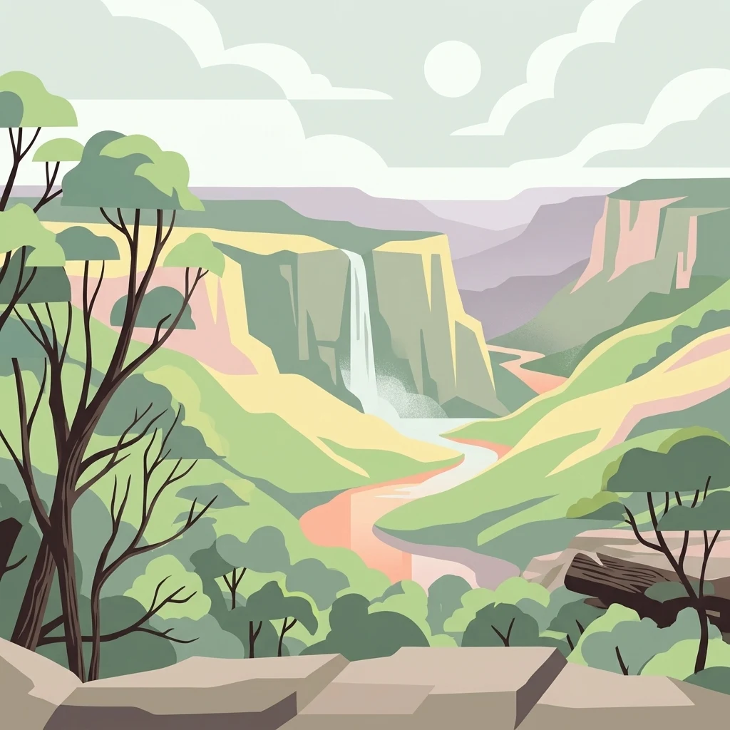
An artistic vector illustration showing a green valley with cliffs, a central waterfall, and a winding river under a pale sky.

Cambewarra Range Nature Reserve

Nature reserve

Park overview

Structured park overview, official facts, and landscape profile for Cambewarra Range Nature Reserve

Cambewarra Range Nature Reserve park facts, protected area profile, and essential visitor context

Review the core facts for Cambewarra Range Nature Reserve, including designation, size, terrain, visitor scale, habitats, and operating context in one park-focused overview.

About Cambewarra Range Nature Reserve

Cambewarra Range Nature Reserve is a substantial protected area on the escarpment country above Kangaroo Valley, where forested plateaus and cliffs drop toward the river below. Sitting at the intersection of the Southern Highlands and South Coast regions of New South Wales, it forms a key refuge for subtropical and warm temperate rainforest in a broader landscape that has long been altered by settlement, agriculture, and selective logging. The reserve is administered by the NSW National Parks and Wildlife Service and forms part of the Kangaroo Valley Group of Nature Reserves, alongside Kangaroo River, Barrengarry, and Rodway Nature Reserves.

The physical setting is dominated by the Cambewarra Range itself, a series of sandstone plateaus, boulder slopes, and south-facing cliffs. These landforms carry a mosaic of vegetation types, ranging from coachwood rainforest in protected gullies and slopes to lowland dry shrub forest, heath shrubland, scattered eucalyptus open forests, and small areas of upland swamp. The Berry Mountain section, the Red Rocks plateau (formerly Red Rocks Nature Reserve), and the Black Ash section (Bellawongarah Mountain) each contribute different combinations of these habitats, giving the reserve considerable ecological variety within a relatively compact area.

What sets the reserve apart in the regional conservation network is its role in protecting rainforest and cliff habitat that links into nearby national parks such as Morton and Budderoo. Much of the broader landscape around Kangaroo Valley has been cleared, fragmented, or affected by rural-residential development, so the intact forested ridges of Cambewarra function as an important refuge for species that require continuous canopy, rock shelter, and minimal disturbance. The reserve also has hydrological significance, with creeks descending into the Kangaroo and Shoalhaven Rivers, whose waters ultimately feed the Sydney and Illawarra drinking water supply.

For a visitor, the reserve offers access to walking, birdwatching, scenery viewing, and a sense of the original forested backdrop to Kangaroo Valley. Access routes such as Leobold Hill Road and the Red Rocks Trig Trail cross the plateau and lead to cliff-edge lookouts, though the steep, damp conditions and limited infrastructure reflect the reserve's focus on nature conservation rather than high-volume tourism. The combination of rainforest, cliff scenery, rocky outcrops, and catchments draining into major rivers makes Cambewarra Range Nature Reserve a meaningful example of the Sydney Basin's surviving escarpment wilderness.

Quick facts and research context for Cambewarra Range Nature Reserve

Cambewarra Range Nature Reserve is a 1,400 hectare (approximately 1,684 hectare in total area including private inholdings) nature reserve on the cliffs and plateaus above Kangaroo Valley in New South Wales, established in 2001 and managed by the NSW National Parks and Wildlife Service.

The reserve lies within the southern Sydney Basin, on Permian and Triassic sedimentary rocks, and contains one of the largest remaining areas of Illawarra-Shoalhaven subtropical warm temperate rainforest. It is part of the Kangaroo Valley Group of Nature Reserves and sits within a wider network of conservation areas that also includes Morton National Park, Budderoo National Park, Barren Grounds Nature Reserve, and several smaller Kangaroo Valley refuges. The catchments on the reserve feed into the Kangaroo River, Shoalhaven River, and ultimately Lake Yarrunga, making the area part of the drinking water supply for Sydney and surrounding regions.

Protection and recognition

Review documented terrestrial protection scope and official recognition records

Cambewarra Range Nature Reserve Protection Status and Recognized Designations

Cambewarra Range Nature Reserve maintains a defined terrestrial protection scope within its regional landscape. Structured records detail official conservation designations and administrative status without additional international listings.

Protection details

Protection scope
Terrestrial
Transboundary protection
No
Park context

Deeper park guide and search-rich context for Cambewarra Range Nature Reserve

Cambewarra Range Nature Reserve history, landscape, wildlife, and travel context

Explore Cambewarra Range Nature Reserve through its history, landscape character, ecosystems, wildlife, conservation priorities, cultural context, and seasonal travel timing in a structured park guide built for atlas discovery and search intent.

Why Cambewarra Range Nature Reserve stands out

Cambewarra Range Nature Reserve is best known for protecting one of the largest remaining tracts of Illawarra-Shoalhaven subtropical and warm temperate rainforest in the region, set against the sandstone cliffs and plateaus that overlook Kangaroo Valley. The coachwood-dominated forests of Cambewarra Mountain, along with the rocky cliffs of the Red Rocks plateau and Bellawongarah Mountain, give the reserve its distinctive vegetated backdrop above the valley floor. The reserve is also recognised as a stronghold for threatened species such as the brush-tailed rock-wallaby and the spotted-tail quoll, the apex mammalian predator of the area. Its combination of coastal hinterland rainforest, lowland dry shrub forest, heath shrubland, and small upland swamps supports an unusually diverse assemblage of birds and herpetofauna, making it a notable site for rainforest and cliff-country wildlife conservation in New South Wales.
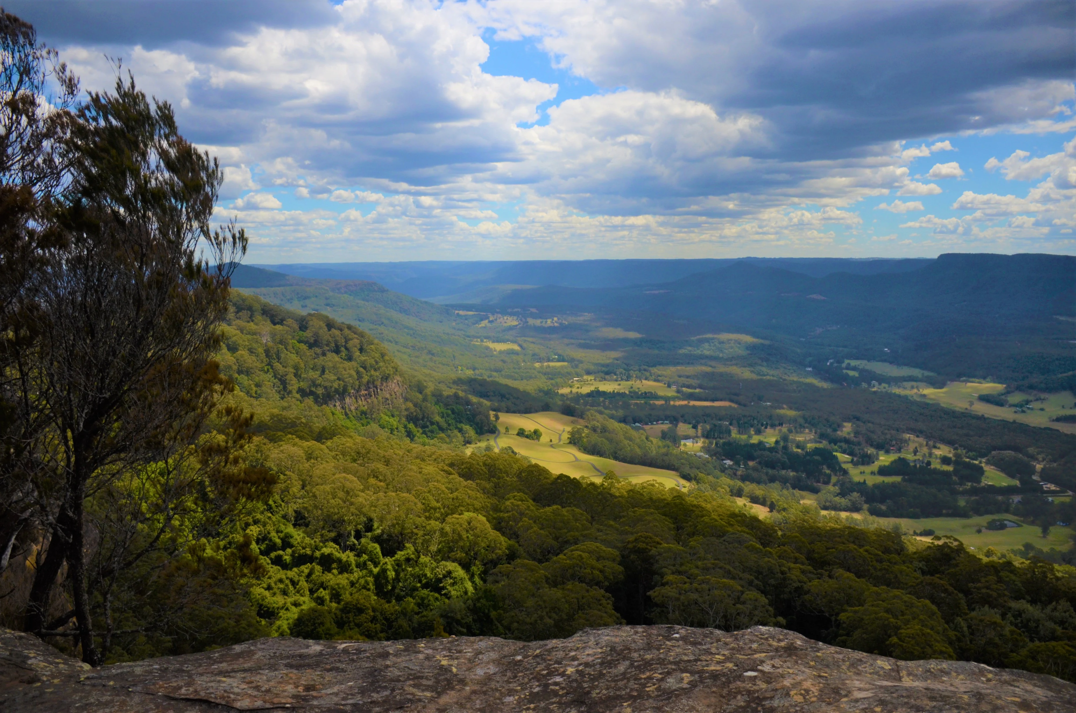
A high-angle view overlooking a deep green valley and rolling hills in the Cambewarra Range, framed by dark foreground trees and a cloudy sky.
A scenic lookout view over the lush valleys and temperate rainforest canopy of the Cambewarra Range.

Cambewarra Range Nature Reserve history and protected-area timeline

The Cambewarra Range has a long history of human interaction, beginning with the Tharawal (Dharawal) people, the traditional custodians of the area, who gave the range its name. The word 'Cambewarra' is understood to mean 'mountain of fire'; one explanation links it to a perceived volcanic past of the peak, while another attributes it to the way clouds often shroud the summit, giving the appearance of smoke rising from the mountain. These Aboriginal communities lived along the coastal areas of what is now the Sydney Basin, relying on hunting of possums, wallabies, goannas and their eggs, along with gathering berries and leafy plants for food and medicine, while creeks supplied fresh water.

European use of the range dates back to the early nineteenth century. Richard Brooks, a soldier-settler in Kangaroo Valley, held the first licence to cut red cedar in the area in 1836, and it is believed cedar was felled in many of the arms of the valley, the Cambewarra Range likely among them. Throughout the 1800s, the land was progressively cleared for agriculture and stock, with broad clearing accelerating from 1861 as settlement expanded. Logging, burning, and trampling of soils altered the forest composition, and around the 1960s parts of the range were used for gravel extraction.

The nature reserve as it exists today was formally established in 2001, with the purpose of protecting the natural heritage of the area and safeguarding its water catchment values. In 2003, the adjoining Devils Glen, Red Rocks, and Black Ash Nature Reserves were amalgamated into Cambewarra Range Nature Reserve, consolidating an expanded protected estate in the upper Kangaroo Valley. The reserve is now managed under the National Parks and Wildlife Act 1974, the Threatened Species Conservation Act 1995, and more recently the Biodiversity Conservation Act 2016, with a focus on protecting rainforest, geology, and cultural values, and on monitoring the populations of threatened species such as the brush-tailed rock-wallaby and the spotted-tail quoll.

Cambewarra Range Nature Reserve landscape and geographic character

The Cambewarra Range sits in the southern part of the Sydney Basin, a large geological basin on the central east coast of New South Wales. The bedrock is made up of sandstones, shales, and volcanic rocks from the Permian to Triassic periods. Of particular note is the Cambewarra Latite, a highly feldspathic, sparsely porphyritic lava within the Shoalhaven Group that gives the Cambewarra Mountain region its highest elevation and forms the resistant core of the range. The Triassic units above, including the Narrabeen Group, Hawkesbury Sandstone, and Wianamatta shale, contribute the typical Sydney Basin layered sandstones seen in the cliffs and plateau edges.

The surface landforms are dramatic: steep south-facing cliffs, boulder slopes, scree, and broad plateaus that overlook the Kangaroo Valley floor. Soils derived from these sedimentary and volcanic rocks are described as fertile and having good water-holding capacity, which helps sustain the dense vegetation cover. Numerous small creeks, including Nugents Creek and O'Hares Creek, drain the reserve, flowing into the Kangaroo River and ultimately the Shoalhaven River and Lake Yarrunga behind Tallowa Dam. The private inholdings in the Berry Mountain section contain small dams that fill quickly during high rainfall, dotting the landscape.

The escarpment setting produces striking contrasts in microclimate: south-facing cliffs and plateaus receive little direct sun and remain damp and cool, while valleys such as Kangaroo Valley can trap cold air under inversion layers and stay misty until mid-morning. Occasional north-westerly winds in spring can bring dangerous bushfire conditions, while prevailing summer onshore northeasterlies and winter westerlies shape the character of the weather across the range.
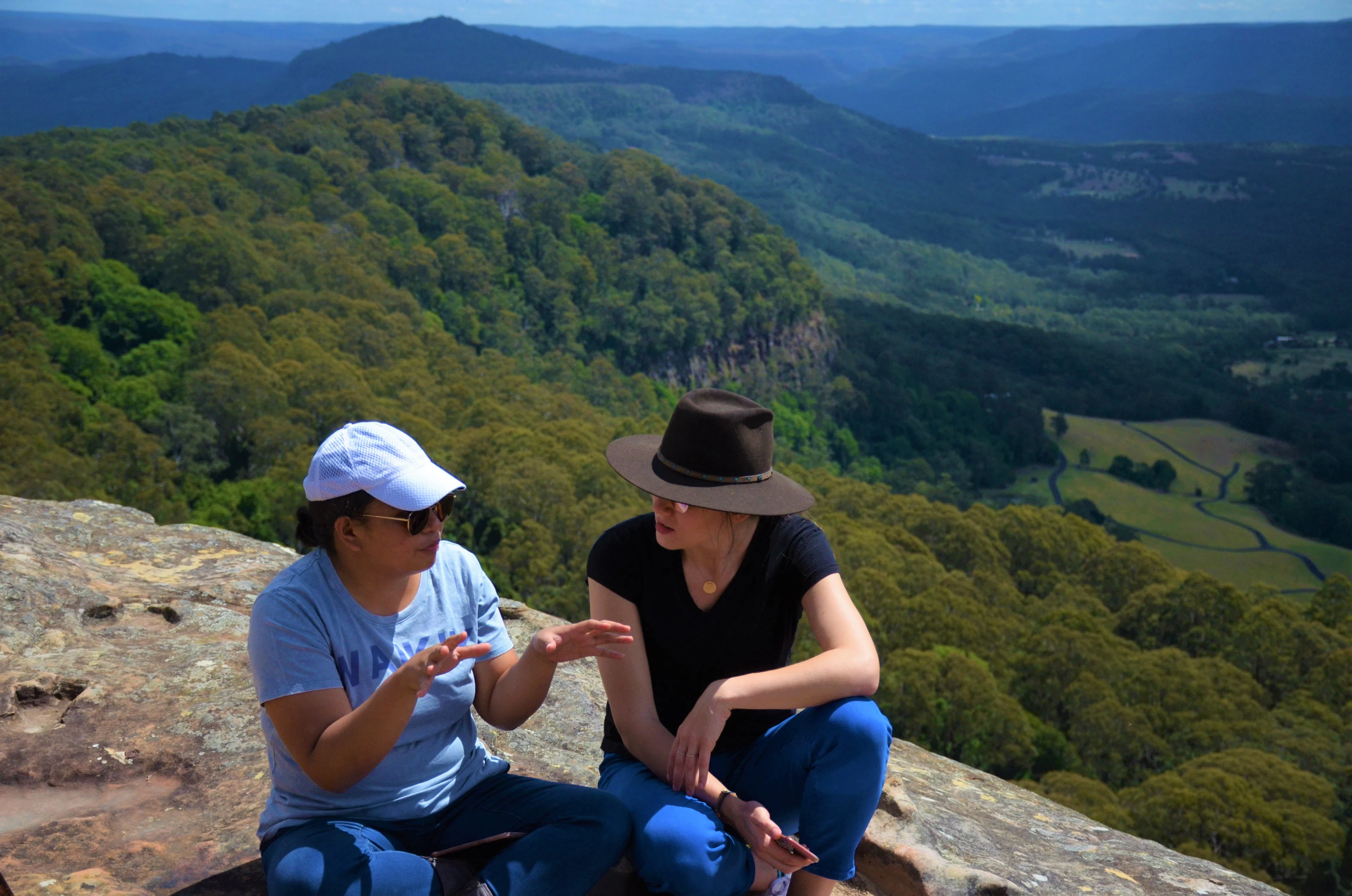
Two people sitting on a rocky cliff edge, talking while overlooking a vast, lush green forest valley and distant ridgelines in the Cambewarra Range.
Visitors taking in the scenic valley views from the rocky lookout in Cambewarra Range Nature Reserve.

Cambewarra Range Nature Reserve ecosystems, habitats, and plant life

Ecologically, Cambewarra Range Nature Reserve is defined by its mosaic of warm temperate and subtropical rainforest types, interspersed with drier shrub forests, heaths, and small upland swamps. The most extensive forest type is the coastal hinterland subtropical warm temperate rainforest, with coachwood (Ceratopetalum apetalum) dominant in sheltered slopes and gullies. Other characteristic canopy species include lilly pilly, native laurel, sassafras, and on richer soils silver quandong, maiden's blush, brush cherry, crabapple, jackwood, bolly gum, and the striking giant stinging tree.

On the exposed plateau tops and upper slopes, the vegetation shifts to lowland dry shrub forest and northern coastal hinterland heath shrub dry forest, where red bloodwood, scribbly gum, brown barrel, Sydney peppermint, silver quandong, brown beech, and soapy box dominate. Heathland-sedgeland communities, tall Melaleuca linariifolia shrubland with Leptospermum polygalifolium, and small Southern Escarpment shrub/fern/herb moist forest patches add to the diversity. The Berry Mountain section alone supports three distinct rainforest groupings: mixed subtropical/warm temperate rainforest on boulder and scree slopes, warm temperate rainforest on mid-depth soils, and dry rainforest on the shallowest, most water-stressed soils.

The reserve sits within the Endangered Ecological Community of the Illawarra Subtropical Rainforest in the Sydney Basin Bioregion and includes old growth and mature forest, alongside disturbed areas and limited regrowth from past fires and selective logging. Much of the Cambewarra Mountain area represents one of the largest contiguous areas of subtropical rainforest remaining in the Illawarra-Shoalhaven, giving the reserve significant botanical and ecological weight in the regional conservation estate.
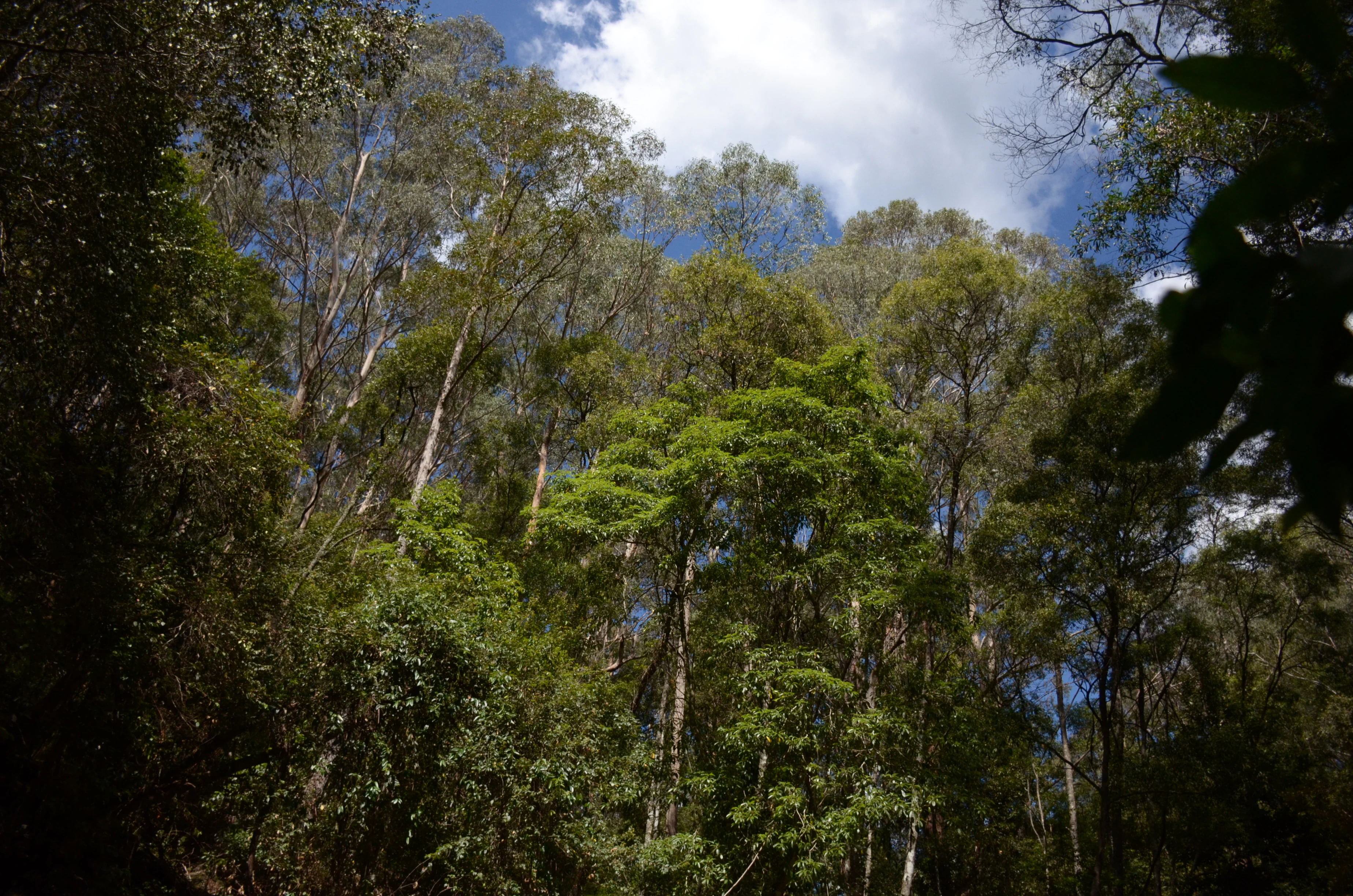
A low angle view of tall trees in a lush forest with sunlight filtering through the canopy against a blue sky with white clouds.
Sunlight filtering through the temperate rainforest canopy in Cambewarra Range Nature Reserve.

Cambewarra Range Nature Reserve wildlife and species highlights

The combination of rainforest, heath, cliffs, and swamps makes Cambewarra Range Nature Reserve particularly rich in birds and herpetofauna, with fauna surveys recording dozens of species across different sections of the reserve. The Red Rocks section alone has been documented to host around 61 species, reflecting how quickly wildlife communities change across the reserve's varied habitats.

Several threatened species depend on the reserve. The brush-tailed rock-wallaby is one of the most notable, with only one known colony now surviving in the western part of the reserve, where rocky cliff habitat remains. The spotted-tail quoll (also called the tiger quoll), the largest native marsupial carnivore, is considered the apex predator of the area and is thought to forage mainly in forested habitat, in contrast to introduced predators that prefer cleared land. Powerful and sooty owls, the eastern bristlebird, olive whistler, giant burrowing frog, yellow-bellied glider, long-nosed potoroo, and eastern bent-wing bat have all been recorded in or near the reserve.

More common native mammals include swamp wallaby, bush rat, eastern swamp rat, brown antechinus, ringtail possum, squirrel glider, and sugar glider, many of which have been documented via remote cameras and hair funnel traps in citizen science projects run with the University of Wollongong. Streams within the reserve are also ecologically significant: surveys of benthic macroinvertebrates in Nugent's Creek and O'Hares Creek have found healthy populations of pollution-sensitive mayfly and stonefly larvae, alongside caddisfly and dragonfly, indicating good water quality in these headwaters.
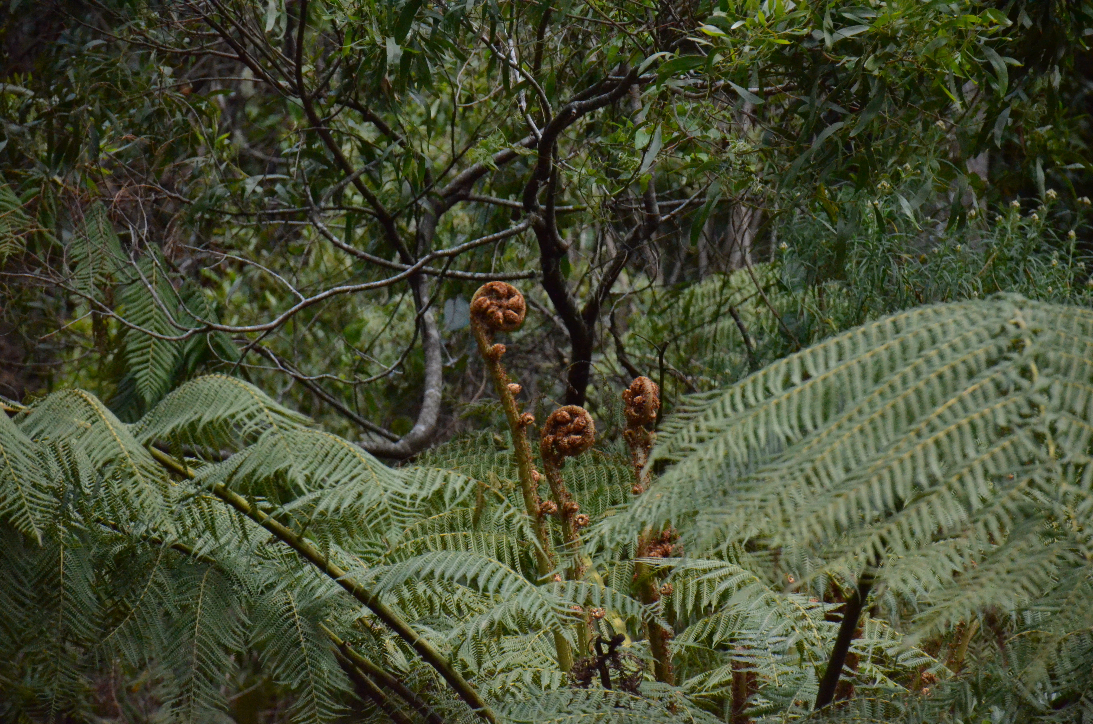
A close-up view of several young, tightly curled fern fiddleheads rising from a dense bed of mature fern fronds in a forest setting.
Developing fern fronds, known as fiddleheads, found within the temperate rainforest of Cambewarra Range Nature Reserve.

Cambewarra Range Nature Reserve conservation status and protection priorities

Cambewarra Range Nature Reserve plays a significant role in regional conservation because it protects large, relatively intact remnants of Illawarra-Shoalhaven subtropical rainforest in a heavily modified landscape. The reserve hosts multiple threatened species, including the brush-tailed rock-wallaby, spotted-tail quoll, sooty and powerful owls, eastern bristlebird, giant burrowing frog, yellow-bellied glider, long-nosed potoroo, and eastern bent-wing bat, and supports two threatened plant species, the endangered Solanum celatum and the vulnerable orchid Cryptostylis hunteriana.

The reserve falls within the Endangered Ecological Community of Illawarra Subtropical Rainforest (Sydney Basin Bioregion) under Schedule 2 of the Biodiversity Conservation Act 2016, and is one of ten priority management sites identified by the former NSW Office of Environment and Heritage, covering around 1,322 hectares of the slopes north of Cambewarra and extending east towards Jaspers Brush. Beyond biodiversity protection, the reserve is a critical part of the catchment for the Kangaroo River and Shoalhaven River, and therefore for the water supply to Sydney, the Illawarra, and the Shoalhaven.

Ongoing management priorities include controlling invasive weeds such as lantana along wet forest margins, managing introduced predators (foxes, feral cats, dogs) that threaten rock-wallabies and compete with quolls, regulating clearing and disturbance from rural-residential development on surrounding private land, and reducing illegal timber harvesting for boutique firewood and furniture use. The reserve has been identified as suitable for long-term ecological research, with regular surveys by University of Wollongong staff and students since 2014 tracking threatened species, weeds, and the impact of feral predators, making it a living laboratory for rainforest conservation in the Illawarra-Shoalhaven.

Cambewarra Range Nature Reserve cultural meaning and human context

The Cambewarra Range has deep cultural significance for the Tharawal (Dharawal) people, the traditional custodians of the region. They lived as groups along the coastal areas of the present-day Sydney Basin, relying on hunting of possums, wallabies, and goannas (including their eggs), gathering berries and leafy plants for food and medicine, and using the creeks that crossed the area as vital sources of fresh water. The reserve still preserves ancient Aboriginal trails that follow traditional routes through the landscape.

The name 'Cambewarra' itself carries cultural meaning that has been interpreted in two complementary ways. One interpretation links it to a belief that the summit once experienced volcanic activity, giving rise to the meaning 'mountain of fire'. Another sees the name as a reflection of clouds frequently shrouding the peak, which from a distance look like smoke rising from the mountaintop. Either way, the name encodes Aboriginal observations of fire-like phenomena in the landscape, whether interpreted geologically or atmospherically, and remains part of how the place is understood today.
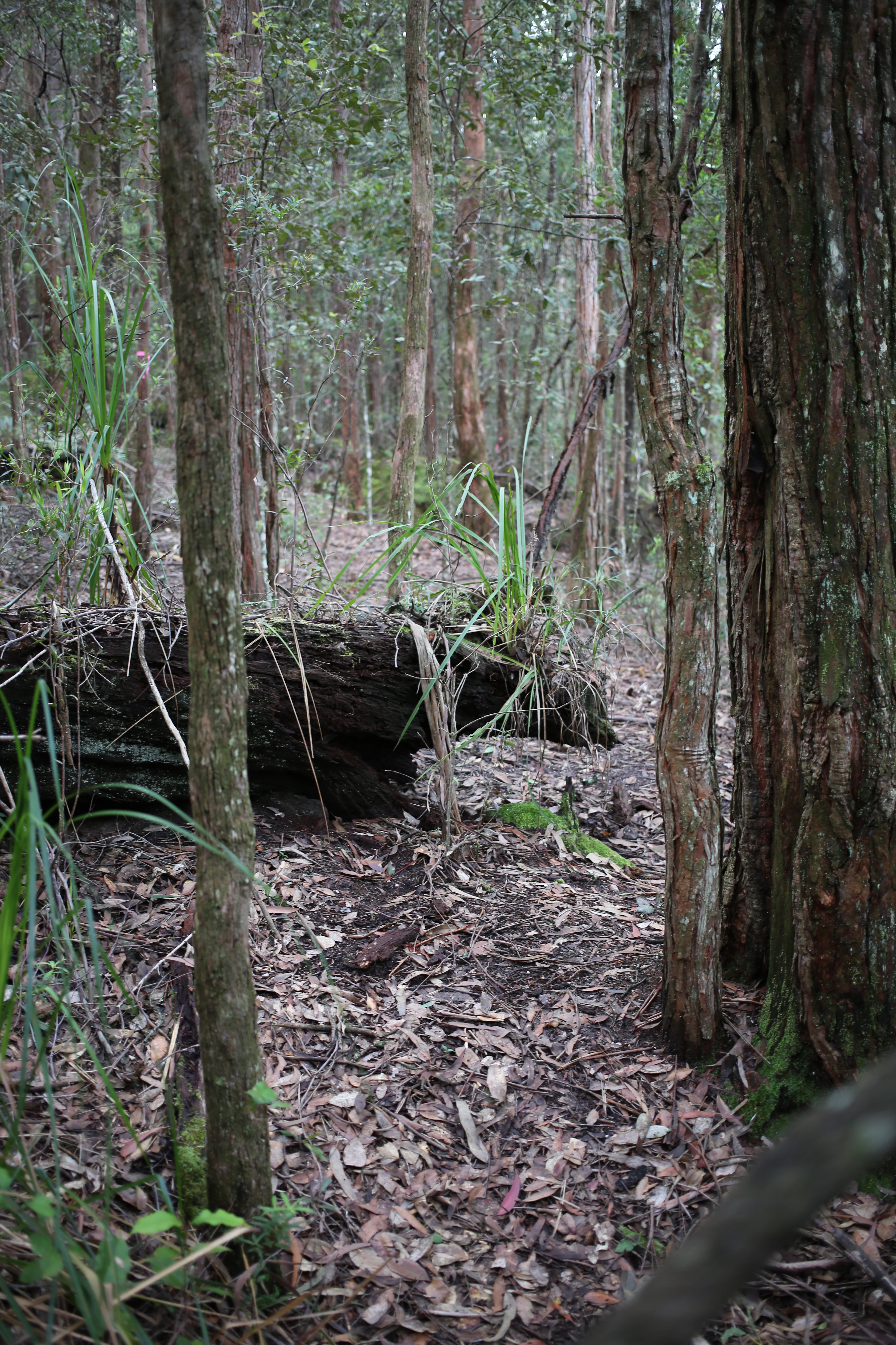
A forest floor covered in dried leaves with tall slender trees and a large fallen log covered in green foliage.
A dense temperate rainforest floor in Cambewarra Range Nature Reserve, featuring tall trees and fallen timber.

Top sights and standout views in Cambewarra Range Nature Reserve

Cambewarra Range Nature Reserve stands out for its combination of dramatic sandstone cliffs and plateaus above Kangaroo Valley, its extensive coachwood-dominated subtropical and warm temperate rainforest, and its importance for threatened wildlife such as the brush-tailed rock-wallaby and the spotted-tail quoll. The reserve also holds healthy populations of pollution-sensitive stream insects, contributes to the drinking water supply of southern New South Wales, and is part of a broader conservation network that includes Morton and Budderoo National Parks and several smaller Kangaroo Valley refuges.

What makes it particularly distinctive is the contrast between the heavily cleared surrounding rural landscape and the dense, largely intact forest cover on the escarpment, combined with the layered geological history of the Sydney Basin and the long Aboriginal cultural heritage of the Tharawal/Dharawal people. For conservation-minded visitors and researchers, the reserve offers an accessible yet ecologically rich slice of the Illawarra-Shoalhaven's surviving rainforest within easy reach of Sydney, Wollongong, and Nowra.
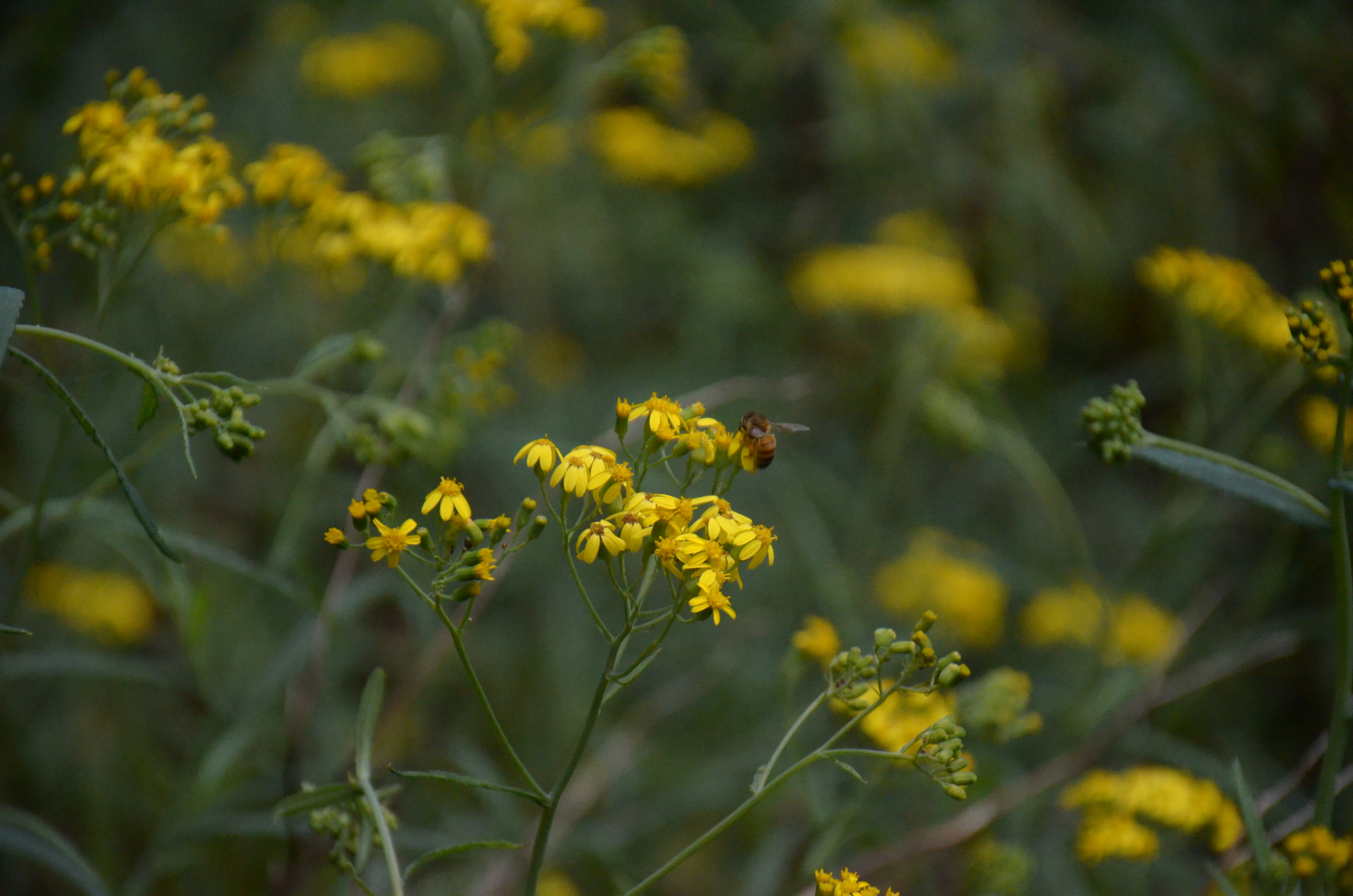
A close up view of several clusters of small yellow flowers with a small insect visible on one of the blooms, set against a soft green blurred background.
Clusters of small yellow flowers found in the Cambewarra Range Nature Reserve.

Best time to visit Cambewarra Range Nature Reserve

Temperatures across the Kangaroo Valley region are mild year round, with mean yearly temperatures around 16 degrees Celsius along the coastal plains, and cooler, mistier conditions inside the valley itself. Rainfall is well above 1,200 millimetres annually, so visitors should generally expect conditions to be neither dry nor arid in any season.

Late spring through early autumn tends to be a particularly rewarding period, when the forests are lush, creeks are flowing strongly, and access roads such as Leobold Hill Road and the Red Rocks Trig Trail are most reliably usable for walking and scenery viewing. Winter brings a different character: cooler, damper conditions, more frequent mist that shrouds the cliffs and plateau, and occasional cold snaps on higher ground. Snow falls occasionally on the higher tablelands in winter but is rare over the reserve itself. Spring and summer also carry a higher bushfire risk, especially when north-westerly winds develop in November.


Monthly climate preview

Long term monthly temperature and precipitation records measured at representative park coordinates

Cambewarra Range Nature Reserve Climate Normals and Annual Temperature Rhythm

Cambewarra Range Nature Reserve displays a measured annual temperature rhythm ranging from cooler midyear periods to warmer summer months alongside consistent daily precipitation. Reviewing the complete twelve month climate profile provides a structured breakdown of average temperature ranges and precipitation normals across the protected area.
Annual mean17 °C
12 °C22 °C
Jan22°
Feb22°
Mar20°
Apr18°
May15°
Jun13°
Jul12°
Aug12°
Sep15°
Oct17°
Nov19°
Dec21°
Warmest month
January

22.3 °C

Coolest month
July

11.7 °C

Wettest month
February

4.4 mm/day

Driest month
September

2 mm/day

Park location guide

Geography guide, regional context, and park location map for Cambewarra Range Nature Reserve

Cambewarra Range Nature Reserve park geography, regions, and map view in Australia

Understand where Cambewarra Range Nature Reserve sits in Australia through a broader geographic reading of the surrounding landscape, nearby location context, and its mapped position within the national park landscape.

How Cambewarra Range Nature Reserve fits into Australia

Australia is a constitutional monarchy and federal parliamentary democracy comprising six states and ten territories. With a population of nearly 28 million, it is one of the world's most urbanised countries, with most people concentrated on the eastern seaboard. The country has a high Human Development Index and is known for its cultural diversity, ancient Aboriginal heritage, and unique wildlife.

Wider geography shaping Cambewarra Range Nature Reserve in Australia

Australia occupies the entire Australian continent, the island of Tasmania, and numerous smaller islands. It is the world's flattest and driest inhabited continent, featuring vast deserts in the interior (the Outback), tropical rainforests along the eastern coast, and a coastline bordering the Indian and Pacific Oceans.

Map view of Cambewarra Range Nature Reserve

Use this park location map to pinpoint Cambewarra Range Nature Reserve in Australia, understand its exact geographic position, and read its mapped placement within the surrounding landscape more clearly.

Pigeon | © OpenStreetMap contributors

Location context for Cambewarra Range Nature Reserve

New South Wales
Natural feature types

Browse the Natural Features of Cambewarra Range Nature Reserve

Trace the diverse geologic and ecological landmarks defined within the boundaries of Cambewarra Range Nature Reserve. This structured index from MoriAtlas allows for deep exploration of the cliffs, forests, and drainage systems that constitute this significant protected area of the New South Wales landscape.
Recorded earthquake history

Explore Recorded Earthquake History for Cambewarra Range Nature Reserve

Examine the history of recorded seismic events associated with Cambewarra Range Nature Reserve. This MoriAtlas collection tracks historical epicentres, magnitudes, and depths to support a clearer understanding of the regional geological landscape through factual documentation.

Cambewarra Range Nature Reserve Earthquakes

Catalogued events

3 events

Strongest magnitude

Magnitude 4.6

Most recent event

Aug 18, 2007

This history includes earthquakes recorded inside the park or within 50 km of its borders

Visualizing the sandstone cliffs, plateaus, and rainforest habitats of the reserve

Cambewarra Range Nature Reserve Photos and Landscape Scenery

Visual documentation captures the dramatic escarpment terrain, ancient coachwood forests, and rugged sandstone plateaus defining the protected landscape. Examining these field photographs reveals the ecological character and varied microclimates shaping the protected reserve above Kangaroo Valley.

A high-angle view overlooking a deep green valley and rolling hills in the Cambewarra Range, framed by dark foreground trees and a cloudy sky.

Three people stand on a rocky outcrop looking out over a wide valley under a blue sky with scattered clouds.

Two people sitting on a rocky cliff edge, talking while overlooking a vast, lush green forest valley and distant ridgelines in the Cambewarra Range.

A low angle view of tall trees in a lush forest with sunlight filtering through the canopy against a blue sky with white clouds.

A close-up view of several young, tightly curled fern fiddleheads rising from a dense bed of mature fern fronds in a forest setting.

A narrow, sandy trail leads into a dense forest of eucalyptus trees under a cloudy sky.

A forest floor covered in dried leaves with tall slender trees and a large fallen log covered in green foliage.

A close up view of several clusters of small yellow flowers with a small insect visible on one of the blooms, set against a soft green blurred background.

A cluster of small, yellow, globe-shaped flowers with spiky foliage growing in a dark, forested understory setting.

A small, partially shaded creek flowing between rocky banks and dense forest vegetation.

Park atlas

Compare regional protected areas and connected escarpment reserves

Parks Near Cambewarra Range Nature Reserve And Protected Landscapes

Continue exploring regional protected areas by comparing other parks near Cambewarra Range Nature Reserve. Examining adjacent escarpment reserves and valley ecosystems reveals the wider conservation corridor framing Kangaroo Valley.
National parkAustralia
0.3 km away#1 closest

Southwest

Bugong National Park: Protected Landscape Identity and Geographic Context in Australia

Discover unique biodiversity, forest habitats, and regional terrain.

Bugong National Park stands as a vital strict nature reserve within Australia's protected lands. Its distinct geography features a plateau below the Cambewarra range and steeply sloping valleys carved by waterways like Bugong Creek and the Shoalhaven River. This protected area is crucial for conserving significant biodiversity, including endemic and threatened species, across its diverse wet and dry forest habitats. For those interested in atlas exploration, Bugong National Park offers a clear example of landscape conservation and protected area geography within New South Wales.

Area
10.22 km²
Established
2001
IUCN
Ia
Relief
Mixed relief
Watercolor landscape illustration showing green fields, trees, hills, and pastel sky
National parkNew South Wales
0.5 km away#2 closest

Southwest

Morton National Park: A Protected Landscape of Waterfalls and Dissected Plateaus in New South Wales

Explore its mapped boundaries and regional geographic context.

Morton National Park is a nationally recognized protected area within New South Wales, Australia, celebrated for its striking natural features and geographic significance. The park's landscape is characterized by a dramatic dissected plateau, giving rise to impressive waterfall systems such as Fitzroy Falls and Belmore Falls that cascade into deep gorges. As a key component of the Southern Highlands' natural heritage, Morton National Park provides a rich subject for atlas exploration, offering insights into regional terrain, protected land distribution, and the unique interplay of natural elements within this Australian national park.

Area
1,997.45 km²
Established
1967
IUCN
II
Relief
Mixed relief
National parkNew South Wales
3.7 km away#3 closest

Northeast

Budderoo National Park: Protected Landscape Exploration in New South Wales

Mapping the protected area and its regional geographic context.

Gain a clear understanding of Budderoo National Park as a protected national park situated within New South Wales. This detail page focuses on its mapped geographic features and protected landscape characteristics, providing critical context for atlas-based discovery. Explore the park's position within the broader regional geography of Australia and appreciate its identity as a conservation landscape.

Area
72.19 km²
Established
1986
IUCN
II
Climate
Subtropical
Nature reserveNew South Wales
About 4.3 km away#4 closest

Northwest

Kangaroo River Nature Reserve: Protected Valley Landscapes in New South Wales

Mapping rainforest gullies and diverse forest ecosystems

Located in the heart of the Kangaroo Valley, this nature reserve protects a vital ecological corridor of sclerophyll forest and rainforest. Its distinct gully systems and volcanic soil pockets provide essential habitat, serving as a cornerstone of the broader Shoalhaven protected landscape network in southern New South Wales.

Area
1.26 km²
Established
2001
IUCN
Ia
Relief
Upland
Nature reserveNew South Wales
About 7.7 km away#5 closest

North

Barrengarry Nature Reserve: A Protected Forest Mosaic in New South Wales, Australia

Illawarra hinterland geography and forest ecosystem mapping

Barrengarry Nature Reserve protects a 21-hectare mosaic of warm temperate rainforest and eucalyptus forest. Situated near Kangaroo Valley, the area demonstrates complex habitat transition and serves as a significant site for threatened species conservation within the broader New South Wales ecological landscape.

Area
0.21 km²
Established
2001
IUCN
Ia
Scope
Terrestrial
A watercolor illustration showing a winding river curving through green rolling hills with scattered trees and a soft pastel pink and yellow sky
Nature reserveNew South Wales
8 km away#6 closest

Northeast

Barren Grounds Nature Reserve: Sandstone Heath and Escarpment Geography in New South Wales

An essential atlas profile of protected plateaus and bird habitat

Located on the high plateau of the Illawarra escarpment, Barren Grounds Nature Reserve protects a unique landscape of sandy soils, coastal cliff lines, and weathered rock formations. This nature reserve offers a distinct look into the ecological and geological character of the Southern Highlands, serving as a vital bird conservation hub within the New South Wales landscape.

Area
20.24 km²
Established
1956
IUCN
II
Relief
Upland
National parkNew South Wales
10 km away#7 closest

East

Seven Mile Beach National Park: New South Wales National Park, Coastal Delta & Bird Habitat Exploration

Explore the mapped terrain and protected landscapes of this significant Australian coastal park.

Seven Mile Beach National Park offers a fascinating case study in coastal geography and protected area management, situated within New South Wales, Australia. The park's landscape is defined by the Shoalhaven River delta, showcasing a unique environment of tidal flats, islands, and a substantial sand barrier. This ecosystem supports significant populations of migratory waders and seabirds, making it a noteworthy site for ornithological interest and broader conservation studies. Understanding this park's atlas representation reveals its distinct littoral rainforest and its role within the regional protected land network.

Area
8.981 km²
Established
1971
IUCN
II
Relief
Lowland
Nature reserveNew South Wales
About 12 km away#8 closest

East

Nameless Sylvan Reserve: A Protected Escarpment Rainforest in New South Wales

Geographic overview of this Illawarra nature reserve

Located in south-eastern New South Wales, Nameless Sylvan Reserve preserves a compact 54 hectare corridor of Illawarra Escarpment habitat. The landscape transitions from subtropical rainforest along Irwin Creek to cooler temperate rainforest on the higher slopes, representing a significant piece of the regional conservation mosaic near Berry.

Area
0.54 km²
Established
2007
IUCN
II
Relief
Mountain

Common questions about visiting, size, designation, and location context for Cambewarra Range Nature Reserve

Cambewarra Range Nature Reserve FAQs for park facts, access, geography, and protected area context

Find quick answers about Cambewarra Range Nature Reserve, including protected-area facts, park geography, trail and visitor context, and how the park fits into its surrounding country and regional landscape.
MoriAtlas Explorer

Continue Your Protected Areas Search Across the Global Atlas

Deepen your exploration by continuing the structured search for national parks and protected areas worldwide. Utilize the comprehensive filtering capabilities to compare different conservation landscapes and refine your understanding of global park geography. Discover more about the distribution and characteristics of protected natural areas.

Global natural geography