

Mori Atlas logo
National parkCamooweal Caves National Park

Discover the mapped boundaries and geographic context of this significant protected area.

Camooweal Caves National Park: Queensland's Protected National Park Landscape & Map Atlas

Camooweal Caves National Park stands as a key protected landscape within northeastern Australia's Queensland region. This national park offers a unique geographic identity, inviting detailed atlas exploration of its protected boundaries and natural terrain. Understand its place within the broader Queensland geography, focusing on the mapped features that define this conservation area.

sinkholesdolomite cavesOutback Queenslandgeological heritageIndigenous cultural landscapebirdwatching

Camooweal Caves National Park

National park

Park overview

Structured park overview, official facts, and landscape profile for Camooweal Caves National Park

Camooweal Caves National Park park facts, protected area profile, and essential visitor context

Review the core facts for Camooweal Caves National Park, including designation, size, terrain, visitor scale, habitats, and operating context in one park-focused overview.

About Camooweal Caves National Park

Camooweal Caves National Park occupies a remote corner of northwestern Queensland, protecting a landscape of profound geological and cultural significance. The park's two accessible sinkholes represent rare windows into Earth's deep geological history, with the dolomite formations dating back over 500 million years to the Precambrian era. These formations developed as groundwater gradually dissolved and percolated through beds of dolomite rock, creating the sinkholes and cave passages that visitors can explore today. The park sits within the Georgina River basin, a vast semi-arid drainage system that supports distinctive Outback ecosystems despite the challenging climate. The vegetation communities reflect this harsh environment, with eucalypt woodland providing scattered canopy across spinifex-dominated ground layers, while wattle and Mitchell grass add to the botanical character of the landscape. Visitor facilities include a picnic area at Nowranie waterhole, offering a rare reliable water source in this arid landscape and a focal point for appreciating the park's natural values.

Quick facts and research context for Camooweal Caves National Park

Camooweal Caves National Park is located in northwestern Queensland, roughly 1720 kilometres northwest of Brisbane. The park was established in 1988 and covers an area of 138 square kilometres. The terrain averages 242 metres in elevation and features two sinkholes that are accessible to visitors, formed through geological processes spanning over 500 million years. The traditional Indigenous name for this place is Wiliyan-ngurru, reflecting the enduring connection between the landscape and the Indjalandji-Dhidhanu People. The park contains eucalypt woodland, spinifex, wattle, and Mitchell grass vegetation communities, with a notable waterhole called Nowranie providing a focal point for visitors.

Protection and recognition

Tracking the terrestrial conservation status and official establishment timeline since 1988

Camooweal Caves National Park Protected Area Designation and Recognition

Camooweal Caves National Park remains structured as a dedicated terrestrial protected area within the regional conservation network. Structured records outline the official designation timeline from 1988 alongside boundary classifications to provide a reliable reference for global environmental databases.

Protection details

Protection scope
Terrestrial
Designated year
1988
Transboundary protection
No
Park context

Deeper park guide and search-rich context for Camooweal Caves National Park

Camooweal Caves National Park history, landscape, wildlife, and travel context

Explore Camooweal Caves National Park through its history, landscape character, ecosystems, wildlife, conservation priorities, cultural context, and seasonal travel timing in a structured park guide built for atlas discovery and search intent.

Why Camooweal Caves National Park stands out

Camooweal Caves is best known for its extraordinary ancient sinkhole formations, which are among the oldest accessible cave systems in Australia. These dolomite-formed sinkholes, created by water seepage through bedrock over more than 500 million years, represent a geological heritage of significant scientific and scenic value. The park's accessibility to the public of these ancient formations, combined with its location in a remote Outback setting, makes it distinctive among Queensland's protected areas. The presence of Nowranie waterhole, the diverse birdlife including waterbirds and woodland species, and the cultural landscape valued by the Indjalandji-Dhidhanu People further distinguish this park.

Camooweal Caves National Park history and protected-area timeline

The establishment of Camooweal Caves National Park in 1988 marked the formal recognition of both the geological significance and cultural heritage of this landscape. The protected area was created to preserve the unique sinkhole formations while providing public access to these remarkable geological features. However, the human history of this region extends far beyond recent protected area designation. The broader Camooweal area, including the lands now within the national park, was inhabited by the Indjalandji-Dhidhanu People for thousands of years before European settlement began in the 1860s. This Indigenous community maintained sophisticated connections to Country, using the park area and the Georgina River as trade routes with neighbouring tribal groups. The Indjalandji-Dhidhanu People continue to hold deep cultural knowledge of this landscape, with Dreamings representing the routes of ancestral spirits who shaped the terrain still traversing the park and creating sites of ongoing spiritual significance.

Camooweal Caves National Park landscape and geographic character

The landscape of Camooweal Caves National Park exemplifies the character of northwestern Queensland's Outback, combining flat terrain broken by extraordinary geological features. The terrain averages 242 metres in elevation and consists largely of flat to gently undulating plains characteristic of the Georgina River basin. The most striking landscape features are the sinkholes themselves, where dissolution of dolomite bedrock has created steep-sided openings into the earth. These formations contrast sharply with the surrounding semi-arid terrain, providing dramatic visual landmarks in an otherwise subdued landscape. The park supports woodland vegetation dominated by various eucalypt species, with an understory of spinifex grass representing one of Australia's most widespread arid-zone plant communities. Scattered wattle species and patches of Mitchell grass add botanical diversity to this landscape. Nowranie waterhole provides a permanent water feature that contrasts with the generally arid surroundings, creating a localized ecological hotspot within the park.

Camooweal Caves National Park ecosystems, habitats, and plant life

The nature of Camooweal Caves National Park reflects the semi-arid Outback environment of northwestern Queensland. The vegetation communities are adapted to low rainfall and high temperatures, with eucalypt woodland forming the dominant canopy layer across much of the park. Spinifex, a tough perennial grass adapted to arid conditions, covers extensive areas of the ground layer, while wattle species provide additional woody vegetation structure. Mitchell grass occurs in patches throughout the park, particularly in areas with slightly better soil moisture. The presence of Nowranie waterhole significantly influences the park's ecology, creating a permanent water source that supports more lush vegetation and attracts diverse wildlife. The waterhole represents a critical resource in this dry landscape, drawing both resident and migratory species to its margins.

Camooweal Caves National Park wildlife and species highlights

Wildlife at Camooweal Caves National Park centres notably on birdlife, with the park supporting both waterbird and woodland bird communities. The presence of Nowranie waterhole provides crucial habitat for waterbirds, attracting species that depend on permanent freshwater in this arid region. Woodland bird species inhabit the eucalypt forests and wattle thickets throughout the park, finding shelter and foraging opportunities in the scattered trees and denser vegetation patches. The contrast between the waterhole environment and the surrounding woodland creates diverse habitat conditions that support different bird communities within relatively close proximity. While the source material specifically highlights avian diversity, the park's position within the broader Outback ecosystem suggests the presence of various reptiles, invertebrates, and smaller mammals adapted to arid conditions.

Camooweal Caves National Park conservation status and protection priorities

Camooweal Caves National Park represents protection of both significant geological heritage and culturally important Indigenous landscapes. The sinkhole formations, dating back over 500 million years, constitute one of Australia's more accessible windows into Precambrian geological processes and represent a protected area category listed under IUCN Category II. The park's designation protects the dolomite formations from development or damage while providing controlled public access for interpretation and appreciation. The conservation value extends to the Indigenous cultural landscape, where the Indjalandji-Dhidhanu People's connection to Country and the Dreaming routes traversing the park represent irreplaceable cultural heritage requiring protection alongside the geological features. The woodland and grassland communities, while not visually spectacular, represent functional Outback ecosystems that have evolved to thrive in this challenging environment.

Camooweal Caves National Park cultural meaning and human context

Camooweal Caves National Park holds profound cultural significance for the Indjalandji-Dhidhanu People, whose connection to this landscape spans thousands of years of continuous habitation and spiritual association. Before European arrival in the 1860s, this community utilized the park area and the Georgina River as trade routes connecting with neighbouring tribal groups, indicating the region's importance in broader regional networks of exchange and interaction. The park remains culturally living for the Indjalandji-Dhidhanu People, with Dreamings representing the routes of ancestral spirits who shaped the landscape still believed to traverse the area. These Dreaming tracks create multiple sites of significance within the park, connecting the geological features to spiritual narratives and ongoing cultural practice. The traditional name Wiliyan-ngurru reflects this deep relationship between people and Country.

Top sights and standout views in Camooweal Caves National Park

The two accessible sinkholes at Camooweal Caves stand as the park's primary attraction, offering visitors the chance to descend into geological formations more than 500 million years old. Nowranie waterhole provides a picnic area with facilities, creating a focal point for visits and offering wildlife observation opportunities in an otherwise arid landscape. The park offers a rare combination of geological wonder, Outback scenery, and Indigenous cultural heritage within a relatively accessible protected area. The contrast between the ancient subterranean formations and the living Indigenous culture that continues to connect with this landscape creates a layered visitor experience that distinguishes Camooweal Caves from more straightforward nature-based protected areas.

Best time to visit Camooweal Caves National Park

The best time to visit Camooweal Caves National Park coincides with the cooler months in Queensland's Outback, typically from April through September. Winter temperatures in northwestern Queensland are mild and comfortable for outdoor exploration, while summer months can bring extreme heat that makes sustained outdoor activity uncomfortable and potentially dangerous. The dry season generally runs from May through October, offering more predictable weather conditions for visitors. Rainfall is sparse throughout the year, but the period between December and March occasionally brings monsoon influences that can affect access and conditions. Visitors should note that the remote location requires self-sufficiency, and that the waterhole provides the primary focus for visitation.
Monthly climate preview

Explore monthly temperature variations and historical precipitation patterns in Queensland

Camooweal Caves National Park Climate Profile and Weather by Month

Long-term climate data for Camooweal Caves National Park reveals hot periods with peak average temperatures exceeding 40 degrees Celsius, contrasted with cooler, dry months. Accessing the full monthly profile provides historical averages to analyze thirty years of precipitation trends, temperature ranges, and cyclical patterns.
Annual mean26 °C
18 °C32 °C
Jan30°
Feb29°
Mar28°
Apr26°
May22°
Jun18°
Jul18°
Aug20°
Sep25°
Oct29°
Nov31°
Dec32°
Warmest month
December

31.5 °C

Coolest month
July

18.1 °C

Wettest month
February

4.2 mm/day

Driest month
July

0.1 mm/day

Park location guide

Geography guide, regional context, and park location map for Camooweal Caves National Park

Camooweal Caves National Park park geography, regions, and map view in Australia

Understand where Camooweal Caves National Park sits in Australia through a broader geographic reading of the surrounding landscape, nearby location context, and its mapped position within the national park landscape.

How Camooweal Caves National Park fits into Australia

Australia is a constitutional monarchy and federal parliamentary democracy comprising six states and ten territories. With a population of nearly 28 million, it is one of the world's most urbanised countries, with most people concentrated on the eastern seaboard. The country has a high Human Development Index and is known for its cultural diversity, ancient Aboriginal heritage, and unique wildlife.

Wider geography shaping Camooweal Caves National Park in Australia

Australia occupies the entire Australian continent, the island of Tasmania, and numerous smaller islands. It is the world's flattest and driest inhabited continent, featuring vast deserts in the interior (the Outback), tropical rainforests along the eastern coast, and a coastline bordering the Indian and Pacific Oceans.

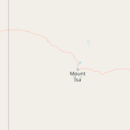
Map view of Camooweal Caves National Park

Use this park location map to pinpoint Camooweal Caves National Park in Australia, understand its exact geographic position, and read its mapped placement within the surrounding landscape more clearly.

Pigeon | © OpenStreetMap contributors

Location context for Camooweal Caves National Park

Queensland
Park atlas

Explore surrounding national park geography and compare protected landscapes across Queensland's semi-arid regions.

Discover More Protected Areas Near Camooweal Caves National Park and Outback Queensland

Browse other protected areas and national parks in the expansive Outback region surrounding Camooweal Caves National Park, tracing a diverse array of geological formations and semi-arid wilderness areas. Compare the unique characteristics of each protected landscape, understanding regional conservation efforts and the spread of Australia's ancient cave systems and savanna habitats.
National parkQueensland
About 153 km away#1 closest

North

Boodjamulla National Park: Queensland National Park Geography and Mapped Boundaries

Explore the protected landscape and regional context of Boodjamulla National Park.

Boodjamulla National Park represents a key protected area within the northeastern Australian state of Queensland, offering users a detailed look at its geographic identity and mapped conservation boundaries. This national park serves as a focal point for understanding the distribution of protected lands and the unique natural terrain it encompasses within its regional setting. Discover its atlas-relevant features and protected landscape context.

Area
2,820 km²
Established
1985
IUCN
II
Relief
Highland
Wildlife reserveNorthern Territory
About 214 km away#2 closest

Northwest

Connells Lagoon Conservation Reserve: Northern Territory Protected Landscape Atlas

Examining the ecological significance of Barkly Tableland grasslands

Connells Lagoon Conservation Reserve, also known as Dalgajini, encompasses a vital protected sample of the Barkly Tableland's Mitchell grassland and black soil plains. This wildlife reserve functions as a sanctuary for native grassland systems, maintaining a rare, cattle-free landscape that allows for the study of regional vegetation, rare avian species, and ancestral Wambaya cultural land patterns within the Northern Territory.

Area
258.9 km²
Established
1994
IUCN
Ia
Relief
Lowland
Nature reserveQueensland
About 344 km away#3 closest

South

Pilungah Reserve: Protected Arid Landscapes and Geography in Western Queensland

Exploration of desert dunefields and Mulligan River catchments

Pilungah Reserve protects over 200,000 hectares of diverse desert terrain, from the rugged Toomba Range to the expansive gibber plains of Central West Queensland. This nature reserve serves as an important ecological refuge, preserving rare reptile and bird habitats within the Channel Country and Simpson Strzelecki Dunefields. The area also holds cultural significance to the Wangkamadla people, reflecting a deep connection between traditional heritage and modern conservation.

Area
2,330 km²
Established
2005
Relief
Mixed relief
Climate
Arid
National parkNorthern Territory
About 350 km away#4 closest

West

Iytwelepenty / Davenport Range National Park: Protected National Park Landscape Atlas

Explore Northern Territory's mapped protected area and regional geography.

Iytwelepenty / Davenport Range National Park is a designated national park offering crucial insights into Australia's protected landscapes. This resource provides a detailed view of its geographic position within the Northern Territory, emphasizing its mapped boundaries and the surrounding regional context. Users seeking to understand the distribution and geographical characteristics of protected areas will find this park's atlas-style data invaluable for discovery.

Area
1,278.47 km²
Established
1993
IUCN
II
Relief
Mountain
National parkNorthern Territory
About 381 km away#5 closest

Southwest

Dulcie Range National Park National Park: Mapped Protected Landscape in Northern Territory

Explore its geographic boundaries and regional terrain.

Dulcie Range National Park, a protected national park in Australia's Northern Territory, offers a focus for structured geographic discovery. This page details its mapped protected area, contributing to an understanding of the regional landscape and terrain. It serves as a vital entry point for exploring the park's specific natural and geographic identity within the vast context of Northern Australia.

Area
191.12 km²
Established
1991
IUCN
II
Relief
Upland
Wildlife reserveNorthern Territory
About 398 km away#6 closest

North

Pungalina-Seven Emu Sanctuary: Protected Wildlife Reserve and Regional Landscape Atlas

Coastal and upland wilderness in the Northern Territory

Uncover the geographic breadth of Pungalina-Seven Emu Sanctuary, an essential wildlife reserve in Australia. The landscape encompasses sandstone gorges, extensive freshwater wetlands, and tidal mudflats, providing a crucial conservation corridor along the Gulf of Carpentaria. This site offers deep insight into the intersection of Indigenous stewardship and professional land management across tropical savanna environments.

Area
3,072.12 km²
Established
2009
IUCN
II
Relief
Upland
Marine protected areaQueensland
About 409 km away#7 closest

North

Gulf of Carpentaria Marine Park: Mapped Marine Protected Area and Tropical Geography

Submerged reefs, coastal basins, and Queensland marine habitats

The Gulf of Carpentaria Marine Park serves as a crucial protected zone in northern Australia, safeguarding complex marine environments. This atlas entry details its significant geographic features, ranging from productive coastal waters and sedimentary basins to isolated coral reefs. Gain a deeper understanding of the bathymetry and protected boundaries that support high levels of tropical marine biodiversity.

Area
23,771 km²
Established
2018
IUCN
VI
Relief
Lowland
Nature reserveNorthern Territory
About 411 km away#8 closest

West

Karlu Karlu / Devils Marbles Conservation Reserve: Mapped Desert Landscapes and Geological Sites

Protected granite formations in the Northern Territory

Investigate the distinctive boulder fields and arid geography of Karlu Karlu / Devils Marbles Conservation Reserve, a significant Indigenous Protected Area located in the heart of Australia. The site maps the intersection of ancient geological processes and enduring cultural narratives, providing clear boundary context for one of the most recognizable natural landmarks in the Barkly region.

Area
18.02 km²
Established
1961
IUCN
V
Visitors
137.5K annual

Common questions about visiting, size, designation, and location context for Camooweal Caves National Park

Camooweal Caves National Park FAQs for park facts, access, geography, and protected area context

Find quick answers about Camooweal Caves National Park, including protected-area facts, park geography, trail and visitor context, and how the park fits into its surrounding country and regional landscape.
MoriAtlas Explorer

Continue Your Protected Areas Search Across the Global Atlas

Deepen your exploration by continuing the structured search for national parks and protected areas worldwide. Utilize the comprehensive filtering capabilities to compare different conservation landscapes and refine your understanding of global park geography. Discover more about the distribution and characteristics of protected natural areas.

Global natural geography