Mori Atlas logo
State or regional parkCañon de Fernández State Park

Mapping the ancient river corridors and arid canyon geography of this Chihuahuan Desert wetland

Cañon de Fernández State Park: A Protected Desert Riparian Landscape in Durango, Mexico

(Parque Estatal Cañón de Fernández)

Cañon de Fernández State Park represents a significant protected area within the Chihuahuan Desert of Durango, Mexico. Centered on the Nazas River, this landscape protects a rare gallery forest featuring centuries-old Montezuma bald cypress trees. The park functions as a vital desert wetland, providing essential habitat for diverse avian species and sustaining a sharp ecological contrast between the lush riverine corridor and the surrounding arid canyon terrain.

Chihuahuan Desertriparian forestwetlandRamsar sitedesert river canyonMontezuma bald cypress

Cañon de Fernández State Park

State or regional park

Park overview

Structured park overview, official facts, and landscape profile for Cañón de Fernández State Park

Cañón de Fernández State Park park facts, protected area profile, and essential visitor context

Review the core facts for Cañón de Fernández State Park, including designation, size, terrain, visitor scale, habitats, and operating context in one park-focused overview.

About Cañón de Fernández State Park

Cañón de Fernández State Park lies in the northern Mexican state of Durango, anchoring a stretch of the Nazas River as it cuts through the Chihuahuan Desert. Although the surrounding region is defined by aridity, sparse vegetation, and dramatic desert scenery, the park itself is closely tied to the river corridor, and it is this corridor that gives the protected area its ecological character and significance. Lerdo Municipality, within which the park is situated, sits in one of the more developed corners of Durango, making the park a valuable natural enclave close to metropolitan pressure.

The protected area was formally established in 2004 by the government of Durango, formalizing protection for a landscape that had long attracted scientific interest because of its old-growth riparian trees. In 2008, it was inscribed as a Wetland of International Importance under the Ramsar Convention, giving the site an international profile and placing it within a global framework for wetland conservation. It is the only Ramsar site in Durango and only the second within the broader Chihuahuan Desert after Cuatrociénegas in Coahuila, an indication of how unusual a desert wetland of this scale and quality is in the region.

What sets the park apart ecologically is the combination of its desert context and its well-developed riparian forest. Montezuma bald cypress, cottonwood, willow, and mesquite form a continuous green ribbon that contrasts sharply with the surrounding xeric landscape. Among the bald cypress stand trees that have been dated to more than 1,400 years old through dendrochronology, a fact that lends the park both cultural and ecological weight. The indigenous name for the bald cypress, ahuehuetl, meaning "old man in the water," reflects the long-standing human awareness of these individual ancient trees beside the river.

Wildlife diversity reinforces the park's importance. The bird list exceeds 220 species and includes species that rarely nest in the Chihuahuan Desert, such as the grey hawk and the green jay. Mammals such as bobcats, mountain lions, and jaguarundis, along with a varied reptile community, contribute to a richer faunal profile than would normally be expected in a desert setting of this kind. The park is managed by the local NGO Prodefensa del Nazas, AC, working under contract with the state government, which adds a distinct community-based dimension to its conservation story.

Quick facts and research context for Cañón de Fernández State Park

Cañón de Fernández is a state-level protected area in Durango, northern Mexico, lying within the Chihuahuan Desert and centered on the Nazas River corridor. It was designated by the state of Durango in 2004, then listed as a Ramsar Wetland of International Importance on 2 February 2008, becoming the only Ramsar site in Durango. The park covers approximately 17,000 hectares and is managed in partnership with the local NGO Prodefensa del Nazas, AC. Its ecological importance rests on an ancient riparian forest, high avian diversity, and its position as a rare desert wetland of international standing.

Protection and recognition

Documented terrestrial protection history, management scope, and Ramsar wetland recognition

Cañon de Fernández State Park Protection Status and International Recognition Data

Cañon de Fernández State Park maintains a documented terrestrial protection status established in 2008 alongside official Ramsar wetland recognition. Structured conservation records outline the designation timeline and administrative history associated with the protected area.

International recognition

Protection details

Protection scope
Terrestrial
Designated year
2008
Transboundary protection
No
Park context

Deeper park guide and search-rich context for Cañón de Fernández State Park

Cañón de Fernández State Park history, landscape, wildlife, and travel context

Explore Cañón de Fernández State Park through its history, landscape character, ecosystems, wildlife, conservation priorities, cultural context, and seasonal travel timing in a structured park guide built for atlas discovery and search intent.

Why Cañón de Fernández State Park stands out

The park is best known for its ancient riparian forest of Montezuma bald cypress, some individuals of which exceed 1,400 years in age according to dendrochronological studies. These trees, called ahuehuetl in Nahuatl, meaning "old man in the water," grow along the Nazas River in a narrow green corridor that runs through the otherwise arid Chihuahuan Desert. This contrast between hyper-arid desert surroundings and a lush, ancient riverine forest is the park's most defining ecological image. Equally, the park is recognized for its ornithological richness. With more than 220 recorded bird species, including nesting rarities such as the grey hawk and the green jay, it stands out as a desert birding site. Its international recognition as a Ramsar Wetland of International Importance further amplifies its profile, making it both a regional conservation landmark and a destination of interest for naturalists drawn to desert wetlands.

Cañón de Fernández State Park history and protected-area timeline

Cañón de Fernández received formal protection in 2004, when the government of Durango established it as a state park with the aim of safeguarding the Nazas River corridor and its surrounding desert landscapes. This designation built on earlier scientific interest in the area, particularly the recognition that the park's bald cypress trees were extraordinarily old and ecologically significant.

The next major milestone came on 2 February 2008, when the site was listed as a Wetland of International Importance under the Ramsar Convention. This international recognition positioned the park as the only Ramsar site in the state of Durango and only the second in the entire Chihuahuan Desert, after Cuatrociénegas in Coahuila. The Ramsar listing also created an additional framework for monitoring and managing the wetland values of the park.

The day-to-day management of the protected area has been shaped by its partnership with Prodefensa del Nazas, AC, a non-governmental organization based in nearby Gómez Palacio. Through a contract with the state government, the NGO plays a central role in stewardship, giving the park a distinctive local governance structure in addition to its state and international designations.

Cañón de Fernández State Park landscape and geographic character

The landscape of Cañón de Fernández is shaped by the meeting of two very different environments: the dry expanse of the Chihuahuan Desert and the narrow, biologically rich corridor of the Nazas River. The surrounding terrain reflects the classic character of the northern Mexican desert, with arid plains, sparse vegetation, and canyon topography, while the river valley introduces a softer, greener ribbon through the middle of this harsh setting.

The riparian zone itself is the dominant landscape feature of the park. Here, Montezuma bald cypress, cottonwoods, willows, and mesquite form mixed forest stands that follow the river's course. The bald cypress trees in particular define the visual character of the corridor, with massive, veteran individuals that have grown along the water for centuries. Dendrochronological work has shown that some of these trees exceed 1,400 years in age, giving the forest a sense of monumentality unusual even for old-growth riverside habitat.

Outside the river corridor, the land rises into drier slopes and benches typical of the Chihuahuan Desert. The sharp transition between the verdant gallery forest and the arid surroundings is itself one of the park's most notable landscape qualities, and it strongly shapes both the visitor experience and the ecological dynamics of the area.

Cañón de Fernández State Park ecosystems, habitats, and plant life

The ecological identity of Cañón de Fernández is rooted in the contrast between desert and river. The Chihuahuan Desert matrix provides the surrounding backdrop, with vegetation adapted to low rainfall and high temperatures, while the Nazas River sustains a more humid microclimate that supports a continuous stretch of riparian forest. This combination of xeric and mesic conditions within a relatively compact area produces an unusually rich set of habitats.

The riparian forest is the core of the park's natural value. Montezuma bald cypress, known locally as ahuehuetl, forms the canopy along with cottonwood and willow, while mesquite contributes in drier transitional zones. The age structure of the bald cypress population is particularly significant, with trees over 1,400 years old coexisting with younger individuals, creating a multi-layered forest environment that supports a wide range of associated species.

The wetland status of the park under the Ramsar Convention reflects the international importance of these river-and-gallery-forest habitats in an otherwise arid region. The park stands as a clear example of how a desert river corridor can sustain ecological complexity far beyond what the surrounding climate alone would predict.

Cañón de Fernández State Park wildlife and species highlights

Cañón de Fernández supports a notably diverse fauna for a desert protected area, partly because the riparian corridor provides habitat conditions that contrast with the surrounding arid matrix. More than 220 bird species have been recorded in the park, putting it among the richer avifaunal sites in the Chihuahuan Desert region. Among them are species that nest only rarely in this biome, including the grey hawk and the green jay, both of which are notable records for northern Mexico's desert landscapes.

The mammal community is also more diverse than the park's arid setting might suggest. Bobcats and mountain lions inhabit the area, and the park is one of the few protected sites in northern Mexico where the jaguarundi, a small wild cat species, has been documented. Reptiles contribute additional diversity to the fauna, rounding out a faunal profile that benefits from the combined desert and riverine habitats.

For visitors and researchers, the birdlife is often the most accessible and rewarding dimension of the park's wildlife. The mix of desert species and river-associated birds in a single protected area makes the park a meaningful site for both ornithological study and birdwatching interest.

Cañón de Fernández State Park conservation status and protection priorities

The conservation significance of Cañón de Fernández rests on a layered set of protections. It was designated a state park in 2004 and then inscribed as a Ramsar Wetland of International Importance in 2008, giving it both national and international recognition. Its Ramsar status is particularly meaningful in regional terms, as it is the only Ramsar site in Durango and only the second within the entire Chihuahuan Desert, after Cuatrociénegas in Coahuila.

The site's importance is amplified by the ecological rarity of what it protects: an old-growth riparian forest in an arid desert setting, sustained by the Nazas River. The presence of bald cypress trees older than 1,400 years makes the park a living archive of long-term ecological history that cannot easily be replaced once lost. The park also contributes to broader regional conservation goals by providing habitat for species of conservation interest, including the jaguarundi and desert-nesting birds such as the grey hawk and the green jay.

Management of the protected area is carried out in partnership with the NGO Prodefensa del Nazas, AC, based in Gómez Palacio, which works under contract with the state government of Durango. This model blends governmental and civil society roles in stewardship. At the same time, the park faces meaningful conservation pressures, including the proposed construction of a water treatment plant serving several surrounding municipalities, depletion of the aquifer through agricultural overextraction, and intensive use of fertilizers and pesticides in the surrounding lands.

Cañón de Fernández State Park cultural meaning and human context

The cultural layers of Cañón de Fernández are most evident in the names and meanings attached to its natural features. The Montezuma bald cypress that defines the park's riparian forest is known in Nahuatl as ahuehuetl, a term meaning "old man in the water." This indigenous name reflects a long-standing human recognition of these ancient trees as distinctive presences along the Nazas River and connects the park to broader Mesoamerican cultural traditions in which the bald cypress held symbolic importance.

The park is also closely tied to the identity of the surrounding municipalities in Durango and Coahuila, where communities along the Nazas River have historic relationships with the river and its floodplain. Conservation efforts led by Prodefensa del Nastas reflect a contemporary local engagement with the river corridor, linking the ecological value of the park to ongoing community-level stewardship in the Laguna region of northern Mexico.

Top sights and standout views in Cañón de Fernández State Park

A Chihuahuan Desert state park centered on a Nazas River corridor, protected since 2004 and internationally recognized as a Ramsar Wetland of International Importance since 2008. It features a rare old-growth riparian forest of Montezuma bald cypress, with individual trees more than 1,400 years old, alongside cottonwood, willow, and mesquite. The park combines desert avifaunal richness with mammals such as the jaguarundi and mountain lions, sustaining more than 220 recorded bird species in a landscape where arid plains meet lush gallery forest. Its Ramsar status and joint management with the local NGO Prodefensa del Nazas give it a distinctive regional and institutional profile in Mexican desert conservation.

Best time to visit Cañón de Fernández State Park

The character of the park shifts with the seasonal rhythm of the Nazas River and the surrounding Chihuahuan Desert. Cooler months tend to be more comfortable for exploring the arid surroundings and for active birdwatching, when temperatures are lower and many species are active around water sources and in the riparian forest. The river itself and the gallery forest maintain their green character across much of the year, but the surrounding desert landscape takes on different tones depending on rainfall and temperature patterns, with the cooler season generally offering the most favorable conditions for visitor activity and wildlife observation in this hot desert region.
Monthly climate preview

Examine long-term representative temperature ranges and monthly precipitation averages across the park coordinate

Cañon de Fernández State Park Climate Normals and Annual Weather Patterns

Historical data from 1991 to 2002 records measured monthly temperature variations alongside recorded precipitation levels at one representative coordinate in Durango. Accessing the complete twelve-month profile allows detailed comparison of long-term climate normals across the protected landscape.
Annual mean20 °C
12 °C27 °C
Jan12°
Feb15°
Mar18°
Apr22°
May25°
Jun27°
Jul26°
Aug26°
Sep23°
Oct20°
Nov16°
Dec12°
Warmest month
June

27 °C

Coolest month
January

12 °C

Wettest month
September

2.3 mm/day

Driest month
April

0.1 mm/day

Park location guide

Geography guide, regional context, and park location map for Cañón de Fernández State Park

Cañón de Fernández State Park park geography, regions, and map view in Mexico

Understand where Cañón de Fernández State Park sits in Mexico through a broader geographic reading of the surrounding landscape, nearby location context, and its mapped position within the national park landscape.

How Cañón de Fernández State Park fits into Mexico

Mexico, officially the United Mexican States, is a country in North America spanning the Sierra Madre mountain ranges, coastal plains, and tropical regions. It borders the United States to the north, Guatemala and Belize to the southeast, and has coastlines along the Pacific Ocean, Gulf of Mexico, and Caribbean Sea. With a population exceeding 130 million, Mexico is home to one of the world's most significant concentrations of Indigenous languages alongside Spanish.

Wider geography shaping Cañón de Fernández State Park in Mexico

Mexico occupies a land area of 1,972,550 km2, making it the thirteenth-largest country in the world. The terrain is highly diverse, featuring the Sierra Madre Occidental and Sierra Madre Oriental mountain ranges, the Mexican Plateau, coastal lowlands along the Pacific and Gulf/Caribbean margins, and the Yucatan Peninsula. The country spans multiple climate zones from desert in the north to tropical rainforest in the south.

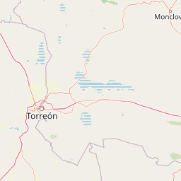
Map view of Cañón de Fernández State Park

Use this park location map to pinpoint Cañón de Fernández State Park in Mexico, understand its exact geographic position, and read its mapped placement within the surrounding landscape more clearly.

Pigeon | © OpenStreetMap contributors

Location context for Cañón de Fernández State Park

Durango
Recorded earthquake history

Review Historical Earthquake Data for Cañon de Fernández State Park

Explore the documented history of seismic events associated with the location of Cañon de Fernández State Park. Access detailed records of regional activity through this MoriAtlas collection to understand the seismic context of this protected Chihuahuan Desert landscape.

Cañon de Fernández State Park Earthquake Records

Catalogued events

1 event

Strongest magnitude

Magnitude 3.8

Most recent event

May 31, 1995

This history includes earthquakes recorded inside the park or within 50 km of its borders

Park atlas

Compare regional desert canyons, river corridors, and protected landscapes across northern Mexico.

Explore Other Parks Near Cañon de Fernández State Park and Surrounding Protected Areas

Visitors exploring Cañon de Fernández State Park can continue browsing adjacent desert reserves, river canyons, and protected ecosystems across the region. Reviewing nearby protected areas provides valuable geographic context for understanding the broader environmental patterns of the Chihuahuan Desert.
National parkSombrerete Municipality
About 160 km away#1 closest

South

Sierra de Órganos National Park National Park: Mapped Protected Landscape Details

Explore geographic context and park boundaries within Sombrerete Municipality.

Sierra de Órganos National Park stands as a vital national park, offering a unique opportunity for geographic and atlas-based discovery. This dedicated entry focuses on its protected landscape identity, providing detailed insights into its mapped boundaries and its place within the regional geography of Sombrerete Municipality. Understand the park's role as a protected natural area through structured data and landscape context, essential for comprehensive geographic exploration.

Area
11.25 km²
Established
2000
IUCN
II
Relief
Mountain
Watercolor painting of a desert landscape with white gypsum dunes, a central turquoise blue pool, and yucca plants.
Wildlife reserveCoahuila
About 231 km away#2 closest

Northeast

Área de Protección de Flora y Fauna Cuatrociénegas: Protected Landscape and Atlas Map

Desert wetlands and gypsum dune geography in Coahuila, Mexico

This wildlife reserve in Coahuila represents a globally significant desert wetland complex. Featuring hundreds of spring-fed pozas and the second-largest gypsum dune field in the Americas, the reserve offers a unique look at isolated ecosystems and specialized biodiversity within the Chihuahuan Desert.

Area
843.47 km²
Established
1994
Relief
Lowland
Climate
Arid
Watercolor painting of a mountain range featuring gentle slopes and low-lying shrubs against a white background.
Protected areaCoahuila
About 275 km away#3 closest

East

Serranía de Zapalinamé: Protected Mountain Geography and Watershed in Coahuila

Ecological transition zone within the Sierra Madre Oriental

The Serranía de Zapalinamé forms a dramatic mountain corridor rising over Saltillo, Coahuila. This state natural reserve protects a vital watershed and biodiversity hotspot where Chihuahuan Desert scrub meets pine and oak montane forests. Its steep canyons and high ridges offer a significant case study in regional landscape conservation and natural water security.

Area
253.74 km²
Established
1996
Relief
Mountain
Climate
Arid
Protected areaCoahuila
About 321 km away#4 closest

East

Cuenca Alimentadora del Distrito Nacional de Riego 026 Bajo Rio San Juan Protected Landscape

Mountain watershed and forest habitat in Coahuila

An expansive protected area encompassing the upper catchments of the San Juan River. The terrain features a significant altitudinal gradient, ranging from semi-arid matorral shrublands to rare high-altitude conifer groves including Mexican Douglas-fir, defining the regional water supply landscape.

Area
1,971.57 km²
Established
1949
IUCN
VI
Relief
Mountain
A soft watercolor illustration of rolling green hills, distant purple mountains, and stylized trees.
Protected areaChihuahua
About 334 km away#5 closest

West

Cerro Mohinora: Protected Volcanic Summit and Alpine Geography in Chihuahua

An analysis of volcanic terrain and high-elevation protected ecosystems.

Cerro Mohinora dominates the skyline as a prominent volcanic landmark within the Sierra Madre Occidental. This record details the protected area's geographic reach, examining its complex igneous history and the dramatic vertical transition from pine-covered slopes to its snowy summit, offering a clear map-oriented view of this significant Chihuahua natural landmark.

Established
2012
Relief
Mountain
Water
Minor water
Season
Seasonal
National parkMexico
About 338 km away#6 closest

East

Cumbres de Monterrey National Park: National Park Protected Landscape Discovery

Explore Mexico's Mapped Terrain and Regional Geography

Understand Cumbres de Monterrey National Park as a distinct protected landscape within Mexico. This page provides detailed atlas-oriented information focused on its geographic boundaries, mapped terrain, and its role in regional conservation. It serves as a valuable entry point for exploring the park's natural context and understanding its place in the national geography.

Area
1,773.96 km²
Established
1939
IUCN
II
Relief
Mountain
Wildlife reserveSinaloa
About 346 km away#7 closest

Southwest

Meseta de Cacaxtla Flora and Fauna Protection Area: Sinaloa Protected Landscape Overview

Mapping dry forests and Pacific coastal ecosystems

Meseta de Cacaxtla Flora and Fauna Protection Area is a significant wildlife reserve in Sinaloa, characterized by its transition from an elevated inland plateau to a complex coastal fringe of mangroves and lagoons. Spanning 508 square kilometers, this protected area preserves an essential blend of arid tropical ecosystems and marine habitats along the Mexican Pacific coast, providing a clear geographic view of regional conservation efforts.

Area
508.62 km²
Established
2000
IUCN
VI
Relief
Lowland
Watercolor illustration of layered mountain ranges with purple peaks fading into a green and yellow foreground.
Natural monumentNuevo León
About 347 km away#8 closest

East

Cerro de la Silla: Protected Natural Monument Geography and Regional Map Context

A rugged mountain landscape in Nuevo León, Mexico

Cerro de la Silla is defined by its unmistakable saddle-shaped silhouette and its status as a vital protected area within the urban matrix of Monterrey. The mountain features complex folded limestone geology and a diverse habitat mosaic that transition from arid scrubland to forested peaks. Use this atlas resource to understand its topographical boundaries, summit formations, and regional environmental significance within the Sierra Madre Oriental fold belt.

Area
60 km²
Established
1991
Relief
Mountain
Climate
Subtropical

Common questions about visiting, size, designation, and location context for Cañón de Fernández State Park

Cañón de Fernández State Park FAQs for park facts, access, geography, and protected area context

Find quick answers about Cañón de Fernández State Park, including protected-area facts, park geography, trail and visitor context, and how the park fits into its surrounding country and regional landscape.
MoriAtlas Explorer

Continue Your Protected Areas Search Across the Global Atlas

Deepen your exploration by continuing the structured search for national parks and protected areas worldwide. Utilize the comprehensive filtering capabilities to compare different conservation landscapes and refine your understanding of global park geography. Discover more about the distribution and characteristics of protected natural areas.

Global natural geography