
Mori Atlas logo
Protected landscapePřírodní park Česká Kanada

Explore the mapped geographic boundaries and distinct natural terrain of this unique South Bohemian protected area.

Přírodní park Česká Kanada: A Protected Landscape of Granite Boulders and Highland Forests

Přírodní park Česká Kanada preserves an expansive, sparsely populated mosaic of forests, peat bogs, and rolling highland ridges on the edge of the Bohemian-Moravian Highlands. This protected landscape reflects the historical isolation of the former Iron Curtain zone, resulting in a rare, well-preserved environment of acidophilous beech forests and granite boulder formations. Mapped terrain within this region encompasses a complex European watershed, serving as a critical habitat for diverse species and offering a window into the natural heritage of the Jihočeský kraj.

Bohemian-Moravian Highlandsgranite boulder landscapepeat bogs and miresacidophilous beech forestjuniper heathsfishponds and wetland mosaic
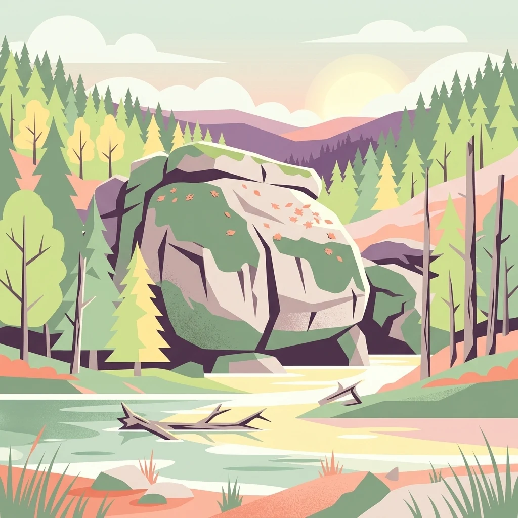
A flat-style vector illustration depicting a peaceful forest scene with a central boulder, evergreen trees, and a small stream in the foreground.

Přírodní park Česká Kanada

Protected landscape

Park overview

Structured park overview, official facts, and landscape profile for Přírodní park Česká Kanada

Přírodní park Česká Kanada park facts, protected area profile, and essential visitor context

Review the core facts for Přírodní park Česká Kanada, including designation, size, terrain, visitor scale, habitats, and operating context in one park-focused overview.

About Přírodní park Česká Kanada

Přírodní park Česká Kanada is one of the largest nature parks in the Czech Republic and a defining protected landscape of South Bohemia. It occupies a remote corner of the country along the former Iron Curtain, just a short distance from the Austrian border, and stretches across the eastern part of the Jindřichův Hradec District. The protected area is centered on the Javořická vrchovina (Javořice Highlands), a sub-region of the Bohemian-Moravian Highlands (Českomoravská vrchovina) characterized by rolling hills, dense forests, granite boulders, and a high density of small streams and ponds.

The defining characteristic of Česká Kanada is the unusually limited transformation of its landscape. Decades of restricted access in the border zone during the communist era, combined with the eventual decline of extensive sheep grazing and arable farming, allowed forests, peat bogs, and traditional meadows to recover. The result is a landscape that feels remote and lightly inhabited, with few large towns, no significant industry, and a network of small villages and seasonal cottages. This rural character, together with the cold, damp climate and the boreal feel of its forests, is what gave the region its evocative name.

Geologically, the park lies on the Moldanubian Pluton, the largest pluton of the Bohemian Massif, dominated by two-mica granites and granodiorites. These rocks weather into striking landforms; solitary boulders, rock outcrops, frost-riven cliffs, rocking stones, dolmen-like blocks, rock gates, and rock basins scattered throughout the forests. The highest point, Vysoký kámen, reaches 732 meters above sea level and anchors the undulating skyline of the protected area.

Hydrologically, Česká Kanada occupies a unique position on the European watershed between the North Sea and the Black Sea, since the rivers Koštěnický potok and Dračice drain into the Nežárka and ultimately the Elbe, while the Pstruhovec and related streams belong to the Moravian Dyje and the Danube basin. Numerous small ponds, peat mires, and a drinking-water reservoir associated with Landštejn Castle further enrich the water-rich landscape. The peatlands and bogs, in particular, are among the most valuable conservation features of the entire region.

Ecologically, the park protects a striking mosaic of habitats; acidophilous beech forests dominated by European beech, oak-pine woodlands with Scots pine, juniper heaths on rocky pastures, marshy alder carrs along streams, and a network of pond margins with floating-leaved and shoreline plants such as white water lily and marsh marigold. The area is also a stronghold for boreal forest species and rare fauna that have disappeared from much of the surrounding agricultural countryside, making it disproportionately important for biodiversity conservation at the regional and national level.

Quick facts and research context for Přírodní park Česká Kanada

Přírodní park Česká Kanada lies in the South Bohemian Region, within the Jindřichův Hradec District, on the Czech-Austrian border. It sits on the southwestern margin of the Bohemian-Moravian Highlands, at elevations ranging from hill country to the 732-meter summit of Vysoký kámen. The park is a regional-level nature park (přírodní park), a category of Czech protected landscape that preserves broader landscape character rather than designating a single strict nature reserve.

The park was first created in 1994 and reformed in 2004 around the area between Nová Bystřice, Kunžak, Slavonice, and the Austrian border. Its underlying geology belongs to the Moldanubian Pluton, dominated by two-mica granites and granodiorites, producing a rolling, boulder-strewn terrain that is unusually well preserved because much of it lay inside the restricted Cold War border zone.

Protection and recognition

Documented terrestrial protection scope, designation year, and international recognition details

Přírodní park Česká Kanada Protection Status and Designation History

Přírodní park Česká Kanada features a documented terrestrial protection scope established in 2004 with specific designation records. Structured protection metrics outline the administrative framework governing this protected area without external recognition sources.

Protection details

Protection scope
Terrestrial
Designated year
2004
Transboundary protection
No
Park context

Deeper park guide and search-rich context for Přírodní park Česká Kanada

Přírodní park Česká Kanada history, landscape, wildlife, and travel context

Explore Přírodní park Česká Kanada through its history, landscape character, ecosystems, wildlife, conservation priorities, cultural context, and seasonal travel timing in a structured park guide built for atlas discovery and search intent.

Why Přírodní park Česká Kanada stands out

Česká Kanada is best known for preserving a relatively intact, sparsely populated landscape of forests, meadows, peat bogs, and ponds on the Bohemian-Moravian Highlands, an unusual condition in central Europe derived from decades of restricted access along the former Iron Curtain. The park has become strongly associated with dramatic granite boulder formations, including balanced rocks, dolmens, stone gates, and named features such as Ďáblova prdel near Valtínov. It is also known for its rich mosaic of habitats within a compact area: acidophilous beech forests, pine-oak woodlands, juniper heaths, peat mires, pond margins with white water lilies, and wetlands that support rare species. Wildlife highlights include the Eurasian beaver, Eurasian lynx, black grouse, hazel grouse, pygmy owl, and white-tailed eagle, several of which are otherwise rare in the Czech Republic.
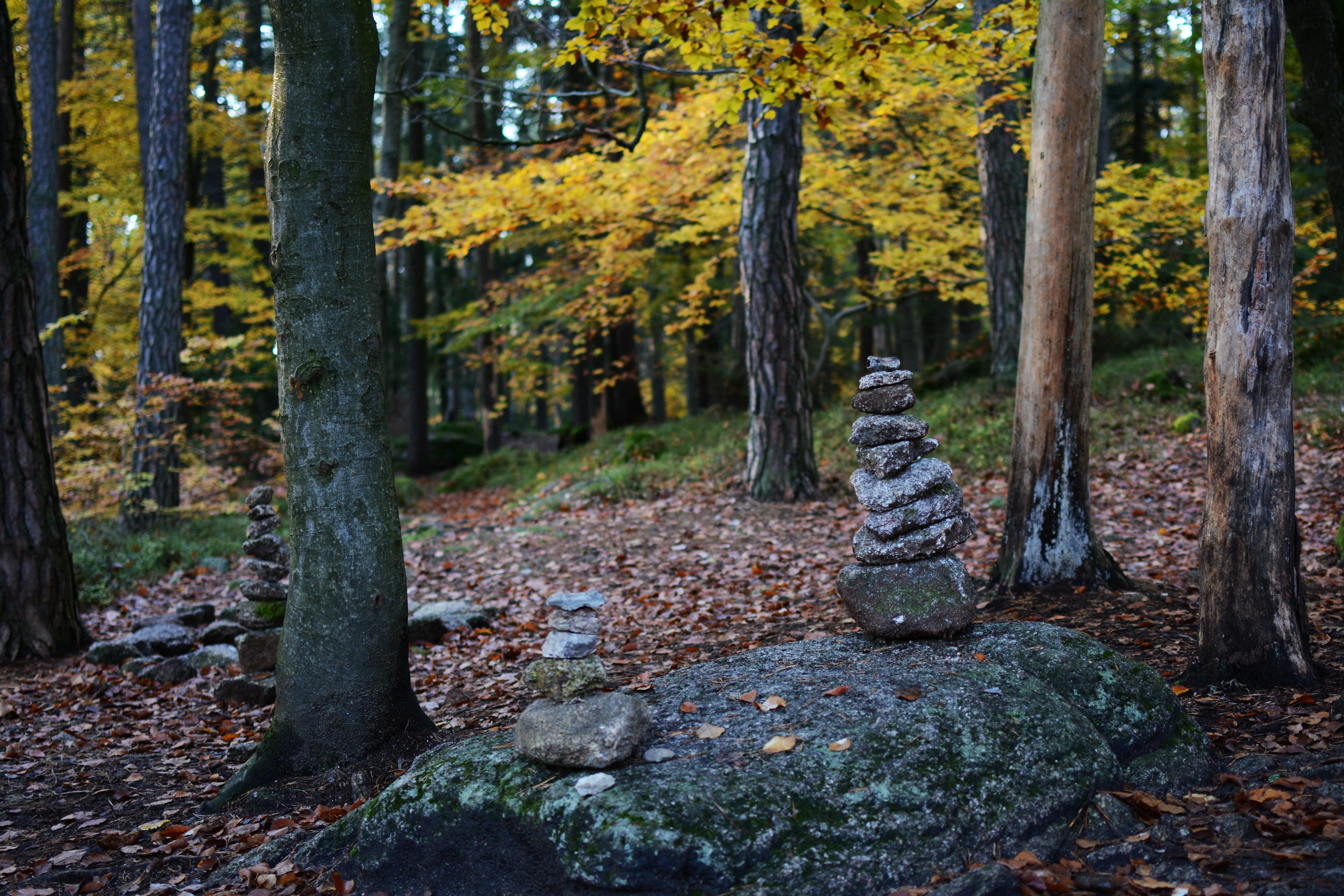
A forest scene in autumn with golden leaves and several cairns, or small stacks of stones, built on top of a large moss-covered boulder and on the forest floor.
Autumn forest with stacked stone formations near Valtinov.

Přírodní park Česká Kanada history and protected-area timeline

The geological foundations of Česká Kanada date back hundreds of millions of years. The bedrock belongs to the Moldanubian Pluton, formed during the Variscan mountain-building phase around 327 million years ago, and was later shaped by ancient lakes, glacial tundra during the ice ages, and the spread of boreal forests as the climate warmed roughly ten thousand years ago. These long-term processes produced the rolling, boulder-strewn terrain and the acidic soils that support the park's distinctive vegetation.

Human presence in the area has been recorded since the 8th to 12th centuries, but major settlement only began in the 13th and 14th centuries under the Lords of Landštejn, a branch of the Vítkovci family, who founded villages such as Nová Bystřice. The 16th century marked the most prosperous period, when many fishponds were constructed and South Bohemia gained its reputation for rich, water-rich landscapes. In the 17th century, hunting in the dense forests became a popular pastime among the local nobility and gentry.

The 19th and 20th centuries brought dramatic transformations. The completion of the narrow-gauge railway from Jindřichův Hradec to Nová Bystřice in 1897 opened the region to outsiders, while the 1930s brought a chain of border bunkers (the so-called řopíky) that would never see active combat. After the Second World War, the expulsion of German-speaking farming families from peripheral villages like Romava, Košťálkov, Rajchéřov, and Návary, combined with the creation of the Iron Curtain border zone in 1951, emptied entire settlements. Many of these villages, including Romava, Rajchéřov, Kuní, Košťálkov, Dětříš, Pernárec, and others, were deliberately demolished in the 1960s and 1970s, leaving only decaying foundations, cellars, and memorials.

Intensive agriculture dominated the landscape until 1989. After the political changes, land use became more extensive, arable fields were gradually reforested or converted to grassland, and traditional cattle grazing on pastures was revived. In 1994, the Jindřichův Hradec District Office established the first large-scale Přírodní park Česká Kanada, covering nearly 450 square kilometers but including areas later excluded. In 2004, the South Bohemian Region issued a new regulation, Regulation No. 1/2004, redrawing the park with adjusted boundaries and updated protective provisions, establishing the form of the landscape that exists today.

Přírodní park Česká Kanada landscape and geographic character

Česká Kanada occupies the southwestern edge of the Bohemian-Moravian Highlands, a low-mountain region of rolling hills, forested ridges, and shallow basins rather than dramatic peaks. Elevations range from approximately 468 meters in the lower valleys up to 732 meters at Vysoký kámen, the highest point of the Javořická vrchovina sub-region. The overall character is gently undulating, with broad forested plateaus interrupted by farmland and pond-filled valleys.

The geology, built upon the granites and granodiorites of the Moldanubian Pluton, gives the landscape one of its most memorable features: abundant granite boulders in a remarkable variety of forms. Solitary boulders, balanced rocking stones, dolmen-like arrangements, frost-shattered cliffs, rock gates, and natural basins are scattered across the forests and pastures. Locally named formations, including the famously whimsically titled Ďáblova prdel near Valtínov, give the boulder field a folklore-rich, almost mythic dimension.

Water shapes the park as much as rock and forest. The region sits on the European watershed between the North Sea (via the Nežárka and the Elbe) and the Black Sea (via the Moravian Dyje and the Danube), a feature that has practical as well as symbolic value. Numerous small streams such as the Koštěnický potok, Dračice, Pstruhovec, and Slavonický potok drain into a network of fishponds similar in spirit to, though less famous than, the nearby Třeboňsko pond system. The park also contains an unusually high density of peat bogs and mires, especially around former lake basins that drained away millions of years ago and left behind waterlogged depressions that have never been fully reclaimed by agriculture.

Human shaping adds another layer to the scenery. Traditional stone walls divide pastures, mosaic-like fragments of cultivated fields and meadows break up larger forest blocks, and chains of ponds cascade down the valleys. The landscape reads as a layered palimpsest of long-term agricultural use interrupted by decades of abandonment and subsequent rewilding along the former border zone, producing an environment that feels both lived-in and quietly reclaimed by nature.
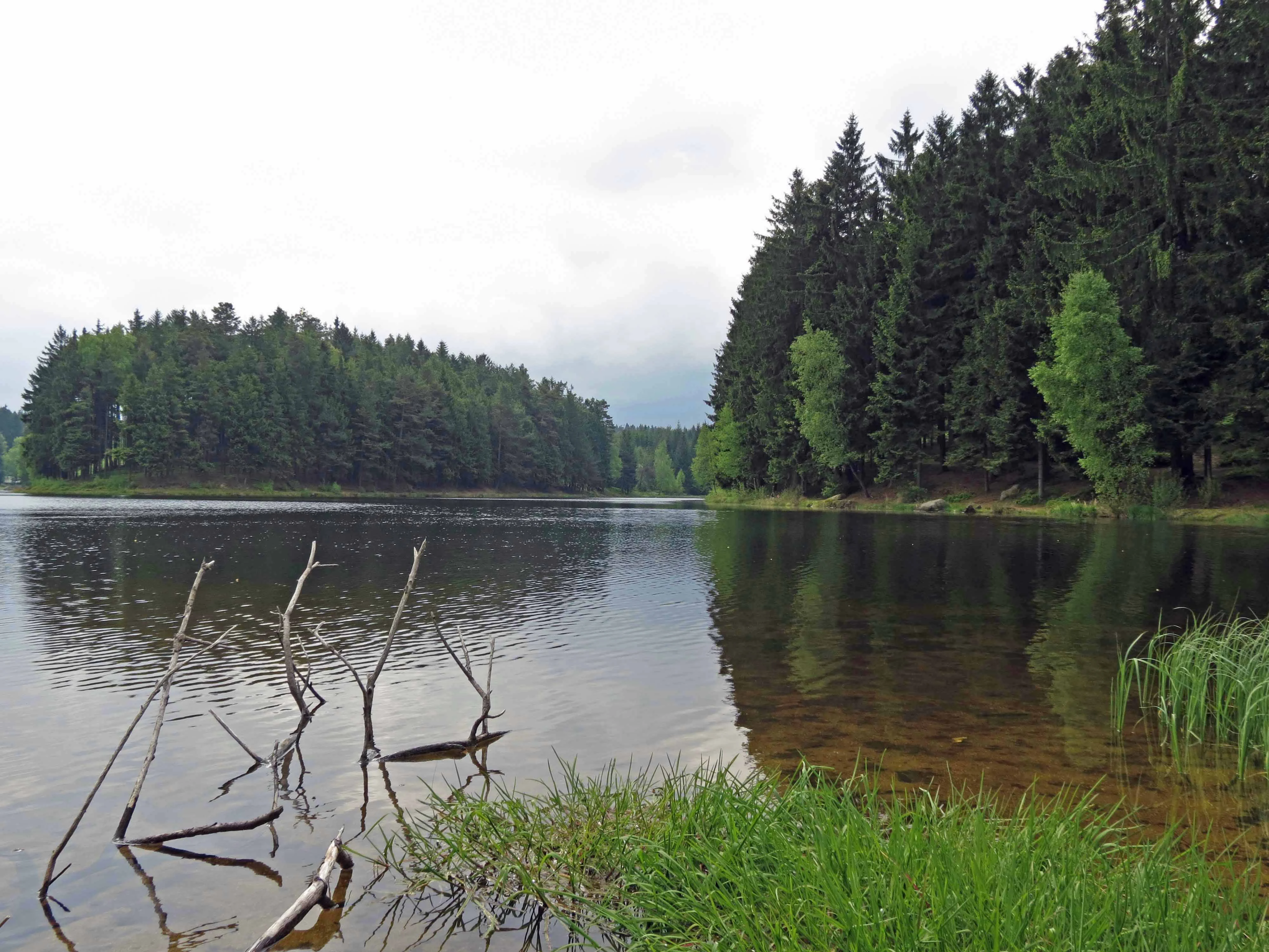
A wide, eye-level shot of a calm pond with dark water, edged by a lush green bank and deep pine forest under an overcast sky.
A serene view of a pond surrounded by dense coniferous forest in Přírodní park Česká Kanada.

Přírodní park Česká Kanada ecosystems, habitats, and plant life

Ecologically, Česká Kanada is defined by the transition between thermophilous and cold-adapted vegetation. The park lies within the Czech Republic's mesophyticum phytogeographical region, with the highest elevations touching the oreophyticum zone. This transitional character is reflected in a striking diversity of forest types for an area of this size, all coexisting within a relatively compact territory.

The dominant natural forests are acidophilous beech woodlands, with European beech (Fagus sylvatica) accompanied by characteristic understory plants such as white wood-rush, wavy hair-grass, and wood bluegrass. In the lower-lying basins near Staré Město pod Landštejnem, oak-dominated woodlands appear, including mixed oak-pine forests with sessile oak, pedunculate oak, Scots pine, silver fir, and herb-layer species such as lily of the valley and common cow-wheat. At higher elevations in the Javořice range, montane spruce and mixed beech forests with whorled Solomon's seal, nine-leaved toothwort, and interrupted clubmoss take over.

Outside the forests, the park is exceptionally rich in open habitats and transitional ecosystems. Juniper heaths with common juniper dominate dry, rocky pastures; thistle meadows thrive in valley bottoms; and fragments of floodplain forest survive along the larger streams. The peatlands are among the most ecologically significant features, with sedge-moss communities, acidic mires, and spring fens that support a specialized flora rarely found elsewhere in South Bohemia. Pond margins host protected aquatic plants such as white water lily, bog bean, and tufted loosestrife, while marshy alder carrs line slow-moving streams.

The animal communities reinforce the park's conservation value. Forests harbor species like the Eurasian pygmy owl, Eurasian nightjar, and Eurasian woodcock, while ponds and wetlands attract black-headed gulls, great crested grebes, tufted ducks, and great cormorants. Rare and threatened waterbirds such as the night heron, great egret, and marsh harrier occur, along with the critically endangered white-tailed eagle. Mammals of particular note include the Eurasian beaver and the Eurasian lynx, both of which have found a refuge here, while boreal forest birds like the black grouse and hazel grouse survive in small numbers that contrast with their decline elsewhere in the country.
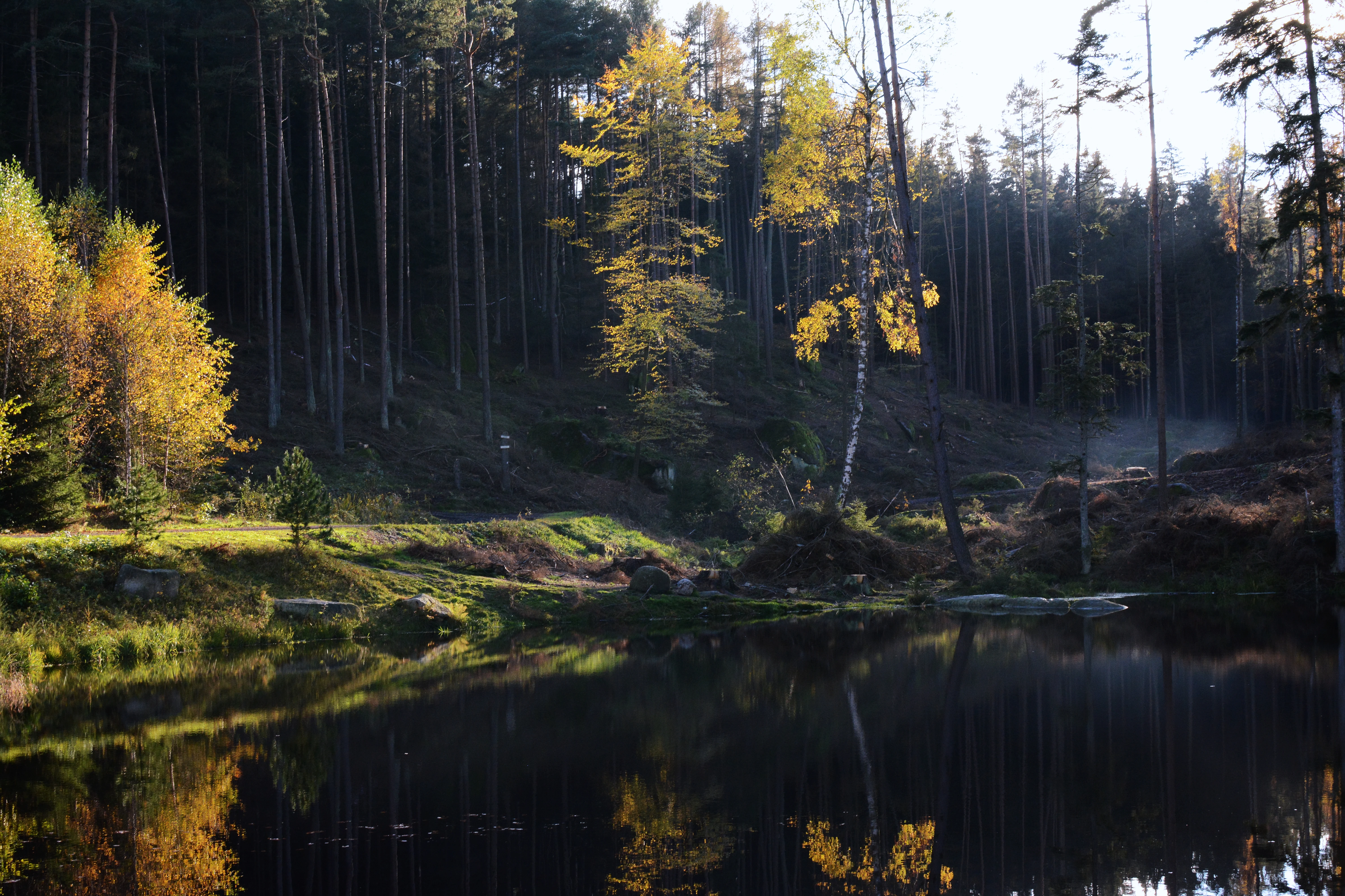
A calm, dark pond reflecting the surrounding forest and yellow autumn trees, set within a dense, shaded woodland area.
A tranquil pond reflecting autumn foliage in the forests of Česká Kanada.

Přírodní park Česká Kanada wildlife and species highlights

Česká Kanada supports a notably rich and somewhat unusual fauna for South Bohemia, with a balance of forest birds of prey, wetland waterbirds, peatland invertebrates, and large mammals. The park's patchwork of habitats and its historical isolation explain why species that have retreated from much of the surrounding agricultural countryside continue to survive here.

Among birds, the forests provide habitat for the Eurasian pygmy owl, one of Europe's smallest owls, as well as the Eurasian nightjar and the Eurasian woodcock. Peat bogs and their surrounding shrub layer support the common linnet, which uses juniper stands as one of its few natural strongholds in the area. In recent decades, woodland grouse associated with extensive boreal-type forest, notably the black grouse and the hazel grouse, have been recorded here, reflecting the ecological value of the park for species that require large, undisturbed tracts of forest.

Wetlands and ponds attract black-headed gulls, great crested grebes, tufted ducks, and great cormorants, along with threatened species such as the night heron, great egret, and marsh harrier. The critically endangered white-tailed eagle has also been recorded within the park, an indication of the area's relatively undisturbed aquatic and forest habitats.

The mammal community is similarly rich. Two particularly significant species stand out. The Eurasian beaver has re-established itself in the region's waterways, leaving signs of activity along several streams and ponds, and the Eurasian lynx, one of Europe's most elusive large carnivores, continues to maintain a presence here. Historically the European moose also occurred in Česká Kanada, but it has since shifted its range toward the Šumava mountains further west. Smaller mammals, amphibians such as the pool frog and the moor frog, and reptiles including the common European adder and the viviparous lizard round out a wildlife profile of high regional importance.
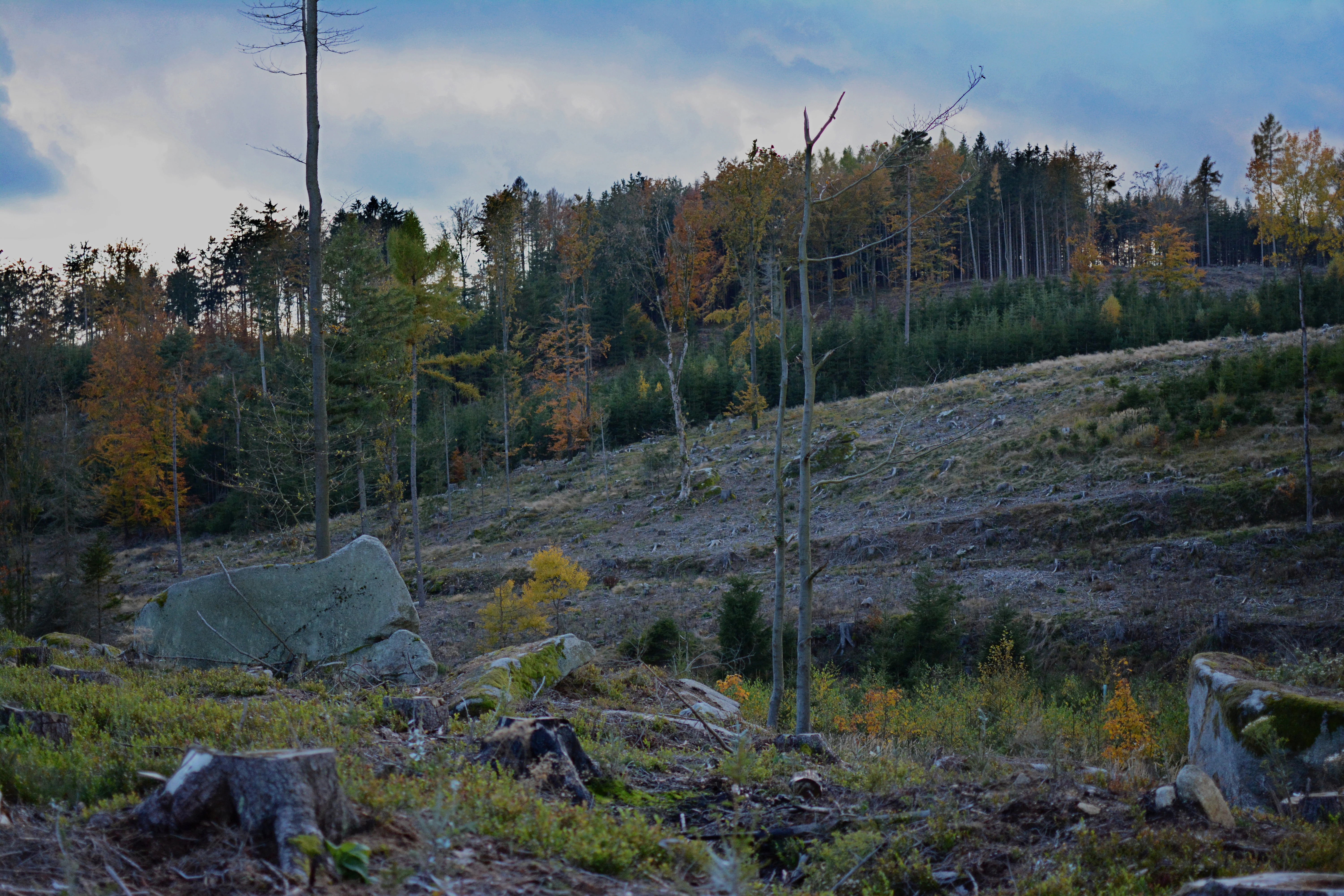
A landscape view of a partially cleared meadow with scattered boulders and tree stumps, transitioning into a forest on a hillside under a cloudy sky.
A cleared meadow area with scattered stones near Terezín within the Česká Kanada nature park.

Přírodní park Česká Kanada conservation status and protection priorities

As a nature park, Česká Kanada is a regional protection category in the Czech system, designed to safeguard a broader landscape character rather than a single strict reserve, and it contains within it numerous smaller protected sites with higher levels of formal protection. These include natural monuments and natural reserves focused on juniper heaths, peatlands, oligotrophic ponds, and rock formations, each managed under its own plan of care. The layered approach allows for the protection of both large-scale landscape character and locally critical habitats.

The conservation significance of Česká Kanada lies in the unusual combination of factors that has preserved its ecological integrity. Because much of the area lay within the restricted border zone during the communist era, large parts of the landscape escaped the intensification of agriculture that transformed much of the Czech countryside. After 1989, the shift from intensive farming toward extensive grazing, meadow management, and reforestation further reduced pressures on ecosystems. Today the park is a stronghold for species that have become rare elsewhere, including the Eurasian lynx, Eurasian beaver, black grouse, hazel grouse, and white-tailed eagle.

Conservation challenges remain significant. The legacy of spruce monocultures, planted in the past for economic reasons and now vulnerable to bark beetle outbreaks, continues to alter forest composition. Drainage carried out in earlier centuries has affected hydrology, and peatlands require active water retention. Invasive species, including the signal crayfish (Pacifastacus leniusculus), the intensification of agriculture on adjacent land, and unregulated forestry all pose ongoing threats. Without continued management such as rotational grazing, mowing, scrub clearance, and targeted rewetting, many of the park's open habitats and peatlands could gradually be lost to forest succession.

Přírodní park Česká Kanada cultural meaning and human context

The cultural identity of Česká Kanada is intimately tied to its character as a former borderland. Centuries of frontier status between Bohemia, Moravia, and Lower Austria have left a landscape layered with the traces of multiple communities, including the medieval Lords of Landštejn who founded the region's first settlements, prosperous pond-builders of the 16th century, German-speaking farming families expelled after 1945, and Czech settlers who arrived in the following years only to be displaced again by the creation of the Iron Curtain.

The name Česká Kanada itself is a cultural artifact. Coined by regional writer and promoter Jaroslav Arnošt Trpák, it reflects the visual and emotional impression of the landscape: cold, damp, forested, sparsely populated, and reminiscent of North American Canada. The name has become a regional brand, embraced in literature, tourism, and local identity, even as the landscape it describes is unmistakably central European.

Today the park is dotted with cultural landmarks that combine natural beauty with historical resonance. Landštejn Castle, often called the king of Česká Kanada, stands above the village of Staré Město pod Landštejnem and dominates the landscape. The Church of the Holy Trinity in the village of Klášter near Nová Bystřice, painstakingly restored after decades of neglect, is another cultural anchor. The remains of depopulated villages such as Romava, Košťálkov, and Rajchéřov have become poignant visitor destinations, while the narrow-gauge Jindřichohradecké místní dráhy railway, operating since 1897, remains a beloved symbol of the region's heritage tourism.

Top sights and standout views in Přírodní park Česká Kanada

Přírodní park Česká Kanada stands out for the unusual depth of its natural character. Among its defining features are extensive peat bogs and mires, large blocks of near-natural beech and oak-pine forest, and a remarkable abundance of granite boulder formations, including balanced rocks, dolmens, and stone gates scattered across the landscape. These landforms are so characteristic that they have been given local names and folklore.

The park also contains the highest point of the Javořická vrchovina, Vysoký kámen, and the watershed between two European seas, the North Sea and the Black Sea, both unusual geographic features for a relatively compact regional protected area. Its wildlife profile includes species that are rare or absent from most other parts of South Bohemia, notably the Eurasian lynx, Eurasian beaver, black grouse, hazel grouse, Eurasian pygmy owl, and white-tailed eagle.

Culturally, the park combines wild-feeling nature with landmarks such as Landštejn Castle, the restored Church of the Holy Trinity in Klášter, the narrow-gauge railway to Nová Bystřice, and the poignant ruins of villages destroyed after 1945 and in the decades that followed. This blend of near-natural landscape, biodiversity, and a layered borderland heritage gives Česká Kanada a depth of identity that few other Czech regional parks can match.

Best time to visit Přírodní park Česká Kanada

Česká Kanada has a cool, somewhat damp microclimate shaped by its position on the Bohemian-Moravian Highlands and its largely forested character. Summers are the warmest and most accessible season, with green forests, blooming meadows around the ponds and peat bogs, and active birdlife along the water bodies and juniper pastures. This is also the time when historic narrow-gauge steam trains typically operate along the Jindřichův Hradec to Nová Bystřice line, making summer the most traditional period for a visit focused on the cultural as well as natural features of the park.

Spring brings rapid changes in the wetlands and a flush of new growth, with peat bogs and pond margins particularly lively as amphibians and waterbirds return. As autumn arrives, the birch and beech forests of the highlands take on color, mushroom foraging becomes a regional pursuit, and the cooling weather reinforces the brooding, Canada-like atmosphere that gave the park its name. Winters are cold, often snowy, and atmospheric, with cross-country ski trails threading through the forests. Because the park's roads and villages are sparse and many visitor services are seasonal, those visiting in the colder months should expect a quieter, more contemplative experience focused on the landscape itself rather than on visitor infrastructure.

Monthly climate preview

Long-term monthly temperature and precipitation rhythm for protected terrain

Přírodní park Česká Kanada climate normals and temperature patterns

Representative coordinates record mean monthly temperatures from negative values up to eighteen degrees and daily precipitation rates reaching nearly three millimeters. Detailed twelve-month climate normals provide comprehensive baseline data for analyzing annual environmental rhythms across the protected territory.
Annual mean8 °C
-3 °C19 °C
Jan-3°
Feb-2°
Mar
Apr
May13°
Jun17°
Jul19°
Aug19°
Sep13°
Oct
Nov
Dec-2°
Warmest month
July

18.7 °C

Coolest month
January

-3 °C

Wettest month
July

2.9 mm/day

Driest month
February

1.1 mm/day

Park location guide

Geography guide, regional context, and park location map for Přírodní park Česká Kanada

Přírodní park Česká Kanada park geography, regions, and map view in Czechia

Understand where Přírodní park Česká Kanada sits in Czechia through a broader geographic reading of the surrounding landscape, nearby location context, and its mapped position within the national park landscape.

How Přírodní park Česká Kanada fits into Czechia

Czech Republic is a landlocked Central European country with a population of approximately 10.9 million people. The nation was established as an independent state on January 1, 1993, following the dissolution of Czechoslovakia. Its capital and largest city is Prague, with other major urban centers including Brno, Ostrava, Plzeň, and Liberec.

Wider geography shaping Přírodní park Česká Kanada in Czechia

The Czech Republic is a landlocked country in Central Europe. It is bordered by Germany to the west, Austria to the south, Poland to the northeast, and Slovakia to the southeast. The landscape is predominantly hilly, with the territory covering 78,871 square kilometers.

Map view of Přírodní park Česká Kanada

Use this park location map to pinpoint Přírodní park Česká Kanada in Czechia, understand its exact geographic position, and read its mapped placement within the surrounding landscape more clearly.

Pigeon | © OpenStreetMap contributors

Location context for Přírodní park Česká Kanada

Jihočeský kraj

Visualizing granite boulder formations, peat bogs, and forested highlands

Přírodní park Česká Kanada Photos and Protected Landscape Scenery

Visual documentation reveals the distinctive terrain and habitat mosaic defining Přírodní park Česká Kanada across the Bohemian-Moravian Highlands. Exploring these photographs clarifies the unique ecological character shaped by dense forests, wetlands, and granite outcrops.

A forest scene in autumn with golden leaves and several cairns, or small stacks of stones, built on top of a large moss-covered boulder and on the forest floor.

A large, weathered granite boulder with a prominent vertical crevice resembling the shape of buttocks, sitting in a forest setting.

A wide, eye-level shot of a calm pond with dark water, edged by a lush green bank and deep pine forest under an overcast sky.

A calm, dark pond reflecting the surrounding forest and yellow autumn trees, set within a dense, shaded woodland area.

A landscape view of a partially cleared meadow with scattered boulders and tree stumps, transitioning into a forest on a hillside under a cloudy sky.

A wide view of a grassy field with a monastery building nestled among trees in the distance under a cloudy sky.

Park atlas

Compare adjacent highland reserves, granite formations, and regional border habitats.

Parks Near Přírodní park Česká Kanada And Surrounding Protected Landscapes

Browsing other parks near Přírodní park Česká Kanada reveals broader patterns of preserved forests, peat bogs, and highland terrain across the region. Expanding the protected-area view provides valuable geographic context for comparing similar natural landscapes and borderland ecosystems.
Natural monumentJihočeský kraj
About 9.5 km away#1 closest

East

Slavonické rybníky Protected Area: Geography and Wetland Habitat in South Bohemia

Analysis of pond-margin ecosystems and regional borderland terrain

Located near the historic town of Slavonice, Slavonické rybníky encompasses two interconnected fishpond systems that support fragile shoreline vegetation. This nature monument highlights the conservation of traditional Bohemian aquatic habitats and their importance for localized invertebrate populations within the larger mosaic of the Česká Kanada landscape.

Area
0.1 km²
Established
1995
IUCN
III
Water
Major water bodies
Natural monumentJihočeský kraj
About 11 km away#2 closest

Northwest

Vosecký rybník Natural Monument: Protected Wetland Geography in Jihočeský kraj

Rare drawdown-bottom flora and aquatic ecosystems

Located in the Javořická vrchovina highlands, Vosecký rybník is a protected natural monument known for its specialized pond-bottom vegetation. The site serves as a vital ecological corridor for threatened species within the broader mosaic of historic Bohemian fishpond landscapes.

Area
0.071 km²
Established
2022
IUCN
III
Relief
Upland
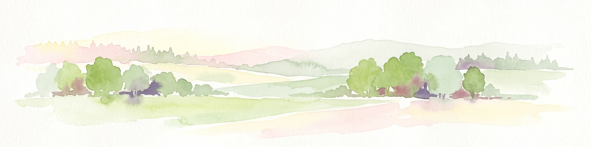
A soft watercolor illustration of a marshy landscape featuring light green grassy plains, patches of water, and a hazy treeline in the distance.
Nature reserveKraj Vysočina
About 24 km away#3 closest

North

Rašeliniště Kaliště Nature Reserve: Geographic Overview and Mapped Protected Boundaries

Highland wetland habitat in the Kraj Vysočina region

Rašeliniště Kaliště is a compact but ecologically significant nature reserve characterized by its rare meadow-type peat bog habitat. Located in the Czech-Moravian Highlands, it functions as a primary site for protected moss species and wetland preservation, offering valuable geographic insight into the hydrologic features of the Vysočina landscape.

Area
0.119 km²
Established
1982
IUCN
IV
Relief
Lowland
A horizontal watercolor painting showing a pale landscape with faint rolling hills in the background and soft green tree silhouettes in the foreground.
Natural monumentJihočeský kraj
About 33 km away#4 closest

West

Slepičí vršek Natural Monument: Exploring Inland Sand Dune Geography in the Třeboň Basin

Protected psammophilous landscape in Jihočeský kraj

Slepičí vršek represents a distinct eolian feature within the broader Třeboňsko landscape, characterized by its dry, undulating sandy soil and rare vegetation. This protected monument offers a clear case study for understanding inland dune development and the specialized biodiversity of relict habitats within the South Bohemian Region.

Area
0.019 km²
Established
1955
IUCN
III
Relief
Lowland
Natural monumentJihočeský kraj
About 37 km away#5 closest

Northwest

Ve Farářském Natural Monument: Wetland Geography and Protected Pond Margins in South Bohemia

Detailed protected wetland terrain in the Tábo district

Ve Farářském preserves a distinctive gradient of waterlogged meadow and marsh habitats along the Farářský pond in the Czech Republic. This natural monument illustrates the ecological transition from mesotrophic grassland to willow-lined littoral zones, offering a clear view of specialized wetland plant communities within the broader South Bohemian landscape context.

Area
0.038 km²
Established
1988
IUCN
III
Relief
Lowland
A watercolor painting showing a soft, panoramic view of a wetland with sparse trees, low bushes, and distant rolling hills in pale green and pink tones.
Nature reserveJihočeský kraj
About 39 km away#6 closest

West

Rašeliniště Hovízna: Protected Peatland and Regional Geography in Jihočeský kraj

Ecological sanctuary and spring-fed wetland landscape.

Rašeliniště Hovízna is a notable nature reserve in the Czech Republic, renowned for its distinctive spring-fed peat formation. Situated near the historic Zlatá stoka canal and the Třeboň Basin, this protected area preserves rare bog habitats and essential groundwater-driven ecosystems within the undulating lowlands of Jihočeský kraj.

Area
0.071 km²
Established
1995
IUCN
IV
Relief
Lowland
Watercolor painting of a forested hillside with evergreen trees and distant rolling purple mountains.
Protected landscapeJihlava District
About 39 km away#7 closest

Northeast

Přírodní park Čeřínek: Map and Protected Landscape Geography of the Jihlava District

Highland forests, granite outcrops, and peatland ecosystems

Located in the Jihlava District, Přírodní park Čeřínek offers a detailed look at the highland terrain of the Křemešnická vrchovina. The area features a mix of dense spruce woodland, prominent rocky outcrops including Přední skála, and the significant Hojkovské rašeliniště peat bog. This protected landscape serves as a regional anchor for understanding the ecological and topographical character of the Czech-Moravian Highlands.

Area
23 km²
Established
1985
Relief
Upland
Climate
Temperate
Watercolor painting of a soft landscape with rolling hills and patches of deciduous trees in shades of green, yellow, and faint red, set against a plain white background.
Natural monumentJihočeský kraj
About 41 km away#8 closest

Southwest

Sokolí hnízdo a bažantnice Natural Monument: A South Bohemian Protected Broadleaf Woodland

Mapping the ecological boundaries and woodland history of this South Bohemian protected area.

Sokolí hnízdo a bažantnice constitutes a critical natural monument in the South Bohemian region of the Czech Republic. Positioned along the Stropnice River, this protected landscape preserves mature deciduous woodland habitats and essential invertebrate populations that define the biodiversity character of the Třeboň Basin.

Area
0.475 km²
Established
2014
Relief
Lowland
Climate
Temperate

Common questions about visiting, size, designation, and location context for Přírodní park Česká Kanada

Přírodní park Česká Kanada FAQs for park facts, access, geography, and protected area context

Find quick answers about Přírodní park Česká Kanada, including protected-area facts, park geography, trail and visitor context, and how the park fits into its surrounding country and regional landscape.
MoriAtlas Explorer

Continue Your Protected Areas Search Across the Global Atlas

Deepen your exploration by continuing the structured search for national parks and protected areas worldwide. Utilize the comprehensive filtering capabilities to compare different conservation landscapes and refine your understanding of global park geography. Discover more about the distribution and characteristics of protected natural areas.

Global natural geography