

Mori Atlas logo
Nature reserveCha-Potami

Explore the diverse riverine gallery forests, rocky gorges, and endemic habitats of this southwestern Cyprus protected area

Cha-Potami Nature Reserve: Mapped Protected Landscapes and River Valley Geography in Paphos District

Cha-Potami represents a significant river-based conservation landscape stretching across 2,626 hectares in the southwestern region of Cyprus. This nature reserve, centered primarily within the Paphos District, features a complex mosaic of Oriental plane gallery forests, hillside olive and carob woodlands, and steep gorge habitats. The area serves as a critical corridor for biodiversity, supporting numerous endemic plant species and threatened bird populations within its winding valley system.

river valleygallery forestMediterranean habitatsNatura 2000 siteFlora-Fauna-Habitat areaendemic plants

Cha-Potami

Nature reserve

Park overview

Structured park overview, official facts, and landscape profile for Cha-Potami

Cha-Potami park facts, protected area profile, and essential visitor context

Review the core facts for Cha-Potami, including designation, size, terrain, visitor scale, habitats, and operating context in one park-focused overview.

About Cha-Potami

Cha-Potami is a river valley protected area situated in the southwest of the Republic of Cyprus, framing one of the more ecologically rich stretches of the Chapotami river. Established under the European Natura 2000 network as a Site of Community Importance, it functions as a Fauna-Flora-Habitat area focused on the conservation of Mediterranean habitats and species of European interest. The site spans the southeastern edge of the Paphos district and crosses into the Limassol district, with roughly three-quarters of its area in Paphos.

The site is shaped by the Chapotami river, which meanders through steep and often narrow valleys, creating conditions for a layered vegetation structure. Hillside slopes carry woodlands of olive and carob mixed with mastic shrubs, kermes oak, and Genista fasselata. Within the gorges, Mediterranean cypress stands and isolated cliff crevice vegetation add vertical structural diversity. Along the river itself, gallery forests of Oriental plane and oleander form the most distinctive linear habitat, while surrounding terraces support phrygana, Mediterranean pine forest, and overgrazed therophytic grasslands that occupy larger open spaces.

The combination of valley topography, riverine forest, dry Mediterranean scrub, and rocky gorges produces habitat heterogeneity within a relatively narrow corridor. This ecological diversity is the core reason the site is protected, and it also gives the area strong conservation value for island-level endemism and for raptors and passerines that depend on cliffs, gallery forest, and open terrain.

Quick facts and research context for Cha-Potami

Cha-Potami is a Natura 2000 Fauna-Flora-Habitat site on the southwestern coast region of Cyprus, designated in February 2000 under site code CY4000002. It is a long, narrow protected area following the Chapotami river, with roughly three-quarters of its territory in the Paphos district and the remainder in the Limassol district. The site covers about 2,626 hectares and stretches about 12.5 kilometers along the river course.

Its mosaic of habitats includes Mediterranean cypress forest, Oriental plane gallery forest, olive and carob woodlands, Mediterranean pine forest, phrygana, therophytic grasslands, and rocky cliff vegetation. Conservation interest focuses on its Cypriot endemic plants, orchids, endemic mammals and reptiles, and bird species that include Annex I species of the EU Birds Directive.

Protection and recognition

Documented terrestrial protection scope and Natura 2000 listings

Cha-Potami Protection Status and International Recognition Data

Terrestrial protection records for Cha-Potami outline documented conservation status and formal boundaries. Official Natura 2000 sources provide verifiable recognition frameworks for the protected landscape.

International recognition

Protection details

Protection scope
Terrestrial
Transboundary protection
No
Park context

Deeper park guide and search-rich context for Cha-Potami

Cha-Potami history, landscape, wildlife, and travel context

Explore Cha-Potami through its history, landscape character, ecosystems, wildlife, conservation priorities, cultural context, and seasonal travel timing in a structured park guide built for atlas discovery and search intent.

Why Cha-Potami stands out

Cha-Potami is best known for its mosaic of Mediterranean habitats compressed into a narrow river valley system, ranging from Oriental plane gallery forests to cypress groves, phrygana, and endemic-rich therophytic grasslands. The site is valued for the westernmost occurrence of the rare and endangered plant Phlomis brevibracteata and for supporting a remarkable concentration of Cypriot endemic plants, including 17 endemic species and 12 protected orchids. The river and its steep banks also support rich birdlife, especially the endemic Cyprus Scops Owl and the globally threatened Black Francolin, alongside Annex I species such as the Cyprus Wheatear, the Masked Shrike, the Eurasian Griffon Vulture, and the Bonelli's Eagle. This combination of concentrated endemism, gallery forest habitat, and raptor-rich cliffs is the defining identity of the protected area.
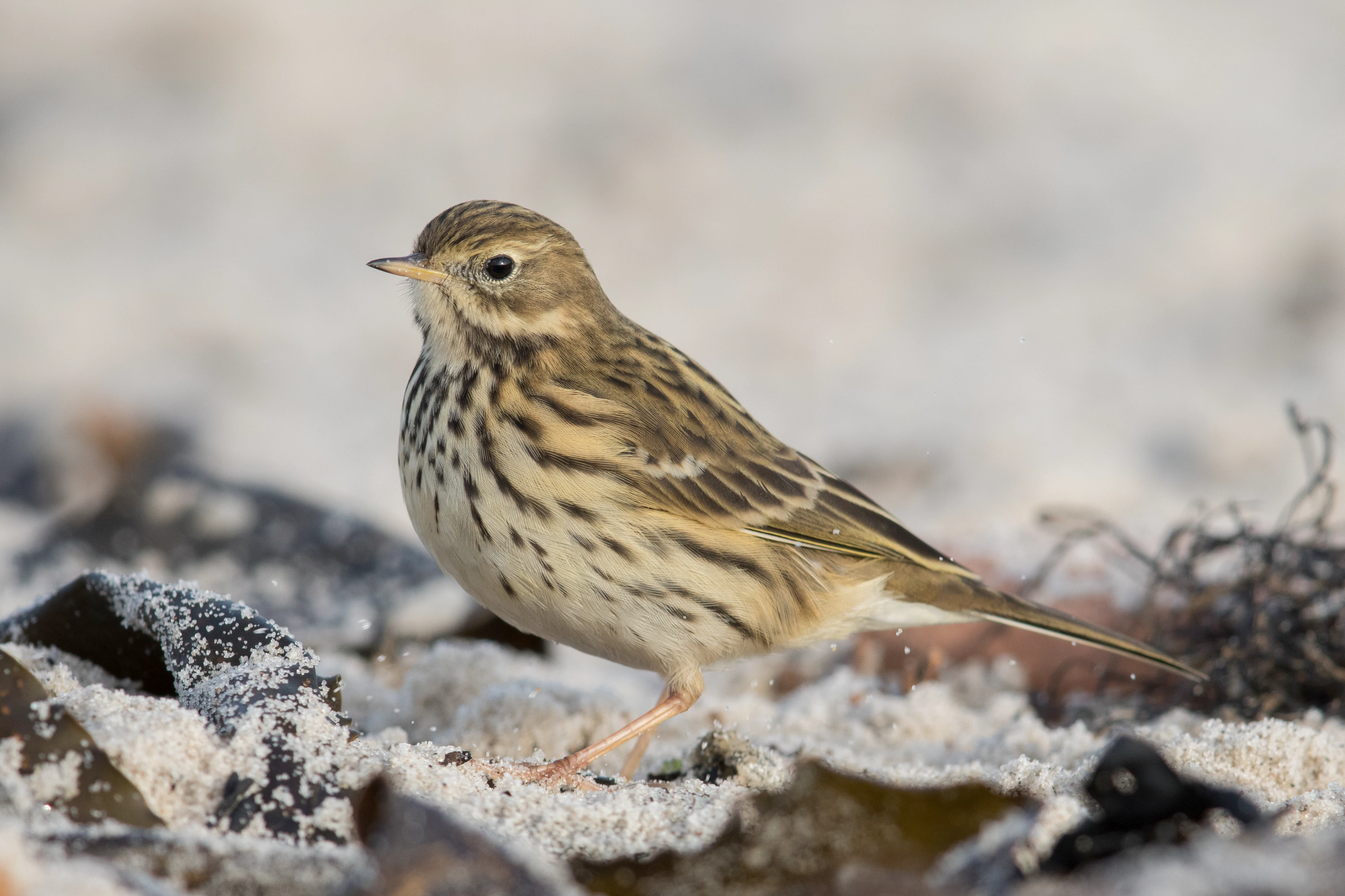
A small meadow pipit bird with brown streaked plumage standing on light-colored ground.
A meadow pipit standing on the ground.

Cha-Potami history and protected-area timeline

Cha-Potami was formally established as a protected area in February 2000, when its boundaries and conservation objectives were set under the European Natura 2000 framework. The designation came as part of Cyprus's participation in the EU Habitats Directive system, which aims to maintain or restore natural habitats and species of community interest to favorable conservation status.

Beyond its formal founding, the site's ecological value has long been shaped by the river itself and by traditional land-use patterns in the region, including grazing pressure that has influenced the present extent of therophytic grasslands. As a Natura 2000 site, it has become part of systematic monitoring of habitat condition and species occurrence, recognizing the site's importance for Cypriot endemics, orchids, and birds covered by the EU Birds Directive. No earlier historical designation as a national park or nature reserve is documented in the available sources beyond its Natura 2000 status.

Cha-Potami landscape and geographic character

The landscape of Cha-Potami is dominated by the winding course of the Chapotami river, which cuts through a varied topography in southwestern Cyprus. Over its roughly 12.5 kilometer extent inside the protected area, the river forms steep and at times narrow valleys, shaping how vegetation arranges itself across the site. The southwestern portion of Cyprus where the site sits has a typical Mediterranean profile, with dry hills, deeply cut drainage lines, and locally exposed rock.

The valley structure produces a clearly layered terrain: elevated slopes above the watercourse carry woodland and phrygana, mid-slopes host the larger olive and carob forest stands, while the river bottom supports dense gallery forest vegetation. Rocky cliffs and gorges break the continuity of woodland in places, forming the cliff and crevice micro-habitats that contribute materially to the site's biodiversity. Distant views within the site alternate between closed woodland cover, semi-open pine and scrub areas, and the linear green ribbon of the riverside corridor.
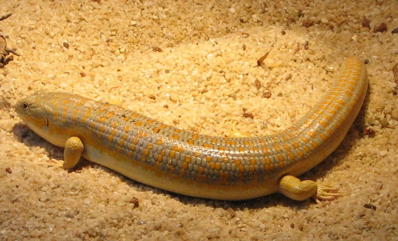
A side profile of a Schneider's skink resting on light brown sandy soil, displaying yellow and greyish-blue patterned scales.
A Schneider's skink, a reptile found in the habitats of Cha-Potami.

Cha-Potami ecosystems, habitats, and plant life

The ecological character of Cha-Potami is defined by the interplay between river, valley, and dry Mediterranean hinterland. The riverine environment supports gallery forests of Oriental plane and oleander, together with Mediterranean riparian scrub, which are among the most important habitat features of the site. Above the river, hillside woodlands of olive and carob, often with mastic shrubs and kermes oak, form extensive semi-natural forest stands, while the gorges add Mediterranean cypress forest and small cliff crevice plant communities.

Wider parts of the protected area also include Mediterranean pine forest, phrygana dominated by Sarcopoterium spinosum, and Mediterranean dry shrub formations. Therophytic grasslands, which are particularly affected by historical grazing pressure, hold a significant share of the site and are recognized as a priority habitat type under the Habitats Directive because of their botanical value and their vulnerability. The diversity of habitat types documented within this relatively compact river valley is what gives the site its conservation weight.

Cha-Potami wildlife and species highlights

Cha-Potami's wildlife significance is anchored in its birdlife, with 85 species protected under the EU Birds Directive reported from the site, including a notable share listed in Annex I. The site supports the endemic Cyprus Scops Owl and the endemic Cyprus Wheatear, alongside the globally threatened Black Francolin. Raptors are a particular feature, with species such as the Bonelli's Eagle, the Eurasian Griffon Vulture, the Long-legged Buzzard, the Peregrine Falcon, and the Eleonora's Falcon recorded in or around the protected area, often associated with the steep cliff and gorge topography that runs along the river.

Mammals include the Egyptian Fruit Bat and several endemic mammals, among them bats such as the European Free-tailed Bat, while reptiles are well represented by Cypriot endemics and by species such as the Levantine Viper, the Montpellier Snake, the Coin Snake, Schneider's Skink, the Mediterranean House Gecko, the Aegean Naked-fingered Gecko, and the Worm Snake. The site also hosts around 30 endemic insect species, of which several are listed on European Red Lists. In addition, amphibians present include the Lemon-yellow Tree Frog, the Green Toad, and the Marsh Frog, complementing the reptilian and mammalian fauna along and around the river.

Cha-Potami conservation status and protection priorities

Cha-Potami's conservation importance lies in its compact but highly diverse river valley ecosystem, which harbors a remarkable concentration of Cypriot endemics, orchids, and bird species of European concern. The site is part of the Natura 2000 network and is reported to hold its habitats in mostly good to very good conservation condition, with the notable exception of therophytic grasslands, which are classed as a priority habitat and have been significantly shaped by overgrazing.

The river and its steep banks are critical structural elements for wildlife, providing nesting and foraging habitat for raptors and passerines, as well as the riparian microclimate that supports gallery forest and associated species. Phlomis brevibracteata, a rare and endangered plant, reaches the western edge of its range at this site, while 17 additional Cypriot endemics and 12 protected orchid species are present. The combination of Mediterranean habitat heterogeneity, endemic-rich flora, and a strong bird directive species list makes the site a meaningful contributor to island and EU-level biodiversity targets.

Top sights and standout views in Cha-Potami

Among the standout features of Cha-Potami are its Oriental plane and oleander gallery forests lining the Chapotami river, contrasted against hillside oak, olive, and cypress woodlands growing on steep valley slopes. The site's therophytic grasslands are a priority habitat under EU law and contribute a distinct open-habitat character to an otherwise heavily wooded river valley.

The site also stands out for the Anhang I bird directive species it supports, including endemics such as the Cyprus Wheatshear and the Cyprus Scops Owl, and globally threatened species such as the Black Francolin. Cliffs and gorges used by raptors such as the Bonelli's Eagle and the Eurasian Griffon Vulture add a vertical, almost mountainous dimension to a generally low-lying Mediterranean river landscape.
Monthly climate preview

Long-term monthly temperature averages and precipitation metrics for Paphos District

Cha-Potami Climate Normals, Annual Temperature and Precipitation Rhythm

Representative coordinate records show measured monthly temperature ranges alongside daily precipitation rates across the annual cycle. Detailed monthly breakdowns provide deeper insight into long-term climate patterns and seasonal weather variations for Cha-Potami.
Annual mean21 °C
15 °C27 °C
Jan15°
Feb15°
Mar16°
Apr18°
May21°
Jun24°
Jul27°
Aug27°
Sep26°
Oct24°
Nov21°
Dec17°
Warmest month
August

27.2 °C

Coolest month
February

14.9 °C

Wettest month
December

3 mm/day

Driest month
July

0.1 mm/day

Park location guide

Geography guide, regional context, and park location map for Cha-Potami

Cha-Potami park geography, regions, and map view in Cyprus

Understand where Cha-Potami sits in Cyprus through a broader geographic reading of the surrounding landscape, nearby location context, and its mapped position within the national park landscape.

How Cha-Potami fits into Cyprus

Cyprus is an island nation in the eastern Mediterranean Sea, positioned at the crossroads of Europe, Africa, and Asia. The Republic of Cyprus governs the southern portion of the island, with Nicosia as its capital and largest city. The island has a complex political situation due to the Turkish occupation in the north and contains British military bases in the south. Cyprus gained independence from Britain in 1960 and is a member of the European Union.

Wider geography shaping Cha-Potami in Cyprus

Cyprus is an island located in the eastern Mediterranean Sea, off the coast of the Levant in West Asia. The island lies approximately 75 km south of Turkey, 105 km west of Syria, and 380 km north of Egypt. The terrain varies from mountainous regions in the north and interior to plains and coastal areas. The Troodos Mountains dominate the central and southwestern part of the island. The island has no land borders as it is entirely surrounded by sea.

Map view of Cha-Potami

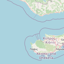
Use this park location map to pinpoint Cha-Potami in Cyprus, understand its exact geographic position, and read its mapped placement within the surrounding landscape more clearly.

Pigeon | © OpenStreetMap contributors

Location context for Cha-Potami

Limassol DistrictPaphos District
Recorded earthquake history

Examine Recorded Earthquake History and Seismic Data Near Cha-Potami

Explore the documented seismic history of the Paphos District through this curated catalogue of events associated with Cha-Potami. Review historical records including magnitude and epicentre distance to understand the regional seismic profile of this protected river valley environment.

Cha-Potami Earthquake History

Catalogued events

377 events

Strongest magnitude

Magnitude 6.8

Most recent event

Dec 12, 2025

This history includes earthquakes recorded inside the park or within 50 km of its borders

Explore photographic records of Mediterranean habitats, gallery forests, and steep gorge topography.

Cha-Potami Photos and Scenery: Visualizing Protected Landscapes and River Valley Terrains

Visual documentation reveals the layered terrain, riverine vegetation corridors, and diverse habitats defining Cha-Potami across its protected boundaries. Examining these detailed landscape photographs provides a clear visual understanding of the valley floor, hillside woodlands, and rugged topography.

A small meadow pipit bird with brown streaked plumage standing on light-colored ground.

Dense green vegetation, including tall reeds, growing along a narrow, muddy riverbed in a valley, with trees and shrubs in the background.

A side profile of a Schneider's skink resting on light brown sandy soil, displaying yellow and greyish-blue patterned scales.

Park atlas

Compare regional valley reserves and connected Mediterranean protected landscapes

Explore Parks Near Cha-Potami and Surrounding Protected Natural Areas

Discover other protected areas near Cha-Potami to evaluate neighboring river valleys, gallery forests, and woodland habitats across southwestern Cyprus. Regional park comparison reveals broader ecological patterns and unique terrain variations within the surrounding administrative districts.
Nature reserveCyprus
1.3 km away#1 closest

Northeast

Koilada Diarizou Nature Reserve and Mediterranean River Valley Geography

Protected riparian landscapes in the Paphos district of Cyprus

Koilada Diarizou represents a prime example of a Mediterranean river valley protected area in western Cyprus. This nature reserve sustains a mosaic of rocky limestone slopes, cypress woodlands, and seasonal riparian channels that serve as a critical reference point for understanding the island's unique ecological connectivity.

Area
13.58 km²
Established
2002
Relief
Mixed relief
Climate
Mediterranean
Nature reserveCyprus
3.4 km away#2 closest

Southeast

Akrotirio Aspro - Petra Romiou Nature Reserve: Cyprus Coastal Geography and Habitat Map

Mediterranean coastal cliffs, bird habitats, and protected conservation landscapes

Akrotirio Aspro - Petra Romiou is an ecologically dense nature reserve in Cyprus, recognized for its varied Mediterranean terrain. The landscape transitions from iconic sea-stack formations and coastal cliffs into juniper matorral, pine forests, and riparian galleries. This site remains a crucial protected area for ornithological research and habitat connectivity across the southern Cypriot coastline.

Area
24.895 km²
Established
2004
Relief
Upland
Climate
Mediterranean
Nature reserveCyprus
3.5 km away#3 closest

West

Ekboles Potamon Ezousas, Xerou, Kai Diarizou: Nature Reserve and Coastal Habitat

Natura 2000 protected landscape in southwestern Cyprus

Spanning over 800 hectares, Ekboles Potamon Ezousas, Xerou, Kai Diarizou protects the vital intersections of three river mouths with the Mediterranean Sea. This nature reserve sustains a dense network of avian habitats, ranging from coastal flats to river corridors, and represents a crucial migratory waypoint and breeding ground within the Cyprus landscape.

Area
8.271 km²
Established
2007
Climate
Mediterranean
Scope
Terrestrial
Nature reserveCyprus
5.8 km away#4 closest

East

Potamos Paramaliou: Geography and Avian Conservation in Southwestern Cyprus

A vital river-centered nature reserve and protected corridor

Potamos Paramaliou serves as a specialized nature reserve in southwestern Cyprus, protecting a seasonal river valley and the diverse bird species it supports. This site illustrates the intersection of Mediterranean riverine ecosystems and arid open landscapes, offering a clear view of how targeted conservation boundaries safeguard avian movement and regional ecological stability.

Area
17.819 km²
Established
2008
Climate
Mediterranean
Scope
Terrestrial
Protected areaCyprus
About 6.8 km away#5 closest

East

Metalleio Kalavasou: A Mediterranean Protected Area in Southern Cyprus

Mapped Mediterranean scrub, pine forests, and habitat mosaics.

Located in the foothills of the Limassol district, Metalleio Kalavasou represents a vital protected landscape within the European Natura 2000 network. The area serves as a case study for Mediterranean biodiversity, where dense pine canopies, olive woodlands, and open garrigue create a unique environment for numerous bird species, reptiles, and endemic vegetation types in a compact geographic footprint.

Area
0.471 km²
Established
1992
Climate
Mediterranean
Scope
Terrestrial
Protected areaCyprus
About 6.8 km away#6 closest

East

Periochi Kokkinokremmos: An Overview of the Protected Landscape and Regional Geography

A vital ecological sanctuary in the Mediterranean landscape of Cyprus.

Periochi Kokkinokremmos represents a specialized protected area in Cyprus, notable for its compact but high-density mosaic of Mediterranean ecosystems. From calcareous cliffs to pine-dominated woodlands, the site offers deep insight into the regional botanical and avian diversity supported by the island's unique Mediterranean terrain.

Area
1.002 km²
Established
1992
Relief
Mixed relief
Climate
Mediterranean
Protected areaCyprus
7.2 km away#7 closest

North

Gkremoi Chanoutari Protected Area; Mapping Cyprus Inland Landscapes and Terrain

A critical Mediterranean bird sanctuary within the Troodos foothill region.

Gkremoi Chanoutari encompasses a unique mix of rocky crags, scrubby slopes, and rural hillsides across 2,470 hectares in the interior of Cyprus. This protected area serves as a primary site for cliff-nesting raptors and Mediterranean avifauna, offering a detailed look at the island's complex topography and mountain-to-valley ecological transitions.

Area
24.698 km²
Established
2007
Climate
Mediterranean
Scope
Terrestrial
Nature reserveCyprus
8.1 km away#8 closest

Northwest

Koilada Ezousas: Protected Inland Valley Landscapes and Map Geography in Western Cyprus

Natura 2000 designated nature reserve in the Paphos district

Koilada Ezousas represents a strategically mapped protected area in western Cyprus, characterized by its extensive inland valley terrain. The site acts as a critical refuge within the Mediterranean ecoregion, supporting a high concentration of raptors and endemic passerines. Understanding its geographic spread provides insight into the broader network of protected corridors across the island.

Area
56.27 km²
Established
2019
Climate
Mediterranean
Scope
Terrestrial

Common questions about visiting, size, designation, and location context for Cha-Potami

Cha-Potami FAQs for park facts, access, geography, and protected area context

Find quick answers about Cha-Potami, including protected-area facts, park geography, trail and visitor context, and how the park fits into its surrounding country and regional landscape.
MoriAtlas Explorer

Continue Your Protected Areas Search Across the Global Atlas

Deepen your exploration by continuing the structured search for national parks and protected areas worldwide. Utilize the comprehensive filtering capabilities to compare different conservation landscapes and refine your understanding of global park geography. Discover more about the distribution and characteristics of protected natural areas.

Global natural geography