
Why Chaîne des Puys - faille de Limagne stands out
The site is best known for allowing visitors and scientists to read a complete tectonic and volcanic story in a single landscape. Within a compact area, the protected property captures the collapse of the Limagne graben along the western European rift, the resulting chain of roughly eighty monogenetic volcanoes that lines up parallel to the fault, and the inverted relief of the Montagne de la Serre, where an ancient valley-filling lava flow now stands above the surrounding terrain. The volcanic variety is itself a defining feature. The Chaîne des Puys contains examples of all three classical monogenetic volcanic landforms: lava domes, cinder cones, and maars. This diversity, combined with unusually fresh surface morphology, makes the alignment one of the clearest and most studied young volcanic fields in Europe, with the Puy de Dôme acting as both its highest point and a symbolic landmark for the entire region.
Chaîne des Puys - faille de Limagne history and protected-area timeline
The geological history recorded in the Chaîne des Puys - faille de Limagne extends back at least to the Hercynian orogeny, between roughly 450 and 250 million years ago, when the rocks of the future plateau were originally assembled into a mountain belt. Long after those ancient mountains were eroded down to the present-day plateau des Dômes, the Alpine orogeny reactivated the crust beneath central France and triggered the opening of the western European rift.
The rifting process collapsed the Limagne block along a major normal fault, producing a deep graben that filled rapidly with sediments reaching more than 3,000 metres in thickness between about 40 and 25 million years ago. Pressure and heat associated with this rifting stimulated continued magmatic activity beneath the plateau, eventually leading to the emergence of the Chaîne des Puys between about 95,000 and 8,400 years ago as a chain of monogenetic volcanoes aligned parallel to the fault. Earlier volcanic activity, well before the Chaîne des Puys, is preserved in the lava flow that now forms the Montagne de la Serre, emplaced about 10 million years ago from the Vigeral vent.
More recent regional uplift, around 2 million years ago, accelerated erosion of the soft sedimentary fill of the Limagne plain and exposed the ancient lava-capped ridges as classic inverted relief. In modern times, recognition of this geological concentration came in 2018, when UNESCO inscribed the Tectonic site of the Chaîne des Puys and Limagne fault as a natural World Heritage Site under criterion (viii). Following the inscription, the Parc naturel régional des Volcans d'Auvergne worked with local authorities such as Clermont Auvergne Métropole and the Riom Limagne et Volcans agglomeration community to develop an architectural and landscape charter aimed at preserving the visual quality of villages within the UNESCO perimeter.
Chaîne des Puys - faille de Limagne landscape and geographic character
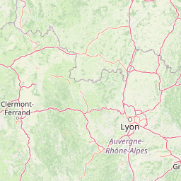
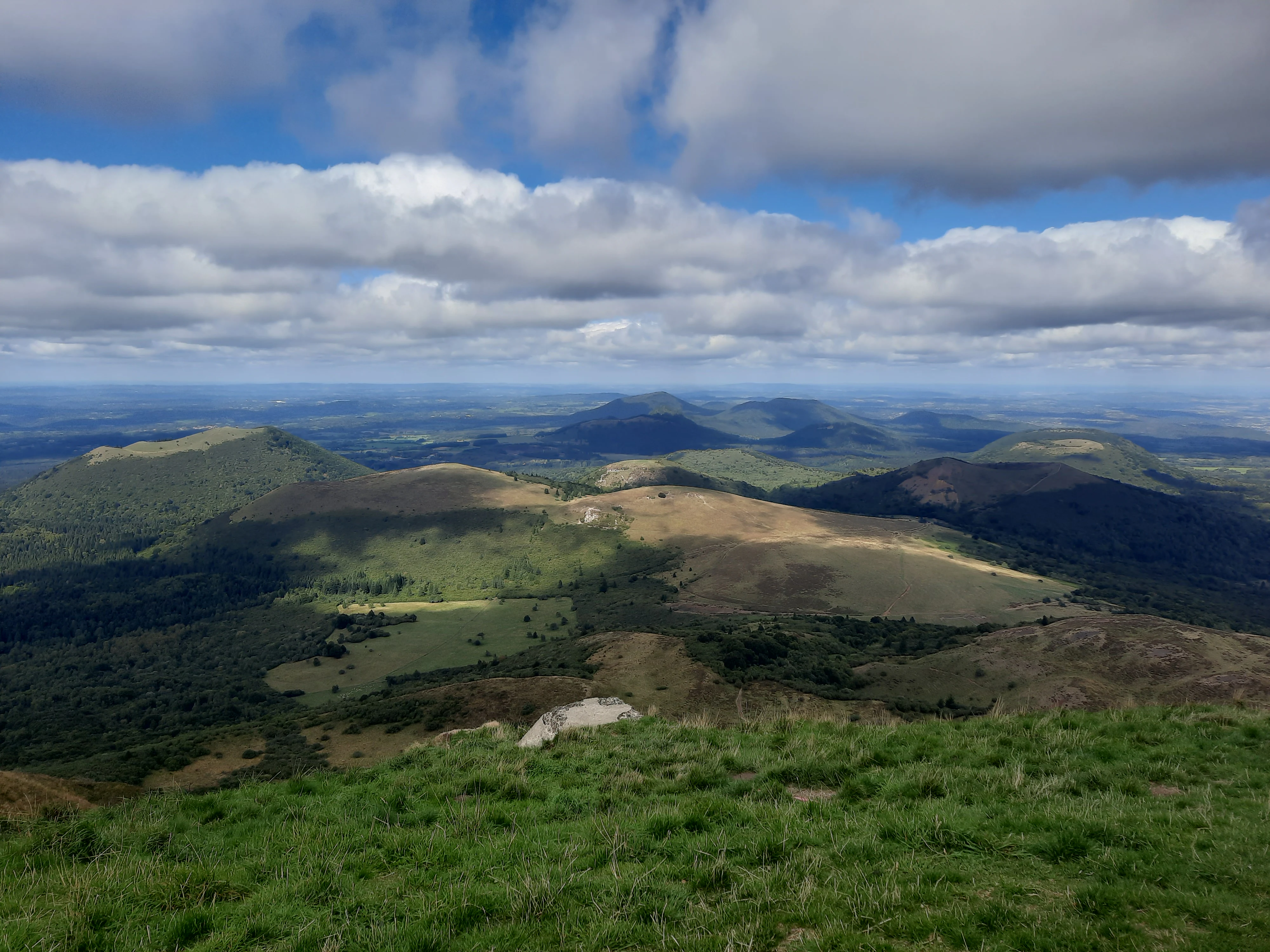
The landscape of the Chaîne des Puys - faille de Limagne is defined by the abrupt contrast between two very different worlds that meet along a single geological line. To the east lies the broad, flat Limagne plain, a subsided basin filled with sediments accumulated during rifting. To the west rises the plateau des Dômes, an older erosional surface that suddenly climbs along the normal fault marking the western edge of the graben. The fault scarp itself is a defining visual feature, separating the densely settled Clermont-Ferrand urban area from the more open, pastoral landscapes of the plateau.
Above this fundamental contrast, the plateau is crowned by the Chaîne des Puys, a north-south alignment of roughly eighty volcanic edifices that runs parallel to the fault. Each volcano is its own small landform, but collectively they create a rhythmic skyline of rounded lava domes, cinder cones, and shallow maar craters. The Puy de Dôme, the highest and most prominent summit in the chain, dominates the visual horizon and anchors the entire protected setting. North of the main chain, the property also includes a sample of older volcanic heritage through the Montagne de la Serre, a long ridge of resistant basalt that now stands above the surrounding terrain as an example of inverted relief.
The interplay of fault, volcanic chain, and inverted relief allows the landscape to function almost as an open-air textbook. Lakes associated with former volcanic craters or lava dams add further texture to the scenery, supporting both the visual character of the property and its outdoor-recreation role. Pastures and traditional land use, maintained by pastoralism, help keep the volcanic cones clearly visible against the skyline, while the natural boundary of the fault continues to limit urban expansion westward from the Limagne plain.
Chaîne des Puys - faille de Limagne ecosystems, habitats, and plant life
Although the site is primarily valued for its geology, the natural environment supported by the Chaîne des Puys - faille de Limagne is closely tied to its volcanic and tectonic setting. The volcanic cones and crater lakes provide a wide range of microhabitats across a relatively compact area, from dry, rocky slopes with thin soils on the higher domes and cinder cones to wetter depressions around maars and former lava-dammed valleys.
Forest cover, grasslands, and open pastoral landscapes coexist across the plateau, shaped both by soil conditions derived from volcanic substrates and by long-standing human land use. The plateau des Dômes retains its rural character largely because urbanisation has been checked by the Limagne fault on its eastern side, so the property functions as a buffer of semi-natural landscapes against the dense urban fabric of Clermont-Ferrand. Within this setting, lakes of volcanic origin contribute distinct freshwater habitats, while the mineral-rich springs that emerge at the foot of the fault feed both natural vegetation and the region's renowned mineral water and spa resources.
The overall ecological character of the property is therefore one of mosaic-like habitats embedded in a strongly geological matrix. The terrain is a product of volcanic landforms, fault-controlled topography, and ongoing erosion, and the natural communities that occupy it reflect that geological diversity rather than forming a single continuous forest or wetland block.
Chaîne des Puys - faille de Limagne wildlife and species highlights
The wildlife profile of the Chaîne des Puys - faille de Limagne is shaped less by charismatic large mammals than by the ecological variety produced by its volcanic landforms. The combination of open pasture, scattered woodland, rocky volcanic slopes, and crater lakes supports a mix of birdlife typical of upland pastoral landscapes in the Massif Central, alongside aquatic species associated with the property's volcanic lakes and wetlands.
The open, semi-natural character of the plateau, maintained in part by pastoralism, favours meadow and edge species, while the crater lakes and maars add freshwater and wetland habitat value. Wildlife observation in the property is therefore best understood as a complement to the geological story, with species patterns tracking the diversity of habitats that the volcanic and tectonic setting has produced rather than forming a standalone biome.
Chaîne des Puys - faille de Limagne conservation status and protection priorities
The primary conservation significance of the Chaîne des Puys - faille de Limagne is geological and tectonic rather than biological. Inscribed on the UNESCO World Heritage List in 2018 under criterion (viii), the site is recognised as an exceptional illustration of continental rifting, monogenetic volcanism, and inverted relief, allowing key stages of plate-tectonic processes to be observed in a single, accessible landscape.
At the national and regional level, the property is embedded in the Parc naturel régional des Volcans d'Auvergne, which provides the broader framework for landscape and rural protection around the inscribed core. The Limagne fault itself acts as a natural conservation boundary, having historically limited the westward expansion of the Clermont-Ferrand metropolitan area and helped preserve the rural plateau from urbanisation. Following the inscription, the Parc naturel régional, together with local authorities and residents, developed an architectural and landscape charter aimed at maintaining the quality of villages within the UNESCO perimeter and reinforcing the visual coherence of the property.
Protection of the site also has implications beyond geology. The volcanic substrate, mineral springs, crater lakes, and pastoral landscapes together make the area an important reservoir of natural mineral water resources, freshwater habitats, and traditional rural land use, giving the property a layered conservation value that combines scientific, landscape, and cultural dimensions.
Chaîne des Puys - faille de Limagne cultural meaning and human context
The cultural identity of the Chaîne des Puys - faille de Limagne is deeply intertwined with its volcanic geology. The dark lava stone extracted from the northern part of the property, including the well-known Volvic stone, has shaped the distinctive black architecture of Clermont-Ferrand, visible for instance in the Notre-Dame-de-l'Assomption cathedral. The volcanic terrain has also given rise to a strong tradition of mineral water production, exemplified by Volvic, and to a long history of thermal spa towns such as Royat and Châtel-Guyon, whose waters emerge at the foot of the Limagne fault.
The wider region has built a substantial cultural and educational infrastructure around its geological heritage. The Puy de Dôme is labelled a Grand Site de France and is also home to a Roman temple at its summit, adding an archaeological and historical layer to the visitor experience. Nearby attractions such as the Vulcania theme park and the open-air Volcano de Lemptégy are recognised among the emblematic tourist sites of the Auvergne-Rhône-Alpes region and present the volcanic story to a broad public. Pastoralism continues to shape the plateau's landscapes, while sites such as the Plateau de Gergovie, just outside the property, recall the regional importance of the Battle of Gergovie.
Top sights and standout views in Chaîne des Puys - faille de Limagne
The protected property brings together, in a compact area, a textbook example of continental rifting, the youngest large volcanic alignment in mainland France, and a clear demonstration of inverted relief where an ancient valley-filling lava flow now forms a hilltop ridge. Its diversity of monogenetic volcanic landforms, including domes, cones, and maars, makes it a reference site for volcanology, while the Puy de Dôme provides an iconic visual landmark that anchors the entire property.
Best time to visit Chaîne des Puys - faille de Limagne
The plateau des Dômes and the volcanic chain are accessible year-round, but late spring through early autumn generally offers the most pleasant conditions for outdoor exploration. Summer brings long days and stable weather for hiking the rims of the cones and visiting the crater lakes, while the cooler months often reveal the volcanic profiles more sharply against the sky, though conditions on the higher summits, including the Puy de Dôme, can be wet, windy, or colder. The pastoral character of the plateau, maintained by traditional land use, gives the landscape a relatively stable rural atmosphere through the warmer seasons, when hiking trails, viewpoints, and the Grand Site de France facilities around the Puy de Dôme are at their liveliest.