Mori Atlas logo
Marine protected areaChannel Islands National Marine Sanctuary

Mapped marine boundaries and deep water habitats of the Southern California coast

Channel Islands National Marine Sanctuary Marine Protected Area and Regional Geography

Channel Islands National Marine Sanctuary encompasses roughly 1,470 square miles of protected ocean surrounding the Northern Channel Islands. This marine protected area sits at a critical convergence of cold and warm currents, fueling exceptional productivity across kelp forests, rocky reefs, and deep water canyons that descend over 5,000 feet. The sanctuary maintains a complex network of habitats that safeguard marine mammals, seabird nesting grounds, and significant submerged cultural sites including historic shipwrecks and ancient Chumash history.

marine sanctuaryprotected marine areaNOAASouthern CaliforniaChannel Islandskelp forest

Channel Islands National Marine Sanctuary

Marine protected area

Park overview

Structured park overview, official facts, and landscape profile for Channel Islands National Marine Sanctuary

Channel Islands National Marine Sanctuary park facts, protected area profile, and essential visitor context

Review the core facts for Channel Islands National Marine Sanctuary, including designation, size, terrain, visitor scale, habitats, and operating context in one park-focused overview.

About Channel Islands National Marine Sanctuary

Channel Islands National Marine Sanctuary is one of the largest and most ecologically significant marine protected areas in the continental United States. Straddling the waters off Santa Barbara and Ventura counties in Southern California, it surrounds the Northern Channel Islands and creates a marine buffer zone between the islands and the open Pacific. The sanctuary is administered by the National Oceanic and Atmospheric Administration as part of the National Marine Sanctuary System, and it functions alongside Channel Islands National Park, with the two areas sharing a strong focus on conservation, research, and public education.

The geography of the sanctuary is shaped by the islands themselves, which act as biological stepping stones between the California coast and the open ocean. Because the waters around the islands lie at the intersection of cold northern currents and warmer southern waters, they support an unusual mix of species. Kelp forests flourish around the islands' nearshore rocky reefs, while deeper offshore areas contain cold-water corals, sponges, and other specially adapted deep-sea communities. Together, these ecosystems make the sanctuary one of the most productive and biologically diverse marine environments on the West Coast.

Beyond its ecological importance, the sanctuary carries significant cultural weight. It preserves submerged evidence of human activity going back to the earliest known Chumash inhabitants and contains the remains of numerous vessels lost over more than a century of maritime history. Federal designation in 1980 was driven in part by the 1969 Santa Barbara oil spill, which raised national awareness of how vulnerable these waters were to industrial impacts. Today, the sanctuary is managed to protect natural and cultural resources while still accommodating compatible human activities such as fishing, shipping, research diving, and wildlife viewing.

Quick facts and research context for Channel Islands National Marine Sanctuary

Channel Islands National Marine Sanctuary is a NOAA-administered marine protected area off the coast of Santa Barbara and Ventura counties in Southern California. It was designated on October 2, 1980, and expanded in 2007, and it surrounds the waters of the five Northern Channel Islands that anchor Channel Islands National Park.

The sanctuary encompasses around 1,470 square miles of ocean and sits at a biogeographic crossroads between cold and warm Pacific currents. Within its boundaries lie a network of marine reserves, deep-water coral and sponge habitat, world-famous kelp forests, and more than 150 reported historic ship and aircraft losses.

Protection and recognition

Marine conservation framework and documented protection scope details

Channel Islands National Marine Sanctuary Protection Status and Designation

Channel Islands National Marine Sanctuary maintains a defined marine protection scope within its designated geographic boundary. Structured facts outline the recorded conservation framework, management jurisdiction, and official administrative status.

Protection details

Protection scope
Marine
Transboundary protection
No
Park context

Deeper park guide and search-rich context for Channel Islands National Marine Sanctuary

Channel Islands National Marine Sanctuary history, landscape, wildlife, and travel context

Explore Channel Islands National Marine Sanctuary through its history, landscape character, ecosystems, wildlife, conservation priorities, cultural context, and seasonal travel timing in a structured park guide built for atlas discovery and search intent.

Why Channel Islands National Marine Sanctuary stands out

Channel Islands National Marine Sanctuary is best known for its exceptional marine biodiversity, which is driven by the convergence of cold and warm ocean currents around the Northern Channel Islands. The resulting productivity supports extensive kelp forests, large seasonal aggregations of whales, breeding populations of California sea lions, and a striking mix of warm-water and cold-water species. It is also recognized for its rich maritime heritage. More than 150 historic ship and aircraft losses have been documented within its waters, and the area preserves submerged prehistoric Chumash cultural sites extending human history in the region back more than 13,000 years.
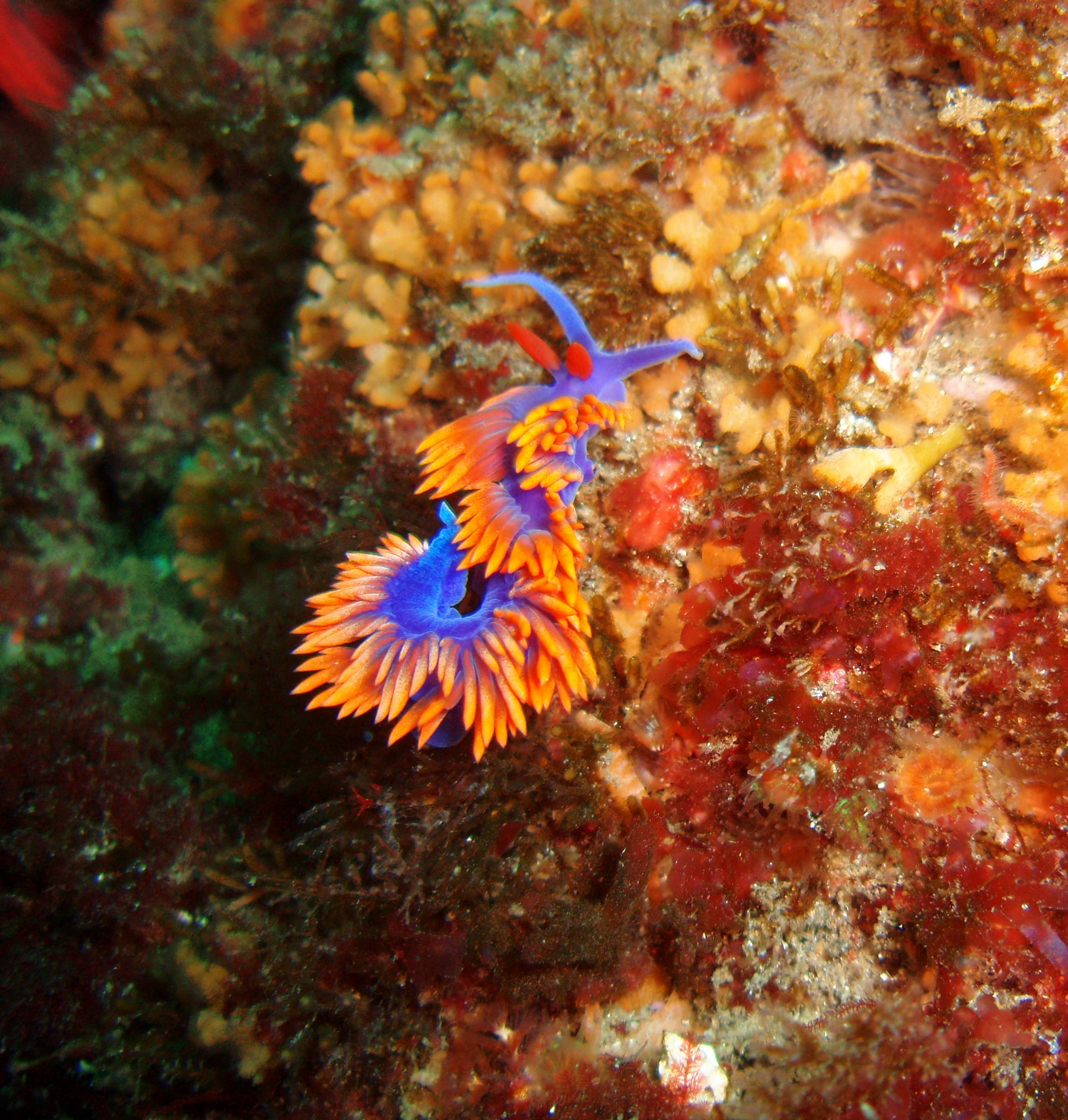
A close up view of a vibrant purple and orange Spanish shawl nudibranch on a colorful, textured reef surface under water.
A Spanish shawl nudibranch, a colorful sea slug, clinging to a textured rocky reef within the marine sanctuary.

Channel Islands National Marine Sanctuary history and protected-area timeline

Channel Islands National Marine Sanctuary has its roots in growing public concern about the ecological and cultural value of the waters around California's Channel Islands. Although the islands themselves had long been recognized for their unique environments, large-scale industrial activity in the Santa Barbara Channel, including oil transportation and shipping, made their surrounding waters increasingly vulnerable to damage.

The turning point came with the 1969 Santa Barbara oil spill, a major blowout near the California coast that released large quantities of crude oil into the Santa Barbara Channel. The disaster underscored how little protection these waters had and helped build momentum for stronger federal safeguards. On October 2, 1980, the National Oceanic and Atmospheric Administration officially designated the Channel Islands National Marine Sanctuary, placing roughly 1,470 square miles of ocean under federal protection.

Since its designation, the sanctuary has continually expanded its scope. In 2002, California established a network of nearshore marine protected areas within the sanctuary, and NOAA extended additional protections into deeper waters in 2006 and 2007, substantially strengthening habitat safeguards across the region. The sanctuary's boundaries were also expanded in 2007. Over the decades, dedicated programs for education, research, maritime heritage preservation, and adaptive management have solidified the sanctuary's role as a flagship example of integrated ocean conservation in the United States.

Channel Islands National Marine Sanctuary landscape and geographic character

Although the sanctuary itself is composed of water rather than land, its physical character is defined by the islands it surrounds and the seafloor beneath it. The Northern Channel Islands, including Anacapa, Santa Cruz, Santa Rosa, San Miguel, and Santa Barbara Islands, form a chain off the Southern California coast, each with steep cliffs, sea caves, rocky intertidal zones, and sheltered coves that shape the surrounding currents and habitats.

The seafloor gradient inside the sanctuary is dramatic. Near the islands, shallow rocky reefs and kelp forests thrive in sunlit waters, but the vast majority of the sanctuary lies beyond the reach of significant light. About 91.5 percent of the sanctuary's area is deeper than 100 feet, descending into cold, low-oxygen waters that reach depths of more than 5,000 feet. This abrupt transition from bright, productive nearshore reefs to dark deep-water environments gives the sanctuary an unusually broad range of physical habitats within a relatively compact area.

Above the water, the islands and channel also influence atmospheric conditions. Wind patterns in the Santa Barbara Channel are affected by seasonal and long-term climate variability, which in turn drive upwelling and shape local marine productivity. The interplay between island topography, ocean currents, and wind makes the physical environment of the sanctuary as ecologically important as the species it supports.
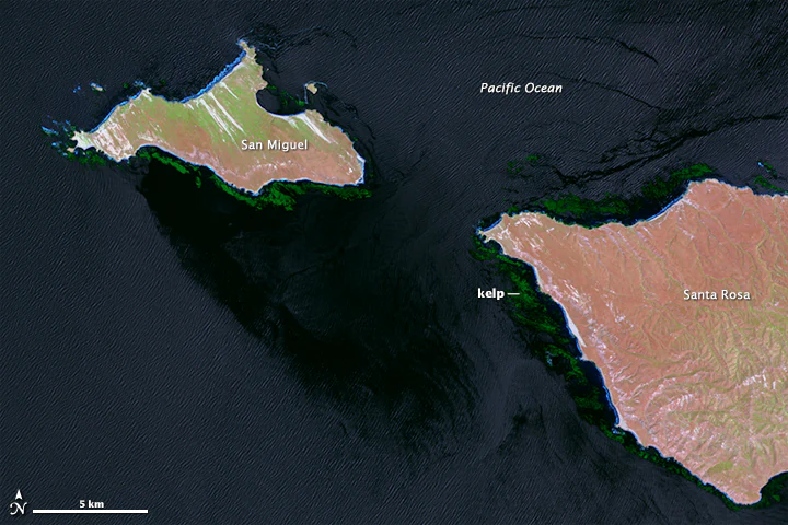
Satellite image showing San Miguel and Santa Rosa islands surrounded by dark green kelp beds in the Pacific Ocean, with labels indicating the locations of the islands and kelp.
Satellite view of kelp beds surrounding San Miguel and Santa Rosa Islands within the Channel Islands National Marine Sanctuary.

Channel Islands National Marine Sanctuary ecosystems, habitats, and plant life

The ecological character of Channel Islands National Marine Sanctuary is shaped by its position at the confluence of two major ocean current systems. Cold water moving south along the California coast meets warmer southern currents, and the mixing of these waters produces exceptionally high productivity. Nutrient-rich upwelling fuels dense blooms of phytoplankton and zooplankton, which in turn support an unusually rich community of fish, marine mammals, seabirds, and invertebrates.

Kelp forests are among the most visible and ecologically important habitats in the sanctuary, particularly around the nearshore rocky reefs of San Miguel and Santa Rosa Islands. These underwater forests shelter sea lions, rockfish, and a wide range of invertebrates, and they also serve as important foraging grounds for larger predators. In deeper waters, communities of cold-water corals, sponges, crabs, sea stars, and other specialized animals occupy reefs and rocky outcrops, forming ecosystems that are less familiar but equally important to the sanctuary's overall biodiversity.

The islands also host significant seabird nesting and roosting habitat, including populations of brown pelicans, Scripps's murrelets, and other species that depend on both the terrestrial and marine environment. Eelgrass beds, shellfish populations, and intertidal habitats add to the mosaic of life and create a complex ecological network that the sanctuary's management and research programs actively monitor.
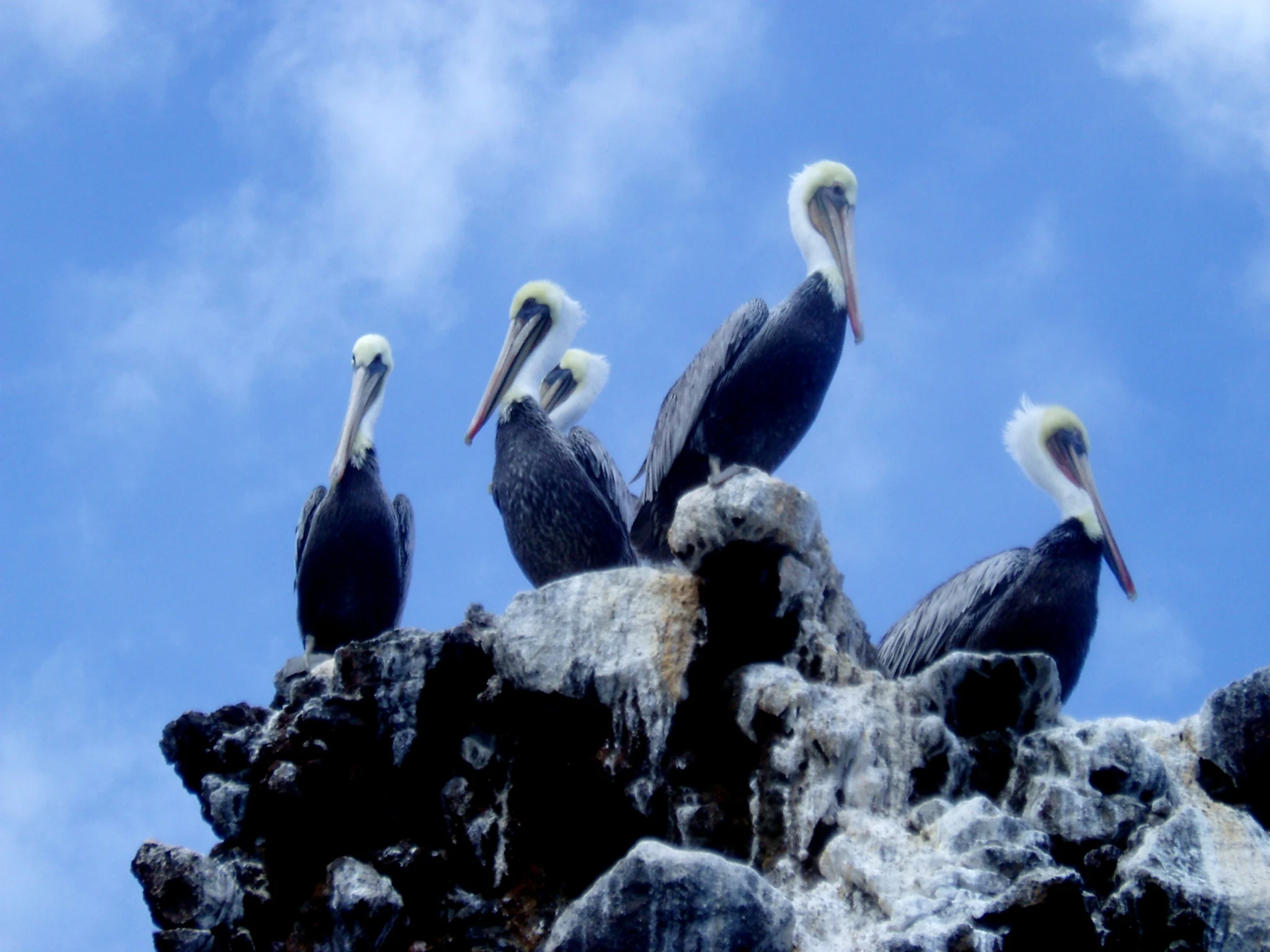
Four brown pelicans standing on a rocky, white-stained coastal cliff against a bright blue sky.
A group of brown pelicans perched on a rocky outcrop at Channel Islands National Marine Sanctuary.

Channel Islands National Marine Sanctuary wildlife and species highlights

The wildlife of Channel Islands National Marine Sanctuary is one of its most striking features. California sea lions breed and haul out around the islands in large numbers, and northern elephant seals, harbor seals, and the occasional Steller sea lion use the rocky shores as resting and breeding habitat. The sanctuary's waters also host seasonal aggregations of large whales that draw international attention.

From early spring through late fall, humpback, blue, and fin whales come to the sanctuary in increasing numbers to feed on krill blooms and other prey. Gray whales pass through on their migrations between Alaska and the lagoons of Baja California. Researchers have documented extraordinary aggregations, including up to 186 unique whale photo identifications in a single day in some cases, underscoring how important the area is for recovering whale populations.

Birds are equally prominent in the sanctuary's wildlife profile. Brown pelicans, once severely reduced in number, now nest on the islands in large colonies. Scripps's murrelets, snowy plovers, and California least terns all rely on the islands and adjacent waters. Beneath the surface, fish such as canary rockfish, copper rockfish, and bocaccio inhabit kelp forest and rocky reef habitats, while white abalone, black abalone, and other invertebrates represent some of the rarer and more vulnerable species protected under the sanctuary's conservation framework.
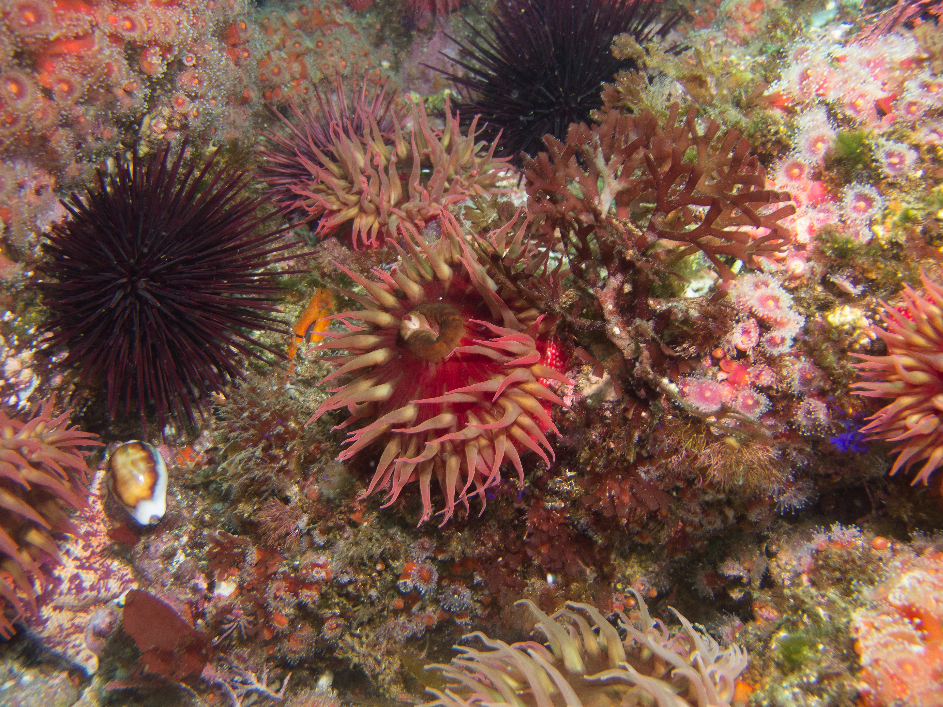
An underwater close-up shot of a rocky reef covered in various sea creatures, including spiky black sea urchins and several reddish-pink sea anemones.
A vibrant underwater scene featuring sea urchins and anemones clinging to a reef within the Channel Islands National Marine Sanctuary.

Channel Islands National Marine Sanctuary conservation status and protection priorities

Conservation is central to the identity of Channel Islands National Marine Sanctuary and one of the reasons it was designated in 1980. The sanctuary was created to protect waters of national ecological and cultural significance, especially after the 1969 Santa Barbara oil spill highlighted how vulnerable the Santa Barbara Channel was to large-scale industrial damage. Federal designation placed these waters under NOAA's stewardship and introduced regulatory oversight of activities ranging from oil development and shipping to fishing and recreational use.

The sanctuary is supported by an extensive network of additional protections. Eleven marine reserves and additional marine conservation areas, covering roughly 241 square miles, prohibit or restrict take and harvest in important habitat zones. These no-take reserves are designed to protect whole ecosystems rather than individual species, and ongoing research suggests that food webs within them are more stable and resilient than those outside.

Conservation in the sanctuary extends beyond habitat protection. Programs monitor whale-ship interactions, ocean acidification, invasive species, damage to eelgrass beds, marine debris, poaching, and water pollution. Partnerships with universities, NOAA research vessels, and international collaborators support long-term ecological monitoring. The sanctuary's deep-water coral and sponge habitats, kelp forest ecosystem, and breeding areas for seabirds and marine mammals are all conservation priorities, and ongoing studies of cetacean populations, kelp forest food webs, and acoustic conditions continue to inform adaptive management decisions.

Channel Islands National Marine Sanctuary cultural meaning and human context

The waters of Channel Islands National Marine Sanctuary hold deep and enduring cultural significance. The Northern Channel Islands have been inhabited for at least 13,000 years, with the earliest known human remains in the area dating back to that period. The Chumash people developed a sophisticated maritime culture centered on these islands and the surrounding waters, building and sailing the traditional plank canoes known as tomols and maintaining complex trade and exchange networks along the California coast. Submerged archaeological sites within the sanctuary preserve evidence of this long human history, including prehistoric landforms now drowned by rising sea levels.

The sanctuary also carries a rich maritime heritage from more recent centuries. More than 150 ships and aircraft have been reported lost within its waters, and roughly two dozen of those wrecks have so far been located and documented. These include vessels such as the SS Winfield Scott, which has become a destination for recreational divers interested in the sanctuary's combined natural and cultural history. Preserving these wrecks, along with the broader underwater archaeological record, is an explicit part of the sanctuary's stewardship mission, and the site hosts public education efforts, interpretive programs, and continuing research into the region's layered history. Today, the Chumash community continues to honor this legacy through cultural events, including the annual traditional tomol crossing of the Santa Barbara Channel.
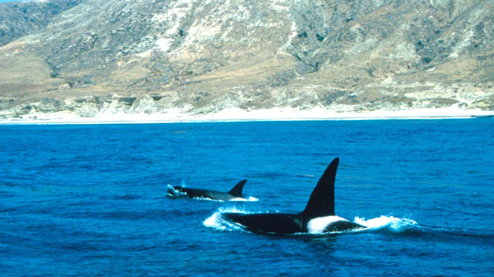
Two orcas, also known as killer whales, swimming in deep blue water near a coastal island with rocky cliffs in the background.
Two orcas swimming off the coast of Santa Rosa Island within the Channel Islands National Marine Sanctuary.

Top sights and standout views in Channel Islands National Marine Sanctuary

Channel Islands National Marine Sanctuary stands out as one of the most biologically productive marine areas on the United States West Coast, owing to the convergence of cold and warm ocean currents around the Northern Channel Islands. This ecological richness supports world-class kelp forests, seasonal aggregations of humpback, blue, and fin whales, and large breeding colonies of California sea lions and seabirds.

Equally distinctive is the sanctuary's dual natural and cultural identity. It preserves deep-water coral and sponge habitats, a system of marine reserves that protects entire food webs, and a remarkable maritime heritage that includes Chumash archaeological sites and more than 150 historic ship and aircraft losses. Combined, these qualities make the sanctuary a benchmark example of multi-layered ocean conservation.
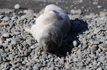
A northern elephant seal pup with light gray fur lying flat on a beach covered in smooth, gray pebbles.
A northern elephant seal pup rests on a rocky beach within the Channel Islands National Marine Sanctuary.

Best time to visit Channel Islands National Marine Sanctuary

The character of a visit to Channel Islands National Marine Sanctuary shifts noticeably with the seasons. Late spring through early fall is generally the most active time above and below the water, when calm seas, longer daylight hours, and warmer temperatures make boating, kayaking, diving, and snorkeling more accessible. This window also coincides with peak whale activity, as humpback, blue, and fin whales feed in the area and gray whales pass through during their migrations.

Winter brings stronger winds, rougher seas, and reduced boating access, but it also brings its own rewards. Migratory seabirds are present, marine mammal breeding behaviors continue on the islands, and cooler conditions can offer clearer underwater visibility for divers on protected days. The best period for most visitors is typically spring to early fall, when the combination of weather, wildlife, and water conditions tends to be most favorable.
Monthly climate preview

Long-term temperature and precipitation patterns across representative coordinates

Channel Islands National Marine Sanctuary Climate Normals and Weather by Month

Channel Islands National Marine Sanctuary records measured monthly temperature variations and precipitation rates based on historical climate data from representative coordinate sampling. Analyzing the complete twelve-month normals profile reveals precise shifts in average minimum and maximum thresholds across the protected marine area.
Annual mean16 °C
14 °C19 °C
Jan14°
Feb14°
Mar14°
Apr14°
May15°
Jun16°
Jul18°
Aug18°
Sep19°
Oct18°
Nov16°
Dec14°
Warmest month
September

18.6 °C

Coolest month
February

13.6 °C

Wettest month
February

3.6 mm/day

Driest month
August

0 mm/day

Park location guide

Geography guide, regional context, and park location map for Channel Islands National Marine Sanctuary

Channel Islands National Marine Sanctuary park geography, regions, and map view in United States of America

Understand where Channel Islands National Marine Sanctuary sits in United States of America through a broader geographic reading of the surrounding landscape, nearby location context, and its mapped position within the national park landscape.

How Channel Islands National Marine Sanctuary fits into United States of America

The United States of America is a federal presidential republic and one of the world's largest countries by area and population. It consists of 50 states across a vast territory spanning multiple time zones, with its capital in Washington, D.C. and largest city in New York City. The nation has a diverse economy, influential political system, and significant cultural and military presence globally.

Wider geography shaping Channel Islands National Marine Sanctuary in United States of America

The United States occupies a vast territory in North America, bordered by Canada to the north and Mexico to the south. The 48 contiguous states stretch from the Atlantic to the Pacific Ocean, while Alaska occupies the northwestern region and Hawaii is an archipelago in the Pacific. The country encompasses diverse terrain including the Rocky Mountains, Appalachian Mountains, Great Plains, and extensive river systems.

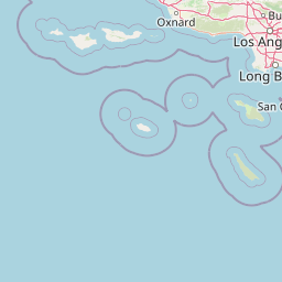
Map view of Channel Islands National Marine Sanctuary

Use this park location map to pinpoint Channel Islands National Marine Sanctuary in United States of America, understand its exact geographic position, and read its mapped placement within the surrounding landscape more clearly.

Pigeon | © OpenStreetMap contributors

Location context for Channel Islands National Marine Sanctuary

California
Recorded earthquake history

Review Recorded Earthquake Activity Near Channel Islands National Marine Sanctuary

Examine the historical record of seismic events associated with the waters of the Channel Islands National Marine Sanctuary. This archive, powered by MoriAtlas, allows for the exploration of regional seismic activity patterns through a structured, data-driven perspective of the Southern California coast.

Channel Islands National Marine Sanctuary Earthquake Records

Catalogued events

482 events

Strongest magnitude

Magnitude 5.5

Most recent event

Jun 6, 2026

This history includes earthquakes recorded inside the park or within 50 km of its borders

Visual exploration of ocean habitats, coastal cliffs, and protected marine environments

Channel Islands National Marine Sanctuary Photos and Scenery

Visual records capture the rugged topography, kelp forests, and open ocean environments defining Channel Islands National Marine Sanctuary. Examining protected area imagery provides deeper insight into the ecological convergence zones and seafloor habitats shaping the region.

A close up view of a vibrant purple and orange Spanish shawl nudibranch on a colorful, textured reef surface under water.

A black and white silhouette of a traditional Chumash plank canoe with four paddlers navigating choppy, sun-glinting ocean waters.

Satellite image showing San Miguel and Santa Rosa islands surrounded by dark green kelp beds in the Pacific Ocean, with labels indicating the locations of the islands and kelp.

Four brown pelicans standing on a rocky, white-stained coastal cliff against a bright blue sky.

An underwater close-up shot of a rocky reef covered in various sea creatures, including spiky black sea urchins and several reddish-pink sea anemones.

Underwater view of several California sea lions swimming among kelp fronds in clear blue water.

Two orcas, also known as killer whales, swimming in deep blue water near a coastal island with rocky cliffs in the background.

A northern elephant seal pup with light gray fur lying flat on a beach covered in smooth, gray pebbles.

An underwater view of a scuba diver swimming near a rocky outcrop surrounded by tall, dense kelp forest.

A humpback whale tail fluke breaking the water surface near the side of a tour boat with passengers looking on.

Park atlas

Compare surrounding regional geography and connected marine landscapes

Parks Near Channel Islands National Marine Sanctuary and Related Protected Areas

Browsing parks near Channel Islands National Marine Sanctuary helps expand regional conservation context across the Southern California coastal zone. Comparing nearby protected areas reveals broader patterns in marine productivity, island topography, and habitat diversity.
National parkCalifornia
Park boundaries overlap#1 closest

East

Channel Islands National Park: A Protected Landscape within California's Geography

Explore its unique mapped terrain and protected area context.

Channel Islands National Park stands as a key protected area, providing critical insight into California's unique geographic features and natural landscapes. This entry focuses on the park's identity as a protected entity, detailing its mapped boundaries and the surrounding regional geography. It offers an atlas-level view, essential for understanding the park's contribution to the broader landscape context of the United States and its conservation importance.

Area
1,009.94 km²
Established
1980
IUCN
II
Visitors
323.2K annual
A horizontal watercolor painting depicting a wide, winding river flowing through a coastal valley with rolling hills in the background and sparse green vegetation in the foreground.
Marine protected areaCalifornia
Park boundaries overlap#2 closest

Northwest

Chumash Heritage National Marine Sanctuary: California Marine Protected Area Atlas

Mapping coastal transition zones and submarine seafloor features

Spanning over 4,500 square miles off the Central Coast of California, the Chumash Heritage National Marine Sanctuary represents a critical ecological intersection between northern and southern marine species. The sanctuary includes dramatic underwater terrain like Arguello Canyon, Rodriguez Seamount, and the Santa Lucia Bank, creating a complex habitat that sustains kelp forests and diverse maritime resources.

Area
11,770 km²
Established
2024
IUCN
V
Relief
Mixed relief
A watercolor illustration of rolling green hills, a small shoreline, and patches of grass against a white background.
Protected landscapeCalifornia
15 km away#3 closest

East

Santa Monica Mountains National Recreation Area: Protected Landscape and Regional Geography

Exploring the ecological and cultural tapestry of Southern California's coastal mountains.

Santa Monica Mountains National Recreation Area comprises a complex array of parks and preserves that protect the unique Mediterranean climate of Southern California. The terrain showcases rugged ridgelines, deeply carved canyons, and vital coastal habitats. As a significant urban protected area, it offers an essential look at how biodiversity, human history, and regional geography coexist within one of the most populated zones in the United States.

Area
638 km²
Established
1978
IUCN
V
Visitors
795.2K annual
Watercolor painting of a mountain landscape with forested foothills and a valley in the foreground.
Protected landscapeCalifornia
28 km away#4 closest

North

Los Padres National Forest: Geography and Protected Landscape Map of Central California

Extensive wilderness corridors and high mountain ridges

Spanning from the Big Sur coastline to the interior ranges of the Santa Lucia and San Rafael mountains, Los Padres National Forest represents a significant protected area in California. The region contains deep gorges, forest-covered canyons, and high-altitude pine ridges that provide essential habitat and support major river headwaters.

Area
7,700 km²
Established
1936
Relief
Mountain
Climate
Mediterranean
A soft, painterly watercolor illustration depicting layered green mountain ridges and rolling foothills under a bright, open sky.
Protected landscapeCalifornia
70 km away#5 closest

East

Angeles National Forest: Mapped Protected Landscapes and Geographic Terrain in California

Mountain wilderness and Mediterranean watershed geography

Spanning the San Gabriel and Sierra Pelona ranges, Angeles National Forest serves as a dramatic ecological transition zone. This analysis of its protected landscape focuses on the interaction between steep canyons, high peaks, and the distinct chaparral and conifer zones that shape California geography.

Area
2,652.26 km²
Established
1908
Relief
Mountain
Climate
Mediterranean
Watercolor painting of a mountain range with a winding stream, small trees, and grassy foreground on a white background.
Wildlife reserveCalifornia
About 79 km away#6 closest

Northeast

Matilija Wilderness: A High Elevation Protected Landscape in the Santa Ynez Mountains

Rugged canyon geography and critical California condor habitat

Spanning from deep canyon bottoms to the high rocky ridges of Monte Arido, Matilija Wilderness represents a significant protected unit within California. The area encompasses a dense network of riparian habitats along Matilija Creek, forming a vital ecological corridor for wildlife and preserving the rugged terrain of the southern Santa Ynez Mountains.

Area
118.2 km²
Established
1992
IUCN
Ib
Relief
Mountain
Wildlife reserveSan Luis Obispo County
110 km away#7 closest

North

Garcia Wilderness: Mapped Boundaries and Geographic Identity in San Luis Obispo County

Studying the Santa Lucia Range ridge and forest ecosystems

Located in San Luis Obispo County, Garcia Wilderness encompasses 14,100 acres of protected coastal mountains. Its topography features a prominent east-west ridge system that dictates local drainage patterns and vegetative shifts, ranging from lower-slope chaparral to dense oak forests. This area represents a vital segment of the federal conservation efforts established to protect the central California landscape.

Area
57 km²
Established
1992
IUCN
Ib
Relief
Mountain
Watercolor painting of a mountain landscape with rolling green hills and small evergreen trees, with soft purple mountain silhouettes in the distance.
Protected landscapeCalifornia
137 km away#8 closest

East

San Bernardino National Forest: Geography and Protected Landscape Atlas

Transverse and Peninsular mountain ranges in California

Spanning over 820,000 acres, San Bernardino National Forest offers a look at one of Southern California's most significant protected landscapes. The forest features seven wilderness areas and a dramatic range of elevation, moving from arid chaparral to old-growth mixed conifer forests. Our geographic mapping traces the unique structure of four intersecting mountain ranges, detailing the terrain from deep canyons to high alpine peaks.

Area
3,333.87 km²
Established
1907
Relief
Mountain
Climate
Mediterranean

Common questions about visiting, size, designation, and location context for Channel Islands National Marine Sanctuary

Channel Islands National Marine Sanctuary FAQs for park facts, access, geography, and protected area context

Find quick answers about Channel Islands National Marine Sanctuary, including protected-area facts, park geography, trail and visitor context, and how the park fits into its surrounding country and regional landscape.
MoriAtlas Explorer

Continue Your Protected Areas Search Across the Global Atlas

Deepen your exploration by continuing the structured search for national parks and protected areas worldwide. Utilize the comprehensive filtering capabilities to compare different conservation landscapes and refine your understanding of global park geography. Discover more about the distribution and characteristics of protected natural areas.

Global natural geography