
Mori Atlas logo
Marine protected areaChurna Island

Analyzing the underwater reef systems and rocky terrain of this Arabian Sea protected area

Churna Island Marine Protected Area: Geographic Atlas and Coastal Landscape Context

Churna Island serves as a significant marine protected area within the coastal geography of Balochistan, defined by a barren rocky surface and a highly diverse submerged reef ecosystem. This atlas entry details the physical characteristics of the island, from its arid topography to the complex underwater ledges and caves that support varied marine life. By mapping the boundaries of this protected zone, visitors gain insight into the convergence of naval, recreational, and conservation interests along the Arabian Sea coast.

arabian seauninhabited islandcoral reefsmarine lifescuba divingsnorkeling
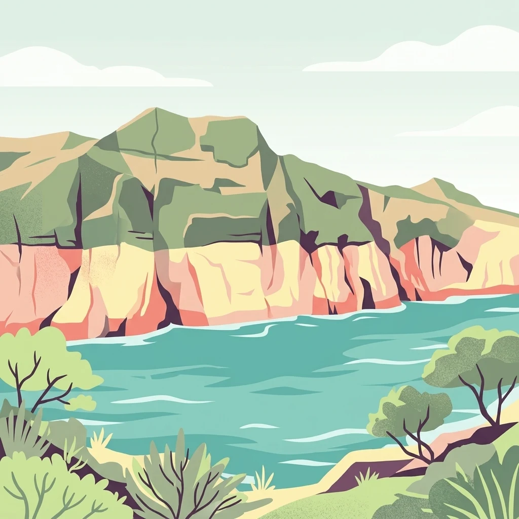
A stylized digital illustration showing rugged green and tan coastal cliffs meeting the calm turquoise waters of the Arabian Sea, with sparse vegetation in the foreground.

Churna Island

Marine protected area

Park overview

Structured park overview, official facts, and landscape profile for Churna Island

Churna Island park facts, protected area profile, and essential visitor context

Review the core facts for Churna Island, including designation, size, terrain, visitor scale, habitats, and operating context in one park-focused overview.

About Churna Island

Churna Island is a low-profile rocky islet in the Arabian Sea, situated about nine kilometers west of the Hub River mouth and roughly six kilometers from the coastal fishing settlement of Mubarak Goth, near Kiamari Town in Karachi. Although it lies only about a kilometer in length and under half a kilometer wide, with a modest maximum elevation of around ninety meters, the island has acquired an outsized identity in Pakistan's coastal geography because of what surrounds it rather than what rises above the sea. The waters encircling Churna contain a notable concentration of coral reefs and reef-associated fauna, transforming a tiny barren landmass into one of the country's most recognizable marine recreation sites.

The island's identity is shaped by a layered history of use. For decades it has functioned as a naval firing range for the Pakistan Navy, and the locality features in accounts of Pakistan Navy history. At the same time, the surrounding sea has been a working space for fishermen from Mubarak Goth, a major coastal community in Karachi that frequently lacks basic infrastructure. In more recent years, Churna has increasingly drawn recreational users: scuba divers, freedivers, underwater photographers, snorkelers, jet skiers, wake surfers, and cliff jumpers, who treat the rocky shoreline and reef platforms as a compact adventure zone only a short boat ride from the city.

Recognition of the island's ecological importance marks a new chapter. In September 2024, the Government of Balochistan formally designated Churna as Pakistan's second Marine Protected Area, following the earlier designation of Astola Island. The protected status reflects the presence of extensive coral coverage, large numbers of reef fish species, and several notable marine vertebrates, while also signaling unresolved tensions between conservation goals and continued industrial, recreational, and fishing pressure along this stretch of coast.

Quick facts and research context for Churna Island

Churna Island is located in the Arabian Sea off the coast of Karachi in southern Pakistan, administratively part of the Sindh-side maritime zone near the Balochistan border. It is uninhabited, roughly 1.2 kilometers long and 0.5 kilometers wide, forming part of the small Churna-Kaio Islands group. Its waters support over fifty species of corals and a wide range of reef-associated fish, which is the foundation of its appeal for diving and game fishing.

The island has a tropical semi-arid climate moderated by the surrounding sea, with relatively stable temperatures and limited rainfall. Designated as a Marine Protected Area in 2024, Churna sits within Pakistan's broader push to expand marine conservation along its Arabian Sea coastline.

Protection and recognition

Documented marine conservation scope and established designation year metrics

Churna Island Protection Status and Marine Reserve Designation History

Churna Island maintains a recorded marine protection scope established in 2024 without transboundary status or imported international recognition sources. Structured facts outline the official designation timeline for this protected area to support geographic research.

Protection details

Protection scope
Marine
Designated year
2024
Transboundary protection
No
Park context

Deeper park guide and search-rich context for Churna Island

Churna Island history, landscape, wildlife, and travel context

Explore Churna Island through its history, landscape character, ecosystems, wildlife, conservation priorities, cultural context, and seasonal travel timing in a structured park guide built for atlas discovery and search intent.

Why Churna Island stands out

Churna Island is most renowned for the diversity of its surrounding coral reefs and reef-associated marine life, which has made it a focal point for scuba diving, snorkeling, and game fishing near Karachi. The waters around the island host more than fifty coral species and an exceptionally varied community of pelagic and reef fish, supported in part by artificial reef structures and natural formations. It is also recognized as one of the first locations in Pakistani waters where living large cetaceans, including a blue whale and killer whale, have been directly observed at the surface.
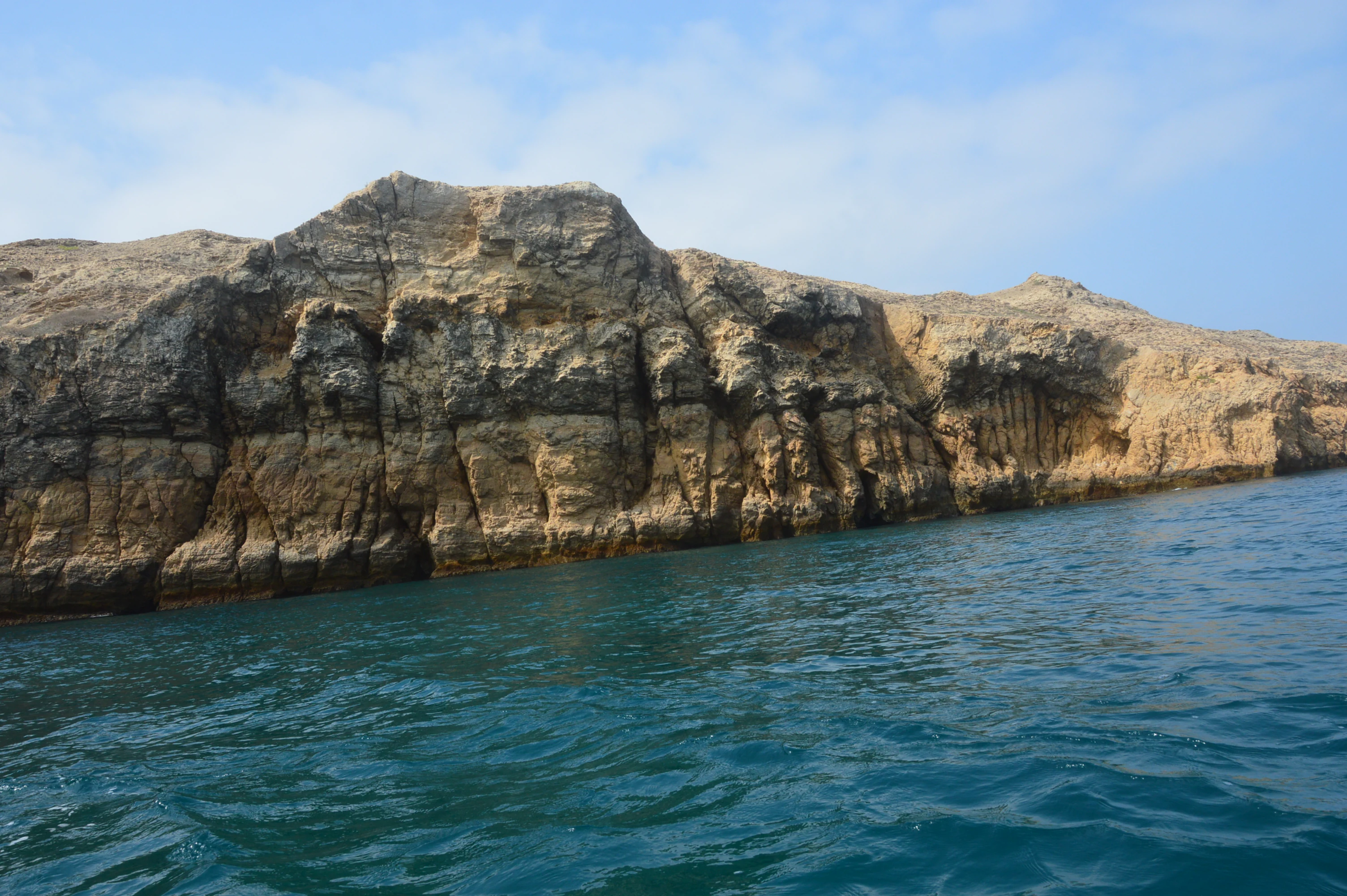
A low-angle view of the steep, light-brown, stratified cliffs of Churna Island against a bright sky, meeting the turquoise water of the Arabian Sea.
The rugged rocky cliffs of Churna Island rising from the Arabian Sea.

Churna Island history and protected-area timeline

Churna Island has acquired a distinct strand of modern history through its longstanding association with the Pakistan Navy, which has used the island as a firing range and has cited it in naval accounts and books. The surrounding waters have long been worked by fishermen from the nearby village of Mubarak Goth, one of Karachi's larger coastal fishing localities. Beyond these overlapping military and fishing uses, the island gained wider public recognition through recreational diving and confirmed cetacean sightings in 2017, and ultimately through its formal designation as a Marine Protected Area in September 2024.

Churna Island landscape and geographic character

Above the waterline, Churna is a small, dry, rocky island with a maximum elevation of around ninety meters and no trees or shrubs. Its surface is barren and exposed, shaped by wind, salt spray, and an arid coastal climate, giving it the character of an austere rocky outcrop rather than a vegetated landmass.

Below the waterline, the landscape changes dramatically. Submerged rocky platforms and reef structures form the basis of coral colonies and associated habitat, creating an underwater terrain of cliffs, ledges, caves, and overhangs that divers describe as varied and visually rich. The contrast between the bare, compact island silhouette and the textured reef system beneath the surface is central to the area's identity.

Churna Island ecosystems, habitats, and plant life

The defining natural feature of Churna Island is the marine ecosystem that surrounds it rather than the landmass itself, which is described as having no trees or shrubs and very limited terrestrial vegetation. The waters support more than fifty coral species across reef formations, with reports suggesting that some coral coverage expanded after the 2004 Indian Ocean tsunami disrupted earlier reef structure and allowed new colonies to establish.

The marine environment is fundamentally reef-based, but it is also shaped by proximity to open Arabian Sea conditions. Pelagic and demersal species mix across the area, and the reef framework provides shelter for invertebrates such as sea urchins, sea fans, and oysters. The result is a relatively compact but ecologically layered marine zone within easy reach of Karachi.

Churna Island wildlife and species highlights

Churna Island's waters host a rich mix of marine life centered on its coral reefs. Reef fish communities include angelfish, barracuda, cobia, mahi-mahi, narrow-barred Spanish mackerel, and skipjack tuna, while rays and the rare green turtle also move through the area. Larger pelagic visitors have been documented as well: a mother blue whale and calf were observed near the island in September 2017, marking the first confirmed sighting of a living blue whale in Pakistani waters, and a killer whale was recorded nearby in November 2017, the first local sighting since 2003.

Churna Island conservation status and protection priorities

Churna Island became Pakistan's second Marine Protected Area in September 2024, designated by the Government of Balochistan following Astola Island's earlier recognition. The designation explicitly aims to protect coral diversity, reef-associated fish, and other marine vertebrates around the island, while aligning Pakistan with international commitments such as the Kunming-Montreal Global Biodiversity Framework and its goal of protecting thirty percent of marine areas by 2030.

Despite this protected status, the island faces heavy and ongoing pressure. Industrial facilities such as power plants and oil refineries operate along the broader coastal zone, contributing to marine pollution, while unregulated recreational activities including diving, jet skiing, and boat traffic continue around the reef. Conservation of Churna therefore centers on balancing the island's ecological value with intense human activity on its doorstep.

Top sights and standout views in Churna Island

Churna Island's standout qualities are its reef-rich waters, its accessibility from Karachi for diving and water sports, and its growing profile as a site of confirmed large-whale sightings in Pakistani waters. The 2024 Marine Protected Area designation adds formal conservation weight to an island that is simultaneously a naval training space, a recreational playground, and a working sea for coastal fishing communities.

Equally distinctive is the contrast the island presents between a barren, shrub-free rocky surface and a vibrant submerged reef system. This combination, along with the reef's role as habitat for game fish, makes Churna a focal point for both conservation policy and recreational marine activity along Pakistan's Arabian Sea coast.

Best time to visit Churna Island

The most favorable period to visit Churna Island is from October to March, when cooler temperatures and calmer sea conditions support snorkeling, scuba diving, and boat-based activities. Outside these months, the climate becomes hotter from April onward, and the surrounding waters may be less suitable for surface recreation. Visitors should also be aware that jellyfish are reported in large numbers around the island during October, which can affect swimming and diving comfort.
Monthly climate preview

Examine long-term representative temperature and precipitation patterns for Churna Island

Churna Island Climate Normals and Annual Weather by Month Overview

Long-term NASA Power climatology records outline the measured annual temperature and precipitation rhythm across representative coordinates in Balochistan. Exploring the complete twelve-month dataset clarifies monthly thermal shifts and precipitation variations in greater detail.
Annual mean26 °C
20 °C30 °C
Jan20°
Feb21°
Mar24°
Apr27°
May30°
Jun30°
Jul30°
Aug29°
Sep28°
Oct28°
Nov25°
Dec21°
Warmest month
June

30.5 °C

Coolest month
January

19.7 °C

Wettest month
August

1.8 mm/day

Driest month
April

0 mm/day

Park location guide

Geography guide, regional context, and park location map for Churna Island

Churna Island park geography, regions, and map view in Pakistan

Understand where Churna Island sits in Pakistan through a broader geographic reading of the surrounding landscape, nearby location context, and its mapped position within the national park landscape.

How Churna Island fits into Pakistan

Pakistan, officially the Islamic Republic of Pakistan, is a federal parliamentary Islamic republic in South Asia. It is the fifth-most populous country and the 33rd-largest by area. The country gained independence from British India in 1947 and has a diverse history spanning ancient civilizations including Mehrgarh and the Indus Valley Civilisation. Pakistan shares maritime borders with Oman and is bounded by the Arabian Sea, Gulf of Oman, and several neighboring countries.

Wider geography shaping Churna Island in Pakistan

Pakistan is located in South Asia, bordered by the Arabian Sea to the south, the Gulf of Oman to the southwest, and shares land borders with India to the east, Afghanistan to the west, Iran to the southwest, and China to the northeast. The country also shares a maritime border with Oman in the Gulf of Oman. The Wakhan Corridor in Afghanistan separates Pakistan from Tajikistan in the northwest.

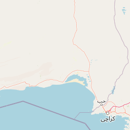
Map view of Churna Island

Use this park location map to pinpoint Churna Island in Pakistan, understand its exact geographic position, and read its mapped placement within the surrounding landscape more clearly.

Pigeon | © OpenStreetMap contributors

Location context for Churna Island

Balochistan

Visualizing the stark rocky surface and vibrant coral ecosystems of Pakistan's coastal marine reserve

Churna Island Photos and Scenery: Exploring Marine Landscapes and Protected Reef Habitats

Visual documentation reveals the sharp contrast between the dry rocky outcrop above the surface and the complex coral reef terrain submerged below. Examining these protected habitats provides clear insight into the marine geography and ecological character of the surrounding Arabian Sea environment.

A low-angle view of the steep, light-brown, stratified cliffs of Churna Island against a bright sky, meeting the turquoise water of the Arabian Sea.

Park atlas

Compare adjacent coastal environments and surrounding regional reserves

Parks Near Churna Island and Other Protected Marine Reserves

Browse other parks near Churna Island to examine related marine protected areas and coastal reserves across the surrounding region. Extended geographic comparison helps place isolated marine habitats within a broader conservation context.
Protected areaBalochistan
About 81 km away#1 closest

Northwest

Miani Hor Protected Area: Coastal Lagoon Mapping and Regional Geography in Balochistan

Coastal lagoon and unique mangrove wetland ecosystem

Miani Hor functions as a major tidal lagoon and protected wetland along the Balochistan coast. The area is defined by its extensive mangrove forests and connection to the Arabian Sea, providing a essential study in estuarine geography and wetland conservation within the Lasbela District.

Area
74.71 km²
Established
2001
Relief
Lowland
Scope
Mixed
National parkBalochistan
About 91 km away#2 closest

Northwest

Hingol National Park: Pakistan's Unique Protected Landscape and Geological Atlas

Discover dramatic rock formations and coastal geography.

Hingol National Park stands as a monumental protected landscape within Balochistan, Pakistan, offering an unparalleled atlas view of geological diversity. Renowned for its hoodoos like the Princess of Hope and the Balochistan Sphinx, the park also features active mud volcanoes and striking coastal semi-desert terrain. The confluence of the Hingol River with the Arabian Sea creates important wetland habitats. This national park provides a rich context for exploring unique natural formations and regional geography, making it a significant point of discovery within Pakistan's protected areas.

Area
6,100 km²
Established
1988
IUCN
II
Relief
Mixed relief
A wide watercolor painting showing a body of water in the foreground, green trees and shrubs in the middle ground, and rolling hills in the background under a pale sky.
Protected areaThatta District
About 120 km away#3 closest

East

Haleji Lake Protected Area: Mapping Wetlands and Freshwater Ecosystems in Thatta District

A significant freshwater reservoir and Ramsar site in southern Sindh, Pakistan.

Situated in the low-lying plains of Thatta District, Haleji Lake functions as an essential freshwater sanctuary for migratory bird species. The site features a distinct mosaic of managed reservoirs, fringing marshes, and brackish lagoons, offering a unique look at the interaction between water engineering and natural wetland conservation in the Indus basin.

Area
6.58 km²
Established
1943
Relief
Lowland
Scope
Terrestrial
National parkPakistan
About 133 km away#4 closest

Northeast

Kirthar National Park: Discover Pakistan's Arid Mountain Protected Landscape

Explore the mapped geography and unique terrain of this vital national park.

Kirthar National Park represents a critical expanse of protected semi-arid mountainous terrain in southern Pakistan, covering over 3,000 square kilometers. It is recognized for its significant populations of Sindh ibex, urial, and chinkara gazelles, alongside a diverse array of raptors, including migratory vulture and eagle species. The park's unique landscape, characterized by parallel ridges and deep, dry valleys, provides crucial habitat in a region facing considerable development pressures, offering a distinct geographical context for protected area exploration.

Area
3,087 km²
Established
1974
IUCN
II
Relief
Mountain
Watercolor painting of a calm lake with grassy foreground, small islands, and distant hills under a soft light.
Wildlife reserveSindh
About 147 km away#5 closest

East

Keenjhar Lake Wildlife Reserve: Sindh Province Protected Wetland and Geographic Atlas

Mapped freshwater wetland and regional wildlife sanctuary

Keenjhar Lake is a prominent freshwater wetland and wildlife reserve in the Thatta District of Sindh. This expansive basin serves as a key ecological anchor for migratory waterbirds and a central feature of the regional landscape. The area combines significant hydrological value with distinct cultural history, providing a unique look into the protected geography of southeastern Pakistan.

Area
134.68 km²
Relief
Lowland
Scope
Terrestrial
Water
Water-dominated
A soft watercolor illustration of a coastal landscape with rocky terrain in the foreground and a calm bay in the distance.
Wildlife reserveBalochistan
About 201 km away#6 closest

West

Ormara Turtle Beaches Wildlife Reserve: Mapping Coastal Protected Habitats in Balochistan

Coastal sandy terrain and protected marine nesting environments

Examine the geography of Ormara Turtle Beaches, a 10 km protected sandy coastline on the Arabian Sea. The reserve offers clear insights into the marine-focused ecosystems and arid landscape character found along the Balochistan Makran coast, serving as a primary site for turtle nesting research and coastal conservation mapping.

Area
24 km²
Established
2001
Relief
Lowland
Climate
Subtropical
Nature reserveSindh
About 212 km away#7 closest

Northeast

Pai Forest Nature Reserve: Geography and Protected Landscape Context in Sindh

An Indus floodplain reserve featuring arid and riverine flora

Pai Forest in Sindh offers a distinctive study of protected landscapes where canal irrigation sustains both riverine and arid plant communities. This reserve functions as a vital ecological island amidst agricultural plains, providing a rich case for exploring the interaction between water management and natural terrain within the Indus valley geography.

Relief
Lowland
Climate
Arid
Scope
Terrestrial
Water
Major water bodies
Wildlife reserveSindh
About 219 km away#8 closest

East

Jubho Lagoon Wildlife Reserve: Coastal Wetland Geography and Regional Map Context

Mapping brackish lagoons and migratory bird habitats in Sindh

Investigate the protected landscape of Jubho Lagoon, a shallow brackish wetland in southern Sindh. The area features a complex mosaic of tidal inlets, exposed mudflats, and freshwater-influenced marshes that serve as a primary regional habitat for migratory flamingos and pelicans.

Area
7.06 km²
Established
2001
Relief
Lowland
Scope
Terrestrial

Common questions about visiting, size, designation, and location context for Churna Island

Churna Island FAQs for park facts, access, geography, and protected area context

Find quick answers about Churna Island, including protected-area facts, park geography, trail and visitor context, and how the park fits into its surrounding country and regional landscape.
MoriAtlas Explorer

Continue Your Protected Areas Search Across the Global Atlas

Deepen your exploration by continuing the structured search for national parks and protected areas worldwide. Utilize the comprehensive filtering capabilities to compare different conservation landscapes and refine your understanding of global park geography. Discover more about the distribution and characteristics of protected natural areas.

Global natural geography