
Mori Atlas logo
Nature reserveCook Island Nature Reserve

A strictly conserved offshore island sanctuary defining the ecological character of the northern New South Wales coast.

Cook Island Nature Reserve: Coastal Geography and Protected Island Landscapes in New South Wales

Cook Island Nature Reserve stands as a compact, strictly protected island environment located 600 metres off the headland of Fingal Head in far northern New South Wales. This isolated coastal refuge preserves essential closed scrub vegetation and serves as a critical breeding ground for seabird colonies, including wedge-tailed shearwaters and crested terns. Its offshore geography and integrated connection to adjacent marine waters establish a distinct conservation boundary within the broader Australian coastal network.

coastal reserveseabird breedingoffshore islandstrict nature reserveIUCN Category Iaclosed scrub
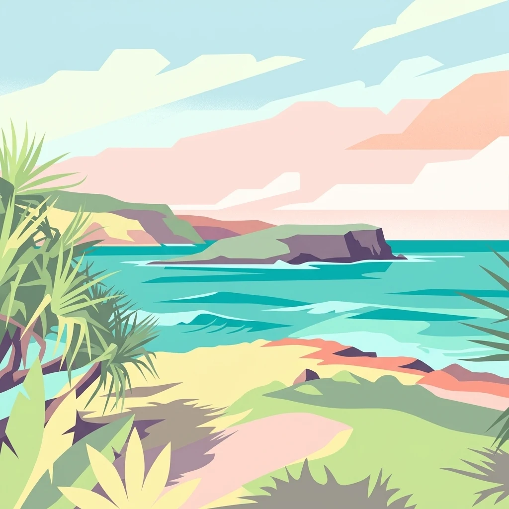
A stylized digital illustration of a coastal landscape with a small, steep island offshore, turquoise water, and tropical foliage in the foreground.

Cook Island Nature Reserve

Nature reserve

Park overview

Structured park overview, official facts, and landscape profile for Cook Island Nature Reserve

Cook Island Nature Reserve park facts, protected area profile, and essential visitor context

Review the core facts for Cook Island Nature Reserve, including designation, size, terrain, visitor scale, habitats, and operating context in one park-focused overview.

About Cook Island Nature Reserve

Cook Island Nature Reserve is a compact but ecologically important protected area on the far north coast of New South Wales, Australia. It occupies Cook Island, a small island situated roughly 600 metres offshore from Fingal Head and about four kilometres south-east of Tweed Heads. Although the reserve covers only around five hectares, its combination of intact island vegetation, seabird breeding habitat, and proximity to a surrounding aquatic reserve gives it an outsized conservation value for the region.

Managed by the NSW National Parks and Wildlife Service, the reserve is classified as an IUCN Category Ia strict nature reserve, the most protection-focused category in the international system. This designation reflects its purpose as a conservation area rather than a destination for recreation. Access to the island is difficult, and this limited accessibility has helped maintain the natural condition of both the vegetation and the wildlife populations, particularly the burrowing and nesting seabirds.

Its location along a dynamic stretch of the New South Wales coast, close to the Queensland border, places the reserve within a broader mosaic of coastal and marine protected areas. Together with the adjoining aquatic reserve, Cook Island Nature Reserve contributes to the protection of a small but ecologically meaningful section of Australia's eastern coastline, reinforcing both seabird habitat and the integrity of nearshore island environments in the region.

Quick facts and research context for Cook Island Nature Reserve

Cook Island Nature Reserve is located just off the coast of northern New South Wales, near Fingal Head and Tweed Heads, and is administered by the NSW National Parks and Wildlife Service.

It encompasses the entire island of Cook Island down to the mean high water mark and is classified as a strict nature reserve, reflecting its conservation-driven rather than visitor-driven purpose. The reserve is surrounded by the Cook Island Aquatic Reserve, extending protection into the surrounding marine waters.

Protection and recognition

Terrestrial conservation scope, designation history, and recognition data

Cook Island Nature Reserve Protection Status and Governance Record

Cook Island Nature Reserve maintains a documented terrestrial protection scope without imported international recognition sources. Review the structured conservation status, designation records, and management parameters associated with the protected area.

Protection details

Protection scope
Terrestrial
Transboundary protection
No
Park context

Deeper park guide and search-rich context for Cook Island Nature Reserve

Cook Island Nature Reserve history, landscape, wildlife, and travel context

Explore Cook Island Nature Reserve through its history, landscape character, ecosystems, wildlife, conservation priorities, cultural context, and seasonal travel timing in a structured park guide built for atlas discovery and search intent.

Why Cook Island Nature Reserve stands out

Cook Island Nature Reserve is best known for its seabird breeding habitat, particularly for crested terns and wedge-tailed shearwaters, and for the well-preserved closed scrub vegetation that shelters those nesting colonies. Its offshore island setting, small protected size, and strict reserve status also give it a clear identity as a low-disturbance refuge within the New South Wales coastal protected-area network.
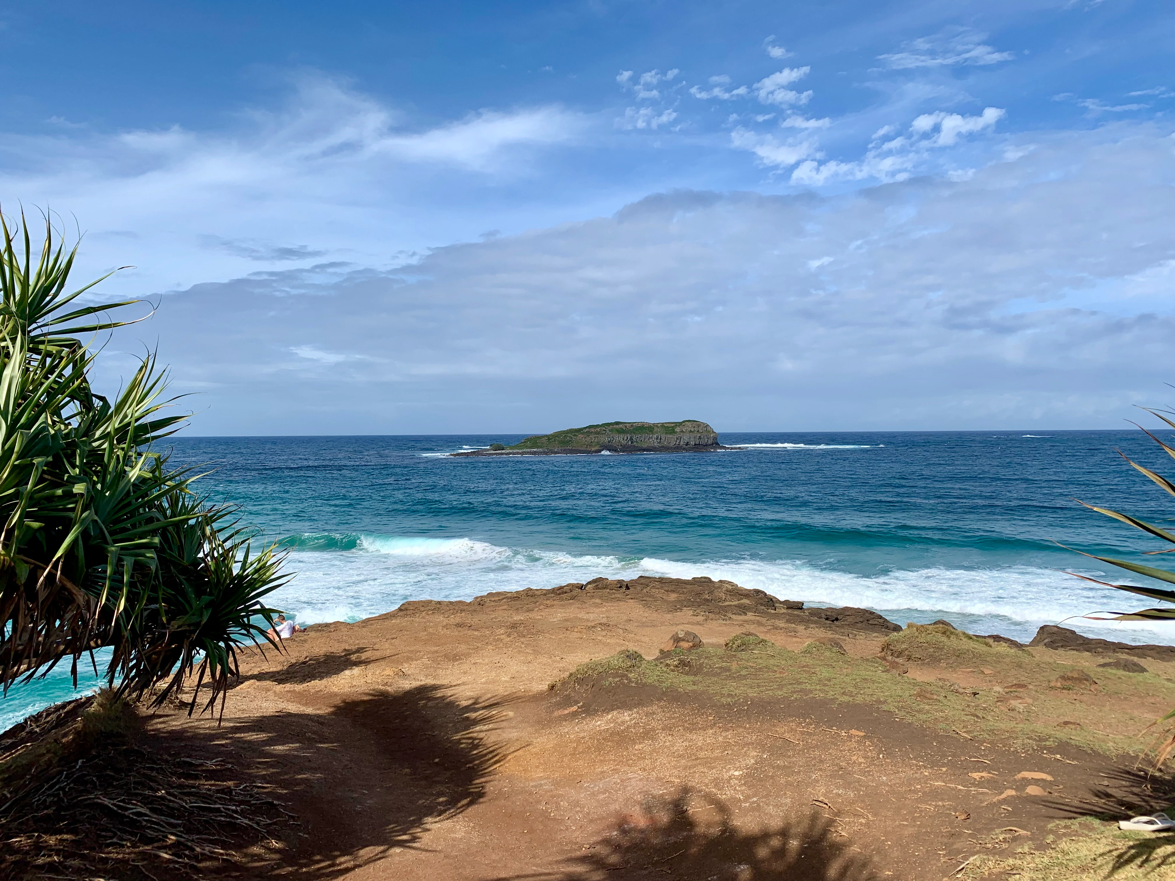
A distant view of Cook Island sitting in the blue ocean, framed by coastal vegetation and a sandy cliffside in the foreground under a partly cloudy sky.
A scenic view of Cook Island off the coast of New South Wales, seen from Fingal Head.

Cook Island Nature Reserve history and protected-area timeline

The land that now forms Cook Island Nature Reserve was first proclaimed as a fauna reserve on 8 August 1959 under the Fauna Protection Act 1948, recognising the island's importance for breeding seabirds and native island vegetation at an early stage of New South Wales conservation history.

In 1967, the reserve's legal basis changed when it was reconstituted as a nature reserve under the National Parks and Wildlife Act 1967, bringing it into the modern framework of New South Wales protected-area management. A 1978 description of the reserve documented its seabird breeding values and the natural condition of its vegetation, and in the same year the area was listed on the now-defunct Register of the National Estate, formally acknowledging its heritage and ecological significance at a national level.

Cook Island Nature Reserve landscape and geographic character

Cook Island Nature Reserve occupies a small offshore island along the far northern New South Wales coast, separated from the mainland by roughly 600 metres of sea near the prominent headland of Fingal Head. The island is surrounded by marine waters that fall within the adjacent Cook Island Aquatic Reserve, reinforcing the combined land and sea character of the protected landscape.

The terrain is shaped by its setting as a coastal island, with vegetation extending across its surface and providing shelter across the relatively small land area. Wave action, salt spray, and exposure to coastal weather influence the physical character of the island, while the surrounding waters play a defining role in shaping both the island's ecology and its broader landscape context within the Tweed Heads region.

Cook Island Nature Reserve ecosystems, habitats, and plant life

The natural environment of Cook Island Nature Reserve is dominated by closed scrub vegetation that covers much of the island, forming a dense plant canopy that has been maintained largely in its natural condition thanks to limited human access.

This vegetation provides important shelter for breeding seabirds and contributes to the ecological integrity of the island. The combination of relatively undisturbed island flora and the surrounding marine environment protected by the adjacent aquatic reserve creates a small but coherent ecological unit, supporting nesting habitat and contributing to the broader health of coastal ecosystems in northern New South Wales.

Cook Island Nature Reserve wildlife and species highlights

The wildlife values of Cook Island Nature Reserve centre on its role as breeding habitat for seabirds, including two species of particular note. The crested tern, recognised as an international migratory bird, breeds on the island, and the reserve also supports a large population of wedge-tailed shearwaters, which use the island's vegetation and soils for nesting.

The intact closed scrub of the island provides crucial shelter for these nesting colonies, and the difficult access to the island has helped reduce disturbance, supporting stable breeding conditions. The surrounding marine environment of the Cook Island Aquatic Reserve further enhances the area's significance for seabirds that depend on both terrestrial nesting sites and productive nearshore waters for feeding.

Cook Island Nature Reserve conservation status and protection priorities

Cook Island Nature Reserve is significant from a conservation perspective because it protects a small, intact island ecosystem that includes both terrestrial vegetation and seabird breeding habitat. Its designation as an IUCN Category Ia strict nature reserve reflects a focus on conservation outcomes rather than recreation, and the limited accessibility of the island has helped preserve its natural condition over time.

The reserve's importance is reinforced by its surrounding designation as the Cook Island Aquatic Reserve, creating a combined terrestrial and marine protection framework for the area. Its inclusion on the Register of the National Estate in 1978 recognised its broader heritage and ecological value, while its ongoing role in supporting migratory and breeding seabirds gives it continued conservation relevance within the New South Wales protected-area network.

Top sights and standout views in Cook Island Nature Reserve

Among Cook Island Nature Reserve's standout qualities are its strict nature reserve status, its seabird breeding importance for crested terns and wedge-tailed shearwaters, and the natural condition of its island vegetation. The protective pairing of the nature reserve with the surrounding Cook Island Aquatic Reserve further adds to its significance, offering a layered land-and-sea protection model in a compact offshore setting.

Best time to visit Cook Island Nature Reserve

Cook Island Nature Reserve is a strict nature reserve managed primarily for conservation rather than visitor access, and meaningful visitation is minimal. Seasonal timing is therefore less relevant than for typical recreational parks, with accessibility generally limited year-round due to the difficulty of reaching the island and to its protected status, which prioritises the integrity of breeding seabirds and vegetation over public use.

Monthly climate preview

Long-term representative monthly temperature and precipitation rhythm

Cook Island Nature Reserve Climate Normals and Annual Weather Patterns

Cook Island Nature Reserve exhibits a measured annual temperature range from roughly eighteen to twenty-five degrees Celsius alongside varying monthly precipitation rates. Reviewing the complete twelve-month climate profile reveals detailed long-term averages sampled from representative protected coordinates.
Annual mean22 °C
18 °C25 °C
Jan25°
Feb25°
Mar25°
Apr23°
May21°
Jun19°
Jul18°
Aug19°
Sep20°
Oct21°
Nov23°
Dec24°
Warmest month
February

25.2 °C

Coolest month
July

18.5 °C

Wettest month
February

5.7 mm/day

Driest month
September

1.2 mm/day

Park location guide

Geography guide, regional context, and park location map for Cook Island Nature Reserve

Cook Island Nature Reserve park geography, regions, and map view in Australia

Understand where Cook Island Nature Reserve sits in Australia through a broader geographic reading of the surrounding landscape, nearby location context, and its mapped position within the national park landscape.

How Cook Island Nature Reserve fits into Australia

Australia is a constitutional monarchy and federal parliamentary democracy comprising six states and ten territories. With a population of nearly 28 million, it is one of the world's most urbanised countries, with most people concentrated on the eastern seaboard. The country has a high Human Development Index and is known for its cultural diversity, ancient Aboriginal heritage, and unique wildlife.

Wider geography shaping Cook Island Nature Reserve in Australia

Australia occupies the entire Australian continent, the island of Tasmania, and numerous smaller islands. It is the world's flattest and driest inhabited continent, featuring vast deserts in the interior (the Outback), tropical rainforests along the eastern coast, and a coastline bordering the Indian and Pacific Oceans.

Map view of Cook Island Nature Reserve

Use this park location map to pinpoint Cook Island Nature Reserve in Australia, understand its exact geographic position, and read its mapped placement within the surrounding landscape more clearly.

Pigeon | © OpenStreetMap contributors

Location context for Cook Island Nature Reserve

New South Wales

Visual reference collection highlighting coastal terrain, native scrub habitats, and offshore marine boundaries.

Cook Island Nature Reserve Photos, Scenery, and Protected Island Landscapes

Visual records capture the distinctive coastal terrain, dense closed scrub vegetation, and surrounding marine waters that define Cook Island Nature Reserve. Photographic documentation reveals the undisturbed character of this offshore sanctuary, providing clear insight into its protected island environment and seabird habitats.

A distant view of Cook Island sitting in the blue ocean, framed by coastal vegetation and a sandy cliffside in the foreground under a partly cloudy sky.

Park atlas

Compare adjacent coastal landscapes and regional protected areas across northern New South Wales.

Explore Other Parks Near Cook Island Nature Reserve and Surrounding Protected Areas

Continue browsing other parks near Cook Island Nature Reserve to examine connected coastal reserves and regional habitats. Expanding the geographic scope helps trace broader protected-area networks and coastal conservation patterns throughout the surrounding region.
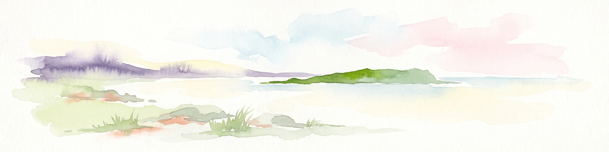
A soft watercolor painting depicting a coastal landscape with a green island in the middle ground and a pale sky above.
Marine protected areaNew South Wales
About 0.2 km away#1 closest

South

Cook Island Aquatic Reserve: Marine Protected Area and Coastal Geography Overview

Mapped marine landscapes on the New South Wales coast.

Cook Island Aquatic Reserve features a compact but ecologically rich seascape surrounding a rocky island near Fingal Head. This marine protected area demonstrates a precise zoned management strategy, preserving critical shark habitats and varied reef communities at the intersection of tropical and temperate maritime zones.

Area
0.74 km²
Established
1998
Relief
Lowland
Climate
Subtropical
Nature reserveNew South Wales
About 3 km away#2 closest

West

Ukerabagh Island Nature Reserve: Mapped Geography and Protected Estuarine Landscapes

Coastal river island habitat in Northern New South Wales

Ukerabagh Island Nature Reserve offers a distinct look at tidal estuarine environments and coastal vegetation. This 125 hectare protected area acts as a sanctuary for bird populations and preserves remnant littoral rainforests within the lower Tweed River, providing a clear view into the ecological character of this southeastern Australian coastal region.

Area
1.25 km²
Established
1983
IUCN
Ia
Relief
Lowland
Nature reserveNew South Wales
About 11 km away#3 closest

Southwest

Stotts Island Nature Reserve: Mapping Protected Rainforest Landscapes in Northern New South Wales

A fluvial river island refuge within the Tweed River valley.

Stotts Island Nature Reserve stands as a significant protected area in New South Wales, preserving a rare, intact block of lowland subtropical rainforest. As a dynamic river island shaped by alluvial deposits and flood cycles, the reserve functions as critical habitat for local species while maintaining a distinct forest canopy against the backdrop of the heavily developed Tweed Valley floodplain.

Area
1.41 km²
Established
1971
IUCN
Ia
Relief
Lowland
National parkQueensland
About 15 km away#4 closest

West

Nicoll Scrub National Park: Queensland National Park Geography and Landscape

Explore the mapped boundaries and regional context of this protected area.

Nicoll Scrub National Park is a designated national park contributing to the rich protected landscape tapestry of Queensland, Australia. This entry provides detailed information focused on its geographic identity, allowing for atlas-style exploration of its mapped boundaries and its role within the state's natural geography. Understand the specific context of this park as a protected natural area.

Area
0.27 km²
Established
1986
IUCN
II
Relief
Mountain
National parkQueensland
About 16 km away#5 closest

Northwest

Burleigh Head National Park: Queensland National Park Geographic Atlas

Explore mapped boundaries and regional landscape context.

Delve into the specifics of Burleigh Head National Park, a protected national park located in Queensland, Australia. This detail page offers a focused view on its geographic setting and landscape characteristics, enabling atlas-based discovery. Understand the park's protected area status and its role within the regional geography of northeastern Australia, providing clear context for map-oriented exploration.

Area
0.3 km²
Established
1994
IUCN
II
Visitors
1.2M annual
National parkNew South Wales
About 22 km away#6 closest

Southwest

Mooball National Park: Protected Landscape Identity and Geographic Context in New South Wales

Atlas exploration of its mapped boundaries and regional setting.

Mooball National Park is a key protected area within New South Wales, Australia, offering a distinct focus for atlas and geography exploration. This detail page illuminates its identity as a national park, detailing its mapped geographic presence and the surrounding regional context. Understand the protected landscape's characteristics and its unique position within the broader atlas of Australian natural reserves.

Area
12 km²
Established
1999
IUCN
II
Relief
Lowland
National parkQueensland
About 22 km away#7 closest

West

Springbrook National Park National Park: Exploring Queensland's Protected Landscape Atlas

Mapped boundaries and regional geographic context for this Australian national park.

Springbrook National Park serves as a vital entry for understanding protected landscapes within Queensland, Australia. As a national park, it offers a distinct geographic profile, contributing to the broader atlas of conservation areas in northeastern Australia. Users can explore its specific mapped boundaries and appreciate its role in the regional geography, providing a factual basis for understanding the distribution and character of Australia's natural parklands.

Area
61.56 km²
Established
1990
IUCN
II
Relief
Mountain
National parkNew South Wales
About 30 km away#8 closest

Southwest

Mount Jerusalem National Park: Ancient Volcanic Terrain and Protected Landscape Discovery in New South Wales

Explore its mapped geography and Albert's lyrebird habitat.

Mount Jerusalem National Park stands as a key protected area within the dramatic landscape of New South Wales. Situated on the eroded outer rim of the ancient Tweed Caldera, the park showcases distinctive volcanic terrain shaped over millions of years. Its protected boundaries encompass vital habitats, notably supporting significant populations of Albert's lyrebird, and contribute to the watershed dynamics of the Tweed, Brunswick, and Richmond River systems, offering a rich focus for geographic and landscape exploration.

Area
52 km²
Established
1995
IUCN
II
Relief
Mountain

Common questions about visiting, size, designation, and location context for Cook Island Nature Reserve

Cook Island Nature Reserve FAQs for park facts, access, geography, and protected area context

Find quick answers about Cook Island Nature Reserve, including protected-area facts, park geography, trail and visitor context, and how the park fits into its surrounding country and regional landscape.
MoriAtlas Explorer

Continue Your Protected Areas Search Across the Global Atlas

Deepen your exploration by continuing the structured search for national parks and protected areas worldwide. Utilize the comprehensive filtering capabilities to compare different conservation landscapes and refine your understanding of global park geography. Discover more about the distribution and characteristics of protected natural areas.

Global natural geography