
Trip Timing
Best time to visit: the short answer for Cradle Mountain Lake St Clair National Park
For most visitors, the best time to visit Cradle Mountain Lake St Clair National Park is during the austral summer months of December, January, and February. This period provides the most consistent weather, with the warmest mean temperatures and the longest daylight hours of the year. During these months, the alpine environment is at its most accessible, offering higher prospects for clear views of iconic landscapes like Dove Lake and the jagged peaks of the surrounding range. While summer brings the mildest conditions, it is critical for travellers to understand that this park is located in a high-elevation environment where weather patterns remain inherently volatile regardless of the calendar date.
Balancing Weather with Park Experience
Choosing when to go involves a fundamental trade-off between predictable daylight and the reality of Tasmania's highland climate. While the summer months offer peak daylight reaching nearly fifteen hours in December, the rapid onset of weather changes means that warm, sunny conditions can be interrupted by cold fronts or even light snow within a few hours. The park's climate is defined by high moisture throughout the year, with precipitation occurring frequently across all seasons. Visitors who prioritize long, stable days for hiking the Overland Track or exploring alpine heaths will find the summer window most rewarding, though they must prepare for the possibility of varied weather even during the warmest weeks.
Understanding Alpine Variability
Rather than searching for a single, perfect month, it is more effective to frame your trip around the level of exposure you are comfortable with. The shoulder months of late spring and early autumn often see lower crowds and the potential for cooler, crisp conditions that can be equally spectacular for photography and nature observation. However, as winter approaches, the increase in precipitation and lower temperatures mean that some higher-altitude tracks may become more challenging or obscured by cloud and mist. The park's significant elevation means that temperature and wind conditions are consistently more demanding than in surrounding low-lying areas. Regardless of when you choose to visit, the primary planning imperative is to account for rapid shifts in local conditions. Always approach your itinerary with a flexible mindset and ensure your gear is appropriate for wet, windy, and cold weather, as these are the defining characteristics of this alpine wilderness, even when the seasonal trends are in your favour.
Seasonal Planning
Best Months to Visit Cradle Mountain Lake St Clair National Park at a Glance
Peak Visiting Windows: December to February
The most popular time to visit the park aligns with the austral summer, when daylight hours peak near 15 hours and average maximum temperatures reach their highest point of roughly 23 to 26 degrees Celsius. This window provides the most reliable conditions for high-alpine traverses and extended outdoor activities. However, travellers must weigh these favourable daylight hours against the reality that alpine weather remains highly volatile, and snow can occur even during the height of summer. Visitors during this period should prioritise early starts to avoid the most intense UV exposure and to manage potential afternoon temperature drops.
Transition Seasons: October to November and March to April
The shoulder months offer a distinct trade-off between daylight and stability. During October and November, the landscape experiences the transition toward summer, with daylight expanding rapidly and temperatures climbing. These months can be excellent for those who wish to avoid the peak crowds of the summer holiday period while still benefiting from milder weather. Conversely, March and April see a contraction in daylight and a shift toward cooler average temperatures, often accompanied by increased moisture. These months are often favoured by experienced hikers who prefer the bracing, crisp conditions of autumn over the variable summer heat.
The Cool and Variable Winter Period: May to September
Winter in the park is defined by significantly reduced daylight hours, dropping to approximately nine hours of light in June and July. This period records the highest precipitation levels and the coldest average temperatures, frequently dipping below freezing at night. While these months offer a starkly different experience of the Tasmanian wilderness, they require a high level of preparedness for snow, ice, and extreme wind. The primary trade-off is between the potential for quiet, snowy, and dramatic alpine scenery and the necessity of navigating much harsher, more dangerous weather conditions. Travellers choosing this window must be experienced in cold-climate navigation and well-equipped for rapid atmospheric shifts.
Decision Factors for Timing Your Trip
- For maximum daylight: Focus on the summer months of December through February, which are ideal for longer treks.
- For mild exploration: Target November or March, when temperatures provide a middle ground between the intensity of summer and the harshness of winter.
- For dramatic alpine scenery: The late autumn and winter months of May to September offer the highest likelihood of snow, provided you possess the necessary gear and experience for severe mountain conditions.
Regardless of the season selected, the park climate is characterised by consistent moisture and the potential for rapid change. Travellers should treat these seasonal windows as broad indicators rather than guarantees of specific weather or accessibility.
Climate and Weather
Monthly Weather and Climate Trends at Cradle Mountain Lake St Clair
The Annual Climate Rhythm of the Highlands
The climate at Cradle Mountain Lake St Clair is defined by a consistent, year-round moisture profile and high levels of atmospheric variability. While long-term normals indicate clear differences between the austral summer and winter, visitors should view these data points as broad indicators of trend rather than predictive forecasts for specific travel dates. The park occupies a rugged alpine environment where the juxtaposition of wind, moisture, and temperature often creates conditions that diverge significantly from lowland Tasmanian averages.
Patterns in Temperature and Daylight
Thermal conditions peak during the summer months of December, January, and February, which record the highest mean temperatures and most stable daytime warmth. January and February typically feature average maximums hovering near 26 degrees Celsius. These months also provide the longest periods of daylight, stretching to approximately 15 hours in December. This extended solar window is a defining characteristic of the summer season, offering the most practical time for activities that require visibility and endurance.
Conversely, as the earth moves toward the winter solstice in June and July, daylight hours contract to approximately 9 hours. During this period, mean temperatures drop significantly, often dipping toward or below freezing during the overnight hours. While these summer and winter extremes define the ends of the spectrum, the transition months of April and October serve as periods of rapid atmospheric shift where daylight and temperature fluctuations can occur with little warning.
Precipitation and Atmospheric Moisture
Rainfall is a persistent feature of the park environment throughout the year. Data trends indicate that precipitation is most concentrated during the winter months, with August recording the highest average daily rainfall. However, moisture is not restricted to the colder months. Even during the drier window of January and February, when daily rainfall averages drop to roughly 3 mm, the park remains humid and prone to rapid cloud formation and light precipitation.
Humidity levels remain consistently high throughout the year, rarely dropping below 80 percent, which contributes to the frequent presence of mist and low-hanging cloud cover. This humidity, combined with the cooling effect of the mountain topography, means that even a sunny morning can transition into a wet or overcast afternoon. Visitors should prioritize moisture management as a standard precaution regardless of their chosen month, as the relative humidity and wind speeds,which tend to peak between August and October,often exacerbate the feeling of cold even when thermometer readings appear moderate.
Understanding Climate Normals Versus Local Weather
The figures discussed are based on long-term climate normals collected at approximately 442 meters of elevation. Because the park features dramatic changes in altitude and diverse microclimates across its peaks and valleys, visitors may encounter conditions that deviate significantly from these station-based averages. High-altitude areas, such as the ridges surrounding the Overland Track or the summit of Mount Ossa, are exposed to higher wind speeds and lower temperatures than the valley floors. These normals provide a useful baseline for planning, but they are not guarantees of weather. Sudden cold snaps and precipitation are common at all times of the year, including the height of summer, reflecting the park's status as a dynamic and unpredictable alpine wilderness.
Seasonal dynamics
Annual weather phases and seasonal patterns at Cradle Mountain
The Rhythm of the Alpine Environment
Cradle Mountain does not adhere to a standard four-season model. Because of its high-altitude setting and proximity to the Southern Ocean, the park experiences a fluid, often volatile climate that shifts through annual weather phases rather than distinct, predictable seasonal blocks. Visitors should anticipate high variability regardless of the calendar month, as the transition between periods is rarely sharp.
The Warmer Growth Phase: December to March
This period represents the most stable interval of the year, characterized by the longest daylight hours and moderate mean temperatures that typically peak between 11 and 13 degrees Celsius. During these months, the park experiences its lowest average precipitation and slightly lower relative humidity compared to the remainder of the year. This phase offers the most reliable window for outdoor activities, yet it remains fundamentally alpine. Even in the heart of this warmer phase, visitors may encounter rapid shifts in conditions where intense solar radiation is replaced by cold winds and sudden rain. It is the peak period for vegetation growth in the alpine heaths, providing a stark visual contrast to the dormant periods, but it should not be viewed as a period of reliable heat or immunity from the park's characteristic wet conditions.
The Transitional Cooling Phase: April to June
As daylight hours begin to recede, the park undergoes a noticeable transition. April serves as a critical month of adjustment, bridging the relative mildness of summer with the onset of winter conditions. By May and June, the average daily precipitation rates begin to rise, and mean temperatures drop significantly, often falling toward the freezing point at night. During this time, the landscape shifts from the vibrant hues of the warmer months to a more muted palette as the alpine environment prepares for the winter dormancy. The increase in humidity, which often exceeds 90 percent, combined with frequent wind, makes the perceived temperature feel much colder than the absolute measurements suggest. This phase is defined by the loss of consistent solar warmth and the onset of frequent, light precipitation that often feels like fine mist or cold rain.
The Winter Dormancy and Peak Cold: July to September
This phase marks the deepest point of the park's annual cycle. Temperatures frequently reach their lowest levels, with average minimums dipping below zero degrees Celsius. This is the period when the alpine landscape is most likely to experience snow cover and frost. Rainfall remains persistent, and the combination of high humidity, low light, and wind creates a rugged, often harsh atmosphere. While the intensity of the weather can be challenging, the environmental character is transformed by these conditions. The park feels more isolated, and the quiet of the mountain peaks is most pronounced. Transitioning out of this phase begins in late August and September as daylight hours increase, though the lingering cold and moisture frequently delay the arrival of warmer, more stable conditions.
The Vernal Awakening: October to November
October and November form a volatile bridge that leads back to the summer phase. These months are defined by rapid oscillation, where the cold legacy of winter contends with the strengthening spring sun. Readers should note that while daylight increases significantly, these months remain highly prone to sudden weather changes. It is a period of high variability, where the park landscape begins to shed its winter dormancy, yet the risk of cold snaps and unexpected storms remains present. This phase is best understood as a process of continuous, uneven warming rather than a consistent climb toward summer stability.
Seasonal Experiences
Experiencing the Landscapes and Activities of Cradle Mountain throughout the Year
Balancing Seasonal Access and Activity Intensity
The experience of exploring Cradle Mountain and Lake St Clair is profoundly shaped by the intersection of alpine climate patterns and the varying accessibility of the park's iconic trails. Because the landscape is characterized by high-altitude plateaus and exposed wilderness, the window for specific activities is tied more to weather stability than to calendar dates alone. Visitors should recognize that the most strenuous activities, such as the full 65-kilometre Overland Track or high-summit climbs like Mount Ossa, are best suited to the period from December through March when daylight hours exceed 12 hours and the risk of extreme temperature drops is comparatively lower.
Walking and Hiking in Varied Conditions
Short, lower-elevation walks such as the Pencil Pine Falls and Rainforest walk or the Enchanted Walk are generally accessible throughout the year, provided visitors arrive with appropriate footwear for mud and damp conditions. These trails, which meander through ancient myrtle beech and pencil pine forests, offer a protected environment during the cooler, wetter months. Conversely, the higher-altitude tracks like the Dove Lake Loop, Marion's Lookout, or the path to Kitchen Hut see significant changes in environmental character as the seasons shift. During the cooler, wetter months from May through September, these higher routes are subject to increased precipitation and high wind speeds, which can render exposed sections with chains,such as those on the path to Marion's Lookout,significantly more challenging. Travellers interested in reaching these viewpoints should prioritize the longer daylight windows of late spring and summer to ensure they have sufficient time to navigate the terrain safely before late afternoon weather changes typically occur.
Wildlife Observation and Naturalist Interests
Wildlife viewing opportunities are influenced by the park's environmental cycles, though endemic species like the Tasmanian devil, pademelon, and various wallabies remain present throughout the year. The cooler, quieter months often present a different rhythm for those interested in natural history. While summer months provide the longest hours for observation, the lower visitor density during the late autumn and early spring can sometimes facilitate more consistent sightings near lodge areas and trailheads, as animals are less deterred by human activity. For those with a specific focus on the park's diverse fungal life, the transition periods in spring and autumn often yield the most notable observations, as these seasons frequently align with the moisture levels necessary for fungal growth, provided temperatures remain above the deep winter minimums. Regardless of the intended activity, visitors must interpret these seasonal patterns as general tendencies rather than rigid schedules, as the park's weather is famously volatile and requires ongoing monitoring against local, current conditions.
Visitor Priorities
Optimizing Your Visit to Cradle Mountain Lake St Clair by Travel Preference
Balancing Daylight and Warmth for Hiking Priorities
For travellers whose primary objective is conquering the Overland Track or extended alpine circuits like the Barn Bluff or Mount Ossa summits, the window between December and February offers the most strategic advantage. These months provide the longest daylight hours, reaching approximately 15 hours in December, which is critical for safety and completing longer, strenuous treks. With average maximum temperatures hovering between 23 and 26 degrees Celsius, these months offer the warmest conditions, reducing the physical burden of carrying cold-weather gear for overnight stays. However, the trade-off remains the park's characteristic volatility, as even mid-summer heat can be interrupted by sudden, freezing drops in temperature or heavy precipitation, requiring hikers to remain prepared for a range of conditions regardless of the season.
Targeting Drier Windows for Landscape Photography
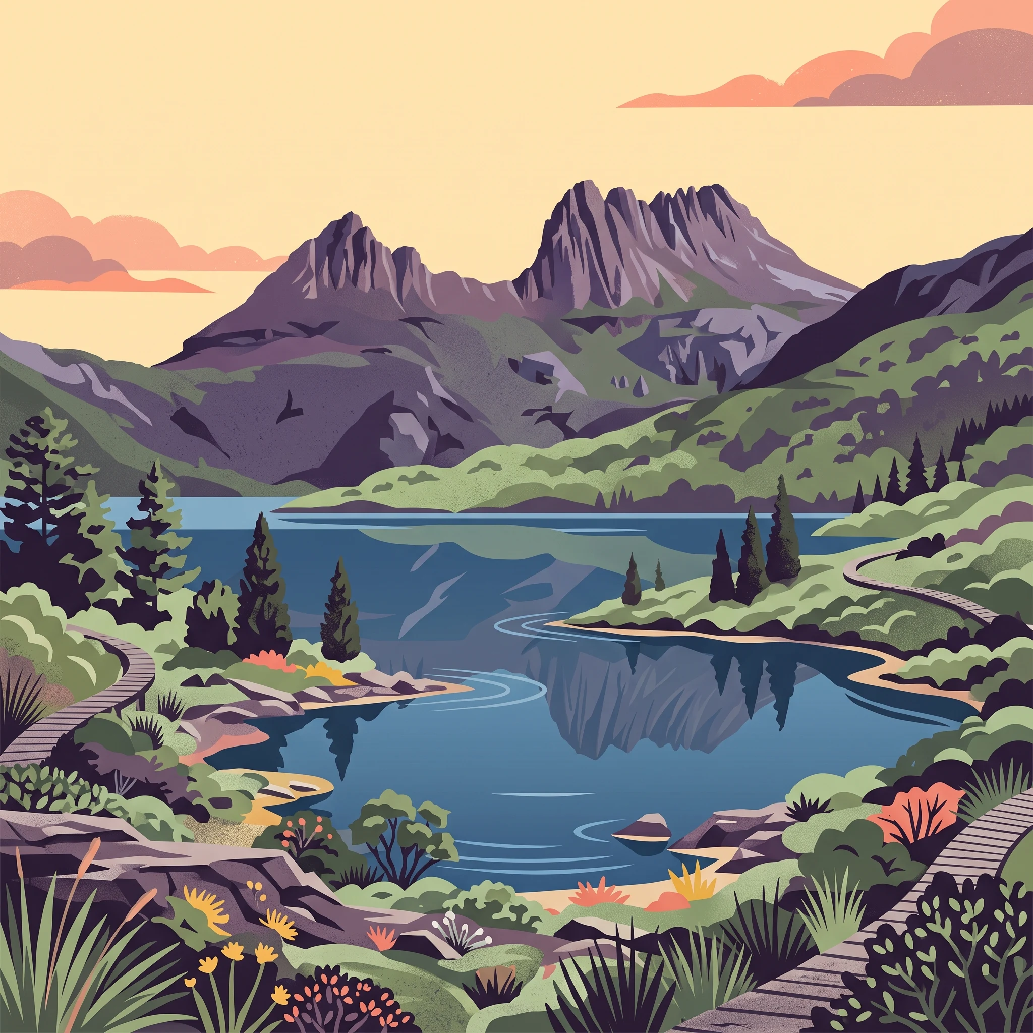
Those seeking to capture the iconic image of Cradle Mountain reflected in Dove Lake or hoping for the best probability of clear alpine vistas should look toward the summer months of January and February. Climate data indicates that these two months experience the lowest daily precipitation levels of the year, averaging just under 3 millimeters per day. While no period in this high-altitude environment is truly dry, the relative reduction in rain and humidity levels during late summer provides a more stable foundation for photography. Visitors should note that morning fog remains a frequent, unpredictable presence even in the drier months, and wait times for clear skies over the peaks can be substantial. Choosing this period prioritizes visibility but requires patience, as clear intervals are often brief and subject to rapid shifts in atmospheric stability.
Selecting Mild Weather for Accessible Exploration
Travellers interested in shorter, lower-altitude walks or less strenuous exploration may find the shoulder months of March, April, and November more manageable. During these periods, the temperature extremes of summer are moderated, with average maximums ranging from 19 to 24 degrees Celsius. This cooler air is often more comfortable for sustained walking, particularly on trails that involve elevation gain but do not require full alpine exposure. November is particularly well-regarded for its increasing daylight and the onset of the vernal bloom. The main compromise here is the increased likelihood of rain and cooler minimums compared to the heart of summer. Visitors during these shoulder months must be prepared for more frequent precipitation and the potential for damp track conditions, which can increase the difficulty of even the shorter, well-maintained boardwalks.
Visitor Access and Operations
Seasonal Access and Operational Considerations at Cradle Mountain Lake St Clair
Navigating Park Entry and Transport
Accessing Cradle Mountain Lake St Clair National Park requires careful planning due to its remote location and the high volume of visitors attracted to its core landscapes. The park is managed through two primary gateways: the Cradle Mountain Visitor Centre in the north and the Lake St Clair Visitor Centre in the south. Because the park infrastructure is designed to protect fragile alpine environments, certain areas are subject to managed access, including shuttle systems during peak periods. Visitors should not assume that road access remains consistent across all seasons, as severe weather can impact vehicle routes leading into the park. You must verify the status of access roads and any required shuttle services with the Tasmania Parks and Wildlife Service before you depart for your trip, as operational policies are subject to change based on management needs and seasonal demand.
Permit Requirements for Wilderness Treks
If your visit involves traversing the Overland Track, you must prepare for specific regulatory requirements that exist independently of general park entry. This 65-kilometre trail traverses remote wilderness, necessitating strict management of visitor numbers to maintain environmental integrity and hiker safety. Whether you plan to hike during the peak summer season or in the shoulder months, check the current official requirements for track permits or fees well in advance of your visit. These requirements are distinct from daily park entry passes, and availability is often limited. Always consult the official park authority to confirm current reservation policies, as these may require booking months ahead of your intended departure date.
Planning for Facility Availability
While visitor centres provide essential orientation, interpretation, and basic amenities, their services vary between the northern and southern park boundaries. Facilities like cafes, souvenir shops, and interpretation displays offer significant support for planning your daily excursions, but their operating hours are not constant throughout the year. It is important to remember that most visitor services are situated outside the immediate park boundary, meaning your transport strategy must account for the distance between your accommodation and the trailheads. Because these services are essential for day-trippers and long-distance hikers alike, confirm the specific operational hours for your arrival date. Relying on outdated travel blogs or historical descriptions of service levels can lead to logistical gaps, so always cross-reference facility details with official updates published by the managing authority.
Safety and Preparation
Seasonal Weather Safety and Preparation for Cradle Mountain Lake St Clair
Managing Alpine Weather Variability
The central challenge for safety in the park is the volatility of the alpine climate. Because Cradle Mountain and the surrounding high plateaus sit in a rugged, exposed environment, weather conditions can shift rapidly within a single day. Even during the warmer summer months, you may experience significant temperature drops, high winds, and moisture that arrives without warning. Rather than relying on seasonal averages, your preparation should focus on being equipped for a range of conditions simultaneously. Before every departure, consult the current regional forecast and official park weather alerts, as these provide the only accurate picture of upcoming shifts that seasonal climate patterns cannot predict.
Essential Gear and Apparel Strategies
Effective preparation for the park is built on the principle of layering. Regardless of your planned activity, carry a high-quality, weather-proof jacket in every season. The park experiences significant precipitation and humidity year-round, and the wind speeds increase particularly during the colder months, which can significantly lower the feel-like temperature. A hat and sunscreen remain critical even on overcast days, as the thin atmosphere in high-elevation areas increases ultraviolet exposure. When choosing footwear, consider the terrain and your planned path. While some well-maintained, lower-altitude paths around Dove Lake are manageable in sturdy walking shoes, the rugged and often muddy nature of the trails found further out,such as those approaching the Overland Track,demands ankle support and reliable grip. If you are starting a walk in the late afternoon, carrying a headlamp is a non-negotiable safety item, as daylight hours compress drastically in winter and cloud cover can reduce visibility earlier than expected.
Preparing for Extended Wilderness Exposure
When planning longer day walks or multi-day treks, the need for autonomy increases. Carry more food than you anticipate requiring, as environmental factors can force unexpected delays. Hydration also requires deliberate planning, as the water in the park's lakes should not be consumed directly. Ensure you have a method for sterilizing water collected from tanks at huts or other designated sources. Because mobile reception is inconsistent or non-existent in much of the rugged landscape, always log your intentions in the official trail registers. This simple step is a primary component of park safety protocols, ensuring that your travel plans are known should you become overdue. By respecting these environmental realities and verifying conditions at the time of your visit, you maintain the flexibility required to navigate one of Australia's most spectacular and unpredictable wilderness zones.
Trip Planning
How to choose the right time to visit Cradle Mountain Lake St Clair National Park
Selecting the right time for your visit requires a deliberate balance between your tolerance for volatile alpine conditions and your need for specific light, temperature, and access windows. Because this environment is defined by its constant potential for moisture and rapid atmospheric shifts, there is no single month that guarantees perfect weather. Instead, the decision rests on matching your personal objectives with the predictable constraints of each period. If your primary goal involves long-distance trekking or maximizing daylight for photography, the austral summer months of December through February offer the most stable thermal baseline and the longest opportunities for activity. These months prioritize logistical ease, yet they also require you to manage the highest probability of peak visitor numbers and the unpredictable reality of summer snow or storms.
Travellers who prioritize solitude or a more subdued experience may find the transitional months of autumn and late spring more rewarding. These periods often present a trade-off where slightly cooler temperatures and shorter, more erratic daylight hours are accepted in exchange for a quieter landscape. During these times, the park feels more isolated, though the risk of encountering muddy trails and sudden temperature drops increases significantly. Choosing these dates requires a commitment to flexible, high-quality gear and a willingness to adjust your itinerary based on the conditions of the day rather than a rigid plan.
Regardless of the season you select, it is critical to view climate normals as general indicators rather than specific forecasts. Alpine terrain naturally amplifies local weather patterns, meaning a sunny morning can transition into a hazardous afternoon in less than an hour. Before finalizing your travel dates, verify current access routes, shuttle operational status, and any active weather alerts through official park resources. Ensure your preparation reflects the reality that every season in this environment carries the potential for wet, cold, and challenging conditions, regardless of the time of year you arrive.