
Trip Timing Orientation
When Is the Best Time to Visit Crater Lake National Park
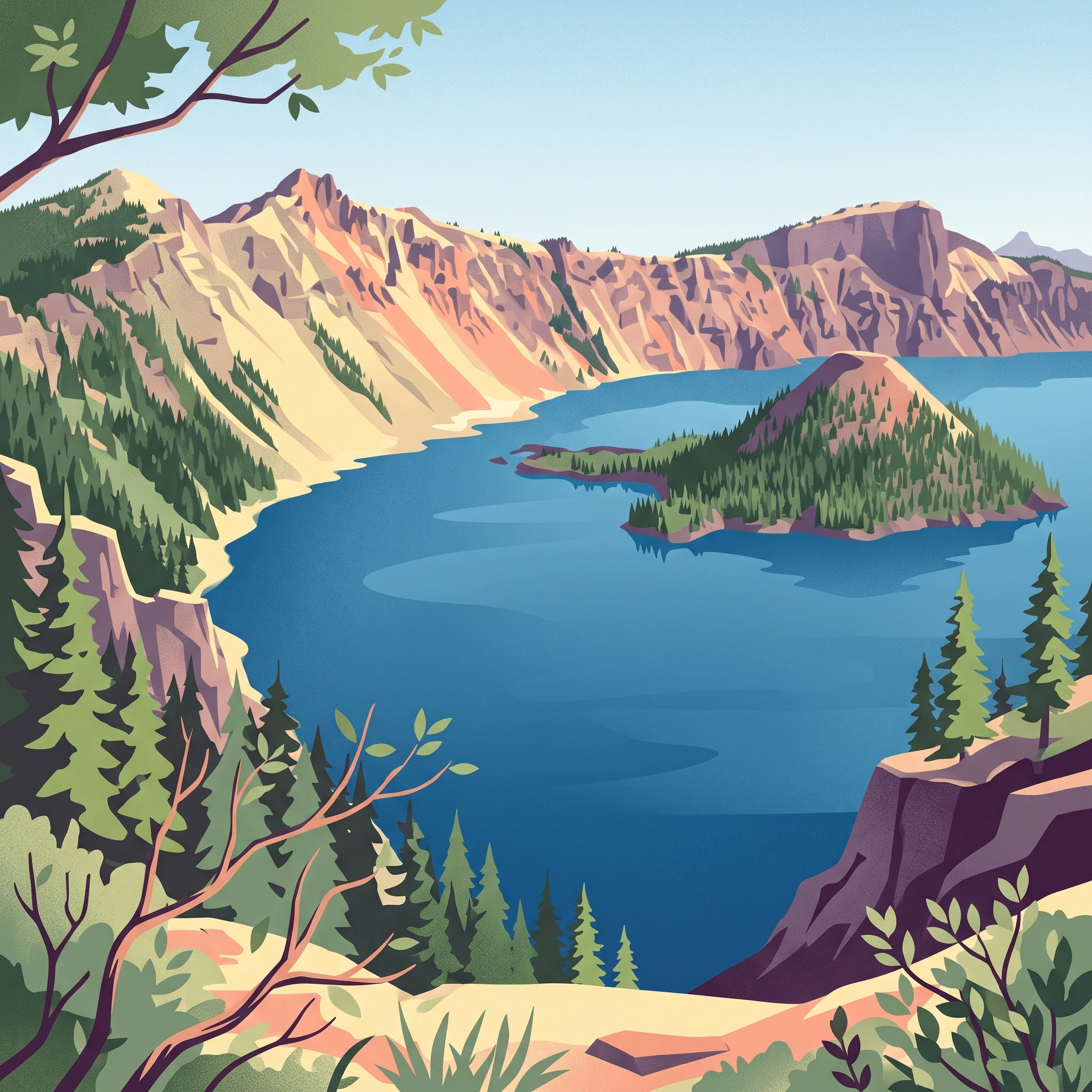
Determining the best time to visit Crater Lake National Park is a study in balancing high-elevation accessibility against the pursuit of solitude. For most visitors, the ideal window falls between July and September. This period represents the only time when the park's iconic 33-mile Rim Drive and its associated viewpoints are reliably clear of heavy snow, allowing for full exploration of the volcanic landscape. During these mid-to-late summer months, the deep blue waters, which have no inlets or outlets, are most visible as they contrast against the steep caldera walls and the summer sky.
The Impact of Elevation and Climate
Because the park sits at the crest of the Cascade Range, its climate is fundamentally governed by its high altitude. Unlike lower-elevation destinations, Crater Lake experiences dramatic seasonal shifts that are dominated by significant snowfall. While summer brings mean temperatures peaking near 16 degrees Celsius in July and August, the remainder of the year is characterized by long, cold winters where temperatures often drop well below freezing. This persistent, heavy snowpack is not merely a seasonal occurrence, as remnants of winter ice can often be seen on the caldera rim even as late as June. Visitors planning trips outside the core summer months must anticipate that while the park remains open, the experience shifts from one of expansive access to one of limited, localized discovery.
Principal Trade-offs in Trip Timing
Choosing when to travel requires deciding between the convenience of summer infrastructure and the aesthetic appeal of a frozen volcanic summit. If your priority is hiking the Cleetwood Cove Trail to the water or circling the entire caldera to view Wizard Island from multiple angles, the summer window is essential. Attempting to visit before July or after September significantly increases the likelihood of encountering restricted access to park facilities and roadways. Conversely, those drawn to the unique, stark beauty of a snow-covered caldera will find that the off-season offers a quiet, rugged environment that is starkly different from the high-traffic summer months. The trade-off is clear: visit when the snow recedes for the widest range of experiences, or visit during the winter and spring months to witness the park in its dominant, frozen state, provided you are prepared for the logistical challenges that accompany such a remote, high-altitude setting throughout the colder seasons.
Visitor Timing Comparison
Best Months to Visit Crater Lake National Park by Priority
Peak Access and High-Elevation Summer
The most reliable window for experiencing the full scope of the park is between July and September. During this period, the intense snowpack of the Cascade Range finally recedes enough to allow for travel across the primary Rim Drive. Visitors during these months benefit from the longest daylight hours and the lowest average precipitation of the year, which facilitates hiking the trails surrounding the caldera. While mid-summer temperatures rarely soar, they reach their annual maximums, providing the most comfortable conditions for reaching higher elevations and exploring the lakeshore. The trade-off for this accessibility is that these months represent the peak of visitor interest, meaning parking and viewpoints are often highly contested.
The Transition of Spring and Fall
Travelers looking for a compromise between lingering snow and accessibility often target the shoulder seasons. Late June marks the start of the transition toward full access, though persistent snowdrifts may still block secondary paths. Conversely, October serves as the definitive end to the accessible period as precipitation begins to rise, signaling the onset of the inevitable mountain winter. These shoulder months offer a distinct, albeit volatile, experience. Temperatures are notably cooler than the mid-summer average, and rapid fluctuations in weather are common. Those who choose to visit during these windows must be prepared for the reality that the park landscape is dictated by the immediate status of snowmelt or early snowfall rather than calendar dates.
The Winter Isolation Phase
From November through May, the park shifts into a period of deep winter conditions, characterized by heavy snowfall and significantly restricted movement. This phase is not a time for casual sightseeing, as the climate at this elevation involves deep freezing temperatures and limited daylight hours. While the park remains a powerful destination for those seeking solitude and a quiet, frozen landscape, it requires a different level of logistical preparation. Most of the famous driving loops are closed to standard vehicular traffic during this duration. Travelers who venture here in the depths of winter do so to witness the caldera in its most dramatic, snow-laden state, accepting that they will be largely confined to the immediate vicinity of open access points rather than traversing the wider park road network.
Annual Climate Overview
Understanding Weather and Climate Patterns at Crater Lake
Understanding the climate at Crater Lake requires recognizing that the park exists at a significant elevation in the Cascade Range, where high-altitude geography dictates the annual rhythm of temperature, precipitation, and daylight. These climate normals, based on data from the 1991 to 2020 period, are intended to provide a long-term reference for planning. They do not represent real-time forecasts or guarantee specific conditions for any single trip, as local mountain weather can shift rapidly and vary significantly across the park's diverse terrain.
The Relationship Between Precipitation and Elevation
Unlike many low-elevation destinations where rain is the primary form of precipitation, the park experiences a dominant winter snowfall pattern that influences the entire annual cycle. The heaviest precipitation occurs between November and January, often arriving in the form of snow that persists well into the warmer months. As temperatures drop below freezing, particularly from November through March, the accumulation of this snowpack defines the park's accessibility. While precipitation frequency decreases significantly from July through September, the residual effects of the winter season remain a critical factor for visitors planning trips during these months.
Temperature Ranges and Seasonal Shifts
Temperature patterns follow a distinct arc characterized by cold, sub-freezing winters and mild, sun-drenched summers. During the winter months of December and January, mean temperatures frequently hover below the freezing point, with average minimums dropping below -14 degrees Celsius. These conditions create the cold, frozen environment for which the high-altitude caldera is known. By contrast, the peak summer months of July and August present the warmest conditions of the year, with average maximum temperatures exceeding 30 degrees Celsius. Visitors should note that these averages represent a baseline; clear, high-altitude days can feel significantly warmer, while nighttime lows even in peak summer can hover near the freezing point, necessitating a flexible approach to clothing and gear.
Daylight Dynamics and the Impact on Visibility
Daylight availability fluctuates dramatically across the year, directly impacting the time available for exploration and photography. From the peak of summer in June, where the park experiences over 15 hours of daylight, the days gradually shorten toward the winter solstice in December, which sees less than 9 hours of daylight. The extended daylight hours of late spring and early summer offer the best opportunity to experience the caldera without the time pressures often associated with winter travel. Conversely, the shorter days of late autumn and winter, coupled with the potential for heavy cloud cover, can limit the window for viewing the lake to a few hours of mid-day light.
Interpreting Annual Humidity and Wind Trends
Relative humidity mirrors the seasonal temperature shifts, peaking in the wetter, colder months of winter when values often exceed 90 percent. As the park enters the drier summer months of July and August, humidity levels drop significantly, sometimes falling below 60 percent. This reduction in atmospheric moisture contributes to the clarity of the air, which is a defining feature for visitors seeking panoramic views. Wind speeds remain relatively stable throughout the year, though exposed areas along the rim naturally experience more persistent breezes compared to the sheltered forested slopes lower in the park. These winds, while generally consistent, can influence the perceived temperature, turning a mild summer afternoon into a much cooler experience, especially at high-elevation vantage points.
Annual Climate Patterns
Seasonal Shifts and Weather Phases at Crater Lake
The High-Elevation Seasonal Cycle
Crater Lake does not adhere to the standard four-season calendar found at lower elevations. Instead, the park operates on a distinct annual rhythm dictated by massive winter snowfall and a brief, compressed period of summer access. The year is effectively divided into a long, dominant winter phase and a short, high-activity window, separated by unpredictable transitional periods that shift depending on the severity of the snowpack.
The Extended Winter Phase: November to May
This period defines the park for the majority of the calendar year. Beginning as early as November and often extending through May, the environment is defined by low temperatures and heavy precipitation, which falls almost exclusively as snow. During these months, the park shifts into an insulated, quiet state. Average minimum temperatures routinely drop well below freezing, and the depth of the snowpack can impede standard navigation. Visitors should interpret this phase as one of restricted mobility, where the landscape is largely blanketed in white, and many of the roads that define a summer visit remain closed or impassable. The intensity of this phase is not uniform; while December and January are characterized by the deepest cold and most frequent snowfall, the spring months of April and May represent a slow, often volatile thaw. This transition is marked by fluctuating daytime temperatures that can rise significantly, yet the high elevation ensures that night temperatures frequently remain below freezing, sustaining the snow cover long into what might elsewhere be considered spring.
The Compressed Summer Window: July to September
By contrast, the summer window is defined by a rapid return to landscape accessibility. From July through September, the snowpack recedes sufficiently to allow full travel around the caldera rim. This phase is characterized by the most stable weather of the year, with significantly lower precipitation and moderate mean temperatures that make hiking and viewpoints accessible. The transition into summer is typically marked by a dramatic drop in humidity and a sharp increase in daylight quality. While July and August are consistently the driest months, September often acts as a pivot point. As the month progresses, the cooling trend begins to emerge, signaling the eventual return of the winter cycle. Visitors during this window benefit from the most reliable road and trail conditions, yet the environmental character remains defined by the underlying volcanic geography rather than extreme heat.
Transitional Months: June and October
June and October serve as the primary boundaries of the park's operational year, acting as bridges between the frozen winter and the temperate summer. June is often a month of uncertainty, where the remnants of the winter snowpack dictate whether secondary roads or high-elevation trails are open. Temperatures are on a steep upward trajectory, but the lingering cold of the ground and the lingering snow mean the park is still in a state of flux. Similarly, October represents the rapid contraction of the summer window. As daylight hours decrease and average temperatures fall, the probability of early-season snowfall increases. These months do not fit neatly into a seasonal box; they are characterized by the rapid onset or retreat of winter conditions, making them the most sensitive periods for travel planning.
Seasonal Experiences
Experiencing Crater Lake National Park Across the Seasons
Caldera Access and Shoreline Exploration
The experience of reaching the water at Crater Lake is strictly tied to the seasonal opening of the Cleetwood Cove Trail. As the only legal access point to the lake shore, this steep, 1.1-mile path requires significant physical effort to descend seven hundred feet. Due to the high-elevation snowpack that persists into late spring or early summer, this trail often remains blocked by snow or debris well after lower-elevation routes have cleared. Visitors planning to descend to the lake or participate in boat tours should anticipate these activities being limited to the peak summer window, typically July through September. Without full access to this trail, the lake remains a visual destination from the rim rather than an interactive one.
Rim Drive and Panoramic Vantage Points
Driving the 33-mile Rim Drive is the foundational way to experience the caldera from multiple elevations and perspectives. Because this route circles the lake at high elevation, it is subject to severe winter conditions and maintenance closures that can span from late autumn through early summer. While the most iconic viewpoints, such as the Watchman Observation Station, offer sweeping vistas of the lake and Wizard Island, their accessibility depends entirely on the completion of seasonal snow removal. Mid-summer is the only period when visitors can reliably navigate the full loop to visit the Pinnacles at the end of Pinnacles Road, an area featuring unique volcanic spires that are inaccessible once the road systems are shuttered for winter.
High-Altitude Hiking and Backcountry Routes
Hiking in the park is fundamentally altered by the elevation of the Cascade Range. Trails located at higher altitudes often hold ice or deep snowpacks until the height of the summer season. During the months of July, August, and September, the high-altitude trails reach their peak accessibility, allowing hikers to explore the varied terrain surrounding the caldera without the hazards of deep snow. However, hikers should be aware that temperatures remain cool even in mid-summer, and the landscape changes rapidly in October as daylight wanes and early snowfall begins to accumulate. Those seeking to hike the segment of the Pacific Crest Trail that traverses the park should coordinate their timing with these seasonal conditions, as the window for safe, snow-free passage is remarkably short compared to lower-elevation wilderness areas.
Winter Landscape and Specialized Exploration
From November through May, the park transforms into a frozen environment defined by deep snow. During this time, the primary visitor experience shifts away from road-based touring and toward snow-based activities. Visitors equipped with the appropriate skills and gear may explore the landscape via snowshoes or cross-country skis on designated trails. These activities require self-reliance, as traditional summer infrastructure is largely dormant. This winter phase provides a quiet, starkly different perspective on the caldera, but it demands careful planning and an acceptance that the primary summer attractions will be entirely unavailable.
Travel Priorities
Best Times to Visit Crater Lake National Park Based on Travel Priorities
Prioritizing High-Elevation Hiking and Lake Access
For visitors whose primary objective is physical access to the caldera, such as descending the Cleetwood Cove Trail or utilizing boat tours to reach Wizard Island, the period between July and September is the only window that reliably supports these activities. Climate normals indicate that by July, the mean temperature reaches 16.16 degrees Celsius with daily highs exceeding 30 degrees Celsius, providing the necessary thermal conditions to navigate the steep descent. The trade-off for this access is a higher likelihood of sharing trails with other visitors during the limited snow-free months. Travelers should note that even in mid-summer, the elevation remains a factor for physical exertion, and activities like scuba diving or fishing require careful planning around the 6,173-foot lake surface elevation.
Seeking Milder Temperatures and Clear Visibility
If your priority is moderate weather for photography or sightseeing along Rim Drive, September stands out as a high-value month. While August provides the warmest conditions with average maximums around 31.23 degrees Celsius, September offers a cooling trend, with average maximums dropping to 28.4 degrees Celsius and lower humidity levels compared to the early summer months. The decrease in relative humidity to approximately 59 percent in September often correlates with clearer, crisper air quality, which is beneficial for viewing the caldera from high-altitude vantage points like the Sinnott Memorial Overlook or the Watchman Observation Station. The primary compromise is the decreasing daylight, which drops from 14.81 hours in July to 12.25 hours in September, shortening the daily window for extended explorations.
Timing for Longer Daylight and Extended Sightseeing
Visitors interested in maximizing daylight hours should target the span from June through July. June offers roughly 15.11 hours of daylight, the longest of the year, though this often comes with the trade-off of lingering, patchy snowpack that may restrict access to secondary trails or specific viewpoints like the road to the Pinnacles. While June temperatures are cooler, with a mean of 11.34 degrees Celsius, the extended solar duration allows for significant time at viewpoints. By choosing late June or early July, travelers can balance the desire for maximum daylight with a higher probability that the primary infrastructure of the park, including the 33-mile Rim Drive, will be fully cleared of winter debris and accessible for transit.
Navigating the Drier Periods for Outdoor Exploration
For those who prefer the driest possible conditions for hiking or bicycling, July and August are the most consistent months. Precipitation normals for these two months are at their annual lows, with average daily precipitation levels of 0.43 mm and 0.46 mm respectively. This stability is critical for activities like bicycling on the Rim Drive, where road conditions are paramount, or for those intending to hike high-exposure paths where afternoon storms could pose safety risks. The trade-off is the intensity of UV exposure at this elevation, as the clear, dry air offers little protection against solar radiation, requiring visitors to prioritize sun protection regardless of the relatively mild temperature averages.
Access and Logistics
Seasonal Access and Operational Planning at Crater Lake
Managing Seasonal Route Variability
The most significant factor in your park itinerary involves the physical access to the 33-mile Rim Drive, which provides the primary vantage points for the caldera. Because the road sits at a high elevation, it is subject to heavy winter snowpack that often persists well into the summer months. While the south and west entrance roads are typically maintained for year-round vehicle access, the North Entrance and large sections of the rim itself are subject to seasonal closures. You should not assume that the calendar month guarantees road availability. Always consult the official National Park Service website for the current status of Rim Drive, trailheads, and park entry points before finalising your travel dates or driving to the park entrance.
Visitor Facilities and Operational Schedules
Support services within the park, including visitor centers and lodge operations, follow a seasonal cycle that mirrors the accessibility of the rim. Facilities like the Steel Information Center serve as the primary hub for obtaining backcountry camping permits, requesting ski route advisories, and receiving professional guidance from park rangers. These locations operate under adjusted hours during the winter, often scaling back services or reducing operating windows when snow prevents full access. If your travel plans depend on specific facilities for amenities, retail, or interpretive programs, verify the opening hours for your intended visit dates through official park channels. The availability of services such as boat tours or specific trail access is similarly contingent on current conditions rather than seasonal averages.
Requirements for Backcountry and Trail Access
Planning a visit that involves deep exploration of the caldera or extended backcountry hiking requires additional administrative preparation. Specific activities, such as camping in non-developed areas or descending certain trails, may require permits that can only be issued upon your arrival or via specific ranger-led processes. During periods of heavy snow, certain routes may be marked as closed or dangerous, and rangers may restrict access to protect both the visitor and the delicate volcanic landscape. You must check the latest permit requirements and safety advisories at the visitor centers before beginning your trek. Do not rely on historical access patterns to assume a trail or route will be open during your visit, as seasonal variations in snowmelt can significantly delay the opening of high-elevation trails each year.
Safety and Preparation
Seasonal Weather Hazards and Packing for Crater Lake
Navigating High Elevation Climate Fluctuations
Preparation for a visit requires understanding the significant disparity between the temperate summer conditions and the harsh reality of a high-altitude winter. Because the park sits at the crest of the Cascade Range, temperatures remain cool even during the peak of summer, while winter brings severe cold with average minimum temperatures consistently dropping well below freezing. Packing must account for these rapid fluctuations, especially because mountain weather can shift within hours. Always check official weather forecasts and regional road reports immediately before your departure, as long-term climate normals suggest trends rather than daily guarantees.
Essential Gear and Layering Strategies
Regardless of the season, effective preparation relies on a versatile layering system rather than heavy, single-purpose clothing. During the July to September period, you may experience intense sun exposure and clear skies, which necessitates protection against high-altitude UV radiation. Conversely, even in mid-summer, morning and evening temperatures often dip near or below freezing. Packing base layers, insulating mid-layers, and a reliable, waterproof outer shell provides the best defense against unpredictable mountain showers and wind chill. Footwear should be broken-in, supportive, and appropriate for uneven volcanic terrain, as trails often consist of loose scree or compacted ash that requires stable footing.
Safety in a Volcanic Terrain
Safety in the park is fundamentally linked to respecting the landscape and its inherent physical risks. Because Crater Lake features steep, unstable caldera walls, staying on marked trails is the primary rule for visitor safety. Hiking near or on the caldera rim outside of developed pathways is prohibited due to the danger of rockfall and potential collapse. Additionally, the high elevation can affect individuals differently. Staying hydrated is vital, but avoid drinking untreated water from any streams or the lake itself, as natural sources may contain contaminants. Always carry adequate water and food for your specific activity level, particularly when venturing away from the main visitor centers at Rim Village or Steel Information Center.
Seasonal Vigilance and Daily Alerts
Preparation needs change drastically between the dry summer months and the heavy-snowfall winter season. If you visit during the long winter phase, which typically spans from November through May, your safety focus must shift toward managing extreme cold, potential ice on paved surfaces, and reduced visibility. When planning travel, verify that your vehicle is equipped for winter conditions if travelling during the off-peak months. Access to parts of the park, including segments of Rim Drive, is determined by current snowpack conditions rather than fixed dates. Always consult the latest alerts from the National Park Service before planning any backcountry exploration or extended outdoor time to ensure your itinerary aligns with current safety assessments.
Trip Decision Framework
How to Choose the Right Time to Visit Crater Lake National Park
Evaluating Your Priorities for a Crater Lake Visit
Choosing the right dates for your trip involves a fundamental trade-off between the desire for full park access and the appeal of a quiet, snow-covered landscape. The primary decision point is the status of the 33-mile Rim Drive and its associated overlooks. If your goal is to experience the park through its iconic hiking trails, boat tours, or a complete circumnavigation of the caldera by vehicle, you must target the window between July and September. This period provides the most consistent weather, characterized by low precipitation and the highest likelihood that snowpack has receded from high-elevation routes.
Matching Seasonal Realities to Your Travel Goals
If your priority is photography or solitude, the shoulder months of June and October offer a distinct experience. During these periods, you may encounter partial road closures or lingering snow, which can create striking visual contrasts between the deep blue water and the white, frozen caldera walls. These months require more flexibility, as sudden weather shifts are common at this elevation. By contrast, winter travel from November through May is best suited for visitors interested in specialized snow activities or those who prefer a remote, frozen environment. In this phase, access is heavily restricted, and the park experience shifts entirely away from the typical summer exploration model.
Finalizing Your Trip Logistics
Before finalizing your travel dates, remember that climate normals are only a statistical baseline. They describe long-term patterns rather than the specific weather you might encounter during your visit. The high-altitude environment of the Cascade Range can produce volatile conditions even in mid-summer. Always verify current operating status, road access, and weather forecasts through official park resources immediately before your departure. Relying on current, park-issued information ensures your plans align with existing conditions rather than general seasonal expectations. By balancing these seasonal trade-offs against your specific interests, you can select a visiting window that aligns with your expectations while staying prepared for the realities of this unique volcanic environment.