
Why Curecanti National Recreation Area stands out
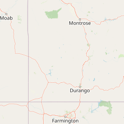
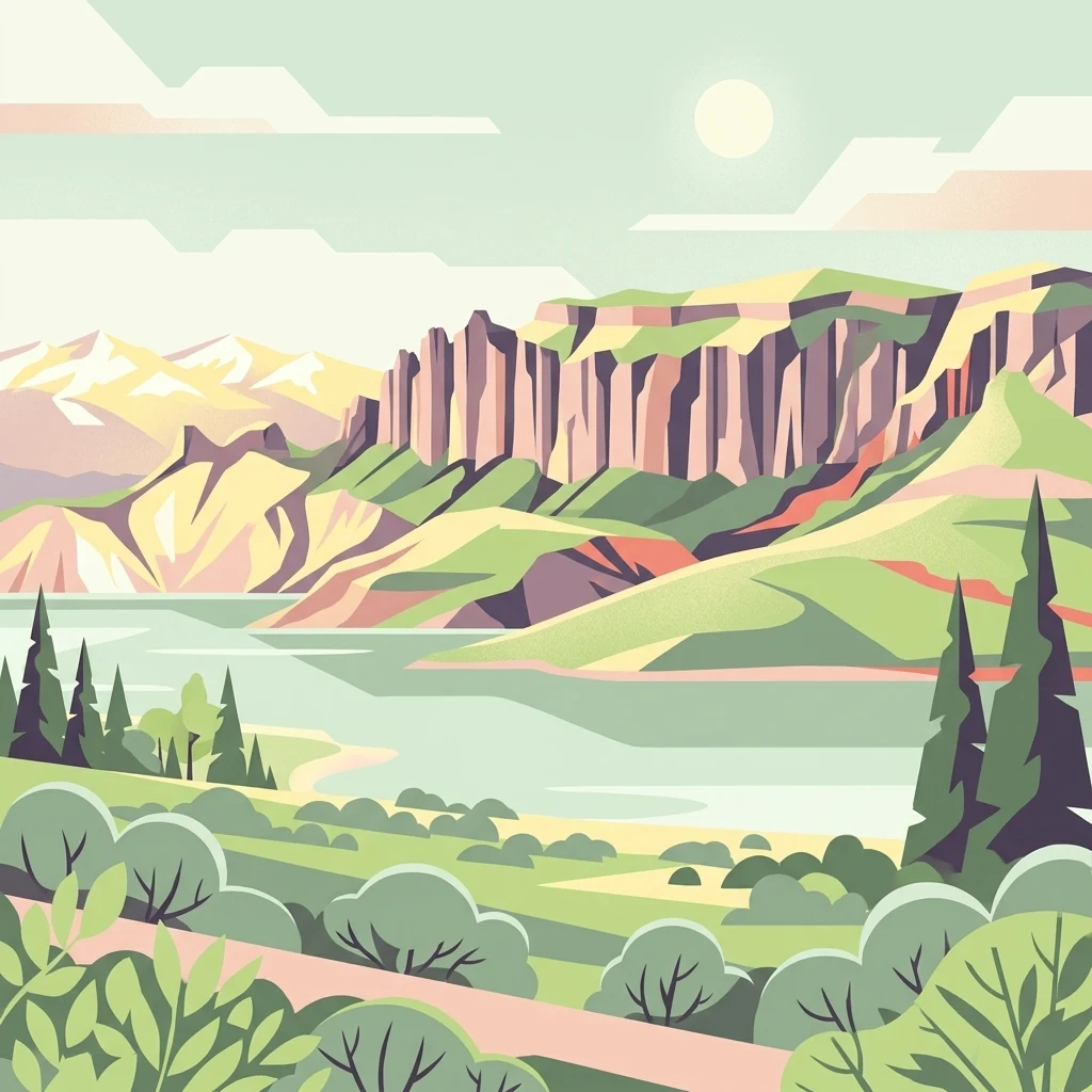
Curecanti is best known for being Colorado's largest body of water at Blue Mesa Reservoir and for the state's most prominent lake trout and Kokanee salmon fishery. It is also recognized as the recreational face of the upper Gunnison's dam-building era, a string of three reservoirs that opened up boating, fishing, and lakeside camping in a region previously defined by a fast, canyon-bound river. The recreation area's other defining identity comes from its setting against the dramatic geology of the Black Canyon of the Gunnison country. Eroded volcanic pinnacles at Dillon Pinnacles, the slender granite spire of the Curecanti Needle in Morrow Point Reservoir, and the sheer canyon walls of Crystal Reservoir give Curecanti a distinctive scenic character that separates it from typical reservoir-based recreation areas.
Curecanti National Recreation Area history and protected-area timeline
Curecanti's origins lie in the long-running effort to manage the waters of the Colorado River system, which began with the 1922 compact among the seven states that share the river. Under that agreement, water was divided between an upper group and a lower group, and the lower-basin states began building large storage projects such as Hoover Dam, while the upper-basin states faced the challenge of delivering a fixed share of water across seasons defined by mountain snowmelt.
The modern Curecanti story begins with the Colorado River Storage Act, signed into law on April 11, 1956, which created the Colorado River Storage Project and authorized four major dams and reservoirs in the upper basin. One of these, originally called the Curecanti Project, was placed on the Gunnison River in western Colorado, the river's fifth-largest tributary, with three dams planned in the upper reaches about 27 miles west of the city of Gunnison. The project reservoir built to create water storage for downstream transfer, local agricultural use, flood control, and hydroelectric generation.
Blue Mesa Dam was completed in 1966, creating the recreation area's centerpiece reservoir, followed by Morrow Point Dam and then Crystal Dam, which was completed in 1976. As the reservoirs took shape, Congress and the Bureau of Reclampsia recognized that managing the resulting recreation opportunities would require a separate federal partner, and in 1965 the National Park Service established a cooperative agreement with the Bureau of Reclamation to create Curecanti National Recreation Area as a distinct unit of the national park system.
The name Curecanti itself reflects the area's deeper cultural roots: it was drawn from a 19th-century Ute Indian sub-chief, preserving a connection to the Indigenous history of the Gunnison valley even as the landscape was transformed by mid-20th-century water development. The recreation area's boundary, drawn through that 1965 memorandum, has remained administratively unusual within the park system, prompting later legislative efforts to formalize the boundary and, pending in 2021, to transfer additional land from the Gunnison National Forest and Bureau of Land Management to expand Curecanti from roughly 43,000 to about 50,000 acres.
Curecanti National Recreation Area landscape and geographic character
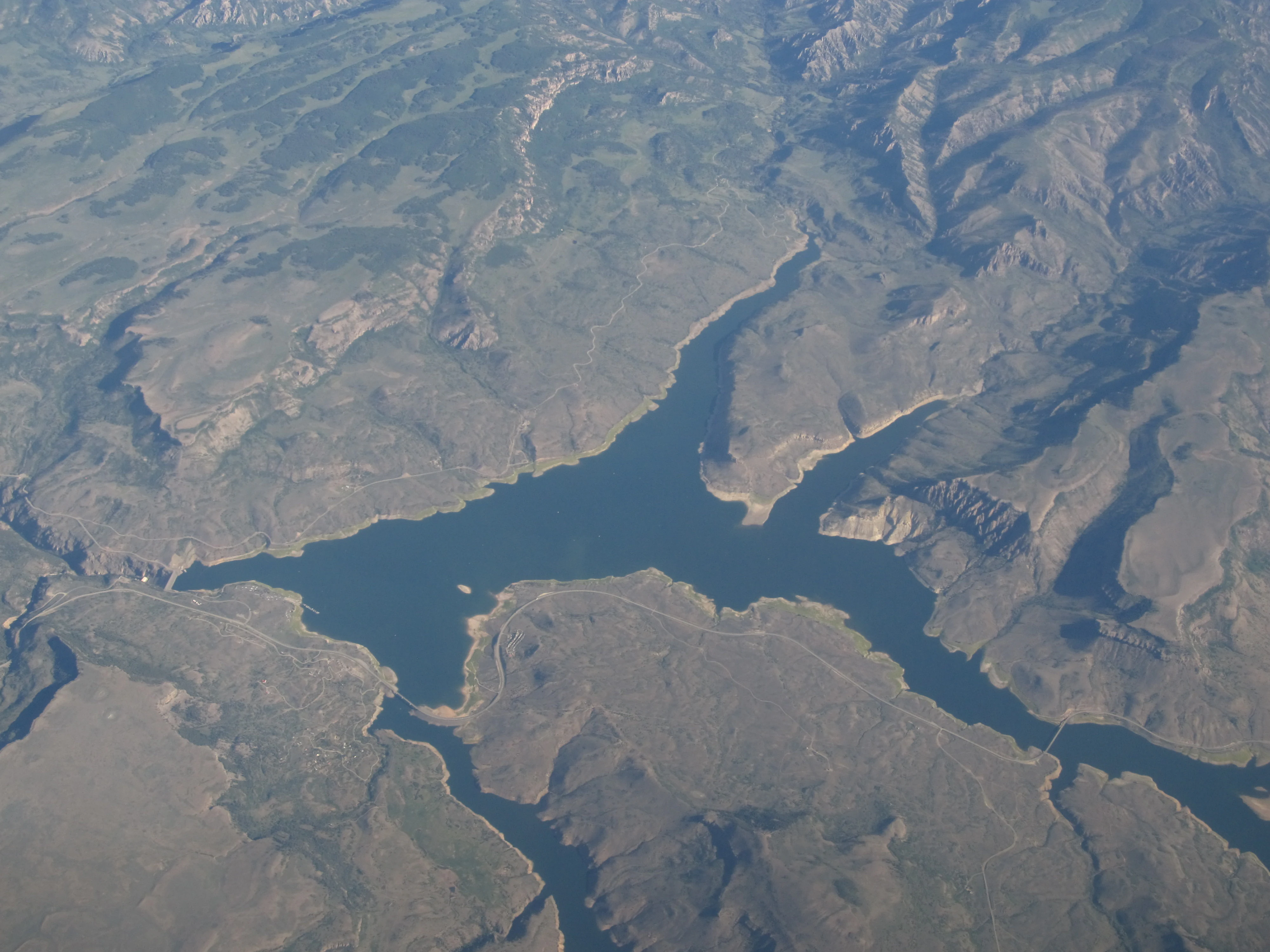
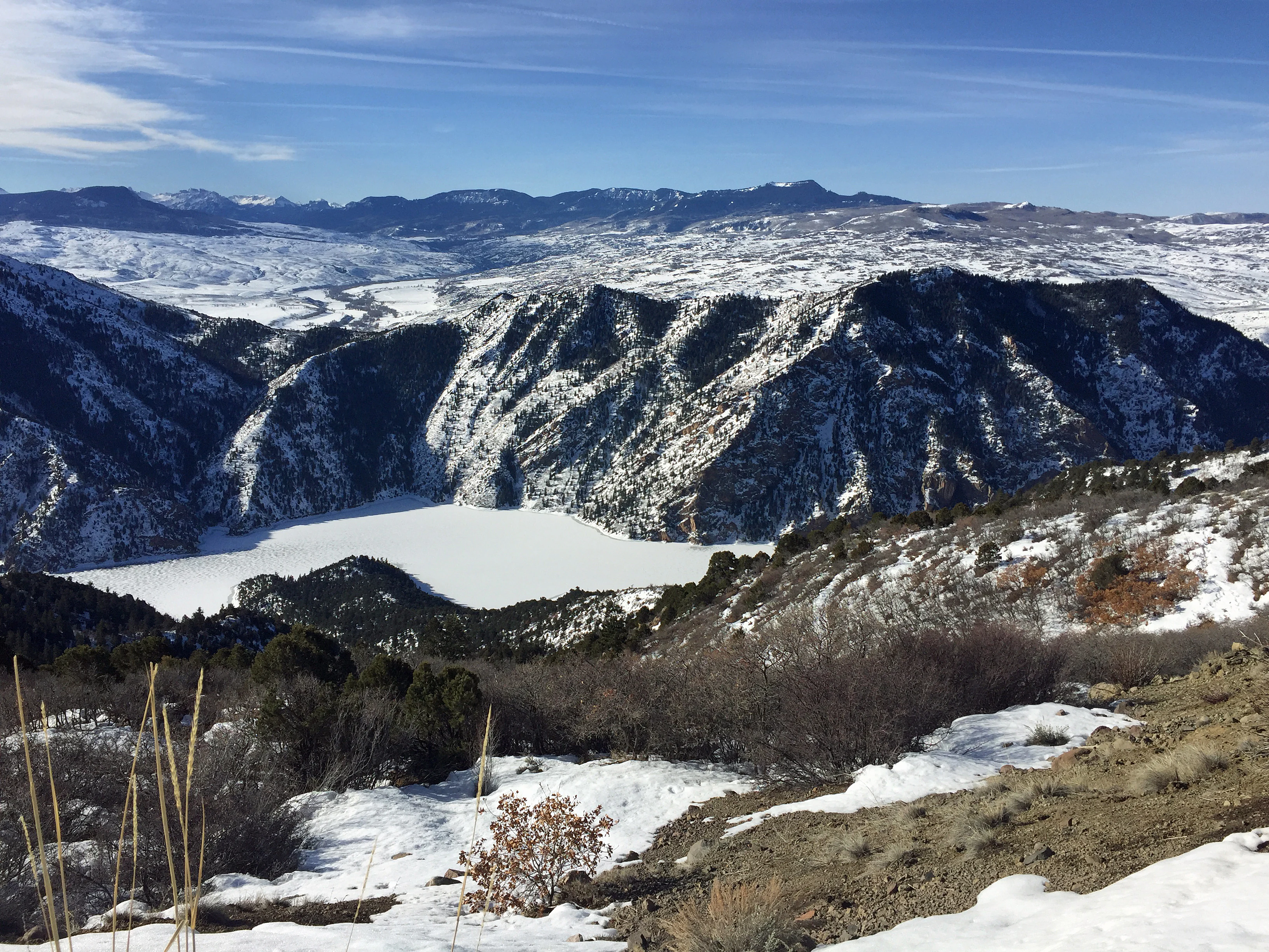
The landscape of Curecanti is organized around the contrast between a broad, open reservoir basin and a deep, steep-walled canyon. Blue Mesa Reservoir, fed by the Lake Fork of the Gunnison, Soap Creek, and Cebolla Creek, spreads across a wide, rolling basin in the upper section of the recreation area, with a long shoreline and several quieter arms reaching into the surrounding high country. Its expansiveness makes it visually closer to a western mountain lake than to a canyon reservoir.
Downstream of Blue Mesa, the Gunnison tightens dramatically as it enters the upper Black Canyon. Morrow Point Reservoir occupies a narrow stretch where canyon walls rise steeply from the water, with very little flat shore and few developed shoreside sites. Crystal Reservoir continues this character even further, tucked into the canyon's upper reaches near Cimarron, where the reservoir is small, contained, and visually dominated by vertical rock and sparse vegetation.
Above and around the reservoirs, the surrounding terrain reflects the layered geology of the Gunnison basin. Eroded volcanic formations rise in striking shapes, most famously at the Dillon Pinnacles, a ridge of dramatically weathered volcanic rock that has become one of the recreation area's most recognizable landmarks. The Curecanti Needle, a roughly 700-foot granite spire on Morrow Point Reservoir's southern bank, adds a slender vertical accent to the canyon scenery and once served as a marketing symbol for the Denver & Rio Grande Western Railroad's Black Canyon Route.
Curecanti National Recreation Area ecosystems, habitats, and plant life
Curecanti's ecological character is shaped by the meeting of reservoir, river canyon, and high-elevation plateau habitats typical of western Colorado. The broad open water and quiet arms of Blue Mesa Reservoir attract waterfowl, while the steep, rocky shorelines of Morrow Point and Crystal retain a more arid, canyon-bound habitat character with thin soils, scattered pinyon-juniper woodland, and exposed rock.
The recreation area's uplands, especially around the arms of Blue Mesa on Cebolla Creek, Soap Creek, and the Lake Fork, mix sagebrush steppe, Gambel oak, and montane forest patterns, transitioning gradually into the conifer-dominated slopes of the surrounding Gunnison National Forest. This gradient from reservoir edge to rocky rim supports a range of habitat types across a relatively compact geographic footprint, including riparian zones along feeder creeks, dry south-facing slopes, and the eroded volcanic terrain around the Dillon Pinnacles.
Vegetation patterns in the recreation area also reflect its position as a transition zone between the higher, wetter ecosystems of the Elk Mountains to the north and the drier, canyon-dominated ecosystems of the Black Canyon to the west. Within the recreation area, this is most visible in the contrast between the forested shoreline of Blue Mesa Reservoir and the bare rock faces and exposed scree that frame Morrow Point and Crystal reservoirs, where plant communities become sparser and more adapted to heat and aridity.
Curecanti National Recreation Area wildlife and species highlights
Curecanti's wildlife profile is largely shaped by its reservoir systems and their associated upland habitats. Blue Mesa Reservoir is recognized as one of the most productive cold-water fisheries in the United States, supporting both lake trout and Kokanee salmon populations that have drawn anglers from across the region since the reservoir was filled in the late 1960s. Sakakawea-style introduced and managed fisheries continue to define the recreation area's wildlife significance for many visitors.
Beyond the fisheries, the mix of open water, sheltered arms, and upland slopes around Blue Mesa Reservoir supports waterfowl, shorebirds, raptors, and the kinds of game species associated with the surrounding national forest land. The shallower arms of the reservoir, especially along Cebolla Creek and Soap Creek, provide quieter habitat for waterbirds and seasonal migratory species, while the more rugged terrain around Morrow Point and Crystal reservoirs plays host to bighorn sheep, mule deer, and a variety of raptors nesting in the canyon walls.
Mammals common to the broader Gunnison basin, including elk, mule deer, black bear, and mountain lion, are also present in and around the recreation area, particularly along the forested transitions between reservoir shorelines and adjacent national forest lands. Game populations in Curecanti are actively managed by the National Park Service in cooperation with the Bureau of Reclamation and state wildlife agencies, reflecting the recreation area's dual purpose as a recreational fishery and a working piece of the regional wildlife landscape.
Curecanti National Recreation Area conservation status and protection priorities
From a conservation standpoint, Curecanti is significant less as a strictly preserved wilderness and more as a carefully managed recreational landscape overlaying a major federal water project. The unit exists because Congress and the Bureau of Reclamation recognized in 1956 that the reservoirs created by the Curecanti Project would generate recreation, and that this recreation needed dedicated stewardship, research, and habitat management rather than being left solely to incidental use around working dams.
The National Park Service's role at Curecanti includes habitat protection, monitoring of fish and game populations, and resource interpretation on the naturally and culturally significant features of the upper Gunnison. The recreation area's lakes support fishery management programs that sustain the lake trout and Kokanee salmon fisheries, while upland management works to maintain vegetation patterns, soil stability, and wildlife habitat on the slopes surrounding the reservoirs.
Legal and administrative conservation work at Curecanti has also been ongoing. Unlike most units of the national park system, Curecanti's boundary is set administratively rather than by statute, which has complicated long-term management. Pending legislation has been aimed at formalizing the boundary, transferring selected Bureau of Reclamation and Bureau of Land Management parcels to National Park Service jurisdiction, and incorporating additional land from the adjacent Gunnison National Forest, which would modestly expand the protected footprint of the unit while clarifying which agency is responsible for which piece of land.
Curecanti National Recreation Area cultural meaning and human context
Curecanti carries a layered cultural history shaped by Indigenous presence, late-19th and early-20th-century railroad and irrigation development, and the mid-20th-century reshaping of the river through the Curecanti Project. The recreation area's name itself comes from a 19th-century Ute Indian sub-chief, anchoring the place's identity to the deep Indigenous history of the Gunnison valley and the broader Ute homeland of western Colorado.
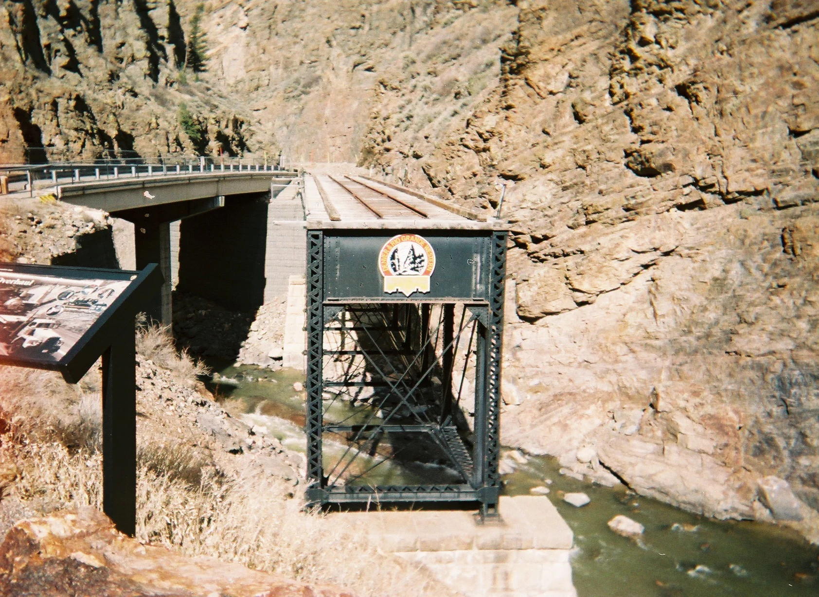
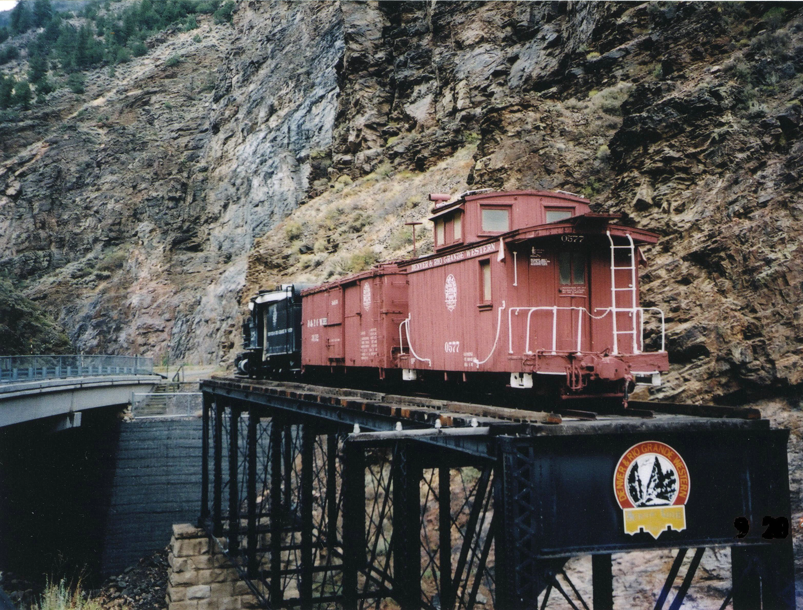
Railroad heritage is closely tied to the recreation area's iconic geology. The Curecanti Needle, a roughly 700-foot granite spire on Morrow Point Reservoir, was once a well-known symbol of the Denver & Rio Grande Western Railroad, which used the easily recognizable formation as a marketing image for its Black Canyon Route through the Gunnison. A surviving 1895 narrow-gauge railroad trestle near Cimarron, listed on the National Register of Historic Places in 1976, remains as one of the recreation area's most tangible reminders of that era.
The East Portal area carries a separate strand of cultural and engineering history tied to irrigation. There, the intake tunnel and diversion dam of the Gunnison Tunnel, a Bureau of Reclamation project begun in 1902, represents an early 20th-century effort to divert river water roughly six miles west to the dry lands around Montrose. Together, the Indigenous name, the railroad remnants, and the early irrigation infrastructure reflect how the upper Gunnison has been at the center of multiple overlapping human histories long before the reservoirs of the Curecanti Project were built.
Top sights and standout views in Curecanti National Recreation Area
Three reservoirs built between 1966 and 1976 by the Bureau of Reclamation form the backbone of the recreation area, with Blue Mesa Reservoir as Colorado's largest body of water and one of the country's most productive inland cold-water fisheries. The narrower Morrow Point and Crystal reservoirs downstream continue the water-based experience into the steep-walled upper Black Canyon of the Gunnison, providing a more remote and adventurous counterpart to the broad landscape of Blue Mesa.
Distinctive landmarks anchor the recreation area's identity: the eroded volcanic spires of the Dillon Pinnacles, the tall granite Curecanti Needle on Morrow Point Reservoir, the preserved Denver & Rio Grande Western narrow-gauge trestle in Cimarron Canyon, and the historic Gunnison Tunnel at East Portal. Together with established visitor centers at Elk Creek and trailheads such as Pine Creek, Pioneer Point, and Hermit's Rest, these features organize the recreation area into a network of distinct scenic and recreational destinations along the Gunnison.
Best time to visit Curecanti National Recreation Area
Summer and early fall are typically the most rewarding seasons at Curecanti, when all three reservoirs are fully accessible, the marinas at Elk Creek and Lake Fork are operating, and the campgrounds around Blue Mesa Reservoir are open. These months bring the widest range of recreational possibilities, from motorboating and water-based fishing to hiking trails such as Dillon Pinnacles and Mesa Creek, and longer routes like the Curecanti Creek and Hermit's Rest trails that descend into the canyon country around Morrow Point Reservoir.
Winter transforms the recreation area into a quieter, ice-influenced landscape, with ice fishing on Blue Mesa Reservoir becoming a distinctive seasonal activity and the frozen surface of Morrow Point offering rare opportunities to reach the Curecanti Needle on foot. Shoulder seasons, spring and late fall, tend to be transitional, with reduced facility services and weather-dependent access to canyon-area trails, though they also offer easier wildlife viewing and fewer crowds around the lake.