
Mori Atlas logo
Nature reserveDachsberg bei Iba

Examining the geographic boundaries and rare calcareous dry grassland terrain of this protected area

Dachsberg bei Iba: A Significant Nature Reserve and Protected Landscape in Hessen, Germany

(Naturschutzgebiet Dachsberg bei Iba)

Dachsberg bei Iba stands as a crucial nature reserve in northeastern Hessen, Germany, preserving a mosaic of calcareous dry grasslands, juniper heaths, and woodland fragments. This protected area, covering roughly 27 hectares across four distinct parcels, offers a window into the traditional pastoral landscapes shaped by centuries of sheep and goat grazing on lime-rich Zechstein soils. The site remains a vital habitat for orchid-rich flora and significant bird populations like the red-backed shrike.

calcareous grasslanddry grasslandjuniper heathorchid habitatcultural landscapeFFH site
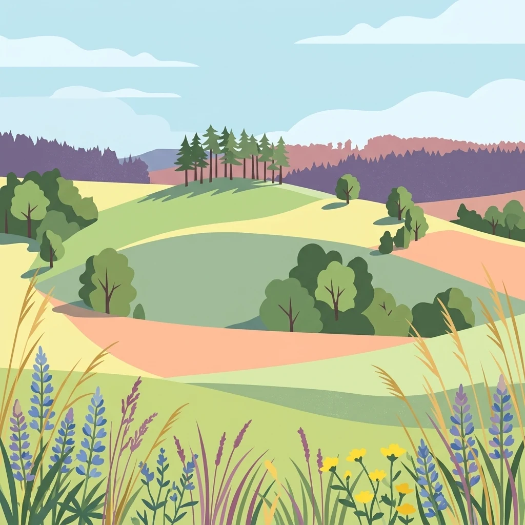
A flat-style digital illustration of rolling hills and meadows featuring wildflowers in the foreground and a small cluster of trees on a hill in the background.

Dachsberg bei Iba

Nature reserve

Park overview

Structured park overview, official facts, and landscape profile for Dachsberg bei Iba

Dachsberg bei Iba park facts, protected area profile, and essential visitor context

Review the core facts for Dachsberg bei Iba, including designation, size, terrain, visitor scale, habitats, and operating context in one park-focused overview.

About Dachsberg bei Iba

Dachsberg bei Iba is a compact yet ecologically rich nature reserve in the rolling hill country of northeastern Hesse. Despite covering only about 27 hectares split across four parcels, it preserves one of the clearest surviving examples of traditional calcareous grassland landscape in the region, a habitat type that has largely vanished from central European farmland due to agricultural intensification and abandonment of marginal pastures.

The reserve sits south of the village of Iba, a district of Bebra, between the Steinküppel, Dachsberg, and Allerhättenberg hilltops. Geologically, it rests on Zechstein limestone and dolomite bedrock, which weathers into thin, lime-rich soils. Because these soils were too poor for productive arable farming, they were traditionally used as extensive pastures for sheep and goats. This long history of grazing prevented forest regrowth and produced the open, semi-dry vegetation mosaic that defines the site today: small-scale patches of sub-Mediterranean semi-dry grassland, nutrient-poor hay meadows, juniper scrub, and remnant woodland fragments interspersed with cultivated fields.

The cultural landscape character of Dachsberg bei Iba is central to its conservation value. These habitats depend on continued traditional use; without grazing or active management, natural succession would quickly convert the open grasslands into dense scrub and forest, eliminating the conditions that support the site's specialized flora and fauna. Management therefore combines ongoing extensive grazing with targeted conservation measures to keep the grassland mosaic intact.

Beyond its national reserve status, the site is fully integrated into the European Natura 2000 network as part of the Habitats Directive site "Kalkmagerrasen zwischen Morschen und Sontra." This dual designation reflects both the regional and European significance of its orchid-rich calcareous grasslands, gentian-violet oatmeal meadows, and broom-grass dry grasslands, and connects Dachsberg bei Iba to a wider network of calcareous grassland sites across northern Hesse.

Quick facts and research context for Dachsberg bei Iba

Dachsberg bei Iba is a 27.08-hectar nature reserve in northeastern Hesse, Germany, within Landkreis Hersfeld-Rotenburg. It lies in the Fulda-Werra-Bergland, a subunit of the Osthessisches Bergland, between roughly 250 and 350 meters above sea level. The site was placed under provisional protection in December 1991 and formally declared a Naturschutzgebiet in March 1993. Its national identifier is 1632023, and its World Database on Protected Areas entry is 162688. The reserve is classified as IUCN Category IV (Habitat/Species Management Area) and lies entirely within the FFH site 5025-350 "Kalkmagerrasen zwischen Morschen und Sontra."

Protection and recognition

Examine official documentation, management scope, and recognition data.

Dachsberg bei Iba Protection Status and Mapped Designation Records

Examine the documented protection status, designation history, and management scope associated with Dachsberg bei Iba. Structured records compile available data regarding international recognition sources and protected area parameters.

Protection details

WDPA ID
162688
Park context

Deeper park guide and search-rich context for Dachsberg bei Iba

Dachsberg bei Iba history, landscape, wildlife, and travel context

Explore Dachsberg bei Iba through its history, landscape character, ecosystems, wildlife, conservation priorities, cultural context, and seasonal travel timing in a structured park guide built for atlas discovery and search intent.

Why Dachsberg bei Iba stands out

The reserve is best known for its calcareous dry grasslands, locally called Kalkmagerrasen, which support orchid-rich vegetation, juniper heaths, and flower-rich poor meadows that bloom throughout much of the year. These open habitats, shaped by centuries of sheep and goat grazing on shallow, lime-rich soils, are now extremely rare in the modern Hessian cultural landscape. The reserve is also recognized as a key stronghold for the red-backed shrike, which reaches its highest density in the Landkreis around the Dachsberg slopes.
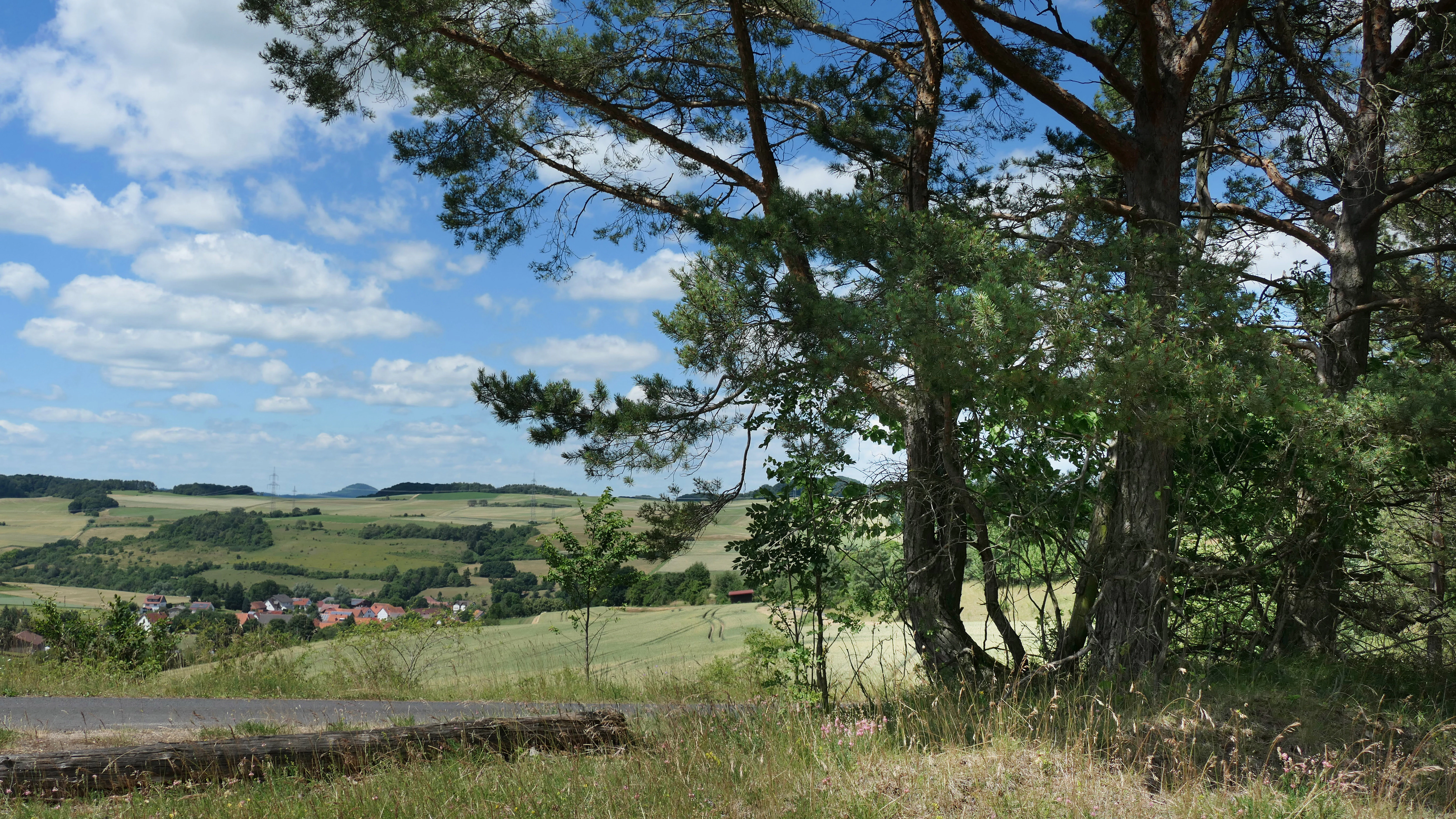
A wide view overlooking a rural valley with rolling green fields and distant hills, framed by pine trees in the foreground under a blue sky with white clouds.
A scenic view over the hilly agricultural landscape of the Dachsberg bei Iba nature reserve.

Dachsberg bei Iba history and protected-area timeline

The habitats of Dachsberg bei Iba originated through centuries of traditional land use rather than natural processes. On the shallow, lime-rich soils over Zechstein bedrock, the terrain was too poor for reliable arable farming, so local farmers used these slopes and hilltops as extensive pasture for sheep and goats. Over time, this grazing pressure created and maintained an open mosaic of dry grasslands, juniper heaths, and poor meadows that became a refuge for plant and animal species adapted to nutrient-poor, sun-exposed conditions. As agriculture modernized, mechanized, and intensified across Hesse, such marginal habitats became increasingly rare and vulnerable.

The first formal protection of the Dachsberg area came in December 1991, when the Regierungspräsidium in Kassel issued a provisional safeguarding order covering around 30 hectares of calcareous grassland and field margin strips near the hill for an initial three-year period. In March 1993, the area was formally declared a Naturschutzgebiet under Hessian law, with the explicit aims of preserving the regional mosaic of dry grassland, scrub, and small woodland fragments, protecting the rare calcareous grassland habitat type, maintaining valuable arable weed flora through extensive cultivation, and safeguarding the populations of rare and endangered plants and animals through active management, especially grazing and scrub clearance.

In June 2000, as part of the implementation of the European Habitats Directive (Directive 92/43/EEC), the area was proposed to the European Commission for inclusion in the Natura 2000 network. The site was confirmed as a Site of Community Importance in December 2004, and in January 2008 the "Verordnung über Natura 2000-Gebiete in Hessen" gave it formal legal protection as part of the larger FFH site 5025-350 "Kalkmagerrasen zwischen Morschen und Sontra," a designation that further secured its long-term management.

Dachsberg bei Iba landscape and geographic character

The landscape of Dachsberg bei Iba is shaped by gently rolling hills and slopes at the edge of the Fulda-Werra-Bergland, part of the broader Osthessisches Bergland of northeastern Hesse. Within the German natural regional classification, the reserve lies in the Ibaer Hügelland, which transitions eastward and southward into the Solztrottenwald, all subunits of the larger Fulda-Werra-Bergland. Elevations across the four parcels range from roughly 250 to 350 meters above sea level.

Underlying the reserve is Zechstein bedrock composed of limestone and dolomite, which has weathered into thin, shallow, lime-rich soils. On the more productive ground around the reserve, arable fields dominate, but within the protected parcels the soil and topography made cultivation unattractive and instead favored pastoral use. The result is a small-scale, open hill landscape of calcareous dry grasslands, juniper heaths, poor meadows, scrubby margins, and isolated woodland remnants, all visible from surrounding agricultural and walking paths.
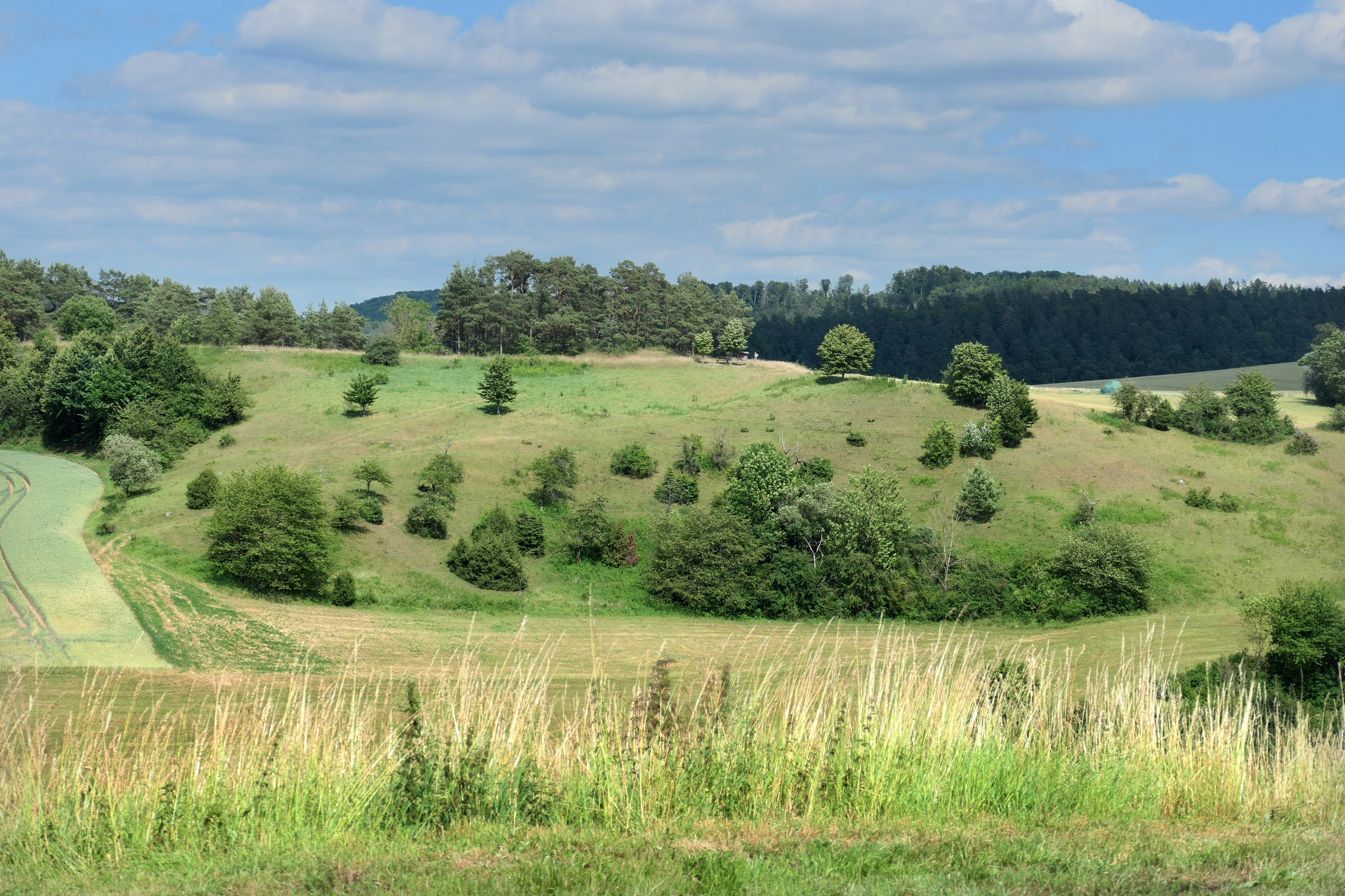
A wide landscape view of rolling green hills in summer, featuring scattered trees, shrubs, and a meadow in the foreground under a blue sky with light clouds.
A scenic view of the calcareous grasslands and juniper heath at Dachsberg bei Iba Nature Reserve.

Dachsberg bei Iba ecosystems, habitats, and plant life

The ecological identity of Dachsberg bei Iba is built around calcareous grassland habitats that are exceptionally rich in species relative to their small area. Two EU habitat types anchor the vegetation: sub-Mediterranean semi-dry grasslands (LRT 6212) and lowland hay meadows (LRT 6510). Together these form a flower-rich, structurally diverse mosaic that provides nectar and pollen resources for insects across much of the growing season.

The flora of the dry grasslands is particularly notable, with characteristic species including common cat's-foot, large white anemone, columbine, fringed and German gentians, fly orchid, early purple orchid, three-toothed orchid, greater butterfly orchid, tufted milkwort, and small-flowered sweet briar. On the lime-rich field margins and historical arable plots within and around the reserve, rare segetal plants such as summer pheasant's eye, corn cockle, small-fruited false flax, bur parsley, field larkspur, broad-leaved hemp-nettle, Venus's looking-glass, round-leaved fluellen, and corn buttercup survive as remnants of traditional low-intensity cropping.

Without grazing or active management, natural succession would convert the open grassland into scrub and woodland, eliminating the habitat. The reserve's ecological future therefore depends on maintaining the traditional disturbances, including extensive grazing and scrub control, that originally shaped the site.
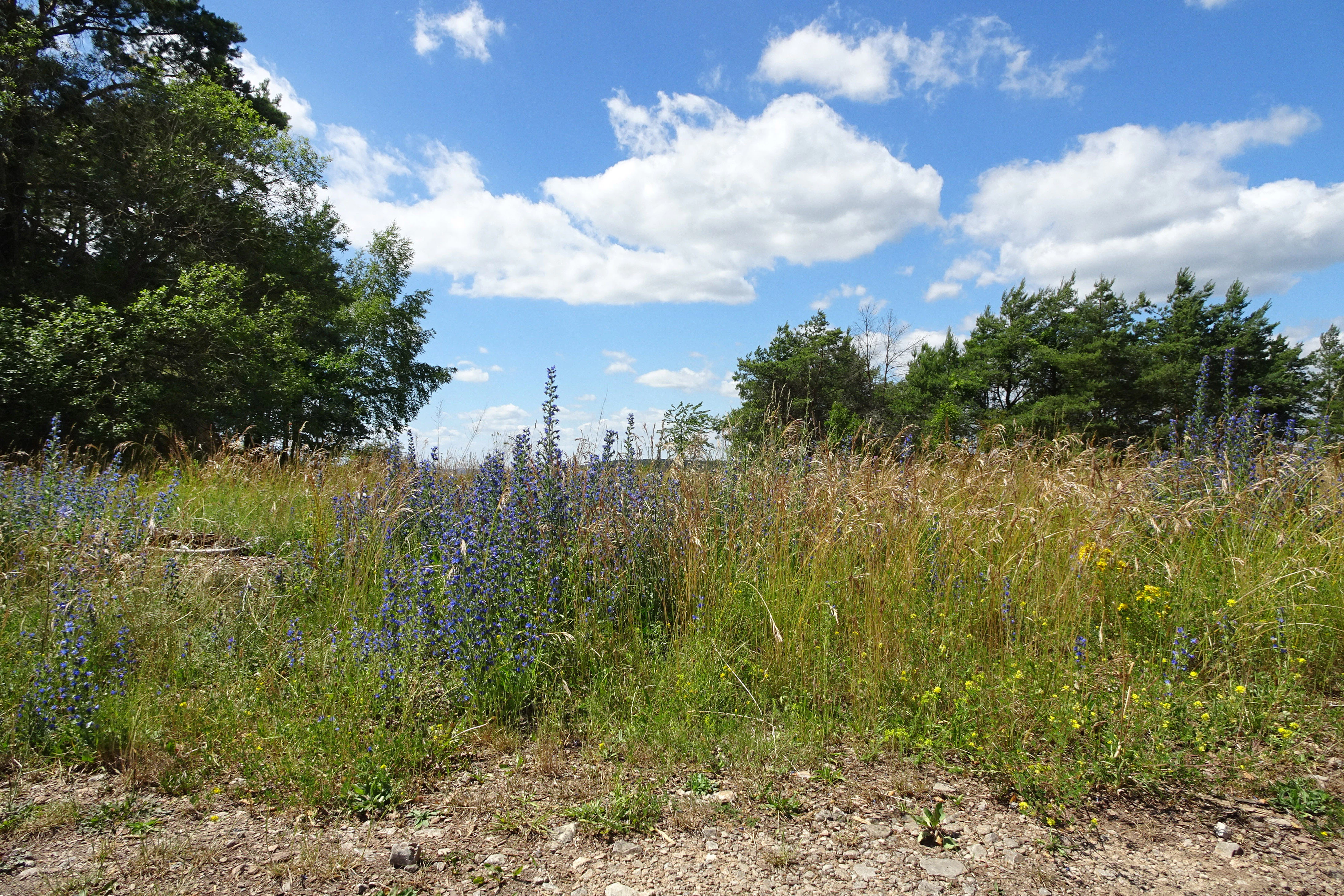
A meadow of tall grasses and purple wildflowers under a blue sky with white clouds, bordered by trees on either side.
Calcareous grassland and wildflower meadow in the Dachsberg bei Iba nature reserve.

Dachsberg bei Iba wildlife and species highlights

The wildlife character of Dachsberg bei Iba is closely tied to its open, semi-dry habitats. The most emblematic species is the red-backed shrike, which is considered the landscape's flagship bird. Around the Dachsberg area the species reaches its highest recorded density in the Landkreis Hersfeld-Rotenburg. This migratory bird, listed under Annex I of the EU Birds Directive and therefore requiring special area protection, breeds in the area in late spring and migrates between September and April to winter in East and Southern Africa.

The grassland parcels also support a diverse invertebrate fauna. Surveys of the dry grassland areas in 1988 recorded more than forty species of butterflies and burnet moths, indicating a notably rich insect community that benefits from the continuous floral resources of the open habitats. The combination of open calcareous grassland, juniper scrub, and small woodland edges provides varied nesting and foraging conditions for many other bird, insect, and small mammal species typical of traditional European pastoral landscapes.

Dachsberg bei Iba conservation status and protection priorities

Dachsberg bei Iba is valued by conservationists as a representative and unusually well-preserved example of a habitat type that has almost disappeared from modern central European farmland: extensive calcareous dry grasslands on shallow, lime-rich soils. Such grasslands support disproportionately high plant and insect diversity relative to their area, and they depend on continued low-intensity land use to persist, making them a high priority for habitat protection across Hesse and the European Union.

The reserve carries a dual designation that reflects this significance. At the national level it is a Hessian Naturschutzgebiet, classified as IUCN Category IV, Habitat/Species Management Area, with explicit management aims focused on maintaining the grassland mosaic, preserving arable weed flora through extensive cultivation, and protecting rare plants and animals through grazing and targeted interventions. At the European level it lies entirely within the FFH site "Kalkmagerrasen zwischen Morschen und Sontra" (5025-350), a multi-part site spanning Hersfeld-Rotenburg, Werra-Meißner, and Schwalm-Eder districts. The site's protection was justified on grounds including a network of small-scale, orchid-rich calcareous dry grasslands in a diverse cultural landscape, the presence of gentian-oat-grass and broom-grass dry grasslands of statewide importance in Hesse, and nationally important populations of the three-toothed orchid.

Dachsberg bei Iba cultural meaning and human context

The reserve is best understood as a relic of the traditional Hessen cultural landscape that took shape over many centuries of subsistence agriculture. Because the shallow, stony soils over Zechstein limestone were unsuitable for reliable crop production, generations of farmers used these slopes primarily for extensive grazing, especially with sheep and goats. This pastoral use shaped not only the vegetation but also the wider cultural identity of hill farming communities in the region.

As agriculture has increasingly mechanized, intensified, or shifted away from marginal lands elsewhere in Germany, the kind of small-scale mosaic of dry grassland, juniper heath, poor meadow, scrub, and cultivated field that Dachsberg bei Iba represents has become increasingly rare. Today the reserve functions both as a living ecological archive of past land use and as an example of how traditional practices, especially extensive grazing, can continue to sustain threatened habitats in a modern agricultural setting.

Top sights and standout views in Dachsberg bei Iba

Despite being only a few dozen hectares in size, Dachsberg bei Iba combines unusually high ecological, cultural, and legal significance. It is a textbook example of calcareous dry grassland habitat on shallow Zechstein soils, shaped and maintained by long-standing sheep and goat grazing. The reserve harbors orchid- and gentian-rich flora, a thriving population of red-backed shrikes that reach their highest local density in the district, and a butterfly fauna documented at over forty species in the dry grassland alone. Protection extends from Hessian nature reserve law to full inclusion in the European Natura 2000 network, making the site a model of how small, traditional cultural landscape fragments can carry both national and European conservation weight.

Best time to visit Dachsberg bei Iba

The reserve's calcareous grasslands are described as flower-rich throughout much of the year, with successive waves of orchids, gentians, and other dry grassland species providing changing color across spring and summer. The most florally spectacular period typically falls in late spring and early summer, when many of the orchids and meadow species bloom, while late summer offers the height of insect activity, including butterflies and burnet moths on the open grasslands. Because the habitats are managed through extensive grazing and active scrub control, the open character of the landscape is maintained year round, but visitors interested in the full flowering display and the birdlife, especially the red-backed shrike during its breeding season, will find late spring and summer the most rewarding time.

Monthly climate preview

Long-term monthly temperature and precipitation data for Hessen

Dachsberg bei Iba Climate Normals and Measured Temperature Rhythm

Dachsberg bei Iba records measured long-term temperature swings from sub-zero winter minimums to warm summer maximums alongside steady daily precipitation rates. Reviewing the complete twelve-month climate profile reveals comprehensive seasonal normals and detailed monthly averages for this protected area.
Annual mean8 °C
-1 °C18 °C
Jan-1°
Feb
Mar
Apr
May12°
Jun16°
Jul18°
Aug18°
Sep14°
Oct
Nov
Dec
Warmest month
July

18.3 °C

Coolest month
January

-1.1 °C

Wettest month
July

2.6 mm/day

Driest month
April

1.4 mm/day

Park location guide

Geography guide, regional context, and park location map for Dachsberg bei Iba

Dachsberg bei Iba park geography, regions, and map view in Germany

Understand where Dachsberg bei Iba sits in Germany through a broader geographic reading of the surrounding landscape, nearby location context, and its mapped position within the national park landscape.

How Dachsberg bei Iba fits into Germany

Germany is a federal republic in Western and Central Europe with a population of over 83 million across sixteen constituent states. It is Europe's largest economy by nominal GDP and a major global exporter and importer. The capital is Berlin, and the country borders Denmark, Poland, Czech Republic, Austria, Switzerland, France, Luxembourg, Belgium, and the Netherlands.

Wider geography shaping Dachsberg bei Iba in Germany

Germany is located in Western and Central Europe, spanning 357,022 km². It borders Denmark to the north, Poland and the Czech Republic to the east, Austria and Switzerland to the south, and France, Luxembourg, Belgium, and the Netherlands to the west. The country has coastlines on the Baltic Sea and North Sea to the north, with the Alps located in the southern region.

Map view of Dachsberg bei Iba

Use this park location map to pinpoint Dachsberg bei Iba in Germany, understand its exact geographic position, and read its mapped placement within the surrounding landscape more clearly.

Pigeon | © OpenStreetMap contributors

Location context for Dachsberg bei Iba

Hessen

Visualizing the calcareous dry grasslands, juniper heaths, and limestone hill terrain of Hesse

Dachsberg bei Iba Photos and Landscape Scenery

Explore detailed visual records of Dachsberg bei Iba, capturing the open hill slopes, sparse calcareous soils, and rare floral habitats. Reviewing these landscape photographs helps interpret the ecological character and traditional pastoral topography that define the protected area.

A wide view overlooking a rural valley with rolling green fields and distant hills, framed by pine trees in the foreground under a blue sky with white clouds.

A wide shot of a rolling, rural landscape with undulating hills, patchwork agricultural fields, and patches of forest under a blue sky with scattered clouds.

A wide landscape view of rolling green hills in summer, featuring scattered trees, shrubs, and a meadow in the foreground under a blue sky with light clouds.

A meadow of tall grasses and purple wildflowers under a blue sky with white clouds, bordered by trees on either side.

Park atlas

Compare regional protected areas and discover connected natural habitats across northeastern Hesse.

Explore Parks Near Dachsberg bei Iba and Surrounding Protected Landscapes

Browsing other parks near Dachsberg bei Iba reveals the broader distribution of calcareous dry grasslands and protected habitats throughout the region. Expanding the geographic comparison provides valuable context on how traditional pastoral landscapes connect across local hills and valleys.
Watercolor painting of a lush, open landscape with a pond in the foreground, rolling green hills, and a forest in the background.
Nature reserveHesse
About 0.6 km away#1 closest

Northwest

Auf dem Ried bei Iba Nature Reserve and Protected Wetland Landscape in Northern Hesse

Mapped brook valley and wet grassland geography

Auf dem Ried bei Iba stands as a significant nature reserve in the Iba valley of eastern Hesse, Germany. This protected area preserves a rare sequence of reedbeds, marshes, and spring-fed wet meadows that sustain diverse aquatic plant communities. By maintaining the natural hydrology of the local brook system, the reserve offers a unique look at the wetland terrain and riparian geography characteristic of the Hesse hill country.

Area
0.047 km²
Established
1985
IUCN
IV
Relief
Lowland
Watercolor painting of a river landscape with lush green vegetation and soft pink hills in the background.
Nature reserveLandkreis Hersfeld-Rotenburg
About 6.1 km away#2 closest

Southwest

Alte Fulda bei Blankenheim Nature Reserve: Mapping the Fulda Valley Floodplain Ecosystem

Protected riparian landscapes in Landkreis Hersfeld-Rotenburg

Alte Fulda bei Blankenheim is a vital nature reserve featuring a restored oxbow, wet meadows, and secondary flood channels. This site showcases the intersection of traditional land management and modern wetland conservation within the broader landscape of the Fulda valley. Explore the boundaries, terrain, and regional geography of this important Hessian bird sanctuary and floodplain habitat.

Area
0.236 km²
Established
1981
IUCN
IV
Relief
Lowland
A soft, painterly watercolor landscape showing a green grassy meadow beside a calm lake with a stand of trees and rolling hills in the background.
Nature reserveLandkreis Hersfeld-Rotenburg
About 6.3 km away#3 closest

West

Forbachsee bei Bebra Nature Reserve: Mapped Protected Landscape in Landkreis Hersfeld-Rotenburg

River-connected gravel-pit lake and floodplain geography

Analyze the protected boundaries of Forbachsee bei Bebra, a nature reserve defined by its active connection to the River Fulda. The site features an evolving shoreline of gravel banks and softwood forest, showcasing how industrial extraction areas mature into essential refuges for migratory waterbirds within the larger regional valley system.

Area
0.219 km²
Established
1985
IUCN
IV
Relief
Lowland
A soft, impressionistic watercolor painting of a serene landscape featuring rolling green hills, lush vegetation, and a calm, reflective lake in the foreground.
Nature reserveHesse
About 7.3 km away#4 closest

Southwest

In den Weiden bei Blankenheim: A Protected Wetland Sanctuary in the Hessian Fulda Valley

Mapping riparian floodplains and bird migration corridors in central Germany.

The In den Weiden bei Blankenheim nature reserve preserves a compact yet ecologically dense floodplain lake environment. Managed as a crucial component of the regional Fulda valley river corridor, it demonstrates the successful conversion of post-industrial gravel pits into a stable habitat for waterbirds, songbirds, and diverse riparian flora within the Hessian landscape.

Area
0.045 km²
Established
1983
IUCN
IV
Relief
Lowland
Nature reserveThuringia
About 7.9 km away#5 closest

Northeast

Werra-Aue zwischen Breitungen und Creuzburg: Protected Floodplain and River Geography

Nature reserve sanctuary in western Thuringia

Spanning over 33 kilometers of the Werra river, this protected floodplain is defined by its distinctive geological sinkholes, seasonal wetlands, and diverse bird habitats. Discover the layered conservation status and riparian terrain that mark this significant Thuringian nature reserve as a crucial node for European ecological connectivity.

Area
25.78 km²
Established
2007
IUCN
IV
Relief
Lowland
A horizontal watercolor painting showing a soft landscape with green meadows, trees, a winding stream, and distant rolling hills in a light, atmospheric style.
Nature reserveHessen
About 8.8 km away#6 closest

Southeast

Säulingssee Nature Reserve: Atlas Overview of this Hessen Protected Wetland Basin

Mapped geography and landscape context of a unique German reserve

Säulingssee serves as an important nature reserve within the Werra valley region of Hessen. This former lake basin now acts as a sophisticated wetland complex featuring subrosion-driven pools, reedbeds, and varied meadow habitats. As part of the Natura 2000 network and the Grünes Band Hessen corridor, the area offers a significant case study for conservation grazing and the restoration of endangered aquatic plants within Germany.

Area
0.214 km²
Established
1984
IUCN
IV
Relief
Lowland
A soft watercolor illustration of a calm pond surrounded by green vegetation and rolling hills in the background.
Nature reserveWartburgkreis
About 10 km away#7 closest

East

Dankmarshäuser Rhäden: Protected Wetland Reserve and Mapped Floodplain in Wartburgkreis

Restored basin landscape along the historic Green Belt corridor.

Dankmarshäuser Rhäden comprises a complex wetland mosaic in the Wartburgkreis district. This nature reserve, characterized by shallow subsidence basins and active floodplain management, represents a critical migratory bird sanctuary and a key component of the protected Green Belt. The area reveals a history of land-use transition, from agricultural depression to a functional, water-managed ecosystem supporting diverse meadow-nesting and migratory bird populations.

Area
1.217 km²
Established
1995
IUCN
IV
A soft watercolor illustration depicting a flat green wetland landscape with a winding river and distant rolling hills under a pale sky.
Nature reserveHesse
About 10 km away#8 closest

East

Rhäden bei Obersuhl und Bosserode: Nature Reserve and Wetland Mosaic in Northern Hesse

A restored floodplain landscape in the Werra valley

Rhäden bei Obersuhl und Bosserode represents a significant subsidence basin restored from agricultural land into a thriving wetland. This protected nature reserve in Hesse features a structured mosaic of ponds, reedbeds, and wet meadows, serving as a primary regional site for bird migration and habitat conservation within the Werra valley geography.

Area
1.204 km²
Established
1973
IUCN
IV
Relief
Lowland

Common questions about visiting, size, designation, and location context for Dachsberg bei Iba

Dachsberg bei Iba FAQs for park facts, access, geography, and protected area context

Find quick answers about Dachsberg bei Iba, including protected-area facts, park geography, trail and visitor context, and how the park fits into its surrounding country and regional landscape.
MoriAtlas Explorer

Continue Your Protected Areas Search Across the Global Atlas

Deepen your exploration by continuing the structured search for national parks and protected areas worldwide. Utilize the comprehensive filtering capabilities to compare different conservation landscapes and refine your understanding of global park geography. Discover more about the distribution and characteristics of protected natural areas.

Global natural geography