
Why Dallol Bosso stands out
Dallol Bosso is best known as the longest and most heavily populated seasonal wadi in western Niger, a valley corridor where clay-rich floodplain soils and persistent groundwater support irrigated farming, mud-brick making, and pastoral land use across the Sudano-Sahelian transition. It is also notable as one of Niger's largest Ramsar wetlands, designated in 2004, and as a traditional homeland shared by the Fulbe, Tuareg, and Zarma peoples. The valley's role as a hydrological and agricultural spine of the Boboye region defines its identity far more than any single landscape feature.
Dallol Bosso history and protected-area timeline
Human presence along Dallol Bosso long predates any modern administrative recognition. The valley became a traditional homeland of the Fulbe people, who settled the fertile valley-floor soils in significant numbers while sharing the territory with Tuareg and, further south, Zarma communities. Over time, the Zarma name for the valley, Boboye, meaning valley, took root as both a regional and an administrative identifier, eventually lending its name to a Nigerien department.
During the twentieth century the valley became the focus of scholarly and development attention. French researchers produced key hydrogeological and ethnographic studies, including a 1986 BRGM assessment of the valley's water resources and the 1977 study of the local Fulbe population by Alain Beauvilain. Subsequent academic work examined the valley's soils, geomorphology, land use, pastoral resources, and the local tradition of mud-brick making, drawing on the valley as a case study for small-scale irrigation in the Sahel.
In April 2004, Dallol Bosso was inscribed as a Ramsar Wetland of International Importance. Covering 892,122 hectares, this designation placed the valley as the second-largest Ramsar site in Niger, after the oases and gueltas of the Aïr, and gave international recognition to the valley's hydrological, agricultural, and ecological significance. The listing has since framed ongoing discussions of land use, irrigation expansion, and conservation management along the valley corridor.
Dallol Bosso landscape and geographic character
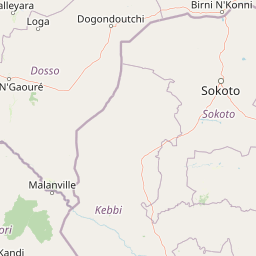
Dallol Bosso is a long, flat-bottomed valley incised into the broader landscape of western Niger. North to south, the corridor stretches some 350 kilometers, and although the wadi channel itself is seasonal, the valley form remains a continuous feature from the Malian border down to the Niger River. Plateau edges rise on either side of the valley, while the valley floor carries the deeper soils and shallow groundwater that define the corridor's character.
The valley crosses two clearly differentiated ecological macro-landscapes. In its northern reaches, the climate and vegetation reflect the Sudano-Sahelian transition, with grasses and scattered tree cover suited to a drier rainfall regime. Further south, the valley enters Sudanian territory, where higher rainfall supports denser woody vegetation and more persistent surface water in tributary channels. This north-south climatic shift gives the valley a layered landscape identity that is rare in the Sahel.
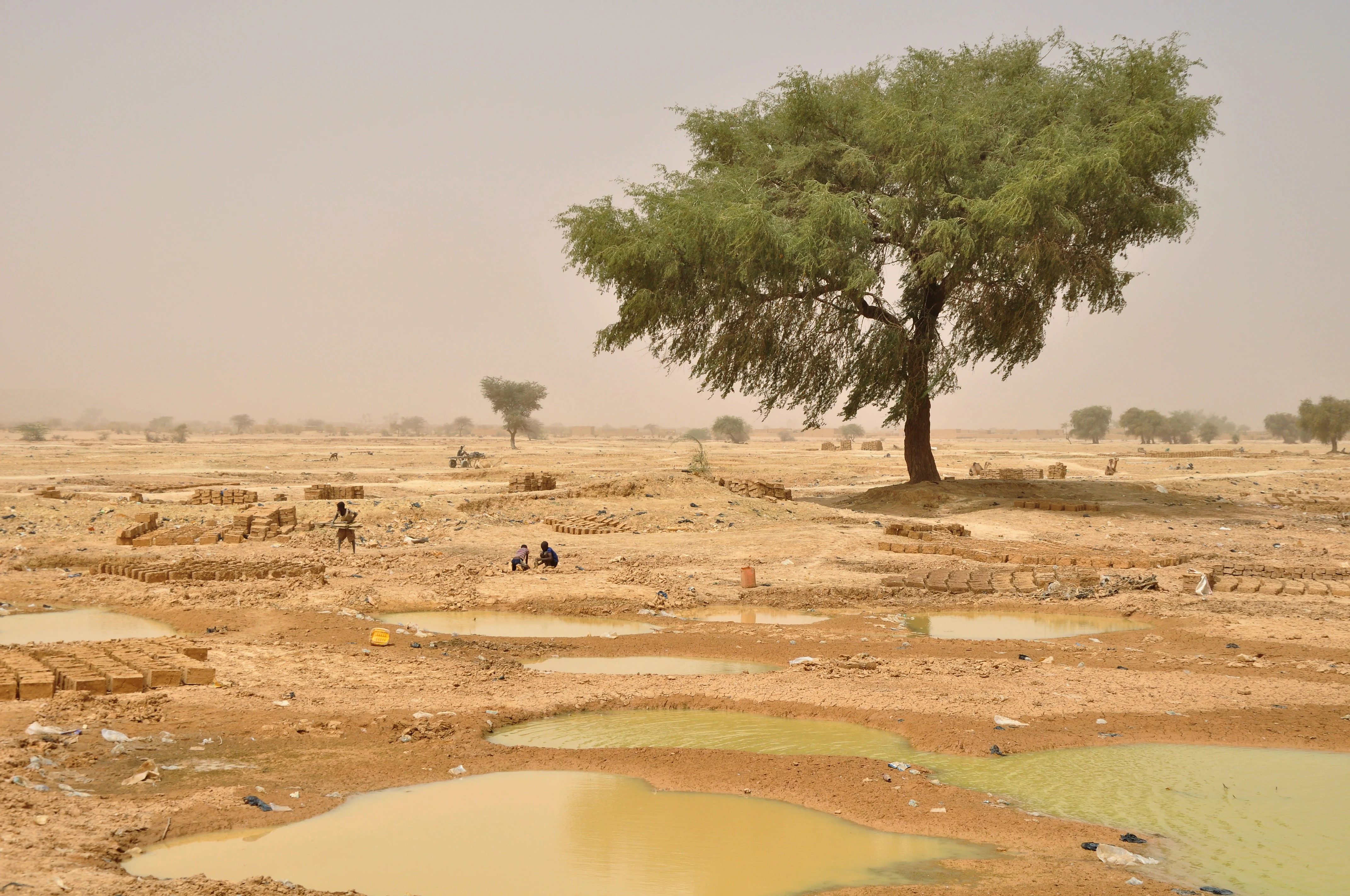
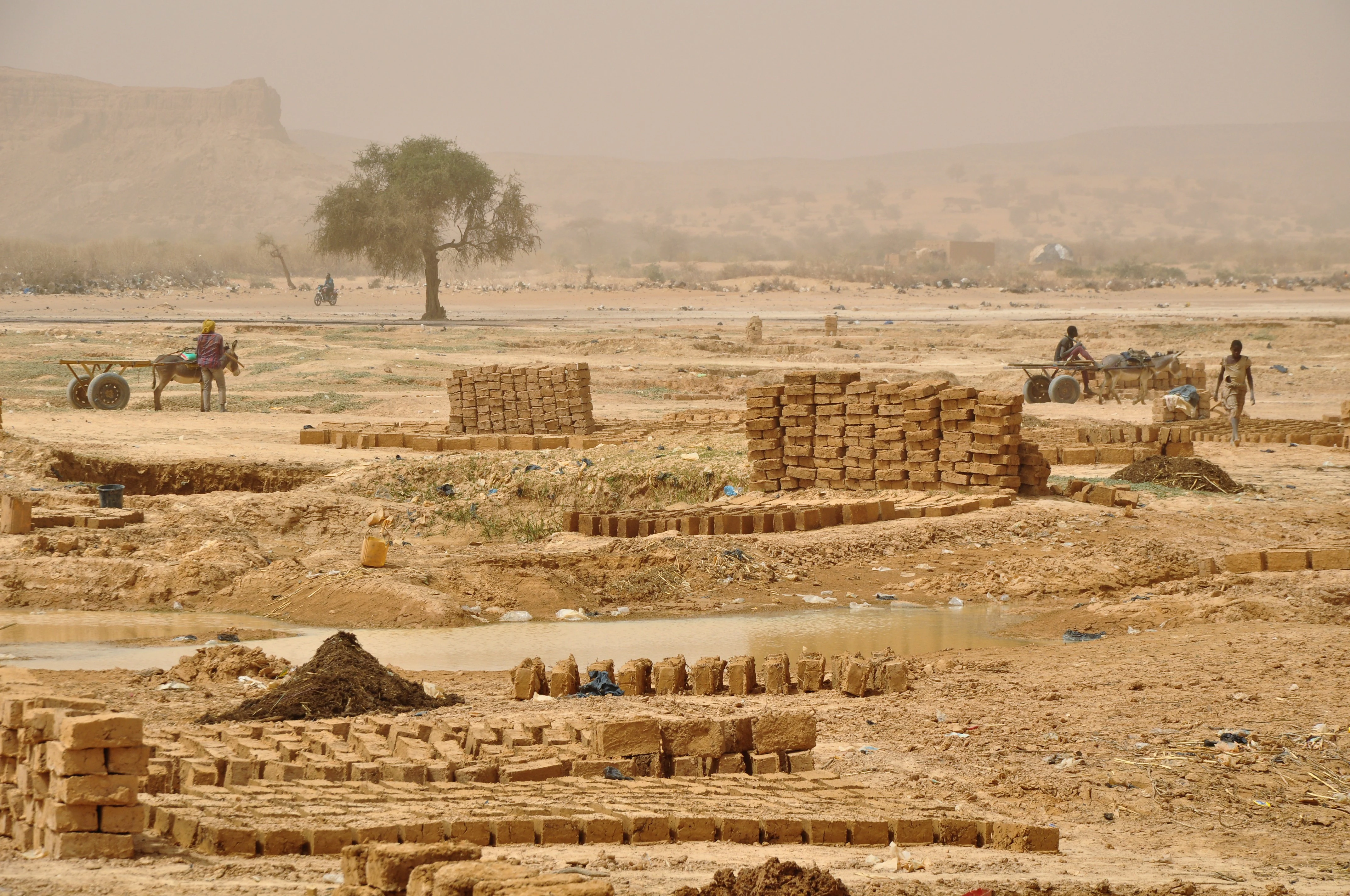
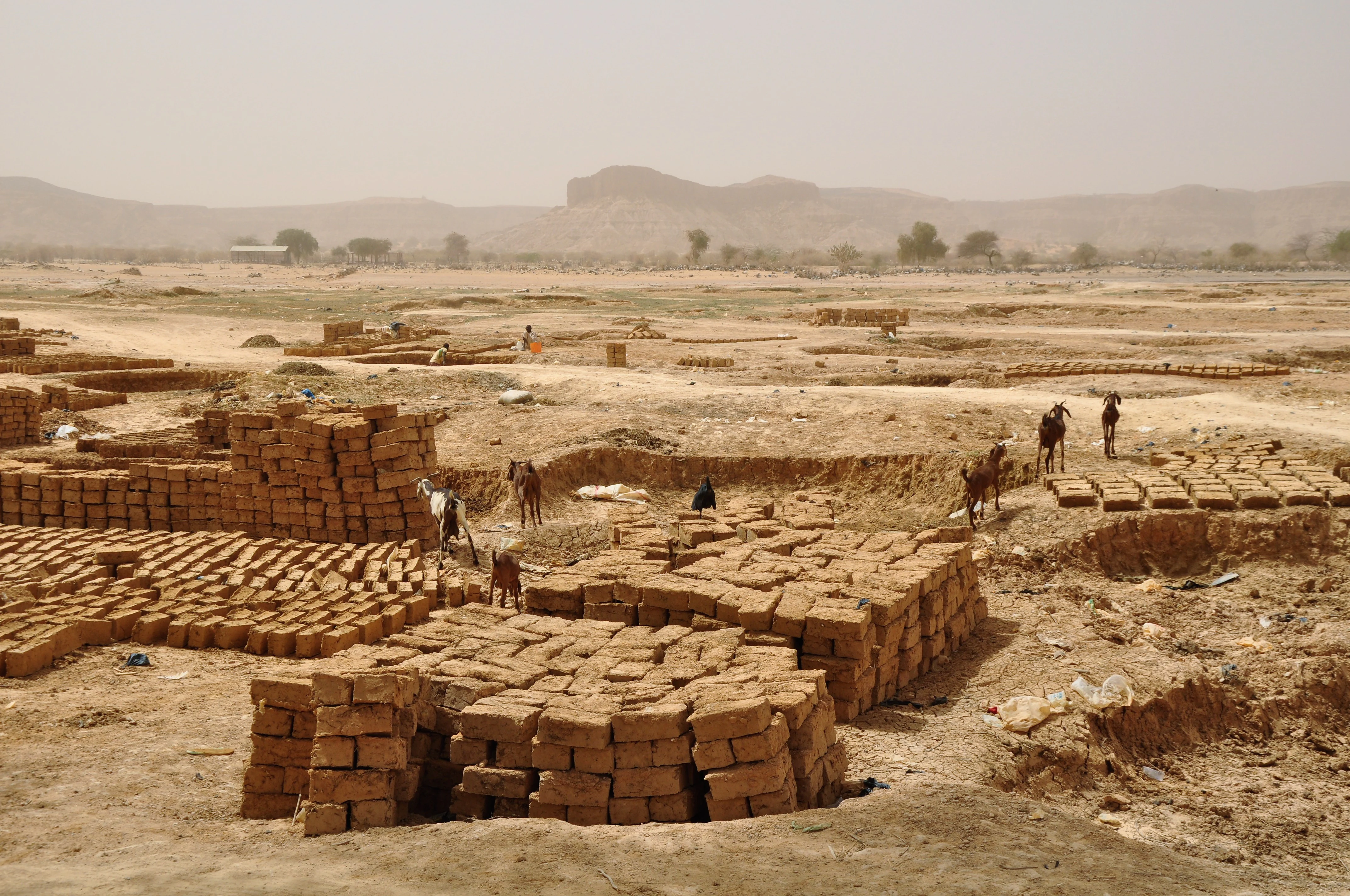
On the flanks of the valley, erosion by wind and water shapes the silt-cloy soils of the bordering plateaus, while grain cultivation takes hold on these higher surfaces. In the valley proper, the flat alluvial floor and its hydromorphic clay soils create the conditions for irrigated field agriculture and the long-established practice of mud-brick making, activities that have visibly shaped the working landscape of the Boboye region.
Dallol Bosso ecosystems, habitats, and plant life
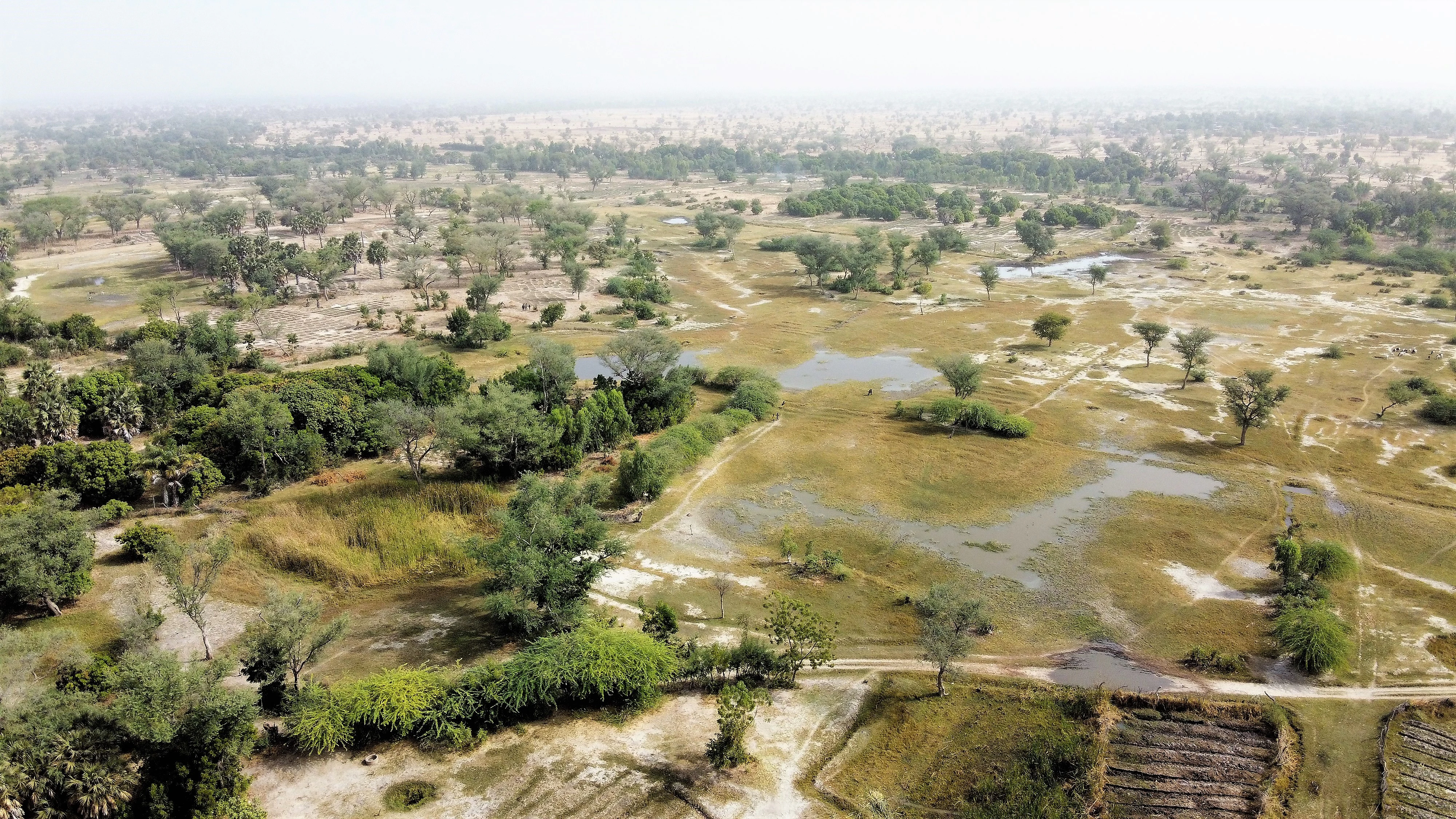
The ecological identity of Dallol Bosso is defined first by its hydrology. A relatively high water table sits beneath much of the valley floor, sustaining vegetation and agriculture through the dry season, while periodic flows reshape the channel and recharge the floodplain soils. The hydromorphic soils of the valley bottom are rich in clay and organic matter, supporting denser and more diverse plant cover than the surrounding plateaus.
The valley spans the Sudano-Sahelian transition and the Sudanian zone, and this dual climatic setting gives the vegetation a distinctive gradient. In the north, Sahelian grasses and drought-tolerant trees dominate the surrounding plateaus, while the valley floor holds more moisture-loving species. Further south, the valley enters true Sudanian territory, where rainfall sustains richer woodland and more permanent wetland vegetation. The palm species Hyphaene thebaica, known locally as the doum palm, has been highlighted in ecological studies as a notable element of the valley's vegetation and a resource for pastoral communities.
Wetland functions along the corridor are unusually significant for a Sahelian landscape. Standing water, shallow aquifers, clay-based floodplain soils, and seasonally inundated zones combine to maintain habitat for waterbirds and other species dependent on persistent moisture in an otherwise dry regional setting. These values were a core reason for the valley's designation as a Ramsar site in 2004.
Dallol Bosso wildlife and species highlights
Dallol Bosso is best understood ecologically as a wetland corridor rather than a wildlife reserve, and its fauna reflects the valley's hydrology more than its drier surroundings. The persistent shallow water table, seasonal surface flows, and hydromorphic soils sustain habitats that support waterbirds, wetland-dependent bird species, and the broader Sahelian bird communities typical of the broader Filingué and Boboye region. Pastoral species, including cattle, sheep, and goats kept by Fulbe and Zarma herders, are a defining and longstanding presence across the valley floor.
The valley also continues to support traditional hunting and gathering of wild plant resources alongside its agricultural land use, linking local livelihoods to the valley's seasonal productivity. Specific charismatic mammal populations are not the primary focus of conservation attention for this site: what matters ecologically is the maintenance of hydrological processes that sustain the entire corridor of habitat, including the wetland mosaic recognized under the Ramsar Convention.
Because the valley is valued primarily for its hydrological and agricultural functions rather than as a wildlife stronghold in the conventional sense, the wildlife profile of Dallol Bosso is best read through the lens of wetland-dependent species and pastoral land use rather than through large-mammal inventories.
Dallol Bosso conservation status and protection priorities
Dallol Bosso has been the focus of conservation attention primarily for its wetland values rather than for a classical wilderness or large-fauna profile. The valley's combination of shallow groundwater, hydromorphic soils, seasonal surface water, and a long, continuous corridor of floodplain habitat across an otherwise water-stressed Sahelian landscape gives it significance at the regional and international scales.
In 2004, the valley was inscribed as a Ramsar Wetland of International Importance, covering some 892,122 hectares. This designation makes it the second-largest Ramsar site in Niger, behind only the oases and gueltas of the Aïr massif, and the largest such site in the country's western agricultural heartland. The Ramsar listing underlines both the size of the wetland complex and the importance of its hydrological functions for biodiversity, pastoralism, and irrigated agriculture.
The conservation challenge in Dallol Bosso is closely tied to land-use pressure. With population densities exceeding one hundred inhabitants per square kilometer on the valley floor and frequent tensions between herders, farmers, and brick-makers, the long-term sustainability of the wetland corridor depends on balancing traditional livelihoods with the need to maintain hydrological processes, soil fertility, and vegetation cover. Research and development work over recent decades has treated the valley as a model site for understanding small-scale irrigation, soil and water management, and pastoral resource use in the Sahel.
Dallol Bosso cultural meaning and human context
Dallol Bosso is a deeply human landscape. The valley has long served as a traditional homeland of the Fulbe people, who form the backbone of the local population, alongside Tuareg communities further north and Zarma communities further south. The fact that three major West African cultural groups share this valley corridor, working the same soils and sharing grazing and farming resources, gives the region a layered cultural identity that is unusual in the Sahelian zone.
Cultural expression in the valley is closely tied to land and craft. The seasonal rhythm of cultivation, herding, and the production of traditional mud bricks from the valley's clay-rich soils shapes village life in settlements such as Filingué, Tagazar, Birni N'Gaouré, and Harikanassou. The Zarma name Boboye, meaning valley, has itself become a regional identity label, and the Boboye department takes its name from this older linguistic designation.
The valley has also been the subject of longstanding ethnographic and scholarly interest. Studies of the local Fulbe population, their customs and livelihoods, and the hydrogeology of the valley itself stretch back to the late twentieth century, including a 1977 study of the Fulbe of the Dallol Bosso and a 1986 hydrogeological evaluation of the valley's water resources. These traditions of documentation have helped establish Dallol Bosso as both a living cultural landscape and a reference site for Sahelian human geography.
Top sights and standout views in Dallol Bosso
The defining strengths of Dallol Bosso are its length, its hydrology, and its cultural depth. The valley extends some 350 kilometers from the Malian border to the Niger River at Boumba, creating one of the longest continuous seasonal-water corridors in the Sahel. Its hydromorphic valley-floor soils and high water table support both irrigated farming and a long tradition of mud-brick making, while the surrounding plateaus carry their own agricultural cycle.
The valley's status as Niger's second-largest Ramsar Wetland of International Importance, designated in 2004 and covering 892,122 hectares, anchors its conservation profile and gives it regional weight. Population densities exceeding one hundred inhabitants per square kilometer along the valley floor, the shared Fulbe, Tuareg, and Zarma cultural heritage, and the multiple linguistic names for the valley itself, including Dallol Bosso in Fulfulde and Boboye in Zarma, together mark it as one of the most distinctive human-environment corridors in West Africa's Sahelian zone.
Best time to visit Dallol Bosso
Dallol Bosso is a seasonal watercourse, and its character shifts notably between the rainy and dry seasons. During the rainy season, the wadi channel can carry water along significant portions of its length, the valley floor greens, and pastoral and agricultural activity intensifies; the vegetation along the valley reaches its fullest expression, and the surrounding Sudano-Sahelian and Sudanian landscapes are at their most photogenic.
In the dry season, surface water largely disappears from the channel, but the valley retains its identity through its clay soils, vegetation cover, brick-making activity, and settlements such as Harikanassou, Filingué, and Birni N'Gaouré, which remain accessible along the corridor. The cooler, dust-harmattan period of the dry season offers clearer skies and easier travel between villages along the valley road, while the immediate post-rainy period brings the most dramatic landscape contrast between green valley floor and dry plateau.