
Why Dassen Island stands out
Dassen Island is most famous for its breeding colony of African penguins, one of the larger and historically important colonies of this endangered species along the South African coast. At its twentieth-century peak the island hosted tens of thousands of breeding pairs, and although the population has since declined sharply, Dassen remains a stronghold of penguin activity, with worn penguin paths crisscrossing parts of the island. Equally distinctive is the island's character as a low, exposed Atlantic seabird refuge fringed by reefs, with centuries of maritime and naming history. Positioned along major international shipping routes, it is a place where conservation, seabird breeding biology, and the human history of Cape navigation converge in a single small oceanic landmass.
Dassen Island history and protected-area timeline
Dassen Island has a layered human history that begins with early Portuguese maritime exploration of the Cape. Portuguese sailors named the island Ilha Branca, or 'white island,' referencing its pale appearance from the sea, embedding the island into the earliest European cartography of southern Africa. The form of the name was later reshaped by Dutch colonial contact when Joris van Spilbergen renamed it Elizabeth Eiland in 1601, anchoring the island within the Dutch seafaring vocabulary of the period.
The modern name reflects the island's natural history rather than colonial naming. Dutch and Afrikaans speakers applied the form Dasseneiland, with 'das' meaning badger and 'dassie' referring to the rock hyrax, after the colonies of hyraxes that early visitors encountered on the island. In everyday use the island was also occasionally referred to as Penguin Island, a nickname that reflected its most visible wildlife and that occasionally caused confusion with other similarly named islands along the South African coast.
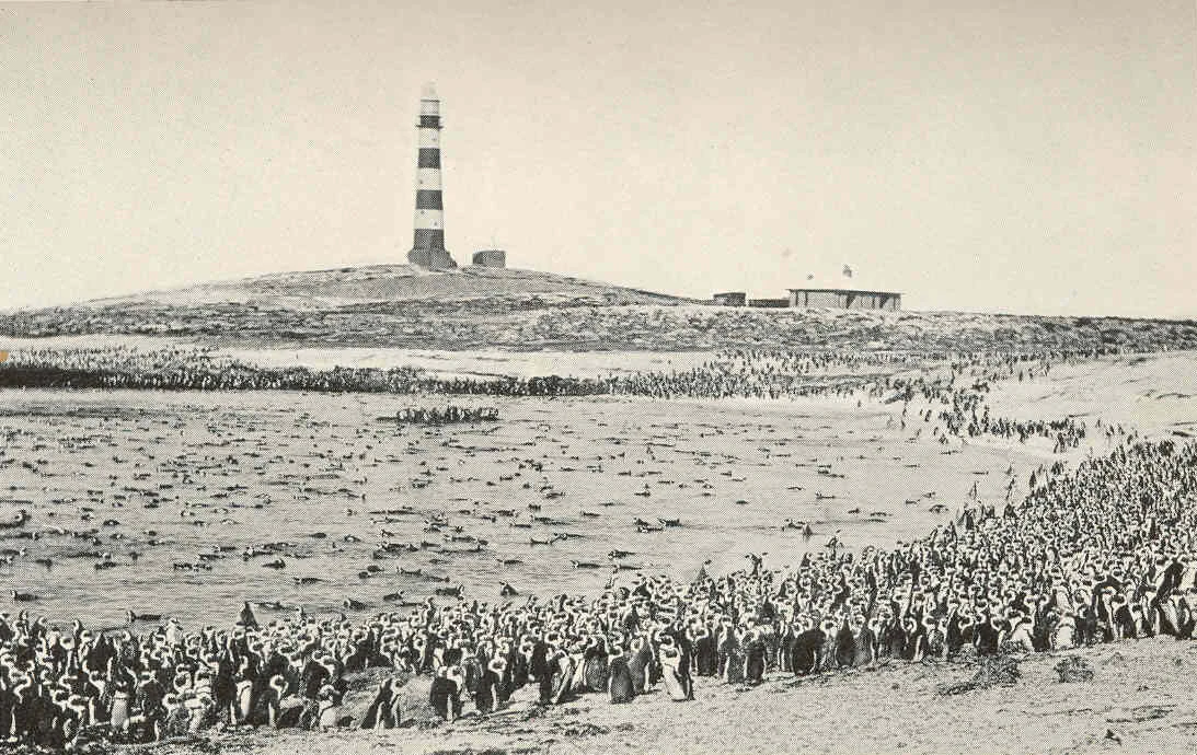
The 19th and 20th centuries brought lighthouse construction, ongoing maritime traffic, and a growing awareness of the island's ecological importance. The construction of a circular iron lighthouse in 1893, painted in distinctive white and red bands, marked the island as an established navigational reference along a shipping route that would later carry hundreds of oil tankers per month. The 20th century also brought the first systematic observations of the penguin colony: estimates from the 1950s placed the population in the tens of thousands, with a 1975 estimate around 60,000 birds, illustrating just how dramatically the colony has since declined. The island was formally proclaimed as a nature reserve and, on 29 March 2019, was officially designated as a Ramsar wetland site, giving its conservation status a clear international anchor.
Dassen Island landscape and geographic character
Dassen Island is a flat and low-lying Atlantic island, with a profile that barely rises above the surrounding sea. It stretches about 3.1 kilometers from northwest to southeast and is around 1 kilometer wide, giving it an elongated footprint shaped by longshore currents and offshore deposition rather than dramatic geological uplift. The island's surface is gentle and undifferentiated, and there are no significant cliffs, peaks, or interior ridges to break the horizontal line of its terrain.
Beneath this plain surface, the island rests on a base of fine-grained tourmaline granite with localized zones of biotite granite, intrusive rocks of late Precambrian origin that connect the island physically to the ancient geology of the western Cape margin. Patches of sand overlie this granite skeleton in places, building the soft substrate that defines the island's interior. Along most of the shoreline, large rounded boulders protrude through the sand just above the high water mark, creating an irregular, wave-washed interface between land and sea.
On three sides the island is encircled by reefs that rise from the surrounding Atlantic shelf, leaving the eastern side comparatively more open. These reefs shape both the visual identity of the island from the sea and its ecological footprint below the waterline. Fresh surface water is scarce: although temporary pans form in the interior during the winter wet season, Dassen Island has no permanent freshwater systems, reinforcing its character as a true oceanic island conditioned as much by sea and weather as by landform.
Dassen Island ecosystems, habitats, and plant life
Ecologically, Dassen Island belongs to the Benguela marine region, where cold, upwelled Atlantic waters drive high productivity and support dense populations of fish, seabirds, and marine predators. Within this broader system the island functions as a small but ecologically significant refuge, where granite bedrock, sand cover, shoreline boulders, and reef-enclosed shallows combine to produce an unusually compact set of microhabitats for its size.
The island's habitats are dominated by coastal strand vegetation, low scrub, and open sandy or rocky ground rather than closed forest or thicket. Limited soil development, exposure to salt spray, and the absence of permanent freshwater mean that plant communities are sparse and adapted to harsh maritime conditions. Seasonal winter rains briefly activate internal pans, creating temporary wetland microhabitats that contribute to the island's later designation as a Ramsar site.
Surrounding the island, the reef systems on three sides of Dassen create nearshore marine habitat that historically supported the prey base for breeding seabirds. This interface between land-based breeding refuge and reef-supported foraging grounds is the defining ecological signature of the island, linking penguin nesting areas to a wider mosaic of rocky reef, sandy seabed, and open Atlantic water.
Dassen Island wildlife and species highlights
Wildlife identity at Dassen Island is defined overwhelmingly by its seabird populations, particularly the African penguin colony that has given the island much of its reputation. The colony once held tens of thousands of breeding birds, with mid-1970s estimates reaching around 60,000 individuals, and even at the start of the 21st century the population was still estimated near 56,000 birds. The physical traces of this colony are visible across the island in the form of rocky penguin paths, worn over generations by birds moving between the sea and their nest burrows.
The penguin population has been shaped by a combination of pressures that have made Dassen Island a focal point in the wider story of the species. Past commercial harvesting of eggs reduced breeding success, while guano collection degraded the soft substrate the birds rely on for burrowing. Broader shifts in the marine environment, including the overfishing of key prey species such as pilchard, have reduced the food supply available to foraging penguins. The island's position along a busy international shipping lane, with very large numbers of oil tankers passing each month during the 1970s, has also exposed the colony to chronic oil pollution and the effects of occasional major spills, including the MV Treasure event.
Beyond penguins, the island supports typical Benguela seabird and shorebird communities, with the surrounding reefs and shoreline boulders providing habitat for a range of marine-dependent species. The historical presence of rock hyrax colonies, from which the island takes its modern name, points to a once richer suite of terrestrial fauna that has since receded or disappeared as the island's ecology has shifted under centuries of human and maritime influence.
Dassen Island conservation status and protection priorities
Dassen Island holds a multi-layered conservation status that reflects both its ecological importance and its place within South Africa's coastal protection network. The island is formally proclaimed as a nature reserve, giving it domestic legal protection and placing its management within the framework of South African biodiversity law. Its designation as a Ramsar wetland site on 29 March 2019, under reference number 2383, recognized its significance at an international scale, particularly for the seabird and coastal wetland functions it performs.
From a conservation perspective, the island matters because it acts as a refugium for African penguins in a region where the species has been in steep decline. Even a substantially reduced penguin colony on Dassen represents a disproportionately important share of the global breeding population for this endangered species, making the island a critical node in safeguarding the species' future. The surrounding reef system reinforces this significance, sustaining prey species and breeding habitat in a context where marine productivity is under pressure from fishing, pollution, and climate change.
The island's conservation profile also extends to chronic threats from maritime traffic. Its location along a major international shipping route has historically exposed it to oil pollution from routine bilge dumping and from occasional major spills, making oil contamination an ongoing conservation concern rather than a rare event. The designation as a Ramsar site explicitly acknowledges the wetland character of the island and the need for integrated management of its seabird, shoreline, and marine components, framing Dassen Island as a case study in linking island, coastal, and offshore protection in a single conservation plan.
Dassen Island cultural meaning and human context
Culturally, Dassen Island is a layered artifact of Europe and southern Africa's long maritime encounter. The earliest preserved European layer is Portuguese, with the name Ilha Branca, or 'white island,' recording one of the first European impressions of the Cape coast from the sea. This Portuguese imprint was overwritten by Dutch navigation in 1601 when Joris van Spilbergen renamed the island Elizabeth Eiland, embedding Dassen into the cartographic vocabulary used by Dutch ships rounding the Cape.
The modern name Dasseneiland reflects the island's natural history rather than imperial naming, with the Dutch and Afrikaans terms das and dassie referencing badgers and rock hyraxes. The presence of hyrax colonies noted by early visitors also gave the island a small place in early natural history writing about the Cape. A more informal cultural layer came from the occasional use of the name Penguin Island, a nickname that reflected the island's most charismatic wildlife and that occasionally surfaced in local usage alongside its formal name.
Out at sea, the island's lighthouse, built in 1893 as a circular iron tower with white and red bands, added a maritime heritage layer that aligns the island with the broader history of navigation aids along the South African coast. The numerous shipwrecks recorded around its reef-fringed shores further deepen this heritage, marking Dassen Island as a place where ecological, cartographic, and seafaring histories meet on a single small landmass.
Top sights and standout views in Dassen Island
Dassen Island's strongest identity points all converge on its role as an oceanic seabird refuge. It hosts one of Africa's most important breeding colonies of African penguins, despite decades of decline from egg collection, guano harvesting, prey fishery pressure, and oil pollution. The worn penguin paths crossing the island are themselves a highlight, recording generations of seabird life in the rocky surface.
Equally notable are the island's Ramsar wetland status, its proclaimed nature reserve protection, and its reef-fringed Atlantic setting, which together place it firmly within South Africa's network of coastal and marine protected areas. Layered on top are centuries of maritime history, Portuguese and Dutch naming layers, and the landmark 1893 lighthouse, making Dassen Island a small island with an unusually rich combination of ecological, cultural, and navigational significance.
Best time to visit Dassen Island
For visitors oriented around the island's seabird character, timing largely depends on the breeding rhythms of the African penguin colony. Penguin activity peaks during the breeding season, when birds come ashore most frequently to nest and roost, and visits aligned with this period offer the most vivid encounters with the colony. Outside the breeding season, penguin numbers at landing points tend to be lower, although the surrounding marine environment and lighthouse heritage remain consistent year-round.
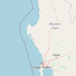
The Western Cape winter wet season, which brings the island's only meaningful rainfall, also shapes its interior landscape, temporarily activating seasonal pans and softening the otherwise dry terrain. Summers tend to be drier and calmer offshore, while winter conditions can be more challenging at sea but bring the island's brief period of internal wetland activity. Any visit is strongly shaped by access constraints, since the island is uninhabited and reached only by boat from the mainland near Yzerfontein, and rough Atlantic conditions can restrict landings regardless of season.