
Mori Atlas logo
Nature reserveDattenbachtal zwischen Kröftel und Vockenhausen

Mapping the stream valley corridors and protected habitats within the western Taunus region

Dattenbachtal zwischen Kröftel und Vockenhausen Nature Reserve and Protected Landscape Geography

(Naturschutzgebiet Dattenbachtal zwischen Kröftel und Vockenhausen)

Dattenbachtal zwischen Kröftel und Vockenhausen preserves a near-natural stretch of the Dattenbach stream valley located within the Hesse region of Germany. This protected area consists of two distinct parcels that follow the upper course of the Dattenbach through the foothills of the Taunus. The site functions as an ecologically significant corridor, buffering the riparian habitat from surrounding agricultural and settlement patterns in an area where the Hochtaunuskreis, Main-Taunus-Kreis, and Rheingau-Taunus-Kreis districts converge.

stream valleynature reserveheadwater streamTaunus foothillsriparian habitatvalley woodland
A flat-style digital illustration of a valley landscape featuring a steep mountain range with a cascading waterfall in the center, framed by silhouetted pine and birch trees in the foreground and a grassy meadow at the base.

Dattenbachtal zwischen Kröftel und Vockenhausen

Nature reserve

Park overview

Structured park overview, official facts, and landscape profile for Dattenbachtal zwischen Kröftel und Vockenhausen

Dattenbachtal zwischen Kröftel und Vockenhausen park facts, protected area profile, and essential visitor context

Review the core facts for Dattenbachtal zwischen Kröftel und Vockenhausen, including designation, size, terrain, visitor scale, habitats, and operating context in one park-focused overview.

About Dattenbachtal zwischen Kröftel und Vockenhausen

Dattenbachtal zwischen Kröftel und Vockenhausen is a compact nature reserve in Hesse that focuses on a relatively short but ecologically significant section of the Dattenbach stream valley. The protected area is unusual in that it crosses the boundaries of three different administrative districts: parts of it lie in the Hochtaunuskreis, in the Main-Taunus-Kreis, and in the Rheingau-Taunus-Kreis. This cross-district character reflects the linear geography of the stream corridor, which cuts across political boundaries as it flows through the Taunus foothills.

Topographically, the reserve sits in the transitional zone between the wooded uplands of the Taunus and the more open landscapes that descend toward the Main valley. The Dattenbach itself is a small left-side headwater of the Schwarzbach, which eventually drains into the Main. By protecting two separated parcels along the upper Dattenbach between the settlement of Kröftel in the north and Vockenhausen in the south, the reserve aims to keep an intact, near-natural stretch of this small watercourse and its immediate valley environment.

The surrounding region is heavily shaped by long-standing human use. Nearby roads, including the L 3023 to the north and the L 3011 along part of the western and southeastern edges, pass close to or directly through parts of the landscape. Despite this, the valley retains a mosaic of valley-bottom habitats shaped by the stream, adjacent slopes, and fringing land use. The reserve is part of a wider constellation of similarly small protected stream valleys in the western Taunus, including neighboring areas such as the Heftricher Moor to the northwest, Rentmauer Dattenberg to the northeast, and the larger Rossert, Hainkopf, and Dachsbau complex and Krebsbachtal bei Ruppertshain to the southeast. Clustered so closely together, these protected areas form a meaningful network of valley and slope habitats in the region.

Quick facts and research context for Dattenbachtal zwischen Kröftel und Vockenhausen

Dattenbachtal zwischen Kröftel und Vockenhausen is a designated nature reserve in Hesse, Germany, within the Taunus region northwest of Frankfurt. It was placed under protection in 1993 and is registered under the federal nature reserve code 1436012. The reserve spans three districts (Hochtaunuskreis, Main-Taunus-Kreis, and Rheingau-Taunus-Kreis), making it a rare cross-district protected area in the region.

Protection and recognition

Examine official protected area metrics, management scope, and verified database identifiers.

Dattenbachtal zwischen Kröftel und Vockenhausen Protection Status and Designated Area Records

Protected area records for Dattenbachtal zwischen Kröftel und Vockenhausen assemble documented conservation assignments and administrative registry details. Verified geographical metrics supply essential context for understanding official protected landscape designations.

Protection details

WDPA ID
162710
Park context

Deeper park guide and search-rich context for Dattenbachtal zwischen Kröftel und Vockenhausen

Dattenbachtal zwischen Kröftel und Vockenhausen history, landscape, wildlife, and travel context

Explore Dattenbachtal zwischen Kröftel und Vockenhausen through its history, landscape character, ecosystems, wildlife, conservation priorities, cultural context, and seasonal travel timing in a structured park guide built for atlas discovery and search intent.

Why Dattenbachtal zwischen Kröftel und Vockenhausen stands out

The reserve is best known for protecting a near-natural stretch of the Dattenbach valley between the villages of Kröftel and Vockenhausen. It preserves the upper course of the Dattenbach, a left-side headwater of the Schwarzbach, in an otherwise settled and agriculturally used part of the western Taunus. The combination of two separate protected parcels along a small stream, paired with an adjoining landscape protection area, makes it a representative example of small-scale valley habitat conservation in Hesse.
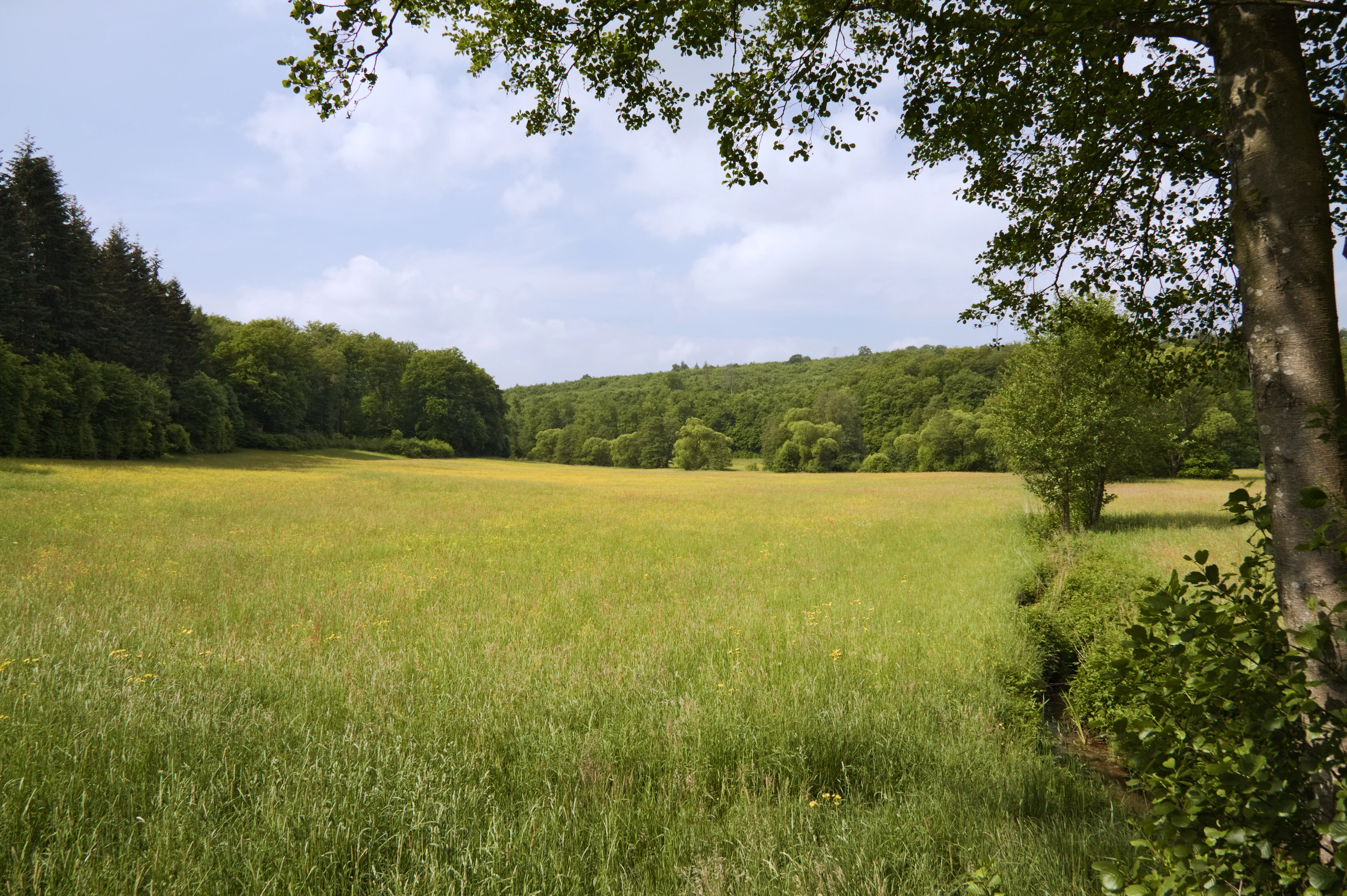
A wide, grassy meadow stretches into the distance, surrounded by green deciduous and coniferous forests under a partially cloudy sky.
A scenic view of the Dattenbach Valley near Kröftel, showing the open meadow landscape bordered by forest.

Dattenbachtal zwischen Kröftel und Vockenhausen history and protected-area timeline

The nature reserve was formally designated in 1993, when the Hessian authorities placed the Dattenbachtal between Kröftel and Vockenhausen under protection under official code 1436012. The designation was published through the Regierungspräsidium Darmstadt and appeared in the Staatsanzeiger für das Land Hessen in 1993.

Alongside the nature reserve itself, the same 1993 ordinance established an adjoining Landschaftsschutzgebiet (landscape protection area) of about 13.8 hectares that buffers the southern end of the protected valley to the west. The simultaneous designation of both areas reflects a coordinated approach to protecting both the core valley habitat and its visual and ecological surroundings.

Dattenbachtal zwischen Kröftel und Vockenhausen landscape and geographic character

The landscape of the reserve is defined by the narrow valley carved by the upper Dattenbach as it flows roughly from north to south between Kröftel and Vockenhausen. The valley sits within the foothills of the Taunus range, where rounded ridges, mixed forest patches, and small agricultural clearings form a typical mid-elevation Hessian landscape. Stream-cut topography, gentle valley slopes, and a clear distinction between valley bottom and adjoining uplands give the protected area its characteristic shape.

Because of the valley's linear form, the protected area is organized as two distinct parcels that follow the stream corridor. The surrounding landscape shows a traditional mix of woodland, grassland, fields, and small village edges, with the built-up areas of Kröftel and Vockenhausen flanking the northern and southern ends of the protected stretch.

Dattenbachtal zwischen Kröftel und Vockenhausen ecosystems, habitats, and plant life

The reserve's natural character is closely tied to the Dattenbach stream and its valley habitats. The protected valley shelters the near-natural course of a small headwater stream, the kind of habitat that is increasingly rare in densely settled parts of central Germany. The valley bottom and adjoining slopes support the kind of wet and moist habitat gradients, woodland edges, and small-scale structural transitions that are typical of Taunus stream valleys.

By separating the valley into two protected parcels, the designation helps maintain ecological continuity along the Dattenbach while accommodating breaks in ownership and land use. The adjoining Landschaftsschutzgebiet provides additional buffering capacity to the south and west, smoothing the transition between the strictly protected nature reserve and the surrounding working landscape.

Dattenbachtal zwischen Kröftel und Vockenhausen conservation status and protection priorities

From a conservation perspective, the reserve protects a representative section of an upper Schwarzbach tributary, contributing to the broader effort to maintain ecologically intact stream corridors in the western Taunus. The 1993 designation combined strict nature protection for the core valley with a complementary landscape protection zone of about 13.8 hectares, an approach that aims to safeguard not only the stream habitat itself but also its visual and ecological surroundings.

The protected area also plays a connective role, sitting within a network of nearby reserves such as Heftricher Moor, Rentmauer Dattenberg, Rossert, Hainkopf, and Dachsbau, and Krebsbachtal bei Ruppertshain. Together these areas preserve a meaningful cluster of valley and slope habitats in the region and help maintain ecological links across district boundaries.

Top sights and standout views in Dattenbachtal zwischen Kröftel und Vockenhausen

Highlights of the Dattenbachtal zwischen Kröftel und Vockenhausen include its cross-district geography across the Hochtaunuskreis, Main-Taunus-Kreis, and Rheingau-Taunus-Kreis, its protection of the upper course of the Dattenbach as a left-side Schwarzbach tributary, and its rare two-parcel structure that follows the stream valley between Kröftel and Vockenhausen. The coexistence of a strict nature reserve and an adjoining landscape protection area, both established under the same 1993 ordinance, is another defining feature of the site.

Best time to visit Dattenbachtal zwischen Kröftel und Vockenhausen

The reserve can be appreciated through much of the year, with spring and early summer typically bringing fresh green valley vegetation and active stream conditions, while autumn tends to highlight the mixed woodland character along the slopes. Winter visits reveal the bare valley structure and the stream's course more clearly. Specific operational details, such as marked trails, access restrictions, or guided options, are not documented in the available sources and should be checked locally before visiting.

Monthly climate preview

Long-term representative point measurements for annual temperature and monthly precipitation

Dattenbachtal zwischen Kröftel und Vockenhausen Climate Normals and Temperature Patterns

Historical climatology records outline measured baseline temperature variations and precipitation rhythms across the representative coordinate of Dattenbachtal zwischen Kröftel und Vockenhausen. Detailed monthly normals provide complete context for analyzing twelve-month environmental patterns within the protected landscape.
Annual mean9 °C
0 °C20 °C
Jan
Feb
Mar
Apr
May13°
Jun17°
Jul20°
Aug19°
Sep15°
Oct
Nov
Dec
Warmest month
July

19.6 °C

Coolest month
January

-0.1 °C

Wettest month
July

2.2 mm/day

Driest month
April

1.5 mm/day

Park location guide

Geography guide, regional context, and park location map for Dattenbachtal zwischen Kröftel und Vockenhausen

Dattenbachtal zwischen Kröftel und Vockenhausen park geography, regions, and map view in Germany

Understand where Dattenbachtal zwischen Kröftel und Vockenhausen sits in Germany through a broader geographic reading of the surrounding landscape, nearby location context, and its mapped position within the national park landscape.

How Dattenbachtal zwischen Kröftel und Vockenhausen fits into Germany

Germany is a federal republic in Western and Central Europe with a population of over 83 million across sixteen constituent states. It is Europe's largest economy by nominal GDP and a major global exporter and importer. The capital is Berlin, and the country borders Denmark, Poland, Czech Republic, Austria, Switzerland, France, Luxembourg, Belgium, and the Netherlands.

Wider geography shaping Dattenbachtal zwischen Kröftel und Vockenhausen in Germany

Germany is located in Western and Central Europe, spanning 357,022 km². It borders Denmark to the north, Poland and the Czech Republic to the east, Austria and Switzerland to the south, and France, Luxembourg, Belgium, and the Netherlands to the west. The country has coastlines on the Baltic Sea and North Sea to the north, with the Alps located in the southern region.

Map view of Dattenbachtal zwischen Kröftel und Vockenhausen

Use this park location map to pinpoint Dattenbachtal zwischen Kröftel und Vockenhausen in Germany, understand its exact geographic position, and read its mapped placement within the surrounding landscape more clearly.

Pigeon | © OpenStreetMap contributors

Location context for Dattenbachtal zwischen Kröftel und Vockenhausen

Hesse

Visualizing stream valley habitats and protected terrain in the western Taunus foothills

Dattenbachtal zwischen Kröftel und Vockenhausen Landscape Photos and Scenery Gallery

Visual documentation of Dattenbachtal zwischen Kröftel und Vockenhausen reveals the complex topography of a protected stream valley nestled between forested uplands and agricultural clearings. Studying these protected area photographs clarifies how the dual parcels preserve rare headwater habitats and valley floor corridors across the Hessian landscape.

A wide, grassy meadow stretches into the distance, surrounded by green deciduous and coniferous forests under a partially cloudy sky.

Park atlas

Compare adjacent Hessian stream valleys and regional reserves across the Taunus foothills

Parks Near Dattenbachtal zwischen Kröftel und Vockenhausen and Surrounding Protected Landscapes

Browse other protected areas and stream valley reserves situated near Dattenbachtal zwischen Kröftel und Vockenhausen. Expanding the geographic comparison reveals broader habitat patterns across the western Taunus landscape.
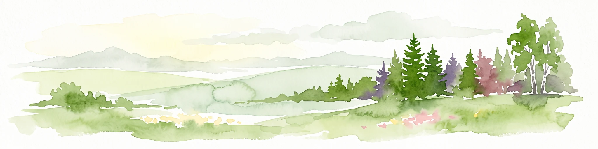
A soft watercolor painting depicting rolling green hills and a forested landscape under a pale, sunrise-hued sky.
Nature reserveHessen
About 3.3 km away#1 closest

Southeast

Rossert - Hainkopf - Dachsbau Nature Reserve: Geography and Protected Taunus Forest Landscapes

A preserved ridge system in the Hessen region of Germany

The Rossert - Hainkopf - Dachsbau nature reserve represents a compact but ecologically vital ridge system in the Taunus foothills. Spanning over 120 hectares of mixed forest, this protected area preserves the transition between woodland and open meadow while securing the headwaters of the Wellbach stream within its geographic boundaries.

Area
1.19 km²
Established
1977
IUCN
IV
Nature reserveHessen
About 4.5 km away#2 closest

Southeast

Krebsbachtal bei Ruppertshain: Protected Stream Valley and Conservation Geography

Nature reserve and FFH site in the Hessian Taunus

Located in the western foothills of the Taunus, Krebsbachtal bei Ruppertshain is a protected nature reserve and Natura 2000 site. It features a linear valley landscape defined by the Fischbach stream corridor and dense mixed deciduous forest. The reserve plays a crucial role in maintaining regional ecological continuity within the Rhine-Main area, providing a distinct geographic boundary near the Rossert massif.

Area
0.845 km²
Established
1992
IUCN
IV
Relief
Upland
A soft, impressionistic watercolor painting of a meadow with wildflowers in the foreground, rolling hills and trees in the midground, and a faint mountain range in the background.
Nature reserveHochtaunuskreis
About 7.4 km away#3 closest

Northeast

Reifenberger Wiesen Nature Reserve: Geographic Profile and Protected Meadow Boundaries

High Taunus mountain meadows within the Hochtaunuskreis region.

Located in the High Taunus mountains, Reifenberger Wiesen provides a concentrated example of mountain hillside meadows. This nature reserve features specialized nutrient-poor grasslands that host diverse botanical communities, supported by its distinct north-facing slope geography and proximity to the headwaters of the Weil river, forming a critical ecological link in the Hessian landscape.

Area
0.234 km²
Established
1983
A horizontal watercolor painting showing a soft, impressionistic landscape with rolling green hills and patches of forest under a pale, muted sky.
Nature reserveHessen
About 8.4 km away#4 closest

East

Burghain Falkenstein Nature Reserve: Protected Woodland Map and Regional Geography

A forest enclave in the Taunus uplands of Hessen, Germany

Burghain Falkenstein stands as a prominent nature reserve and Natura 2000 site located on the slopes of the Burgberg. This compact protected area features a mosaic of beech and ravine forests, providing a rare green massif amidst the urban sprawl of the Taunus foothills. The reserve documents a complex history where natural woodland succession intersects with medieval fortification remains, offering a concentrated study of regional forest geography near Frankfurt am Main.

Area
0.363 km²
Established
1966
IUCN
IV
Relief
Mountain
Watercolor painting depicting a landscape with rolling hills in the background and trees in autumn colors in the midground.
Nature reserveHochtaunuskreis
About 10 km away#5 closest

Northeast

Saubach und Niedgesbach bei Schmitten Nature Reserve: High Taunus Landscape Geography

Mapped protected valleys in the Hochtaunuskreis region.

This nature reserve protects the parallel stream valleys of the Saubach and Niedgesbach near the village of Schmitten. The site is a significant example of High Taunus upland ecology, where abandoned pastoral land has fostered unique plant diversity. It remains a key focal point for understanding the transition of cultural landscapes into protected wild habitats within the Hochtaunuskreis.

Area
0.58 km²
Established
1995
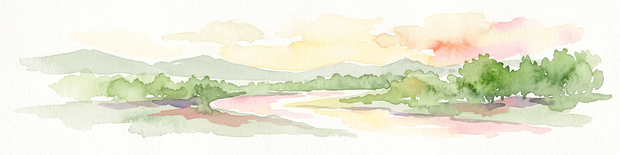
A horizontal watercolor painting depicting a gentle stream flowing through a lush meadow with trees and hills in the background.
Nature reserveHessen
About 11 km away#6 closest

North

Oberes Dombachtal Nature Reserve: Valley Geography and Protected Landscapes in Hessen

Mapping rare floodplain habitats in the eastern Taunus foothills

Oberes Dombachtal protects a specialized valley system characterized by relict alder woodland, purple moor-grass stands, and near-natural stream segments. Located in the eastern Taunus, the reserve serves as a crucial link for local biodiversity, offering a concentrated look at the valley-floor ecosystems that define this part of the Hessen landscape. Its geography demonstrates the importance of small-scale corridor protection for stream health.

Area
0.187 km²
Established
1995
IUCN
IV
Relief
Upland
A watercolor illustration of a landscape with green meadows, flowering bushes, and distant rolling hills on a white background.
Nature reserveHesse
About 12 km away#7 closest

Southwest

Rabengrund von Wiesbaden: Mapping Protected Landscapes and Habitats in Hesse

Nature reserve and FFH site in the Taunus foothills

Rabengrund von Wiesbaden serves as a distinct protected valley system characterized by a compact coexistence of acid grasslands, reedbeds, and orchid-rich meadows. Managed as both a nature reserve and a Natura 2000 site, this area provides a rare window into the historical cultural landscape of the Taunus region. The site offers essential insight into small-scale habitat diversity near the urban core of the Hessian state capital.

Area
0.791 km²
Established
1988
IUCN
IV
Relief
Upland
A watercolor painting of a rolling landscape featuring open fields in the foreground, distant hills, and a cluster of pine and deciduous trees on the right side.
Nature reserveHochtaunuskreis
About 12 km away#8 closest

North

Riedelbacher Heide Nature Reserve: Geographic Map and Landscape Analysis of the Taunus

A preserved open heathland within the forested Hintertaunus uplands

Riedelbacher Heide offers a focused look at an 8.4 hectare nature reserve located on the high plateau of the eastern Hintertaunus. This area provides valuable insight into the ecological and cultural history of the Taunus, where historical grazing practices shaped a distinctive mosaic of open, sun-exposed vegetation. The reserve serves as a critical example of traditional land management in a predominantly forested low-mountain geography.

Area
0.084 km²
Established
1969

Common questions about visiting, size, designation, and location context for Dattenbachtal zwischen Kröftel und Vockenhausen

Dattenbachtal zwischen Kröftel und Vockenhausen FAQs for park facts, access, geography, and protected area context

Find quick answers about Dattenbachtal zwischen Kröftel und Vockenhausen, including protected-area facts, park geography, trail and visitor context, and how the park fits into its surrounding country and regional landscape.
MoriAtlas Explorer

Continue Your Protected Areas Search Across the Global Atlas

Deepen your exploration by continuing the structured search for national parks and protected areas worldwide. Utilize the comprehensive filtering capabilities to compare different conservation landscapes and refine your understanding of global park geography. Discover more about the distribution and characteristics of protected natural areas.

Global natural geography