

Mori Atlas logo
Nature reserveDensu Delta Ramsar Site

Mapping the intricate tidal marshes, mangrove forests, and lagoon systems of southern Ghana

Densu Delta Ramsar Site: A Coastal Nature Reserve and Wetland Landscape in the Greater Accra Region

The Densu Delta Ramsar Site represents a dynamic coastal landscape where the Densu River meets the Gulf of Guinea. This nature reserve sustains a mosaic of interconnected lagoons, salt pans, and tidal marshes that provide critical habitats for migratory waterbirds. Beyond its ecological significance, the delta functions as a natural buffer for the surrounding Greater Accra Region, stabilizing the coastline and managing sediment flow within a complex river basin environment.

coastal wetlandRamsar siteImportant Bird Areamangroveslagoonssalt pans
A flat-design digital illustration showing a calm river winding through a valley with pine trees, grassy banks, and a small waterfall on a distant cliff.

Densu Delta Ramsar Site

Nature reserve

Park overview

Structured park overview, official facts, and landscape profile for Densu Delta Ramsar Site

Densu Delta Ramsar Site park facts, protected area profile, and essential visitor context

Review the core facts for Densu Delta Ramsar Site, including designation, size, terrain, visitor scale, habitats, and operating context in one park-focused overview.

About Densu Delta Ramsar Site

The Densu Delta Ramsar Site is the coastal terminus of the Densu River, one of southern Ghana's most economically and ecologically significant waterways. Located along the country's Atlantic coast in the Greater Accra Region, the delta is the point at which the river's freshwater system finally mingles with the Gulf of Guinea through a network of brackish lagoons, tidal channels, and protected shallows.

The wetland is not a single uniform habitat but rather a mosaic of interdependent environments. Mangrove fringes line parts of the tidal margin, salt pans occupy exposed flats where evaporation concentrates brines, and open marsh and lagoon systems provide sheltered feeding areas for waterbirds. The interplay of river flow, tidal rhythm, and wave action creates conditions that support diverse aquatic and semi-aquatic life, while the surrounding coastal plain places the delta at the interface of marine, freshwater, and human-influenced landscapes.

The delta's protected status was formally recognized in 1992 when it was designated as a Wetland of International Importance under the Ramsar Convention. It has since received additional acknowledgment as an Important Bird Area, reflecting the site's importance for migratory and resident birdlife along the West African coast. As a protected wetland, the Densu Delta complements the broader Densu River basin, which is itself critical for water supply, agriculture, and flood regulation in southern Ghana.

In practical landscape terms, the Densu Delta offers a rare example of an urban-adjacent coastal wetland. The Greater Accra Region, with its concentration of population and infrastructure, borders the site, making the delta both an ecological refuge and a working landscape where fishing, salt extraction, and small-scale commerce continue alongside conservation recognition.

Quick facts and research context for Densu Delta Ramsar Site

The Densu Delta Ramsar Site is a designated Wetland of International Importance under the Ramsar Convention, designated in August 1992, with Ramsar reference number 564. It lies at the mouth of the Densu River in southern Ghana, where the river discharges into the Gulf of Guinea on the country's Atlantic coast.

The wetland spans roughly 5,893 hectares of lagoons, mangroves, salt pans, and marshes, and is also identified as an Important Bird Area for its support of migratory and resident waterbirds. The surrounding Densu basin covers a much larger catchment that supplies the majority of potable water for the Greater Accra Region.

Protection and recognition

Documented designation history and official Ramsar recognition records

Densu Delta Ramsar Site Protection Status and International Recognition

Historical protection records for Densu Delta Ramsar Site span a designated year of 1992 alongside official Ramsar wetland recognition sources. Structured preservation data provides a factual reference for examining the formal conservation framework governing the protected landscape.
Park context

Deeper park guide and search-rich context for Densu Delta Ramsar Site

Densu Delta Ramsar Site history, landscape, wildlife, and travel context

Explore Densu Delta Ramsar Site through its history, landscape character, ecosystems, wildlife, conservation priorities, cultural context, and seasonal travel timing in a structured park guide built for atlas discovery and search intent.

Why Densu Delta Ramsar Site stands out

The Densu Delta is best known as a coastal wetland of international importance, recognized both for its mosaic of mangroves, lagoons, salt pans, and marshes and for its role as an Important Bird Area supporting migratory waterbirds. Among its most distinctive birdlife signals are several tern species, including little, black, roseate, common, Sandwich, and royal terns, along with western reef egrets and spotted redshanks that use the wetland during non-breeding and wintering periods. The site is also known for its functional value in the wider coastal landscape, acting as a natural flood buffer, sediment trap, and shoreline stabilizer where the Densu River meets the Atlantic. Together with its Ramsar designation in 1992, these features have made the Densu Delta one of Ghana's most recognizable coastal wetland conservation sites.
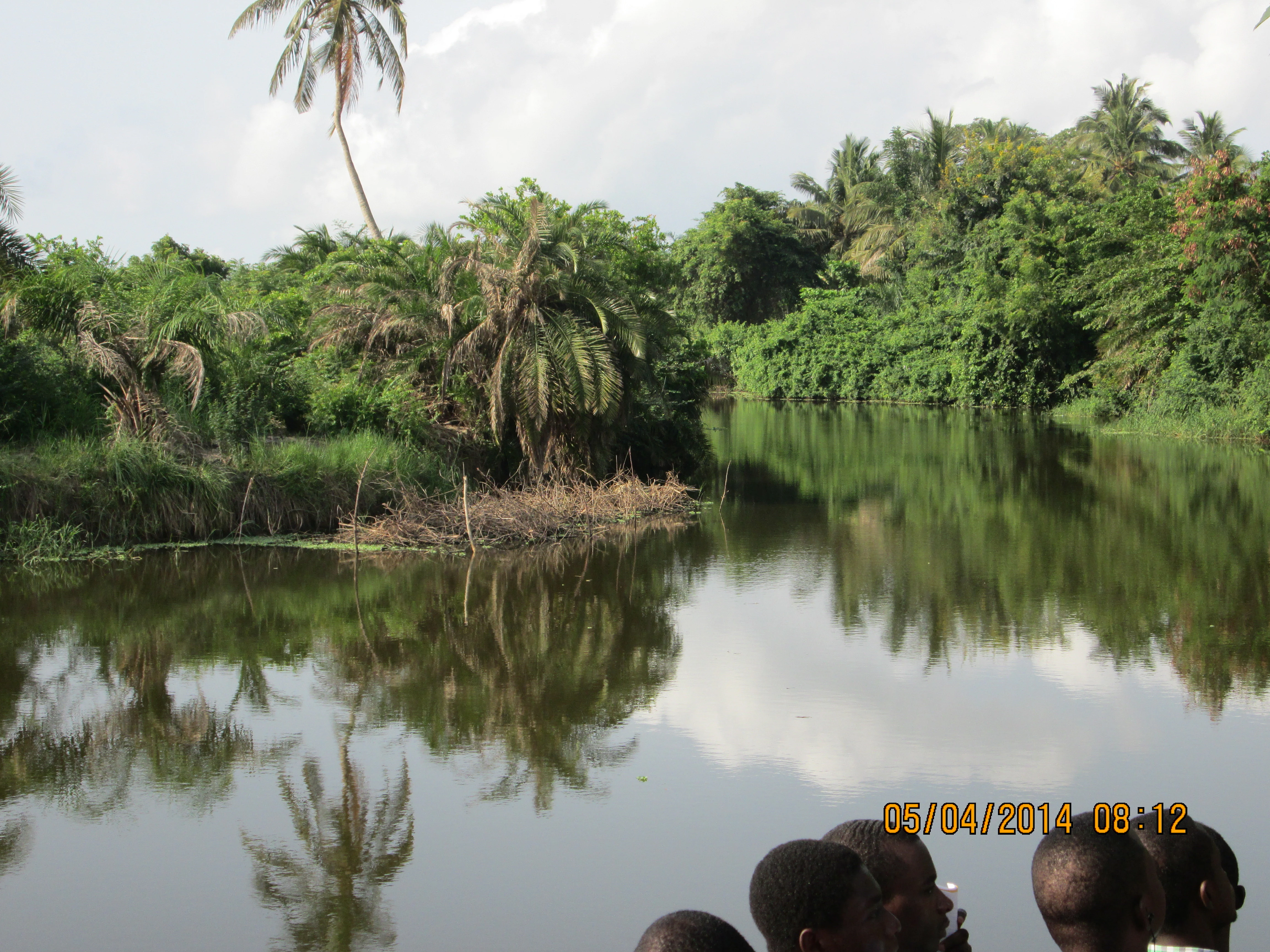
A view across a calm river channel lined with dense tropical vegetation, including palm trees, reflecting in the water, with the heads of several people visible at the bottom of the frame.
The tranquil waters of the Densu River flowing through the Densu Delta Ramsar Site.

Densu Delta Ramsar Site history and protected-area timeline

The Densu Delta gained formal international conservation recognition when it was designated as a Wetland of International Importance under the Ramsar Convention on 14 August 1992, assigned reference number 564. This designation reflected the growing awareness, beginning in the late twentieth century, of the ecological and hydrological importance of tropical coastal lagoons and mangrove systems along the Gulf of Guinea.

The broader Densu River basin, of which the delta is the lower terminus, had earlier developed its significance through the construction of major hydraulic infrastructure. The Weija Dam on the Densu River was built to provide water supply for metropolitan Accra and became the focal point of urban water management in the Greater Accra Region, supplying a large share of the region's potable water. The dam's creation reinforced the strategic importance of the basin and, by extension, heightened interest in the ecological state of the downstream wetlands.

Following Ramsar listing, the site was subsequently identified as an Important Bird Area by BirdLife International, reflecting its growing profile as a refuge for waterbirds. Over time, the delta's history has been shaped by the combination of environmental pressures, including agricultural expansion, sand mining, informal dumping, and rapid urbanization in the surrounding coastal plain, alongside the institutional recognition of its ecological value.

Densu Delta Ramsar Site landscape and geographic character

The physical setting of the Densu Delta is defined by the meeting of river, lagoon, and sea along Ghana's southern coast. The Densu River approaches the Atlantic Ocean through a low-gradient coastal plain, and as it nears the shoreline its flow disperses into a series of shallow lagoons and tidal marsh systems rather than a single channel mouth. The result is a fragmented, mosaic-like landscape in which land and water interleave across several kilometres of coastal terrain.

The surface features of the delta include open lagoon water, exposed tidal flats, fringing mangrove stands, and human-modified salt pans. These elements create a patchy environment where elevation differences are subtle but ecologically significant, with brackish pools sitting beside dense mangrove root systems and drier salt-encrusted flats. In the wider context, the delta forms part of the southern terminus of the Densu basin, whose northern reaches rise into the forested Atewa-Atwiredu Range; the lower basin, by contrast, becomes progressively drier and more urbanized as it moves toward the coast.

The delta also functions as a transitional buffer zone between the river basin and the open Gulf of Guinea. Sediment carried downstream is deposited and reworked by tides and storms, gradually shaping the lagoon margins, while seasonal pulses of freshwater influence the salinity and character of the shallow water bodies. This continuously reshaped interface produces a dynamic coastal landscape in which geomorphology and ecology are tightly intertwined.

Densu Delta Ramsar Site ecosystems, habitats, and plant life

Ecologically, the Densu Delta is characterized by a mix of mangrove, lagoon, marsh, and salt-pan habitats that together support a productive coastal wetland community. The mangrove component provides shelter, nursery habitat for fish and invertebrates, and root structures that stabilize sediments along the tidal margins. The lagoon and marsh areas offer shallow, often brackish environments that are rich in organic productivity and provide feeding grounds for waterbirds and aquatic species.

The plant communities of the site reflect the salinity and hydrological gradient that runs from river-influenced edges to the more marine-influenced flats. Salt-tolerant vegetation and mangrove species dominate the margins, while more terrestrial pioneer species may colonize drier patches. Across the mosaic, the vegetation performs important ecological functions, including trapping sediments, filtering nutrients, and buffering the coastline against storm-driven seawater intrusion.

The site's broader ecological significance is amplified by its position within the West African coastal wetland network. Tidal and lagoon dynamics create varied microhabitats within relatively short distances, supporting ecological processes such as seasonal nutrient cycling, fish migration between river and sea, and the use of the area as a stopover or wintering ground for migratory birds. These dynamics place the Densu Delta among the more ecologically active coastal wetlands in Ghana.

Densu Delta Ramsar Site wildlife and species highlights

The Densu Delta is recognized internationally as an Important Bird Area, and waterbirds are the most visible wildlife feature of the site. The wetland supports notable populations of non-breeding and wintering waterbirds, with terns being especially prominent; little, black, roseate, common, Sandwich, and royal terns have all been associated with the site. Wading species such as the western reef egret are also recorded, and spotted redshanks contribute to the diversity of shorebirds using the lagoons and tidal margins.

The combination of open water, mudflats, mangroves, and salt pans creates different feeding opportunities for different bird groups. Open lagoon areas favour surface-feeding terns and plunge-divers, while the shallower mudflats and marsh edges attract waders and egrets. The mangrove fringe offers roosting and nesting cover that is relatively rare along heavily urbanized stretches of the Ghanaian coast.

Beyond birds, the wetland also supports fish, invertebrates, and other aquatic organisms that move between the river, the lagoon systems, and the sea. These species sustain local fisheries and form the base of the food web on which the birdlife depends. While specific mammal and reptile records are less prominent in the international descriptions, the structural complexity of the mangrove and marsh mosaic provides habitat that is consistent with the broader fauna typical of West African coastal wetlands.

Densu Delta Ramsar Site conservation status and protection priorities

The Densu Delta's principal conservation value lies in its formal recognition as a Wetland of International Importance under the Ramsar Convention, designated in 1992. This recognition places the site in the global network of wetlands whose ecological character is considered significant at an international scale, highlighting its importance for waterbirds, mangrove habitat, and the broader functioning of the coastal ecosystem.

Conservation significance is shaped by several functions the delta performs. As a natural flood buffer, the wetland absorbs and slows pulses of river and storm-driven water, reducing the risk of inland flooding. As a sediment trap, it retains materials carried by the Densu River, influencing downstream water quality and the geomorphology of the coastline. As a coastal stabilizer, the mangrove and marsh systems protect adjacent communities from erosion and storm surges, particularly during severe weather events.

Because the delta lies within a heavily populated and economically dynamic region, its conservation status is reinforced by pressures rather than diminished by them. Challenges documented in the broader Densu basin include water pollution from informal dumping, agricultural runoff, sand mining, and quarrying, alongside rapid urbanization in the southern catchment. Maintaining the ecological character of the Ramsar site in the face of these pressures remains a central challenge for regional environmental management.

Densu Delta Ramsar Site cultural meaning and human context

The Densu River and its delta hold a recognizable place in Ghanaian cultural life, extending well beyond their ecological identity. The river has been referenced in popular music, with Ghanaian artist Kojo Antwi naming his second studio album, released in 2002, after the Densu River, and the Afrobeat band Osibisa having composed a piece titled Densu that references the varieties of fish and the songs of the fishermen.

In the lower basin and delta region, communities have long depended on the river and its wetlands for fishing, salt production, and small-scale commerce. Salt extraction from coastal pans is a traditional livelihood linked directly to the wetland landscape, while fishing communities along the lagoon margins maintain working relationships with the seasonal rhythms of the river, tides, and fish populations. These practices tie the cultural identity of the delta to the practical use of its resources.

At the urban edge, the river and its associated infrastructure, including the Weija Dam, are central to daily life in Accra and the Greater Accra Region as a source of drinking water. This makes the Densu system part of the lived cultural and economic geography of millions of people, even when their direct interaction with the delta wetland itself is limited.

Top sights and standout views in Densu Delta Ramsar Site

The Densu Delta Ramsar Site stands out as one of Ghana's key coastal wetland conservation areas, recognized internationally under the Ramsar Convention and highlighted as an Important Bird Area. Its defining strengths are the diversity of its habitats, the functional value it provides in regulating floods, sediment, and shoreline dynamics, and its importance for migratory waterbirds along the Gulf of Guinea coast.

The site's combination of mangroves, lagoons, salt pans, and marshes in close proximity to a major metropolitan area gives it a distinctive character that is unusual among West African Ramsar sites. This juxtaposition of working wetland, ecological refuge, and urban water source underpins the recognition it has earned at both national and international levels.

Best time to visit Densu Delta Ramsar Site

The Densu Delta's character is shaped by the bi-modal rainfall pattern of southern Ghana, which produces wetter and drier seasons across the basin. During and shortly after rainy periods, freshwater inflow into the lagoon and marsh systems increases, expanding wetland extent, refreshing habitat conditions, and influencing the visibility of waterbirds using the area.

Drier periods tend to bring more concentrated salt-pan activity, more exposed mudflats, and distinctive bird assemblages, with conditions suitable for observing waders and terns along the lagoon edges. For visitors interested in birdlife, periods when migratory and non-breeding waterbirds are present tend to offer the richest viewing opportunities, though specific seasonal access conditions and logistics around the delta are best confirmed with current local guidance rather than inferred from general climate patterns.
Monthly climate preview

Long-term representative monthly averages and temperature ranges for Densu Delta Ramsar Site

Densu Delta Ramsar Site Climate Normals, Annual Temperature and Precipitation Rhythm

Representative coordinate records show measured monthly temperature variations alongside shifting precipitation averages throughout the year at Densu Delta Ramsar Site. Examining the complete twelve-month climatology profile provides deeper insight into long-term temperature ranges and precipitation patterns.
Annual mean26 °C
24 °C28 °C
Jan27°
Feb28°
Mar28°
Apr27°
May27°
Jun25°
Jul24°
Aug24°
Sep25°
Oct26°
Nov27°
Dec27°
Warmest month
February

27.8 °C

Coolest month
August

24 °C

Wettest month
June

7.3 mm/day

Driest month
January

0.8 mm/day

Park location guide

Geography guide, regional context, and park location map for Densu Delta Ramsar Site

Densu Delta Ramsar Site park geography, regions, and map view in Ghana

Understand where Densu Delta Ramsar Site sits in Ghana through a broader geographic reading of the surrounding landscape, nearby location context, and its mapped position within the national park landscape.

How Densu Delta Ramsar Site fits into Ghana

Ghana, officially the Republic of Ghana, is a West African nation spanning approximately 240,000 km² along the Gulf of Guinea. It achieved independence from Britain in 1957, becoming the first Sub-Saharan colony to do so, and transitioned to a republic in 1960. The country has a population of over 35 million, with Accra as its capital and largest city. Ghana features diverse ecosystems from coastal savannas to tropical rainforests and is linguistically and ethnically rich, with English as the official language.

Wider geography shaping Densu Delta Ramsar Site in Ghana

Ghana is located in West Africa along the Gulf of Guinea and Atlantic Ocean to its south. It borders Côte d'Ivoire to the west, Burkina Faso to the north, and Togo to the east. The country spans diverse ecologies including coastal savannas and tropical rainforests.

Map view of Densu Delta Ramsar Site

Use this park location map to pinpoint Densu Delta Ramsar Site in Ghana, understand its exact geographic position, and read its mapped placement within the surrounding landscape more clearly.

Pigeon | © OpenStreetMap contributors

Location context for Densu Delta Ramsar Site

Greater Accra Region
Recorded earthquake history

View the Earthquake History Catalog for Densu Delta Ramsar Site

Examine historical seismic activity recorded near the Densu Delta Ramsar Site through our structured dataset. This MoriAtlas resource provides clear access to event metadata and geographic proximity records for those interested in the seismic context of this significant coastal landscape.

Densu Delta Ramsar Site Earthquake History

Catalogued events

6 events

Strongest magnitude

Magnitude 4.4

Most recent event

Jun 24, 2020

This history includes earthquakes recorded inside the park or within 50 km of its borders

Visualizing coastal wetlands, mangroves, and tidal marsh habitats in southern Ghana

Densu Delta Ramsar Site Photos and Landscape Scenery Exploration

Visual documentation captures the intricate mosaic of lagoons, mangrove forests, and salt pans that define the protected terrain of the Densu Delta Ramsar Site. Studying these protected area views reveals how river, tide, and sea interact along the Gulf of Guinea coastline.

A view across a calm river channel lined with dense tropical vegetation, including palm trees, reflecting in the water, with the heads of several people visible at the bottom of the frame.

A view of the brown waters of the Densu River flowing through a lush, green, densely vegetated riverbank.

Park atlas

Compare regional protected areas and connected coastal ecosystems across southern Ghana

Explore Other Parks Near Densu Delta Ramsar Site and Surrounding Coastal Reserves

Visitors exploring Densu Delta Ramsar Site can continue comparing other protected wetlands and coastal reserves across the surrounding region. Examining adjacent natural habitats provides broader context on regional conservation landscapes and coastal geography.
Wildlife reserveGreater Accra Region
25 km away#1 closest

East

Sakumo Ramsar Site Wildlife Reserve: Geographic and Protected Landscape Overview

Coastal lagoon and savanna wetland within the Greater Accra Region

Located along the southern coast of Ghana, the Sakumo Ramsar Site functions as a unique wildlife reserve where a seasonally shifting lagoon meets freshwater marshes and coastal savanna. This map-focused profile examines the ecological boundaries and terrain features of this significant wetland, which serves as a vital sanctuary for migratory birds despite its position within the dense urban fabric of the Accra-Tema metropolitan area.

Area
14 km²
Established
1992
Relief
Lowland
Climate
Tropical
Wildlife reserveCentral Region
30 km away#2 closest

Southwest

Muni-Pomadze Ramsar Site: Protected Coastal Wetlands and Forest Reserves in Ghana

Coastal lagoons, mangrove stands, and undulating hill geography

Covering a compressed sequence of coastal and inland landforms, the Muni-Pomadze Ramsar Site serves as a significant protected landscape. This area encompasses the Muni Lagoon, shoreline dunes, and the forested slopes of the Yenku and Egyasimanku Hills, creating an ecologically diverse habitat that defines the geography of the surrounding coastline.

Area
3 km²
Established
1992
IUCN
II
National parkGhana
91 km away#3 closest

West

Kakum National Park: Ghana's Landmark Protected Rainforest and Canopy Walkway

Mapped tropical forest landscape and unique elevated park exploration.

Kakum National Park represents a significant protected area within Ghana, characterized by its 375 square kilometers of moist evergreen tropical rainforest. The park's identity is strongly linked to its iconic canopy walkway, an engineering feat offering elevated views into the forest structure. As a national park, Kakum provides crucial mapped context for understanding West African biodiversity and regional geography, including notable primate populations and the densest concentration of forest elephants in Ghana. Its community-driven establishment also marks it as a key site for participatory conservation examples.

Area
375 km²
Established
1992
IUCN
II
Visitors
135.9K annual
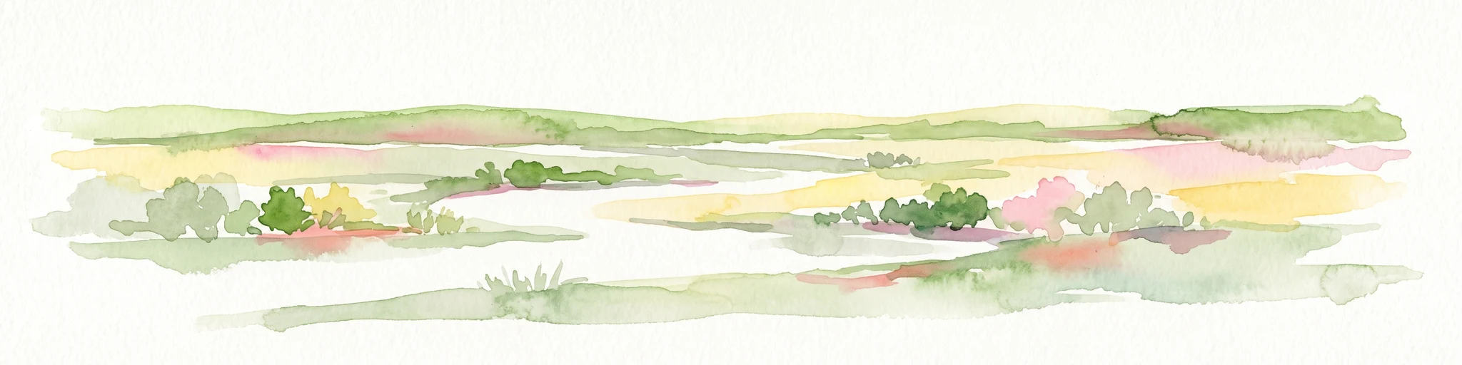
A watercolor painting showing a soft, impressionistic landscape of Keta Lagoon, featuring patches of green vegetation, yellow grasses, and calm water against a light, airy background.
Protected areaVolta Region
About 127 km away#4 closest

East

Keta Lagoon Protected Area: Coastal Wetland Geography and Regional Landscape Mapping

A vital ecological and cultural landscape in Ghana's Volta Region

Keta Lagoon represents a primary coastal wetland system in eastern Ghana. Spanning the coastline between sandy barriers and inland floodplains, this protected area features a unique mosaic of mangroves, tidal flats, and islands. Its role as a major waterbird habitat and the center of Anlo-Ewe cultural life makes it a significant site for understanding West African coastal geography and environmental conservation.

Area
1,200 km²
Established
1992
Relief
Lowland
Climate
Tropical
Wildlife reserveVolta Region
About 131 km away#5 closest

Northeast

Kalakpa Game Production Reserve: Atlas Overview of Protected Terrain in Ghana

Ecological mosaic landscape in the Volta Region

Kalakpa Game Production Reserve represents a diverse protected area where Borassus and Combretum woodlands meet semi-deciduous gallery forests. Situated on the foothills of the Togo Mountains, this reserve provides essential habitat in the forest-savanna transition of southeastern Ghana, defined by its rugged rocky hills and seasonal valley streams.

Area
320 km²
Established
1975
IUCN
VI
Relief
Upland
Wildlife reserveVolta Region
About 165 km away#6 closest

Northeast

Tafi Atome Monkey Sanctuary: Mapping Ghana's Community Protected Wildlife Reserves

Protected sacred grove geography in the Volta Region

Tafi Atome Monkey Sanctuary preserves a unique tropical forest ecosystem that has been protected by local tradition for over two centuries. Located in the Volta Region of Ghana, this wildlife reserve demonstrates the significance of community-based conservation. View the sanctuary through the lens of its forest structure, primate populations, and the surrounding rural mosaic that makes this site a key element of the region's protected landscape.

Established
1993
Relief
Lowland
Climate
Tropical
Access
Access unknown
Wildlife reserveAshanti Region
About 165 km away#7 closest

Northwest

Bobiri Forest Reserve and Butterfly Sanctuary: Mapped Wildlife Reserve and Forest Geography

Ashanti Region protected landscape and butterfly habitat

Focusing on its status as a dedicated butterfly sanctuary, this protected forest reserve in Ghana offers a clear window into semi-deciduous ecology. Covering 54 square kilometers, the site is recognized for high insect biodiversity and its unique position as both an active research area and a managed wildlife reserve near the village of Kubease.

Area
54.65 km²
Established
1939
Relief
Upland
Climate
Tropical
Wildlife reserveGhana
About 181 km away#8 closest

Northwest

Bomfobiri Wildlife Sanctuary: Mapped Geography and Protected Landscapes in Central Ghana

A diverse habitat mosaic featuring forests, savanna, and waterfalls.

Bomfobiri Wildlife Sanctuary offers a compressed look at Ghana's natural diversity, where riverine corridors transition into open savanna. The protected area is recognized for its combination of dense forest, varied geological rock formations, and significant natural landmarks like the Lion Stone and local waterfalls, providing a clear perspective on the region's complex physical geography.

Area
53 km²
Established
1975

Common questions about visiting, size, designation, and location context for Densu Delta Ramsar Site

Densu Delta Ramsar Site FAQs for park facts, access, geography, and protected area context

Find quick answers about Densu Delta Ramsar Site, including protected-area facts, park geography, trail and visitor context, and how the park fits into its surrounding country and regional landscape.
MoriAtlas Explorer

Continue Your Protected Areas Search Across the Global Atlas

Deepen your exploration by continuing the structured search for national parks and protected areas worldwide. Utilize the comprehensive filtering capabilities to compare different conservation landscapes and refine your understanding of global park geography. Discover more about the distribution and characteristics of protected natural areas.

Global natural geography