
Why Desolation Sound Marine Provincial Park stands out
Desolation Sound Marine Provincial Park is best known for its sheltered, anchor-filled waters that draw yachts and kayakers to one of the most iconic boating areas on Canada's west coast. The combination of calm coves, glaciated mountains, coastal waterfalls, and warm seawater creates a distinctive cruising landscape that is hard to match elsewhere in the region. The park is also recognized for its ecological productivity, particularly its eelgrass meadows, kelp beds, shellfish habitat, and significance for the threatened marbled murrelet, which uses the area in large numbers during summer and fall. This blend of recreational appeal and ecological value, set against a backdrop of deep Indigenous history, gives the park a layered identity that goes well beyond its name.
Desolation Sound Marine Provincial Park history and protected-area timeline
The name Desolation Sound itself was given by Captain George Vancouver during his late eighteenth-century exploration of the Pacific Northwest. Encountering what he interpreted as abandoned settlements, gloomy weather, and barren terrain, Vancouver described the area in negative terms, but later historians have noted that his visit likely coincided with a smallpox outbreak, the inland seasonal movements of Indigenous peoples, ongoing conflict with Lekwiltok raiders, and a European frame of reference that did not recognize Indigenous land management. What he called desolation was in fact a richly inhabited cultural landscape.
The Marine Provincial Park itself was created on May 18, 1973, out of more than 8,400 hectares of coastline and over 60 kilometers of shoreline through the joint advocacy of MLA Don Lockstead and the BC New Democratic Party government. Like many provincial protected areas of its era, the park was established against a backdrop of expanding resource extraction, and signs of past clear-cut logging remain visible in areas such as Theodosia Inlet.
The deeper history of the landscape is inseparable from the experience of the Sliammon (Tla'amin Nation) and Klahoose First Nations, whose ancestors, archaeological sites, and seasonal harvesting places lie within the present park boundaries. From 1875 onward, Sliammon communities were progressively pushed onto small reserves, and 1920 federal legislation allowed the government to unilaterally reduce those reserves. As the area increasingly came to be valued as an untouched wilderness destination, summer cottages and tourism leases were established in prime hunting and gathering locations, and even graves were disturbed as souvenirs. The creation of the marine park both reflected and accelerated this displacement, restricting traditional land use while formalizing the area as a recreational landscape for non-Indigenous visitors.
More recently, both the Sliammon and Klahoose have engaged in treaty negotiations with senior levels of government, beginning with formal participation in 2008. Their input has been incorporated into the park's management plan, and the First Nations Health Authority's Environmental Pollutants Program is investigating concerns about water contamination from boats and shoreline development that affect traditional foods such as shellfish.
Desolation Sound Marine Provincial Park landscape and geographic character
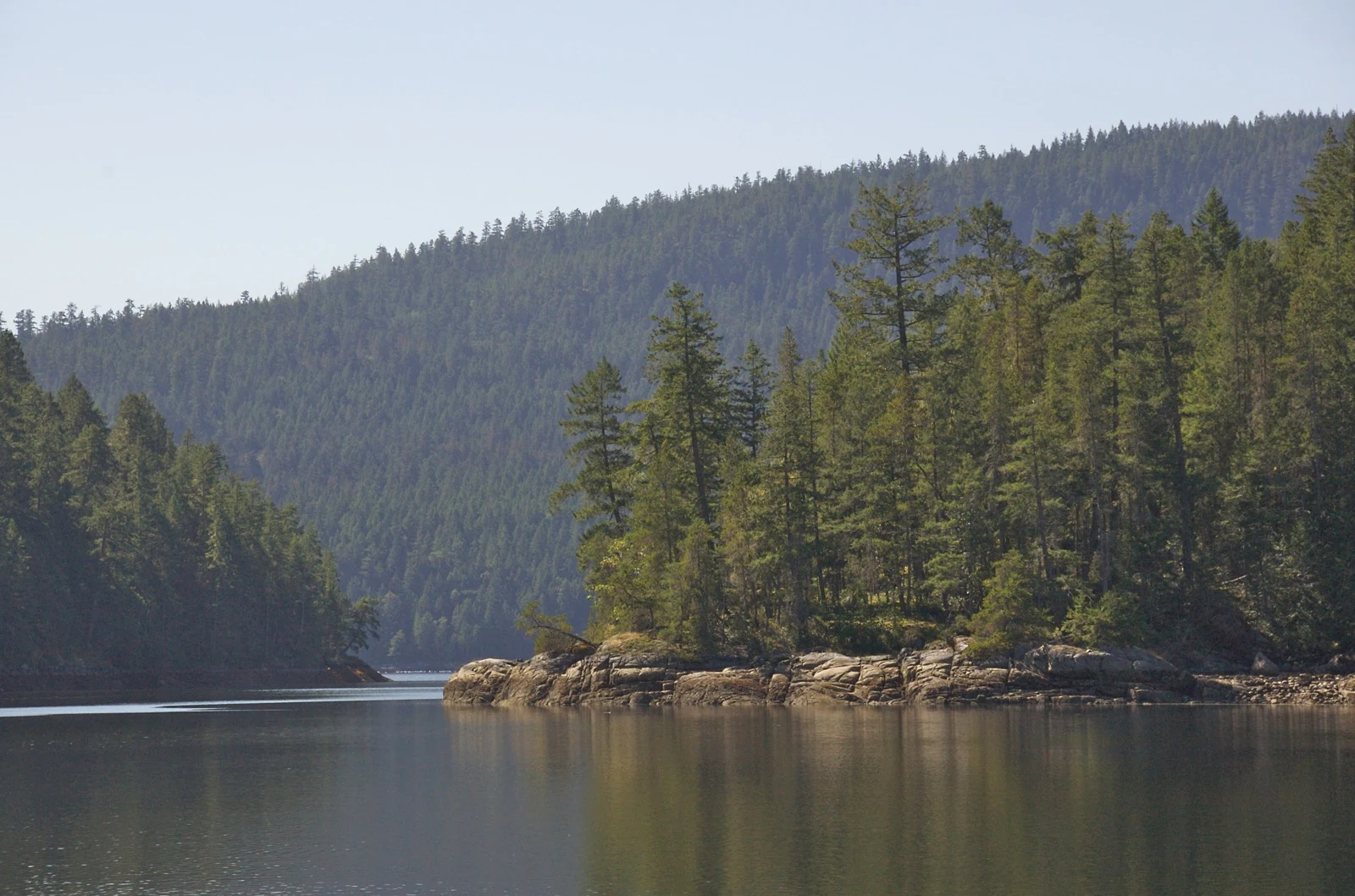
Desolation Sound Marine Provincial Park sits within one of the most dramatically indented sections of the British Columbia coast, where the mainland mountains plunge directly into the sea. The park's scenery is shaped by past glaciation, leaving steep fjord-like valleys now partly drowned by the ocean to form deep inlets, narrow passages, and sheltered bays. Waterfalls tumble from hanging valleys into the water below, and the shoreline is a near-continuous alternation of rocky headlands, pebble beaches, and steep forested slopes.
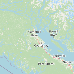
The park sits at the meeting point of Malaspina Inlet and Homfray Channel, an area characterized by scattered rocks and small forested islets that break up the surface of the sound and provide protected anchorages. Because the surrounding mountains shelter the area from ocean swells, the waters can be remarkably calm, allowing many small craft to share tight anchorages during summer. Above the waterline, the terrain rises into rugged glaciated peaks, while below the surface, submerged reefs and kelp forests add to the structural complexity of the seascape.
Although the region is heavily forested and visually lush, traces of past industrial use are still legible in the landscape. Areas such as Theodosia Inlet show clear-cut scars where logging has reached down toward the water, and the forest cover across much of the park is in a second-growth state interrupted by occasional pockets of older trees. This juxtaposition of soft, rounded second-growth forest, sharp glaciated ridgelines, and reflective marine waters gives the landscape its distinctive, layered character.
Desolation Sound Marine Provincial Park ecosystems, habitats, and plant life
The park protects a rich transition zone where coastal temperate rainforest meets a highly productive marine environment. On land, the forests are dominated by conifers, with deciduous maples and alders lining the banks of creeks and the margins of coves. While much of the forest is second growth following earlier logging and wildfire, isolated stands of old-growth trees still survive within the park, providing habitat for species associated with mature coastal ecosystems.
Below the waterline, the park's marine habitats are unusually varied for a fjord-style coastline. Eelgrass meadows grow in the shallow, sun-warmed waters, anchoring sediments and sequestering carbon while sheltering juvenile fish and invertebrates. Kelp beds and salt marshes add further structural complexity, and together these habitats support a wide range of shellfish, including species that have historically been central to both Indigenous food systems and local aquaculture. Calmer inlets combined with relatively warm surface waters in summer make the sound especially productive in ecological terms.
This combination of forest, freshwater, shoreline, and open water habitats allows the park to support a broad spectrum of ecological functions. Species can move between marine, intertidal, and terrestrial environments within relatively short distances, and the mosaic of sheltered bays, exposed outer coast, and steep valley walls creates a wide variety of microhabitats across a compact area.
Desolation Sound Marine Provincial Park wildlife and species highlights
Desolation Sound Marine Provincial Park hosts an unusually complete cross-section of Pacific Northwest coastal wildlife, spanning terrestrial mammals, marine mammals, seabirds, and anadromous fish. On land, black bears and black-tailed deer are among the larger mammals present, alongside smaller fur-bearing species and reptiles typical of the south-central coast.
The marine environment is particularly rich. Inlets and channels serve as spawning and rearing habitat for several salmon species as well as herring, while porpoises and seals are regularly observed in the calmer waters. The park is also important for larger marine carnivores, including seasonally present killer whales, as well as sea lions, which use the area for foraging and haul-out sites.
Birdlife is a defining feature of the park's ecological identity. The sound supports numerous migratory waterfowl and seabirds, including ducks and gulls, but its most notable avian inhabitant is the marbled murrelet, a seabird that nests in old-growth forest and forages at sea. Roughly 10 percent of the Canadian population and around 1 percent of the global population of marbled murrelets are estimated to use the marine park during summer and fall, a concentration that reflects the park's importance to the species' conservation. Other species at risk documented within or near the park include eulachon and heron, reinforcing the area's significance for threatened coastal biodiversity.
Desolation Sound Marine Provincial Park conservation status and protection priorities
Conservation significance in Desolation Sound Marine Provincial Park centers on the protection of an interconnected suite of marine, intertidal, and coastal forest ecosystems along a coastline that has historically been subject to logging and shoreline development. The park's establishment in 1973 created a framework for limiting extractive and disruptive activities within a large, contiguous area of sheltered coast, and its management is oriented around maintaining a healthy and productive coastal ecosystem as the foundation for all other values.
Particular conservation focus is placed on the park's marine and intertidal habitats, including eelgrass meadows, kelp forests, and salt marshes that support shellfish and numerous fish species, as well as on the recovery of wildlife populations such as salmon and the marbled murrelet. The murrelet's concentration here, combined with the presence of other species at risk such as eulachon and, seasonally, killer whales, gives the park a recognized role in regional biodiversity protection.
BC Parks also frames the area within a broader coastal management strategy that emphasizes climate resilience, habitat connectivity, and nature-based responses to ocean acidification and sea level rise. Reducing marine pollution, addressing contamination from vessel and shoreline discharges, and integrating Indigenous knowledge into decision-making are explicitly identified as priorities, reflecting both ecological and cultural dimensions of conservation in Desolation Sound.
Desolation Sound Marine Provincial Park cultural meaning and human context
The cultural landscape of Desolation Sound extends back roughly ten thousand years and is inseparable from the histories of the Sliammon (Tla'amin) and Klahoose First Nations, whose traditional territory encompasses the present park. For countless generations, the inlets, islands, and shorelines here have supported seasonal patterns of hunting, fishing, shellfish harvesting, and ceremonial life, and the area's mussels, oysters, and other shellfish have long been central to Indigenous foodways and economies.
The European name assigned to the sound reflects Captain George Vancouver's brief encounter with the coast, and that naming has long framed the area in non-Indigenous imagination as an empty wilderness. The park's formal establishment in 1973, along with subsequent tourism and recreational development, took place within a longer trajectory of displacement that began in the late nineteenth century, when Indigenous communities were pressured onto small reserves and, in some cases, saw their land allocations reduced through federal legislation. Summer cottages, tourism leases, and even the disturbance of graves in culturally significant areas accompanied this transformation.
In the contemporary era, Sliammon and Klahoose representatives have engaged in treaty negotiations beginning in 2008, contributed to the park's management planning, and partnered with bodies such as the First Nations Health Authority to investigate the health implications of environmental contamination on traditional foods. This growing recognition of Indigenous governance, knowledge, and rights is reshaping how Desolation Sound is understood, moving beyond the framings inherited from Vancouver's journals toward a more layered view of the landscape as a continuing cultural homeland.
Top sights and standout views in Desolation Sound Marine Provincial Park
Desolation Sound Marine Provincial Park stands out for the unusual combination of calm, warm-water anchorages set against jagged glaciated peaks, forested shores, and countless waterfalls that define the south-central coast of British Columbia. The density of sheltered coves and islets makes it one of the most celebrated cruising grounds in the Pacific Northwest, while the surrounding ecosystem supports eelgrass meadows, kelp forests, and shellfish beds that anchor a remarkably productive marine food web.
Equally distinctive is the park's ecological importance for the marbled murrelet, whose seasonal reliance on Desolation Sound places the area among the more significant protected sites for the species in Canada. Layered over this natural richness is a deep Indigenous history, marked by the long presence of the Sliammon and Klahoose First Nations and an evolving dialogue about rights, treaty processes, and environmental health that continues to shape how the park is governed and experienced.
Best time to visit Desolation Sound Marine Provincial Park
Summer is the primary season for visiting Desolation Sound Marine Provincial Park, when calmer weather, longer daylight hours, and the warmest surface waters of the year create ideal conditions for kayaking, sailing, and small-craft cruising. Sheltered anchorages allow scores of boats to gather even in conditions that would be uncomfortable on the more exposed outer coast, and the warm water temperatures characteristic of this part of British Columbia make the sound particularly attractive for swimming and extended time on the water.
Outside of summer, conditions become considerably more demanding. Shoulder seasons in spring and early fall can offer quieter anchorages and changing light on the coastal mountains, but visitors should expect cooler weather, more variable winds, and shorter days. Winters are typically marked by heavy rainfall, reduced visibility, and rougher seas, and the park is rarely visited for recreation during this period. Wildlife viewing opportunities shift across the seasons, with summer and fall being especially important for marbled murrelets and other seabirds using the area.